Mosquito Pass, Colorado

Martinjmpr

Wiffleball Batter
(Xposted on Colorado4x4.org.)

Wife and I decided (at the last minute) to go 'wheeling on Sunday. She asked me to choose the trail and I chose Mosquito Pass.

Why Mosquito? Well, a few reasons:

1. Mosquito pass is the highest continuous road in CO (13,185'.) Anything higher and you have to go up and come back down the same way.

2. Last time I tried to cross Mosquito was in 1997 in my Montero. Got up to the top from the Leadville side but couldn't go all the way to Alma as the trail was blocked by a snowdrift just on the East side of the pass. In fact, the only time I'd crossed Mosquito before was in 1985 in my then-new Toyota pickup.

3. Awesome views! :D

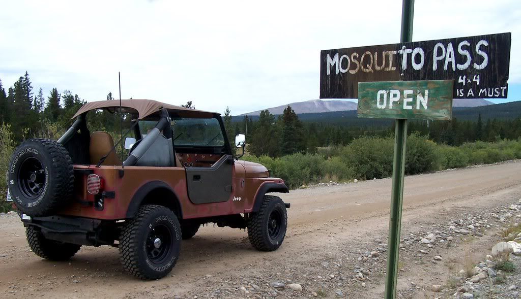
Anyway, the trail was open (I checked Bushducks ahead of time.) No problems at all, though there is a big boulder in the middle of the trail on the East side about half a mile from the summit. However, it was easy to get around.

Heck, I met a guy going the other way and he was in a bone-stock Ford Expedition, so that kind of tells you how easy a trail this is.

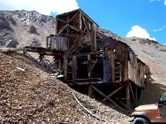
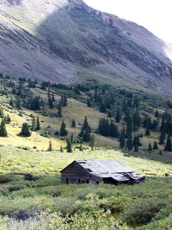
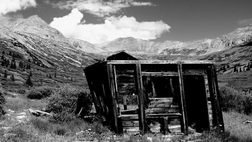
Here are a few snapshots:


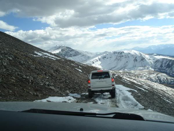
Approaching the trail from the Leadville side:

2011_0821_114757AA.jpg


If you don't like shelf roads, you probably shouldn't be on this trail ;) :

2011_0821_121228AA.jpg


2011_0821_121321AA.jpg


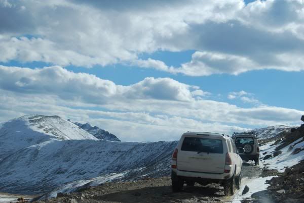
Looking back towards Leadville:

2011_0821_121435AA.jpg


At the top:

2011_0821_122908AA.jpg


Here is the rock on the East side of the trail. There is a drop off on the downhill side of this, but there's plenty of room for even a full-sized rig:

2011_0821_125353AA.jpg


This guy was just standing on the side of the trail gawking at us. You can tell he hasn't missed too many meals.

2011_0821_130806AA.jpg


(to be continued)
 

Martinjmpr

Wiffleball Batter
Part 2...

Continued from previous...

Remains of the North London mine:

2011_0821_134920AA.jpg


2011_0821_133821AA.jpg


2011_0821_135109AA.jpg


Looking East towards South Park:

2011_0821_135142AA.jpg


Our cattle dog Shaila was having a good time running around the mountain:

2011_0821_135354AA.jpg


Yeah, you pretty much need low range but other than that any stock 4x4 can make it over this trail.

2011_0821_150040AA.jpg


For those who are interested in going, a few notes:

1. Remember that vehicles going uphill have the right of way. There are several very narrow sections of shelf road on this trail, so it is a good idea to watch for traffic coming uphill. It's also a good idea to keep your eyes open for potential pull-out areas where vehicles can pass.

2. IMO it's much easier (and safer) to run this trail from Leadville to Alma. That way the worst shelf roads are at the beginning and you are going uphill, not downhill on them.

3. It's always a good idea to remember that the weather can be quick to change at 13,000'. Also note that you are above timberline for most of this trail so if lightning starts, get into your vehicle or under cover.
 
Last edited:

mph

Expedition Leader
Great pics...thanks for sharing...The snow has sure melted since I was there in June.
 

colodak

Adventurer
lol at the 4x4 only sign, I've done Mosquito 4 times. First time was in 1989, 2wd Mazda B2200 p-up with 31's, got 3/4 of the way up from the Alma side but it was blocked with snow, mid-July. Did it again a month later, same vehicle, no problems made it all the way across. Have done it twice in my 4x4 Dakota, last time though took some body damage, it is definetly rougher coming up from Alma then from Leadville. Bent one of the cross bars on my push bar, put a lovely gouge in my sidesteps.
 

Bushmaster6

Adventurer
looks familiar ;)

I went up the east side, hit the top and turned around to make it home to Colorado Springs (when I was living there).. road condition on my trip, particularly at the top, was rough.. my CJ was bouncing all over place and there were a few heavily rocked-in spots.. I was travelling alone so I was a bit wary of snapping an axle at 13k feet!

MosqpassSign1.jpg

londonmineruins1.jpg


from the valley below... ruins
mosqpassruins1.jpg

mosqpassruins3.jpg


and one of my favorite roads to travel on ;)
KootchieKootchieRd.jpg
 

ColoDisco

Explorer
Nice pics and report! I ran it last October with my 4 wheeling group. Snow at the top but not enough to stop us. We ran it from Alma to Leadville. I called it a tale of two asses. We ate lunch at the brown burro in fairplay, then hit up the golden burro in leadville for dinner. :sombrero:

Only section that was sketchy is the shelf road on the west side. Going down that with some snow on it was a bit dicey. :Wow1:
mosquitopass10_16_1020019.jpg


This is the east side:
DSC_0115.jpg
 

Snafu

Adventurer
I've been interested in the Colorado Mtn passes for some time....this one looks very reallistic for me and my stock rig!! I've been so interested in Engineer Pass but I'm doubtful I could make it out without breaking quite a few bits and pieces on the daily driver

Thanks a lot for sharing everybody!!
 

colodak

Adventurer
Mosquito isn't difficult, however, coming from Leadville to Alma is much easier than Alma to Leadville. The East side is very rocky, undercarriage damage is possible, if you don't have skid plates I would not recommend it. It will toss you around inside the vehicle quite a bit, the West side is a dirt road.
 

Bushmaster6

Adventurer
I've been interested in the Colorado Mtn passes for some time....this one looks very reallistic for me and my stock rig!! I've been so interested in Engineer Pass but I'm doubtful I could make it out without breaking quite a few bits and pieces on the daily driver

Thanks a lot for sharing everybody!!

your rig will be fine on most of them.. get one of the Colorado guide books/backcountry trail books off Amazon and start your planning.. I took my FZJ80 over Engineer pass with wife and a 6 month old in the back seat.. can't wait to get back to that part of the country..
 

gotspeed1

New member
Great pictures. I've been on Mosquito Pass three times now, but still have yet to complete in Eastward. Everytime I have been up from the Leadville side, it has been blocked right after the summit. It is definitely a good trail to run, as are many up there. If you get a chance to run Birdseye Gulch, it's worth the time. In relation to your statement about weather changes at 13,000', here is a picture from my first time up. It was nice in Leadville, but the snow started shortly after the first switchback.

100_2531.jpg
 

Forum statistics

Threads
189,797
Messages
2,920,943
Members
232,931
Latest member
Northandfree
Top