OTG_1
Well-known member
After fueling up in Merlin, we followed Galice Road to the start of the track, the 311 mile Siskiyou Crest Adventure Trail. When we headed out, there were some new trails that we'd be exploring to see if we could update the original iteration of the route to include more dirt, and extend the track further to the north. The new route was largely dependent on our ability to connect the Chrome Ridge area with the Illinois River gorge via a crossing at Briggs Creek. I'd found some old public tracks in Gaia GPS showing that folks had indeed crossed the creek, but the maps that I came across didn't always show it connecting, and satellite views were unhelpful as well. I'd even tried to get in touch with one of the road engineers for the national forest but never got a call back. So I guess we'd need to figure this one out on our own!
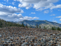
After airing back up at the Rogue River, a few light sprinkles began to fall on our vehicles. We made the drive through Merlin and followed Galice Road to the northern terminus of the Siskiyou Crest Adventure Trail. The pavement gave way to dirt and immediately we were surrounded by views overlooking the rugged mountains. Climbing higher into the mountains, rust red serpentine rocks appeared all around. Serpentine soil is highly alkaline with high concentrations of heavy metals like chromium, nickel, lead a zinc which stunts the growth of plants and trees in these ecosystems. It's precisely why the forest isn't nearly as dense and the trees tend to be much smaller. The serpentine environment is home to many endemic species, like the Kalmiopsis flowering bush as well.
As we reached the top of the rideline along Chrome Ridge Road, the wind was whipping as we drove through the clouds. I'm sure the views are fantastic on a calm and sunny day, but e the mist covered ridgetops creted a surreal experience-- but certainly not the sort of camp setting we were after (at least with all of the wind and moisture in the air). It was now mid-week so I wasn't as adverse to staying at a developed campground. We drove down the mountain to Sam Brown Camp, a pleasant campground that is well sheltered from the elements and sits beneath tall stands of Doug Fir and Ponderas Pines. Sam Brown is a popular OHV staging area on weekends, and there was one small group in the day use area that was also target shooting, and apparently they had hundreds of runs to waste! I was hoping the shooting wouldn't continue into the night, but by dinnertime, they'd abandoned camp and we were the only ones left in the campground. Having the campground and forest to ourselves was quite nice. I did some exploring of the surrounding area with Shasta and found several large campsites down the road, and the equstrian camp was one of the nicest I've come across. I befriended a local who was camped down the way with his two boys, and he said there was definitely a road that crossed Briggs Creek, but being that it was the first week of summer, he though the creek might be running to high for a safe crossing. Well, at least we knew a road crossed the creek!
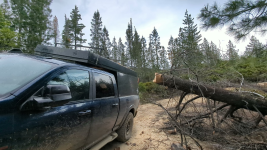
The next morning we woke to the familiar sound of scrub jays calling throughout the forest floor and canopy. The sun had come out and was illuminating the meadow adjacent to our campsite. After breakfast and tea, we climbed in our rigs retracing our tire tracks back up to Chrome Ridge. I hoped the weather would hold so I could launch the drone, as the scenery atop chrome ridge is second-to-none, and definitely one of my favorite stretches of track along our adventure. Reaching the ridgetop, clouds dotted the sky, but the wind wasn't whipping like it was the previous evening. I launched the drone and managed to get some nice video shots. We continued south towards Briggs Creek, and then we encountered a massive ponderosa pine across the trail. After much deliberation, we determined our 18" chainsaws were not much for the giant, but we could drive around it-- and then more deadfall! Luckily the next 3 trees were all less than 2' in diameter. They took a bit longer than anticipated, but we were on our way within about 45 minutes. We began the descent into the Illinois River Gorge, which like many of these canyons has seen massive fires come through in the last decade or so. Apparently, the unique climate of the Klamaths makes them one of the most fire prone mountain ranges in all of North America, and with warmer temps, shorter snow seasons, and agroforestry practices that create densely packed plots of immature trees that are highly fireprone-- these forests are not well equipped to deal with wildfires like they once were. Which is really a shame because the Klamaths are absolutely beautiful and one of the wildest places left on the West Coast.
Driving slowly through the burn zone, there were branches and shards of wood everywhere. A giant shard of wood managed to lodge itself into one of my front tires. We tried to remove it with a pair of pliers, but eventually resort to a drive to dislodge it. I nervously stuffed the gaping hole with several tire plugs, hoping it'd hold. We continued down the trail eventually reaching the the flood plain of Briggs Creek-- so far so good! Then we arrived at the creek, from what I could tell, it didn't look deeper than 30", which would be a cakewalk for our rigs. And sure enough, it was. In fact, I don't think it was deeper than 2 feet at any given point. We plowed on through and a couple of miles later we were in the deep reaches of the Illinois River Canyon. The 50 mile stretch upstream of where we'd popped out is one of the most stretches of wilderness in the lower 48. We passed a beautiful ranch and a couple of homesteads that had been spared from the massive fire that blew through the canyon. Lunch would be had at Miami Bar-- it seemed like we were the only people out for the day. Our next stop would be the swinging bridge and if the gate was open, I wanted to drive up towards Pearsoll Peak.
The drive along the Illinois River Gorge is incredibly rugged and not for the faint of heart. If you're not a fan of shelf roads, especially those that cling to the side of a mountain 500+ feet above a river, then this may not be your cup of tea! We passed one vehicle that was pulling a horse trailer on the way out (I can't imagine pulling a 30' trailer on this road!), eventually making it to the swining bridge. The swinging bridge is a popular place that locals hang out on summer weekends, and I can see why. With its deep emerald pool and huge dirt lot, this portion of the Illinois is perfect for cooling off in the inviting emerald waters of the Illinois. Unfortunately, the bridge is closed, so while we were able to walk up to it, we decided it was in our best interest not to attempt fate and cross the bridge. The more daring folks jump off the 60' span into the deep swimming hole below. The road to Pearsoll Peak was also gated as well (check out Adenture Taco's blog as he made the hike to the lookout-- absolutely beautiful).
A buddy of mine had turned me onto a campsite further downstream the Illinois. We jumped on pavement for a few miles before turning back onto dirt. Arriving at the location, it was filled with tons of trash, lots of high grass, not much shade and really no nearby access to water. We decided to push on to see what was further downstream, and that's when it happened. On a narrow piece of trail, a massive boulder was sticking out from the bench of the road cut. It looked like my full size rig had a good 4-6" inches to spare, so I rolled through at around 5mph, and then my 5 ton steel bast jolted to a sudden stop. I managed to hit the boulder right at axle height on front right tire. It was a BIG hit!! Everything seemed fine at the time, but later on the trip, I noticed at the very least the alignment was way off. Not thinking too much about what just happened, we continued on finding a series of small campsites along the river. Some looked more promising than others. Eventually we made it back to pavement to see what else might be in the vicinity, and after a bit of searching we concluded that one of the camps upstream was our best bet. The camp was surrounded by massive tailings of river rocks, so we dubbed in Tailings Camp. A flat spot big enough for both of our rigs was perched over the Illinois with no one around for at least a mile in either direction.
Watch the Adventure On Youtubez

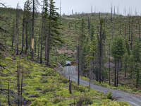
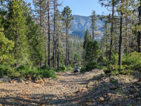
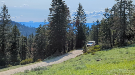
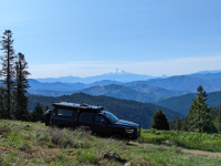
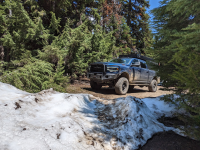
Back on dirt! The views on the way to Chrome Ridge Road are impressive the entire drive up.
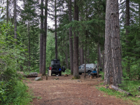
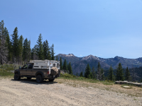
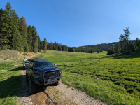
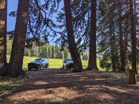
By suppertime, we had Sam Brown camp all to ourselves.

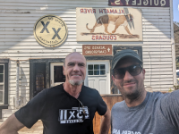
A beautiful old wooden site that pre-dates the conjoining of the Rogue River National Forest with the Siskiyou National Forest. Can we just do away with cheapo plastic signs altogether?
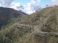
Drone friendly weather!
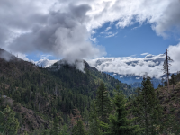
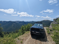
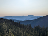
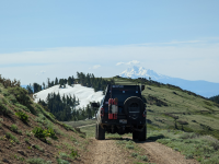
The views atop Chrome Ridge are impressive.
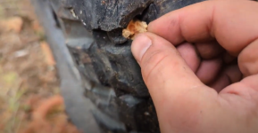
This pesky wooden shard would turn my damaged tired into a persistent bother over the next few days.

The crossing at Briggs Creek turned out to be a cakewalk.
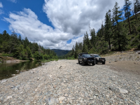
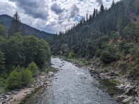
Miami Bar along the Illinois.
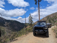
Driving the Rugged Illinois River Canyon
After airing back up at the Rogue River, a few light sprinkles began to fall on our vehicles. We made the drive through Merlin and followed Galice Road to the northern terminus of the Siskiyou Crest Adventure Trail. The pavement gave way to dirt and immediately we were surrounded by views overlooking the rugged mountains. Climbing higher into the mountains, rust red serpentine rocks appeared all around. Serpentine soil is highly alkaline with high concentrations of heavy metals like chromium, nickel, lead a zinc which stunts the growth of plants and trees in these ecosystems. It's precisely why the forest isn't nearly as dense and the trees tend to be much smaller. The serpentine environment is home to many endemic species, like the Kalmiopsis flowering bush as well.
As we reached the top of the rideline along Chrome Ridge Road, the wind was whipping as we drove through the clouds. I'm sure the views are fantastic on a calm and sunny day, but e the mist covered ridgetops creted a surreal experience-- but certainly not the sort of camp setting we were after (at least with all of the wind and moisture in the air). It was now mid-week so I wasn't as adverse to staying at a developed campground. We drove down the mountain to Sam Brown Camp, a pleasant campground that is well sheltered from the elements and sits beneath tall stands of Doug Fir and Ponderas Pines. Sam Brown is a popular OHV staging area on weekends, and there was one small group in the day use area that was also target shooting, and apparently they had hundreds of runs to waste! I was hoping the shooting wouldn't continue into the night, but by dinnertime, they'd abandoned camp and we were the only ones left in the campground. Having the campground and forest to ourselves was quite nice. I did some exploring of the surrounding area with Shasta and found several large campsites down the road, and the equstrian camp was one of the nicest I've come across. I befriended a local who was camped down the way with his two boys, and he said there was definitely a road that crossed Briggs Creek, but being that it was the first week of summer, he though the creek might be running to high for a safe crossing. Well, at least we knew a road crossed the creek!
The next morning we woke to the familiar sound of scrub jays calling throughout the forest floor and canopy. The sun had come out and was illuminating the meadow adjacent to our campsite. After breakfast and tea, we climbed in our rigs retracing our tire tracks back up to Chrome Ridge. I hoped the weather would hold so I could launch the drone, as the scenery atop chrome ridge is second-to-none, and definitely one of my favorite stretches of track along our adventure. Reaching the ridgetop, clouds dotted the sky, but the wind wasn't whipping like it was the previous evening. I launched the drone and managed to get some nice video shots. We continued south towards Briggs Creek, and then we encountered a massive ponderosa pine across the trail. After much deliberation, we determined our 18" chainsaws were not much for the giant, but we could drive around it-- and then more deadfall! Luckily the next 3 trees were all less than 2' in diameter. They took a bit longer than anticipated, but we were on our way within about 45 minutes. We began the descent into the Illinois River Gorge, which like many of these canyons has seen massive fires come through in the last decade or so. Apparently, the unique climate of the Klamaths makes them one of the most fire prone mountain ranges in all of North America, and with warmer temps, shorter snow seasons, and agroforestry practices that create densely packed plots of immature trees that are highly fireprone-- these forests are not well equipped to deal with wildfires like they once were. Which is really a shame because the Klamaths are absolutely beautiful and one of the wildest places left on the West Coast.
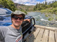
Driving slowly through the burn zone, there were branches and shards of wood everywhere. A giant shard of wood managed to lodge itself into one of my front tires. We tried to remove it with a pair of pliers, but eventually resort to a drive to dislodge it. I nervously stuffed the gaping hole with several tire plugs, hoping it'd hold. We continued down the trail eventually reaching the the flood plain of Briggs Creek-- so far so good! Then we arrived at the creek, from what I could tell, it didn't look deeper than 30", which would be a cakewalk for our rigs. And sure enough, it was. In fact, I don't think it was deeper than 2 feet at any given point. We plowed on through and a couple of miles later we were in the deep reaches of the Illinois River Canyon. The 50 mile stretch upstream of where we'd popped out is one of the most stretches of wilderness in the lower 48. We passed a beautiful ranch and a couple of homesteads that had been spared from the massive fire that blew through the canyon. Lunch would be had at Miami Bar-- it seemed like we were the only people out for the day. Our next stop would be the swinging bridge and if the gate was open, I wanted to drive up towards Pearsoll Peak.
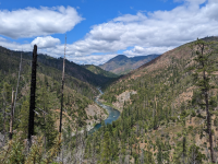
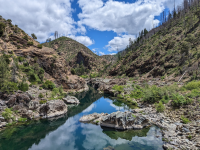
The drive along the Illinois River Gorge is incredibly rugged and not for the faint of heart. If you're not a fan of shelf roads, especially those that cling to the side of a mountain 500+ feet above a river, then this may not be your cup of tea! We passed one vehicle that was pulling a horse trailer on the way out (I can't imagine pulling a 30' trailer on this road!), eventually making it to the swining bridge. The swinging bridge is a popular place that locals hang out on summer weekends, and I can see why. With its deep emerald pool and huge dirt lot, this portion of the Illinois is perfect for cooling off in the inviting emerald waters of the Illinois. Unfortunately, the bridge is closed, so while we were able to walk up to it, we decided it was in our best interest not to attempt fate and cross the bridge. The more daring folks jump off the 60' span into the deep swimming hole below. The road to Pearsoll Peak was also gated as well (check out Adenture Taco's blog as he made the hike to the lookout-- absolutely beautiful).
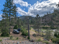
A buddy of mine had turned me onto a campsite further downstream the Illinois. We jumped on pavement for a few miles before turning back onto dirt. Arriving at the location, it was filled with tons of trash, lots of high grass, not much shade and really no nearby access to water. We decided to push on to see what was further downstream, and that's when it happened. On a narrow piece of trail, a massive boulder was sticking out from the bench of the road cut. It looked like my full size rig had a good 4-6" inches to spare, so I rolled through at around 5mph, and then my 5 ton steel bast jolted to a sudden stop. I managed to hit the boulder right at axle height on front right tire. It was a BIG hit!! Everything seemed fine at the time, but later on the trip, I noticed at the very least the alignment was way off. Not thinking too much about what just happened, we continued on finding a series of small campsites along the river. Some looked more promising than others. Eventually we made it back to pavement to see what else might be in the vicinity, and after a bit of searching we concluded that one of the camps upstream was our best bet. The camp was surrounded by massive tailings of river rocks, so we dubbed in Tailings Camp. A flat spot big enough for both of our rigs was perched over the Illinois with no one around for at least a mile in either direction.
Watch the Adventure On Youtubez


Back on dirt! The views on the way to Chrome Ridge Road are impressive the entire drive up.

By suppertime, we had Sam Brown camp all to ourselves.

A beautiful old wooden site that pre-dates the conjoining of the Rogue River National Forest with the Siskiyou National Forest. Can we just do away with cheapo plastic signs altogether?

Drone friendly weather!

The views atop Chrome Ridge are impressive.

This pesky wooden shard would turn my damaged tired into a persistent bother over the next few days.

The crossing at Briggs Creek turned out to be a cakewalk.

Miami Bar along the Illinois.

Driving the Rugged Illinois River Canyon

