Luinil Explorations
Adventurer
This trip started in 2018 when I was wondering if there was a north south backcountry route through the Oregon coastal mountains from the Columbia River to the California Border. I started researching maps and the web to see if it was possible. A route slowly appeared that ran through a mix of public and private land.. The route travels through active logging areas where a CB radio is required to monitor the log truck operations. Remember that logging operations have the right of way. There are several gates that were open to the private land areas with signs that they could be closed and locked at anytime. I hope you enjoy the trip.
You can read about more of our adventure and see photos of our trips on our travel blog.
You can support the channel by donating via PayPal.
You can also support the production of more remote travel videos by becoming a member of my Patreon team.
Forest waterfall

Typical forest road

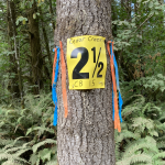
Sweet Creek

Nehalem River

Up on top

Columbia Lily

The thimble berries were ripe and plentiful

The Chetco River

On the Oregon California border at the end of the April scouting trip

Camping in the tall firs

You can read about more of our adventure and see photos of our trips on our travel blog.
You can support the channel by donating via PayPal.
You can also support the production of more remote travel videos by becoming a member of my Patreon team.
Forest waterfall

Typical forest road

Sweet Creek

Nehalem River

Up on top

Columbia Lily

The thimble berries were ripe and plentiful

The Chetco River

On the Oregon California border at the end of the April scouting trip

Camping in the tall firs


