You are using an out of date browser. It may not display this or other websites correctly.
You should upgrade or use an alternative browser.
You should upgrade or use an alternative browser.
2021 RAM 3500 Tradesman | AEV Prospector | FWC Grandby
- Thread starter ramblinChet
- Start date
ramblinChet
Well-known member
Big Bend Adventure Route
Exploring Big Bend in Texas has been on my list of things to do for some time and I was bound and determined to visit one of them next time I was in the area. One of them? Well, I am embarrassed to admit that it was not too long ago that I learned there was Big Bend National Park and Big Bend Ranch State Park. The National Park is east of Terlingua and the Ranch State Park is to the west. Just in case you are interested, Terlingua is a ghost town now inhabited by around one-hundred people which has food and drink, and lodging, plus an annual international chili cook-off competition.
Getting back to Big Bend - it seems most folks are talking about the National Park when they mention Big Bend so that is where I planned to visit. Although there are a few routes available I decided to use the 188-mile Big Bend Adventure Route as published by Overland Trail Guides. They recommend three to five days although I would suggest slowing down and enjoying a full five or seven days if this is your first time visiting. There is lot's to do an see here.
One cautionary note - fuel is limited in this part of Texas so my suggestion is to stop up north in Alpine, Texas, fill up your tank, drive south into Study Butte/Terlingua, and top off once again before you enter the park. It also appears that there was gasoline available for a sale at a few of the campgrounds but I would not depend upon them.

This is Luna’s Jacal which was handbuilt by Gilberto Luna who lived here with his large family until he passed away at the age of 109 years of age. The roof is around chin high so you really must bend over and walk like a duck to get around inside. Since it was a warm day I ducked inside and enjoyed the cool shade for a bit as I studied how Gilberto built this home using locally sourced materials that have lasted a long time.

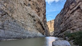
My next stop was the one place you must visit: Santa Elena Canyon. One of the difficulties I encounter when taking pictures in some situations is how to accurately capture the scale of the objects I am photographing. In this case, the walls of the canyon are 1,500 feet tall and I'm not sure any picture would be capable of capturing their true beauty. My suggestion is for you to visit yourself and make sure to follow the trail and hike back into the canyon as far as you can. To the left is Mexico and these United States are on the right. Maybe next time I visit I will paddle a kayak through this natural wonder.
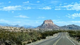
For those who are not interested in hitting the trail, there are a series of paved roads connecting major areas of the National Park. Don't ignore these scenic drives since they quickly transport you from one beautiful area of the park to another.
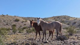
While enjoying a trail named River Road West I came upon what I believed were wild horses. What I discovered later is that Mexican vaqueros have been driving their horses and cattle across the Rio Grande River for hundreds of years to graze in these rich areas. Since the area is so large and the rangers are so few and focused on other areas, this "illegal" grazing continues.
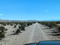
Much of my time was spent alone in the desert driving on rough roads that seemed to never end. At times I felt like a hamster in a cage but then I would remember and smile that I successfully escaped that trap years ago and I am not truly free. There is a feeling I am unable to describe that you feel while alone in the desert - it's the essence of pure beauty. Airing down your tires will significantly knock the edge off the harsh ride and moving too slowly sometimes hurts more than moving too fast. That's a life lesson for you...
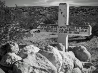
When exploring nature, man-made objects really stick out from far away. I stopped at this grave and took some time to wonder who this young man was. He was a child to a father and mother, possibly had siblings, or maybe even a child himself. I sat there in the desert and although I never met this young man - I prayed for him and while driving away though of this following quote...
"War is a place where the young kill one another without knowing or hating each other, because of the decision of old people who know and hate each other, without killing each other." ~ Erich Hartmann
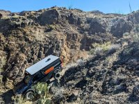
And here we have another interesting photograph of my AEV Prospector on the edge of a windy cliff complete with a never-ending view to the horizon. It's really an interesting feeling to be able to look dozens of miles in every direction and not see another human being or anything man-made. If you have not felt that before you need to. And no, having someone with you will not count - go out alone into the wilderness and be free even if it's only for a few hours. Once you experience what I am struggling to describe you will have that gift forever and no one will be able to take it away.

Interestingly enough there were a few springs in the Chihuahuan Desert so it was strange to drive through these puddles in the middle of a seemingly dry desert. I am certain that all the wildlife in the surrounding area knew exactly where all the springs were. It's disappointing how detached we have become from nature in just a hundred years or so. Do you consider yourself to be somewhat detached from nature and if so, how are you actively working to become reattached?

Here is a final shot for all of my fellow adventurers. Of course there was a rocky ledge in front of my vehicle that I initially stopped to take a picture of but when I looked around and realized I had all of the time I wanted, I climbed up this small jagged hill and snapped a picture from above. Big Bend is a different sort of park to visit but I can assure you that once you visit, you will smile and never forget. Happy trails!
Last edited:
ramblinChet
Well-known member
Big Bend Ranch State Park
In my previous post I shared with you my lack of knowledge regarding Big Bend National Park and Big Bend Ranch State Park which are only a dozen or so miles apart. These are very different parks with each having it's own beauty and type of overall experience. After completing the national park it was mandatory that I at least spent a few days in the state park.
This was not a formal trail ride but more of an exploratory adventure to collect some basic information to help plan a more in depth ride in the future. I spent two days at Big Bend Ranch State Park and traveled approximately 135 miles with 85 being off-road and the rest on pavement.
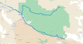
Oh, I can not express enough how majestic of a ride this was. Passing through Terlingua, heading east along FM170 parallel to the Rio Grande River, and enjoying the rising sun. Guys, it just does not get any better and I really wish my picture taking ability was able to even begin to capture the true beauty but it was so much more - windows down, warm morning air, silence, and the mountains coming awake...
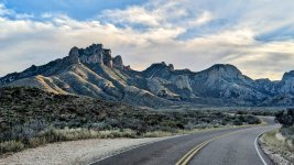
I spent time exploring the primary roads on the interior of the park and even stopped by the ranger station to take a much needed shower. It felt good to take a warm shower after ten or so days of basic field care. Living like this opens many doors inside your mind where you truly appreciate the luxuries we have in our normal lives. Even the poor in western civilization live beyond what kings and queens did just a few centuries ago. And none of us men should feel the least bit ashamed - these luxuries are our rewards for our creative western minds and never ending hard work.
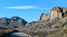
What was very enjoyable at this park was transitioning from one type of geologic setting to another. There are some really interesting areas at the state park so if you visit I would encourage you to spend time and explore. There are dozens of rougher unmaintained side roads with several dozen disbursed camp sites I am looking forward to exploring next time I visit. The rangers shared much information and pointed out many of the must visit locations.
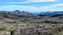
This is what I did for two days - I drove around some of the most beautiful and rugged parts of Texas. Although the drives were beautiful it seems all I have are landscape pictures to share so I will end with this one. All I can say is that if you are planning to spend time in Big Bend, and enjoy the natural beauty God created for us, make sure to set aside enough time to visit both parks.
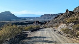
Let me take a step back in time to the week prior when I spent time at Big Bend National Park. Since I employ a "move, shoot, communicate," type of structure to my adventures, it is necessary for me to intentionally slow my movement down and limit my time behind the wheel. It's really difficult but when you consider my two greatest expenses are fuel and food, you can understand why I must control my driving.
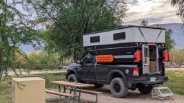
With that in mind I did something unusual when I visited the national park - I reserved campgrounds for three nights. Since I was entering into a national park I was well aware that the operations would be a bit stricter when compared the many of the national forests I routinely visit. In an effort to avoid ruffling any feathers and make sure I had a place to lay my head I reserved spots at Cottonwood, Rio Grande Village, and Chisos Basin campgrounds. All the facilities were great but you must understand there is no electricity, no showers, but all have flush toilets and water available. If I were to return again I would add two or three disbursed camps sites in between the formal campgrounds to break up the trip and slow it down.
This is a picture of a distant storm on one of the nights I camped at Cottonwood. I just like to play around and experiment taking pictures of different things. Considering this was a handheld picture at night - the new technology is amazing!
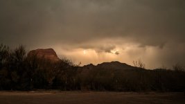
Here is a shot from the basin inside of the Chisos Mountains where I camped. My guess is this is the best place to camp during the hot summer since you are a mile high and surrounded my mountains. The sun begins to rise but you will remain in the shade for hours. It reminded me of camping in the Rockies back in the mid-90s while attending Camp Jeep just begging for the sun to rise so we could begin to get warm.

As I was heading west out of Marfa following my visit to the national and state park I happened upon this interesting store along US Route 90 in the middle of nowhere. Of course, it was late and I had nothing but time so I stopped and tried to figure out just what I was looking at and more importantly, why was it here in the middle of nowhere. I guess this is considered art - das ist entartete Kunst.

Here is a natural light shot after a late dinner on my final night of camping in the Chisos Mountains. The cold moon was full and shining brightly. There was no wind and the stars slowly began to appear in the clear sky. I warmed my hands over my stove as my steak began to sizzle. I smiled, looked up into the sky, though about my late father, and thanked God for yet another blessing
Boots and saddles!
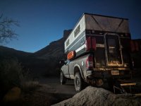
Last edited:
Throughout the last few days I read through this thread. Thank you for posting, your pictures are fantastic.
Big bend is high on my list, I wanted to go last year. I’d like to go this year. We will see. I have a trip coming up in February, maybe I stretch out how long I’m going to be gone and take off to Texas.
The routes you post are great to have. Thank you again.
Big bend is high on my list, I wanted to go last year. I’d like to go this year. We will see. I have a trip coming up in February, maybe I stretch out how long I’m going to be gone and take off to Texas.
The routes you post are great to have. Thank you again.
Pacific Northwest yetti
Expedition Medic
I have found the rangers, and staff at the interpretive centers are usually more than happy to recommend roads, routes, and just generally get solid info. I have rarely not enjoyed a conversation with park staff.
Thanks for posting!
Thanks for posting!
ramblinChet
Well-known member
El Camino del Diablo
Part One of Three
Part One of Three
While researching trails in Arizona I came across one in particular that caught my eye - the El Camino del Diablo. Although this trail is listed as 124 miles it took me 165 since I took my time to explore some of the alternate trails in the area. If you look at the map below you will notice the trail appears to pass through an area parallel to the Mexican boarder where there are no other roads nearby on the US side - this is accurate. This historic route passes though the middle of the Sonoran Desert and over the past several centuries, various reports suggest many hundreds, or even thousands, have perished while traveling along "the Devil's road." If you explore this path you will come upon several graves.
There is no cellular service along the route and you should not expect to encounter any traffic. With that in mind I made sure to inspect my vehicle, fill my refrigerator and aluminum cases with a few weeks of food and drink, top off all of Rotopax water jugs, and fill up my fuel tank in Ajo just a few miles before the trail began. The trip took me three days and I guess of you were in a rush it could be completed in two. When I return someday, I will most likely take four or five days since I plan to include a full day at the nearby Organ Pipe Cactus National Monument. Like most all of my adventures, I explored alone.
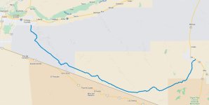
This is a sign that you don't necessarily see too often so as always, life is a balancing act. I smiled while remembering one of my favorite quotes:
“I would rather be ashes than dust! I would rather that my spark should burn out in a brilliant blaze than it should be stifled by dry-rot. I would rather be a superb meteor, every atom of me in magnificent glow, than a sleepy and permanent planet. The function of man is to live, not to exist. I shall not waste my days trying to prolong them. I shall use my time.” ~ Jack London
And with those words in my head, my AEV Prospector slowly rolled forward and the adventure began.

Maybe the desert just looks normal to people that grew up in the region but to me, it's almost like exploring another planet. I grew up and have spent most of my life east of the Mississippi and even during my time spent in the middle east, most of it was spent in a military helicopter a few hundred feet above the sand. In summary, traveling out west has been rather exciting and if you have not been out here, you really must schedule some time.
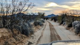
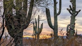
There were many areas along the route displaying various species of cacti. Here are some Saguaro cactus which were plentiful in some areas along the route. Some day when I return I would like to take more time to photograph these interesting plants and attempt to do better at capturing the sunrise and sunset. The colors were just amazing although my pictures don't even come close to showing the natural beauty.
On my first night I slept just slightly off the road in the Cabeza Prieta National Wildlife Refuge. Let me back up a bit and share with you that if you travel this rugged and remote route you will also be passing through the Barry M. Goldwater Air Force Range where air-to-air and air-to-ground battle simulations take place. Although live ordnance is dropped on the range, most of the weapons dropped are inert practice bombs. With all the being said, you should familiarize yourself with unexploded ordnance (UXO).
Before you enter the area, you must register and obtain an access permit.
I was pleasantly surprised to come upon two operational water wells along the trail. Although I was topped off I stopped to check and verify that both tanks were full and the were able to provide clean water.

Here is the grave of Dave O'Neill who died in 1915 from exposure and dehydration. Many people passing by stop at his grave and pay their respects by leaving a trinket or saying a prayer. I drove away wondering about the man, praying for him, and observing an area that most likely appeared very much the same as when he was alive. It's strange to describe but it felt as if I was looking through the eyes of men who have been dead for centuries or more.
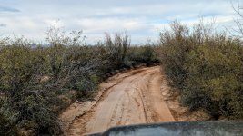
The initial miles of the trail are wide and seem to be maintained on a regular basis. As you drive deeper into the heart of the desert the trail narrows and becomes rather primitive. This was an area that seemed to collect and store water to a greater degree when compared to other surrounding areas. The desert was telling me something although I could hear it, I didn't fully understand.
Now this was a pretty cool section of the trail - I had the pleasure of driving over a lava flow. I mean, guys talk about dirt, shale, and tree roots back east, or sand down south, the slickrock in Moab, but how many guys have wheeled over a lava flow? I guess for those in Hawaii it might be quite common. It was cool though and I of course acted like a little boy and studies the basaltic rock.

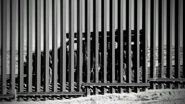
Here is my attempt at an artsy picture for your viewing pleasure. The funny thing is, when I see this picture, the first thing that comes to my mind is driving through what appeared to be a dry desert and then realizing it was very slick mud that only appeared to be dry on the surface. Yeah, I had water, food for a few weeks, etc. But a self recovery in the desert? Let's review my experience in my next post as it deserves it's own discussion.
Last edited:
ramblinChet
Well-known member
El Camino del Diablo
Part Two of Three
Part Two of Three
This is part two of three regarding my adventures along the infamous El Camino del Diablo trail in Arizona.
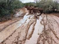
Throughout the years there have only been a handful of times where the surface of the terrain appeared to be one thing, yet proved to be another. Yes, a few of those times things turned out to be much better than expected but this is one of those times where it was actually much worse. The trail has been dry and dusty with much traction and although I had not been in this part of Arizona long, I was not aware of any recent storms, so I was expecting the remainder of the trail to provide good traction. As I entered the Pinta Sands area I was expecting very deep., powdery, and rutted sand. What I thought I discovered was sand that had been wet some time ago and was now firmer, and possibly a bit slicker. Oh, how wrong I was.

Of course I drive into the area in two wheel drive testing my traction and as I began to sink, my forward progress was slowed, and the rear tires began to slip. I stopped immediately, shifted into four wheel drive, and proceeded with the trail while really paying attention to my traction. I was moving along just fine and since there were bushes along the side of the trail I was not able to spot the end. Looking back, what I should have done the first time I began to lose traction was to stop, back out in four wheel drive, if necessary, and perform some basic reconnaissance on the condition of the trail ahead.

Once again I began to feel that sinking feeling, this time even deeper. I pointed towards the side of the trail and would attempt to maintain some forward momentum and crawl out onto firmer ground. No joy - as I neared the edge of the trail my progress ground to a halt and my heavily worn all-terrain tires began to spin. Well, I guess now was a great time to hope out and take a look at the mess I had created. As soon as I stepped out I realized just how much fun this was going to be - not only was the mud very slippery, but as the same time it was sticky and heavy. My shoes were instantly clumped up and weighed five to ten pounds each, and I was having a tough time walking without falling.
It was time to slow the process down and really think about where I was, and what all of my available options were regarding extraction. I was alone, had no cellular service for the past few days, and was not expecting to encounter anyone else in the middle of this desolate 135 mile trail. I walked around and began to construct a list in my mind of what recovery gear I had available, and then began to itemize another list that began with the simplest type of recovery that had the highest probability of success, all the way down to the most complex recovery option that seemed least successful. Since I had a few weeks worth of water and food, three-quarters of a tank of gasoline remaining, and solar panels, I was not rushed for time and this was a good position to be in.
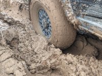
After twenty or so minutes I began to notice the very slick mud was now was feeling a bit firmer after being exposed to the sun and air with very low humidity. I decided to jump back into my Prospector, move straight backwards as far as possible, begin moving forward to build as much momentum, and one I reached my maximum speed, cut my wheels hard to the right and attempt to climb out once again. Although this was largely unsuccessful I could feel the tires just beginning to climb up and out as they continued to spin. Flashing back to my younger years spending hundreds of hours in the middle of the night becoming stuck, then unstuck, in deep snow on trails in the forest, I had another idea.
It was now time to cut my wheels hard to the left, as if I wanted to drive towards the center of the trail, and place my truck into reverse, while attempting to drag that passenger side front tire up and out of the slick trail. As I backed up I began to feel her bite and with just the right amount of traction and momentum, she popped up and out onto former ground with much more traction. I knew I was almost there so I straightened my wheels out, began moving forward, and built enough momentum so as soon as the driver side front tire hit the slick slope, I turned hard right and with two tires on dry ground, maintained momentum and crawled up and out.
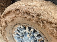
Once I was on firm ground I parked my rig and scouted ahead for a way out. Within a minute I located a parallel trail and began to walk it for maybe a half-mile. This is the primary trail near the end where it is obvious someone else attempted to drive in, and was forced to back up and out, and followed the alternate trail that I was now walking. If I had scouted ahead I would have noticed this - I failed in that respect and will consider this another lesson learned.
Some may ask why I did not consider using my Maxtrax or my Warn 16.5ti winch - all good points and I did consider, and was prepared to use them. Maxtrax are absolutely wonderful in sand and dirt since they clean right up - in mud, they become their own worst enemy and cleaning Maxtrax clumped with mud before attempting to stow them is a story of its own. The winch was another option but there was really nothing that appeared solid enough to winch off of - I certainly did not want to destroy a cactus or small shrub. One other option was to bury my Maxtrax in the sand and use them as a winching point. Another option was to set up camp and wait a day or two for another vehicle to come along and hopefully be able to use their rig as a winching point.
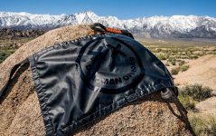
Since Maxtrax are not designed to be buried but the Deadman is, I felt it was time that I ordered one for myself. I spent time reviewing the differences between the Classic Deadman V2 and Ruggedized Deadman V2 and decided to go with the ruggedized variant since it has heavy-duty Cordura sleeves which offer additional protection to the nylon "arms and legs." If I only traveled part time and didn't expect to use this type of recovery much I believe the classic would have been fine but since I do travel full time, and mostly alone, and will be exploring for years to come, I could justify the additional hundred dollars for a tougher product.

This picture was copied from the Deadman web site. Here is their description of their product:
Create a safe winch anchor point in the ground, or around rocks and trees.
MADE IN THE USA
The Deadman™ Earth Anchor™ (patent pending) is the world’s most versatile off-road recovery anchor, capable of anchoring to just about anything Mother Earth throws your way. Lightweight and easily stowed under your seat, it’s the self-recovery anchor that’s always with you, allowing you to explore with confidence!
The webbing of The RUGGEDIZED Deadman has been sleeved with a heavy duty Cordura to protect the bits that do all the heavy lifting. When the Deadman is put to use in the ground or around rocks, this sleeving guards the polyester webbing from becoming damaged, protecting you and prolonging the life of your Deadman. Bonus: he’s completely blacked out.
While the Deadman loves to go around hugging trees or rocks, he is also an extremely capable ground anchor as well. Instead of debating whether to carry a heavy metal ground anchor, the Deadman becomes the ground anchor that’s a permanent member of your recovery kit.
With a Minimum Breaking Strength (MBS) ranging from 33,200 – 66,400lbs after assembly (depending on its configuration), the Deadman will be the strongest member of your recovery kit. We’ve gone to great lengths to ensure we get every last ounce of strength out of these American made, Class VII polyester industrial slings. The Deadman won’t let you down!
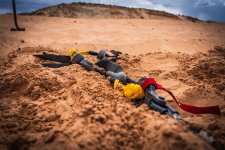
The following three pictures were copied from this informative article in the American Adventurist.
American Adventurist picture one - burying the Deadman approximately two feet deep.

American Adventurist picture two - the Deadman has been buried with the two arms and two legs now being connected to each other, and the winch.
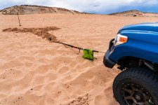
American Adventurist picture three - extracting a vehicle using a Deadman earth anchor.
Last edited:
ramblinChet
Well-known member
El Camino del Diablo
Part Three of Three
Part Three of Three
This is final post detailing my adventures along the infamous El Camino del Diablo trail in Arizona.
As a follow up to my previous post on the unexpected slick mud this is something I came upon after departing the trail. Although this information was not posted until after I had begun the trail there is always a chance that useful information may be posted ahead of a planned excursion. I guess checking the weather for the past thirty days might be a good idea also since even storms from a week ago or more may impact local conditions.
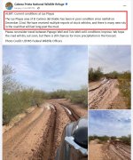
And just like that I am back on dry higher ground but this time following the trail through a wash. Folks back east may not be familiar with what a wash is but if you can imagine a river that only exists for brief periods - maybe seasonally or just a few hours during a thunderstorm. I can imagine that during the monsoon season in the summer this could be very interesting.

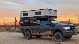
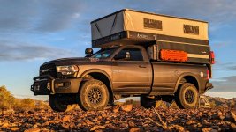
Since I was taking my time and stopping for all sorts of reasons I decided to become a bit artsy and snap a picture of my beautifully decorated AEV Prospector badge on the side of my rig. Here is my message to all the men reading this - at some point in your life you deserve the gift you have always dreamt of owning. Some may consider me crazy for dropping the cash and having a serialized Prospector custom built. I say it was crazy for me to wait so long. If you have worked hard for a few decades and have never really been able to enjoy that one thing - it's time to get it. You deserve it and there is no need to explain to anyone else.

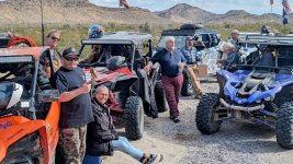
During the middle section I did come across a group of adventurers on the trail - this was a local gang from Yuma. To celebrate New Year's Day they ride from Yuma to Ajo and spend time in Ajo before heading back to Yuma. I didn't ask if they camped along the trail although they confirmed that they spend a night or so in Ajo. Since spending time out in Arizona one thing I can confirm is that if you are interested in driving these trail at high speed, pick up a nice side-by-side. These vehicles easily travel three to five times faster compared to my speed and seem much more agile and adept at just devouring obstacles.
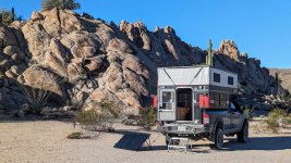
My final night was spent maybe seven miles north of the trail at Christmas Pass. This was another awesome campground and all I can say is that once again, I was alone and felt very comfortable knowing there was not another soul within at least a dozen or so miles of me. The road north to Christmas Pass is marked "high clearance 4x4 only" but I had no problem navigating it in two wheel drive. Just take your time and pick good lines. Right at the pass there was a technical section that was very rocky and narrow so I did take advantage of my two wheel drive low range capability. It really is a nice option to have available and I use it more frequently than what I would have expected.
Ah, the mountains are ahead and the road is dry. I was amazed at how frequently the conditions varied and it all made sense when I read this on the CPNWR web site:
National wildlife refuges offer us all a chance to unplug from the stresses of daily life and reconnect with our natural surroundings. With 803,418 acres of designated wilderness, Cabeza Prieta National Wildlife Refuge offers wonderful opportunities to explore the wild Sonoran Desert. As one of the largest wilderness areas in the contiguous United States, visitors can experience the rugged solitude of the Sonoran Desert wilderness. Nicknamed “The Green Desert”, the Sonoran Desert is the most biodiverse desert in the world and is home to at least 60 species of mammals, more than 350 bird species, 20 amphibians, some 100 reptiles, and about 30 species of native fish. In addition, more than 2,000 species of plants have been identified in the Sonoran Desert.

My final dozen or so miles were again "high clearance 4x4 only" and let me assure you, these trails heading north through Sheep and Red Top Mountain very rarely experienced full size trucks. The two-track was very narrow and it looked like only side-by-sides passed through this area. The most fun was dropping down into and climbing up out of a very rocky and rugged wash several times within a half-mile. At times it was difficult to see exactly where the trail was so I was working hard to follow the existing path.

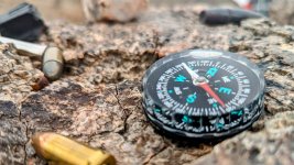
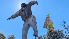
Strange things happen in the desert and sometimes this results in unique forms of art. I am not sure what the message was at this location but it was interesting none-the-less. At the base of this were offerings to include a chrome bumper, a BIC lighter, worn shoes, an assortment of beer cans and ammunition. What might you decide to contribute if you came across this wort of creation in the desert?
As I was nearing the end of the trail I came upon another side-by-side and the two men in the vehicle pulled off to the side of the trail to make room for me. I pulled along side, rolled down my window, and shut off my engine so would could chat for a few. The driver assumed that I had been southbound and had turned around when it became a bit more rugged south of Fortuna Mine. I smiled to let him know that I had piloted this four-ton heap of American metal from Ajo and was now northbound finishing up the El Camino.
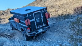
The end of another trail and time alone in the wilderness. As mentioned previously, the final section passes through an active range so make sure you register, follow all the rules, and have a great time. In closing...
“I have always loved the desert. One sits down on a desert sand dune, sees nothing, hears nothing. Yet through the silence something throbs and gleams…” ~ Antoine de Saint-Exupéry, French writer, poet, aristocrat, journalist, and pioneering aviator

Last edited:
ramblinChet
Well-known member
For the past ten or more days I have been relaxing in and around Quartzsite, Arizona. If you know anyone who travels full time in an RV then it is highly likely they have spent time at Quartzsite or at least knows of it. During the months of December through February, this small town of two-thousand people swells to approximately one-million. RV owners from all around the country converge in this area due to the moderate climate (60-75 day/45-60 night), and multiple free BLM camping areas surrounding the town. This is a picture of me camping at Roadrunner Wash BLM south of town.

While researching Quartzsite I found a great article titled Quartzsite BLM Boondocking Tips and Tricks which answered many of my questions. Using this information I explored the town and camped at all of the free BLM sites which included Plomosa Road, Hi Jolly, Dome Rock, Scadden Wash, and Roadrunner Wash. The La Posa LTVA (Long Term Visitors Area) is a fee area which includes potable water, garbage, and dump station access and if I were planning to visit for a month or more and was traveling in an RV, I would check in there for sure.
The image below is displayed in the very informative article mentioned above.

One of the first things I did when I arrived was to visit Tyson Wells which is basically the largest flea market I have ever visited. If you are interested in a fossil of a Trilobite from a few hundred million years ago, there are many to be found. Maybe you are searching for new or used tools, or components for RVs, there is no shortage. Oh, you mentioned you might want a cattle, or even a bison skull, you will find piles. It was just my luck that they were in the middle of a world-class gem and mineral show so I walked around learning about all sort of interesting rocks. Seriously, if you enjoy shopping for unusual things on a nice warm and sunny day in the middle of winter, this is the place to be!

Another reason I wanted to visit Quartzsite at this time was to attend the iconic Rubber Tramp Rendezvous which turned out to be even more interesting than I could have ever imagined. You are wondering what the RTR is? I though you would never ask!
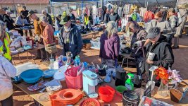
The picture below is of what is called the "free pile" where other travelers donate new or used items that they no longer need, so others can sift through and pick up items that are needed. Nearby they also had a "Cold Weather Gear Giveaway" where Columbia Sportswear provided $15,000 worth of free items for those who really could use it - I though that was very nice.
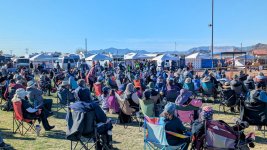
The most attractive events for me were the educational and informational presentations of which there were several offered each day for an entire week. The first few days are reserved for the W-RTR, which is a women's only event where female specific issues related to nomadic travel are discussed. To be honest, I was disappointed on the majority of the presentations I attended since the individuals presenting were not as well organized as I would have expected nor were they as knowledgeable as they should have been. My suggestion to RTR for the future is to reach out to professional groups and ask for volunteer speakers to cover topics. There were a few topics I really enjoyed and learned much from but there were a few that left me shaking my head in disbelief.
Getting back to the flea market, I laid down a big green one dollar bill and walked away with a huge bottle containing seventy-five cleaning and disinfecting wipes. Since I was slowing my travels down I wanted to perform an above average cleaning of the interior of my camper. Since I had wipes remaining I decide to also clean my 200-watt solar suitcase and boy, was I surprised how different a clean panel appeared adjacent to a dirty one. What was even more interesting is that the difference in energy being produced appeared to be zero. I was expecting to see maybe a five or ten percent jump but unless I missed something, the difference was immeasurable.

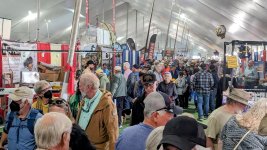
Around town every was talking about the "Big Tent RV Show" that was coming up so I decided to hang around and check it out. What a pleasant surprise - this was a trade-show of sorts with a focus on the end customer. Inside the big tent there were three long and wide aisles with hundreds of companies displaying everything from specialized RV power plugs to specialized temporary work for nomadic folks. One of most enjoyable discussions centered on Passive Daytime Radiative Cooling and the physics associated with how an object is capable of remaining cooler than the ambient air temperature. I always meet interesting people and enjoy learning everywhere I go.
Another equally interesting technical discovery was the new Battle Born Lithium Power Pack which is designed and constructed to replace a conventional diesel generator on an RV. This system utilizes 540 Ah of 12V LiFePO4 deep cycle batteries combined with an assortment of Victron Energy components to include an inverter charger, DC-DC charger, charge controller, battery monitor, etc. Its exciting to see these plug-and-play systems manufactured using premium components.

The past ten or so days have been nice. I spent most of my time camping around the Quartzsite area, enjoying nice weather, and learning. As I force myself to slow down and enjoy life even more I begin to consider everything I do and how I desire to slow it down also. What is strange is that we all become tangled in this never ending web of hurry up and do this, or go faster and do that. We live this way so often that it feels strange and unnatural to slow down.
Let me tell you my friend, when you begin to slow everything down your picture of life becomes crystal clear and you truly feel peaceful and happy. Sure, there are still times here and there which require speed but I would reserve those for emergencies and such. Stop rushing and destroying your mind, body, and soul. It's not normal and certainly is not worth it. Dial it back and just let it come to you.
I know this sounds counterintuitive but here is an example: I had a talk with my son years ago when he began racing superbikes and sort of hit a wall. No matter how much harder he tried, he was not becoming faster on the racetrack. He banged on the throttle earlier, grabbed a fistful of brake at the last second, threw the bike over into a turn virtually defying the laws of physics...but still no more speed. We had a long talk and I told him to dial it back and to focus more on being smooth. Slowly throttle up and keep the bike settled, gradually apply the brakes, and let the bike naturally fall into the turn. Just slow it down and smooth it out. I convinced him that the speed would come to him when it was ready and not a second sooner. He listened and became fast enough to win multiple championships this past year.
I am asking you to take care of yourself and slow down your life. The speed and success will come when it is ready...
Slow is smooth and smooth is fast.

While researching Quartzsite I found a great article titled Quartzsite BLM Boondocking Tips and Tricks which answered many of my questions. Using this information I explored the town and camped at all of the free BLM sites which included Plomosa Road, Hi Jolly, Dome Rock, Scadden Wash, and Roadrunner Wash. The La Posa LTVA (Long Term Visitors Area) is a fee area which includes potable water, garbage, and dump station access and if I were planning to visit for a month or more and was traveling in an RV, I would check in there for sure.
The image below is displayed in the very informative article mentioned above.

One of the first things I did when I arrived was to visit Tyson Wells which is basically the largest flea market I have ever visited. If you are interested in a fossil of a Trilobite from a few hundred million years ago, there are many to be found. Maybe you are searching for new or used tools, or components for RVs, there is no shortage. Oh, you mentioned you might want a cattle, or even a bison skull, you will find piles. It was just my luck that they were in the middle of a world-class gem and mineral show so I walked around learning about all sort of interesting rocks. Seriously, if you enjoy shopping for unusual things on a nice warm and sunny day in the middle of winter, this is the place to be!

Another reason I wanted to visit Quartzsite at this time was to attend the iconic Rubber Tramp Rendezvous which turned out to be even more interesting than I could have ever imagined. You are wondering what the RTR is? I though you would never ask!
The RTR is an annual gathering of nomads and like-minded individuals who live a mobile lifestyle in vehicles such as cars, vans, RVs, and buses. It provides an opportunity for community building, sharing resources, and learning about the nomadic lifestyle.
The picture below is of what is called the "free pile" where other travelers donate new or used items that they no longer need, so others can sift through and pick up items that are needed. Nearby they also had a "Cold Weather Gear Giveaway" where Columbia Sportswear provided $15,000 worth of free items for those who really could use it - I though that was very nice.

The most attractive events for me were the educational and informational presentations of which there were several offered each day for an entire week. The first few days are reserved for the W-RTR, which is a women's only event where female specific issues related to nomadic travel are discussed. To be honest, I was disappointed on the majority of the presentations I attended since the individuals presenting were not as well organized as I would have expected nor were they as knowledgeable as they should have been. My suggestion to RTR for the future is to reach out to professional groups and ask for volunteer speakers to cover topics. There were a few topics I really enjoyed and learned much from but there were a few that left me shaking my head in disbelief.

Getting back to the flea market, I laid down a big green one dollar bill and walked away with a huge bottle containing seventy-five cleaning and disinfecting wipes. Since I was slowing my travels down I wanted to perform an above average cleaning of the interior of my camper. Since I had wipes remaining I decide to also clean my 200-watt solar suitcase and boy, was I surprised how different a clean panel appeared adjacent to a dirty one. What was even more interesting is that the difference in energy being produced appeared to be zero. I was expecting to see maybe a five or ten percent jump but unless I missed something, the difference was immeasurable.

Around town every was talking about the "Big Tent RV Show" that was coming up so I decided to hang around and check it out. What a pleasant surprise - this was a trade-show of sorts with a focus on the end customer. Inside the big tent there were three long and wide aisles with hundreds of companies displaying everything from specialized RV power plugs to specialized temporary work for nomadic folks. One of most enjoyable discussions centered on Passive Daytime Radiative Cooling and the physics associated with how an object is capable of remaining cooler than the ambient air temperature. I always meet interesting people and enjoy learning everywhere I go.

Another equally interesting technical discovery was the new Battle Born Lithium Power Pack which is designed and constructed to replace a conventional diesel generator on an RV. This system utilizes 540 Ah of 12V LiFePO4 deep cycle batteries combined with an assortment of Victron Energy components to include an inverter charger, DC-DC charger, charge controller, battery monitor, etc. Its exciting to see these plug-and-play systems manufactured using premium components.

The past ten or so days have been nice. I spent most of my time camping around the Quartzsite area, enjoying nice weather, and learning. As I force myself to slow down and enjoy life even more I begin to consider everything I do and how I desire to slow it down also. What is strange is that we all become tangled in this never ending web of hurry up and do this, or go faster and do that. We live this way so often that it feels strange and unnatural to slow down.
Let me tell you my friend, when you begin to slow everything down your picture of life becomes crystal clear and you truly feel peaceful and happy. Sure, there are still times here and there which require speed but I would reserve those for emergencies and such. Stop rushing and destroying your mind, body, and soul. It's not normal and certainly is not worth it. Dial it back and just let it come to you.
I know this sounds counterintuitive but here is an example: I had a talk with my son years ago when he began racing superbikes and sort of hit a wall. No matter how much harder he tried, he was not becoming faster on the racetrack. He banged on the throttle earlier, grabbed a fistful of brake at the last second, threw the bike over into a turn virtually defying the laws of physics...but still no more speed. We had a long talk and I told him to dial it back and to focus more on being smooth. Slowly throttle up and keep the bike settled, gradually apply the brakes, and let the bike naturally fall into the turn. Just slow it down and smooth it out. I convinced him that the speed would come to him when it was ready and not a second sooner. He listened and became fast enough to win multiple championships this past year.
I am asking you to take care of yourself and slow down your life. The speed and success will come when it is ready...
Slow is smooth and smooth is fast.

ramblinChet
Well-known member
Mojave Road
My most recent adventure was the 150-mile Mojave Road which passes east to west through southern California. I want to start by thanking the late Dennis Casebier for all of his work related to the re-discovery and layout of this historic trail. This trail has been used for centuries by American Indians to transport goods, by Spanish priests, early American's headed west, our US military, and adventurers like us. Dennis Casebier is also the author of the famous Mojave Road Guide.
Casebier points out that the road, while not a particularly tough 4-wheel drive trail, is a dangerous place. "You can die out there," he said. "And the people who want to go see the trail need to be equipped properly...you are alone and many, many miles from help when you're on that road."

This was my first campsite which also provided good protection from potential high winds rolling off the desert. Although the sleep that night was good I could tell my looking to the west that things were not going to be bright and sunny like they had been in Quartzsite. Since this was early in the adventure I thought long and hard about backing out and returning again at some point when the weather was nicer. I woke up and decided to continue my travel along this historic trail and convinced myself that I would minimize any chance of me becoming stuck and I had enough food and water to last several weeks so I would be just fine. Well, that's what I thought anyway...
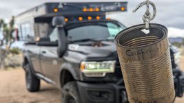
Ah, Penny Can Tree...a place to stop, pay your toll, make a wish, or in my case, say prayers, and snap a picture. I am not sure who began this strange ritual but there are several others along the way such as the mail box, frog shrine, and a ghost town named Zzyzx!
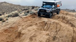
The hill dropping down into Watson Wash is a section along the trail where I spend more time teetering on two wheels, and sometimes three, but rarely all four. This mogul section was fun and although it does not appear to be anything challenging, I would suggest using a spotter, or as in my case, getting out and figuring out the safest path to the bottom of the hill. When you are all alone and your 8,700 pound truck is nose down and rolls to one side, you are fixated on there here and now and nothing else matters.
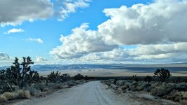
Guys, the views out here are breathtaking. If you look closely you will see the road stretching out to the horizon. A few miles down the road the view was even more beautiful - I looked to the left and watched the clouds bumping into a distant mountain range. I drove slowly and smiled so hard my cheeks hurt. This trip was majestic in so many places...
Here I am being the typical ramblinChet - rolling across Soda Dry Lake as the sun disappears, alone, on well used all-terrain tires, after it rained. Not. Very. Smart.
Let me back up and explain again why I always travel in two wheel drive - it's because I have a very good sense of the traction available and use this information for safety. If I lose control over my forward movement in two wheel drive I still have four wheel drive available which "should" provide me with the ability to exfiltrate myself. Although this is not beneficial 100% of the time I have discovered it works exceptionally well over the years. On the contrary, if I was in four wheel drive I most likely would have been able to proceed even farther, with a high probability of becoming very stuck, and then what?!?
For those who have traversed this dry lake before you know exactly what I am talking about when I say it was slick. For those up in the great white north, it's like sliding on wet ice that is not perfectly level, you just slooowly drift sideways. Despite my best efforts, I identified the traction issue early in two wheel drive and after shifting in four wheel drive, slowly began to back out. I was so happy I had reinstalled my backup camera and even turned on the LED rear flood lights on my camper so I was able to drive backwards and follow my previous tracks. Maybe if it was dryer, I had tires with much deeper tread, and I also was traveling with a few other rigs, I would have been successful. But this time I was successful in making the correct decision at the last possible moment, and removing myself from a potentially bad situation.
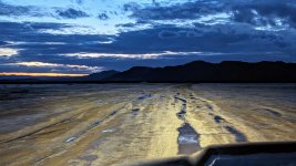
Since I was not able to cross Soda Dry Lake it took me maybe an additional hour to navigate up north, and find a way back down onto the Mojave Road. I make is a habit to pre-download all the GPX data for the surrounding area into Gaia so in the event that I have to create a bypass, and do not have cellular service, I still have a useful map displaying roads, topographical information, etc.
Once I was back on the trail I encountered some unusual situations. In this instance I would be driving into, and following, a wash, which included driving under, or alongside, several railroad bridges. I was only an hour or so away from camp so I felt the normal pressure to reach my goal but at the same time it was late, I had spent the full day on the trail, and the Mojave Road was different when compared to many of the trails I have encountered over the years. I guess the main differences I have noticed when traveling in the desert is that there are many parallel trails and it is difficult to select the proper one to travel on. There have been times where I was absolutely certain I was on the correct trail although it did not appear anyone else had used in in quite some time while at the same time there were multiple trails adjacent to the unused one I was on. And while some criss-crossed, others gradually pulled away and led off in other directions. And driving down a mostly dry, but sometimes wet and soggy river bed always feels a bit funny.

Here is a water crossing that was so close to camp it begged me to just hammer the accelerator and go. But I stepped out, surveyed the area, and after I was certain this was going to be a normal water crossing; placed my vehicle into low range, second gear, and kept my engine revs up as I crossed at 3-4 mph with an amazingly beautiful bow wave. Out the other side and so close to turning in for the night.
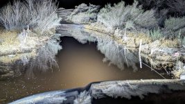
It rained throughout the night, and do you remember earlier when I convinced myself that I was an all weather type of guy with an all weather machine versus a fair weather fellow? As I woke up and prepared breakfast the rain came down even harder. I researched the last section of the trail and it showed me driving down through the center of the Mojave River and through places with names like nine-mile waterhole. Since I was just a few miles south of a major road I could navigate my way out to it, but I was so close...
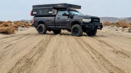
So I saddled up, and headed back out in two wheel drive to continue along the trail while constantly testing the conditions. Actually, I was surprised to see how well everything was going and most of my time was spent in soft-fluffy sand with only a few wet and slippery areas. In this particular picture I had been traveling parallel to the railroad and was now dripping back down into the wash area - while it was still raining. For many with more experience in the area this may have been no big deal but for someone like me with limited experience in the desert, especially in wet conditions, it was another learning experience.

One of the most beautiful sights I saw near the end were other tire tracks in the wash I was following. It looked like two motorcycles had laid fresh tracks so it was very comforting to look ahead and see how the conditions treated them. Occasional animal tracks are seldom useful but here is a trick - if you want to sample an area to see how your vehicle may perform, do not walk across flatfooted but instead walk on your heels. Through the years I have experimented with all sorts of ways to estimate how deep a tire will sink when driving over a particular area and I have found that walking on your heels provides you with a measurement that includes a bit of a safety margin.
The Mojave Road was a wonderful adventure and I do hope you are able to explore it also. Compared to what I was able to view with my own eyes over the span of three days, these pictures have almost no value. By using words I struggle to even begin to capture just a small part of how good it felt to travel through time. Let me end by telling you that you really must begin to experience trail like this for yourself. And it would be even better if you were able to include others so years, or decades, from now, you can sit around a campfire and tell tall stories about nearly becoming entombed in a dry lake bed, or sleeping near a ghost town named Zzyzx, which according to some, "was the 'last word' in health and vitality."
Last edited:
ramblinChet
Well-known member
Battle scar on the passenger side from Mojave Road?
That scar was created on the Bloody Basin Trail. At the end of the trail is Sheep Bridge which crosses the Verde River and on the east side of the river there are two paths through the trees with many bushes. It is common for me to drive through tight areas and have bushes drag down the side of my vehicle but this time there was a thick branch that had previously cut off and was now hidden in the bushes.
My goal is to locate a "paintless dent repair" shop to receive an estimate, and if the price is not crazy, have it corrected. If anyone has information to share, please do.
mog
Kodiak Buckaroo
I test drove a Ram this last weekend. Really gives me pause to order one. Honestly this thread is what made me go look at them.
What would you change if you were to order again?
I’ll have to get a crew cab
I want 4.10, anti spin rear, 220 alternator, 6.4 8 speed, 40/20/40 front seat, level 2 entertainment, led lighting upgrade, upfitter switches, Sport package.
Or maybe find a lightly used power wagon..
What would you change if you were to order again?
I’ll have to get a crew cab
I want 4.10, anti spin rear, 220 alternator, 6.4 8 speed, 40/20/40 front seat, level 2 entertainment, led lighting upgrade, upfitter switches, Sport package.
Or maybe find a lightly used power wagon..
Similar threads
- Replies
- 2
- Views
- 1K
- Replies
- 20
- Views
- 1K


