You are using an out of date browser. It may not display this or other websites correctly.
You should upgrade or use an alternative browser.
You should upgrade or use an alternative browser.
3 Years Around North America, Plus a Few More
- Thread starter Umnak
- Start date
Umnak
Adventurer
Plague Camping
The Olympic National Forest reopened dispersed camping just before Memorial Day. It’s been two months since we were able to spend a night in the “Cabin”, so we decided for one overnight near our home in Port Townsend.
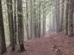
After walking the Mount Zion Trail in late afternoon we decided that enough shooting had stopped to take a look at one of the quarries along the main Forest Service Road in the northeast part of the Forest. It was a Sunday afternoon and most of the gravel slopes in the borrow pits were being used by locals for target practice.
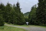
Our camp was just off a recently used target range on a side road the also featured a trailhead that connected with Gold Creek and a longer trail into the Brothers Wilderness.
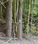
The next day we walked the trail to the creek. We found a barred owl on a snag who had no idea what we were. It stayed on its perch while we passed and was happy to pose for pictures.
I kept on looking at the map this past week for another place to camp and found a photograph on flickr of a spot near where we had stayed but far more secluded. We gave it a try and are very happy with what we now call Camp Rhody.

I used 4WD to get up the soft and damp hill from the secondary FS road. The turn around we camped on isn’t shown on the FS road map, it doesn’t even rate a 0-0 number. It is more or less flat and has been kept clean and empty of spent cartridges — why people can’t pick up their brass is beyond me.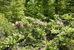
The rhododendrons were in bloom everywhere. Paths led through the Rhody gardens, one ending in an open toilet. That, along with at least nine camp sites around the circle make me think this is a place used by either a social or church group.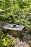
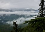
The view is very impressive and would have been even more so just a few years ago before the trees to the south gained their height. We backed in so as to see the mountains from the door and close to a large — and again cleanish — fire pit.
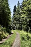
We walked the secondary road to its end up near the top of Bear Mountain where we found another clean camp and a trail leading to the summit.
Our evening included a long fire and dinner.

The next morning we woke late and while contemplating a second cup of tea heard thunder coming from the southwest. In moments the rain poured as it will in the Olympics, and we decided a retreat down the already muddy hill was probably more important than that cup of tea.
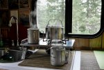
The Olympic National Forest reopened dispersed camping just before Memorial Day. It’s been two months since we were able to spend a night in the “Cabin”, so we decided for one overnight near our home in Port Townsend.


After walking the Mount Zion Trail in late afternoon we decided that enough shooting had stopped to take a look at one of the quarries along the main Forest Service Road in the northeast part of the Forest. It was a Sunday afternoon and most of the gravel slopes in the borrow pits were being used by locals for target practice.

Our camp was just off a recently used target range on a side road the also featured a trailhead that connected with Gold Creek and a longer trail into the Brothers Wilderness.
The next day we walked the trail to the creek. We found a barred owl on a snag who had no idea what we were. It stayed on its perch while we passed and was happy to pose for pictures.

I kept on looking at the map this past week for another place to camp and found a photograph on flickr of a spot near where we had stayed but far more secluded. We gave it a try and are very happy with what we now call Camp Rhody.

I used 4WD to get up the soft and damp hill from the secondary FS road. The turn around we camped on isn’t shown on the FS road map, it doesn’t even rate a 0-0 number. It is more or less flat and has been kept clean and empty of spent cartridges — why people can’t pick up their brass is beyond me.

The rhododendrons were in bloom everywhere. Paths led through the Rhody gardens, one ending in an open toilet. That, along with at least nine camp sites around the circle make me think this is a place used by either a social or church group.

The view is very impressive and would have been even more so just a few years ago before the trees to the south gained their height. We backed in so as to see the mountains from the door and close to a large — and again cleanish — fire pit.

We walked the secondary road to its end up near the top of Bear Mountain where we found another clean camp and a trail leading to the summit.
Our evening included a long fire and dinner.

The next morning we woke late and while contemplating a second cup of tea heard thunder coming from the southwest. In moments the rain poured as it will in the Olympics, and we decided a retreat down the already muddy hill was probably more important than that cup of tea.

Umnak
Adventurer
North Fork of the Clearwater River
There is a gravel road that follows the North Fork of the Clearwater River in Idaho for about 170 miles into the Bitterroots and over Hoodoo Pass on the Montana border. The Pierce, ID to Superior, MT section is part of the Idaho Backcountry Discovery Route. After a nice visit with friends in Orofino, Idaho we spent the better part of a week camping and hiking along this route.

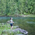
Clearwater County Road 147 leads into Road 250 at Pierce. We began the route with a fishing trip at the Isabella Creek trailhead. Our friends and Eve fished while I photographed and offered encouragement and put up a tarp that came in handy when the rain and hail started.
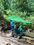
Our first camp was at Weitas Creek, which is a large tributary of the North Fork of the Clearwater. The rain continued for most of our stay but didn’t interfere with Eve’s fly fishing and our walks. The camp sites have river access and the trails follow the creek into the wilderness. We spent three nights here.
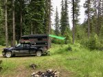
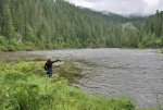
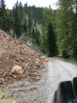
We had heard the road was washed out from the rain in a couple of spots along Black Rock Canyon which we wanted to drive to get to our next camp at Cedar Bridge. A grader had been working for a day to clear the rock slides and with that a much smoother track was being created. And aside from some stray rocks and tight corners, the drive was uneventful.
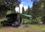
The Cedars Campground was dark, damp and muddy. We plowed through a rather deep pool of water and set our camp along the North Fork in a dispersed site called Cedar Bridge. It is one of the best water-side camps we’ve found accessible by road. It is in the open with a large cedar offering shade — the sun finally came out. While this was the run up to the Independence Day weekend, there were few cars along the road and even less coming over the bridge.
We walked the forest service roads and along a trail to Trap Creek over our 3 night stay. I set the solar panels to recharge the battery each day with continued sun. A family set up camp in another site on July 3, bringing with them the happy camper sounds of a 6 year old boy.
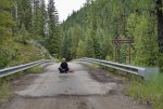
Eve’s temporary fishing license had expired the day before but she wanted to practice her cast off the bank of our camp. She came into camp after an hour with a concerned look on her face. She had spotted a sheriff’s truck stopped on the bridge watching her and it had moved into the campground. She was certain he knew her license had expired. The truck stopped just on the other side of the cedar at our camp site. I came around the corner and waited while I supposed the deputy was running our plates. He finally came into camp and asked if I was Reeves, and wondering if an Eve was with me. He was doing a welfare check. I started laughing as she came around the back of the truck. He said he was doing a welfare check on us and Eve started telling him about her Covid-19 test which was negative (she’s been working as a speech pathologist part time and had the test twice before we left). The deputy joined me in laughter while I explained what a welfare check was to her.

On our first long kayak trip just after our wedding in 2001 Eve’s Irish mother asked me how she would know that we were okay during the two week-long trip in Southeast Alaska. I looked at her and said, “ We’ll give you a call every now and then on the satellite phone I’m going to buy tomorrow.” That phone became almost useless when the U.S. invaded Iraq as the satellites were repositioned to cover the middle east. Alaska got 10 minutes an hour for potential coverage. I gave-up on the phone and bought the 1st generation SPOT. It has been a great tool for letting friends — and in-laws — know of our whereabouts. However, it can fail to send a message and especially in tight river canyons. So, for 4 days there was no SPOT transmission. Also, I learned later that Eve had told her mother that she would text her ever day. She also told her we might be out of cell service but obviously that point wasn’t made strongly enough. We’ve paddled the entire length of the Inside Passage, we’ve paddled the outer coast of Baranof Island and from Sitka to Juneau. I’ve paddled most of Baffin, been tracked by polar bears and have been to places in the Canadian high arctic and Alaska that most people never see. I’ve never had to activate an Epirb, never dangled from a helicopter and never had a sheriff come looking for me. Until then.
We laughed more with the Deputy, then he went off down the road 45 miles to his remote station. I learned when we got into cell service that Eve’s mother was relieved to get the call back from the Sheriff. So, now we have a new rule. If her parents are concerned about us they are to call a close friend who was with us on most of those kayak trips in Alaska, and his charge is to tell them we are fine, unless he can see our blood.


Later that evening our neighbors brought out a home made cannon and shot golf balls across the river. Eve was offered a chance to load, prime and fire the canyon. It was fun.
The 10 miles of road from Cedar Bridge to Hoodoo Pass is paved. The pass itself offers wonderful views into the Bitterroots. From there to Superior MT is a downhill run which ends at I 90.
We’re going to use this route on our visits with the friends in Orofino in the future.
There is a gravel road that follows the North Fork of the Clearwater River in Idaho for about 170 miles into the Bitterroots and over Hoodoo Pass on the Montana border. The Pierce, ID to Superior, MT section is part of the Idaho Backcountry Discovery Route. After a nice visit with friends in Orofino, Idaho we spent the better part of a week camping and hiking along this route.

Clearwater County Road 147 leads into Road 250 at Pierce. We began the route with a fishing trip at the Isabella Creek trailhead. Our friends and Eve fished while I photographed and offered encouragement and put up a tarp that came in handy when the rain and hail started.

Our first camp was at Weitas Creek, which is a large tributary of the North Fork of the Clearwater. The rain continued for most of our stay but didn’t interfere with Eve’s fly fishing and our walks. The camp sites have river access and the trails follow the creek into the wilderness. We spent three nights here.


We had heard the road was washed out from the rain in a couple of spots along Black Rock Canyon which we wanted to drive to get to our next camp at Cedar Bridge. A grader had been working for a day to clear the rock slides and with that a much smoother track was being created. And aside from some stray rocks and tight corners, the drive was uneventful.

The Cedars Campground was dark, damp and muddy. We plowed through a rather deep pool of water and set our camp along the North Fork in a dispersed site called Cedar Bridge. It is one of the best water-side camps we’ve found accessible by road. It is in the open with a large cedar offering shade — the sun finally came out. While this was the run up to the Independence Day weekend, there were few cars along the road and even less coming over the bridge.

We walked the forest service roads and along a trail to Trap Creek over our 3 night stay. I set the solar panels to recharge the battery each day with continued sun. A family set up camp in another site on July 3, bringing with them the happy camper sounds of a 6 year old boy.

Eve’s temporary fishing license had expired the day before but she wanted to practice her cast off the bank of our camp. She came into camp after an hour with a concerned look on her face. She had spotted a sheriff’s truck stopped on the bridge watching her and it had moved into the campground. She was certain he knew her license had expired. The truck stopped just on the other side of the cedar at our camp site. I came around the corner and waited while I supposed the deputy was running our plates. He finally came into camp and asked if I was Reeves, and wondering if an Eve was with me. He was doing a welfare check. I started laughing as she came around the back of the truck. He said he was doing a welfare check on us and Eve started telling him about her Covid-19 test which was negative (she’s been working as a speech pathologist part time and had the test twice before we left). The deputy joined me in laughter while I explained what a welfare check was to her.

On our first long kayak trip just after our wedding in 2001 Eve’s Irish mother asked me how she would know that we were okay during the two week-long trip in Southeast Alaska. I looked at her and said, “ We’ll give you a call every now and then on the satellite phone I’m going to buy tomorrow.” That phone became almost useless when the U.S. invaded Iraq as the satellites were repositioned to cover the middle east. Alaska got 10 minutes an hour for potential coverage. I gave-up on the phone and bought the 1st generation SPOT. It has been a great tool for letting friends — and in-laws — know of our whereabouts. However, it can fail to send a message and especially in tight river canyons. So, for 4 days there was no SPOT transmission. Also, I learned later that Eve had told her mother that she would text her ever day. She also told her we might be out of cell service but obviously that point wasn’t made strongly enough. We’ve paddled the entire length of the Inside Passage, we’ve paddled the outer coast of Baranof Island and from Sitka to Juneau. I’ve paddled most of Baffin, been tracked by polar bears and have been to places in the Canadian high arctic and Alaska that most people never see. I’ve never had to activate an Epirb, never dangled from a helicopter and never had a sheriff come looking for me. Until then.
We laughed more with the Deputy, then he went off down the road 45 miles to his remote station. I learned when we got into cell service that Eve’s mother was relieved to get the call back from the Sheriff. So, now we have a new rule. If her parents are concerned about us they are to call a close friend who was with us on most of those kayak trips in Alaska, and his charge is to tell them we are fine, unless he can see our blood.


Later that evening our neighbors brought out a home made cannon and shot golf balls across the river. Eve was offered a chance to load, prime and fire the canyon. It was fun.
The 10 miles of road from Cedar Bridge to Hoodoo Pass is paved. The pass itself offers wonderful views into the Bitterroots. From there to Superior MT is a downhill run which ends at I 90.
We’re going to use this route on our visits with the friends in Orofino in the future.
Last edited:
Umnak
Adventurer
Another Plague Trip
Eastern Oregon
Our Idaho friend and her two children joined us on a five day trip in Eastern Oregon’s Blue Mountains. Eve and I left on a Saturday and made it to Pendleton for the evening. The plague had descended upon the town and only take-out was available for our dinner, which we ate at the hotel we stayed. The temperature was 105 when we stopped for the day.
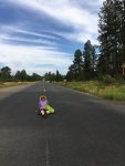
Birdtrack Springs is a Forest Service Campground about 15 minutes off of I 82 just north of La Grande. We arrived Sunday afternoon to an also empty campground. It was our first time camping with young children — 7 & 4 — and we were excited by the prospect of the experience.
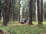
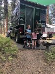
Eve and Reece (7) have been role playing a game of Pirates/Explorers since he was 4. He asked his mother to stop the car when they came into the campground and he saw Eve. He ran by me with open arms saying “Eve!, Eve!” . I know where I stand with him, essentially a guy to sort of fool around with but, in the end, isn’t going to be wearing a sword and slashing monsters while standing on the living room couch. Nora is 4 and trys to keep up with her brother. They are a couple of cool kids.
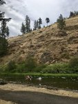
It was hot during the day, high 90s. Fortunately, the Grand Ronde River was just across the road and there was a real swimming hole where we could cool off.
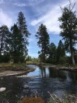
We walked, swam and played most of our waking hours. Gin and Tonics at 1700 hours was a nice way to welcome in dinner and a fire.
A visit to La Grande included stopping at toy stores and deciding which stuffed animal to buy. Then to the grocery store for ice to cool the tonic and some more wine for Megan and I.
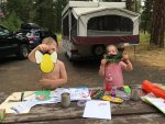
All 217 camp sites at the Lake Wallowa state park near Joseph were booked when I checked the week before we left. Nothing had changed when we arrived on our 5th night of the trip. I used my camp site app to locate The Hurricane Creek Forest Service campground on the other side of the mountain from the lake and we were fortunate to find a nice spot.
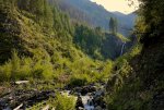
After setting camp we drove to the Falls Creek Trail and walked up a couple of miles until we realized the best view was at the trail head. I was impressed with the children’s stamina and interest in the trail and mountains. These are pretty cool kids.
The drive from Joseph to Lewiston is very nice. It follows the Grand Ronde River for a good deal of the route. The Rattlesnake Ridge grade offers exciting switchbacks and impressive views.
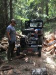
Once in Orofino we cleaned up and joined Jarel for a couple of days. He had not come on the camping trip as he was heading to Kodiak for fishing with his brother.
Late summer in Idaho means hot days and cool nights. We had a great visit. I helped with splitting a few cords of wood before we left for the coast and cooler weather.
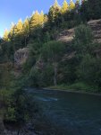
We made it to the east side of the Cascades our first day and stayed at a packed FS Campground on the Tieton River. It’s a well worn campground. There are sites on the river but it looked as though they had been reserved for days. Our site was in the forest and quiet.
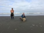
The next day’s drive to Ocean Shores began and ended with nice driving. The middle part was on I 5, which isn’t a lot of fun to drive.
Our friends from Juneau retired, sold their house and almost everything else they owned and are now starting a multi-year road trip. It was great to see them and their amazing Cairn Terriers for a couple of nights near the coast. We spent an additional night out on the Sol Duc River off of Rt. 101 between Forks and Crescent Lake.
Good trip.
Eastern Oregon
Our Idaho friend and her two children joined us on a five day trip in Eastern Oregon’s Blue Mountains. Eve and I left on a Saturday and made it to Pendleton for the evening. The plague had descended upon the town and only take-out was available for our dinner, which we ate at the hotel we stayed. The temperature was 105 when we stopped for the day.

Birdtrack Springs is a Forest Service Campground about 15 minutes off of I 82 just north of La Grande. We arrived Sunday afternoon to an also empty campground. It was our first time camping with young children — 7 & 4 — and we were excited by the prospect of the experience.

Eve and Reece (7) have been role playing a game of Pirates/Explorers since he was 4. He asked his mother to stop the car when they came into the campground and he saw Eve. He ran by me with open arms saying “Eve!, Eve!” . I know where I stand with him, essentially a guy to sort of fool around with but, in the end, isn’t going to be wearing a sword and slashing monsters while standing on the living room couch. Nora is 4 and trys to keep up with her brother. They are a couple of cool kids.

It was hot during the day, high 90s. Fortunately, the Grand Ronde River was just across the road and there was a real swimming hole where we could cool off.

We walked, swam and played most of our waking hours. Gin and Tonics at 1700 hours was a nice way to welcome in dinner and a fire.

A visit to La Grande included stopping at toy stores and deciding which stuffed animal to buy. Then to the grocery store for ice to cool the tonic and some more wine for Megan and I.

All 217 camp sites at the Lake Wallowa state park near Joseph were booked when I checked the week before we left. Nothing had changed when we arrived on our 5th night of the trip. I used my camp site app to locate The Hurricane Creek Forest Service campground on the other side of the mountain from the lake and we were fortunate to find a nice spot.

After setting camp we drove to the Falls Creek Trail and walked up a couple of miles until we realized the best view was at the trail head. I was impressed with the children’s stamina and interest in the trail and mountains. These are pretty cool kids.
The drive from Joseph to Lewiston is very nice. It follows the Grand Ronde River for a good deal of the route. The Rattlesnake Ridge grade offers exciting switchbacks and impressive views.

Once in Orofino we cleaned up and joined Jarel for a couple of days. He had not come on the camping trip as he was heading to Kodiak for fishing with his brother.
Late summer in Idaho means hot days and cool nights. We had a great visit. I helped with splitting a few cords of wood before we left for the coast and cooler weather.

We made it to the east side of the Cascades our first day and stayed at a packed FS Campground on the Tieton River. It’s a well worn campground. There are sites on the river but it looked as though they had been reserved for days. Our site was in the forest and quiet.

The next day’s drive to Ocean Shores began and ended with nice driving. The middle part was on I 5, which isn’t a lot of fun to drive.
Our friends from Juneau retired, sold their house and almost everything else they owned and are now starting a multi-year road trip. It was great to see them and their amazing Cairn Terriers for a couple of nights near the coast. We spent an additional night out on the Sol Duc River off of Rt. 101 between Forks and Crescent Lake.
Good trip.
Umnak
Adventurer
North Cascades Loop
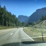
The Cascade Loop — really its’ the North Cascades — is a 400 mile paved road trip along US 2, US 97 and WA Route 20. We’ve been on 20 enough but had yet to take US 2 over Stevens Pass and into Leavenworth, Chelan and Wenatchee. So, I took a few days to make the loop starting in that direction.
US 2 runs from Everett Washington to Boston. I took the Kingston ferry across Puget Sound and avoided the interstates to connect with it at Snohomish. The road narrows and climbs into the mountains passing Sultan and Skykomish before Stevens Pass, which isn’t as impressive as the other routes over the Cascades.

My first camp was at a Forest Service Campground on Lake Wenatchee. The view of Glacier Peak was impressive. The early morning fog wasn’t. But I had a fire even with the damp local fire wood bundle. This was to be a theme for the next few days. Sign says dry wood, but with the plague still keeping people out in the forest, the wood cutters were pushing the seasoning.

The highway follows the Wenatchee River downstream to Leavenworth. Leavenworth was a dying hill town when at some point the community decided to turn it into a replica Bavarian Village. All of the hotels and businesses have that wood and stucco look. Given the lack of people for mid-week in early October, it was kind of weird, looking more like a movie set. I imagine that the October Fest had been canceled. The only beer garden I saw was empty of tables. I bought some gas and brandy and kept moving.

Lake Chelan is 50 miles long and 1400’ deep. The town of Chelan is on the south end and the hamlet of Stehekin on the north. Stehekin is only accessible by water and plane. The lake reminds me of a Southeast Alaska fjord with steep mountains on both sides the farther north you travel. Eve and I returned a couple of weeks after my solo trip and took the boat up lake.
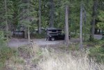
Route 97 out of Chelan follows the Columbia, which looks more like a lake than a river along this stretch. At Pateros I turned north into the Methow Valley to connect with Rt 20. at Twisp. The Valley has a “western” feel to it and the communities have embraced this with an old west architecture as standard. Twisp was packed, the state park looked like a plague camp with tents and RVs in a field. I kept going and found a decent Forest Service campground outside of Mazma and along Early Winters Creek.
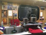
There seem to be a lot more people out camping this fall, and given that many have small children and nice rigs I imagine they are techies who are working from “home”. I spoke with a few of these people who said they are new to traveling and enjoying it a lot.
I hiked the trails around camp and spent way too much time getting a decent fire going with my latest purchase of “dry” wood.
The Pacific Crest Trail crosses Rt 20 just past where I had camped. Dozens of cars were parked in the lot and along the highway at both the north and south trailhead. Everyone is getting outside.
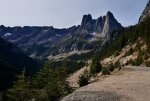
Washington Pass is a spectacular area. It will soon be closing for the winter and with it the loop until late spring. You can access the closed portion of highway during the winter and I would imagine it to be a great place to ski and snowshoe.
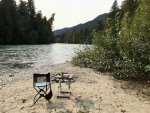
I had hoped to spend my last night at the North Cascade National Park’s Newhalem Campground. However, it had closed due to the plague and, I’ll assume, the input of Seattle Light who owns the company town of the same name. Instead, I stayed across the Skagit River at the Cambell Creek campground. I had my own beach and all afternoon to watch the river.
Timing is everything for driving the Cascade Loop in the fall. The trees were still mostly green when I went through and two weeks later there was a lot of snow. I’d take the leaves over the snow.

The Cascade Loop — really its’ the North Cascades — is a 400 mile paved road trip along US 2, US 97 and WA Route 20. We’ve been on 20 enough but had yet to take US 2 over Stevens Pass and into Leavenworth, Chelan and Wenatchee. So, I took a few days to make the loop starting in that direction.
US 2 runs from Everett Washington to Boston. I took the Kingston ferry across Puget Sound and avoided the interstates to connect with it at Snohomish. The road narrows and climbs into the mountains passing Sultan and Skykomish before Stevens Pass, which isn’t as impressive as the other routes over the Cascades.

My first camp was at a Forest Service Campground on Lake Wenatchee. The view of Glacier Peak was impressive. The early morning fog wasn’t. But I had a fire even with the damp local fire wood bundle. This was to be a theme for the next few days. Sign says dry wood, but with the plague still keeping people out in the forest, the wood cutters were pushing the seasoning.

The highway follows the Wenatchee River downstream to Leavenworth. Leavenworth was a dying hill town when at some point the community decided to turn it into a replica Bavarian Village. All of the hotels and businesses have that wood and stucco look. Given the lack of people for mid-week in early October, it was kind of weird, looking more like a movie set. I imagine that the October Fest had been canceled. The only beer garden I saw was empty of tables. I bought some gas and brandy and kept moving.

Lake Chelan is 50 miles long and 1400’ deep. The town of Chelan is on the south end and the hamlet of Stehekin on the north. Stehekin is only accessible by water and plane. The lake reminds me of a Southeast Alaska fjord with steep mountains on both sides the farther north you travel. Eve and I returned a couple of weeks after my solo trip and took the boat up lake.

Route 97 out of Chelan follows the Columbia, which looks more like a lake than a river along this stretch. At Pateros I turned north into the Methow Valley to connect with Rt 20. at Twisp. The Valley has a “western” feel to it and the communities have embraced this with an old west architecture as standard. Twisp was packed, the state park looked like a plague camp with tents and RVs in a field. I kept going and found a decent Forest Service campground outside of Mazma and along Early Winters Creek.

There seem to be a lot more people out camping this fall, and given that many have small children and nice rigs I imagine they are techies who are working from “home”. I spoke with a few of these people who said they are new to traveling and enjoying it a lot.
I hiked the trails around camp and spent way too much time getting a decent fire going with my latest purchase of “dry” wood.
The Pacific Crest Trail crosses Rt 20 just past where I had camped. Dozens of cars were parked in the lot and along the highway at both the north and south trailhead. Everyone is getting outside.

Washington Pass is a spectacular area. It will soon be closing for the winter and with it the loop until late spring. You can access the closed portion of highway during the winter and I would imagine it to be a great place to ski and snowshoe.

I had hoped to spend my last night at the North Cascade National Park’s Newhalem Campground. However, it had closed due to the plague and, I’ll assume, the input of Seattle Light who owns the company town of the same name. Instead, I stayed across the Skagit River at the Cambell Creek campground. I had my own beach and all afternoon to watch the river.
Timing is everything for driving the Cascade Loop in the fall. The trees were still mostly green when I went through and two weeks later there was a lot of snow. I’d take the leaves over the snow.
Umnak
Adventurer
The Plague Year’s finish.
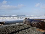
We were able to do a few short trips on the Olympic Peninsula in November and December. Our third post Thanksgiving trip to Rialto Beach and Mora Campground was uneventful and relaxing.
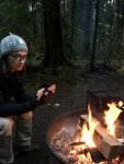
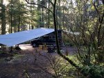
High winds and tides prevented us from moving along the coast and the threat of rain allowed me to set tarps.
We had planned on a trip to California's for the last half of December but the plague numbers — and the closing of campgrounds — made us rethink that.
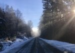
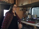
Instead, we spent more time on the Olympic Peninsula. First at Salt Creek in a snow storm then along the Quinault River and the Graves Creek Campground which gives access to the Enhancement Valley hiking trails.
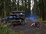
The rain forest is incredibly beautiful along the Quinault River.
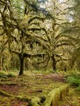
Let's hope 2021 is a lot better than the past 9 months of 2020.
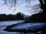

We were able to do a few short trips on the Olympic Peninsula in November and December. Our third post Thanksgiving trip to Rialto Beach and Mora Campground was uneventful and relaxing.

High winds and tides prevented us from moving along the coast and the threat of rain allowed me to set tarps.

We had planned on a trip to California's for the last half of December but the plague numbers — and the closing of campgrounds — made us rethink that.


Instead, we spent more time on the Olympic Peninsula. First at Salt Creek in a snow storm then along the Quinault River and the Graves Creek Campground which gives access to the Enhancement Valley hiking trails.

The rain forest is incredibly beautiful along the Quinault River.

Let's hope 2021 is a lot better than the past 9 months of 2020.

Sierra Valley
Wander
Great to see you back posting. I bet you got more pics than that 
Umnak
Adventurer
Bought Back the Sportsmobile

Been a while since I've posted - a long while - but thought you all may be interested in knowing how and why we repurchased our T1N after five years in a truck camper.
This winter we spent 6 weeks in the southwest. A portion of that time was wet and cold. So wet and cold that we spent a lot of time in the 7' space of the truck camper. Those were long nights.
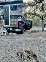
I had to be on a board meeting in March and we decided to get a hotel room for a couple of nights. We talked about wanting to get back into a Sprinter and I decided to take a look at RV Trader. I plugged in Sportsmobile Sprinter and the 2nd van that showed up was the one we sold to a couple from Georgia in 2018. I responded to the ad with the note that we had owned the van previously. A call the next day from a car dealer in Athens confirmed that it was our van and that one of the owners was a friend of the dealer and that person had recently died.
We flew to Georgia and drove the van back to the Olympic Peninsula in late March. There were just over 10,000 more miles on it than when we sold it. Four thousand of those miles were the trip from Seattle to Athens. The van drove well, though for some reason -- never fully diagnosed -- it required a screw driver to override some chip when the temperature dropped below 34 f.
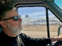
We got it home and have recently had a master Sprinter mechanic go over it and fix what needed to be fixed. It is such a pleasure to be back in the Sprinter.
More room, no propane a real bathroom and did I say more space? Also, the bed is not as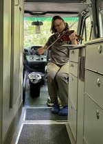 weird to get into as the truck camper east west set-up. We're happy to have our old friend back.
More to come

Been a while since I've posted - a long while - but thought you all may be interested in knowing how and why we repurchased our T1N after five years in a truck camper.
This winter we spent 6 weeks in the southwest. A portion of that time was wet and cold. So wet and cold that we spent a lot of time in the 7' space of the truck camper. Those were long nights.

I had to be on a board meeting in March and we decided to get a hotel room for a couple of nights. We talked about wanting to get back into a Sprinter and I decided to take a look at RV Trader. I plugged in Sportsmobile Sprinter and the 2nd van that showed up was the one we sold to a couple from Georgia in 2018. I responded to the ad with the note that we had owned the van previously. A call the next day from a car dealer in Athens confirmed that it was our van and that one of the owners was a friend of the dealer and that person had recently died.
We flew to Georgia and drove the van back to the Olympic Peninsula in late March. There were just over 10,000 more miles on it than when we sold it. Four thousand of those miles were the trip from Seattle to Athens. The van drove well, though for some reason -- never fully diagnosed -- it required a screw driver to override some chip when the temperature dropped below 34 f.

We got it home and have recently had a master Sprinter mechanic go over it and fix what needed to be fixed. It is such a pleasure to be back in the Sprinter.
More room, no propane a real bathroom and did I say more space? Also, the bed is not as
 weird to get into as the truck camper east west set-up. We're happy to have our old friend back.
More to come
Umnak
Adventurer
and that it had so few miles put on it in 5 years. Good KarmaInteresting, What are the odds you find the vehicle you owned in the past after several years...
Similar threads
- Replies
- 9
- Views
- 2K
- Replies
- 0
- Views
- 517
- Replies
- 3
- Views
- 1K
- Replies
- 3
- Views
- 476

