You are using an out of date browser. It may not display this or other websites correctly.
You should upgrade or use an alternative browser.
You should upgrade or use an alternative browser.
3 Years Around North America, Plus a Few More
- Thread starter Umnak
- Start date
Umnak
Adventurer
We hope to make the trip to NF and PEI in the next year or so.
Your comments just reinforce my decision!
Thanks.
Don't skimp on time, we wish we had another month in NF.
Umnak
Adventurer
On to Labrador
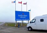
Clouds covered the tops of the headlands of Labrador during our crossing, so much so it was difficult to determine if what we were seeing were mountains or hills. We disembarked in Blanc Sablon, Quebec, and from there a steep road leads into Labrador. The headlands are mountains not hills.
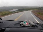
The clouds also obscured the views into the interior and often the road ahead, which required long descents into the coves where small communities hang on to a fishing economy gone bad. There were more trees than I expected, small pines similar to those along the tree-line in Alaska and the Yukon. Wooden sleds were scattered about at pullouts along the road. Left there, untouched, from the previous year when locals had hauled out wood for fuel.
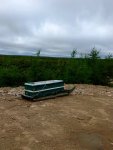
The communities are as neat and clean as those in Newfoundland, where awards are presented to the cleanest village in each region, and those are proudly displayed at the entrance to the town.
Newfoundland/Labrador’s population has not increased in the past 40 years, and the number of people who live in Labrador may have diminished. The cod moratorium that came in the 1990s ended a way of life for thousands of people, and the cod has not made a substantial come back since that time. There is a shrimp fishery and an emerging oyster industry, but not enough to provide work for the young, who leave if they are able.
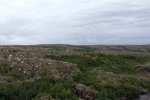
The accents confound and surprise. Eve — a speech pathologist — noticed a marked absence of the diphthong “th”, so it is, “I tink tat” instead of I think that. Whatever the word choice, the people are friendly and kind.
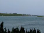
A storm blew in while we were camped at the Provincial Park near Pinware. We had chosen a spot on a rise above the ocean to catch a breeze against the black flies. The site was surrounded on three sides with a thick covering of pine, which proved to be useful against the strong wind that began in the early morning and would increase that afternoon to more than 50 mph.
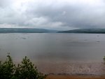
The park has a great view of the Strait of Belle Isle and the Pinware river that feeds it in this part of the province. The attendant said we were the first Alaskan’s he had registered in more than 10 years on the job. The Sportsmobile was like having a dog in the campgrounds we visited, as it was a topic of conversation where ever we went, especially among people who had other Sprinter builds. They marveled at the utility, strength and simplicity of the design. Alaska plates doubled the interest, like walking a puppy through the campsites.
The road out of Pinware is paved. It rises from the sea and passes over the mountains and then down again into the next cove. The terrain looks sub arctic with occasional stands of small trees beaten by the wind. That wind was hitting us broadside on the ridges, and there were times I feared it would move us across the road and into the ditch. However, the Sprinter held to the road and we muscled into Red Bay.

Clouds covered the tops of the headlands of Labrador during our crossing, so much so it was difficult to determine if what we were seeing were mountains or hills. We disembarked in Blanc Sablon, Quebec, and from there a steep road leads into Labrador. The headlands are mountains not hills.

The clouds also obscured the views into the interior and often the road ahead, which required long descents into the coves where small communities hang on to a fishing economy gone bad. There were more trees than I expected, small pines similar to those along the tree-line in Alaska and the Yukon. Wooden sleds were scattered about at pullouts along the road. Left there, untouched, from the previous year when locals had hauled out wood for fuel.

The communities are as neat and clean as those in Newfoundland, where awards are presented to the cleanest village in each region, and those are proudly displayed at the entrance to the town.
Newfoundland/Labrador’s population has not increased in the past 40 years, and the number of people who live in Labrador may have diminished. The cod moratorium that came in the 1990s ended a way of life for thousands of people, and the cod has not made a substantial come back since that time. There is a shrimp fishery and an emerging oyster industry, but not enough to provide work for the young, who leave if they are able.

The accents confound and surprise. Eve — a speech pathologist — noticed a marked absence of the diphthong “th”, so it is, “I tink tat” instead of I think that. Whatever the word choice, the people are friendly and kind.

A storm blew in while we were camped at the Provincial Park near Pinware. We had chosen a spot on a rise above the ocean to catch a breeze against the black flies. The site was surrounded on three sides with a thick covering of pine, which proved to be useful against the strong wind that began in the early morning and would increase that afternoon to more than 50 mph.

The park has a great view of the Strait of Belle Isle and the Pinware river that feeds it in this part of the province. The attendant said we were the first Alaskan’s he had registered in more than 10 years on the job. The Sportsmobile was like having a dog in the campgrounds we visited, as it was a topic of conversation where ever we went, especially among people who had other Sprinter builds. They marveled at the utility, strength and simplicity of the design. Alaska plates doubled the interest, like walking a puppy through the campsites.
The road out of Pinware is paved. It rises from the sea and passes over the mountains and then down again into the next cove. The terrain looks sub arctic with occasional stands of small trees beaten by the wind. That wind was hitting us broadside on the ridges, and there were times I feared it would move us across the road and into the ditch. However, the Sprinter held to the road and we muscled into Red Bay.
AllAmericanInfidel
Observer
Great story! looks like an awesome adventure!
Umnak
Adventurer
Red Bay & Mary's Harbour

The wind increased as we came down off the mountain toward the sea. Upon entering Red Bay we learned of a woman who had opened the trunk of her rented vehicle that morning as a gust pushed down the hill. The trunk blew out the rear windscreen. People from the Parks Canada site were quick to help and taped visqueen over the hatch. Later, I stopped another traveler from opening a car door into the wind which was then at its peak.
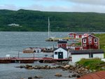
Red Bay Coastline
Red Bay hosts the UNESCO/Parks Canada Basque Whaling site which includes a small vessel from a ship that sank in 1546. The Basque are known to have used the area seasonally beginning in 1503. It seems reasonable to assume they were familiar with this part of the world earlier than that, given their knowledge of the fishing banks off the coast. Their remarkable skills in ship building and sailing would have easily put them on the North American mainland earlier than 1503.

Basque Whale Boat
A small museum that displays artifacts from the underwater excavation is the focal point of the town’s economy. The site’s maintenance man pointed across the bay to a lighthouse and told us he lived there until he was 16, when his father was replaced by a mechanized light. It is also the location of the sunken ship.
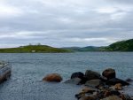
Wreck Site and Former Lighthouse
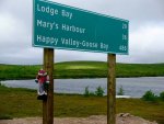

The pavement ends at the sign leading out of Red Bay along the South Labrador Highway. The wind was now assisted by pot holes and mud in making the 55 mile drive to Mary’s Harbour a challenge. The van proved itself as the terrain changed to barren ground and tundra. A few coves held settlements or fish camps. The sky cleared, though the wind held on, giving us a remarkable view inland and out into the Strait.

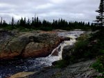
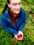
Mary’s Harbour is larger than Red Bay, and a small fleet of Shrimpers gives the place a sense of prosperity that doesn’t come with the Basque archaeology site. The houses crowd around the protected cove that pushes inland. A trail to a falls was recommended by a group of kids hanging out at the sign post announcing the name of the town and upcoming events, such as the start of school and the closing of a fish opening. It was a good walk, and one we needed after a couple of hours of tense driving. Eve found a patch of berries.
We ordered a loaf of bread from the mother of the shop keeper to be picked up in two days, then checked in at the office for the morning’s run to Battle Harbour. The clerk offered the use of a parking space for the night on the wharf, and said she would leave the bathrooms unlocked for our use. We just closed the blinds and made ourselves at home on the dock. She also said that the last group to head out to the island had been unable to return because of the wind, so to expect them early the next morning.
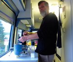

The wind increased as we came down off the mountain toward the sea. Upon entering Red Bay we learned of a woman who had opened the trunk of her rented vehicle that morning as a gust pushed down the hill. The trunk blew out the rear windscreen. People from the Parks Canada site were quick to help and taped visqueen over the hatch. Later, I stopped another traveler from opening a car door into the wind which was then at its peak.

Red Bay Coastline
Red Bay hosts the UNESCO/Parks Canada Basque Whaling site which includes a small vessel from a ship that sank in 1546. The Basque are known to have used the area seasonally beginning in 1503. It seems reasonable to assume they were familiar with this part of the world earlier than that, given their knowledge of the fishing banks off the coast. Their remarkable skills in ship building and sailing would have easily put them on the North American mainland earlier than 1503.

Basque Whale Boat
A small museum that displays artifacts from the underwater excavation is the focal point of the town’s economy. The site’s maintenance man pointed across the bay to a lighthouse and told us he lived there until he was 16, when his father was replaced by a mechanized light. It is also the location of the sunken ship.

Wreck Site and Former Lighthouse


The pavement ends at the sign leading out of Red Bay along the South Labrador Highway. The wind was now assisted by pot holes and mud in making the 55 mile drive to Mary’s Harbour a challenge. The van proved itself as the terrain changed to barren ground and tundra. A few coves held settlements or fish camps. The sky cleared, though the wind held on, giving us a remarkable view inland and out into the Strait.

Mary’s Harbour is larger than Red Bay, and a small fleet of Shrimpers gives the place a sense of prosperity that doesn’t come with the Basque archaeology site. The houses crowd around the protected cove that pushes inland. A trail to a falls was recommended by a group of kids hanging out at the sign post announcing the name of the town and upcoming events, such as the start of school and the closing of a fish opening. It was a good walk, and one we needed after a couple of hours of tense driving. Eve found a patch of berries.


We ordered a loaf of bread from the mother of the shop keeper to be picked up in two days, then checked in at the office for the morning’s run to Battle Harbour. The clerk offered the use of a parking space for the night on the wharf, and said she would leave the bathrooms unlocked for our use. We just closed the blinds and made ourselves at home on the dock. She also said that the last group to head out to the island had been unable to return because of the wind, so to expect them early the next morning.

Umnak
Adventurer
Battle Harbour 1
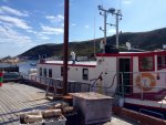
Iceberg Hunter
The former Canadian Coast Guard vessel, Iceberg Hunter arrived at the dock before 9:00 am even as the shore clerk came speeding down the lane to the wharf. It had left early to give the stranded visitors a chance at making the ferry in Blanc Salon and crossing back to Newfoundland later that morning. One couple was traveling in a rented sub compact. Thinking of the size of the pot holes on the road, I wished them luck. The Captain and mate left the vessel to check in on their families, saying to be ready to leave by 11.
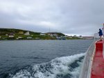
There were only five of us heading to the island that day. The 45 minute crossing reveals a bare landscape and sounded whales and dolphins. A diesel heater offered comfort from the wind and temperatures in the mid 40s.
Battle Harbour is a very special place that opened itself to our understanding over the course of the 24 hours were there. I would recommend a two-day visit knowing what we now know. We had read about it on the ferry from Nova Scotia, but couldn’t quite figure out what to expect. Even when we purchased the one night package for $525, which included transportation, meals and lodging, it wasn’t clear what we would find there. Our limited access to the internet hadn’t helped, so we were relying on the rather limited brochure found at the Mary’s Harbour office, and the smiles of the people who disembarked from the Iceberg Hunter. Smiles and encouragement even after weathering the storm we had drove though the day before.
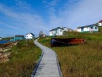
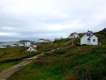
Like many settlements along the Labrador coast Battle Harbour has an uncertain history. Even the name has different variations, one being that the Inuit and Inuk had a fight nearby, while another is that the English mispronounced the Basque word for boat. What is known is that the English firm of John Slade & Poole Company was using the island for harvesting seals and cod as early as 1750. Its location offered a safe anchorage and it eventually became a commercial and, to some extent, political center of Labrador though the 19th century.

Think of Battle Harbour as a coal town without the dirt. The resident fishermen and their families were inextricably tied to the company who owned the store, the processing equipment and materials for salting the cod. The infrastructure was sold to another concernwho kept the inhabitants impoverished and alive for the next 100 years. The company also kept the community going even after the Canadian government’s relocation programs in late 1960s and early 1970s. These relocations were not as heavy handed in southern Labrador as those in the far north, but with the loss of a school and clinic, most moved to Mary’s Harbour or farther along the coast. Many kept summer houses at Battle Harbour and continued to fish until the closing of the cod fishery in 1990. At that time the company donated the site to the newly formed Battle Harbour Historic Trust. This trust, whose board consists of people whose families had lived in the community for generations, wanted to preserve the buildings and offer a glimpse into the life their ancestors had lived. They have done a remarkable job at that while making the visit and their hospitality memorable.
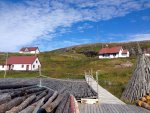

Iceberg Hunter
The former Canadian Coast Guard vessel, Iceberg Hunter arrived at the dock before 9:00 am even as the shore clerk came speeding down the lane to the wharf. It had left early to give the stranded visitors a chance at making the ferry in Blanc Salon and crossing back to Newfoundland later that morning. One couple was traveling in a rented sub compact. Thinking of the size of the pot holes on the road, I wished them luck. The Captain and mate left the vessel to check in on their families, saying to be ready to leave by 11.

There were only five of us heading to the island that day. The 45 minute crossing reveals a bare landscape and sounded whales and dolphins. A diesel heater offered comfort from the wind and temperatures in the mid 40s.
Battle Harbour is a very special place that opened itself to our understanding over the course of the 24 hours were there. I would recommend a two-day visit knowing what we now know. We had read about it on the ferry from Nova Scotia, but couldn’t quite figure out what to expect. Even when we purchased the one night package for $525, which included transportation, meals and lodging, it wasn’t clear what we would find there. Our limited access to the internet hadn’t helped, so we were relying on the rather limited brochure found at the Mary’s Harbour office, and the smiles of the people who disembarked from the Iceberg Hunter. Smiles and encouragement even after weathering the storm we had drove though the day before.


Like many settlements along the Labrador coast Battle Harbour has an uncertain history. Even the name has different variations, one being that the Inuit and Inuk had a fight nearby, while another is that the English mispronounced the Basque word for boat. What is known is that the English firm of John Slade & Poole Company was using the island for harvesting seals and cod as early as 1750. Its location offered a safe anchorage and it eventually became a commercial and, to some extent, political center of Labrador though the 19th century.

Think of Battle Harbour as a coal town without the dirt. The resident fishermen and their families were inextricably tied to the company who owned the store, the processing equipment and materials for salting the cod. The infrastructure was sold to another concernwho kept the inhabitants impoverished and alive for the next 100 years. The company also kept the community going even after the Canadian government’s relocation programs in late 1960s and early 1970s. These relocations were not as heavy handed in southern Labrador as those in the far north, but with the loss of a school and clinic, most moved to Mary’s Harbour or farther along the coast. Many kept summer houses at Battle Harbour and continued to fish until the closing of the cod fishery in 1990. At that time the company donated the site to the newly formed Battle Harbour Historic Trust. This trust, whose board consists of people whose families had lived in the community for generations, wanted to preserve the buildings and offer a glimpse into the life their ancestors had lived. They have done a remarkable job at that while making the visit and their hospitality memorable.

Umnak
Adventurer
Battle Harbour 2
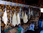
It is the connection to the island of those who live and work here that makes Battle Harbour different than an overnight at a reconstructed historical site. Daphne Smith, who is both chief and tour guide, was born and raised in Battle Harbour. Her description of the buildings is from the memory of her heart. She tells the story of hiding in the engine room of her grandfather’s boat after being told that she was too young at 8 to be on the boat, and besides as a girl she had no place in cod fishing. She was found well off shore and stayed the day. The next time they went out she simply said she was going, and he said to stay out of the way. Daphne continued to offer vignettes and insights during our afternoon walk through the outbuildings and along the board walks. She and her husband keep the family house on the island and spend the summer working and fishing.

This photograph shows Daphne with a cut out photograph of her grandmother taken in the 1960s.
She went off to finish our dinner while Eve I went settled in to our room. The hotel is new and built to the standard of a modern facility while incorporating designs of the 19th century. Our room had plank floors, walls and ceilings, a luxurious bath, infrared heat and furniture not unlike that which would have decorated the homes on the island.

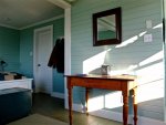
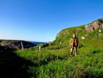
We then went for a walk, passing two cemeteries, the oldest of which showed stones from the 18th century.
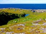
I invited everyone in our party to the bar for drinks following an exquisite dinner. There, a young guest played the resident harmonium as we watched the late summer sun dip into the hills across the pass separating Battle Harbour from its larger neighbor.
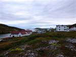
There is a sense of peace and adventure here. The picturesque village and barren landscape are enticing, drawing us into a past that exists in the heart, and brought to our awareness though the voices of those who call this place home.
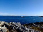
We all loaded into the Iceberg Hunter the next morning after a great breakfast and heartfelt farewells. Whales and dolphins escorted us back to Mary’s Harbour. Eve remembered the promise of fresh bread waiting for us at the store, and after slicing a piece for second breakfast, we took off back down the road toward Blanc Sablon and tomorrow’s ferry.
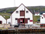

It is the connection to the island of those who live and work here that makes Battle Harbour different than an overnight at a reconstructed historical site. Daphne Smith, who is both chief and tour guide, was born and raised in Battle Harbour. Her description of the buildings is from the memory of her heart. She tells the story of hiding in the engine room of her grandfather’s boat after being told that she was too young at 8 to be on the boat, and besides as a girl she had no place in cod fishing. She was found well off shore and stayed the day. The next time they went out she simply said she was going, and he said to stay out of the way. Daphne continued to offer vignettes and insights during our afternoon walk through the outbuildings and along the board walks. She and her husband keep the family house on the island and spend the summer working and fishing.

This photograph shows Daphne with a cut out photograph of her grandmother taken in the 1960s.
She went off to finish our dinner while Eve I went settled in to our room. The hotel is new and built to the standard of a modern facility while incorporating designs of the 19th century. Our room had plank floors, walls and ceilings, a luxurious bath, infrared heat and furniture not unlike that which would have decorated the homes on the island.


We then went for a walk, passing two cemeteries, the oldest of which showed stones from the 18th century.


I invited everyone in our party to the bar for drinks following an exquisite dinner. There, a young guest played the resident harmonium as we watched the late summer sun dip into the hills across the pass separating Battle Harbour from its larger neighbor.

There is a sense of peace and adventure here. The picturesque village and barren landscape are enticing, drawing us into a past that exists in the heart, and brought to our awareness though the voices of those who call this place home.

We all loaded into the Iceberg Hunter the next morning after a great breakfast and heartfelt farewells. Whales and dolphins escorted us back to Mary’s Harbour. Eve remembered the promise of fresh bread waiting for us at the store, and after slicing a piece for second breakfast, we took off back down the road toward Blanc Sablon and tomorrow’s ferry.

Umnak
Adventurer
Back to Newfoundland
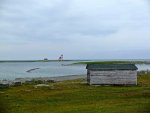
Though the lighthouses in Atlantic Canada are no longer operated by resident keepers, they still provide guidance to mariners. Their gas lights replaced by strong LEDs enhanced with the Fernell Lens. A few of them are also set aside as museums and bed and breakfasts. We stopped at L’anse Amour on our way down Belle Isle Strait to Blanc Sablon, which is home to the tallest light in Labrador at 100 feet, and the grave of an infant who died 7,500 years ago.
The alarm went off at 4:00 am the next morning in the parking lot of the ferry terminal where we had spent the night. No one came by to ask about us, nor does it seem that anyone really cares. We made tea while waiting for the big rigs to load.
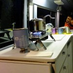
This ferry was full. The truckers sit together trading stories and lies. Their words almost impossible to distinguish given the strong accent, though their laughter gives evidence of intent, if not content. The cook calls the passengers “my darling” when she takes their order. We were back on Newfoundland by mid morning, driving south toward Gros Morne.
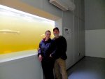
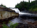
As Alaskans, we are not impressed or happy with farmed salmon. The B.C. farms are a concern to real fishers because of the possibility of the fish escaping their pens and spreading disease among the wild salmon stock. Atlantic salmon appeared on menus and in grocery stores along our route, though never identified as farmed fish. I had assumed there were no wild Atlantic salmon left. Then we drove past the Torrent River fish ladder, which has a viewing room. People in the area restored the Torrent River and built the ladder after extensive logging had wiped out the spawning ground. Four to five thousand fish now pass through each year. There is still no commercial fishery, but it is nice to see the salmon make their way up the ladder for the fly fishers.
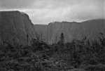
We walked the trail to the spectacular Western Brook Pond, but were put off by the crowds waiting to board the tour boat, so we headed back to a small campground on the ocean for the night.
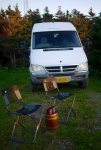
The next day we fumbled our way down the coast to Corner Brook where we shopped and made an appointment for an oil change after the long holiday weekend. It turned out that the garage couldn’t find a filter for the Sprinter, so we put that maintenance off for a couple of weeks until we made Halifax.
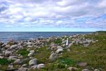

Though the lighthouses in Atlantic Canada are no longer operated by resident keepers, they still provide guidance to mariners. Their gas lights replaced by strong LEDs enhanced with the Fernell Lens. A few of them are also set aside as museums and bed and breakfasts. We stopped at L’anse Amour on our way down Belle Isle Strait to Blanc Sablon, which is home to the tallest light in Labrador at 100 feet, and the grave of an infant who died 7,500 years ago.
The alarm went off at 4:00 am the next morning in the parking lot of the ferry terminal where we had spent the night. No one came by to ask about us, nor does it seem that anyone really cares. We made tea while waiting for the big rigs to load.

This ferry was full. The truckers sit together trading stories and lies. Their words almost impossible to distinguish given the strong accent, though their laughter gives evidence of intent, if not content. The cook calls the passengers “my darling” when she takes their order. We were back on Newfoundland by mid morning, driving south toward Gros Morne.
As Alaskans, we are not impressed or happy with farmed salmon. The B.C. farms are a concern to real fishers because of the possibility of the fish escaping their pens and spreading disease among the wild salmon stock. Atlantic salmon appeared on menus and in grocery stores along our route, though never identified as farmed fish. I had assumed there were no wild Atlantic salmon left. Then we drove past the Torrent River fish ladder, which has a viewing room. People in the area restored the Torrent River and built the ladder after extensive logging had wiped out the spawning ground. Four to five thousand fish now pass through each year. There is still no commercial fishery, but it is nice to see the salmon make their way up the ladder for the fly fishers.


We walked the trail to the spectacular Western Brook Pond, but were put off by the crowds waiting to board the tour boat, so we headed back to a small campground on the ocean for the night.


The next day we fumbled our way down the coast to Corner Brook where we shopped and made an appointment for an oil change after the long holiday weekend. It turned out that the garage couldn’t find a filter for the Sprinter, so we put that maintenance off for a couple of weeks until we made Halifax.

Umnak
Adventurer
Leaving Newfoundland
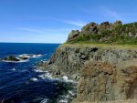
By the end of the first week of September we were almost at the end of the Provincial Park system’s season in Newfoundland. We spent a few days on the coast about an hour drive from Corner Brook. The Blow Me Down Park on the coast was closing for the year the day after we visited, forcing us to boondock a couple of days as we made our way back to Port aux Basques.
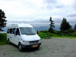
The camp at Blow Me Down was at the beach and not a regular site. I think the park attendant put us there as a novelty for the group of regulars who were spending their final night of the season. They welcomed us to their fire and conversation, which ranged from how Canadians are different from Americans, and how Newfoundlanders are different from Canadians. It was a pleasant night. I was happy to get a sense of the their view on the national political campaign — Newfoundland had voted Liberal since the 1950s and wasn’t going to change.
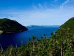

A steep climb from the beach offers fantastic views of the surrounding bays, mountains and cliffs. From there we boondocked on a bluff overlooking Bottle Cove during a violent and beautiful storm. The sunrise the next morning was startling on the far cliffs. We met here a couple from Maine, whom we would run in to over the next couple of weeks.

An interesting aspect of this road trip has been the chance to get a new sense of who we are, having stripped away the usual indicators of how we have identified ourselves. For almost 30 years my professional interactions have included an assumption that I was going to create or solve a problem (I worked for associations serving large numbers of locally elected officials). And in Alaska, if not known for that, we were known as the long distance kayakers. So, aside from our closest friends, any interaction we had with people was colored with these foundations.
I think now we have an opportunity to get to know people without the advantages/barriers of our past. This permits us to get a sense of who we are through our connection with people we meet briefly. It offers a wonderfully reflective opportunity if we stay open to these transitory experiences and not bring the past into the interaction.
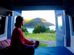
Our last night in Newfoundland was in Cheeseman Park, which was also readying for the end of the season. There is a two mile trail that moves through the rocks and grass leading to a beautiful beach.
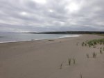
The ocean was relatively calm on the six hour crossing to Nova Scotia. We sat forward in the bar, but left due to the too loud and awful music the bar keeper was playing for herself. Though in the stern we were subjected to a small group of travelers complaining of change, the internet, and the general demise of Canadian/American Culture. All while dolphins played with our wake.

By the end of the first week of September we were almost at the end of the Provincial Park system’s season in Newfoundland. We spent a few days on the coast about an hour drive from Corner Brook. The Blow Me Down Park on the coast was closing for the year the day after we visited, forcing us to boondock a couple of days as we made our way back to Port aux Basques.

The camp at Blow Me Down was at the beach and not a regular site. I think the park attendant put us there as a novelty for the group of regulars who were spending their final night of the season. They welcomed us to their fire and conversation, which ranged from how Canadians are different from Americans, and how Newfoundlanders are different from Canadians. It was a pleasant night. I was happy to get a sense of the their view on the national political campaign — Newfoundland had voted Liberal since the 1950s and wasn’t going to change.


A steep climb from the beach offers fantastic views of the surrounding bays, mountains and cliffs. From there we boondocked on a bluff overlooking Bottle Cove during a violent and beautiful storm. The sunrise the next morning was startling on the far cliffs. We met here a couple from Maine, whom we would run in to over the next couple of weeks.

An interesting aspect of this road trip has been the chance to get a new sense of who we are, having stripped away the usual indicators of how we have identified ourselves. For almost 30 years my professional interactions have included an assumption that I was going to create or solve a problem (I worked for associations serving large numbers of locally elected officials). And in Alaska, if not known for that, we were known as the long distance kayakers. So, aside from our closest friends, any interaction we had with people was colored with these foundations.
I think now we have an opportunity to get to know people without the advantages/barriers of our past. This permits us to get a sense of who we are through our connection with people we meet briefly. It offers a wonderfully reflective opportunity if we stay open to these transitory experiences and not bring the past into the interaction.

Our last night in Newfoundland was in Cheeseman Park, which was also readying for the end of the season. There is a two mile trail that moves through the rocks and grass leading to a beautiful beach.

The ocean was relatively calm on the six hour crossing to Nova Scotia. We sat forward in the bar, but left due to the too loud and awful music the bar keeper was playing for herself. Though in the stern we were subjected to a small group of travelers complaining of change, the internet, and the general demise of Canadian/American Culture. All while dolphins played with our wake.
Umnak
Adventurer
Cape Briton
Cape Briton
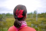
We drove Cape Briton with the ocean on our right, having been told the safer route in the fog and rain would be in the opposite direction. The road rolls and turns as it makes it way along the headlands and past the coves to Ingonish, which we made at nightfall. Unfortunately, the park had closed for the season the previous week. Broad Cove, another 10 clicks north, was open so we settled in there for a few days of hiking. There are a lot of rules about hiking and especially backpacking in Cape Briton’s National Park.
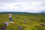
We didn’t manage to backpack due to the limited slots available, but instead did a series of day hikes. The Broad Pond trail follows a two-track that becomes a path through Acadian and Boreal forest until cresting a mountain onto alpine. The rain had settled into a series of showers and that gave us a commanding view to the southeast. We ate blueberries along the trail. Large sweet berries that came in handfuls off every bush. A few more hikes revealed what must be a shadow trail system, blazed, but not shown on the park maps. I posed the question to one of the campground staff and was told it is only used in winter, though it was clear others had been on the trail.
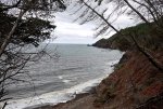
The Sprinter is almost perfect as a tiny house. After more than two months we continue to be surprised about how much room we have relaxing at the end of the day, closing up for the night. And when transformed to a sleeping space, it is cosy and as comfortable as any bed in a house.
A family from Vancouver, BC driving the Park in their Westy stopped by our camp, saying they were looking to upgrade to a Sprinter, and they had been looking at Sportsmobiles. They came back later for a tour while Eve was playing her violin.

Fall means rain in Nova Scotia, and our days in Cape Briton proved that point. We broke the Broad Cove camp in rain, drove the winding roads through clouds and rain, then walked the famous skyline trail in mist. We saw nothing but what was in front of us along the trail.
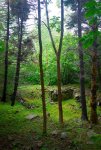
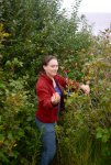
There is a short walk ( 2-3 miles) near Chiticamp that follows a wagon trail past four or five old farmhouse foundations. At each site a small plaque offers the name of the father and mother of the 9 or 10 children who lived at the farmstead. At certain times of the year the men went off to work in the coastal fishery, leaving the others to tend the crops and livestock. We found an apple tree with sweet fruit toward the end of the trail. A thin river passed along the fields between the wagon trail and the flats. I imagine the community of women and children was often a happy place.
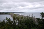
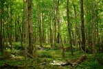
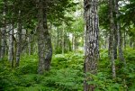
The temperate Acadian forest consists of broadleaf and conifers depending on elevation. While almost all of the area had been cleared for farming, the forest is returning and in some places small pockets of old growth are to be seen. Alpine plants and dwarf pine thrive in the cool wet mountain tops.
The final disappointment of Cape Briton came at the Celtic Music Center after a night boondocking at the coastal trail parking lot at Baxter Cove. It is essentially a restaurant with some good local fiddle music. A small museum shows some photographs and album covers, and patrons can pick up a violin and walk through a few basic notes, or try to clog on the makeshift kitchen floor. The rain began again, so we put Cape Briton behind us and headed toward Halifax.
Cape Briton

We drove Cape Briton with the ocean on our right, having been told the safer route in the fog and rain would be in the opposite direction. The road rolls and turns as it makes it way along the headlands and past the coves to Ingonish, which we made at nightfall. Unfortunately, the park had closed for the season the previous week. Broad Cove, another 10 clicks north, was open so we settled in there for a few days of hiking. There are a lot of rules about hiking and especially backpacking in Cape Briton’s National Park.

We didn’t manage to backpack due to the limited slots available, but instead did a series of day hikes. The Broad Pond trail follows a two-track that becomes a path through Acadian and Boreal forest until cresting a mountain onto alpine. The rain had settled into a series of showers and that gave us a commanding view to the southeast. We ate blueberries along the trail. Large sweet berries that came in handfuls off every bush. A few more hikes revealed what must be a shadow trail system, blazed, but not shown on the park maps. I posed the question to one of the campground staff and was told it is only used in winter, though it was clear others had been on the trail.

The Sprinter is almost perfect as a tiny house. After more than two months we continue to be surprised about how much room we have relaxing at the end of the day, closing up for the night. And when transformed to a sleeping space, it is cosy and as comfortable as any bed in a house.
A family from Vancouver, BC driving the Park in their Westy stopped by our camp, saying they were looking to upgrade to a Sprinter, and they had been looking at Sportsmobiles. They came back later for a tour while Eve was playing her violin.

Fall means rain in Nova Scotia, and our days in Cape Briton proved that point. We broke the Broad Cove camp in rain, drove the winding roads through clouds and rain, then walked the famous skyline trail in mist. We saw nothing but what was in front of us along the trail.


There is a short walk ( 2-3 miles) near Chiticamp that follows a wagon trail past four or five old farmhouse foundations. At each site a small plaque offers the name of the father and mother of the 9 or 10 children who lived at the farmstead. At certain times of the year the men went off to work in the coastal fishery, leaving the others to tend the crops and livestock. We found an apple tree with sweet fruit toward the end of the trail. A thin river passed along the fields between the wagon trail and the flats. I imagine the community of women and children was often a happy place.

The temperate Acadian forest consists of broadleaf and conifers depending on elevation. While almost all of the area had been cleared for farming, the forest is returning and in some places small pockets of old growth are to be seen. Alpine plants and dwarf pine thrive in the cool wet mountain tops.


The final disappointment of Cape Briton came at the Celtic Music Center after a night boondocking at the coastal trail parking lot at Baxter Cove. It is essentially a restaurant with some good local fiddle music. A small museum shows some photographs and album covers, and patrons can pick up a violin and walk through a few basic notes, or try to clog on the makeshift kitchen floor. The rain began again, so we put Cape Briton behind us and headed toward Halifax.
Attachments
Umnak
Adventurer
Halifax
Halifax

My father was born in Halifax in 1917 just a few months before the huge explosion that destroyed much of the city harbor and shattered windows miles away. A French cargo ship carrying ordinance had collided with a Norwegian vessel in the small strait near the city center. I thought of that explosion and destruction as we made the crossing on the ferry from Dartmouth, where we spent a few nights in the municipal campground. The inexpensive ferry and the reasonable parking fee at the terminal made it a great campground choice, even with the lack of trees.
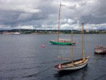
The Halifax harbor area is nice, though touristy. There is a lot of construction and demolition downtown which may indicate an upturn in the otherwise moribund economy.
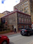
We walked long routes through the older portions of the city and spent a morning at the Citadel which has knowledgable costumed interpreters. The firing of the noon four-pounder cannon was fun to watch.
The Cabin had its oil changed in Dartmouth at a service station with a lot full of European vehicles on our last day in the area. We went off to Halifax and returned in the early afternoon to pick it up and head south toward Lunenberg. The over filled oil light came on as we entered the highway about 10 miles from Dartmouth, so I stopped to check. Looking at the dip stick it seemed within reasonable margins, based on my experience with other engines, but the light would not go off once we got up to speed. I phoned the garage and told them I was coming back. They devised a siphon and removed close to a quart. The Sprinter calls for 10 liters with a new filter, and I imagine they were using quarts instead.
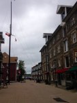
The delay caused us to reconsider our route, and we decided to head toward the Bay of Fundy and the possibility of backpacking along that coast. That meant a couple of hours on the Trans Canada Highway for the first time since Ottawa. We stopped at a weigh station outside of Halifax and loaded the Sprinter on the scales, it came in at 7,800 pounds.
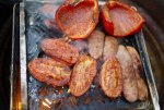
That night we grilled our dinner at a campground overlooking the Bay of Fundy.
Halifax

My father was born in Halifax in 1917 just a few months before the huge explosion that destroyed much of the city harbor and shattered windows miles away. A French cargo ship carrying ordinance had collided with a Norwegian vessel in the small strait near the city center. I thought of that explosion and destruction as we made the crossing on the ferry from Dartmouth, where we spent a few nights in the municipal campground. The inexpensive ferry and the reasonable parking fee at the terminal made it a great campground choice, even with the lack of trees.

The Halifax harbor area is nice, though touristy. There is a lot of construction and demolition downtown which may indicate an upturn in the otherwise moribund economy.

We walked long routes through the older portions of the city and spent a morning at the Citadel which has knowledgable costumed interpreters. The firing of the noon four-pounder cannon was fun to watch.
The Cabin had its oil changed in Dartmouth at a service station with a lot full of European vehicles on our last day in the area. We went off to Halifax and returned in the early afternoon to pick it up and head south toward Lunenberg. The over filled oil light came on as we entered the highway about 10 miles from Dartmouth, so I stopped to check. Looking at the dip stick it seemed within reasonable margins, based on my experience with other engines, but the light would not go off once we got up to speed. I phoned the garage and told them I was coming back. They devised a siphon and removed close to a quart. The Sprinter calls for 10 liters with a new filter, and I imagine they were using quarts instead.

The delay caused us to reconsider our route, and we decided to head toward the Bay of Fundy and the possibility of backpacking along that coast. That meant a couple of hours on the Trans Canada Highway for the first time since Ottawa. We stopped at a weigh station outside of Halifax and loaded the Sprinter on the scales, it came in at 7,800 pounds.
That night we grilled our dinner at a campground overlooking the Bay of Fundy.

Attachments
Umnak
Adventurer
Bay of Fricking Fundy
Bay of Fundy
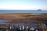
The sun was out in force as we drove to the southern shore of the peninsula that creates the Bay of Fundy. This peninsula has a lot of meaning to me, not only is it where my father's family settled in the mid 18th century, it has also been, along with L’anse aux Meadow, one of the places I've been wanting to visit since a child. The roads here didn't seem as busy or manicured as Cape Briton. Villages and settlements are well spaced between fields of hay and hills of cultivated blueberries. And we were back to our comfortable Blue Highways after a day of driving the Trans Canada. We arrived at Five Islands Park and at our campsite for the last minutes of a beautiful sunset. A rising moon gave us light as I cooked dinner using the Snow Peak Fireplace.
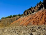
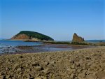
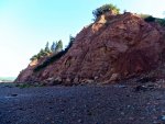
A tide clock was posted at the entrance to the Five Islands Park and marked times to avoid walking the beach. The cliffs are steep and the sea stacks are dramatic. There are places with no access above the high tide mark, and to not heed those warnings would be unwise. Fortunately, we were up and out in time to walk a couple of miles along the beach, which put us well beyond the other visitors.
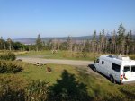
A surprising large amount of the country is set aside as parks, forest land and wilderness. The roads are as often unpaved as not, and there are a number of two tracks in the forest that would be a lot more fun in our 4Runner, though the Sprinter held its own even on the most rugged ones we drove. There were some, however, we didn’t attempt.
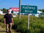
I found the village of Halfway River where my grandmother was born in the late 19th century. It was rather bleak, and I’m happy that she and my grandfather left the blueberry fields that were then, and are stil,l the mainstay of the local economy. There is no village center there, just a sign and a berry packaging plant.
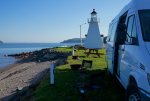
Our last night was spent at a coastal campground which was once a shipyard.
Bay of Fundy

The sun was out in force as we drove to the southern shore of the peninsula that creates the Bay of Fundy. This peninsula has a lot of meaning to me, not only is it where my father's family settled in the mid 18th century, it has also been, along with L’anse aux Meadow, one of the places I've been wanting to visit since a child. The roads here didn't seem as busy or manicured as Cape Briton. Villages and settlements are well spaced between fields of hay and hills of cultivated blueberries. And we were back to our comfortable Blue Highways after a day of driving the Trans Canada. We arrived at Five Islands Park and at our campsite for the last minutes of a beautiful sunset. A rising moon gave us light as I cooked dinner using the Snow Peak Fireplace.


A tide clock was posted at the entrance to the Five Islands Park and marked times to avoid walking the beach. The cliffs are steep and the sea stacks are dramatic. There are places with no access above the high tide mark, and to not heed those warnings would be unwise. Fortunately, we were up and out in time to walk a couple of miles along the beach, which put us well beyond the other visitors.


A surprising large amount of the country is set aside as parks, forest land and wilderness. The roads are as often unpaved as not, and there are a number of two tracks in the forest that would be a lot more fun in our 4Runner, though the Sprinter held its own even on the most rugged ones we drove. There were some, however, we didn’t attempt.

I found the village of Halfway River where my grandmother was born in the late 19th century. It was rather bleak, and I’m happy that she and my grandfather left the blueberry fields that were then, and are stil,l the mainstay of the local economy. There is no village center there, just a sign and a berry packaging plant.
Our last night was spent at a coastal campground which was once a shipyard.

Umnak
Adventurer
Seal Cove Backpacking
Seal Cove Backpacking
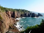
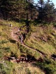
Nova Scotia's Chignecto Park covers a large section of the coast on the southeast of Bay of Fundy. We walked atop rugged cliffs to a campsite at seal cove, which is about 5 miles from where we parked the van.
In the past we have used tarps and bivies, but have switched to a Big Agnes two person tent for this road trip -- it's the bugs. While rated at 29 sq ft. the tent feels much larger given the straight walls.
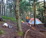
The designated camps are in a very thick forest and offer no view. We had considered an illicit camp on the beach, but the wind picked up considerably and we were not sure how that would affect the high tide level. And this is the Bay of Fundy, so it was thought best to not play with the tide.
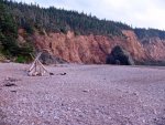
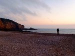
We were the only people on the trail and at camp. The wind died down in the night and the ocean replaced the movement of the trees as the predominant sound. It was a nice place to camp. Eve carried her tea to the beach and our breakfast was taken there, which was calm and pretty in the early morning light.
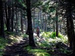
It was not as hot on our return, which took just under 2.5 hours.
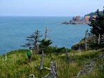
I’d like to come back here and spend more time along the coast and longer backpacking trips. There are campsites every five miles and water is available at each site. The full path would be doable in a few days of walking and would offer excellent views of the coast and the ocean.
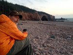
Seal Cove Backpacking

Nova Scotia's Chignecto Park covers a large section of the coast on the southeast of Bay of Fundy. We walked atop rugged cliffs to a campsite at seal cove, which is about 5 miles from where we parked the van.

In the past we have used tarps and bivies, but have switched to a Big Agnes two person tent for this road trip -- it's the bugs. While rated at 29 sq ft. the tent feels much larger given the straight walls.

The designated camps are in a very thick forest and offer no view. We had considered an illicit camp on the beach, but the wind picked up considerably and we were not sure how that would affect the high tide level. And this is the Bay of Fundy, so it was thought best to not play with the tide.


We were the only people on the trail and at camp. The wind died down in the night and the ocean replaced the movement of the trees as the predominant sound. It was a nice place to camp. Eve carried her tea to the beach and our breakfast was taken there, which was calm and pretty in the early morning light.

It was not as hot on our return, which took just under 2.5 hours.

I’d like to come back here and spend more time along the coast and longer backpacking trips. There are campsites every five miles and water is available at each site. The full path would be doable in a few days of walking and would offer excellent views of the coast and the ocean.

Similar threads
- Replies
- 9
- Views
- 2K
- Replies
- 0
- Views
- 520
- Replies
- 3
- Views
- 1K
- Replies
- 3
- Views
- 527

