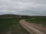
Its a very unique ranch because they use only horse teams to move quiptment and they have a huge haying operation where they build these huge hay stacks using horse teams. They have a couple of tractors but only use those when its wet in the bottoms and horses sink real bad in the soft soil. There is a documentary that was on TV several years ago documenting the entire operation. My brother was in that video too.
Great memories but sadly I was too young to really appreciate where I was and the history. I think I was maybe 14.
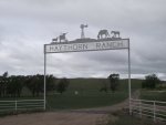
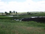
Heres a link to it. The pic at tha top shows a team pulling hay equiptment and hay stacks in the background
http://www.haythorn.com/history.html
They give tours, you should consider doing one sometime. Step back in history.