AdventureTaco - turbodb's build and adventures

turbodb

Well-known member
Mojave Redemption #4 - Hidden Mines and Highway Robbery
Part of the Mojave Redemption (Dec 2019) trip.

Our location at the Kelso Dunes was the first where I thought there'd be a chance of a nice sunrise, so I'd set my alarm for 6:00am to try and catch the orange on the horizon. It was of course quite chilly at 6:00am, and so I had the bright idea to just take a photo with my phone out the door of the tent, rather than climbing down the ladder to fetch the Canon 80D - that I shoot with - from the truck.

Well, the photo came out so poorly - compared to what I'm now used to - that I'm not even going to share it. But hey, I stayed warm and got another hour of sleep! ?

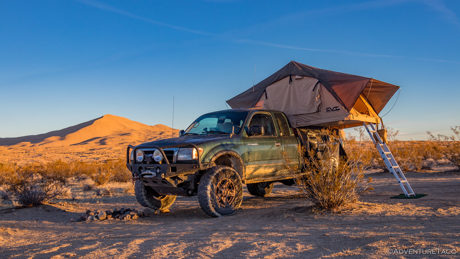
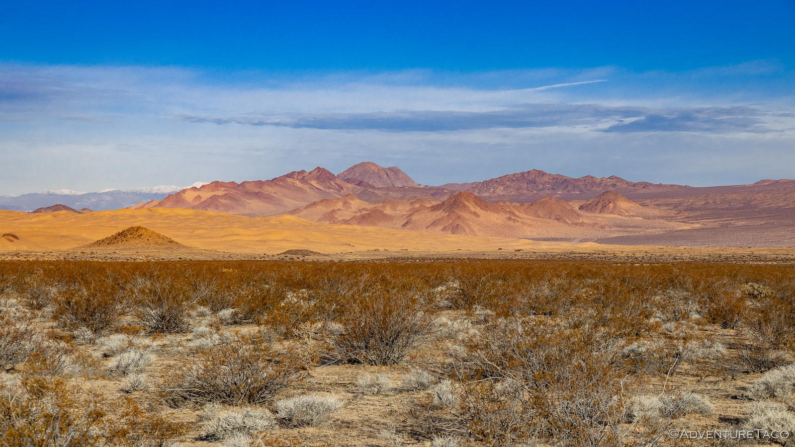
As the sun crested the horizon - or at least our horizon for the morning - we did finally pull ourselves out of bed, happy to see that the breeze we'd had during the night was successful in keeping the tent totally dry. And waking up to the illuminated dunes and Devil's Playground wasn't anything to complain about!
49370864277_40eafb2d64_h.jpg

49370196048_e2573741e8_h.jpg

Not having to wait for anything to dry out, we made quick work of breakfast and camp tear-down, and we were soon on the road and headed south. Our goal for the day was twofold - visit cool places, and stay out of the snow (if possible). Our first cool place - Hidden Hill, home to the Hidden Hill Mine and Golden Queen Mine - was between 3300' - 3950', so we knew it'd be a good indicator for the remainder of the day, where we'd be spending some time between 4000' - 4700'.

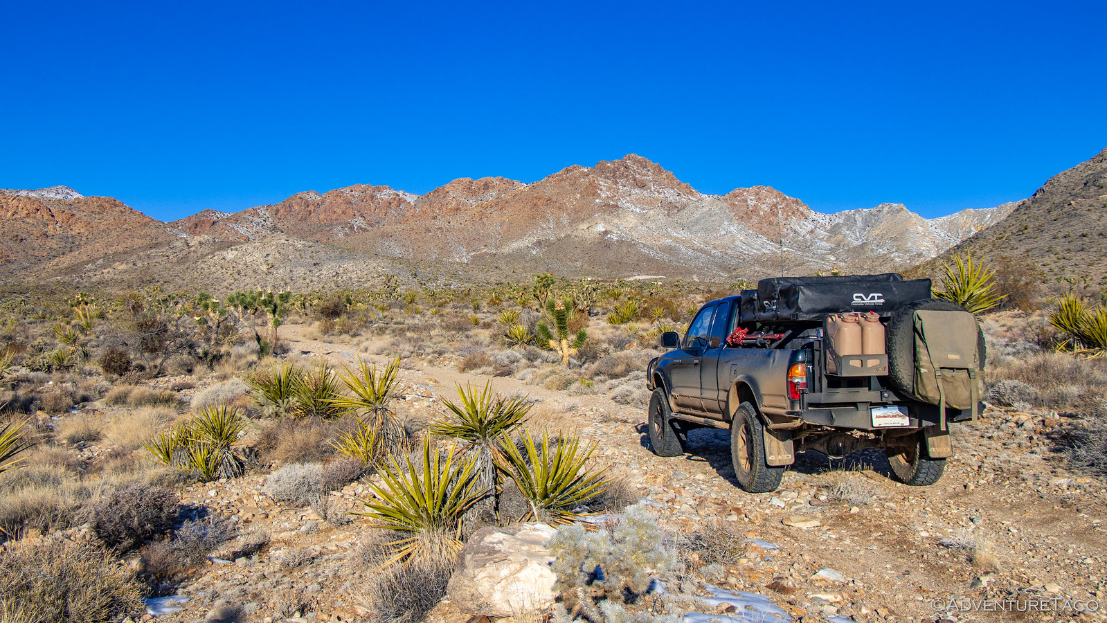
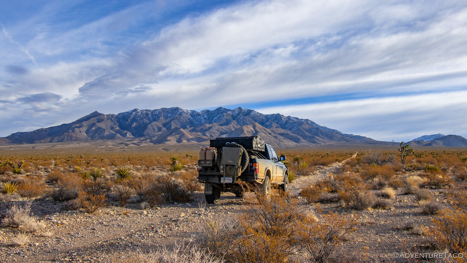
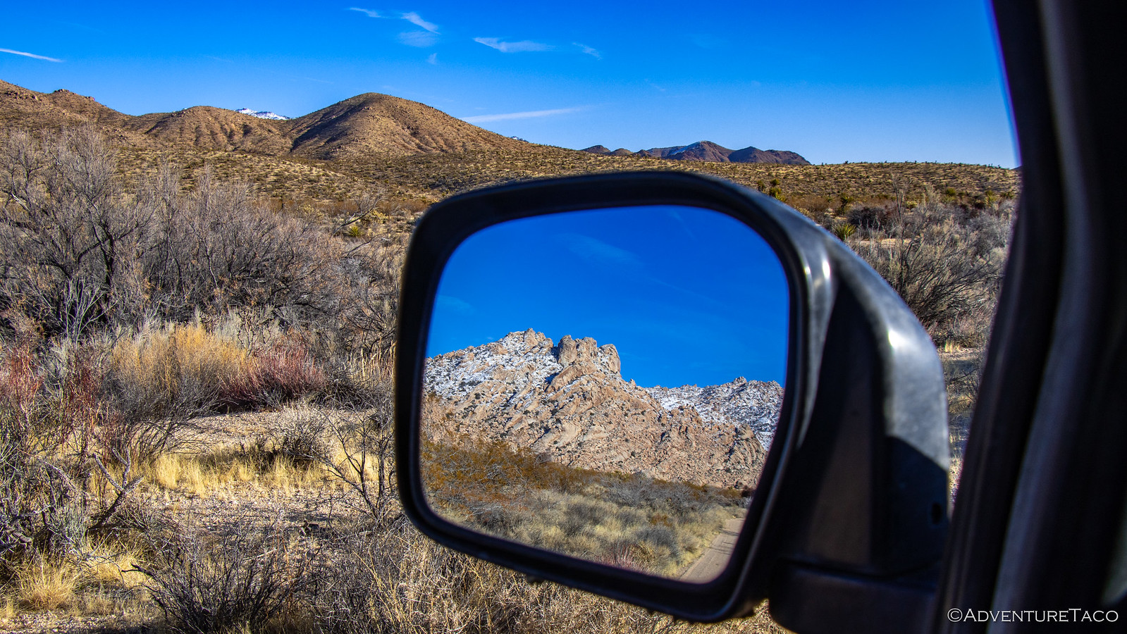
Hidden Hill Road is accessible from Kelbaker road, just south of Granite Pass, which afforded us an amazing view of the Granite Mountains, still very snow-covered from the storm a few days earlier. Even with a full day in front of us, we spent a bit of time soaking in the views here - first in front of us, and then in our mirrors as we made our way east.

49370864032_b6abddea2a_h.jpg

49370195603_4e5ce49407_h.jpg

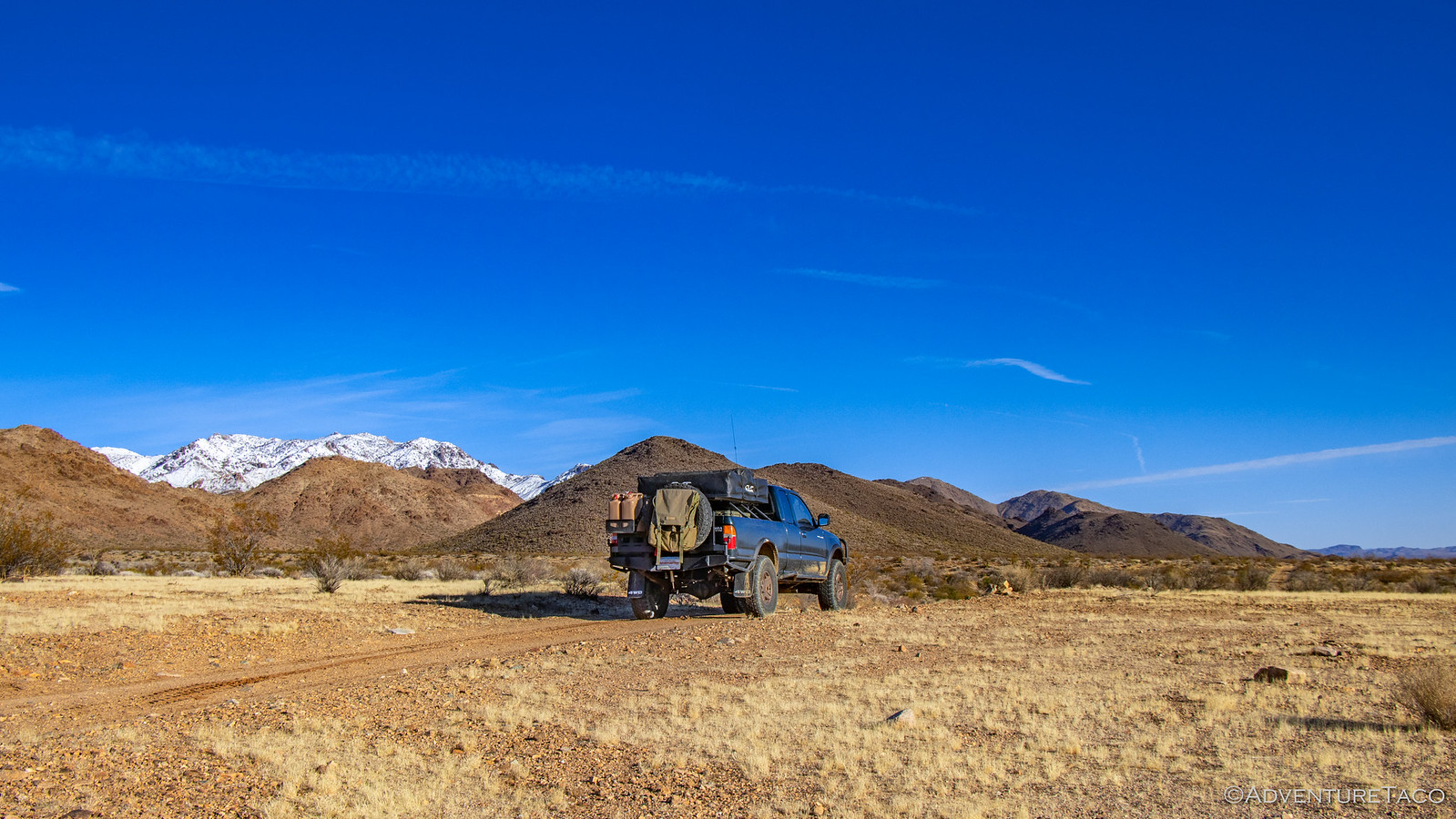
It's probably worth mentioning here - and maybe a few other places in this series of stories - that the roads in the Mojave National Preserve are generally in amazingly good condition. As I recall, we were still aired up at this point, and only aired down a couple times throughout the entire trip as we encountered individually rough roads, or wanted to increase our speed. At any rate, heading east, we had a few miles to travel towards the south end of the Providence Mountains before we came to an old windmill that marked the entrance to the Hidden Hill area.
49370195428_8501c1e3a7_h.jpg

49370863537_4947ed885b_h.jpg

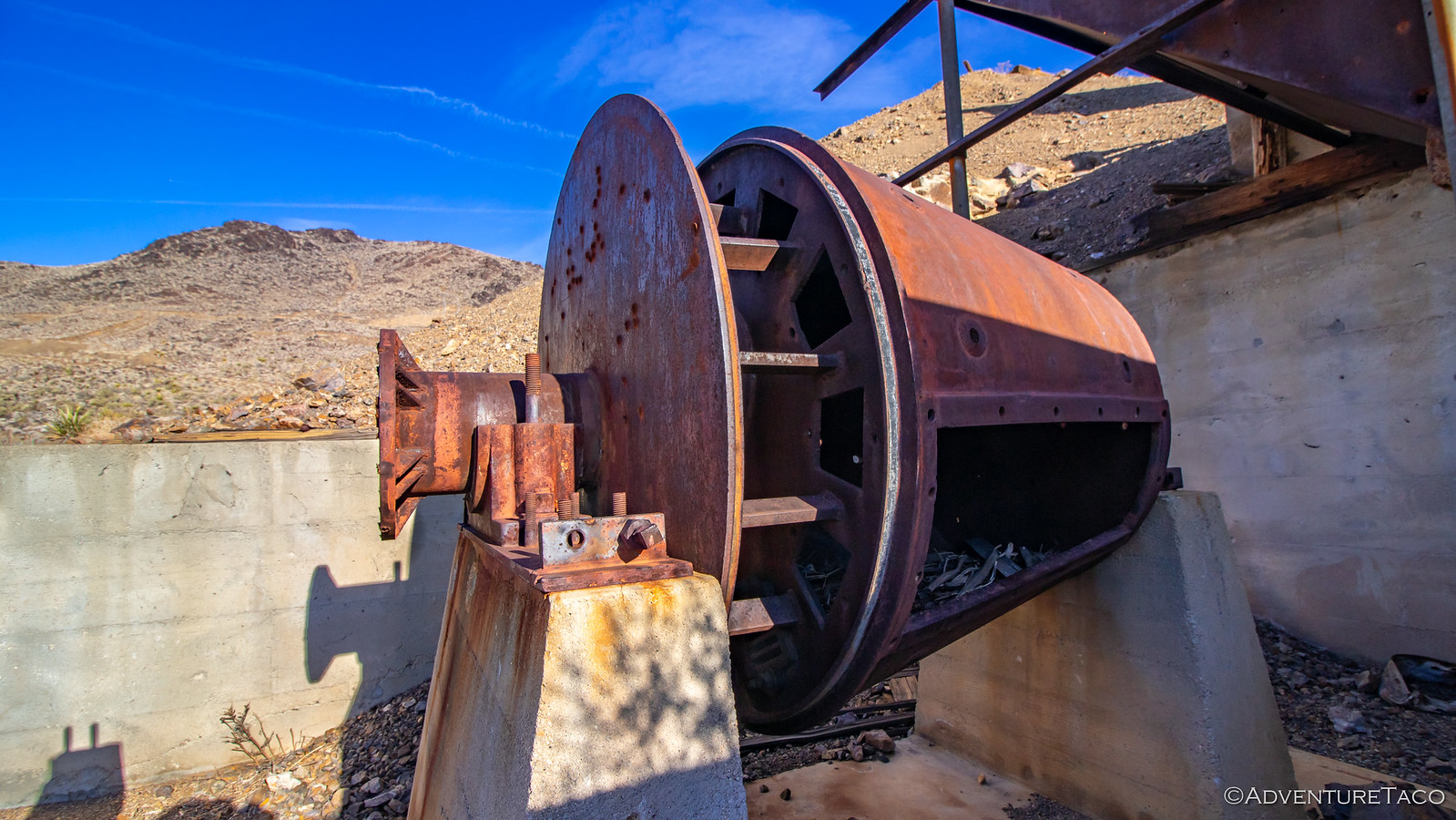
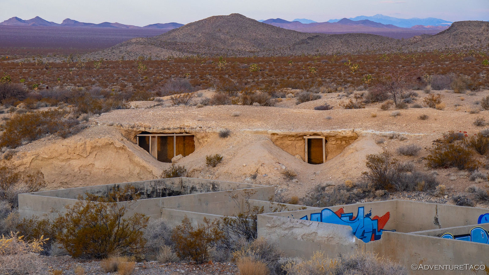
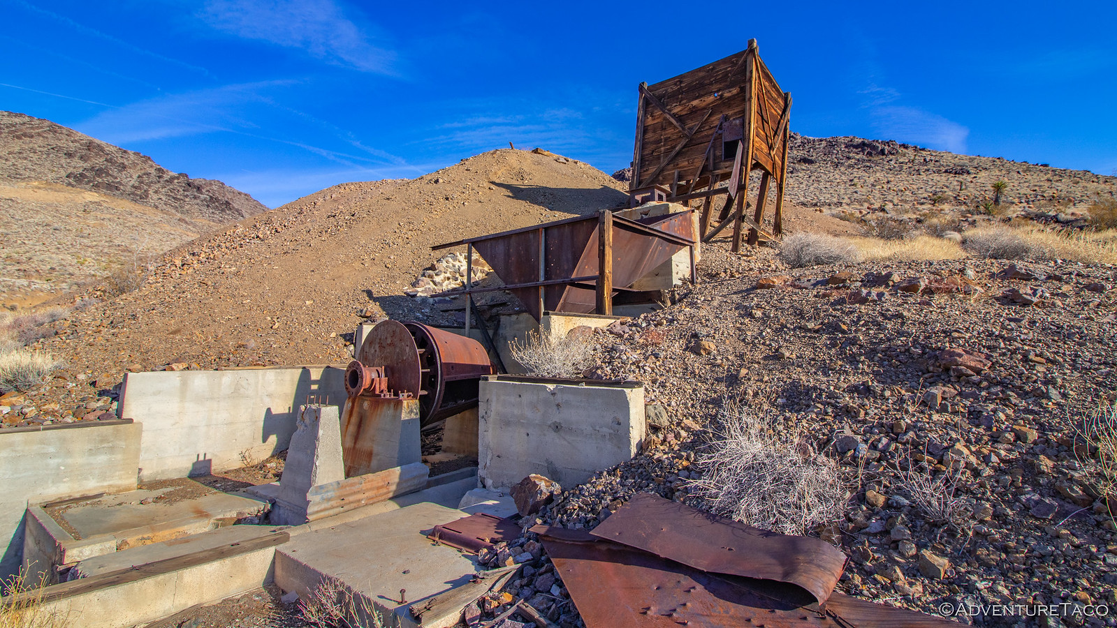
The first mine we came to - a quarter mile or so further up the road - was the Golden Queen Mine. With one of the best-preserved mills in the area, it allowed us to see the path through witch ore flowed better than any other we'd encounter on the trip. Ore was loaded into the wooden hopper at the top of the mill and then fed down into a crusher (which is now gone). After being crushed, it would enter the triangular funnel to be fed into a horizontal cone-shaped ball mill at the next level of concrete foundation. After being further pulverized, it would drop into the final level of partitioned concrete vats, where the gold was separated from the rest of the ore using cyanide.

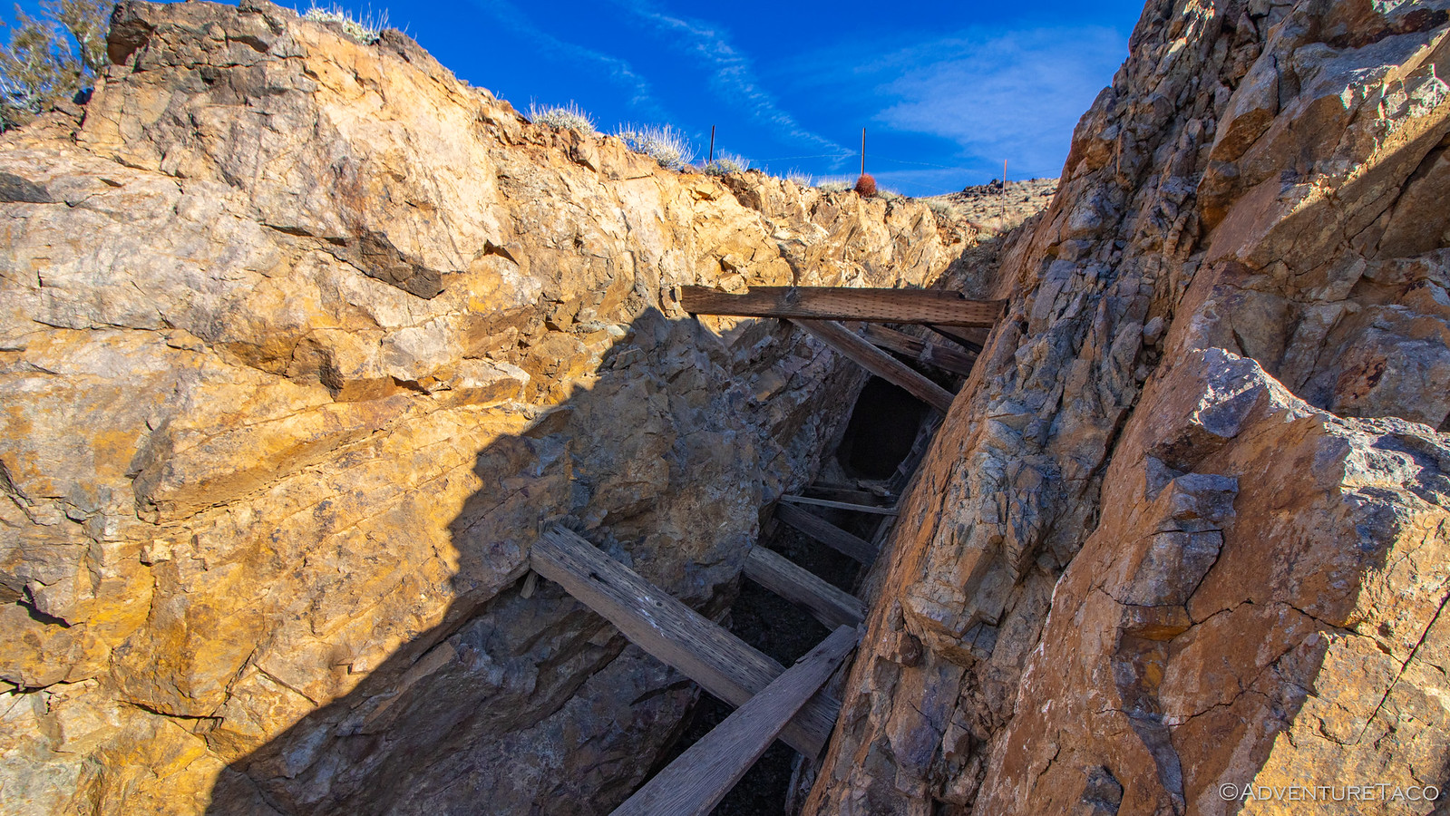
And, next to the mill are two large mine shafts and their associated tailings piles - all of it dating from the early 1900s.
49370654696_d7081fe7d0_h.jpg

49370654491_81fd6dddc8_h.jpg
A view of the concrete foundations and vats, where cyanide was used to separate gold from the ore.

49370654356_f8641716a0_h.jpg
An old ball mill.

49370862917_3f97b66cc0_h.jpg
The Golden Queen's main mine shaft.

49370862717_c4cd86ba7c_h.jpg

49370194198_5ca59d02b7_h.jpg
Looks legit. Safety was clearly the first priority here. ?

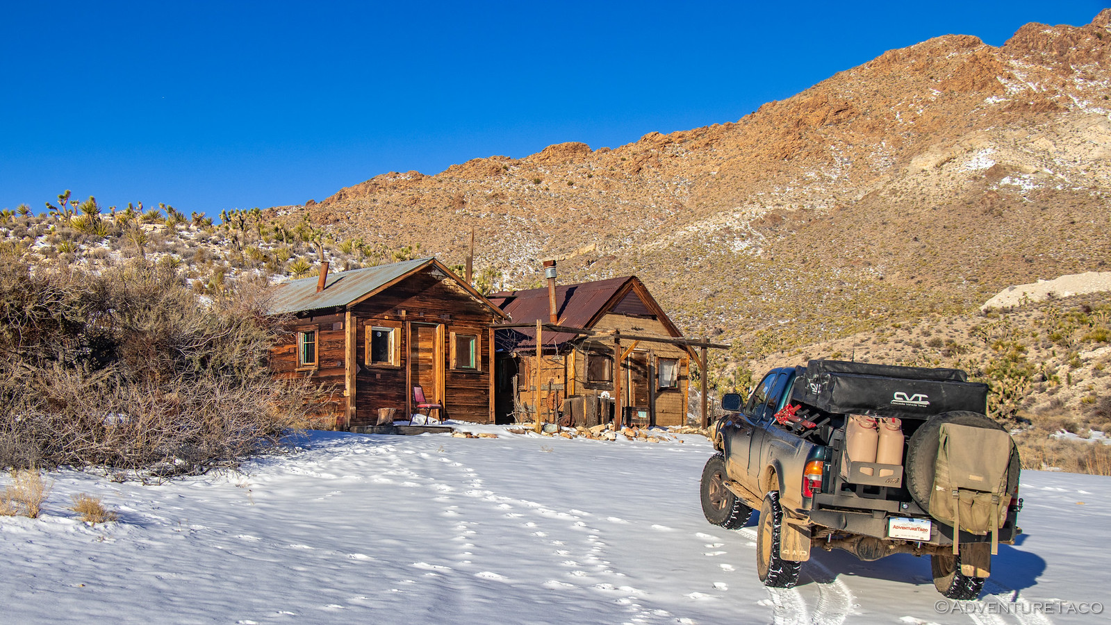
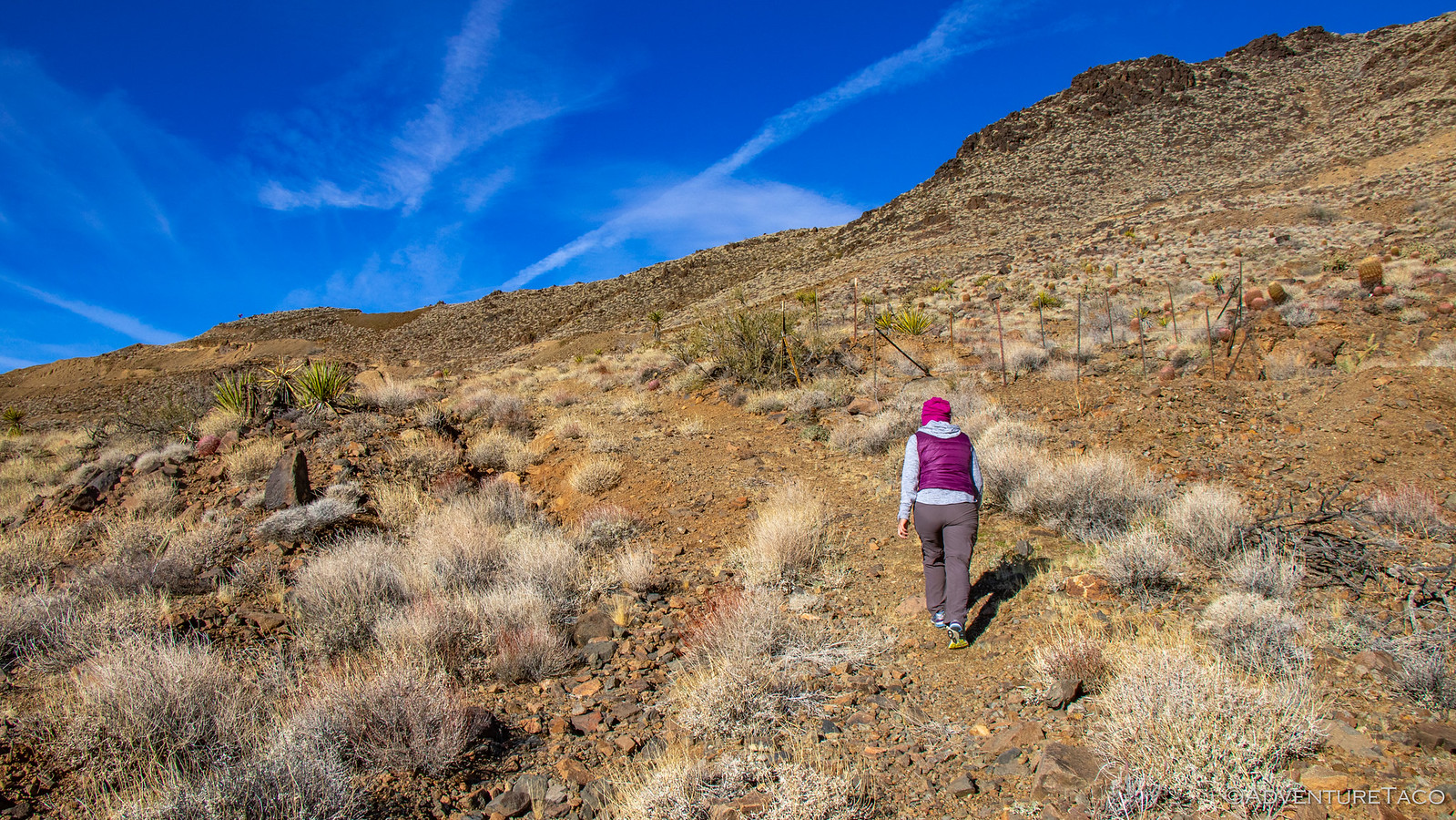
After exploring the Golden Queen mine and its shafts for a good half hour or so, it was time to check out the rest of what Hidden Hill had to offer - namely, the workings of the similarly named Hidden Hill Mine. Worked around the same time as the Golden Queen, the hiking trail starts from the Golden Queen's mill and works its way up the face of Hidden Hill to the north. This hiking trail was at one time a mining road, and while it still seemed like it could be drivable, there were two metal fence posts placed to block the way, which should be respected. Regardless, the hike passes by so many mine workings that walking is likely as fast as driving, so we were happy to set out on foot, the barrel cactus and yucca covering the hillside in a beautiful display of color.
49370194088_cea4264a83_h.jpg

49370193848_e0cccffca2_h.jpg

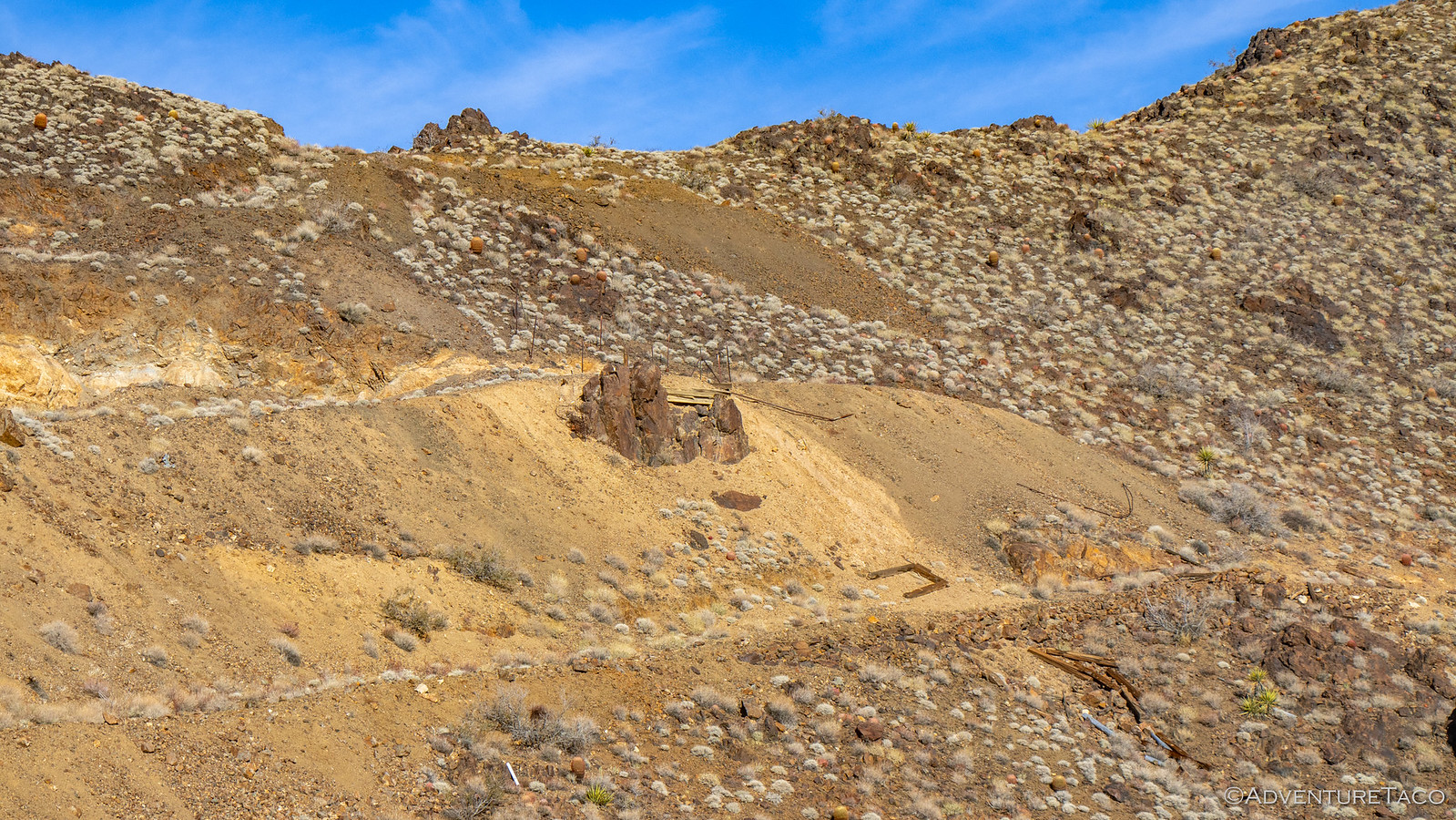
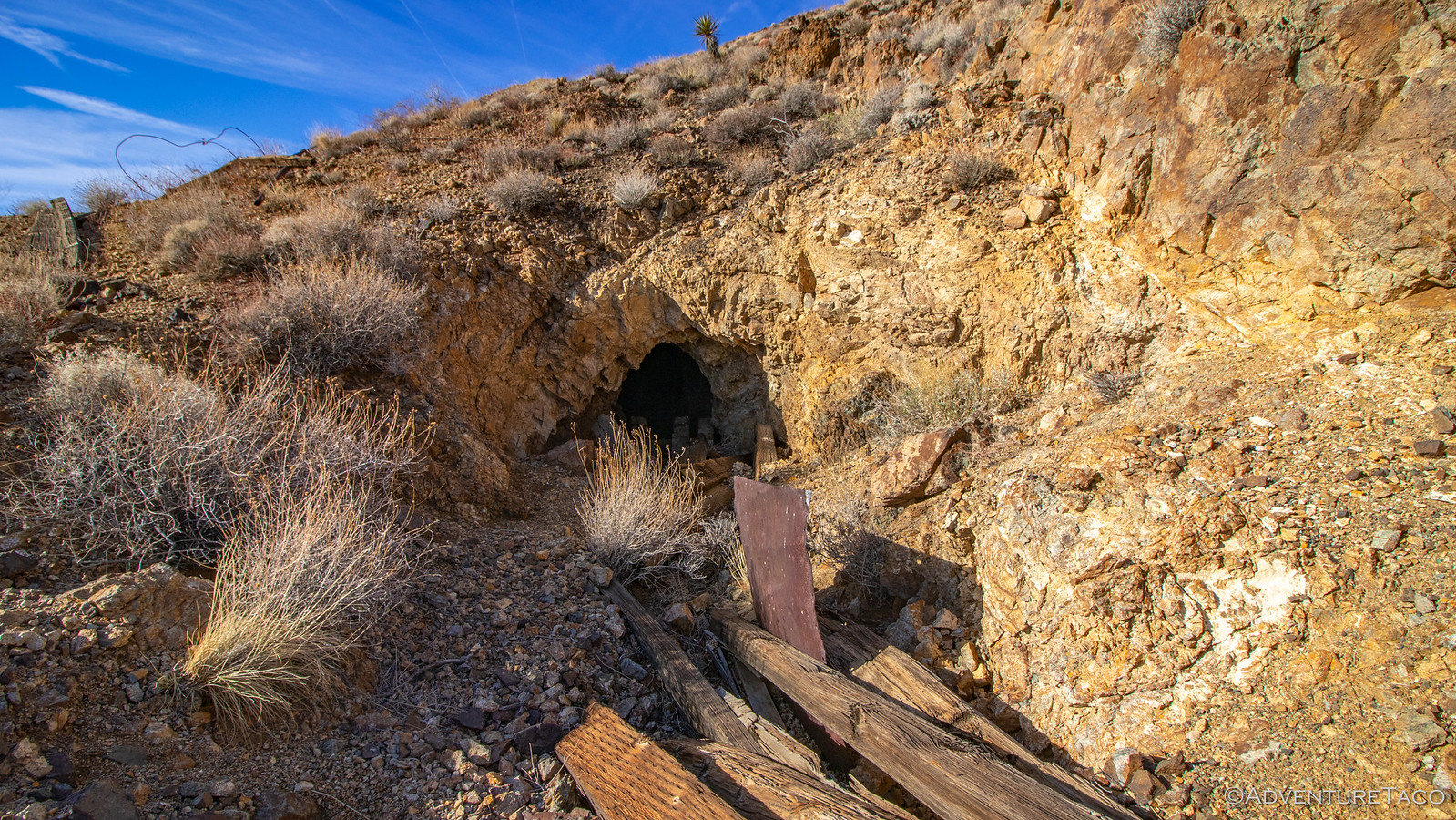
It seemed that every 50 feet or so we were stopping to investigate another working. Some were deep mine shafts, others were simple diggings. Still others appeared to be road cuts or ore chutes that material would be sent down in order to reach the mill. Wandering from working to working, we thoroughly enjoyed ourselves - this set of mines being one of our favorite even after visiting many more over the remainder of the trip.
49370862047_554fa31941_h.jpg
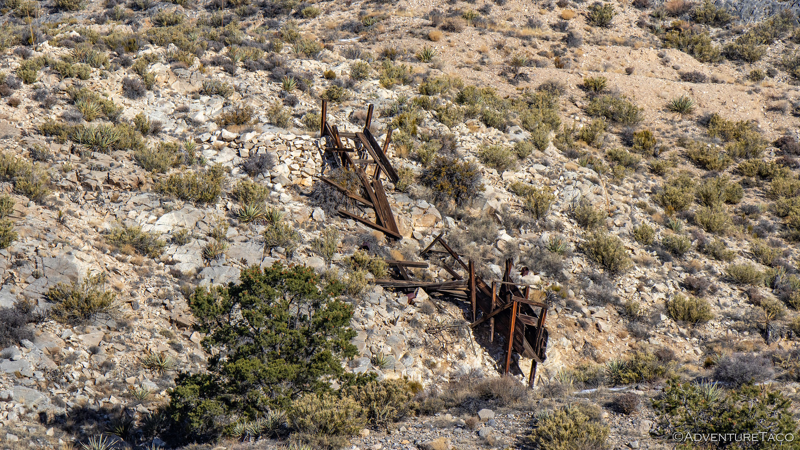
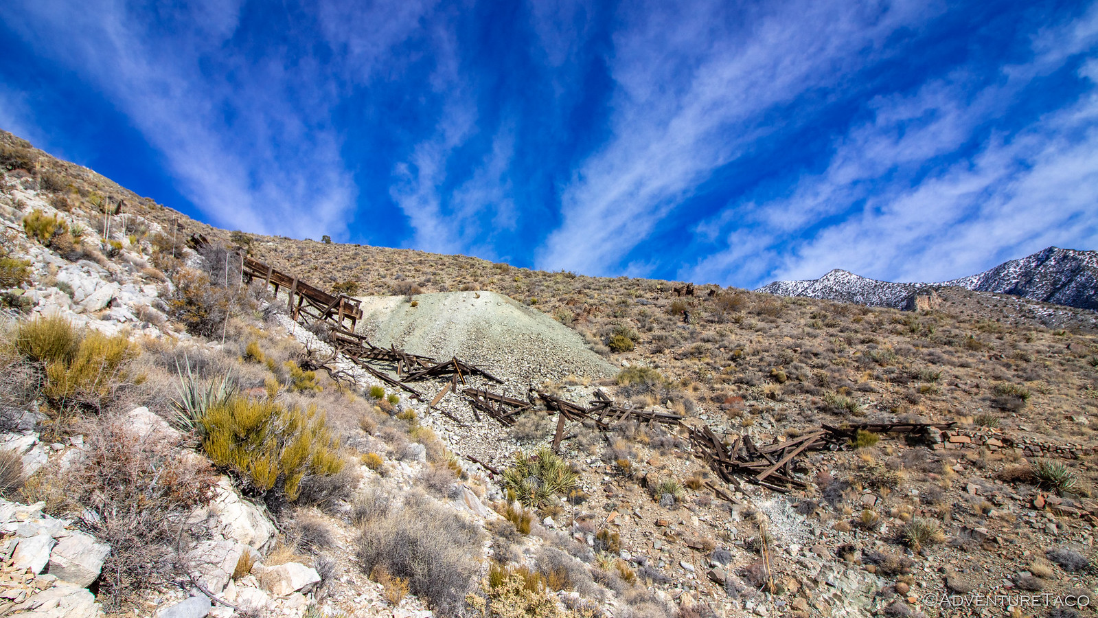
Remains of mine shaft reinforcements, now scattered down the slopes of Hidden Hill.

49370193373_ec213b03ed_h.jpg
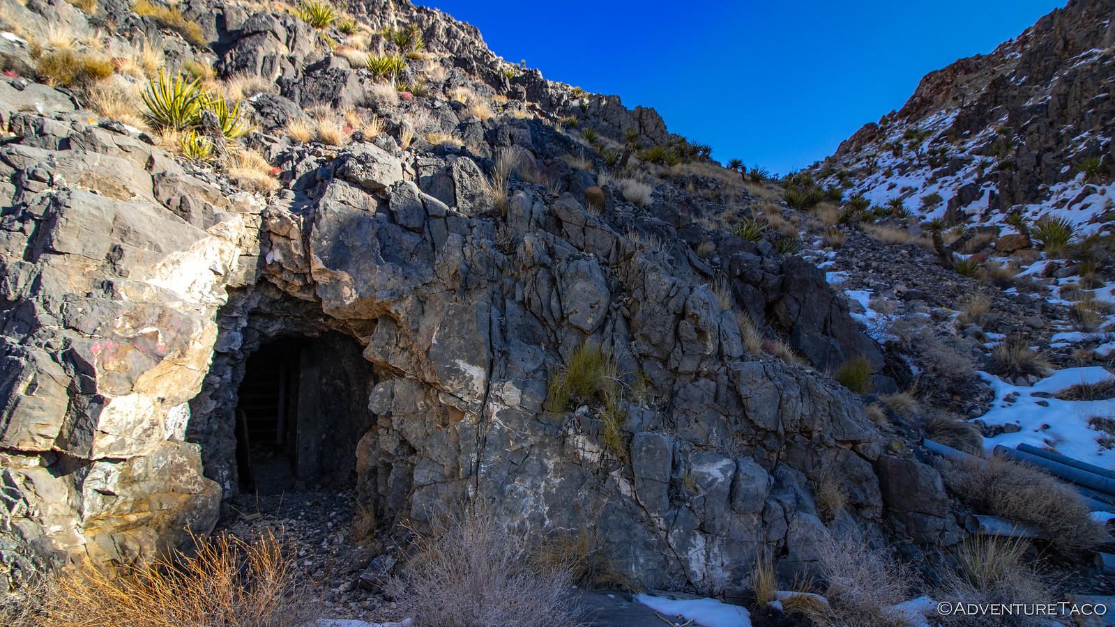
An old mine shaft, ready to be investigated!

49370861572_e25dec41d4_h.jpg
The view out of the old mine shaft, @mrs.turbodb making sure I'm OK.

49370193123_b99eec2478_h.jpg
Inside the same old mine shaft - the intricate tunnel systems evident even in the first 50' of the shaft.

Having completed our investigation, we made our way back down to the Tacoma - itself framed by views of the Clipper Valley to the south. And, as though we hadn't seen enough already, we discovered a new shaft on our way down, ripe for the exploring.


Don't miss the rest of the story, and all the remaining photos that don't fit here (due to max post size). Hopefully that can change in the future, but until then...


.
 

turbodb

Well-known member
Mojave Redemption #5 - Into the New York Mountains
Part of the Mojave Redemption (Dec 2019) trip.
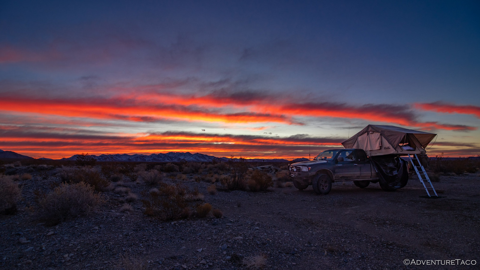
It seems that after several very cold nights, we were both starting to get used to the temperature and though it was cold, we were both cozy under the covers for the duration of the night. And, having gone to bed with a few clouds in the sky, I set my alarm early in hopes that a few would stick around until morning when they'd once again be illuminated by a sun that seemed to hug the horizon through the entirety of the day.

And sure enough, the long rays of the winter put on quite the show - even if the clouds had mostly cleared and it was a short one!

49377736112_992097736b_h.jpg

We breakfasted and packed up, today a special day on this far-from-normal trip to the Mojave Preserve. Today, we were going to attempt the exploration of Carruthers Canyon. Located in the New York Mountains, this was the single place in the preserve that I was most looking forward to exploring, its description in Hiking the Mojave Desert intriguing me for some reason. Reaching elevations of 6000 feet, I knew there was no possibility that we'd be able to camp there as I'd hoped, but even just hiking the canyon was sure to be a special time.

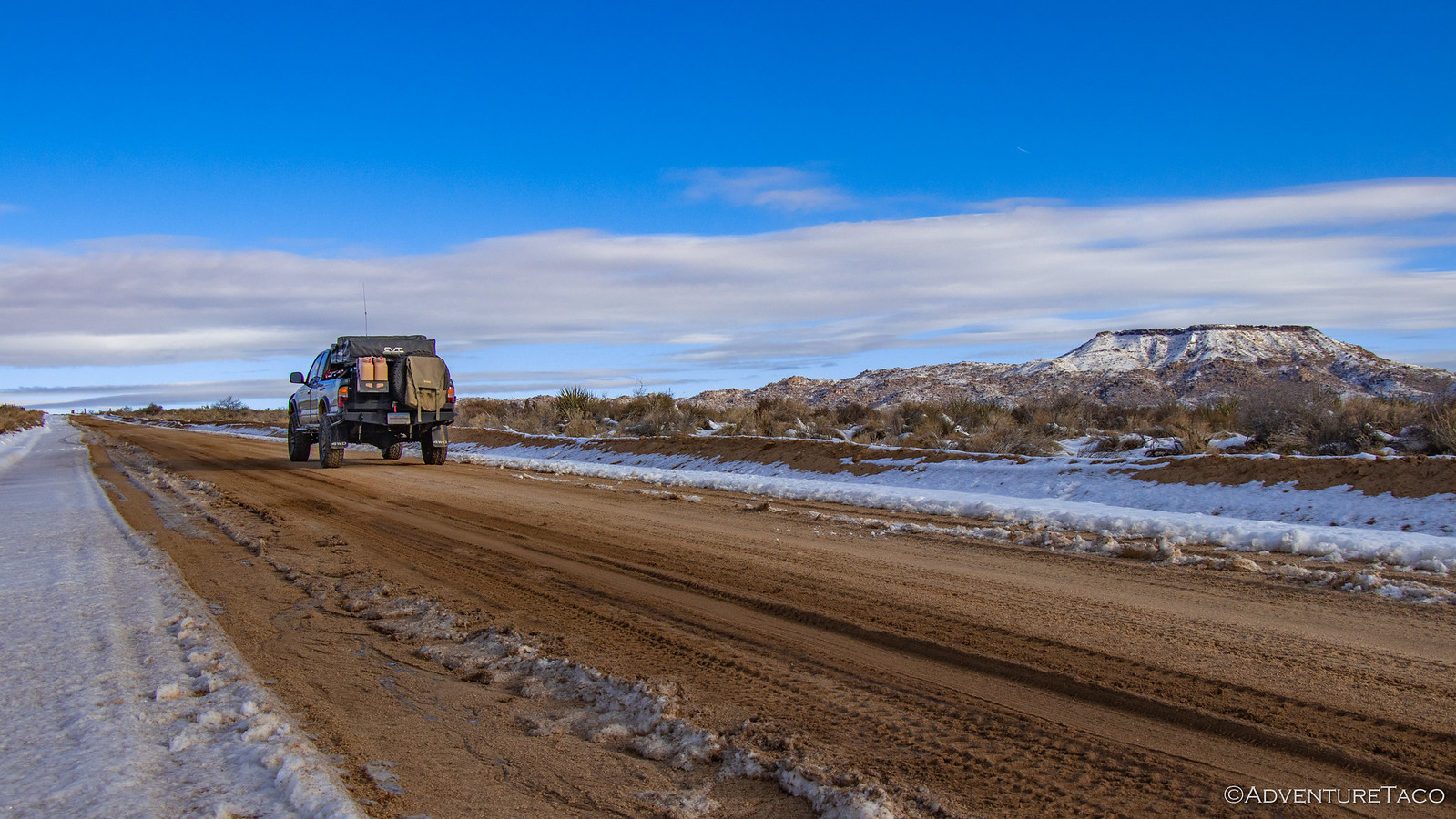
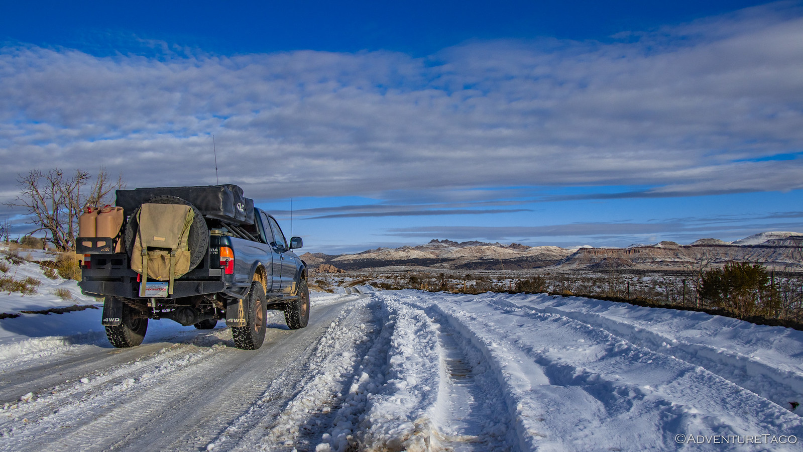
As we ventured north on Essex Road, it quickly became clear just how close to the snow line we'd camped the previous night. The entire desert was covered in snow at elevations as low as 4500', but at least the road - which could have been a sloppy mess - was frozen at this early hour, making travel much easier than it'd be later in the day. :mudding:

49377735977_978d12bbb3_h.jpg

As we turned onto the Old Mojave Road for a short stint east, conditions got even whiter. Nothing that caused any trouble for the Tacoma, but enough to make us wonder what we'd find at our destination for sure.

49377536786_b52800e2bf_h.jpg

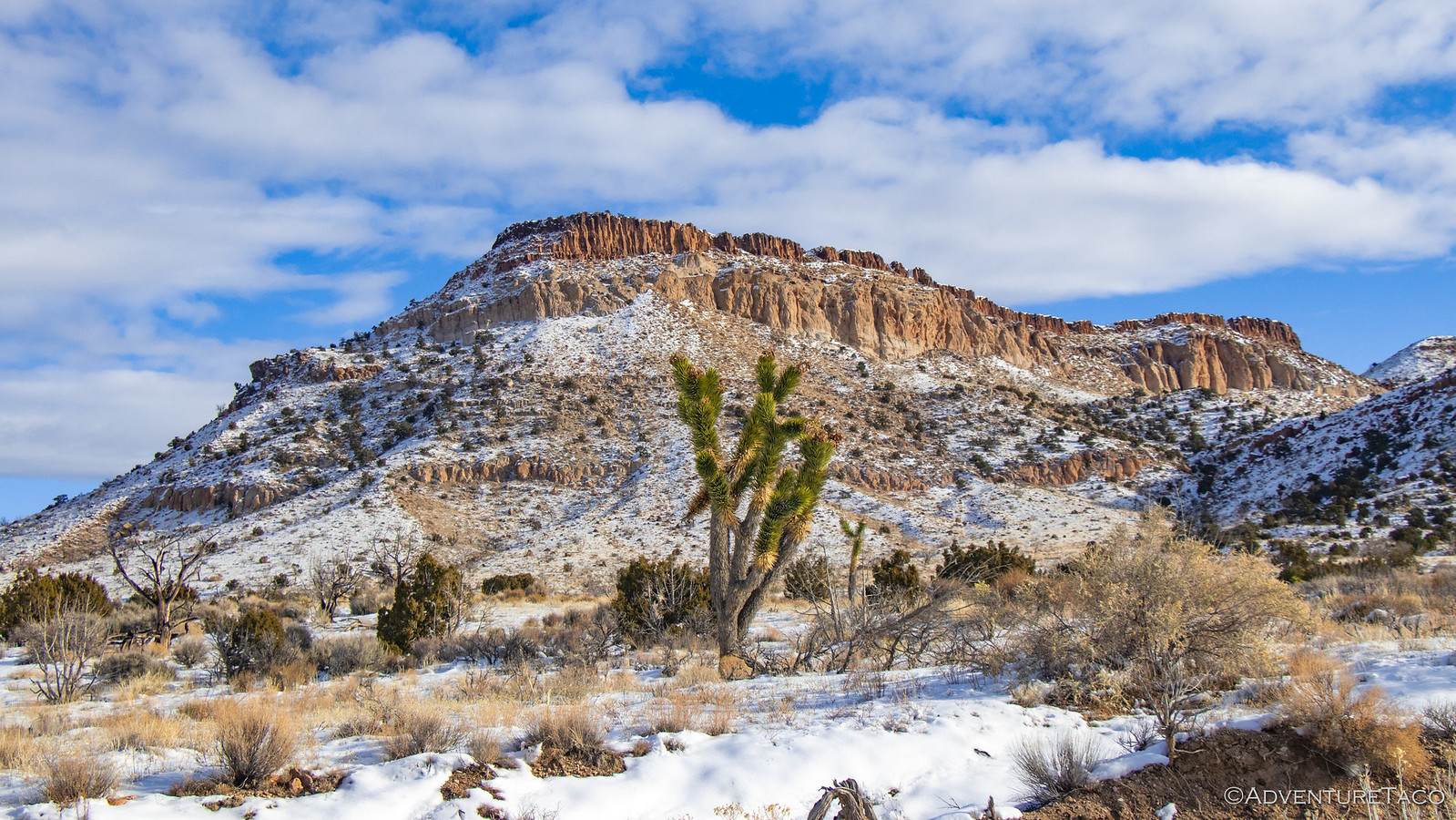
The whiteness - we decided - was a double-edged sword. On the one hand, it had the possibility to severely limit our ability to explore and see cool things. On the other, boy, did it make the landscape beautiful! It's not often you see a Joshua Tree framed by a snow-covered mountain!

49377735677_c66689ec23_h.jpg

49377735532_f79341b2a0_h.jpg

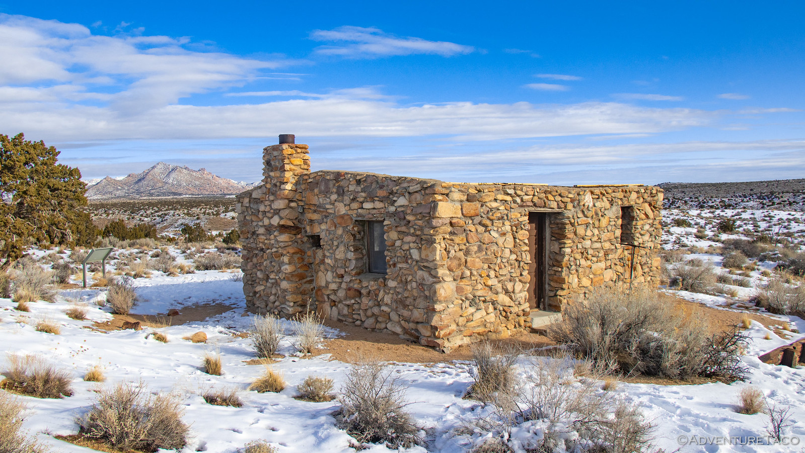
It turns out our short stint on the Mojave Road took us by the rock house at Rock Canyon that we'd investigated on our last adventure through these parts almost exactly a year earlier, and we figured a quick stop just to see what it looked like in the snow was in order.

49377536361_4668e63aa0_h.jpg
The New York Mountains, rising in the distance, were our next destination.

As you might expect, turning off the main drag onto New York Mountain Road resulted in the snow level getting significantly deeper. Traffic had gone before us, but it had been light - two, or perhaps three vehicles over the last several days. We pressed on.

49377536241_1f241f9b85_h.jpg

49377734977_379d1f82e8_h.jpg

Higher and higher we pushed until we reached about 5200' - the highest we'd been since the snow by nearly 700'. As we'd experienced at the Colosseum Mine - but now several days later - the snow was 10-12" deep and we found the truck struggling a bit for traction through various washes where the drifts were even deeper. Still half a mile from the end of the road and beginning of the hike, I realized it was a fools errand to keep going.

But we weren't beat! We found a nice place to park and made the decision to travel the rest of the way on foot - there was just too much cool stuff to see for us to turn around now!

49377535806_43c9631e8d_h.jpg
Carruthers Canyon, so close. We'd walk from here.

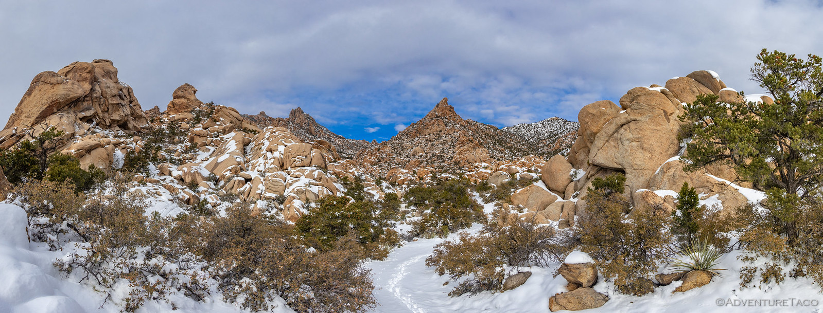
Entering the canyon, the reason it's so special is immediately apparent - the ground here is a giant field of Cretaceous quartz monzonite (think orangish granite), which has been erroded into countless hoodoos. One of the first that explorers encounter is Easter Island Rock, named for its resemblance to the carved heads found on the far away island. Balanced high above the trail, it seems to defy gravity as it overlooks the mouth of the canyon.

49377082208_1e68814ca6_h.jpg

We pushed on, the snow getting deeper - @mrs.turbodb following in my footsteps as I used my Muck boots to compact a path. The views were spectacular.

49377535526_b4a20a2a45_h.jpg

49377535356_697b73e1be_h.jpg

This was not at all what we'd expected, and the snow kept us from exploring as thoroughly as we may have otherwise, but it was still a magical experience. As we continued up the canyon, Foot Rock rose out of the snow.

49377535201_8bbc950ad7_h.jpg
Chilly out here with no socks.

After a slow mile of climbing up the canyon, we reached the apex of our hike - the Giant Ledge Mine Camp. We'd planned to continue further, but that was when we'd be hiking on solid ground - today was no day to crest the top of the canyon, its ridge shared with Keystone Canyon to the north.

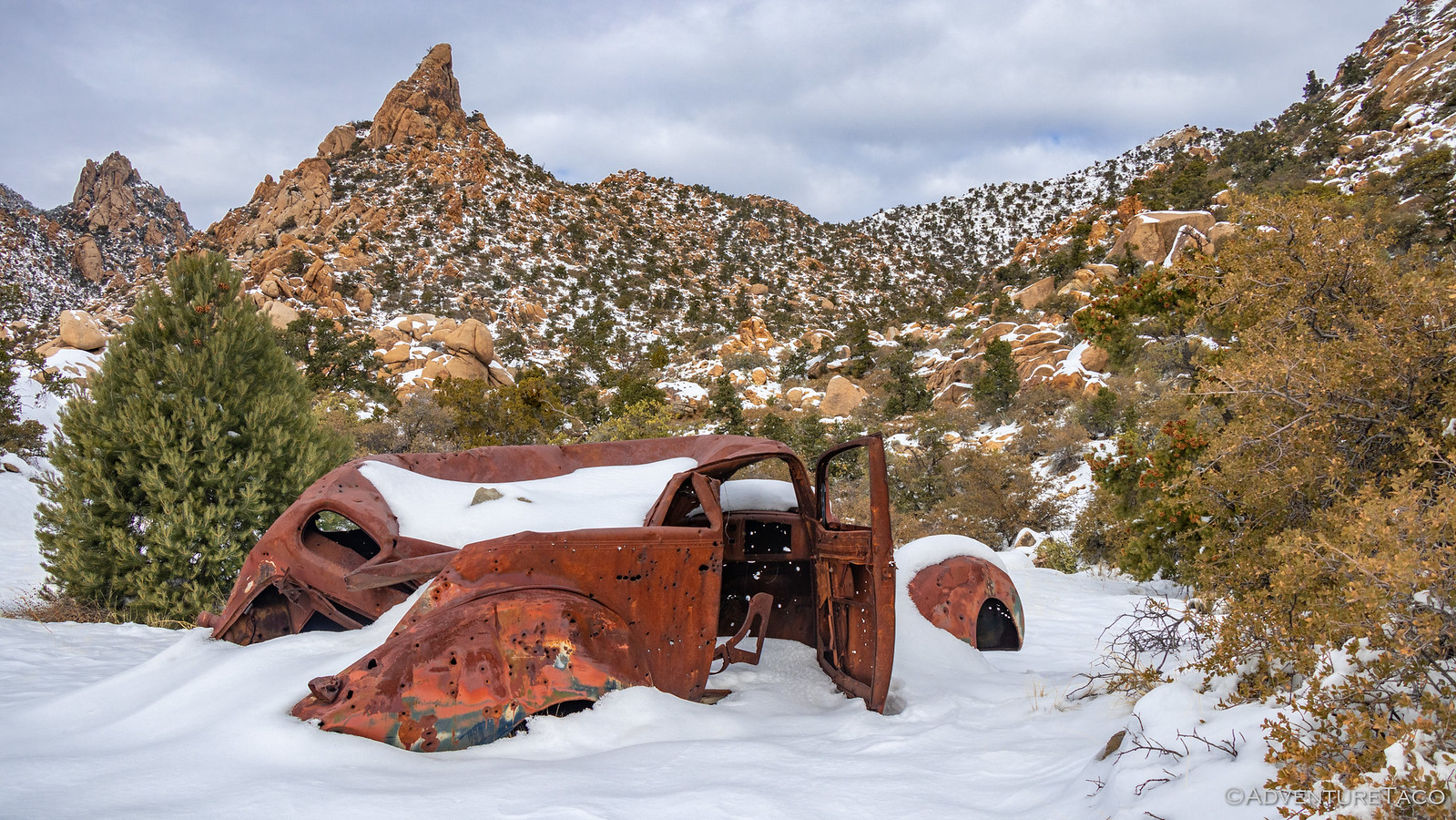
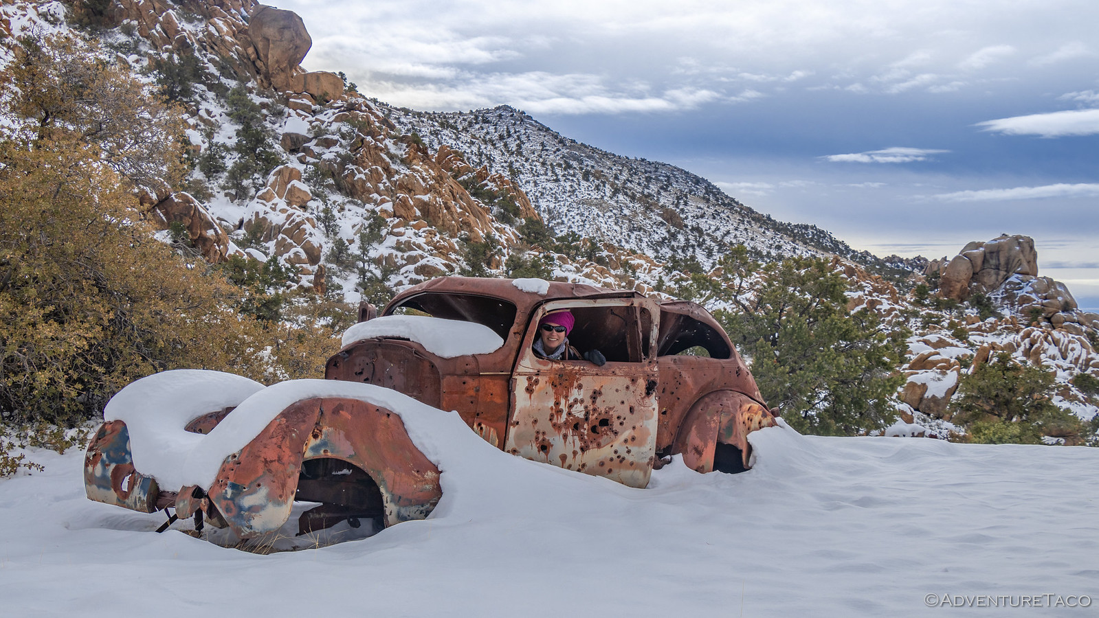
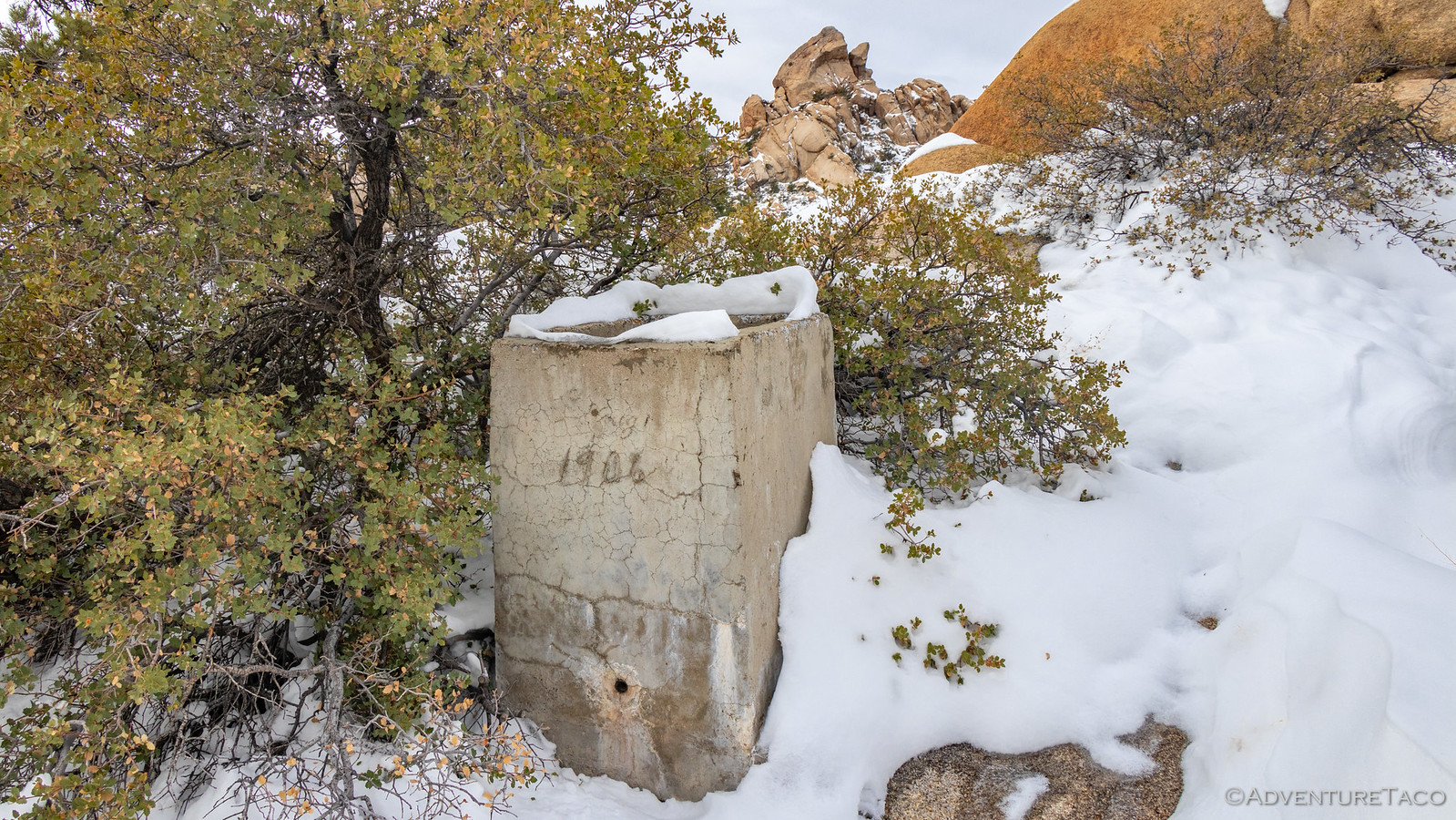
Instead, we investigated what we could at the old camp. Everything covered in snow, there are surely things that we missed - just another reason to return under more "normal" conditions. Still, an old car, stove, and what appeared to be a 1906 water source were fun discoveries to make.

49377081448_b03b06948f_h.jpg

49377534636_dde33972cc_h.jpg
Remnants of an early overlander.

49377733512_e4295adf5e_h.jpg

49377080843_53fbd6972e_h.jpg

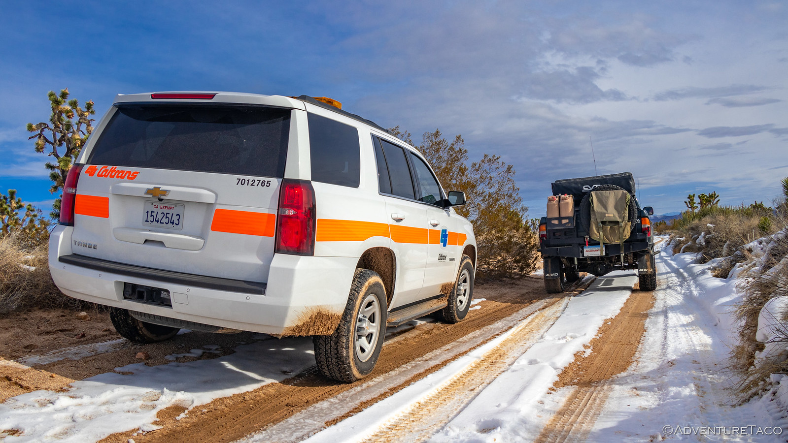
Having explored as much as we could in the snow, we headed back down Carruthers Canyon to the waiting truck - wondering how long it would be before the snow would be gone and we could return. And, as we made our way back out to Ivanpah Road, we stumbled upon something we'd definitely not expected to see out here in the middle of the preserve - CalTrans!

49377080548_9029cf310a_h.jpg

It turns out - unsurprisingly - they were not here to check on the road conditions to make sure that we'd get through without issue; rather, they were checking up on a plot of land that was part of a restoration project the company was undertaking to offset a project elsewhere in the state. As the man and two women returned to their truck, we had a fun conversation about the road conditions - they hadn't expected any snow - nor my stopping to capture a photo of their vehicle in the middle of the Mojave. With that, we bid each other safe travels and continued on with our day.

For us, that meant continuing north on our counter-clockwise loop of the preserve, fingers crossed that our next destination would be clearer than the last. In fact, while we'd originally planned to visit Keystone Canyon - just north of Carruthers - at nearly 6800' and on the north side of the range, we decided against it, instead opting to investigate the historic ghost town of Vanderbilt.


Don't miss the rest of the story, and all the remaining photos that don't fit here (due to max post size). Hopefully that can change in the future, but until then...


.
 

turbodb

Well-known member
Mojave Redemption #6 - Blue Rocks and a Dozen Cabins
Part of the Mojave Redemption (Dec 2019) trip.

We had mostly clear skies and a it of breeze when we awoke in the morning. Our spot on the alluvial fan had worked out great, though not quite as remote as it appeared - the Morning Star Mine Road below us was significantly busier than we'd expected.

49382792543_e5fd475f2f_h.jpg

The sun out, nothing about the morning seemed out of the ordinary as we got breakfast underway and broke down the tent. It was only when we went to latch the swing-outs closed that we discovered something was amiss.

49383450797_5d5abe9c00_h.jpg

49383450742_43997e178a_h.jpg

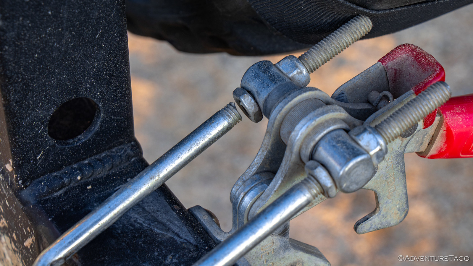
The u-bolt on the latch had broken, and no longer secured the swing-outs. we were lucky to have caught it before the entire latch failed, and as soon as we did, I knew we'd found the source of a rattling I'd heard since lunch time the previous day. At the time, I'd thought it was either the shovel, our water Jerry can, or the skid plate. I'd checked the bolts of the skid, and rearranged the bed in order to address the issue, and ultimately chalked the continued rattle up to things simply bouncing in the bed.

After a bit of thought, I realized that I could solve the problem - temporarily - by through-bolting the swing-outs together. This was only possible since I'd drilled a hole to do exactly this when at home - the latch for the swing-outs resulting in the truck being a bit too long to allow the garage door to close. (Yes, it's that close!) So I fished an M8 bolt and the requisite washers out of the OSK, and secured the swing-outs. It'd be inconvenient every time we needed to get into the bed, but it'd allow us to complete the trip.

More on this to follow in the trips Rig Review (which I'll post in a few days - sign up here if you don't want to miss it).

49383450652_f2262308cd_h.jpg

Our first stop for the morning was just a few more miles up the road we'd camped on, at the New Trail Mine. Really the access point to several mines, we climbed the rest of way to the base of the Mountains and started our exploration with the investigation of a couple cabins and work shed at the old mine camp.

49382792253_58d12a9307_h.jpg

49383450427_be7ca56c86_h.jpg

49383450302_960b713ba7_h.jpg

49383254491_938da3c18a_h.jpg

These cabins were in reasonably good condition, and after poking around a bit and doing our best to untangle the flag hanging from the shed, we pushed forward. This camp sits at the base of New Trail Canyon, and our goal for the morning was to tackle a 3-mile loop hike to the top - in the snow the entire time - exploring several old mines along the way.

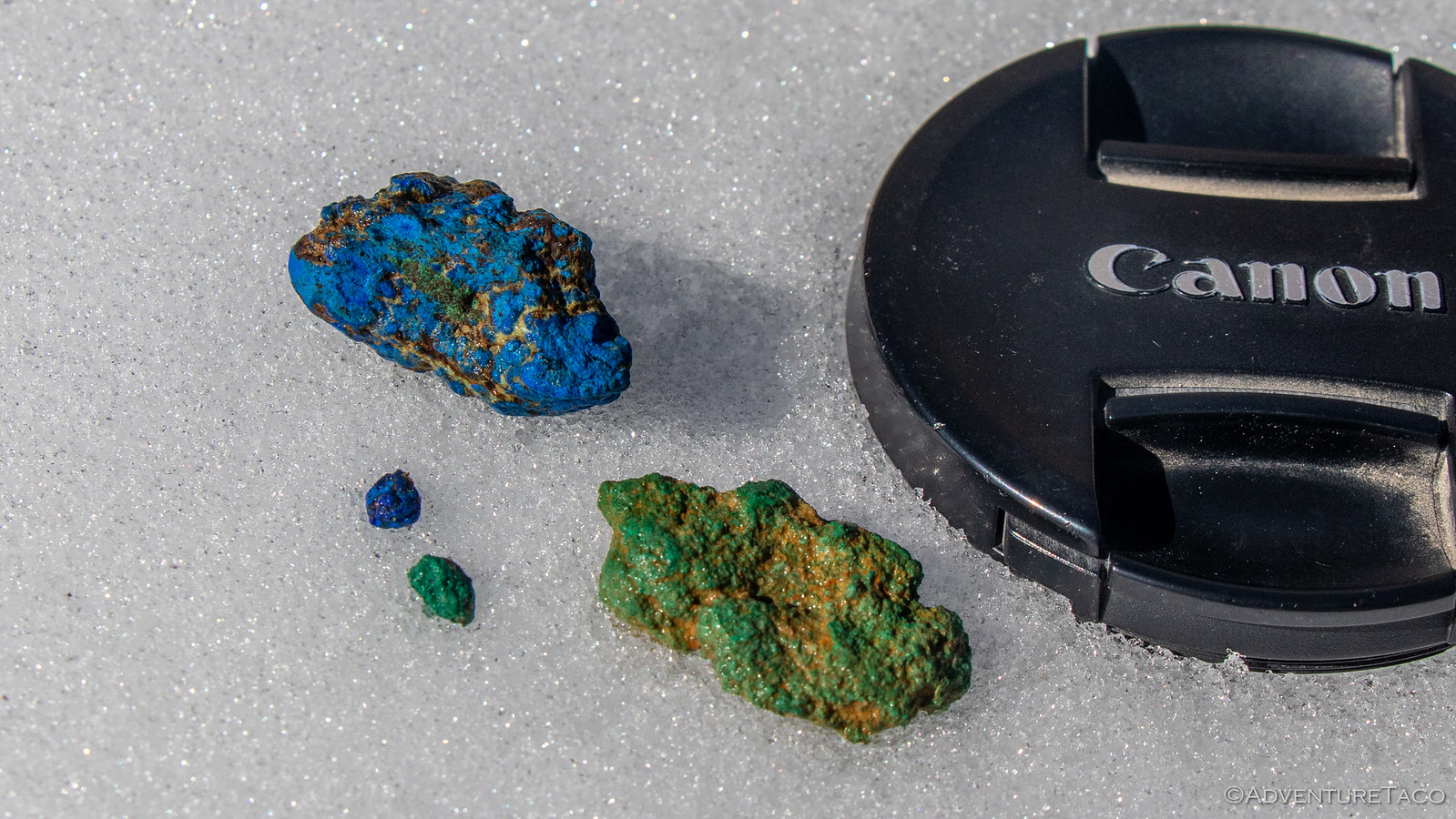
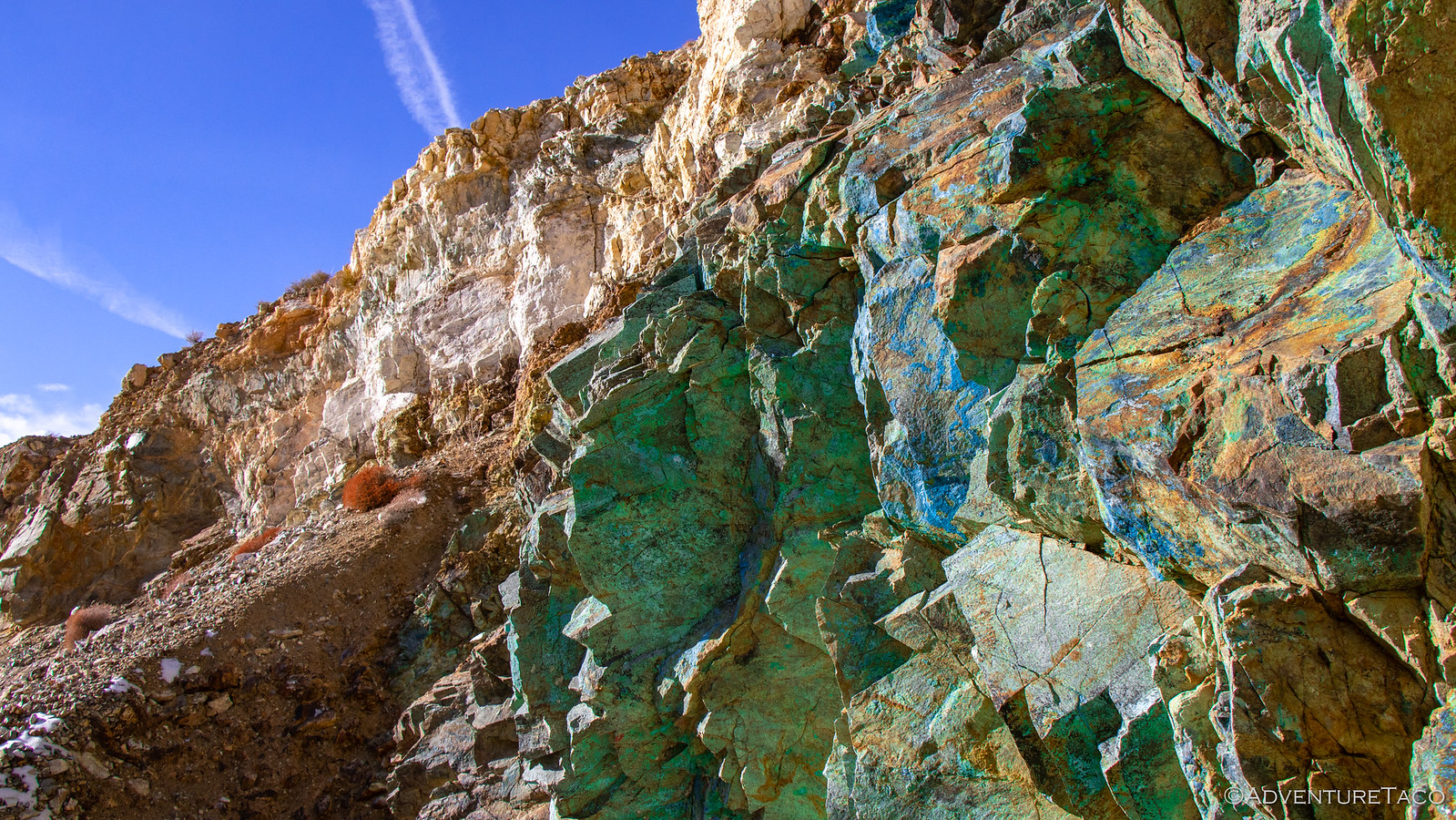
Almost immediately @mrs.turbodb found this amazing blue and green rock. Green copper patina we are familiar with, but neither of us had ever seen anything like the blue before in our lives!

49383450092_a5342bc9c2_h.jpg

The earliest mine here was the Bullion Mine - worked initially in the 1860's it produced silver-lead combo so valuable that the ore itself was shipped halfway around the world - to Wales - for processing. Its tunnels were worked for many decades - even as late as 1917 - continuing to produce lead-copper-silver ore the entire time. Up a couple of adjoining side canyons, our first stop was a large shaft at the end of a steep access road. It provided splendid views back down the canyon, but no real chance for exploration - a thick metal grate placed securely across our way.

49383254281_1041de5db3_h.jpg

49383449867_a18374a3eb_h.jpg

49382791568_952d2a0b9a_h.jpg

It was at this point that we made a navigational error. We thought the main shaft for the Bullion Mine was further up the same - very steep and snow covered - wash that passed the tunnel we'd found, but after climbing to the top, we realized that it was actually in the adjoining canyon! :frusty: You win some, you lose some!

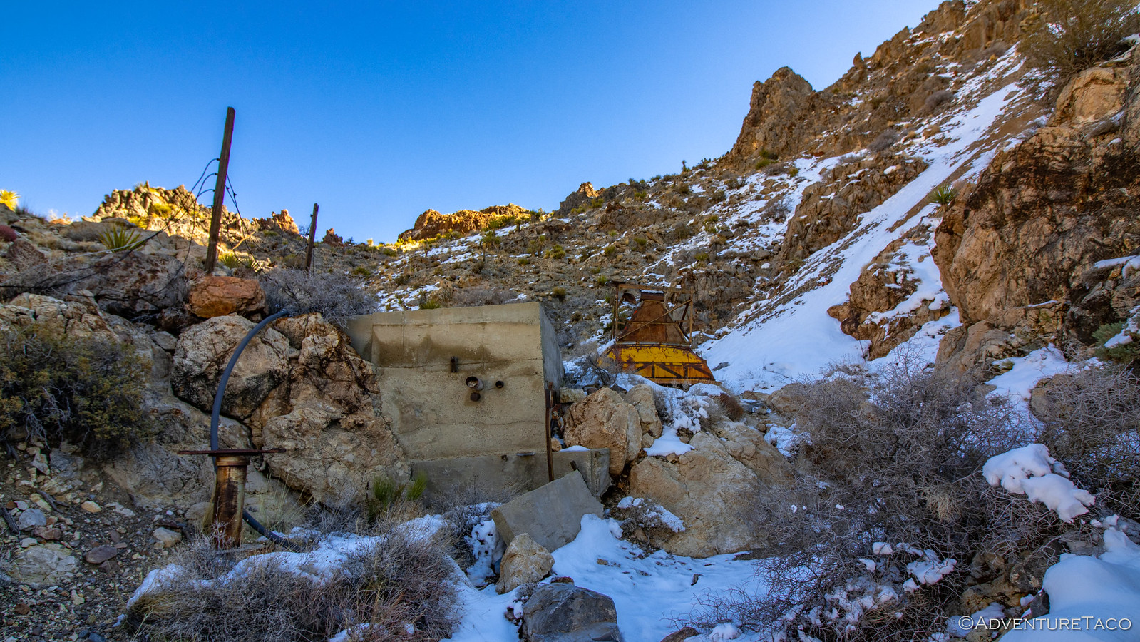
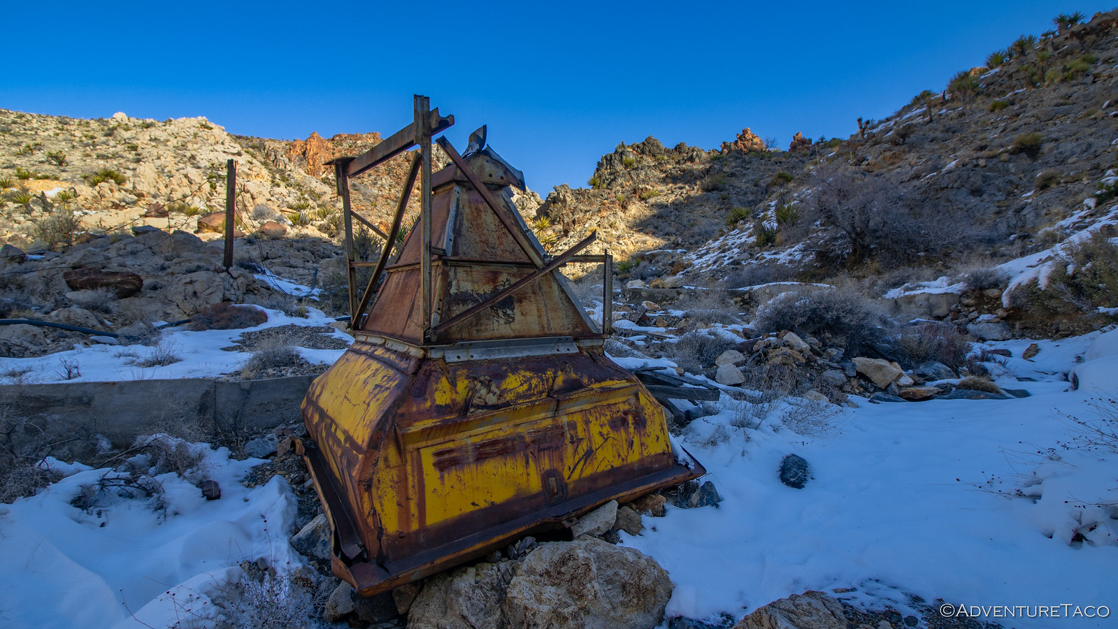
So, we headed back down and made our way to the next side canyon and wash. Even with snow covering much of the ground, we immediately we knew we were in the right place - concrete foundations, a large yellow metallic tipple, the remains of an old rusty trailer and loading dock, and a cableway leading to the mine shaft we thought we were climbing to, all there for our viewing pleasure. It all seemed very close to the bottom of the wash from our perspective - an indication that water flow through this area must have been reasonably low for a very long time.

49383449657_e00ef656d2_h.jpg

49382791388_913276fdb9_h.jpg

49383253781_f7e6a5ec30_h.jpg
This trailer is the converted bed of a pickup - little has changed in the last 150 years!

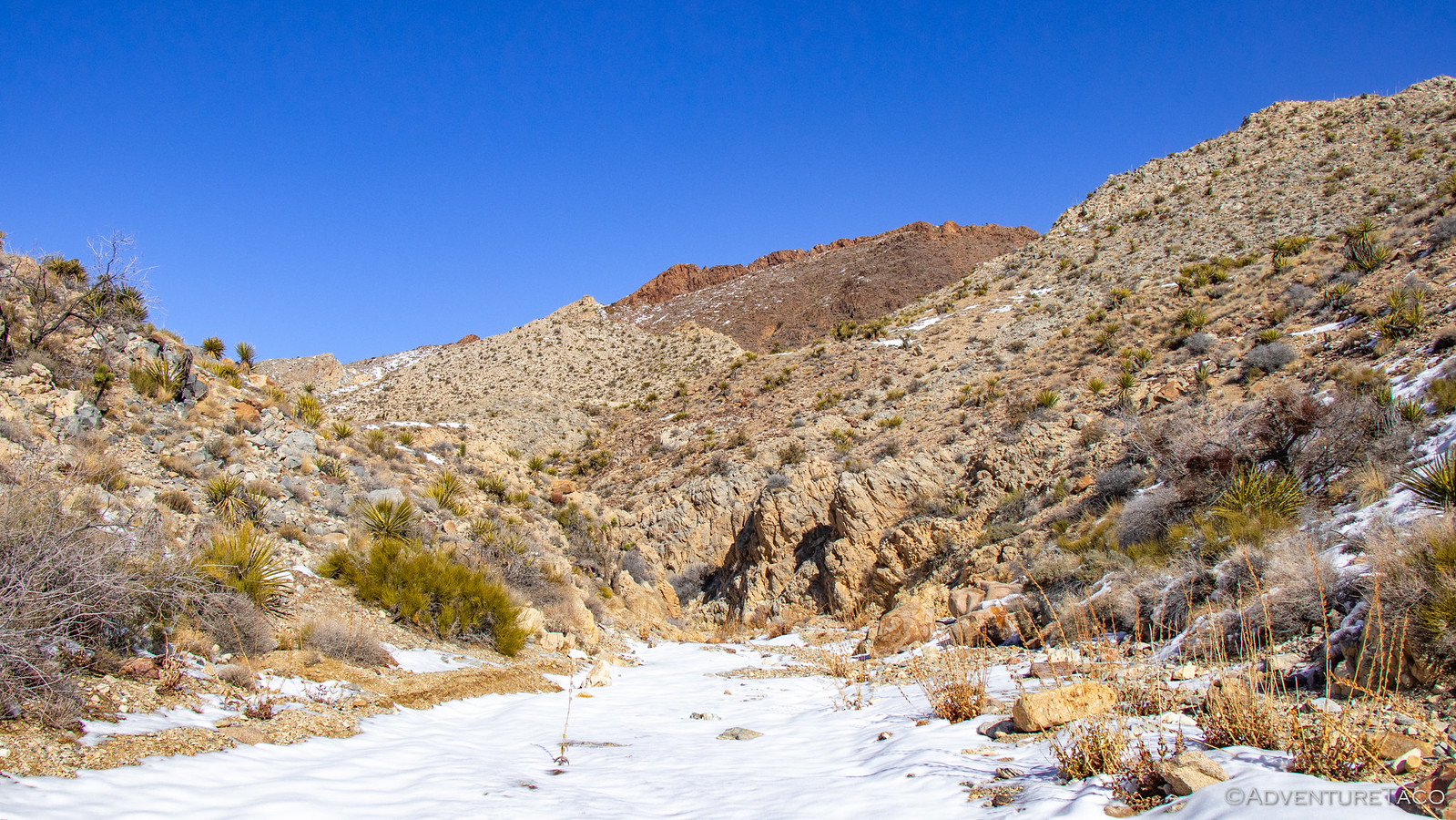
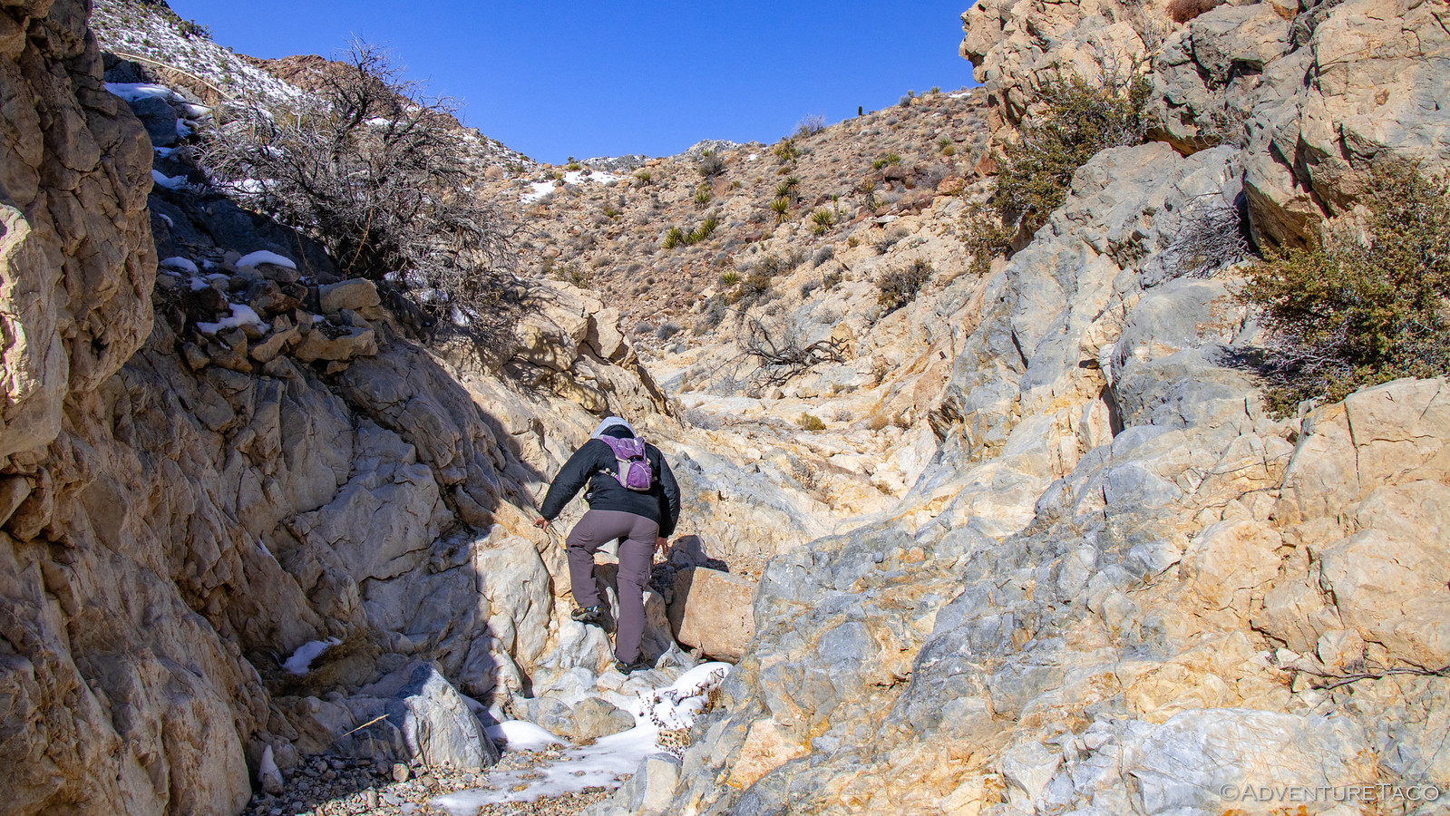
From the Bullion Mine, the hike up the New Trail Canyon wash really picked up. The wash itself transforms here from a wide sandy stroll, to a steep, rocky climb. Not that it bothered us - quite the contrary, it provided tons of visual interest and fun scrambles up old dry falls.

49383449297_21d485be8f_h.jpg

49382790988_024ea83f99_h.jpg

As we progressed, we - and especially @mrs.turbodb - were stopping frequently to admire the plethora of minerals that were present along the way. Clearly, this area was rich in copper, though its concentration here is surely increased by the dozens of tailings piles along the sides of the wash. When we stumbled upon these two large blue and green specimens, there was no way we were going to pass by without a photo.

49383448952_16e6e87e35_h.jpg

Eventually we reached the head of the wash - still several hundred feet below a large tailings pile from the Revenue Copper Mine - and made a final push up the side of the canyon to reach its diggings.


Don't miss the rest of the story, and all the remaining photos that don't fit here (due to max post size). Hopefully that can change in the future, but until then...


.
 

turbodb

Well-known member
Mojave Redemption #7 - Redemption in the Clark Mountains
Part of the Mojave Redemption (Dec 2019) trip.

When I'd marked the spot we camped in Valley Wells, I hadn't really done any research on it. I knew it was on a road that would take us to the Copper World Mine, and I'd seen what looked like some ruins during my route planning in Google Earth, but that was the extent of my research. Shoot, I didn't even know that it was called Valley Wells! :laugh:

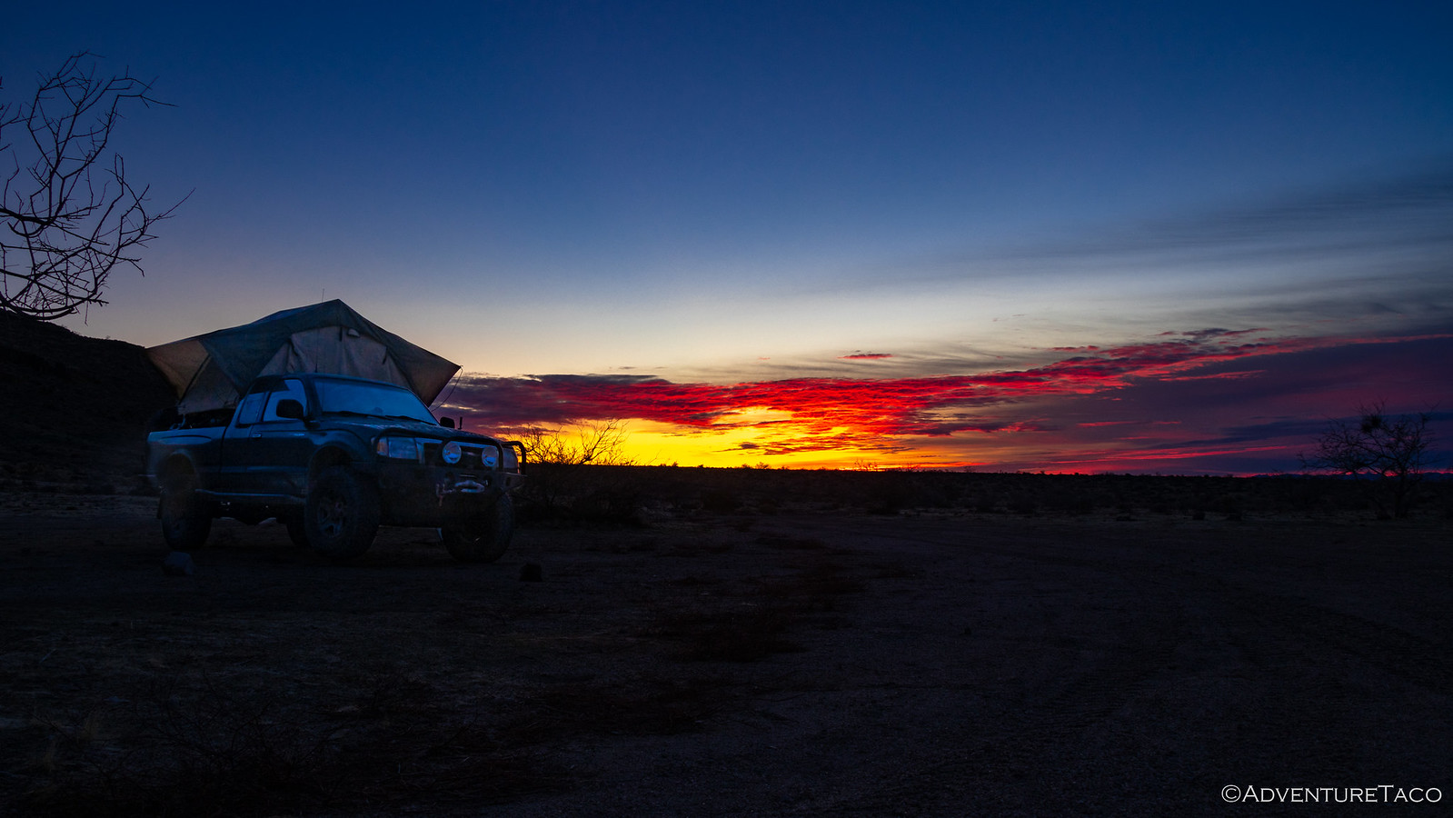
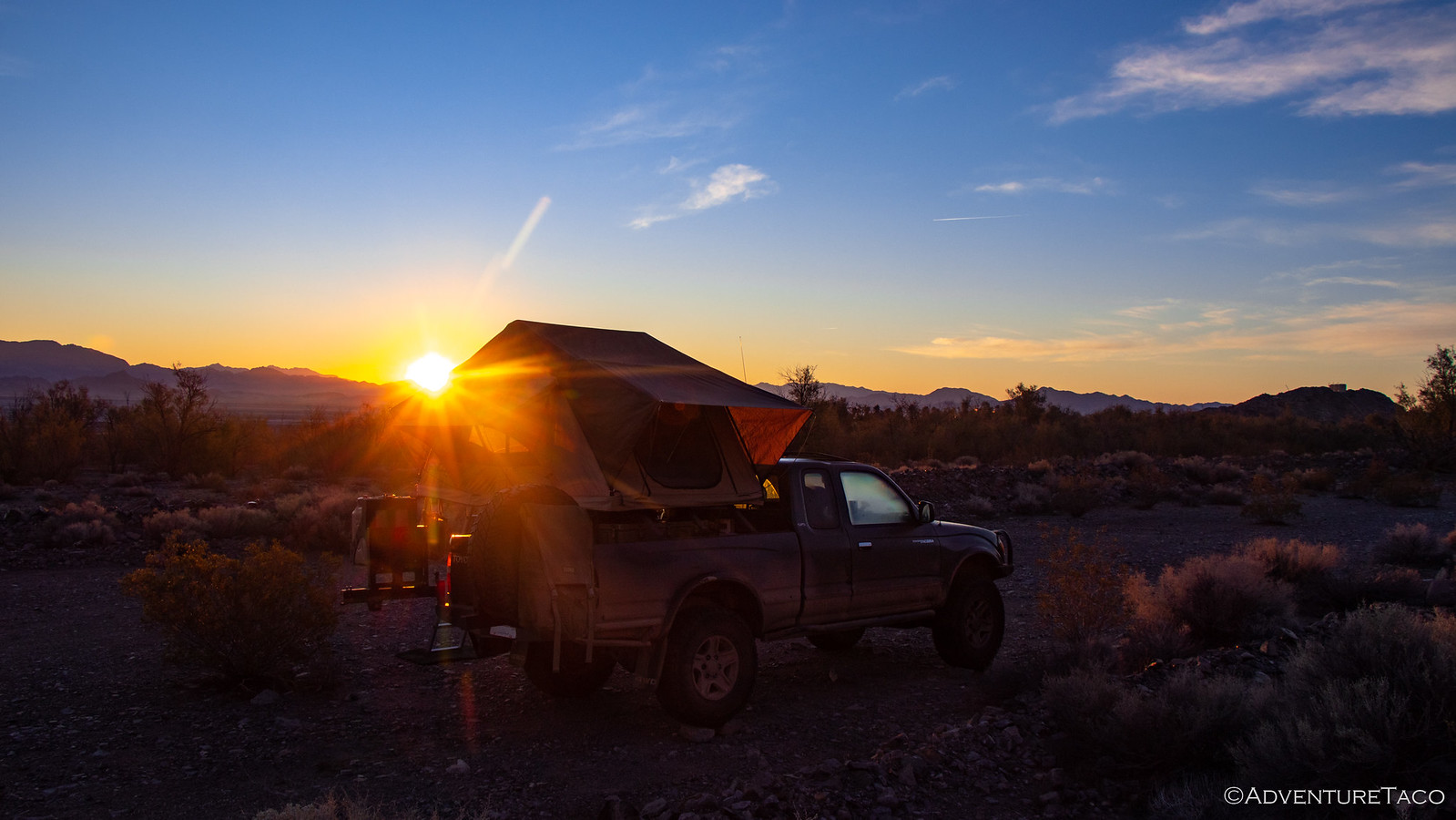
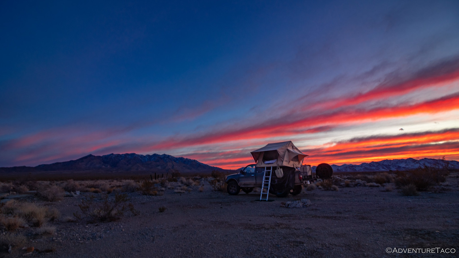
What I did know when we went to bed though was that we were well positioned for a colorful sunrise - if some clouds showed up overnight. Lucky for us, they did, stretched all across the southern horizon and above both the Clark and Ivanpah Mountains.

49387408371_81339696f3_h.jpg

49387602137_4c1ea02912_h.jpg

I'd been up for 45 minutes or so when the sun finally peaked above the horizon at 7:05am, and I'd waited till then to start exploring the area - my curiosity piqued by the little bit of looking around I'd done during sunrise.

It turns out that Valley Wells is the site of several historically interesting remains, which @mrs.turbodb related to me from Hiking the Mojave Desert. The smelter here was constructed in 1898 to process ore from the Copper World Mine - the next place we planned to go explore!

Today, there are only foundations and a slag pile left over from the smelter that worked from 1899-1904 and 1917-1918, but they are still interesting to explore. The foundations have been vandalized as is often the case with easily accessible locations, though the artwork is eye catching.

49387408226_1bd8c28ff4_h.jpg

49387601972_100a659908_h.jpg

49387601877_ff6a51d1e0_h.jpg

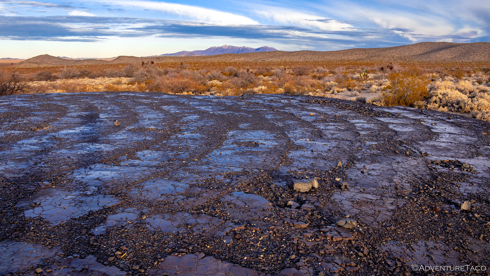
The slag pile on the other hand, looks mostly untouched. Having not read any details about it when we were there, we initially thought it was some sort of volcanic flow, it's surface glossy and glass-like, similar to obsidian. However, it turns out that this is actually a mixture of iron, copper, and calcium silicates that was the "waste" from the smelter. As it was poured, it cooled rapidly into what is essentially a metal-rich glass. If you visit this site, refrain from walking on the slag piles, as their glassy surfaces are very brittle, and doing so destroys them over time.

49387601762_d9dce22dd5_h.jpg
The top surface of this slag pile has been ground off, the slag reprocessed decades later when it was discovered to contain between 2 to 10% copper - richer than the original ore from which it was created!

While in retrospect, the slag pile seems the most interesting part of Valley Wells to me, at the time I was more intrigued by the troglodyte ruins that are visible along the banks of the wash system that weaves its way through the site.

49387601542_d0edd993f7_h.jpg

These dugouts were used by the miners in the Valley Wells community who noticed that the top layer of ground in this area was harder than the layers under it. They then excavated one perfectly rectangular room at a time to create dwellings, many of the rooms containing amenities such as nooks for shelves, and even chimneys. While many are in various states of erosion, they were definitely a cool thing to wonder about as we looked around.

49386931858_8b26a8c0ee_h.jpg

49386931713_2b76004736_h.jpg

By 8:15am, we'd completed our exploration - for this trip anyway - of Valley Wells, and were headed east from Valley Wells to the mine from which the vast majority of its copper ore had originated - the Copper World Mine in the southern folds of the Clark Mountains.

49387407211_338b73516f_h.jpg

While not a difficult road, we still weren't sure what to expect given we'd be reaching elevations of 5500', but we were relieved to see that the hillsides seemed to be mostly free of snow - or at least deep snow. After about five miles we reached the bottom of the massive pile of tailings - nearly 200 feet tall - which was where the truck would stop and our hike would start.

49387407076_2e39d30a50_h.jpg

The Copper World Mine was the East Mojave's richest copper property, and it's clear with even just a cursory glance that there is a lot of copper still left at this site after it was worked from 1898-1918. To get a closer look - and and because we wanted to do a little exploring of other mining claims on the other side of the ridge - we made our way up the tailings pile as quickly as possible, which is to say slowly given the many stops to check out all the ore.

And then, as we neared the top, all the stops and bits of green we'd seen suddenly seemed like the minor leagues. Here, the entire side of the hill was green, shafts all around indicative of the riches that lay within the mountain. It was stunning.

49387412226_715c9aaf1f_h.jpg

49387412001_47d5899a4e_h.jpg
A geologist at heart, @mrs.turbodb insisted on a photo in this location. Understandably.

49387605787_189583eeee_h.jpg

While the tailings of the Copper World Mine are obviously still quite evident, unlike other sites where various human debris seems to be scattered across the landscape, there were no buildings or machinery that we could find. We knew however that just on the other side of the ridge - in the next wash over - were the remains of the Copper Commander Mine, so that's where we headed next.

Not as successful as the Copper World Mine, the tailings of the Copper Commander were much smaller and split into four distinct levels leading up the side of the mountain. At the bottom, an old cabin - recently (in the last 6 years) reduced to just a roof when the walls collapsed - an ore chute, and the frame of a collapsed mine shaft dot the landscape. The wood used to build these structures may be crumbling, but judging by the nesting materials inside, they are still providing shelter to many a small animal.

49386935868_e4860517ae_h.jpg

49387411401_31218201ba_h.jpg

49386935498_8f76218ddc_h.jpg

There's a nice loop hike from the Copper Commander Mine to nearby Pachalka Spring, but that's something we'll have to explore next time - for on this trip we'd planned to head back over the ridge and tailings pile that we'd climbed to get here in order to visit a third copper mine in this area - the Dewey Mine.

The Dewey was on our list because of its relatively unique tram that lowered copper ore nearly 550 feet down the mountain side to a stone loading platform at the end of a steep mountain road. This structure was an engineering marvel at the time, and though the lower half has collapsed, it's easy to see how it made material removal significantly easier for the miners.

49386935368_d79bd7149c_h.jpg


Don't miss the rest of the story, and all the remaining photos that don't fit here (due to max post size). Hopefully that can change in the future, but until then...


.
 

turbodb

Well-known member
Mojave Redemption #8 - Zzyzx, The Last Word - By Design
Part of the Mojave Redemption (Dec 2019) trip.

When we arrived at Zzyzx the previous evening, we’d expected to drive right into the town of the old Mineral Springs and Health Spa - so you can imagine our surprise when we encountered a locked gate across the road. It didn't matter all that much since it was dark and we weren't planning on exploring until the next morning anyway, so we found a campsite that was reasonably private near the base of the Soda Mountains. After our normal routine, found ourselves snoozing through our warmest night of the trip - understandable give our elevation of only 951 feet above sea level!

Morning brought another nice day and a cloudless sky meant I got a few extra minutes of sleep - only jumping out of the tent as the sun crested Cowhole Mountain to our east.

49387614303_fd1d780999_h.jpg


49388088226_e866cc7146_h.jpg

After a quick breakfast that consumed the last of our milk and cereal (perfect timing) and the breakdown of camp, we retraced our steps to the gate we'd discovered when we arrived the night before. It turns out that while the Zzyzx Mineral Springs and Health Spa has been closed since 1974, the California State University system now manages the land in and around Zzyzx and uses it as their Desert Studies Center. Visitors must park in a nearby lot and are then welcome to walk around the small town - being respectful of its current residents, of course.

The history of the resort is an interesting one. In 1944, Los Angeles radio evangelist Curtis H. Springer decided to make the mineral springs - which had been a common stop for American Indians, Spanish explorers, and even the railroad - into a health resort. As a gimmick to be the last listing in any directory, he and is wife ended up naming it the Zzyzx as it’s “the last word in health,” and the last word in the English language. The resort was a huge success, with guests frequenting the “healing waters” and Springer shipping his “medical products” all over the world. (wikipedia, Hiking the Mojave Desert)

Walking through town, the CSU system has done a great job of restoring and maintaining several of the buildings, and it looks like a fabulous place to hang out for a while studying the desert - if only I'd known it existed when I was attending! ?

49388286397_f028a1e000_h.jpg

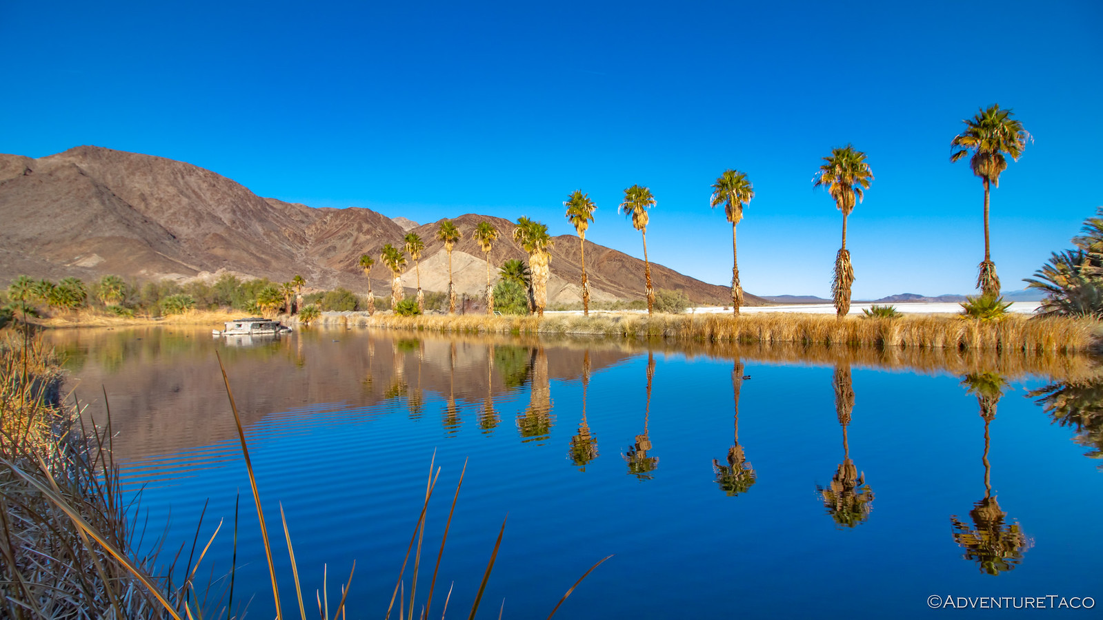
An oasis on the edge of Soda Lake.

49388286227_cb9ec3f4d8_h.jpg

The main street - Blvd of Dreams and the living quarters for CSU Desert Studies.

49387613863_38ec49d45c_h.jpg

The healing waters of Lake Tueandae. Now a magnet for all manner of birds and other wildlife.

49387613708_cf440449a0_h.jpg

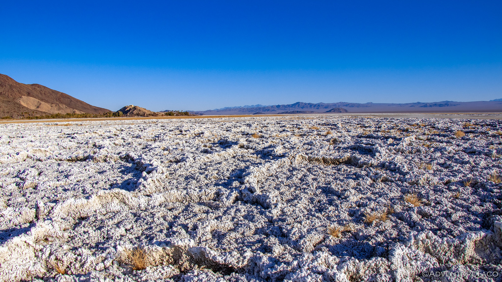
In addition to browsing around the empty streets at this early hour, we had one other task we wanted to accomplish on this - our last morning in the preserve: Hike out to Travelers Monument in the Dry Soda Lake. While this might seem at first to be less glamorous than some of our other explorations, it was in fact quite cool to walk across the lake bed.

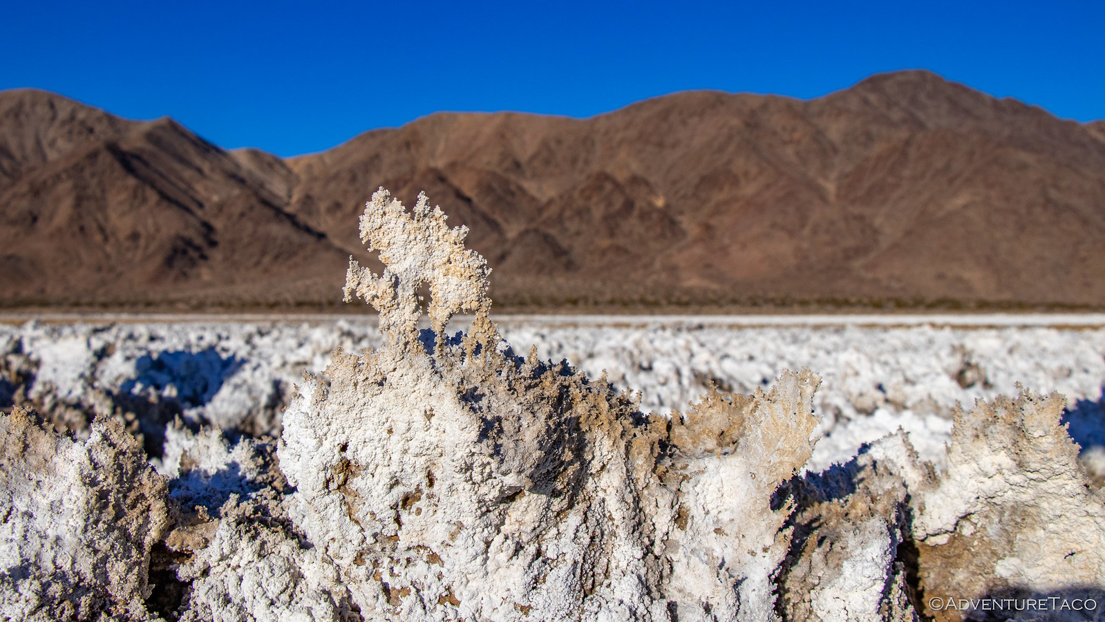
Reminiscent of Devils Golf Course in Death Valley, the salty crust was over a foot tall in places, and here - unlike Death Valley - walking is allowed on the lake bed. Naturally, we did our best to stick to existing trails and tire tracks anyway, but it was a special experience to be out there in the middle of it all.

49387613643_362e6ef422_h.jpg


49387615078_17da2f8232_h.jpg


49388287362_e9c98c1bbf_h.jpg

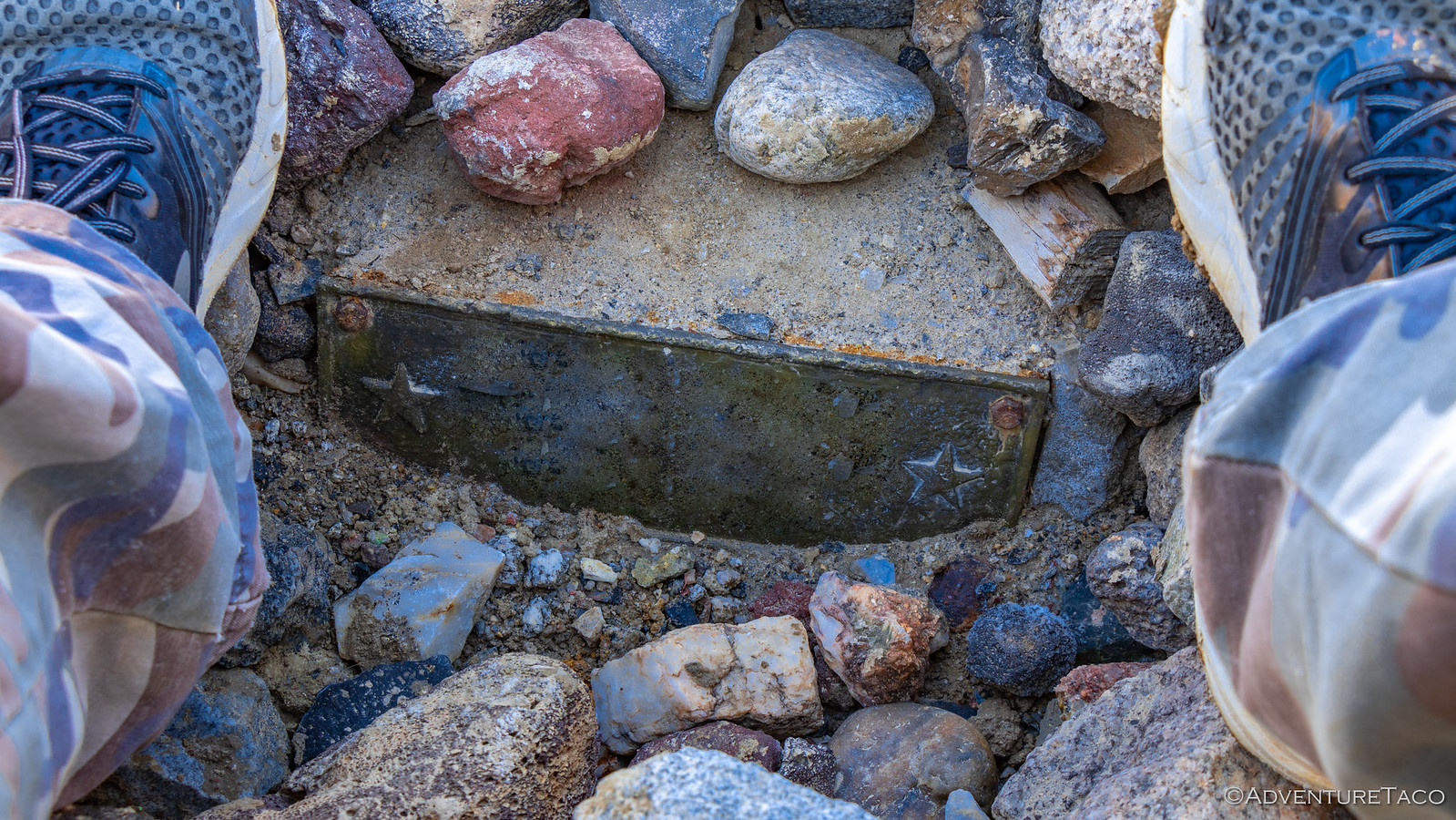
After a mile or so of hiking, we reached Travelers Monument. It was a place we'd missed the last time we'd run the Old Mojave Road since we'd routed around the muddy lake bed, and it was a fitting place to end this years amazing trip. Looking through dozens of the rocks on the pile left by previous visitors, it was an almost reverent time to see all the travelers who'd been by this very spot.

49388088891_52da5246b6_h.jpg


49388088791_bcd08a3aaf_h.jpg

Guess you'll just have to visit to see what this says. ? I will say, it's probably true.

49387614683_23f98d6e8b_h.jpg


49388286817_42d2d88f0e_h.jpg

Our last destinations now in the books, we headed back to the truck, and out to the highway - mostly satisfied. We'd seen a ton of what the Mojave Preserve had to offer. We'd run into only a few other folks - all great - over the course of the week. And of course, we'd had a great time doing it. Perhaps predictably, my hope that we'd "see it all" was obviously unfulfilled - this place, like so many others we've visited, is full of secrets that could take a lifetime to uncover.

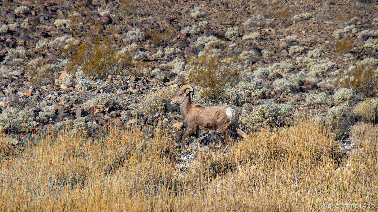
As a matter of fact, just as we were nearing the highway for the long trip home, we spotted a herd of Bighorn Sheep - our first experience seeing them despite having traveled through much of their range. Twice.

49387614538_81c282cb3f_h.jpg

Even this simple encounter was a good reminder to us that this is surely not be the end of our relationship with the Mojave National Preserve. Until next time, get out there and enjoy!
 

Forum statistics

Threads
188,007
Messages
2,901,048
Members
229,355
Latest member
BDM66

Members online

Top