You are using an out of date browser. It may not display this or other websites correctly.
You should upgrade or use an alternative browser.
You should upgrade or use an alternative browser.
Arizona Strip / Grand Escalante / Canyonlands / Bear Ears - 15 day Solo Adventure - May 2025
- Thread starter bashinate
- Start date
bashinate
Active member
Day 8: May 19
Day Mileage: 95
Total Mileage: 745
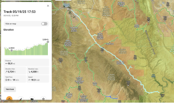
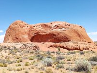
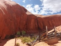
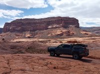
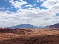
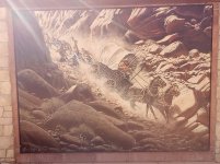
This day I slept in pretty late. I had finally reached that exhausted phase of a trip in a good way. For someone that puts in long days and covers a lot of ground I was finally happy to slow down for a bit.
I took my time getting up enjoying coffee at the boulder campsite. The plan today was to make it to the hole in the rock and hike down as far as I could. I had read you could no longer reach the shoreline of lake powell with recent rock falls.
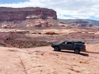
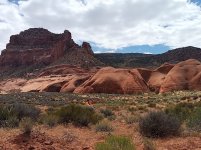
It took me longer than I had anticipated to reach the end of the road and I made a few stops along the way including Dance Hall Rock (https://www.blm.gov/visit/dance-hall-rock-historic-site)
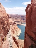
Picturing the pioneers out here playing music and dancing in such a remote area is just so hard to imagine. I would love to see that. Once I got to hole in the rock I signed the visitor log and hiked my way down. For a moment I was convinced I could make it all the way down but towards the very end it was indeed completely blocked. With a little sigh I climbed my way back out. I had read quite a bit and watched documentaries about the mormon expedition so it was definitely rewarding to finally make it out there. (https://ensignpeakfoundation.org/hole-in-the-rock-expedition)
I started making my way back down hole in the rock road and ultimately decided to find somewhere to camp off the road that goes out to the cosmic ashtray. I found a nice spot not too far down and enjoyed settling in early with a good meal and some freshly acquired Moab Brewery beers from Escalante. The previous night and this evening were both very calm and I got to fly the drone some and get a good campfire going.
I normally take way too many pictures of food and campfires and yet this trip apparently I hardly took any. I guess for once I finally figured out how to just be in the moment.
Day Mileage: 95
Total Mileage: 745

This day I slept in pretty late. I had finally reached that exhausted phase of a trip in a good way. For someone that puts in long days and covers a lot of ground I was finally happy to slow down for a bit.
I took my time getting up enjoying coffee at the boulder campsite. The plan today was to make it to the hole in the rock and hike down as far as I could. I had read you could no longer reach the shoreline of lake powell with recent rock falls.
It took me longer than I had anticipated to reach the end of the road and I made a few stops along the way including Dance Hall Rock (https://www.blm.gov/visit/dance-hall-rock-historic-site)
Picturing the pioneers out here playing music and dancing in such a remote area is just so hard to imagine. I would love to see that. Once I got to hole in the rock I signed the visitor log and hiked my way down. For a moment I was convinced I could make it all the way down but towards the very end it was indeed completely blocked. With a little sigh I climbed my way back out. I had read quite a bit and watched documentaries about the mormon expedition so it was definitely rewarding to finally make it out there. (https://ensignpeakfoundation.org/hole-in-the-rock-expedition)
I started making my way back down hole in the rock road and ultimately decided to find somewhere to camp off the road that goes out to the cosmic ashtray. I found a nice spot not too far down and enjoyed settling in early with a good meal and some freshly acquired Moab Brewery beers from Escalante. The previous night and this evening were both very calm and I got to fly the drone some and get a good campfire going.
I normally take way too many pictures of food and campfires and yet this trip apparently I hardly took any. I guess for once I finally figured out how to just be in the moment.


dstefan
Well-known member
Great trip report and pics! Thanks for posting the gpx files. I’m gonna try the Grand Wash route next time I go up there.
I’m curious how bad the Hole in the Rock road washboards were? 2 years ago when I was on it they were the worst I’ve ever been on — thought they’d destroy something on my truck. Hope it’s been graded since.
I’m curious how bad the Hole in the Rock road washboards were? 2 years ago when I was on it they were the worst I’ve ever been on — thought they’d destroy something on my truck. Hope it’s been graded since.
bashinate
Active member
Day 9: May 20
Day Mileage: 189
Total Mileage: 934
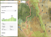
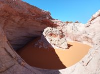
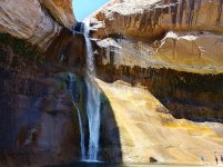
My first order of business today was to find the cosmic ashtray. I packed up and kept heading down the road I camped right off of and drove until I was right next to where I could see the ashtray marked on the map. I couldn't find any specific trail so I launched the drone to see if I could find it unsuccessfully. It looked like there was a hiking trail just past the road so I hiked across a wash and eventually found some cairns and started following them up until I found it. Very strange formation. It was fun flying the drone around it. After that I headed to hike calf creek falls which I had missed on multiple previous trips. It was already fairly warm in the day and there were a lot of people out there. I have seen many waterfalls but this was definitely one of the more beautiful ones I have seen. The ice cold water was super refreshing after that hike. Unfortunately it was packed with people including a couple women in bikinis that seemed intoxicated doing a "photo shoot" taking up prime access for pictures. This is why I stick to remote places away from people. After this hike I had gone from ripe to over-ripe since I hadn't had a shower since Sand Hollow State Park 5 days prior. I had planned to get a shower at hills and hollows gas station in Boulder as I had done on a previous trip as well as get some of the delicious indian food at the food trailer there. Unfortunately the bathroom was closed due to plumbing issues and the food trailer was also closed.
I then headed to Anasazi State Park Museum in Boulder. I had been wanting to check this out on a previous trip but it was closed. I'm glad I went. They have a great collection of artifacts and I didn't even realize they had all the Kivas out in the back. Highly recommend. There was no entry fee either (https://stateparks.utah.gov/parks/anasazi/) . Most of this day was on blacktop along highway 12 but one of the most scenic highways in Utah. I never get tired of that one. I planned to look for a shower in Torrey and after inquiring at an RV Park they pointed me to Chuck Wagon Lodge (https://chuckwagonlodge.com/) that had a general store and showers. Best shower of the trip !
I then headed through Capitol Reef and turned off onto Notom Bullfrog Road which I had been down before. I planned to turn off to head up into and around the Henry Mountains across a section I hadn't been through before.
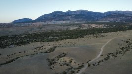
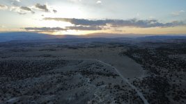
I found a lovely open camp spot for an amazing sunset.
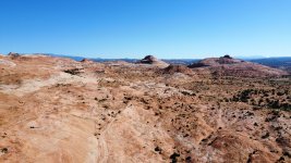
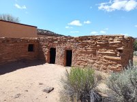
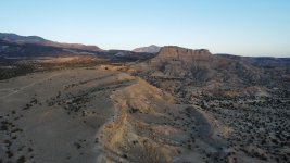
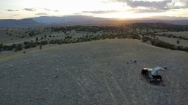
Day Mileage: 189
Total Mileage: 934

My first order of business today was to find the cosmic ashtray. I packed up and kept heading down the road I camped right off of and drove until I was right next to where I could see the ashtray marked on the map. I couldn't find any specific trail so I launched the drone to see if I could find it unsuccessfully. It looked like there was a hiking trail just past the road so I hiked across a wash and eventually found some cairns and started following them up until I found it. Very strange formation. It was fun flying the drone around it. After that I headed to hike calf creek falls which I had missed on multiple previous trips. It was already fairly warm in the day and there were a lot of people out there. I have seen many waterfalls but this was definitely one of the more beautiful ones I have seen. The ice cold water was super refreshing after that hike. Unfortunately it was packed with people including a couple women in bikinis that seemed intoxicated doing a "photo shoot" taking up prime access for pictures. This is why I stick to remote places away from people. After this hike I had gone from ripe to over-ripe since I hadn't had a shower since Sand Hollow State Park 5 days prior. I had planned to get a shower at hills and hollows gas station in Boulder as I had done on a previous trip as well as get some of the delicious indian food at the food trailer there. Unfortunately the bathroom was closed due to plumbing issues and the food trailer was also closed.
I then headed to Anasazi State Park Museum in Boulder. I had been wanting to check this out on a previous trip but it was closed. I'm glad I went. They have a great collection of artifacts and I didn't even realize they had all the Kivas out in the back. Highly recommend. There was no entry fee either (https://stateparks.utah.gov/parks/anasazi/) . Most of this day was on blacktop along highway 12 but one of the most scenic highways in Utah. I never get tired of that one. I planned to look for a shower in Torrey and after inquiring at an RV Park they pointed me to Chuck Wagon Lodge (https://chuckwagonlodge.com/) that had a general store and showers. Best shower of the trip !
I then headed through Capitol Reef and turned off onto Notom Bullfrog Road which I had been down before. I planned to turn off to head up into and around the Henry Mountains across a section I hadn't been through before.
I found a lovely open camp spot for an amazing sunset.


bashinate
Active member
Its definitely wash boardy but wasn't too bad overall. I have been on way worse for sure.Great trip report and pics! Thanks for posting the gpx files. I’m gonna try the Grand Wash route next time I go up there.
I’m curious how bad the Hole in the Rock road washboards were? 2 years ago when I was on it they were the worst I’ve ever been on — thought they’d destroy something on my truck. Hope it’s been graded since.
bashinate
Active member
Day 10: May 21
Day Mileage: 150
Total Mileage: 1084
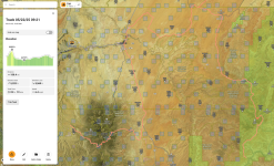
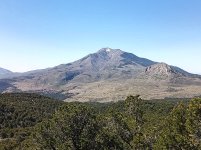
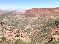
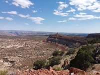
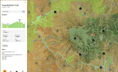
Today my goal was to make it out to camp somewhere out in the maze district of canyonlands. The only part of canyonlands I hadn't explored yet.
I made my way around the Henry mountains and ultimately down to Highway 95 and headed to hanksville and got gas and supplies at the infamous Hollow mountain.
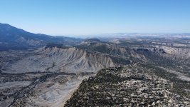
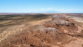
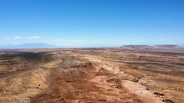
Just north of hanksville I turned off onto dirt to head out into the maze district. Before getting out there I noticed something named Sweetwater Reef on the map just up a side trail so I followed it out to a pretty cool overlook of a big reef area.
I flew the drone around here for a bit. It was so wide open and vast out in this area. Could see for days. I then made my way to the maze district Hans Flat Ranger Station.
Double checked on what the camping rules were and planned to just drive through and camp just outside the boundaries where camping was permitted.
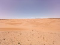
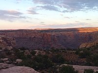
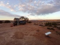
I had several marked spots in this area already. The flint trail switchbacks were fun. When I got to the bottom there was a ranger hiking and patrolling. I was surprised to see them on foot. He offered some camping spot recommendations and mentioned the exact spot I had marked and was planning to check out which is where I ultimately ended up for the night (Bowdie Canyon). The maze district was stunning and made me wish I had more time to truly explore it. Definitely an area I will come back to and dedicate more time to.
I did not pass a single other person in the two days I was in this area outside of the ranger station. In hind sight I should have hiked down from the camp spot I had parked at to the edge of the canyon but alas I just enjoyed a steak dinner / campfire and more moab brewery suds.
Another calm night thankfully.


bashinate
Active member
Day 11: May 22
Day Mileage: 116
Total Mileage: 1200
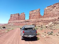
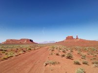
This day I continued on the road to hite out to highway 95 which absolutely stunning drive with all of the buttes through this section.
This section was postcard Utah that most people envision.
The plan was to head into Bear Ears National Monument / Cedar Mesa to find some ruins for the final leg of the trip.
I went to the Kane Gulch Ranger Station to get my hiking permit and get some info.
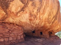
After checking out the exhibits I made my way to the House on Fire trail and hiked the relatively short distance out there.
Even though it wasn't in prime light hours I could still see where it got its name and could only imagine it in prime lighting.
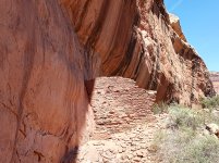
From there I started down Arch Canyon and checked out the ruins. I decided to not go all the way down and instead to start heading towards some "epic camp" spots I had marked up on comb ridge.
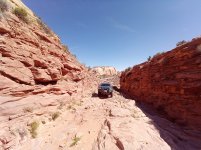
I saw that there was a trail that climbed straight up onto Comb Ridge (Old Highway 95) and the camp spot turn off I had marked was just past that.
Wow that trail was an adventure and there was some serious butt puckering on that climb. It was nothing but rocks to small boulders. In hindsight I probably would have skipped it but I was committed by the time I started climbing.
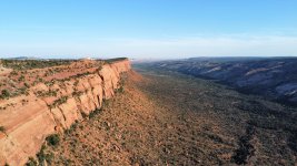
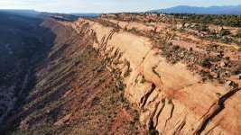
I took it slow jumping out multiple times to spot myself and made it up without incident. That connected me to country road 240 and I turned off of that out to a spot on the edge of comb ridge.
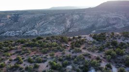
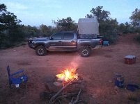
I was blessed again with a low wind evening for the drone and sunset. I have been through Bears Ears multiple times but have still barely scratched the surface.


bashinate
Active member
Day 12: May 23
Day Mileage: 107
Total Mileage: 1307
After packing up I explored a couple side trails around where I had camped and then headed towards blanding. I was able to take a shower at the rec center there when purchasing a day pass. I then headed to the edge of the cedars museum which I had heard good things from multiple people.
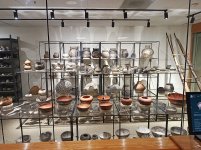
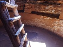
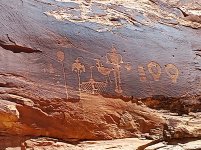
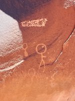
I was glad I did as they have quite an impressive array of artifacts and one of the most amazing pottery collections I have ever seen along with being able to climb down into a kiva outside in the back. After picking up some supplies I headed down butler wash road to check out all the petroglyphs and ruins along comb ridge.
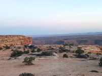
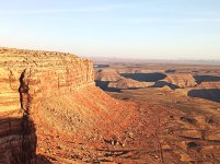
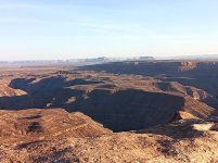
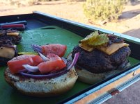
I then went over to the San Juan River petroglyphs which I had camped at previously but missed for some reason. Finally I headed to hike out to the wolfman panel in Butler Wash. This was probably my favorite one I had seen so far. After that I was ready to find somewhere to camp. I had previously been through valley of the gods and up the moki dugway to muley point but had never camped in this area. I figured I would go through valley of the gods and either find a spot up there or just head to muley point. Being a friday afternoon valley of the gods was packed with campers already and swarming with traffic so muley point it was.
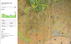
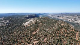
When I got up there I was shocked to only see a single jeep anywhere in the area and no one else showed up to my surprise. I had been wanting to camp up here since I had first visited a couple years back. Watching the sunset over monument valley is not something any camera can capture.


bashinate
Active member
Day 13/14
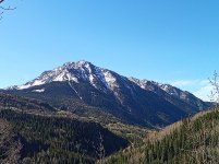
For my final night of the trip I wanted to soak up some cool mountain colorado air and snow capped mountains before heading back to the brutal Texas summer heat.
On my way east I stopped at four corners national monument which I had been close to many times but never stopped at because I knew it was mostly a tourist trap. I can confirm indeed.
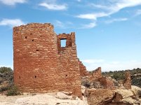
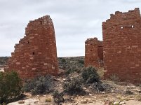
There was a huge line of people waiting to take a picture. I bought a couple souvenirs from the stands and carried on. I then headed very close by to Hovenweep National Monument and did the circle hike around all the ruins. I didn't realize how big these were. It was definitely worth the visit.
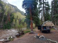
I then made my way into Colorado and headed up the million dollar highway taking a trail I hadn't been on before and ultimately found a perfect spot next to a river.
I enjoyed my final fire of the trip with the sounds of the water right next to me. The next morning I packed up and made the long haul back to Texas after staring at those snow capped San Juan mountains for a bit.
Well on that note it concludes this adventure however in just 3 more days time I leave for Death Valley / Mojave Preserve / Mojave Trails NM and surrounding public lands.
The Desert is calling me back.........


Similar threads
- Replies
- 33
- Views
- 7K
- Replies
- 22
- Views
- 9K
- Replies
- 29
- Views
- 6K
- Replies
- 54
- Views
- 28K
