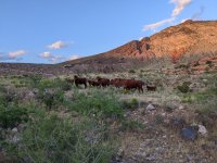
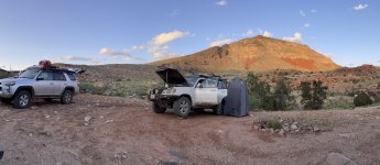
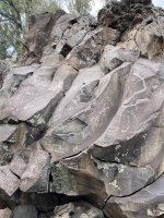
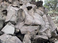
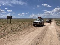
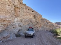
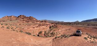
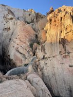
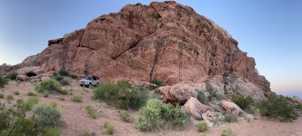
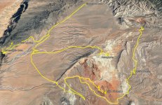
The Arizona Strip (AZ) and Little Finland (NV) - 9 Days in May 2023

boyfester

Observer
The heat at the bottom of the Grand Canyon was probably pushing 120°F, but jumping in the water felt great! We soaked our shirts and headed back up the 1.6 mile hiking trail. By the time we reached the top, our shirts were completely dry and the temperature cooled to a nice 110°F. Due to these high temperatures at Whitmore Canyon Overlook and the road being pretty bumpy back to the Bar 10 Ranch, we decided that we'd try to find a campsite at a higher elevation after dinner. We headed back up to Bar 10 and filled up our trucks with the discounted super unleaded gas as well as a couple extra gas cans.
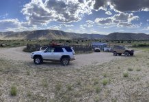
IMG_8329.jpg

After filling up our water bottles too and taking some nice hot showers, the dinner bell was rung and we were treated to an amazing all-you-can-eat dinner at the Bar 10.

IMG_8337.jpg

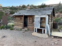
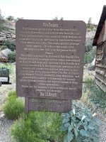
At dinner I spoke to a couple of the ranch hands and they said we could camp at the Pa's Pocket cabin on their private property, although they gave tours of it to their guests. If we were ok with some visitors in the afternoon, it was a nice place to camp with nice weather and no wind. We jumped at it.
IMG_8345.jpg

IMG_8346.jpg

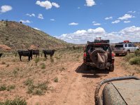
We were surrounded by cattle.

PXL_20230525_022818070.jpg

IMG_8350.jpg

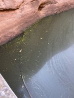
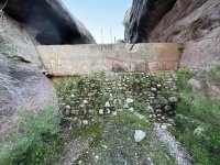
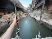
Pa's Pocket is named for the man-made water tank and so we took a quick walk after setting up camp to check it out. The water was a little nasty with floating dead frogs inside.
IMG_8356.jpg

IMG_8358.jpg

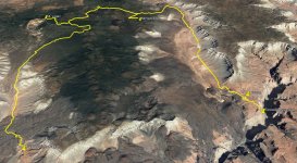
Day 5 GPX Track on Google Earth with hike to Colorado River. The ancient lava flows can be seen on the satellite image.

AZ Strip Google Earth - Day 5.jpg
 
Last edited:

Jupiter58

Well-known member
Great trip!and photos! What were the temps?? What did you pay for gas at the bar10?


Sent from my iPhone using Tapatalk
 

boyfester

Observer
Day 6 - Pa's Pocket, Mount Logan Hike, Nampaweap Rock Art Site, Sawmill, Toroweap Overlook (50 miles)

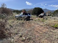
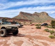
After some rest at Pa's Pocket, we took another small walk back to some of the man made tanks and then headed north on BLM1246 and then BLM1045. The guy who fueled our vehicles at Bar 10 told me about an alternate way to Nampweap and Toroweap Overlook and that was to take the SXS route through the Mount Logan Wilderness via BLM1023 and BLM1044. He said we'd be able to make it if we were OK with some more desert pinstripes some uneven terrain. We were up for anything!

Early morning photo at Pa's Pocket on Day 6

IMG_8365.jpg

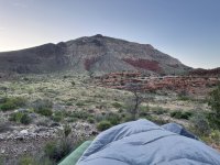
View from my cot at Pa's Pocket looking at an unnamed hill

IMG_8390.jpg

One last look at the dead frogs in the Pa's Pocket Tank. I don't know if I'd want to drink that water.

IMG_8403.jpg

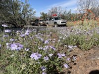
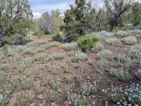
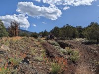
The trail, BLM1023, split through the Mount Logan Wilderness. The flower blooms were crazy along this spectacular trail!!

IMG_8420.jpg

IMG_8425.jpg

PXL_20230525_161409298.jpg

IMG_8413.jpg

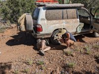
Sean was hearing some metal vibration noises in his Lexus and found the culprit. His exhaust pipe was rubbing against his redesigned hull for his enormous fridge/freezer. He was able to bend it out of the way.

PXL_20230525_162250069.jpg
 
Last edited:

boyfester

Observer
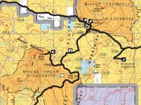
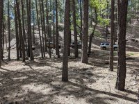
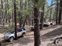
We reached the end of BLM1023 instead of driving straight through the wilderness, we headed northwest on BLM1044 with the wilderness now on our left side. We were eventually heading toward the Nampaweap Rock Art Site and Toroweap Overlook, when I saw another trail heading back into the wilderness (BLM1064) and a hiking trail to Mount Logan. I radioed the guys not knowing anything about this road and if they'd want to try it out. They were game and so we headed up. We were greeted with very tall trees before reaching the trailhead to the hiking trail.

Screenshot 2023-09-18 150750.jpg

PXL_20230525_172823239.jpg

IMG_8430.jpg

We reached the end of the out-and-back trail and had a great view of a valley west of Mount Trumbull Wilderness. Mt. Trumbull Schoolhouse is on the far left.

PXL_20230525_185928303.jpg

We also found out the hike to the top of Mount Logan (2,398') was a short, gradual 1-mile hike. When we reached the peak, we had a amazing view of the red and white hole knows as Hells Hole. It was very cool!

PXL_20230525_182201684.jpg

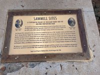
We hiked back to the trucks and continued on BLM1044 toward the wide, graded dirt road of CR 5. We passed the Mount Trumball Fire Station and then the Sawmill Historic Site.

IMG_0014.jpg

IMG_8453.jpg
 

boyfester

Observer
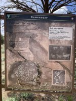
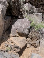
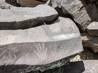
We then headed east to Nampaweap and found out we had to do another 1.5-mile hike to reach the site. It was incredible and had more petroglyphs in one location than I'd ever seen!

IMG_8455.jpg

IMG_8457.jpg

IMG_8459.jpg

IMG_8460.jpg

IMG_8461.jpg

IMG_8473.jpg

PXL_20230525_204045974.jpg

IMG_8467.jpg

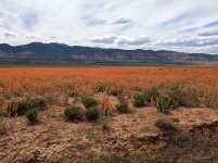
Our next stop after this was the Grand Canyon National Park and the Toroweap Overlook. The drive down was spectacular with orange blossoms in the entire valley.

PXL_20230525_215419002.jpg
 

boyfester

Observer
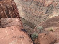
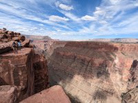
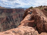
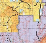
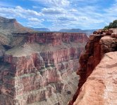
As noted, Toroweap Overlook is within the National Park and so you need to have advanced reservations if you want to camp, a National Park pass to enter the park, and now an additional daily permit is required for each vehicle ($2 each per day). The permit is a new 2023 requirement to reduce the amount of daily vehicles and people at Toroweap Overlook, as it's very popular on social media now. It's the only area in the entire Grand Canyon, where you can see the Colorado River from the rim's edge, 3,000' straight down. Without any guardrails, it's INSANE and very humbling to be that close to its edge! The volunteer NP rangers were very friendly when we arrived at the Tuweep gate and, although they checked to see our camping reservations and day permits, they never asked to see our National Park passes. The park's campground (also called Tuweep) is just north of Toroweap and the drive is very slow and rocky to the overlook. There is only one (1) group site and it's needed as it is the only site that allows more than 2 vehicles and up to 11 people.

Screenshot 2023-09-18 153734.jpg

The views from the Tuweep group campsite are spectacular!

IMG_8500.jpg

IMG_8483.jpg

The drive from the group campsite at Tuweep to Toroweap takes about 10 minutes and the trail is on solid granite.

IMG_0015.jpg

PXL_20230525_223140250.jpg

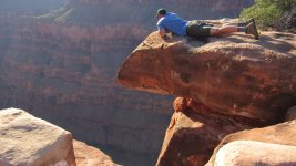
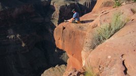
Getting this close to edge is creepy

PXL_20230525_223308226.jpg

PXL_20230525_223400584.jpg

PXL_20230525_223755842.jpg

PXL_20230525_230008289.jpg

Day 6 GPX Track on Google Earth

AZ Strip Google Earth - Day 6.jpg

More to come ...
 
Last edited:
boyfester

Observer
Great trip!and photos! What were the temps?? What did you pay for gas at the bar10?


Sent from my iPhone using Tapatalk
It was in the 70s for the most part. The North Rim is considerably higher in elevation than the South Rim.

We paid $7.50 per gallon of super unleaded at the Bar 10 Resort. Very cheap for being the only fuel station in an area larger than the state of Rhode Island. I’ve paid more in Death Valley, CA.
 
Last edited:
boyfester

Observer
Day 7 - Toroweap Overlook, Arizona Longhorns, Hurricane Valley, Honeymoon Trail, Dinosaur Tracks (114 miles)

We were supposed to spend two nights at Toroweap Overlook and each of us paid for an extra night, but there weren't any 4x4 trails to explore and none of us were in the mood for more hiking, so we decided to leave and head back toward St. George, Utah. It would be a very long day and so we decided to take a different route and camp along the way. The original planned route was going to be via CR 5 along Main Street Valley, but we changed it to include a new route along CR 105 and into Hurricane Valley. The valley was huge and we were surprised to find some longhorn cattle.

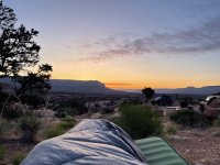
This is the view from my cot on the morning of Day 7.

IMG_8528.jpg

I woke up early and walked back to the Toroweap Overlook with my SLR for some timed selfies. I set the timer to the maximum of 30 seconds and walked over to the edge. This is a place that you do not want to have to run and get into position.

IMG_1025.jpg

IMG_1040.jpg

IMG_8538.jpg

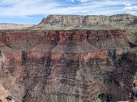
Looking across the Colorado River at the Aubrey Cliffs on the South Rim

IMG_8541.jpg

We packed up and headed north on CR 115 through Toroweap Valley taking in the orange flowers once again, which filled the entire valley floor.

IMG_8550.jpg

We turned west along CR 5 and passed the fire station and the Sawmill Historic Site from the previous day, before descending the Sawmill Mountains and heading back toward the Mount Trumbull Schoolhouse.

IMG_8557.jpg

We reached the school and headed north on CR 5 before turning northeast on CR 105 into Hurricane Valley. We found an old structure that looked like it was about to fall over.

IMG_8561.jpg

We passed between Diamond Butte and Twin Butte and came to Childers Well, where there were about 10-15 cattle with the longest horns I'd ever seen. We never saw the ranch hands.

PXL_20230526_180641121.jpg

PXL_20230526_180638434.jpg
 

boyfester

Observer
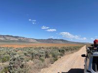
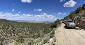
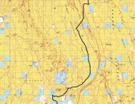
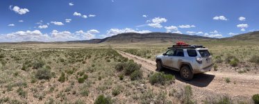
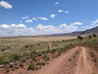
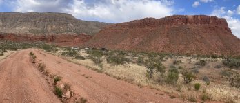
Below is a screenshot of the route we took through Hurricane Valley on CR 105. It was beautiful! The dirt road was really smooth and the light wind pushed any trailing dust out of the way for the next truck.

Screenshot 2023-09-18 210711.jpg

IMG_8564.jpg

PXL_20230526_180949251.jpg

PXL_20230526_181307549.jpg

IMG_8567.jpg

We eventually reached the junction of the Temple Trail

IMG_8573.jpg

The "Grandstand" is up ahead which splits through the Hurricane Cliffs and gets on top of the Uinkaret Plateau

IMG_8568.jpg
 

boyfester

Observer
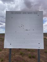
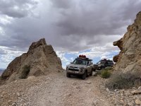
Next up was the Historic Honeymoon Trail which eventually drops back down through the Hurricane Cliffs via an extreme 4x4 section and into the valley again. I did this crazy section with a friend in January 2018 after the Winter 4x4 Jamboree in Sand Hollow, when it was raining and it was frightening. The wet clay and terrain were gnarly. It wasn't as bad this time with dry weather, but the off-camber section was still tricky.

IMG_8577.jpg

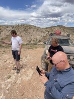
Before descending the cliffs, we stopped on a nearby hill to check out the view and for the first time in 7 days, everyone had a cell signal and our phones exploded with text messages, voicemails, and emails.

IMG_8582.jpg

IMG_8585.jpg

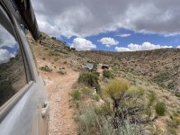
This is a rear view photo just before the gnarly section. The photos don't do it justice. There are many YouTube videos of this section of the trail, but most people are going up it. It's really hairy going down due to the off-camber sections and a deep and steep ravine on the side.

IMG_8588.jpg

Here is a Matt's Offroad Recovery Video of a Ford FXR150 stuck going down the gnarly sections. We didn't have any problems where this truck was stuck as the driver didn't hug the hillside. For us, the hairy section is at 08:48 min - 09:21 minutes of the video, where it's off-camber.


Unfortunately, Troy hit some shrapnel in the trail and got a huge hole in the sidewall.

IMG_8589.jpg

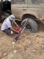
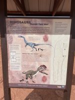
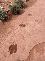
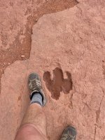
He was able to stuff a ton of plugs into it and fill it back up. We were on our way again and headed to the dinosaur tracks, southeast of St. George.

IMG_8591.jpg

IMG_8595.jpg

IMG_8603.jpg

IMG_8609.jpg
 
Last edited:

boyfester

Observer
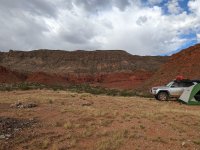
It was getting late in the day and we drove around a few times before finding a fairly level spot to camp east of the dinosaur tracks up against the Hurricane Cliffs in Utah.

IMG_8613.jpg

PXL_20230527_001733992.jpg

Day 7 GPX Track on Google Earth

AZ Strip Google Earth - Day 7.jpg
 
Last edited:
boyfester

Observer
Day 8 - Hurricane Cliffs, St. George, UT, Whitney Pocket, NV, Little Finland (62 miles)

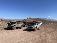
In the morning, we headed into St. George, Utah and aired up in Warner Valley, just outside of St. George, UT. It was the end of an amazing trip with these guys! We completed over 400 miles of off-road driving in 8 days.

IMG_8647.jpg

Day 8 GPX Track from Hurricane Cliffs to St. George

AZ Strip Google Earth - Day 8.jpg

When we reached pavement at South St. George, UT, I asked the guys if they wanted to join me on one more side trip on the way home. I was going to visit the Gold Butte area of Nevada and check out Little Finland aka Devil's Playground. I went there in 2021 on a short motorcycle trip and I wanted to spend more time there, preferably in the evening, when the afternoon sun was hitting the rocks. Everyone was pretty beat at that point and decided they didn't want to have to air down again. And so, we said our goodbyes in St. George and they jetted back home on 27 May. I continued on to Mesquite, NV and then ventured south to Gold Butte. It was Memorial Day weekend and I was expecting a ton of people, but I was in for a surprise. The paved road to Whitney Pocket is one of the worst asphalt roads I've ever been on. I actually stopped and aired down and it really smoothed out the ride.

IMG_0032.jpg

This is the Virgin River just off of the roughly paved Gold Butte Road, the same river that flows through The Narrows in Zion National Park, Utah.

IMG_8648.jpg

I decided to take a long way to Little Finland and found a cool trail that started south of the paved road. It was smoother than the pavement.

IMG_0029.jpg

IMG_8659.jpg

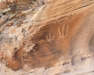
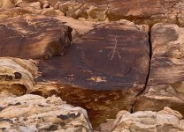
I found some more petroglyphs on the way to Little Finland.

IMG_8673.jpg

IMG_8675.jpg

IMG_0027.jpg
 
Last edited:
boyfester

Observer
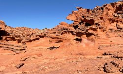
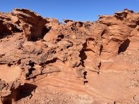
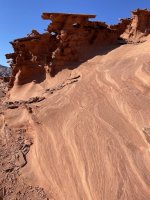
I reached Little Finland and to my surprise, there was no one in sight. I thought that there would be lots of people on Saturday of Memorial Day weekend, but I was wrong. I spent a couple of hours hiking around and taking photos.

IMG_8710.jpg

IMG_8731.jpg

IMG_8729.jpg

IMG_8743.jpg

IMG_8724.jpg

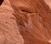
I poured some water on this section and the wavy lines really stood out.

IMG_8726.jpg

IMG_8722.jpg

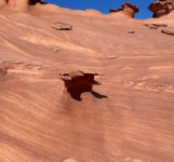
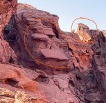
This last photo had two strange shapes in it. I thought one looked like a face with a pointed nose and chin and the other, the head of a gorilla.

Screenshot 2023-09-18 234533.jpg

I ended up leaving and headed to Whitney Pocket and the CCC Dam, but first drove over to the Devil's Nostril. Interesting sink hole in the middle of nowhere.

IMG_8769.jpg
 

boyfester

Observer
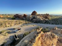
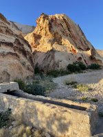
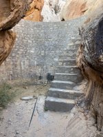
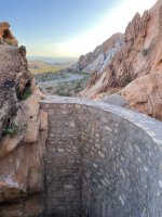
Whitney Pocket is a great place with lots of wind caves and mountain shelters for camping. There is also the Civilian Conservation Corps' (CCC) Dam which is a marvel to behold.

IMG_8786.jpg

IMG_8773.jpg

IMG_8777.jpg

IMG_8779.jpg

IMG_8787.jpg

IMG_8794.jpg

I drove around the side of a hill and found a great place to camp.

IMG_8808.jpg

This concluded our trip to the Arizona Strip and Little Finland. The total mileage from Orange County, CA included 800+ miles of pavement and 450+ miles of off-road. It was amazing and I can't wait to come back!

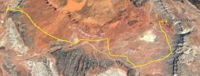
Day 8 & 9 GPX Track on Google Earth

AZ Strip Google Earth - Day 8B.jpg
 
Last edited:
Forum statistics

Threads
188,399
Messages
2,906,858
Members
230,176
Latest member
Arcadia1415
Top