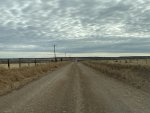
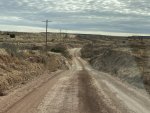
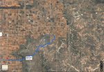
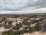
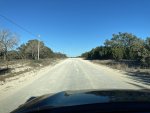
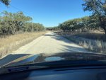
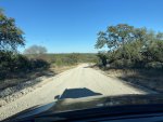
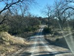
Austin to Lubbock and back; my first Expedition (or not)

My first expedition. Ish. Kinda. Only in the broadest possible terms. And even then, not really.

I recently found myself needing to take a road trip from Austin, TX up to Lubbock, and I took the opportunity to get in a kind of soft-road, car camping shakedown for my new-to-me DD. The trip wound up being about 1000 miles, with about 10-15% on county-maintained unpaved roads and included a (cold) night camping in the vehicle at a state park.

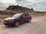
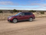
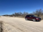
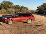
My mighty steed for this trip was my box-stock, OEM-equipped, unmodified, all-season-tired, don’t-know-what-all the buttons-do 2019 Subaru Outback 2.5L.

IMG_E1562.JPG

I wasn’t driving a thousand miles in 38 hours for the fun of it (mostly). The reason for this trip, and my codriver from Austin to Lubbock, was this guy

IMG_E1594.JPG

My wife and I volunteer for a hedgehog rescue organization, and this little dude had been surrendered to us the week before (basically the owner got in touch and said they couldn’t care for the hedgehog any more). My role as Pig Chauffeur was to collect the hog from the owner, and deliver it to a long-term foster home ASAP (to keep the stress of a new home to a minimum). According to that post at the top of this Adventure Reports forum, this TOTALLY counts as a “higher purpose”. So tick that Expo box. :cool:

I spent a week poring over Google Earth, Google Maps, and my old Texas Road Atlas (which came in handy during Hurricane Ike evacuation in 2008) I had picked out a return route (Lubbock to Austin) that had as much interesting off-pavement driving as possible. I had three main considerations:

First, I wanted the drive to be not boring, and put me a little more in touch with the terrain. The highway route to Lubbock was a slog even at 90mph, and I knew there was more terrain to see along the way.

Second, I wanted to test the car. I know that a dirt county road aren’t the same as a 2-track in remotest Namibia, but an Outback isn’t a Troopy LC either (Though I’m pretty sure I saw one in one of the Top Gear Africa specials, which is basically the same thing). Some of the more remote camping locations my wife and I like to visit are at the far end of roads like these (Big Bend Ranch SP), and I wanted to see how the car would handle what hills, creek crossings, such in its stock configuration before I start spending money to modify it. I was limited in route choice by the fact that all the roads needed to be a: public, and b: actually go in vaguely the right direction, because…

Third, I had about 40 hours to get from Austin to Lubbock and back. So I figured I’d blast up to Lubbock, drop off hedgehog, then turn south and take my planned route to stay the night at Lake Colorado City State Park, camping in the car. The next morning I’d continue my route back to Austin. I wanted to avoid being in the more remote parts of the route after dark, so I tried to plan accordingly. As we will see, I didn’t quite make it. “Expo Rule: Duration: Typically several weeks” LOL NOPE. I GOT WORK ON TUESDAY

Still, it took a lot of planning, soooo…”Expo Rule: Route Planning Requiring Extensive Research” TICK and “Detailed Logistical Planning” TICK.

While we’re at it, I grew up in the German part of Central Texas, so to me anything north of Dallas is basically Canada. “International Borders” TICK.

I left at 7:00 on a Sunday morning and headed north. Apparently, if you want to travel at high speed through the city of Austin, the time to do that is 7:45 on a Sunday morning.

IMG_1604.JPG

The rest of the drive was uneventful, with my codriver/payload asleep in a small pet carrier on the passenger seat (heated seats and zoned climate control, BTW, are awesome if you have to keep an African insectivore toasty on a 38 degree day but you yourself HATE being hot in a car).

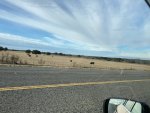
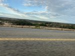
It’s always interesting to watch the terrain change.
IMG_1607.JPG

1608IMG_1608.JPG

More coming
 
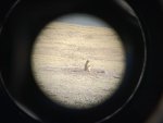
After saying goodbye to the little guy (I hope he settles in well and gets re-homed before too long, he was a very sweet and cuddly hedgehog) I made my traditional stop to say hello to the prairie dogs at Mackenzie Park (what can I say, I have an affinity for small potato-shaped creatures).

IMG_1622.JPG

1623IMG_1623.JPG

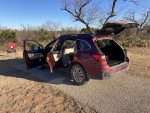
Gratuitous car shot #1 (I was traveling solo, so ya’ll are gonna get real familiar with the driver’s side of my car in from of slightly different backgrounds)

IMG_1628.JPG

So far, so boring. I gassed up and headed south about an hour behind schedule, to my first planned unpaved leg of the trip.

map1.JPG

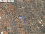
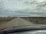
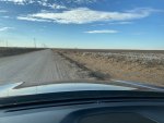
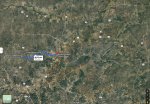
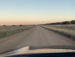
This was a series of county roads that left Hwy 84 and rejoined it again further south. I chose CR 130 and 145 because a: they went somewhere I wanted to go, and b: had bends in them (kinda). In this part of Texas, finding a through road that isn’t just arrow straight is kind hard.

IMG_1629.JPG

IMG_1631.JPG

The topsoil here is the stuff the Dust Bowl was made of. It’s thick, but it blows away if not anchored by plants.

IMG_1634.JPG

Gratuitous car shot #2

IMG_1632.JPG

“has a single squiggle in it” means it’s not just arrow straight, right?

IMG_1637.JPG

IMG_1638.JPG

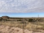
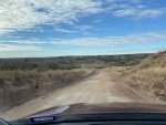
I should note that this is the perspective you’re going to get for most of these photos, because I was travelling solo and didn’t want to stop every 5 minutes. But they give a good impression of the roads, which weren’t bad at all, but were a little boring. There winds of being fewer photos on the bendier, hillier roads, because I was too busy to take pictures. I’d honed my loose-surface driving skills to a keen edge by watching African endurance rally videos on Youtube all week (Scandinavian Flicks look super easy, why not try one using the handbrake you don’t have, on the questionable road you’ve never heard of in a county you don’t know, with the cell signal that’s not there), but I took it slow because I was on street tires and my support truck didn’t exist. :cool:
 
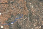
Several more miles down the highway I turned off again, this time for ACTUAL TERRAIN (eventually)

Map2.JPG

County Road 399 was a paved road that ran dead straight down past the town of Post. Eventually, after some dog-legging around fields, it lost the tarmac and turned into CR 308. This road ran down into a little valley and back up the other side. Like most roads I saw on this trip that ran through ranches, it was decently well-signed (though this is by no means universal), and private turnoffs were posted No Trespassing (this usually is). I did not want to raise the ire (or draw the fire, especially during deer season) of landowners or hunters, so I stuck religiously to the public roads and maintained strict gate discipline.

Whoever owns this tract of land is a lucky, lucky dude.

IMG_1639.JPG

1640IMG_1640.JPG

CAR!
IMG_1641.JPG

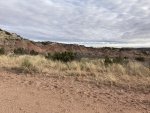
The geology of this place is such that all the terrain happens in a downward direction. Lots of canyons and valleys as opposed to hills. Two excellent state parks in the area (Caprock Canyon and Palo Duro Canyon, both sadly too far out of the way to visit on this trip) are fine examples of Panhandle geography
IMG_1645.JPG

IMG_1646.JPG

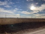
The road climbed back up out of the valley (not a bad test of the car on a loose, but not rocky, surface) and flattened out again. The terrain opened up onto a new terrain feature; the wind turbine forest

IMG_1647.JPG

IMG_1650.JPG

There are THOUSANDS of these things in the Panhandle and other parts of W. Texas. In the Hill Country we see the blades passing through on 18 wheelers (though I assume that most are moved by train). They’re huge up close, and look serene until you to try to follow a blade tip around and realize how fast it’s moving.

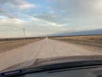
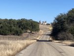
One other thing about these N.Texas dirt roads. EVERYTHING turns to mud here, so in an effort (I assume) to avoid having to run a box blade down a million miles of dirt road after every rainstorm), most of these roads are equipped with giant car-killing ditches on either side. Despite that, the road itself was lovely, wide, and smooth. I think many here will agree with me that a well-maintained dirt/gravel/caliche road is FAR superior to a badly-maintained, poorly patched asphalt road.

1652IMG_1652.JPG

I hit hardball again and headed SE for miles and miles down a farm-to-market road to the nearest highway, only to turn off onto yet another FM road. All paved, but there was NO other traffic. Driving down a deserted road in N Texas, alone, listening to Guy Clark and Robert Earl Keen is a great experience. Even in a Subaru.

More coming. Dang, I'm not even at the overnight halt yet. This is gonna take a while.
 

Attachments

  • Map2.JPG
    Map2.JPG
    269.5 KB · Views: 3
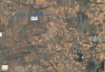
60 miles later I was running out of daylight and was considering giving up on my planned route in the interest of time. I still had to get to Lake Colorado City. When I compared my plans to what the Google Maps told me, I realized that my next unpaved leg was actually a nice little shortcut (Google Maps needs a “******KIT” button that will disregard all road conditions and find you the straightest possible route as the crow flies)

Map3.JPG

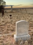
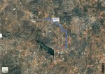
This was a straight shot down CR 226. Flat, fast, and easy. It terminates at what was the town of Cuthbert, which is now just a few building footprints and an old cemetery.

IMG_1662.JPG,

IMG_1665.JPG

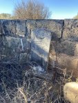
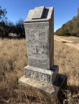
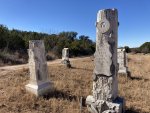
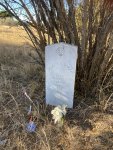
The town was abandoned by the end of WWI. I don’t think these folks get a lot of visitors, but there were a few newer memorials.

IMG_1667.JPG

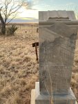
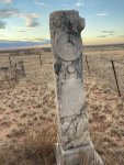
The “gates of heaven” motif was a popular one. I wonder if that was a larger style trend, or just something the local stonecutter did. It will appear again. The road in the background is the one I drove in on.

IMG_1668.JPG

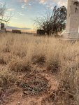
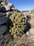
The funny little cactus in this one is called a Horse Crippler.

IMG_1669.JPG

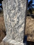
This “Woodmen of the World” thing appears of several stones here and at another cemetery I stopped at. I’ll have to look it up and see what it was.

IMG_1672.JPG

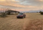
Golden Hour car shot (of course). As I was getting back in the car I saw a giant dust trail approaching down the road I’d just driven. It was a Ford Raptor doing about 65. That road wasn’t a challenge for me; it must’ve been a piece of cake for him.

IMG_1674.JPG


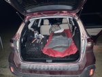
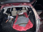
After a brief tarmac drive (made slightly longer by the train that had parked itself at the crossing I’d intended to use) I got to my destination. Lake Colorado City State Park. Not much to see in the dark, so I parked and set up camp. It took a little bit of rearranging to get everything situated comfortably (and I wasn’t heavily encumbered by gear) but it all worked. The milk crates I’d bought as ad-hoc traction mats actually worked great for storing larger tools/general car gear, and once I’d bungeed them to the various eyes in the cargo bed they didn’t slide around at all. One thing I am going to need to consider is seatback/seat protection; the lovely cream-colored interior upholstery gets dirty if you look at it wrong, which isn’t great considering most of my cargo spent the last 6 years in the toolbox of a truck and is therefor all dirty and gross.

IMG_1676.JPG

The night was cold but not too bad. Wool blankets did not do as well as I’d hoped, and the Klymit pad didn’t iron out the various ridges and bumps in the seatback, so a thicker pad is needed in the future. Apart from that it was roomier than some tents I’d stayed in, and by stacking the chuck box, toolbox, and my duffel in the rear passenger footwell I created a level enough surface to be able to stretch out. So not a bad car camping vehicle, at least for one person. If we ever tried to sleep two, then some sort of roof storage would be required for some of the gear.

“Expo Rule: Accommodations will range from remote camping…” Like shivering on the lumps of my seatback next to a hatchet and tire repair kit. TICKEROONY.
 

Attachments

  • IMG_1675.JPG
    IMG_1675.JPG
    2.6 MB · Views: 3

billiebob

Well-known member
Outbacks are the best overlanders when covering a lot of miles every day. Especially if you can keep the roof empty.
Gorgeous countryside, the kind of roads which beg for tall skinny tires.
 

rcintx

Adventurer
What an interesting perspective. These backroads are in my backyard and I’ve driven many county roads between fields and pastures in this area. Never thought about ‘traveling’ them and seeing what’s out there. Thanks for the inspiration.
 
What an interesting perspective. These backroads are in my backyard and I’ve driven many county roads between fields and pastures in this area. Never thought about ‘traveling’ them and seeing what’s out there. Thanks for the inspiration.

LOL yeah I guess "Remote" and "Exploration" are all relative terms.

That scrape of caliche out in the middle of nowhere is new to me, but it's somebody's main route to town, and even when you're in a Land Rover on some track in the truly backwater parts of the world there's probably still some trucker that drives that route twice a month. "The Road Less Traveled" often has an unstated coda "...by you"

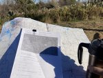
I got a late start the next morning, but still dined luxuriously on Mountain House Biscuits and Gravy (my camping go-to) and coffee, while looking over the planned route. I’d decided the day before that the best way to wayfind (with the equipment I had on hand, and with the understanding that not everything was well marked on the ground) was to review the route notes, while comparing them to the atlas maps. That way I had a frame of reference when looking for particular junctions or landmarks without having to pull over and go digging through the book. I knew what page to be on, and what section of the map I needed to be looking at. It made navigation a whole lot easier.

IMG_1689.JPG

IMG_1690.JPG

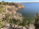
Lake Colorado City SP doesn’t have much in the way of trails, but I hiked around the lake for a mile or so just to warm up and get the blood moving. The big draw at the park is the Lake; unfortunately the park has cut off lake access due to a blue/green algae bloom (a health hazard for people if ingested, I think).

IMG_1694.JPG

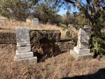
Onward toward San Angelo. I turned off the highway down a road that ran down to Robert Lee. Again, not a bad drive, though I saw a lot more traffic (3 trucks!) than I had the previous day. Stopped at another little cemetery out in the sticks.

Map4.JPG

IMG_1699.JPG

IMG_1702.JPG

IMG_1703.JPG


IMG_1704.JPG
Lots of kids, both here and back in Cuthbert. Life was unforgiving out here.

IMG_1707.JPG

The “Woodmen of the World” and “heaven’s gate” motifs again

IMG_1708.JPG

By this point it was getting towards noon, and I had a lot of ground still to cover. Back on the road.
 
Starting to see more cedar trees and fewer mesquites along the roads. This was a comfort for me; as mesquite or Black Locust branches on the road mean hellacious thorns and punctured tires (being on OEM highway tires, getting a flat was my big worry on this trip). Those with terrible pollen allergies may think different. When the cedars bloom you can shake the trees and watch the pollen come off like dust; it looks like smoke coming off the trees on a breezy day, and it covers everything in a fine yellow layer of plant sperm.
IMG_1710.JPG

On the other side of San Angelo there’s an interesting little town called Christoval. Heading SE from town is a long ranch road that terminates in a dirt county road that runs most of the way to my next stop. This road runs through a series of ranches, which meant gate discipline, cows, cattle guards (and the potholes on either side) and thankfully, well-maintained roads. A lot of these roads see large truck traffic (oil/gas) so they tend to be wide.
Map5.JPG

IMG_1713.JPG

IMG_1715.JPG

IMG_1716.JPG

You know what we haven’t seen yet??

IMG_1714.JPG
 
The road turned back to tarmac just before my next stop; Fort McKavett.

IMG_1726.JPG

Trying to use digital zoom on my phone from inside a vehicle doesn't really work, but I thought it gave a nice Impressionistic quality. Or something :cool:

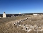
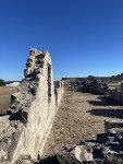
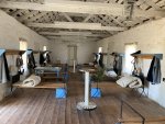
Ft McKavett was a part of a string of pre-civil war frontier forts that protected settlers and stage routes from the local Comanches. The fort was abandoned by the US Army before the Civil War but reoccupied by the CSA as a frontier outpost until 1863. The Texas frontier shrank during the war, but after 1865 westward expansion began again and the fort was rebuilt and reoccupied until 1883.

IMG_1731.JPG

IMG_1732.JPG

IMG_1733.JPG

IMG_1735.JPG

IMG_1737.JPG

Down at Government Spring, where the fort got its water, did its laundry, and had both a lime kiln and stone quarry. This part of the Hill Country is all limestone; there’s granite elsewhere that I’d planned to visit, but as we’ll see I ran out of daylight before I could get there.

IMG_1744.JPG
 
I was running severely behind schedule by the time I finished at the fort, so I took the highway route to Menard rather than take the roundabout route I’d planned. South of Menard there’s a nice shortcut, Whiskey Road, that runs across to London.

Map6.JPG

The road was a windier and hillier than what I’d encountered in N Texas, but still very well maintained and not substantially slower.

IMG_1745.JPG

IMG_1747.JPG

IMG_1749.JPG

1751IMG_1751.JPG

IMG_1754.JPG
 
From London I cut across the Llano River and turned down a long, isolated Ranch Road to what turned out to be my final unpaved leg of the trip.

Map7.JPG

This is a road that I’d wanted to try years ago but could never make fit into a larger plan. It runs through and around the hills and goes past ranch houses that were build by the old German settlers in the mid 1800’s. I wish I’d had more time to stop and enjoy it, but the light was fading and I was still lots of miles from home (and I had to work the next day).

IMG_1756.JPG

IMG_1757.JPG

IMG_1760.JPG

The last one, I swear

IMG_1762.JPG

IMG_1763.JPG

Here’s where I ran out of time. I had three or four more unpaved legs planned, heading most of the way back to Austin, but the sun was already down and I had to head for home. It still took me 2 and a half hours of Ranch Road and highway driving to get back. My planned routes probably would have been 2 or 3 hours longer at least.
 
Lessons Learned:

The Outback is a great car. “Car” being the important word here. It’s a very capable AWD car, but at the end of the day it's a slightly tall station wagon. At no point did I feel like it could not handle the roads I was taking it down, but as ya’ll can see, the roads were not challenging. They were well-graded and dry, and I was driving cautiously to avoid getting a flat. Had conditions been wet and muddy I think there would have been moments where the car struggled with the stock tires, or the mud may have forced me to drive through difficult areas at higher speed in order to avoid getting stuck. I don’t know if a lift is necessary for the sort of places I will likely wind up going with this vehicle, but I think better tires and skid plates are in my future.

That said, the Outback got me and all my stuff down every road without issue, it got me around corners that would’ve had my old 2wd truck fishtailing, and it up loose-surface hills that would’ve had my truck bouncing and skittering looking for rear-wheel traction. It did a thousand miles of fast highways, backroads, and dirt roads comfortably and with great fuel economy. I’m pleased with its performance.

As a tent, the Outback leaves some things to be desired. I need to figure out if there’s a way to keep the 12V outlets powered when the car is off. I need to find out how to turn the dash display off when the rear gate is open. A better air mattress will be needed for comfortable sleeping, and I need to figure out better storage for tools/recovery gear (also I need recovery gear). An easily removable roof basket or box may be a solution. It’ll be essential if I get a full-sized spare.

I failed to account for the shortness of the days when doing my route planning. I was pushing hard to get to my destinations (or at least get back onto pavement) by dark, mainly due to the added pain in the ass if I’d had to stop and make a tire repair or get unstuck, run across/into a suicidal deer on my own after dark. I had to abandon the final few legs of my route, which is disappointing. A different time of year, another day of travel, or a different destination would’ve made life easier. However, the trip window was when it was, and the hegdgehog could not wait. If nothing else, this gives me an excuse to plan another trip, and a different route, in the spring when all the vegetation is some other color than brown.

So that’s my “expedition”. I accomplished my concrete goals; deliver the hedgehog, test the car as a soft-road driving platform, and test the feasibility of camping in the car. I can’t say that I was never bored on the drive, but I never got tired of getting off the pavement and hitting the dirt. I wish I’d had another 6 hours of drive time, but that’s a planning failure on my part.

Finally, if there’s anyone in Texas that’s looking for simple in-state trips that are pretty easy to plan but a little more exciting than hitting the interstate, I hope they are inspired to crack open a map and find some of the less beaten paths that are open to them.

Sorry for the long posts and all the windshield shots.
 

FAW3

Adventurer
I enjoyed your report and photos. I'm passing through that general area in 2 weeks and likely will hit Fort McKavett based on your details. Thanks!
 
I enjoyed your report and photos. I'm passing through that general area in 2 weeks and likely will hit Fort McKavett based on your details. Thanks!
This was my 2nd visit to the site, and both times I've been hampered either by very high temps (I went in late August a couple of years ago) or jsut being in too big a hurry. It's definitely a spot worth at least a couple of hours.

The ruins of Mission San Saba, in Menard, is much quicker to visit and worth a half-hour or so stop as well.
 

Forum statistics

Threads
188,411
Messages
2,907,003
Members
230,176
Latest member
Arcadia1415

Members online

Top