Adventurous
Explorer
So in what appears to be a now annual tradition, the wife and I took off for Moab, UT over the Memorial Day weekend. The plan was to hop in the truck on Friday and head west towards Gateway, CO. I had read about another all dirt route from CO to UT (did the Kokopelli Trail last year) and was curious to check it out as it was supposed to dump you on the back side of the La Sals and descend down towards Moab.
We took off around 4:30 on Friday and after working our way through rush hour, torrential rains on the east side of the Eisenhower tunnel and then some snow on the west side of the Eisenhower we finally bunkered down in the access road to the Dominguez-Escalante National Conservation Area at 11:30 at night. The next morning we were treated to daylight as we traversed the remaining portion of route 141 and ended up in Gateway, CO. Gateway was an amusing little town boasting a massive, world renowned resort but also being absolutely tiny. Making our way through town we ended up at the trailhead for the Gateway Road/John Brown Canyon. Knowing we had another 57 miles of dirt to go before we touched asphalt again I aired down for comfort.
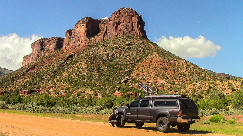 20160528-IMG_0109 by Tim Souza, on Flickr
The road itself wasn't difficult at all. You could navigate it in a Subaru in fact, but amazing sights and cool roads aren't limited to ones only navigable by full blown offroad vehicles. We made our way up out of the canyon bottom and into the high country. Not that long afterwards we hit the CO/UT border that was distinguished by a spray painted fence in what was perhaps the most shoddy state border crossing I have ever seen.
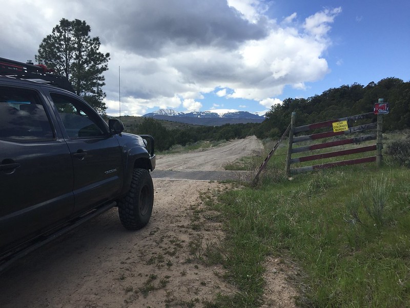 20160528-IMG_1373 by Tim Souza, on Flickr
The La Sals continued to grow in size and still appeared to have a sizable snow pack up in the higher elevations which eliminated my plan of trying to cross over or through them. No matter, I had already mapped a route for us that brought us north of the mountain range. We reached the Polar Mesa/Thomson Canyon junction and turned right towards the Mesa. The first part of the journey was mellow and we were treated to watching a couple of women and cattle dogs drive a herd of cattle. It was pretty neat for them to split at the truck and we had cows on both sides of the truck. It was like a time traveling experience.
After that the trail turned vertical and we headed up the switchbacks that ascend the mesa. Once again, nothing too steep or difficult, just chugging up them. The mesa top is reached fairly quickly and we headed out to the little lollipop that gives you access to the views and mines. We wandered around that area for a little bit before pulling out the awning and getting some lunch.
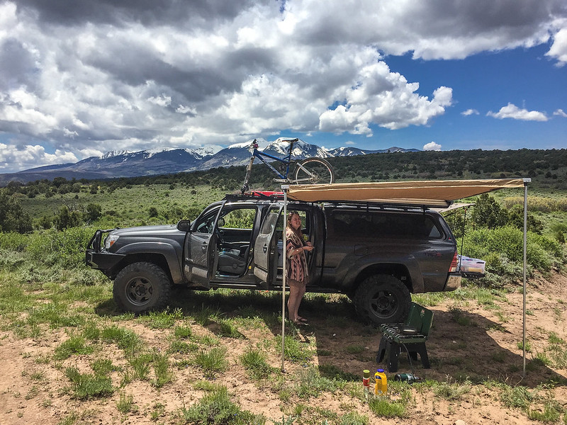 20160528-IMG_1374 by Tim Souza, on Flickr
At this point the camera went away for a bit as we re-traced our steps and took the cutoff towards Thomson Canyon. It proved to be a long descent off of the mesa top into a canyon bottom. Once again not that difficult but still provided enough challenge to make things interesting. We weaved our way through the canyon bottom and made our way up the very step shelf road exit. At this point we were at the termination point of the Onion Creek trail with the choice of either going up Rose Garden Hill or out towards highway 128. I decided not to push my luck and turned the truck towards Onion Creek road. We splish splashed through the dozen or so creek crossings along the way. It was a unique trail following the spine of a ridge with the creek running on either side. Video to come later. Anyway, I won't bore anyone with the details but we spent the rest of the day going into Moab for a few supplies then navigating the dispersed camping north of town with our 10 million other best friends.
Sunday we decided to head to Canyonlands National Park. The majority of the day was uneventful, just a mash-up of navigating through the hordes of rude and inconsiderate people while peeping pretty awe inspiring canyon views. Snapped a quick selfie of the wife and I up top.
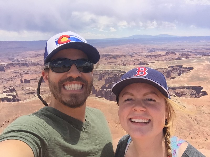 20160529-IMG_1386 by Tim Souza, on Flickr
And Mesa Arch. Pretty killer views, only marred by the fact that it's a mere 1/2 mile off of the main road.
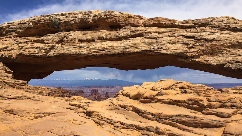 20160529-IMG_1389 by Tim Souza, on Flickr
I had the foresight to get a permit for the White Rim Road earlier in the day when we stopped at the visitor center. The conversation with the kind lady went something like this, "Do you have an appropriate vehicle for the trip?" Me "Yes." Her "With a high and low range transfer case?" Me "Yes" Her "And at least 8" of ground clearance?" Me "Yes." And so it was, we got a day permit for the trip. I did overhear one ranger lady with a finely tuned bullsh!t detector shut down a guy who was inquiring about the White Rim Road who clearly had no clue what was down there nor did he have the proper vehicle to do so. I giggled to myself listening to her refuse to give him any further information.
Anyway, we aired down and headed down the Shafer Switchbacks. They were narrow, steep, and exposed in places but nothing a little engine braking couldn't control.
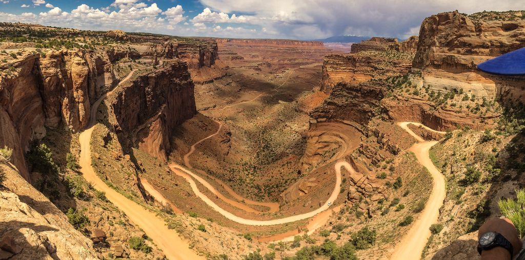
Once at the bottom we were faced with the choice of heading out and back on the White Rim Road or heading north to Potash Road and back to town. I chose the later but made sure to stop at Gooseneck Point to check out how the Colorado River meandered through the park.
 20160529-IMG_1401 by Tim Souza, on Flickr
And turning around to see where we had come from.
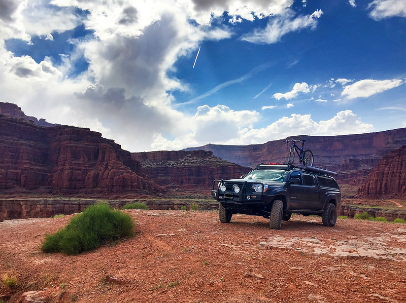 20160529-IMG_1402 by Tim Souza, on Flickr
The trip out was kind of a trip. Like being on a foreign planet at points as the salt formed giant white crusties and dried up salty rivers left their mark on the landscape. We passed by the huge open air ponds of the Moab Salt LLC before hitting the Potash company as the road turned to pavement. Such concluded the 4wd portion of the trip, however we still had a few more activities before we returned home.
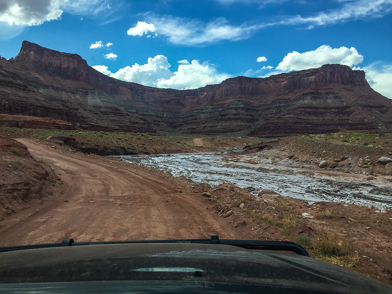 20160529-IMG_1404 by Tim Souza, on Flickr
Monday = Mountain bike day! I rented a bike at Poison Spider, gave my bike to the wife, then hit up the Klondike Bluff trails. We stuck to the easy/intermediate stuff as she is still learning and I didn't want to make that mistake again. We both had fun, the terrain there was very conducive to a beginner.
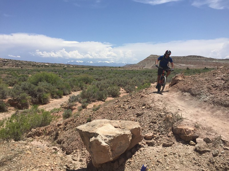 20160530-IMG_1449 by Tim Souza, on Flickr
We returned the bike after making it all the way to the pavement before I realized I left the front wheel of the rental at the trailhead. Oopsies! With that in hand we returned the bike, grabbed some food and ice cream, then booked it out of town back towards Colorado. We came up with an impromptu plan to hike Hanging Lake on the way back. Things were in our favor as we snagged one of the 50 or so parking spaces shortly before 9am. It was a good hike, not terribly difficult but still pretty steep as you ascend over 1,000' in a bit over a mile. It was well worth it to see this CO gem.
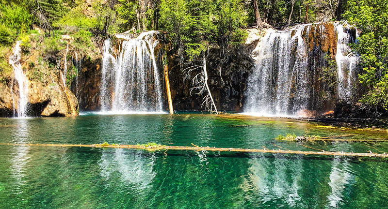 20160531-IMG_1468 by Tim Souza, on Flickr
Amazingly the Spouting Rock waterfall, only a mere 1/4 mile away, received way less than half the traffic but was no less spectacular. There were a grand total of 4 waterfalls, one coming off of the top then 3 progressively shorter ones coming out of the rock itself. We played around those for a while going behind them and taking pictures.
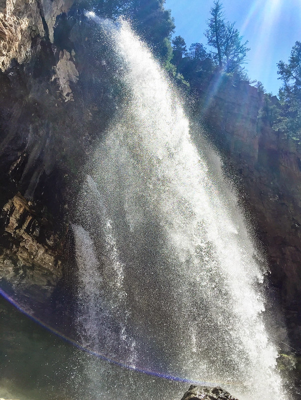 20160531-IMG_1478 by Tim Souza, on Flickr
Then I got tired of typing so we hiked down and uneventfully drove back to Denver.
The end.
We took off around 4:30 on Friday and after working our way through rush hour, torrential rains on the east side of the Eisenhower tunnel and then some snow on the west side of the Eisenhower we finally bunkered down in the access road to the Dominguez-Escalante National Conservation Area at 11:30 at night. The next morning we were treated to daylight as we traversed the remaining portion of route 141 and ended up in Gateway, CO. Gateway was an amusing little town boasting a massive, world renowned resort but also being absolutely tiny. Making our way through town we ended up at the trailhead for the Gateway Road/John Brown Canyon. Knowing we had another 57 miles of dirt to go before we touched asphalt again I aired down for comfort.
 20160528-IMG_0109 by Tim Souza, on Flickr
The road itself wasn't difficult at all. You could navigate it in a Subaru in fact, but amazing sights and cool roads aren't limited to ones only navigable by full blown offroad vehicles. We made our way up out of the canyon bottom and into the high country. Not that long afterwards we hit the CO/UT border that was distinguished by a spray painted fence in what was perhaps the most shoddy state border crossing I have ever seen.
 20160528-IMG_1373 by Tim Souza, on Flickr
The La Sals continued to grow in size and still appeared to have a sizable snow pack up in the higher elevations which eliminated my plan of trying to cross over or through them. No matter, I had already mapped a route for us that brought us north of the mountain range. We reached the Polar Mesa/Thomson Canyon junction and turned right towards the Mesa. The first part of the journey was mellow and we were treated to watching a couple of women and cattle dogs drive a herd of cattle. It was pretty neat for them to split at the truck and we had cows on both sides of the truck. It was like a time traveling experience.
After that the trail turned vertical and we headed up the switchbacks that ascend the mesa. Once again, nothing too steep or difficult, just chugging up them. The mesa top is reached fairly quickly and we headed out to the little lollipop that gives you access to the views and mines. We wandered around that area for a little bit before pulling out the awning and getting some lunch.
 20160528-IMG_1374 by Tim Souza, on Flickr
At this point the camera went away for a bit as we re-traced our steps and took the cutoff towards Thomson Canyon. It proved to be a long descent off of the mesa top into a canyon bottom. Once again not that difficult but still provided enough challenge to make things interesting. We weaved our way through the canyon bottom and made our way up the very step shelf road exit. At this point we were at the termination point of the Onion Creek trail with the choice of either going up Rose Garden Hill or out towards highway 128. I decided not to push my luck and turned the truck towards Onion Creek road. We splish splashed through the dozen or so creek crossings along the way. It was a unique trail following the spine of a ridge with the creek running on either side. Video to come later. Anyway, I won't bore anyone with the details but we spent the rest of the day going into Moab for a few supplies then navigating the dispersed camping north of town with our 10 million other best friends.
Sunday we decided to head to Canyonlands National Park. The majority of the day was uneventful, just a mash-up of navigating through the hordes of rude and inconsiderate people while peeping pretty awe inspiring canyon views. Snapped a quick selfie of the wife and I up top.
 20160529-IMG_1386 by Tim Souza, on Flickr
And Mesa Arch. Pretty killer views, only marred by the fact that it's a mere 1/2 mile off of the main road.
 20160529-IMG_1389 by Tim Souza, on Flickr
I had the foresight to get a permit for the White Rim Road earlier in the day when we stopped at the visitor center. The conversation with the kind lady went something like this, "Do you have an appropriate vehicle for the trip?" Me "Yes." Her "With a high and low range transfer case?" Me "Yes" Her "And at least 8" of ground clearance?" Me "Yes." And so it was, we got a day permit for the trip. I did overhear one ranger lady with a finely tuned bullsh!t detector shut down a guy who was inquiring about the White Rim Road who clearly had no clue what was down there nor did he have the proper vehicle to do so. I giggled to myself listening to her refuse to give him any further information.
Anyway, we aired down and headed down the Shafer Switchbacks. They were narrow, steep, and exposed in places but nothing a little engine braking couldn't control.

Once at the bottom we were faced with the choice of heading out and back on the White Rim Road or heading north to Potash Road and back to town. I chose the later but made sure to stop at Gooseneck Point to check out how the Colorado River meandered through the park.
 20160529-IMG_1401 by Tim Souza, on Flickr
And turning around to see where we had come from.
 20160529-IMG_1402 by Tim Souza, on Flickr
The trip out was kind of a trip. Like being on a foreign planet at points as the salt formed giant white crusties and dried up salty rivers left their mark on the landscape. We passed by the huge open air ponds of the Moab Salt LLC before hitting the Potash company as the road turned to pavement. Such concluded the 4wd portion of the trip, however we still had a few more activities before we returned home.
 20160529-IMG_1404 by Tim Souza, on Flickr
Monday = Mountain bike day! I rented a bike at Poison Spider, gave my bike to the wife, then hit up the Klondike Bluff trails. We stuck to the easy/intermediate stuff as she is still learning and I didn't want to make that mistake again. We both had fun, the terrain there was very conducive to a beginner.
 20160530-IMG_1449 by Tim Souza, on Flickr
We returned the bike after making it all the way to the pavement before I realized I left the front wheel of the rental at the trailhead. Oopsies! With that in hand we returned the bike, grabbed some food and ice cream, then booked it out of town back towards Colorado. We came up with an impromptu plan to hike Hanging Lake on the way back. Things were in our favor as we snagged one of the 50 or so parking spaces shortly before 9am. It was a good hike, not terribly difficult but still pretty steep as you ascend over 1,000' in a bit over a mile. It was well worth it to see this CO gem.
 20160531-IMG_1468 by Tim Souza, on Flickr
Amazingly the Spouting Rock waterfall, only a mere 1/4 mile away, received way less than half the traffic but was no less spectacular. There were a grand total of 4 waterfalls, one coming off of the top then 3 progressively shorter ones coming out of the rock itself. We played around those for a while going behind them and taking pictures.
 20160531-IMG_1478 by Tim Souza, on Flickr
Then I got tired of typing so we hiked down and uneventfully drove back to Denver.
The end.
Last edited:

