You are using an out of date browser. It may not display this or other websites correctly.
You should upgrade or use an alternative browser.
You should upgrade or use an alternative browser.
Buffalo National River
- Thread starter TripLeader
- Start date
TripLeader
Explorer
According to my Google search, you can expect relative humidity in the upper 70% range during the summer.How was the humidity? That's what I remember being bad, but it was a long time ago.
_____
Hopefully you had a chance to explore the area a little bit.I was just in Forsyth and Protem, Missouri, last weekend, and passed right through all these regions you had explored...
Mark@GXV
New member
All you people were in our back yard and didn't stop for a visit? Shame, shame.
I go down to NW Arky all the time. Couple of things not mentioned in this thread yet:
If you feel up to it and it's the right (rain dependent) time of year be sure to do the hike down to Hemmed-in-Hollow waterfall. They say it's the tallest waterfall between the Appalachians and the Rockies. Needs rain though to really flow and it's not an easy hike, about 6 miles round trip. 3 miles down to the bottom of the valley and a tough 3 mile hike back out. It's totally worth it though.
Another stop: Get a chicken fried chicken sammy and a $4 shake at Ozark Cafe in Jasper, AR. It's been there over 100 years and the whole little area is sweet. Don't miss this. http://ozarkcafe.com/
All you people were in our back yard and didn't stop for a visit? Shame, shame.
I go down to NW Arky all the time. Couple of things not mentioned in this thread yet:
If you feel up to it and it's the right (rain dependent) time of year be sure to do the hike down to Hemmed-in-Hollow waterfall. They say it's the tallest waterfall between the Appalachians and the Rockies. Needs rain though to really flow and it's not an easy hike, about 6 miles round trip. 3 miles down to the bottom of the valley and a tough 3 mile hike back out. It's totally worth it though.
Another stop: Get a chicken fried chicken sammy and a $4 shake at Ozark Cafe in Jasper, AR. It's been there over 100 years and the whole little area is sweet. Don't miss this. http://ozarkcafe.com/
Mark
I used to come through Nixa all the time when our son was little and we would take him to SDC. Hemmed-in-Hollow gets a thumbs up from me also - great place. I need to come down and ride the new bike park near you and the trails at Table Rock. Funny how I used to haul a mtn. bike down all those years with no good legal place to ride, then once the boy got too big for SDC and we sold the travel trailer two good trail systems get opened. I need to get down and explore Glade Top a little further now that I got better tires on the truck.
ex-coloradan
New member
Nice Jeeps............especially that GREEN one........
TripLeader
Explorer
Thanks.Just got back from a backpacking trip on the buffalo...the only big landmark you seemed to miss was hemmed in hollow waterfall and granny henderson's cabin.
Good trip report!
-----
We were close to Hemmed-In-Hollow and wanted to see it, but it just did not work out. Another place I had wanted to go to was Big Bluff.
-----
I had never heard of Granny Henderson's Cabin. I just looked it up on the internet--one of the last inhabited places the federal government took over when the area was made into a national river. Looks like it's worth a visit.
zelseman
Observer
They are both worth the extra work to get there.Thanks.
-----
We were close to Hemmed-In-Hollow and wanted to see it, but it just did not work out. Another place I had wanted to go to was Big Bluff.
-----
I had never heard of Granny Henderson's Cabin. I just looked it up on the internet--one of the last inhabited places the federal government took over when the area was made into a national river. Looks like it's worth a visit.
Big bluff is a little bit of a hike, but if you make it an overnight hike, you can catch both on the Centerpoint Trail.
TripLeader
Explorer
May 2019
Part 1 [Intro]
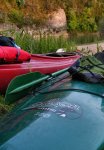
I was fortunate enough to return to NW Arkansas last year. A friend and I made plans to float the Buffalo River. Here's the details...
We packed up one morning in May 2019 and drove to Ponca, Arkansas. We made our camp at Steel Creek.

We went and scoped out the river by camp.
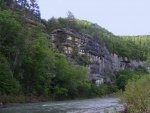
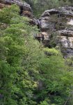
We then went and checked in at the Buffalo Outdoor Center in Ponca that afternoon. We had planned on using them to shuttle our pick-up truck down the river for us. They told us it would be no problem. We just needed to come in the next morning and give them the destination and day we wanted the truck dropped off at our take-out. They were easy to work with and we had no problems, just like they said.
Part 1 [Intro]

I was fortunate enough to return to NW Arkansas last year. A friend and I made plans to float the Buffalo River. Here's the details...
We packed up one morning in May 2019 and drove to Ponca, Arkansas. We made our camp at Steel Creek.

We went and scoped out the river by camp.


We then went and checked in at the Buffalo Outdoor Center in Ponca that afternoon. We had planned on using them to shuttle our pick-up truck down the river for us. They told us it would be no problem. We just needed to come in the next morning and give them the destination and day we wanted the truck dropped off at our take-out. They were easy to work with and we had no problems, just like they said.
Last edited:
TripLeader
Explorer
Part 2 [Ponca to River Mile 42]
The next morning was overcast with light rain. We had a little wiggle room in our schedule. We waited for a couple hours to see what the weather might do...
The Buffalo River runs approximately 153 miles in the Boston Mountains, until it flows into the White River. The uppermost section, above Ponca, is usually too low to run most times during the year.
There is a low-water bridge at Ponca, at the put-in. The entire river is often gauged by that bridge. "Zero Air" means the water is to the top of the bridge. That means the river is up. It wasn't quite Zero Air, but it was just several inches down.
The upper river was in play.
The weather started to clear that morning. We went to the BOC to schedule our route with them. We asked their professional opinion about taking this opportunity to run the very upper section of the Buffalo. The man at the counter asked about our kayaks and our experience. I pointed out the touring kayaks in the back of my truck. He took a look at the window, then paused to consider whether it was a good idea for us. It wasn't hard for us to interpret that pause as his disapproval. We made the decision to put in at Ponca, River Mile 28.5. It was the right decision. We planned on a pickup at Rush in six days.
We paid our money and handed over an extra set of car keys. All we had to do was leave the pick-up truck at the put-in. They would come and get it later that day and park it in their lot. Then they would park it out our take-out on the date we gave them, by 11:00 a.m. Deal.
We ended up taking longer to load our kayaks at the put-in than we expected. This was my first overnight kayaking trip. I've done numerous multi-day canoe trips, and a lot of day trips in the kayak. We got on the water about noon.
Floating past Steel Creek.


The first couple of days of the float had a lot of rough water. You may look at the photos and think it doesn't look too bad. You would be correct. I never was able to get my camera out and take a photo while I was paddling through and around the rough stretches, which were presented to us about every couple hundred yards.
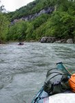
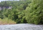
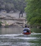

This section of the river took us past Hemmed-In Hollow. We stopped and hiked up the stream to the Hemmed-In Falls.
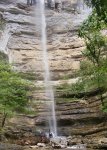
I can't really do the falls justice with my photos. It's a 240 foot waterfall!
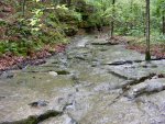
We got back on the water after the side trip to Hemmed-In Falls. This was what was there--fairly typical of some of the rough spots of the first two days of our float. I took this photo from the bank.

We made it a little farther and stopped for the day. We made a primitive camp on the left bank. We had travelled about 15 miles on the river.
The next morning was overcast with light rain. We had a little wiggle room in our schedule. We waited for a couple hours to see what the weather might do...
The Buffalo River runs approximately 153 miles in the Boston Mountains, until it flows into the White River. The uppermost section, above Ponca, is usually too low to run most times during the year.
There is a low-water bridge at Ponca, at the put-in. The entire river is often gauged by that bridge. "Zero Air" means the water is to the top of the bridge. That means the river is up. It wasn't quite Zero Air, but it was just several inches down.
The upper river was in play.
The weather started to clear that morning. We went to the BOC to schedule our route with them. We asked their professional opinion about taking this opportunity to run the very upper section of the Buffalo. The man at the counter asked about our kayaks and our experience. I pointed out the touring kayaks in the back of my truck. He took a look at the window, then paused to consider whether it was a good idea for us. It wasn't hard for us to interpret that pause as his disapproval. We made the decision to put in at Ponca, River Mile 28.5. It was the right decision. We planned on a pickup at Rush in six days.
We paid our money and handed over an extra set of car keys. All we had to do was leave the pick-up truck at the put-in. They would come and get it later that day and park it in their lot. Then they would park it out our take-out on the date we gave them, by 11:00 a.m. Deal.
We ended up taking longer to load our kayaks at the put-in than we expected. This was my first overnight kayaking trip. I've done numerous multi-day canoe trips, and a lot of day trips in the kayak. We got on the water about noon.
Floating past Steel Creek.


The first couple of days of the float had a lot of rough water. You may look at the photos and think it doesn't look too bad. You would be correct. I never was able to get my camera out and take a photo while I was paddling through and around the rough stretches, which were presented to us about every couple hundred yards.


This section of the river took us past Hemmed-In Hollow. We stopped and hiked up the stream to the Hemmed-In Falls.

I can't really do the falls justice with my photos. It's a 240 foot waterfall!

We got back on the water after the side trip to Hemmed-In Falls. This was what was there--fairly typical of some of the rough spots of the first two days of our float. I took this photo from the bank.

We made it a little farther and stopped for the day. We made a primitive camp on the left bank. We had travelled about 15 miles on the river.
TripLeader
Explorer
Part 3 [River Mile 42 to Gray Bluff]
We continued downriver the next morning.
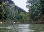
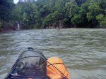
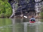
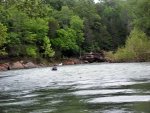
We had our first, and only, capsizing. It was in a relatively minor stretch of rough water. But a tap of the kayak against a partially-submerged tree stump did it. Luckily my friend was able to get everything under control in a shallow spot just downriver.
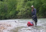
We continued on.

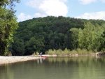
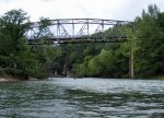
We found a place to camp, at Gray Bluff, near River Mile 57.5.
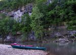

We had travelled another 15 miles on the river. Day two of the float was in the books.
We continued downriver the next morning.


We had our first, and only, capsizing. It was in a relatively minor stretch of rough water. But a tap of the kayak against a partially-submerged tree stump did it. Luckily my friend was able to get everything under control in a shallow spot just downriver.

We continued on.


We found a place to camp, at Gray Bluff, near River Mile 57.5.


We had travelled another 15 miles on the river. Day two of the float was in the books.
TripLeader
Explorer
Part 4 [Gray Bluff to Woolum]
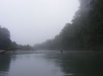
We departed Gray Bluff in the morning fog.
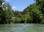
We stopped near Blue Hole and took a trail to an overlook.

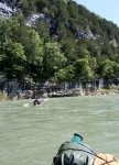
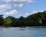
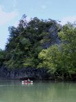
We were in a stretch of the river called "The Narrows."
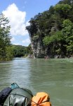
We passed Skull Bluff.

We came upon Woolum and decided to camp there, at the established campground. It was completely vacant, other than one other pair of campers.
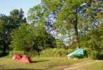
Our kayaks at rest for the night.
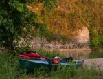
We had put in about 21 miles on our third day on the river.
We departed Gray Bluff in the morning fog.

We stopped near Blue Hole and took a trail to an overlook.


We were in a stretch of the river called "The Narrows."


We passed Skull Bluff.

We came upon Woolum and decided to camp there, at the established campground. It was completely vacant, other than one other pair of campers.

Our kayaks at rest for the night.

We had put in about 21 miles on our third day on the river.
TripLeader
Explorer
Part 5 [Woolum to Spring Creek]
We awoke to a beautiful morning at Woolum.
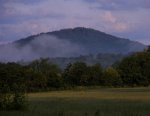
We got back on the river.

We walked our kayaks through some shallows as we approached Tyler Bend. We made a stop there and topped off our water. We found it was easiest to refill at the established campgrounds than to otherwise have to purify river water.
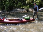
We had been considering time and distance as we approached Tyler Bend. We decided to make a push in mileage. We called Buffalo Outdoor Center from Tyler Bend and asked them to drop off our pick-up truck at Rush one day earlier than we had scheduled. They accommodated.

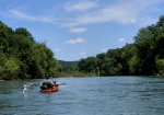
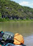
The weather turned for a bit while we were on the water that afternoon. There was a thunderstorm in the distance. It was closing in on us. We made record time (for us) in the last three miles of the day, taking us into Spring Creek. We did not want to be caught out on the river in the lightning.
We pulled into Spring Creek. We hastily set up camp. We caught some sprinkles. The storm never hit us.


We went down to the water and did some fishing.
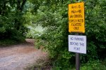
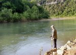
This was our big day on the water. We put in 8 hours of work and paddled 37 miles.
We awoke to a beautiful morning at Woolum.

We got back on the river.

We walked our kayaks through some shallows as we approached Tyler Bend. We made a stop there and topped off our water. We found it was easiest to refill at the established campgrounds than to otherwise have to purify river water.

We had been considering time and distance as we approached Tyler Bend. We decided to make a push in mileage. We called Buffalo Outdoor Center from Tyler Bend and asked them to drop off our pick-up truck at Rush one day earlier than we had scheduled. They accommodated.


The weather turned for a bit while we were on the water that afternoon. There was a thunderstorm in the distance. It was closing in on us. We made record time (for us) in the last three miles of the day, taking us into Spring Creek. We did not want to be caught out on the river in the lightning.
We pulled into Spring Creek. We hastily set up camp. We caught some sprinkles. The storm never hit us.


We went down to the water and did some fishing.


This was our big day on the water. We put in 8 hours of work and paddled 37 miles.
Last edited:
TripLeader
Explorer
Part 6 [Spring Creek to Rush]
Our fifth, and last, day on the water. We put in that morning.
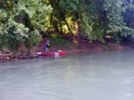
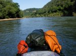

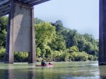
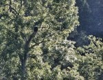
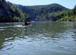
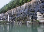
Vultures were prevalent on the river. There was a committee of them on a beach we passed. We had also seen a group of them in a tree. I had never seen them sit with their wings spread, but it was a popular thing for them to do around the river.

The river, especially on the lower end, can rise and fall several feet in a matter of hours.
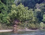
The float was nearly over. We would soon be at Rush.
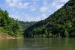
The pick-up truck was waiting for us when we arrived. We loaded up our boats and gear. We had put in about 13 miles that day.
Our fifth, and last, day on the water. We put in that morning.


Vultures were prevalent on the river. There was a committee of them on a beach we passed. We had also seen a group of them in a tree. I had never seen them sit with their wings spread, but it was a popular thing for them to do around the river.

The river, especially on the lower end, can rise and fall several feet in a matter of hours.

The float was nearly over. We would soon be at Rush.

The pick-up truck was waiting for us when we arrived. We loaded up our boats and gear. We had put in about 13 miles that day.
Similar threads
- Replies
- 5
- Views
- 1K
- Replies
- 1
- Views
- 861
- Replies
- 12
- Views
- 3K
- Replies
- 81
- Views
- 16K
- Replies
- 23
- Views
- 4K
