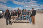
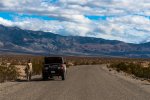
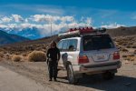
paulbgardner
New member
I love Death Valley. The desert just fascinates me. As a Florida native, there is just no place on the east coast that creates the sense of remoteness and calmness.
Six years ago, I moved to California. And of course, my first desert experience was Death Valley. It holds a special place in my heart and I try to go back as often as possible.
My past three forays into Death Valley were solo adventures (solo = me + wife), staying in the valley proper and only driving the easier day trip trails like Racetrack Playa, Titus Canyon and Eureka Dunes, and camping at established campgrounds along the way. But this time would be different. This time, I wanted to get off the beaten path. Off the pavement that traverses the park. And onto the trails that always tempted my better judgment.
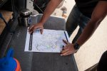
There had to be a way to link the more difficult Lippincott Road and Steele Pass with a few other trails to create an all dirt route from the South to the North. So I printed out a few 11x17 inch maps, took out a highlighter and started linking up trails in an attempt to stay away from pavement as much as geographically possible.
Several years and one baby later, and I hadn't found the time or right people to do this big trip with. But thanks to IH8MUD, I developed the pretty good group of local friends that shared similar overlanding ambitions. We completed lots of short trips together to Big Bear, Antelope Valley, Mojave Road and some other local OHV areas and were ready for something a little more ambitious. The summer of 2012 rolled around and I found out that my wife is pregnant with baby number two. I now had the reason and the people to join me. The perfect opportunity for one last epic Pre-Baby #2, guys only Death Valley Trip.
My plan was to go with one other truck. Word spread and one turned into two, then three, then four, then 13 other trucks, all friends of friends. Typically I would post this kind of trip on the online forums but decided to keep this one limited to friends for a more intimate trip. An epic email thread started to coordinate the trip. Over 300 emails and a handful of scheduling conflicts later and 13 trucks whittled down to eight.
The Trip
My trips always have some kind of goal. Some trips are based around getting to that perfect location at the perfect time for that perfect picture. Other trips are about finding old mines, exploring historical areas or just seeing some natural scenery. The goal of this trip was to drive. I wanted plan a trip that would test my planning skills, driving endurance and vehicle capability. There would be no wimping out on this trip. If we had to drive all night to read the next destination, then that is what we would do. No getting tired and stopping short, until of course there was a safety risk.
When I go on an off-road, overland, backcountry camping or whatever you want to call it, I really enjoy moving forward. Base camping and doing day trips has its place but isn't what excites me the most. With my trip planning goals of avoiding backtracking and pavement while seeking out a challenge, my route covered almost 300 miles of dirt over 4 days. This may seem easy to some, and it would be with 1-2 other trucks, 8 trucks adds another layer of complexity to the planning. I had to rethink communications, timing and camping locations. Could 8 big trucks even fit in these camp locations? Daylight is limited in November and not everyone would to want to get up at 5am to start driving. Eight times the potential for a break down on top of the driver fatigue that comes with technical terrain and mediocre road for 10 hours a day. But the point of the trip was to seek out a challenge.
The final itinerary for the trip was:
Thursday:
• Meet in Baker, CA between noon and 3pm
• Depart for Stripped Butte no later than 330-400pm
• Arrive at camp in the evening
• Trails: Harry Wade Road, Warm Springs Road
• Total Mileage from Baker: 88.5 miles
• Things to see: Barker Ranch (Charles Manson's hideout)
Friday:
• Wake up early, eat breakfast, break down camp
• Depart for Racetrack Playa
• Refuel at Panamint springs
• Trails: Goler Wash, Mengel Pass, Cerro Gordo Mine, White Mountain Talc Road, Saline Valley Road South Pass, Lippincott Mine Road (up)
• Arrive at camp at Racetrack Playa
• Total Mileage: 142.1 miles
• Things to see: Ballarat Ghost town, Cerro Gordo Silver Mine
Saturday
• Wake up early, eat breakfast, break down camp
• Depart for Eureka Dunes
• Trails: Lippincott (down), Saline Valley Road North Pass, Steele Pass, Dedeckera Canyon, Eureka Dunes
• Total Mileage: 63 miles
• Things to see: Racing Rocks at Racetrack Playa, Saline Valley Dunes, Salt Lake, Upper and Lower Hot Springs
Sunday
• Wake up early, eat breakfast, break down camp
• Depart for Big Pine
• Trails: Big Pine Road, Death Valley Road
• Total Mileage: 48.9 miles
• Things to see: Eureka Dunes, Old sulfur mines
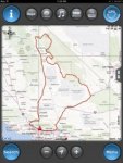
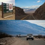
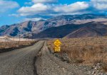
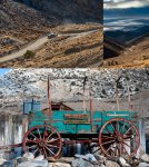
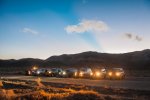
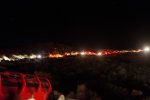
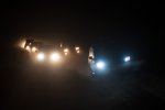
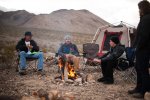
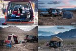
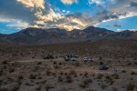
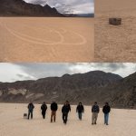
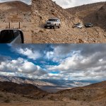
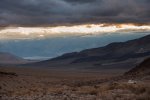
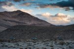
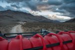
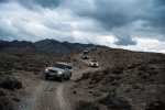
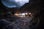
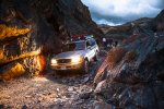
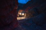
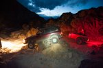
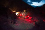
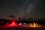
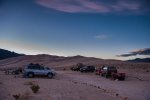
I'm writing this a few months after the trip so my memory may be a little cloudy. I'll let the photos do the talking with a bit of narration on things I remember.
Day 1:
The meet up point was Baker, CA. Some of us meet up on the freeway by chance and convoyed together to Baker. When Craig arrived in Baker there were no signs of our planned meet up point, Coco's Bakery; just a nice big dirt lot along the main drag through town. Coco's or not, it wasn't too difficult to spot the half dozen Land Cruisers pulled off on the side of the road.
After lots of lollygagging around, eating lunch, fueling up and tech talk it came time find out who was who. You spend a lot of time chatting with people on the forums, so it's always fun put a face and a real name to a screen name. Before hitting the road we had a powwow to discuss the plans for the day and the trip, talk rules, and to make sure everyone had all the gear they needed.

When I was planning the trip I used Google earth a lot to chart our course. The satellite view of the road out of baker looked like it was a dirt road. To my dismay it turned out to be 30 miles of the smoothest pavement in California. On the upside it gave the group an opportunity to get into the driving together groove, test out all the various radio communications, and just have some low-pressure chitchat on the way to the start of the real driving. We turned onto our first dirt road, Harry Wade road, where we stopped to air down.
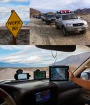
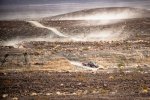
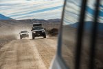
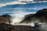
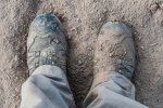
We hit the dirt. Instant white out conditions. The road had just been graded and made completely of dried out riverbed silt. I can only compare it to what the surface of the moon must be like. Just driving the truck at idle speeds kicked up a huge dust cloud. When I stepped out of my truck, I was instantly ankle deep in dust. Not the most fun driving conditions.
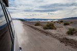
At points, the convoy stretched 8 miles long with everyone trying to keep at least a mile between trucks to avoid collisions. There was absolutely no wind at all, not even the slightest cross wind to blow the dust to the side. It just hung in the air forever making it almost impossible to see past the hood of the truck.
As the group slowed to a stop I heard the radio crackle “everyone stop! I got hit”. I was way ahead leading the group and my heart sank. This was the last thing I wanted to happen on the trip. My biggest concern as leader of the group was the safety of everyone. Thankfully the rear ending was at very low speeds and nothing more than some paint was hurt. We all got out of our trucks and regrouped to talk about the road conditions and keeping spacing to try to avoid another collision. The group pressed on.
After what seemed like only 30 seconds, I heard the radio crackle again “STOP! Got hit again”. I couldn't believe it but really I could believe it. The conditions were even worse on the start of Warm Springs Road. The dust was so thick that even at a few miles per hour you could not see your own hood, let alone the truck in front of you until it was too late. I was way out ahead of the main pack of trucks so I turned around to drive back to see what happened. Unfortunately we were not so lucky the second time around.
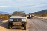
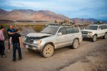
As I drove up, I said to my co-pilot, Don, “Is that the hood of his truck lifted up? That can't be good.” One of the trucks with no steel front bumper rear ended a truck with a high clearance steel rear bumper, complete with gas can rack and tire swing out. You can guess who won. The collision occurred at under 10mph yet it managed to destroy the entire front end of Adam's truck. The headlights were busted, the radiator support bent in, the hood crumpled, yet the bumper only scratched and cracked.
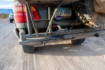
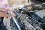
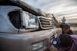
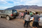
Everyone got out to assess the damage. In a group of self-proclaimed mechanics there were a lot of opinions flying around of what to do. We debated the merits of continuing on and working on the truck at camp that night or having Adam drive back to Baker. The truck was still running fine but we decided that because we were only getting more and more remote that it would not be wise for Adam to continue on. He probably could have continued on because several months later his truck was in the same condition driving all over Santa Monica while he waited for insurance to work itself out. I was super bummed out that he had to bail after only a few hours on the road. I can't imagine how furious Adam was. Through it all he really managed to keep his cool. It was quite impressive. We managed to pull the front of the truck out with a ratchet strap hooked to the car that got rear ended, flattened down the hood as much as possible and secured everything so Adam could get back to Baker to decide if he could drive home or have to call in a tow.
Six years ago, I moved to California. And of course, my first desert experience was Death Valley. It holds a special place in my heart and I try to go back as often as possible.
My past three forays into Death Valley were solo adventures (solo = me + wife), staying in the valley proper and only driving the easier day trip trails like Racetrack Playa, Titus Canyon and Eureka Dunes, and camping at established campgrounds along the way. But this time would be different. This time, I wanted to get off the beaten path. Off the pavement that traverses the park. And onto the trails that always tempted my better judgment.
There had to be a way to link the more difficult Lippincott Road and Steele Pass with a few other trails to create an all dirt route from the South to the North. So I printed out a few 11x17 inch maps, took out a highlighter and started linking up trails in an attempt to stay away from pavement as much as geographically possible.
Several years and one baby later, and I hadn't found the time or right people to do this big trip with. But thanks to IH8MUD, I developed the pretty good group of local friends that shared similar overlanding ambitions. We completed lots of short trips together to Big Bear, Antelope Valley, Mojave Road and some other local OHV areas and were ready for something a little more ambitious. The summer of 2012 rolled around and I found out that my wife is pregnant with baby number two. I now had the reason and the people to join me. The perfect opportunity for one last epic Pre-Baby #2, guys only Death Valley Trip.
My plan was to go with one other truck. Word spread and one turned into two, then three, then four, then 13 other trucks, all friends of friends. Typically I would post this kind of trip on the online forums but decided to keep this one limited to friends for a more intimate trip. An epic email thread started to coordinate the trip. Over 300 emails and a handful of scheduling conflicts later and 13 trucks whittled down to eight.
The Trip
My trips always have some kind of goal. Some trips are based around getting to that perfect location at the perfect time for that perfect picture. Other trips are about finding old mines, exploring historical areas or just seeing some natural scenery. The goal of this trip was to drive. I wanted plan a trip that would test my planning skills, driving endurance and vehicle capability. There would be no wimping out on this trip. If we had to drive all night to read the next destination, then that is what we would do. No getting tired and stopping short, until of course there was a safety risk.
When I go on an off-road, overland, backcountry camping or whatever you want to call it, I really enjoy moving forward. Base camping and doing day trips has its place but isn't what excites me the most. With my trip planning goals of avoiding backtracking and pavement while seeking out a challenge, my route covered almost 300 miles of dirt over 4 days. This may seem easy to some, and it would be with 1-2 other trucks, 8 trucks adds another layer of complexity to the planning. I had to rethink communications, timing and camping locations. Could 8 big trucks even fit in these camp locations? Daylight is limited in November and not everyone would to want to get up at 5am to start driving. Eight times the potential for a break down on top of the driver fatigue that comes with technical terrain and mediocre road for 10 hours a day. But the point of the trip was to seek out a challenge.
The final itinerary for the trip was:
Thursday:
• Meet in Baker, CA between noon and 3pm
• Depart for Stripped Butte no later than 330-400pm
• Arrive at camp in the evening
• Trails: Harry Wade Road, Warm Springs Road
• Total Mileage from Baker: 88.5 miles
• Things to see: Barker Ranch (Charles Manson's hideout)
Friday:
• Wake up early, eat breakfast, break down camp
• Depart for Racetrack Playa
• Refuel at Panamint springs
• Trails: Goler Wash, Mengel Pass, Cerro Gordo Mine, White Mountain Talc Road, Saline Valley Road South Pass, Lippincott Mine Road (up)
• Arrive at camp at Racetrack Playa
• Total Mileage: 142.1 miles
• Things to see: Ballarat Ghost town, Cerro Gordo Silver Mine
Saturday
• Wake up early, eat breakfast, break down camp
• Depart for Eureka Dunes
• Trails: Lippincott (down), Saline Valley Road North Pass, Steele Pass, Dedeckera Canyon, Eureka Dunes
• Total Mileage: 63 miles
• Things to see: Racing Rocks at Racetrack Playa, Saline Valley Dunes, Salt Lake, Upper and Lower Hot Springs
Sunday
• Wake up early, eat breakfast, break down camp
• Depart for Big Pine
• Trails: Big Pine Road, Death Valley Road
• Total Mileage: 48.9 miles
• Things to see: Eureka Dunes, Old sulfur mines

I'm writing this a few months after the trip so my memory may be a little cloudy. I'll let the photos do the talking with a bit of narration on things I remember.
Day 1:
The meet up point was Baker, CA. Some of us meet up on the freeway by chance and convoyed together to Baker. When Craig arrived in Baker there were no signs of our planned meet up point, Coco's Bakery; just a nice big dirt lot along the main drag through town. Coco's or not, it wasn't too difficult to spot the half dozen Land Cruisers pulled off on the side of the road.
After lots of lollygagging around, eating lunch, fueling up and tech talk it came time find out who was who. You spend a lot of time chatting with people on the forums, so it's always fun put a face and a real name to a screen name. Before hitting the road we had a powwow to discuss the plans for the day and the trip, talk rules, and to make sure everyone had all the gear they needed.

When I was planning the trip I used Google earth a lot to chart our course. The satellite view of the road out of baker looked like it was a dirt road. To my dismay it turned out to be 30 miles of the smoothest pavement in California. On the upside it gave the group an opportunity to get into the driving together groove, test out all the various radio communications, and just have some low-pressure chitchat on the way to the start of the real driving. We turned onto our first dirt road, Harry Wade road, where we stopped to air down.

We hit the dirt. Instant white out conditions. The road had just been graded and made completely of dried out riverbed silt. I can only compare it to what the surface of the moon must be like. Just driving the truck at idle speeds kicked up a huge dust cloud. When I stepped out of my truck, I was instantly ankle deep in dust. Not the most fun driving conditions.


At points, the convoy stretched 8 miles long with everyone trying to keep at least a mile between trucks to avoid collisions. There was absolutely no wind at all, not even the slightest cross wind to blow the dust to the side. It just hung in the air forever making it almost impossible to see past the hood of the truck.
As the group slowed to a stop I heard the radio crackle “everyone stop! I got hit”. I was way ahead leading the group and my heart sank. This was the last thing I wanted to happen on the trip. My biggest concern as leader of the group was the safety of everyone. Thankfully the rear ending was at very low speeds and nothing more than some paint was hurt. We all got out of our trucks and regrouped to talk about the road conditions and keeping spacing to try to avoid another collision. The group pressed on.
After what seemed like only 30 seconds, I heard the radio crackle again “STOP! Got hit again”. I couldn't believe it but really I could believe it. The conditions were even worse on the start of Warm Springs Road. The dust was so thick that even at a few miles per hour you could not see your own hood, let alone the truck in front of you until it was too late. I was way out ahead of the main pack of trucks so I turned around to drive back to see what happened. Unfortunately we were not so lucky the second time around.

As I drove up, I said to my co-pilot, Don, “Is that the hood of his truck lifted up? That can't be good.” One of the trucks with no steel front bumper rear ended a truck with a high clearance steel rear bumper, complete with gas can rack and tire swing out. You can guess who won. The collision occurred at under 10mph yet it managed to destroy the entire front end of Adam's truck. The headlights were busted, the radiator support bent in, the hood crumpled, yet the bumper only scratched and cracked.


Everyone got out to assess the damage. In a group of self-proclaimed mechanics there were a lot of opinions flying around of what to do. We debated the merits of continuing on and working on the truck at camp that night or having Adam drive back to Baker. The truck was still running fine but we decided that because we were only getting more and more remote that it would not be wise for Adam to continue on. He probably could have continued on because several months later his truck was in the same condition driving all over Santa Monica while he waited for insurance to work itself out. I was super bummed out that he had to bail after only a few hours on the road. I can't imagine how furious Adam was. Through it all he really managed to keep his cool. It was quite impressive. We managed to pull the front of the truck out with a ratchet strap hooked to the car that got rear ended, flattened down the hood as much as possible and secured everything so Adam could get back to Baker to decide if he could drive home or have to call in a tow.

Last edited:

