East Mojave Heritage Trail mini report

MountainBiker

Experience Seeker
Day 5, Leiser Ray Mine to Cottonwood Cove Campground

Hanging out the night before, catching up with Driller, I got quite cold. The wind was relentless all day today, and I wasn't looking forward to hours between sunset and bedtime, as I expected it to be in the low 40s and windy.

Anyhow, we went north and the EMHT travels a portion of the Mojave Road. Driller and I had travelled through here a couple years ago, so we kept moving, not going to any of the nearby sites that we both knew about. This section also had the most traffic, so we just kept moving, all the way to Carruthers Canyon. We did stop at this homestead, which should be a familiar sight to Mojave Road veterans:
homestead.jpg

Carruthers Cyn has been on my list to check out for quite some time, and it is very nice! There are several campsites tucked up under trees! That was quite a change from the creosote and cholla I'd been looking at for 4 days. A couple had just vacated phallic rock campsite, and if it was a couple hours later in the day, or at least a little warmer, we would've set up camp then and there.

For the rest of the day, I forgot about checking a few spots I had waypointed, petroglyphs, the Juan Ghost Town, etc. Not sure why, but I guess I was thinking about camp. Along the way towards Searchlight (our planned gas stop), we looked for protected campsites, but couldn't find anything. As we pulled in to town, I remembered that I had camped at Cottonwood Cove Cpgrd on the Colorado river a prior winter, and it was a pleasant experience, for a campground anyway. Thinking of the trees and wind protection, as well as the 1000' elevation drop down to the river, we decided to camp there. It's very quiet in the winter, but I bet it is a zoo in the summer with the boat launch and several dozen rental houseboats!

End of Day 5, 97 miles, 6:30 rolling time
 

MountainBiker

Experience Seeker
Day 6, Cottonwood Cove Campground to Kingston Wash

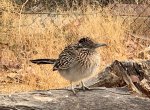
That was a pleasant and warm night next to the Colorado river! I knew this looked like a roadrunner from the coloring, but I've never seen one so fat looking. I guess it was cold enough that it was puffed up. It was also begging for food at our campsite.
cold roadrunner.jpg

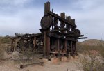
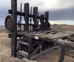
I've been wanting to check out the Oakland Mine near Searchlight for some time. This is interesting stamp mill:
stamp mill.jpgstamp mill 2.jpgstamp.jpg
 

MountainBiker

Experience Seeker
Day 6, continued

We travelled across the New York Mtns to the town of Nipton that is for sale! Due to Covid, we practiced social distancing and did not enter the town.

Caution: Just south of Nipton at 35.463026, -115.269344, there is a low clearance railroad overpass. Tall rigs may need to reroute around this. The route in the GPX file routes around this by going up a steep concrete abutment, which can see longer wheelbase rigs high center. Even Driller's 2door wrangler scraped the edge when rolling over the top! I opted to go under the RR.

We passed the Ivanhoe solar project (nee, State Line Solar.) This project emits a LOT of CO2 because it preheats the boilers using natural gas every morning. My wild guess is that some combination of tax credits makes the accountants and shareholders happy. I'm not complaining about solar tax credits or natural gas tax credits either, just pondering how they make it profitable.

We also checked out Colosseum pit mine remains. I've been here several times, so i didn't take photos. It's interesting to see in person for sure! When I was here last, you could drive all the way down to the water (I didn't), but now there was a locked gate.

When we got to a closed gate on Kingston Wash Road, we ran into a young woman in a Subaru Outback who said she was exploring the geologic features in the area. It's really cool to see young folks getting out to some of the remote areas in our country! On Kingston Wash Road, there were some interesting exposed aggregate pylons spaced periodically. Some of them had arrows directing drivers going the other direction, they appeared to be installed in 2001. I should've taken a picture, but alas, I did not. Another strange thing in the desert, as I've never seen such a thing on BLM routes before. I didn't see the Mojave Mailbox #2 in Kingston Wash, so that one will have to wait until my next trip to get my signature.

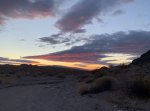
By this point, we were looking for a place to camp, with a little bit of wind shelter if possible. Around sunset (~4:30pm) we pulled into a side wash. The wind protection wasn't significant, and we didn't like the idea of camping in narrow wash with the threatening clouds. So we made dinner, talked about it some more, and decided to drive further up the main wash to find a better high point. A few miles later, we set up camp. The threating clouds aren't visible, as they were moving in from the North.
sunset.jpg

End of Day 6, 105 miles, 6:30 rolling time
 
Last edited:

MountainBiker

Experience Seeker
Day 7, Kingston Wash to Devil's Playground (Mojave NP)

Today would be the last full day for Driller and I on this trip. In order to get to a decent spot where he and I could start heading home by midday tomorrow, we had to skip a section of the EMHT. What we skipped was a little loop that goes by Clark Mountain and crosses I-15 at Mountain Pass. We also missed Piute Valley and Carbonete King, Standard and Evening Star Mines.

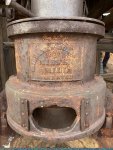
We refueled in Baker, then followed the EMHT to Valley Wells. There is a large slag heap in Valley wells, here are some pics.
reflecting slag.jpgslag close.jpg
 

MountainBiker

Experience Seeker
Day 7 Continued

From the slag heap, we cut out an EMHT segment as described above, and headed south to the Aiken Cinder Mine. If you are going to damage your tires on the EMHT, the area through the cinders of Mojave NP is where it will happen! There are some petrroglips off of this segment in MNP, requiring a ~3 mile round trip hike. As we wanted to camp close to I-40, we skipped the hike this time. I guess I didn't take any photos of Aiken Mine. I'm sure a google search will get you better photos than I can take!

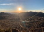
We also skipped the lava tube cave, as we've been there before quite recently. We crossed over the Old Dad mountains following a powerline access road through Jacka$$ Canyon. Found an interesting perspective on the powerlines:
above powerlines.jpg

We camped in the Devils Playground dunes just after sunset.

End Day 7, 116 miles, 6:40 rolling time
 
Last edited:

MountainBiker

Experience Seeker
Day 8, Devils Playground to I-40

Morning in the Devil's Playground, you can just pick out our rigs in camp:
camp in devils playground.jpg

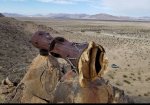
The next interesting site is the Mojave Megaphone. There is a lot of speculation about what this is, I have my opinion. These 2 pics are from a prior trip, as I didn't take photos of it when we hiked up to it on this trip.
megaphone1.jpgmega2.jpg

Down the road, we passed a private airfield called the Bacon Strip, with some well maintained vintage planes in residence. Looks like people fly in to this remote strip and camp out.

When we got to I-40 around 11am, Driller and I said our goodbyes, thus concluding our time on the EMHT for this trip.

EMHT on Day 8 was 40 miles and about 2 hours rolling time.
 
Last edited:

MountainBiker

Experience Seeker
Day 9, Steam Well Peteroglipps

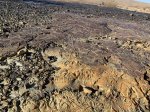
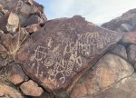
After leaving the EMHT, I camped near California City (night of day 8). The next day (Day 9), I checked out the Steam Well Peteroglipps, which I hadn't seen in over 15 years. Here are some photos, to give another taste of what the amazing Mojave Desert has to offer.
steam well.jpgsteam well2.jpg

And then I headed home...
 
Last edited:

1leglance

2007 Expedition Trophy Champion, Overland Certifie
BIg thanks for the writeup, I have the old books and they are a great read, now to get out and explore it all
 

MountainBiker

Experience Seeker
Thank you everyone, I enjoyed writing it. I'll have to do more trip reports in the future!

I was actually thinking that I could do this trip in about 4 days, even with side trips. But as I mentioned at the beginning of the report, the trail is rough enough that for the standard 4x4, it's pretty slow going. I recommend that anyone doing the EMHT should break it up into smaller bites. I'm sure that I'll revisit sections in different seasons, especially since I will pass through the Mojave on my way to my future adventures in AZ, UT, NM and Anza Borrego. I also want to get to the small segment that I had to bypass for schedule reasons.
 

cellularsteve2

Adventurer
Enjoyed your report. I just got back from the Mojave Trail last night and need to go back to some of the spots you wrote about. Much appreciated!
 
I, too, have a set of the original hardcover guides. Read them all, checked off my COVID reading list. I’m looking to complete the sections on different trips, maybe linking up with other trails. Thanks for the trip report!
 

Forum statistics

Threads
188,177
Messages
2,903,354
Members
229,665
Latest member
SANelson
Top