Get your tickets to THE BIG THING 2026!
You are using an out of date browser. It may not display this or other websites correctly.
You should upgrade or use an alternative browser.
You should upgrade or use an alternative browser.
Exploring Australia From The Left
- Thread starter luthj
- Start date
Paddler Ed
Adventurer
Did you read the history of The Great Ocean Road? It was in part used as a way to help returning soldier rehabilitate after WW1 - the routine, comradery and purpose was what they were familiar with, and this gave them a similar experience.
Great photos and write up so far - I love how different your Tasmanian adventure was to ours! Have you seen the weather that's hit Hobart in the last few days? http://www.abc.net.au/news/2018-05-12/hobart-flooding-clean-up-worst-storm-in-decades/9753434
Great photos and write up so far - I love how different your Tasmanian adventure was to ours! Have you seen the weather that's hit Hobart in the last few days? http://www.abc.net.au/news/2018-05-12/hobart-flooding-clean-up-worst-storm-in-decades/9753434
luthj
Engineer In Residence
Did you read the history of The Great Ocean Road? It was in part used as a way to help returning soldier rehabilitate after WW1 - the routine, comradery and purpose was what they were familiar with, and this gave them a similar experience.
Great photos and write up so far - I love how different your Tasmanian adventure was to ours! Have you seen the weather that's hit Hobart in the last few days? http://www.abc.net.au/news/2018-05-12/hobart-flooding-clean-up-worst-storm-in-decades/9753434
We did read some of the history of the GOR. There is a very nice mini-museum along the route which goes into details. Apparently working conditions on the road weren't much better than the military offered away from the front lines... Picks/shovels and dynamite. A canvas tent with your swag and boots. Canned beef and hard bread. Of course compared to the horrors of WWI, it was pure heaven! Better than unemployment and vagrancy as well.
https://en.wikipedia.org/wiki/Great_Ocean_Road
Both Australia and NZ have a strange (and long lasting) idolization of the ANZAC and other war-time efforts to which they contributed. Part of the colonial and ex colonial psychological need to achieve recognition from the homeland/rest of the world?
I just saw the news about the flooding. That is pretty bad. That same storm system has just now started dropping rain over eastern NZ (north island). We are down a long gravel road (which washed out in the last ex-cyclone). So hopefully it doesn't wash out.
The cool thing about these places, is that you can have a 100 people visit, and get a hundred different experiences. Heck, we could visit two or three times and still get a different take on each pass!
luthj
Engineer In Residence
The Great Ocean Road Part 2
The oldest surviving Lighthouse on the Australian mainland is on Cape Otway. Initially built around 1850, it was constructed using a mortar free interlocking stone method. 40 stoneworkers took over a year to precision cut and quarry the sandstone. Which was then carted 6km up to the site. There was no road to the Otway lightstation, and all manpower and supplies had to land miles away, and be carried in.
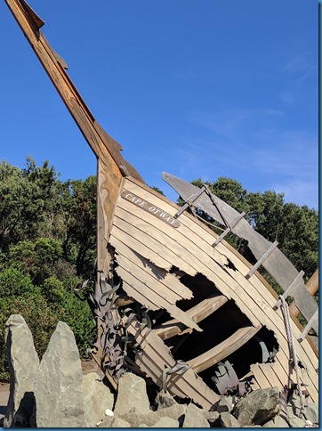
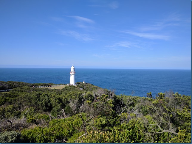
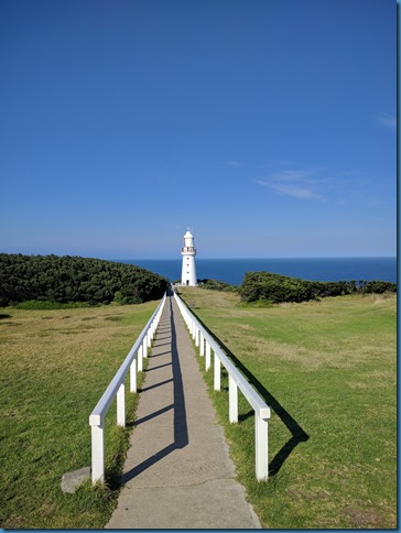
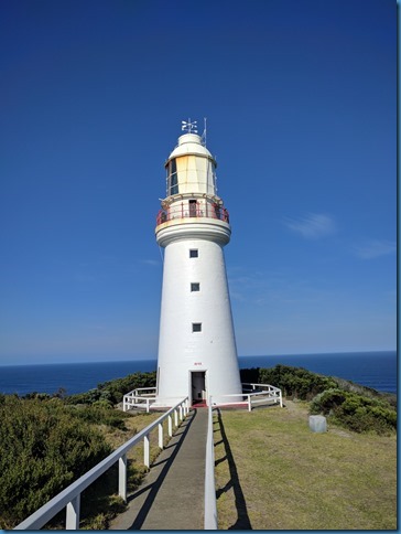
You can see the precision joints in the stone here.

It is a bit of a climb up.

Here is the rotating lamp assembly. You can see the huge Fresnel lenses which allow this light to be seen over 30 nautical miles at sea. Ships would use this light to guide them on the treacherous approach (threading the needle) between Cape Otway and Flinders island to the south.

As always the views are awesome.


Cape Otway was also home to a WWII radar installation (remains of similar installations and batteries are scattered across the Victoria Coast).
Here is the radar antenna mast and pivot assembly.

The oldest surviving Lighthouse on the Australian mainland is on Cape Otway. Initially built around 1850, it was constructed using a mortar free interlocking stone method. 40 stoneworkers took over a year to precision cut and quarry the sandstone. Which was then carted 6km up to the site. There was no road to the Otway lightstation, and all manpower and supplies had to land miles away, and be carried in.


You can see the precision joints in the stone here.

It is a bit of a climb up.

Here is the rotating lamp assembly. You can see the huge Fresnel lenses which allow this light to be seen over 30 nautical miles at sea. Ships would use this light to guide them on the treacherous approach (threading the needle) between Cape Otway and Flinders island to the south.

As always the views are awesome.


Cape Otway was also home to a WWII radar installation (remains of similar installations and batteries are scattered across the Victoria Coast).
Here is the radar antenna mast and pivot assembly.

luthj
Engineer In Residence
This is the remains of a German sea mine laid in the Bass Straight (by a captured Norwegian freighter no less).

The next stretch of coastline is home to a variety of interesting geological formations. Many with interesting names. For example the 12 Apostles (there are only 7! used to be named Sow and Piglets), Gog and Magog, Loch Ard Gorge, Bay of Islands, etc. The 12 Apostles especially had a large tourist crowd, it’s all about marketing I guess?
Ah, the tourist hordes at the 12 Apostles. Something we did not miss!
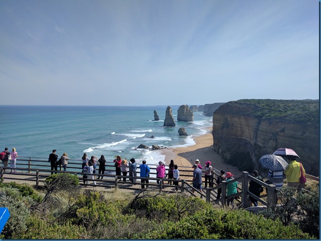
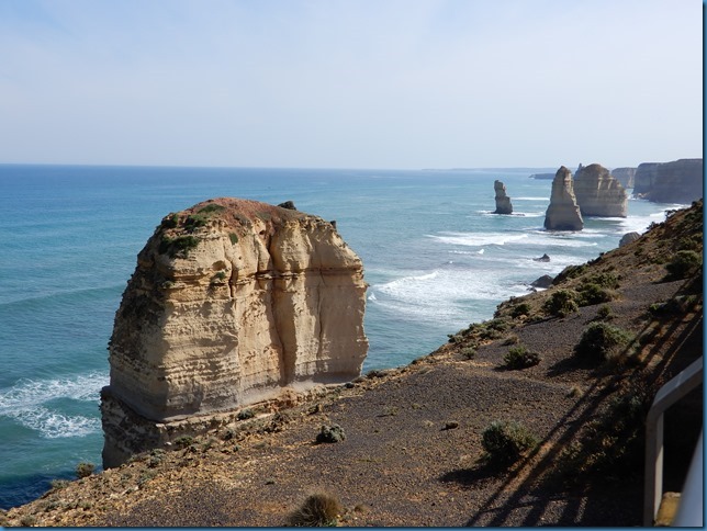


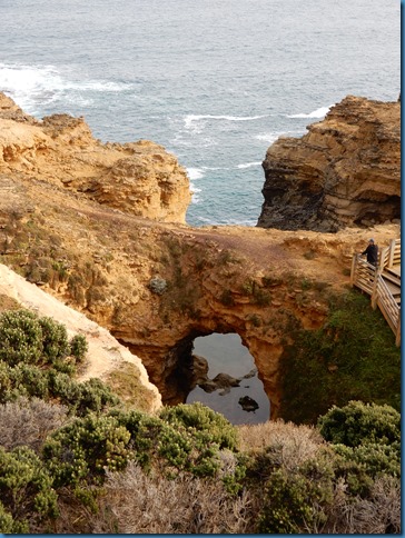
Here is a few photos of some of the formations.


Once connected by natural bridge, this formation (London Bridge) was not an island. In 1990 it collapsed into the sea leaving 2 tourists trapped on Australia’s newest island.

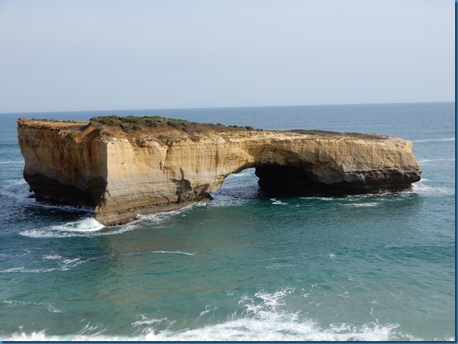

The next stretch of coastline is home to a variety of interesting geological formations. Many with interesting names. For example the 12 Apostles (there are only 7! used to be named Sow and Piglets), Gog and Magog, Loch Ard Gorge, Bay of Islands, etc. The 12 Apostles especially had a large tourist crowd, it’s all about marketing I guess?
Ah, the tourist hordes at the 12 Apostles. Something we did not miss!


Here is a few photos of some of the formations.


Once connected by natural bridge, this formation (London Bridge) was not an island. In 1990 it collapsed into the sea leaving 2 tourists trapped on Australia’s newest island.


luthj
Engineer In Residence
A South Australian Welcome
By Jen.
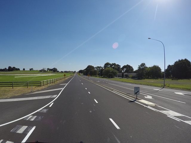
Almost immediately upon entering South Australia (SA), we noticed the flat lands. We had been in the hills of Victoria and Tasmania since we had arrived in Australia, so it was a different, but welcome (at least on my part, Jonathan may not like the flatness), landscape. In fact, I was surprised at how different it was from Victoria just across the border. On the SA side, they practiced logging, so the towns on the border seemed really prosperous and new. The roads were straight and flat, which was a welcome relief from Victoria’s pitching and curving roads.
One of the first sites we visited was the Blue Lake in Mount Gambier (pronounced Gam-bee-ya). Mount Gambier is a town located on one of the few hills in the region. The reason for the hill? An extinct volcano. At the top of this hill, the volcano’s crater has filled with water (from both rain and groundwater). What makes it unique is that it develops an unique blue color from calcite crystals that form in the spring (sometime in November). Nearly in one day, it will transform from a steely-gray color to a brilliant blue that lasts all summer, and then it slowly fades back to the gray color. We caught it at the end of the summer. Might be even more blue a month ago.

https://www.blogger.com/null
The birds at our campsite the night before we visited the cave below.
https://www.blogger.com/null
The view from our campsite the night before we visited the cave below.
Next, we decided to hit up the Naracoorte Caves National Park. This park has received UNESCO World Heritage status because of the marsupial fossils found in the caves there. These caves had holes in the ceiling that allowed animals to fall into the caves and not be able to get back out. As a result, a large pile of bones were fossilized in the cave when the holes filled back up. They have found the remains of large animals that no longer exist. Such as large koalas and echnidas, as well as leaf-eating kangaroos, a hippo-like marsupial, and a large python. They have even discovered the largest marsupial to have ever lived. Many of these animals died out only after humans first started populating the continent.
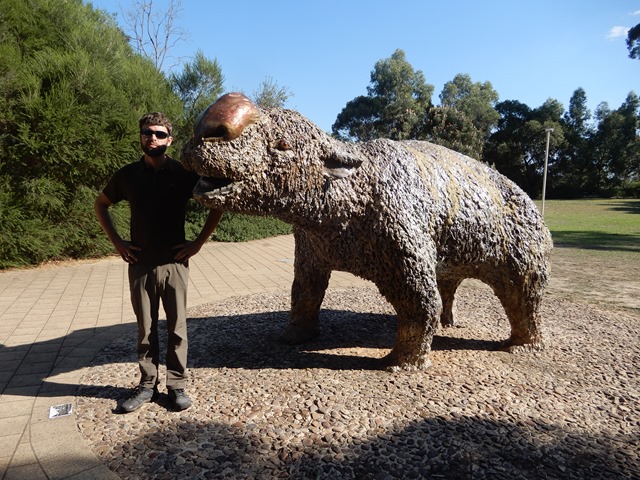
This is a life-size statue of the diprotodon, the largest marsupial to have ever lived.
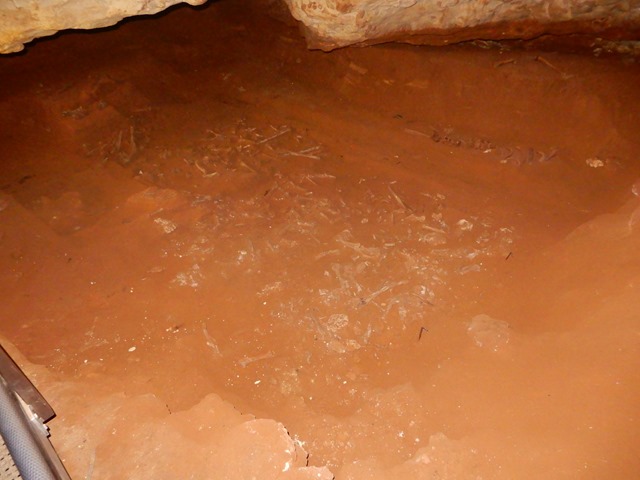
These are just a small percentage of the fossils found in the cave and how they look before the extracted and assembled.

The leaf-eating kangaroo (skull is similar to a koalas).
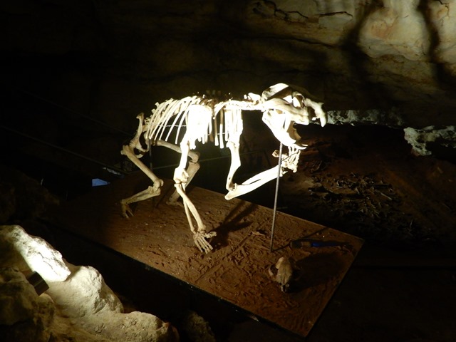
This is a marsupial lion-like creature, which may have dropped down onto its prey from the trees, which sounds a lot like the drop-bear legends that they use to scar kids and tourists here in Aussie.
From there, we made our way to the coast again. We had heard Robe is lovely. So, I set the GPS to Little Dip Conservation Park and Jonathan turned the van down the road. We found the park easily and started driving down the road. Little did we know that, at the end, there were sand dunes with deep sand. We made it all the way to the end, but when we tried to turn around, we got stuck. We managed to get ourselves unstuck, only to get ourselves stuck again at the top of the hill, where some 4x4ers decided to assist us using their winch to save some time. Beautiful views at least.
 [/i]
[/i]
By Jen.
Almost immediately upon entering South Australia (SA), we noticed the flat lands. We had been in the hills of Victoria and Tasmania since we had arrived in Australia, so it was a different, but welcome (at least on my part, Jonathan may not like the flatness), landscape. In fact, I was surprised at how different it was from Victoria just across the border. On the SA side, they practiced logging, so the towns on the border seemed really prosperous and new. The roads were straight and flat, which was a welcome relief from Victoria’s pitching and curving roads.
One of the first sites we visited was the Blue Lake in Mount Gambier (pronounced Gam-bee-ya). Mount Gambier is a town located on one of the few hills in the region. The reason for the hill? An extinct volcano. At the top of this hill, the volcano’s crater has filled with water (from both rain and groundwater). What makes it unique is that it develops an unique blue color from calcite crystals that form in the spring (sometime in November). Nearly in one day, it will transform from a steely-gray color to a brilliant blue that lasts all summer, and then it slowly fades back to the gray color. We caught it at the end of the summer. Might be even more blue a month ago.
https://www.blogger.com/null
The birds at our campsite the night before we visited the cave below.
https://www.blogger.com/null
The view from our campsite the night before we visited the cave below.
Next, we decided to hit up the Naracoorte Caves National Park. This park has received UNESCO World Heritage status because of the marsupial fossils found in the caves there. These caves had holes in the ceiling that allowed animals to fall into the caves and not be able to get back out. As a result, a large pile of bones were fossilized in the cave when the holes filled back up. They have found the remains of large animals that no longer exist. Such as large koalas and echnidas, as well as leaf-eating kangaroos, a hippo-like marsupial, and a large python. They have even discovered the largest marsupial to have ever lived. Many of these animals died out only after humans first started populating the continent.
This is a life-size statue of the diprotodon, the largest marsupial to have ever lived.
These are just a small percentage of the fossils found in the cave and how they look before the extracted and assembled.
The leaf-eating kangaroo (skull is similar to a koalas).
This is a marsupial lion-like creature, which may have dropped down onto its prey from the trees, which sounds a lot like the drop-bear legends that they use to scar kids and tourists here in Aussie.
From there, we made our way to the coast again. We had heard Robe is lovely. So, I set the GPS to Little Dip Conservation Park and Jonathan turned the van down the road. We found the park easily and started driving down the road. Little did we know that, at the end, there were sand dunes with deep sand. We made it all the way to the end, but when we tried to turn around, we got stuck. We managed to get ourselves unstuck, only to get ourselves stuck again at the top of the hill, where some 4x4ers decided to assist us using their winch to save some time. Beautiful views at least.
luthj
Engineer In Residence
Next on the list was Coorong National Park, which is this long coastal strip of land south of the Murray River outlet. I figured we would just treat it like the Alpine National Park and just follow signs and see what is interesting. Turns out for this park, that is a bad idea. That just leaves you driving very corrugated roads with nothing to see. There were a few interesting turnouts, but most were accessible from the smooth highway, no need to punish oneself. The park ends at the Murray River outlet. The Murray River is the longest river in Australia. Right before its outlet are several large lakes. We tried to take the ferry across through some of the small islands, but it turns out that section was closed. We did end up on a few ferries though when we turned around and went around the long way.
luthj
Engineer In Residence
Adelaide and Surrounds
By Jen.
After enjoying several free ferries by the lakes at the base of the Murray River, we thought we would head west into Kangaroo Island. However, on our way to the ferry, we learned that it would cost about $400 one way. With descriptions sounding much like Tasmania, we decided to skip the experience. We did have some interesting views of large waves and dolphins along the way, though.


Sorry for the shakiness of the video, but thought you might enjoy the movement of the dolphins.
Next stop on the list was Adelaide. The guidebook was pretty sparse on suggested things to do there, so we decided to only take 1 day there, including a stop to a local hardware store so that we could update the fittings for our water hose. Australia uses two sizes of spigots, 0.75” and 1”. Our hose is 0.75”, so it limited our water-filling options. Additionally, all hoses come with quick disconnects already installed, so many of the outlets have that as well. So, in order to make filling easier, we splurged and bought several fittings; now we can use all types of ends. It is also easier to put the hose on now.
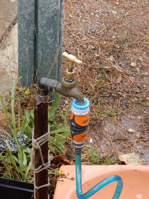
The orange section is the quick disconnect that connects to any other quick connect, while the blue adapter is removed if the larger 1” thread is needed.
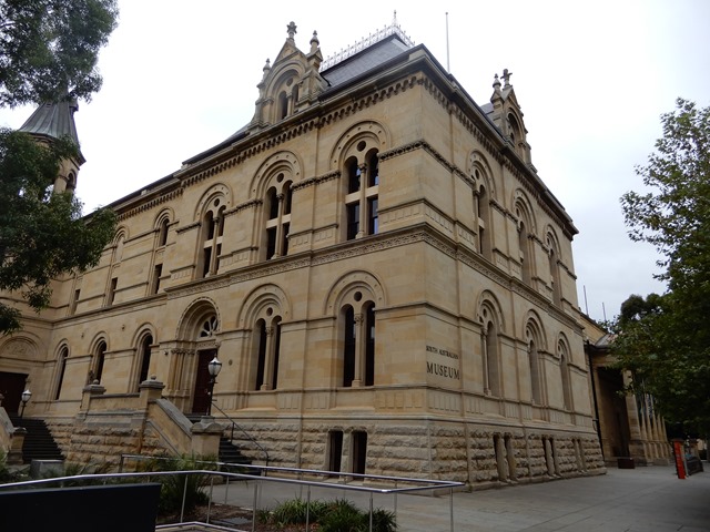
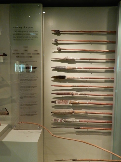
The layout of the city itself is very interesting. The CBD (Central Business District) is encircled by gardens. We drove into the CBD and went to see the South Australian Museum. It is one of many beautiful buildings that line the street, sitting next to the art museum and the University of South Australia. It had impressive collections of aboriginal items all displayed next to each other so that you could compare how different tribes did things.
https://www.blogger.com/null
I had been craving ramen since the Alpine National Park in Victoria, and so we tried to hit up a ramen place for lunch. However, it seemed that Google had a slightly wrong location listed, and we couldn’t find the place. So, my craving will have to wait until Perth. Hopefully, they will have some ramen shops that we can find.
From Adelaide, we had heard driving through the suburbs in the Adelaide hills was worth it during the autumn (some of the best displays of traditional autumn color in the country), so we started weaving through the hills to find a few treasures (we were still a few weeks too early to see the trees in all their grandeur).
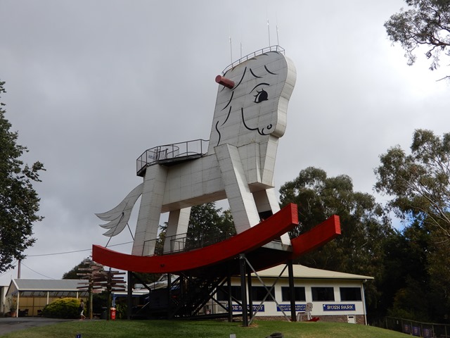

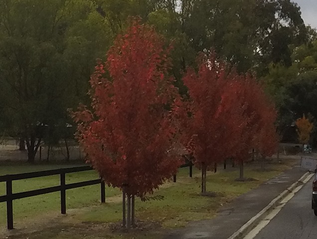
By Jen.
After enjoying several free ferries by the lakes at the base of the Murray River, we thought we would head west into Kangaroo Island. However, on our way to the ferry, we learned that it would cost about $400 one way. With descriptions sounding much like Tasmania, we decided to skip the experience. We did have some interesting views of large waves and dolphins along the way, though.
Sorry for the shakiness of the video, but thought you might enjoy the movement of the dolphins.
Next stop on the list was Adelaide. The guidebook was pretty sparse on suggested things to do there, so we decided to only take 1 day there, including a stop to a local hardware store so that we could update the fittings for our water hose. Australia uses two sizes of spigots, 0.75” and 1”. Our hose is 0.75”, so it limited our water-filling options. Additionally, all hoses come with quick disconnects already installed, so many of the outlets have that as well. So, in order to make filling easier, we splurged and bought several fittings; now we can use all types of ends. It is also easier to put the hose on now.
The orange section is the quick disconnect that connects to any other quick connect, while the blue adapter is removed if the larger 1” thread is needed.
The layout of the city itself is very interesting. The CBD (Central Business District) is encircled by gardens. We drove into the CBD and went to see the South Australian Museum. It is one of many beautiful buildings that line the street, sitting next to the art museum and the University of South Australia. It had impressive collections of aboriginal items all displayed next to each other so that you could compare how different tribes did things.
https://www.blogger.com/null
I had been craving ramen since the Alpine National Park in Victoria, and so we tried to hit up a ramen place for lunch. However, it seemed that Google had a slightly wrong location listed, and we couldn’t find the place. So, my craving will have to wait until Perth. Hopefully, they will have some ramen shops that we can find.
From Adelaide, we had heard driving through the suburbs in the Adelaide hills was worth it during the autumn (some of the best displays of traditional autumn color in the country), so we started weaving through the hills to find a few treasures (we were still a few weeks too early to see the trees in all their grandeur).
luthj
Engineer In Residence
Heading north, we decided to hit up the historical mining town of Burra. We were finally seeing the terra rossa (red dirt) that is so iconic to Australia.
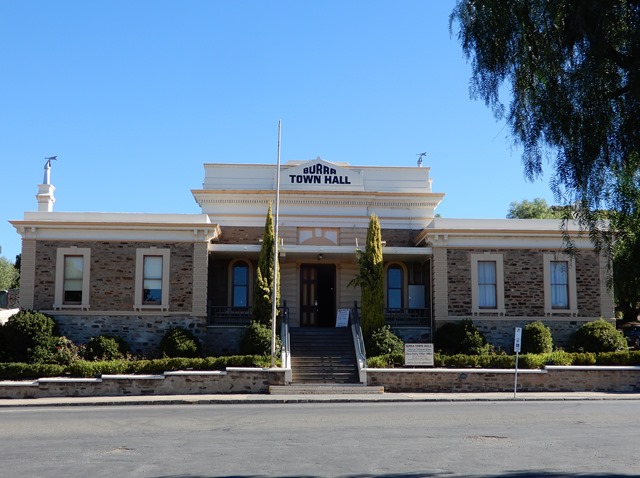

At the time, it was the largest copper mine in the world.
Lastly, we hit up Mount Remarkable National Parks. Coming from the south, it is a single large hill that rises out of the flat plain (from the other directions, you can actually see it is part of a range). It had one of my favorite short walks so far; but probably just because it was so different from what we had previously walked. I loved the red walls of the gorge contrasted against the green eucalyptus trees. And, there were even a few flowers still blooming this late in the season. So, if you are in the vicinity, I highly recommend the Alligator Gorge Circuit track.
luthj
Engineer In Residence
More SA National Parks
By Jen.
We went northeast from Mt Remarkable to the Flinders Ranges National Park. At this point, I have been a couple of weeks without a working phone and starting to get irritated at poor Jonathan when he gets absorbed in the internet on his phone, while I can’t do the same. Fortunately, Flinders Ranges NP has enough to keep me occupied. We spent 2 full days here fitting in as much as we could.
On the first hike of the first day, I realized pretty quickly that I had forgotten to put tape on my knee (I now only needed it on the back of my knee); but there was nothing to do about it until after the hike was over. However, during the hike, my knee didn’t hurt so I thought I would see how long it would go before it started hurting. So we went about the various hikes of the day, including the next hike through the Sacred Canyon, where aboriginal rock drawings could be spotted.
https://www.blogger.com/null
Arkaroo Rock. This half-eroded-out rock housed aboriginal paintings (shown below).
https://www.blogger.com/null
https://www.blogger.com/null
Aboriginal paintings.
https://www.blogger.com/null
In the Sacred Canyon, there were aboriginal rock carvings. Apparently the circle means spring or rockhole. The 3 lines in a bird-foot shape mean emu.
With our interest in technology, we also did the solar power station walk, where kangaroos were our companions. Apparently when it was installed it was the largest solar power system in Australia.
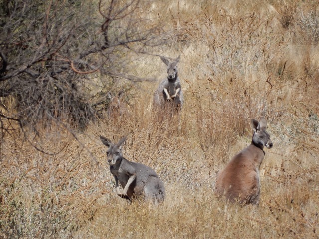

Then to finish the day, we walked to the Wilpena Pound lookout. Emus led the way on this track. The pound is this bowl-like valley surrounded by high hills with only one entrance through the nearly unpassable gorge. Aboriginals considered it special, but early white settlers thought it looked like a great corral (pound) to house large flocks. I think they had 120,000 sheep in there at one point, which ended up with it being overwhelmed and the flocks dying by the tens of thousands.

The next morning we decided to do a longer hike to the top of St Mary. The views were good, but once we got onto the mountain proper, we and several other parties lost the path. Apparently the path had done a sudden switchback that we hadn’t noticed and we had continued following along old paths, but could not see the telltale trail markers. Debating on which method was best, we finally decided to walk back along the path until we found the last trail marker. Upon finding, we (by “we” I mean “I”, as I stood in my bright orange shir loudly and humorously calling people to me while Jonathan walked ahead without me) shouted to the others and redirected the masses back along the correct path. From here, the path became exceedingly more steep with increasing rock scrambles. By the time we got to the saddle, we decided we had seen enough (views from the top weren’t going to make anything else visible), so we headed back down so that we could start our journey towards the Eyre Peninsula.
https://www.blogger.com/null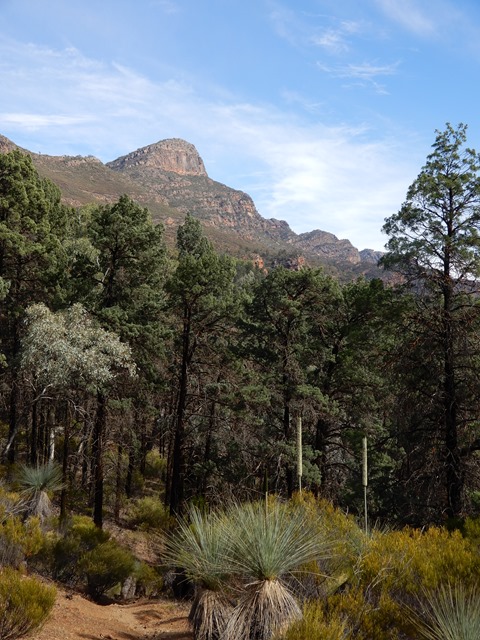
That peak is St Mary.
https://www.blogger.com/null
https://www.blogger.com/null
An example of some of the rocks we had to scramble up. As you can see, the rock closest to the camera is nearly as tall as me.
Throughout this walk, I kept a close watch on my knee. I hadn’t taped it since all the walks the day before hadn’t bothered it. During each step, my hopes grew stronger and yet more cautious that I would make the entire walk without my knee hurting. Sure enough! There was no pain AT ALL during the entire walk! I was very excited. I won’t claim it is healed to 100%, but this was a major milestone. A month or so ago, frustrated that my knee was getting worse (cramping pain every time I took a stair step up or down), I noticed that the muscles in my right knee were drastically smaller than those in my left knee. Besides being less used, I realized that it was because during our walks, I would time my steps so that my left knee would be the one to take the step up or down, to save my right knee from pain. I knew that if I was ever going to fully recover, I needed my right knee to be the same size as my left knee, so I started consciously using my right leg to step up or down (despite the pain) and increased my right-leg exercises for up and down motions. I believe this painless walk was a result of that training, combined with having completed several “no-incline” walks recently, in addition to not spending long hours in a seat without stretching (like when driving or working). Forgive me for taking blog space from our pretty travels to mention this, but I wanted to celebrate with everyone. I also know not to think that my knee issues are over (spoiler alert: about a week later I did a micro hike and felt that recently familiar knee cramping again), just celebrating my current progress.
We stopped at a Hungry Jack for dinner. This is Australia’s Burger King. I think McDonald’s came here first and licensed the name Burger King so the company had to choose a different name when it crossed the sea. I can’t compare it to a USA BK, though, because I haven’t eaten at one in about 20+ years. I don’t think Jonathan has done so since we started dating, so that is about 10 years for him. The food was tasty and I took some pictures for you to enjoy.
By Jen.
We went northeast from Mt Remarkable to the Flinders Ranges National Park. At this point, I have been a couple of weeks without a working phone and starting to get irritated at poor Jonathan when he gets absorbed in the internet on his phone, while I can’t do the same. Fortunately, Flinders Ranges NP has enough to keep me occupied. We spent 2 full days here fitting in as much as we could.
On the first hike of the first day, I realized pretty quickly that I had forgotten to put tape on my knee (I now only needed it on the back of my knee); but there was nothing to do about it until after the hike was over. However, during the hike, my knee didn’t hurt so I thought I would see how long it would go before it started hurting. So we went about the various hikes of the day, including the next hike through the Sacred Canyon, where aboriginal rock drawings could be spotted.
https://www.blogger.com/null
Arkaroo Rock. This half-eroded-out rock housed aboriginal paintings (shown below).
https://www.blogger.com/null
https://www.blogger.com/null
Aboriginal paintings.
https://www.blogger.com/null
In the Sacred Canyon, there were aboriginal rock carvings. Apparently the circle means spring or rockhole. The 3 lines in a bird-foot shape mean emu.
With our interest in technology, we also did the solar power station walk, where kangaroos were our companions. Apparently when it was installed it was the largest solar power system in Australia.
Then to finish the day, we walked to the Wilpena Pound lookout. Emus led the way on this track. The pound is this bowl-like valley surrounded by high hills with only one entrance through the nearly unpassable gorge. Aboriginals considered it special, but early white settlers thought it looked like a great corral (pound) to house large flocks. I think they had 120,000 sheep in there at one point, which ended up with it being overwhelmed and the flocks dying by the tens of thousands.
The next morning we decided to do a longer hike to the top of St Mary. The views were good, but once we got onto the mountain proper, we and several other parties lost the path. Apparently the path had done a sudden switchback that we hadn’t noticed and we had continued following along old paths, but could not see the telltale trail markers. Debating on which method was best, we finally decided to walk back along the path until we found the last trail marker. Upon finding, we (by “we” I mean “I”, as I stood in my bright orange shir loudly and humorously calling people to me while Jonathan walked ahead without me) shouted to the others and redirected the masses back along the correct path. From here, the path became exceedingly more steep with increasing rock scrambles. By the time we got to the saddle, we decided we had seen enough (views from the top weren’t going to make anything else visible), so we headed back down so that we could start our journey towards the Eyre Peninsula.
https://www.blogger.com/null
That peak is St Mary.
https://www.blogger.com/null
https://www.blogger.com/null
An example of some of the rocks we had to scramble up. As you can see, the rock closest to the camera is nearly as tall as me.
Throughout this walk, I kept a close watch on my knee. I hadn’t taped it since all the walks the day before hadn’t bothered it. During each step, my hopes grew stronger and yet more cautious that I would make the entire walk without my knee hurting. Sure enough! There was no pain AT ALL during the entire walk! I was very excited. I won’t claim it is healed to 100%, but this was a major milestone. A month or so ago, frustrated that my knee was getting worse (cramping pain every time I took a stair step up or down), I noticed that the muscles in my right knee were drastically smaller than those in my left knee. Besides being less used, I realized that it was because during our walks, I would time my steps so that my left knee would be the one to take the step up or down, to save my right knee from pain. I knew that if I was ever going to fully recover, I needed my right knee to be the same size as my left knee, so I started consciously using my right leg to step up or down (despite the pain) and increased my right-leg exercises for up and down motions. I believe this painless walk was a result of that training, combined with having completed several “no-incline” walks recently, in addition to not spending long hours in a seat without stretching (like when driving or working). Forgive me for taking blog space from our pretty travels to mention this, but I wanted to celebrate with everyone. I also know not to think that my knee issues are over (spoiler alert: about a week later I did a micro hike and felt that recently familiar knee cramping again), just celebrating my current progress.
We stopped at a Hungry Jack for dinner. This is Australia’s Burger King. I think McDonald’s came here first and licensed the name Burger King so the company had to choose a different name when it crossed the sea. I can’t compare it to a USA BK, though, because I haven’t eaten at one in about 20+ years. I don’t think Jonathan has done so since we started dating, so that is about 10 years for him. The food was tasty and I took some pictures for you to enjoy.

luthj
Engineer In Residence


The next major stop was visiting koalas. Thanks to a WikiCamps tip, we found a four of them out in the boonies where there weren’t other tourist hordes to fight over best picture locations. Aren’t they just adorable?!
Sunset on the first night on the Eyre Peninsula.
From there, it was onward to Coffin Bay National Park, which we mostly just drove through on our way back up the peninsula to start our trip across the Nullarbor.
This is Anxious Bay along the Great Ocean Tourist Drive (not to be confused with the Great Ocean Road).
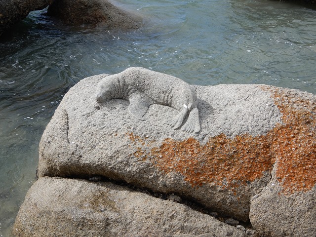
I shouldn’t forget to mention Point Labett Conservation Park, where we got see Australian sea lions and New Zealand fur seals.
Nursing mom and pup. Australian sea lions.
luthj
Engineer In Residence
Across the Nullarbor
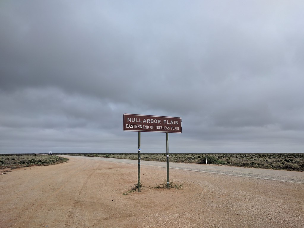
When we left off, we were working our way towards the long drive between SA and WA across the Nullarbor plain.The drive once past Ceduna can be brutally boring at times.You pass the time (watching the fuel tick down, and the kms tick up) but looking for "tourist attractions".
Such as random holes in the ground "caves".
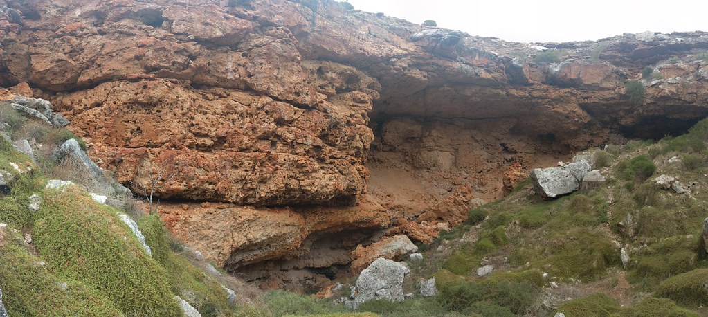
Some of these have "blowholes" which continuously vent cold air year round.A great relief in the summer I am sure.
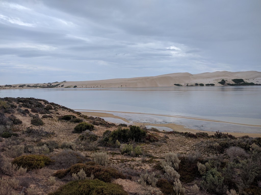
Other attractions include desolately beautiful coastlines.
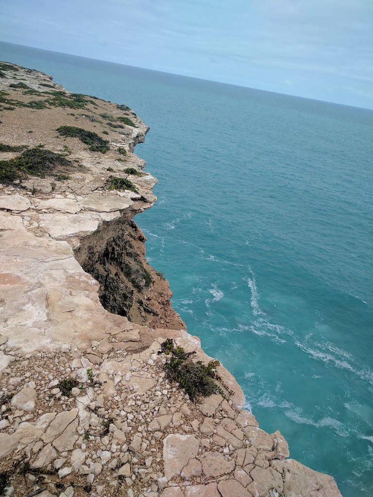

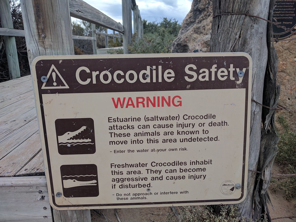
This is at a popular surf break.Oz's rules on these signs are interesting.After a single sighting, the signs warning of Saltwater crocs must stay up for something like 50 years.
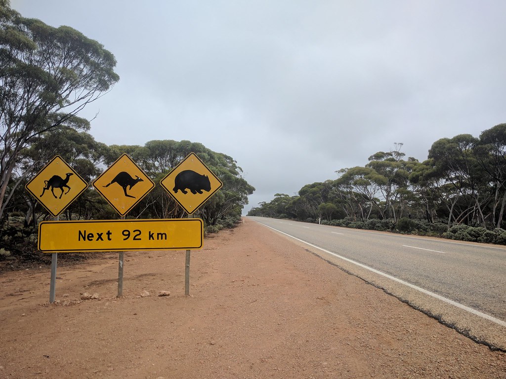
Watching out for roadkill and road trains is also part of the fun. Along the way we crossed the longest straight. At 90 miles without a single curve, it is the record holder.
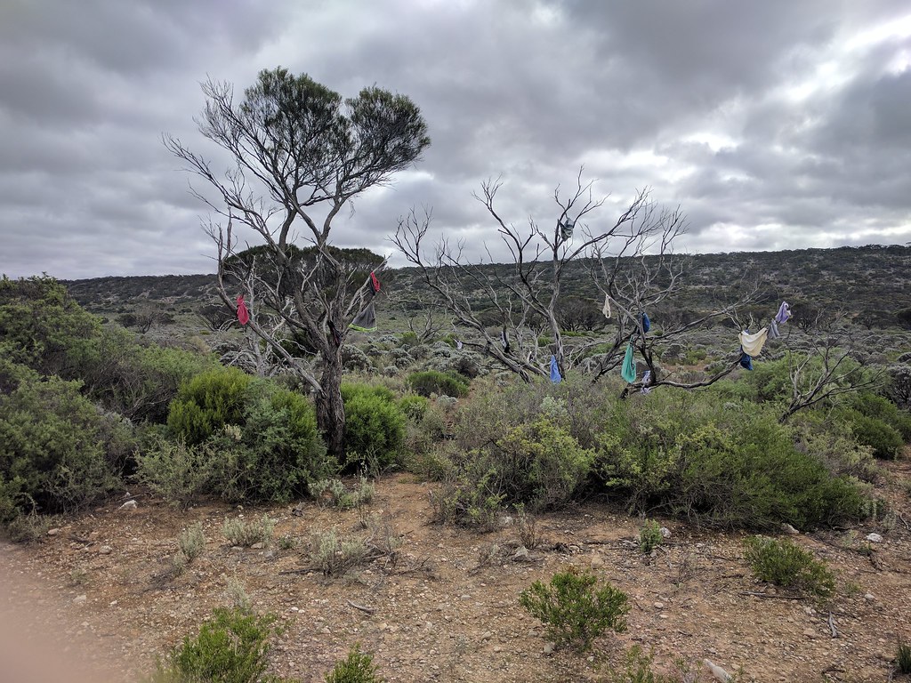
Trees covered with items of a random theme adds... variety...
Camping on the edge of the world all by yourself is an experience.

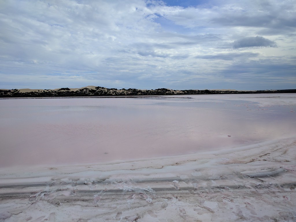
Occasionally stopping by a pink lake is a welcome break.
When we left off, we were working our way towards the long drive between SA and WA across the Nullarbor plain.The drive once past Ceduna can be brutally boring at times.You pass the time (watching the fuel tick down, and the kms tick up) but looking for "tourist attractions".
Such as random holes in the ground "caves".

Some of these have "blowholes" which continuously vent cold air year round.A great relief in the summer I am sure.
Other attractions include desolately beautiful coastlines.


This is at a popular surf break.Oz's rules on these signs are interesting.After a single sighting, the signs warning of Saltwater crocs must stay up for something like 50 years.

Watching out for roadkill and road trains is also part of the fun. Along the way we crossed the longest straight. At 90 miles without a single curve, it is the record holder.


Trees covered with items of a random theme adds... variety...

Camping on the edge of the world all by yourself is an experience.

Occasionally stopping by a pink lake is a welcome break.

Similar threads
- Replies
- 0
- Views
- 561
- Replies
- 9
- Views
- 2K


