You are using an out of date browser. It may not display this or other websites correctly.
You should upgrade or use an alternative browser.
You should upgrade or use an alternative browser.
Exploring the West - A couple's 2 week travels through CO, UT, and AZ
- Thread starter JamesDowning
- Start date
JamesDowning
Explorer
Thanks for the encouragement guys! I get a lot of joy going back through these things because it allows me to dig through my memory and relive it as much as I can. Ok, on to the next day.
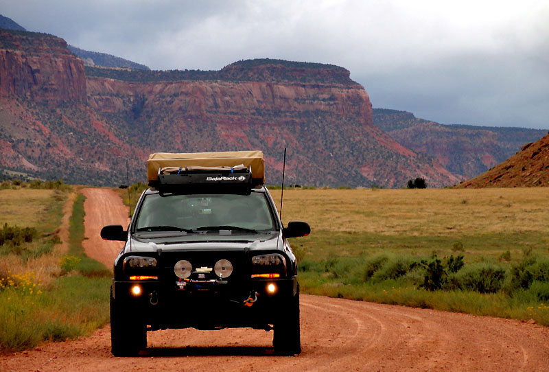
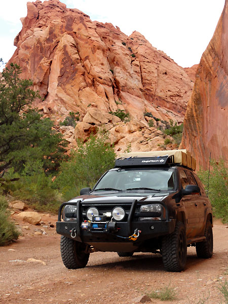
We woke early the next morning to a bit of a contrast to the night before. Clouds had rolled in overnight, the wind had picked up, and rain was threatening. Where did our good weather go?
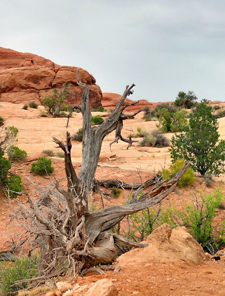
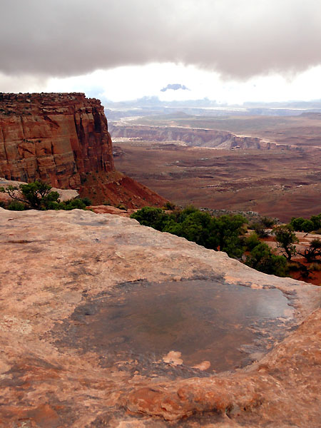
We had a quick breakfast of pop-tarts, and while the wife was getting ready, I explored our little peninsula and grabbed a few more pictures. I've been experimenting a bit with bracketing photos and doing the HDR thing, but I've found it's absolutely critical to use a tripod. So, if any of them appear a bit blurry, that's probably why (not all photos are, but I ended up experimenting with it a good bit today).
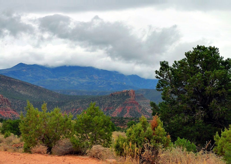

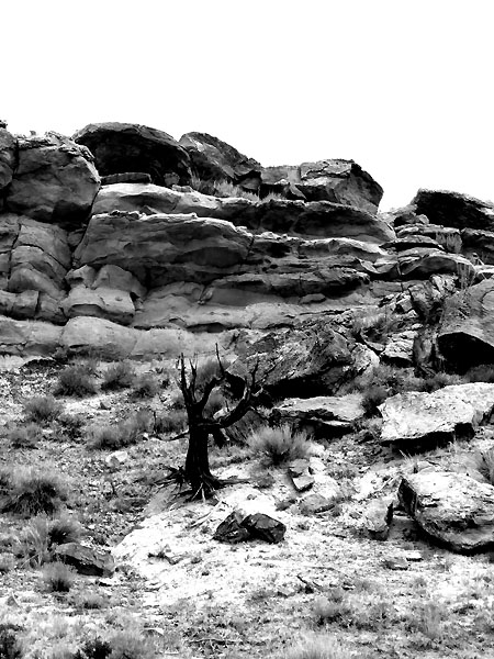
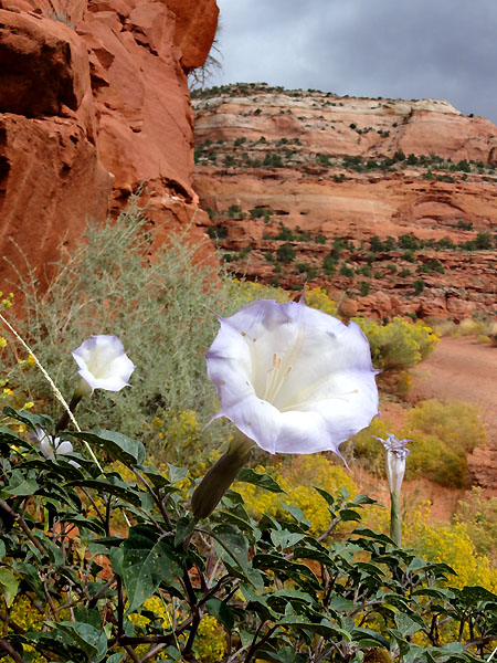
It's hard capturing the depth of a landscape as diverse as this.
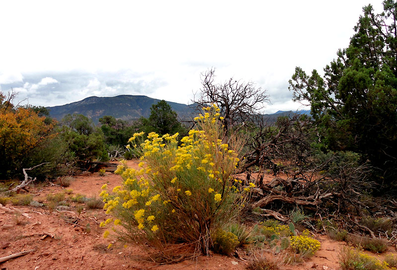
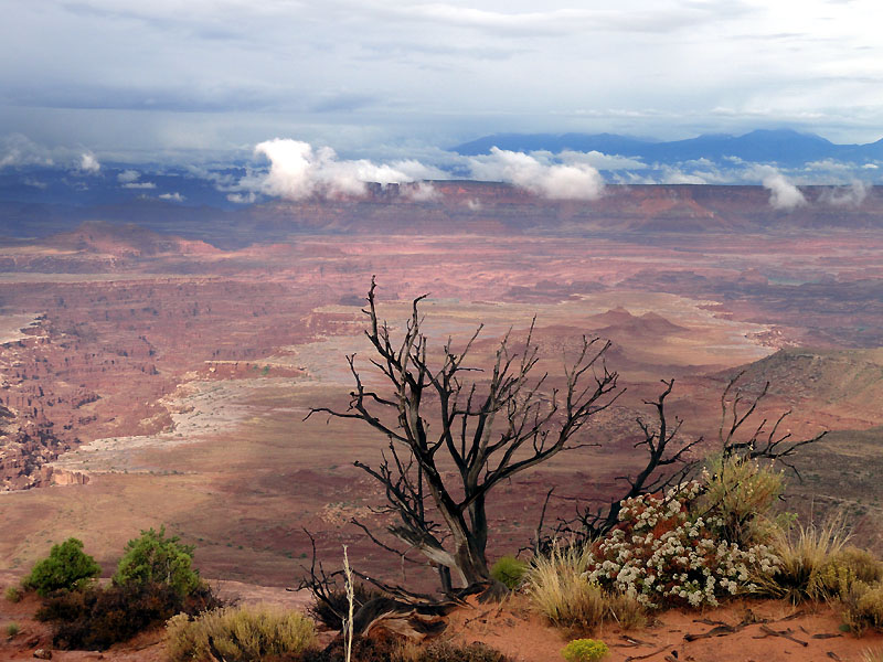
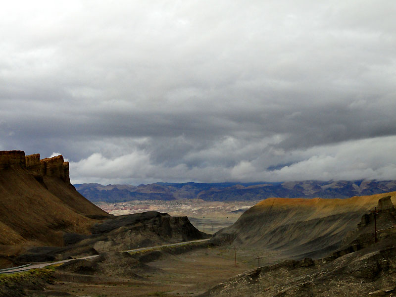
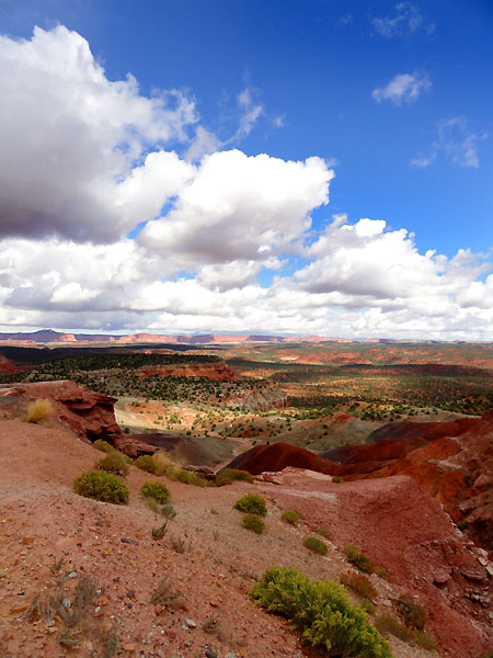
Anyways, it was time to head off and explore some more. I really wanted to spend the day going deeper into Beef Basin - at least to Bobby's hole. However, I thought it wouldn't be smart to press on with the clouds looking as they were. This was a good call in retrospect, because as we were driving back towards Moab, we looked back at the area north of the Abajos and sure enough it looked like heavy rain was falling on the basin. I confirmed that with the weather radar.
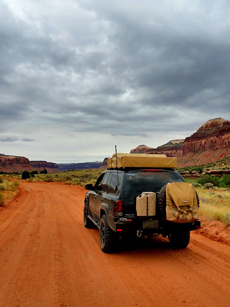
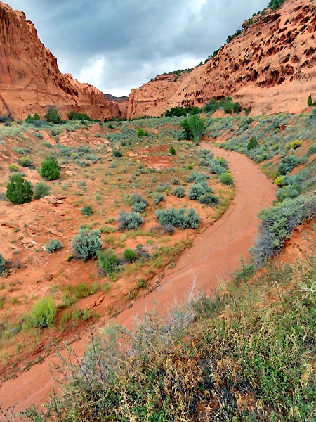
I really like this picture as we were heading out of the basin. It captured the looming cloud cover well.
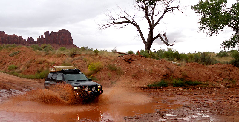
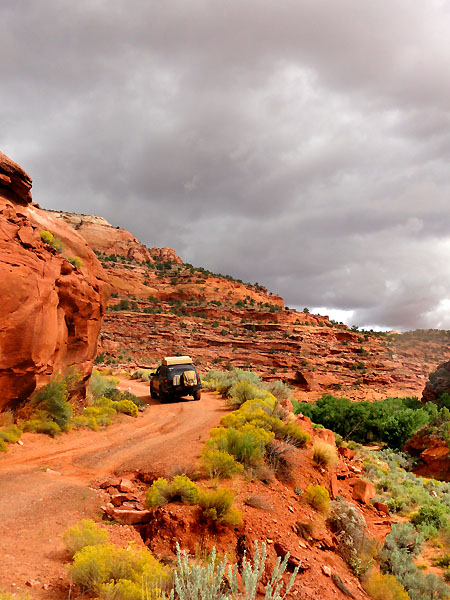
Megan reluctantly stood out in the sprinkles and got a good shot of me hitting the stream crossing near the entrance to the basin. I think it was well worth it, but then again, I wasn't the one getting wet.
Upon returning to Moab, our hunger caught up with us again. This time we tried Zax, and thus started my love affair with southwest burgers (I love those green chillies!).
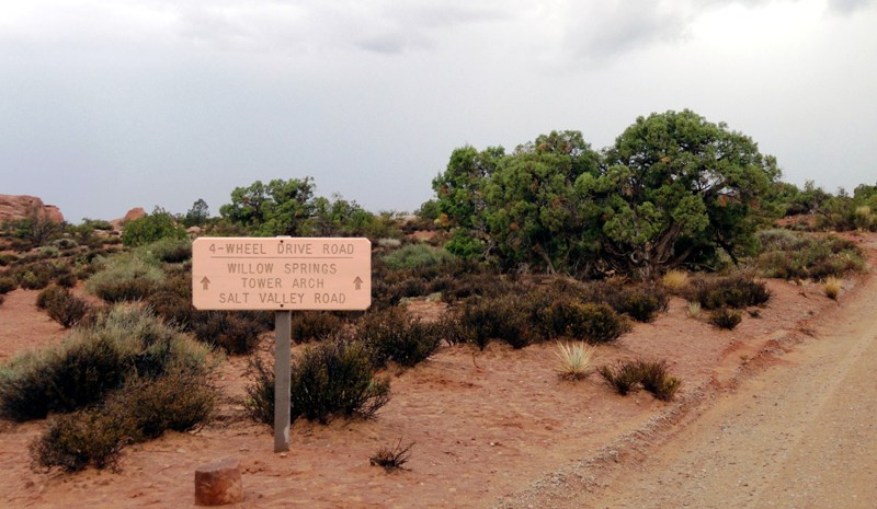
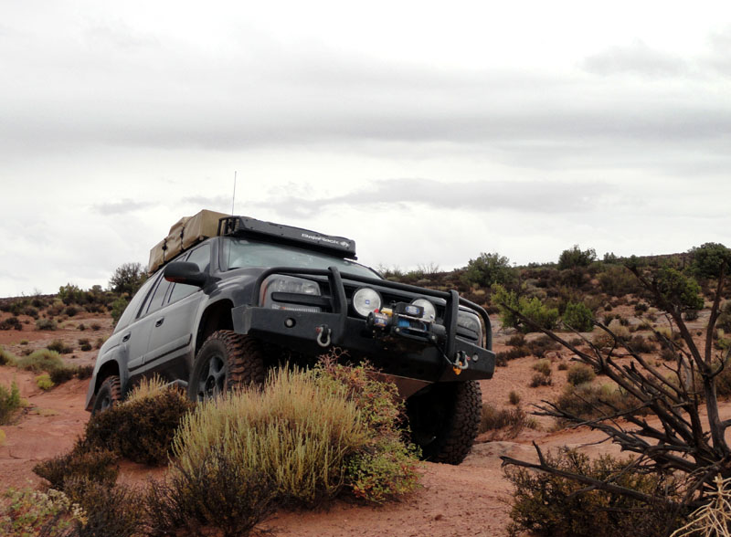
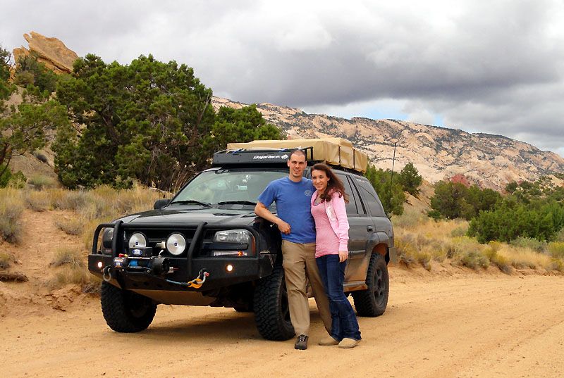
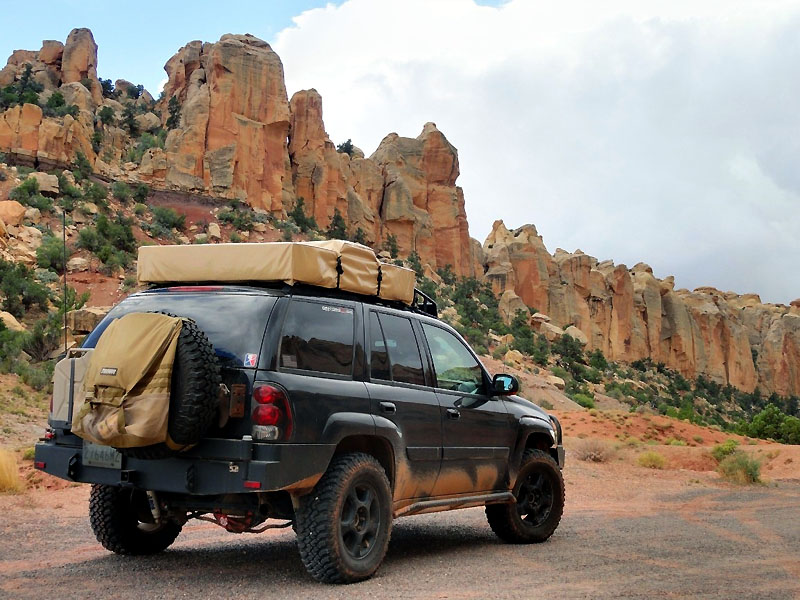
So we headed on to Arches (which turned out to be the busiest time of day to go), so we decided to explore some of the dirt roads in the area to escape the hordes of RVs.
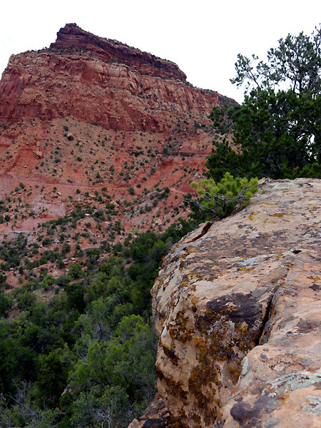
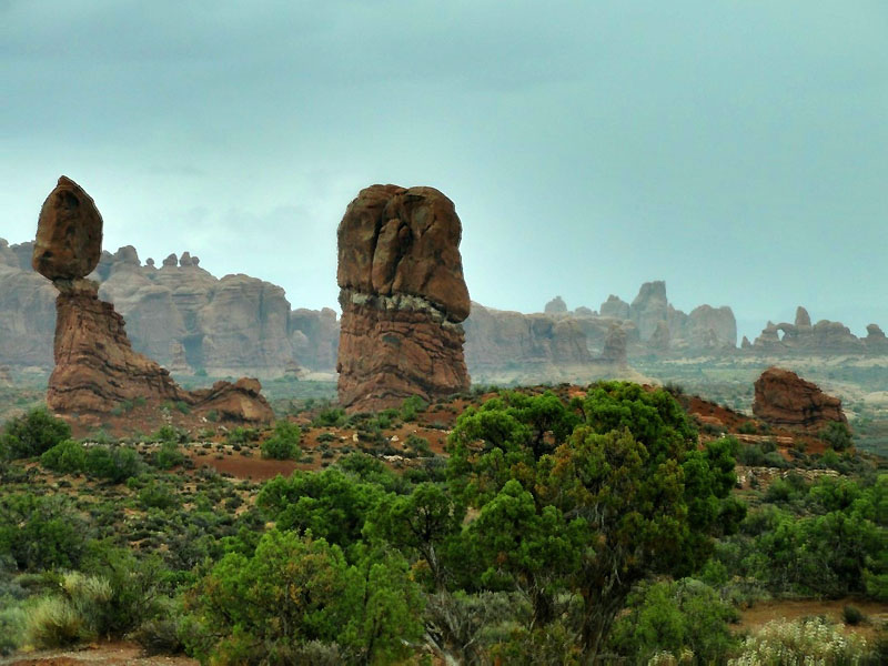
I liked the depth of this image... kinda felt 3D to me. Possibly due to the slight double image on the right side foreground.
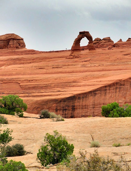
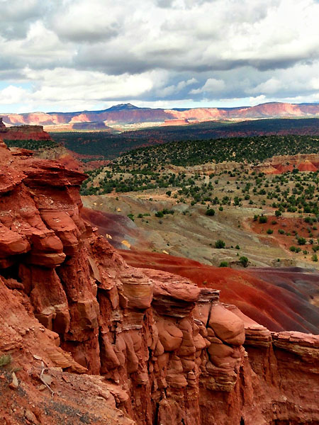
After putting around a bit, not seeing much, we decided to hack it back with the throngs of tourists. Since it was raining, we weren't in much of a mood to hike up the 3 mile hike to see the delicate arch, so we took the "medium" trail. Not very close, but we got a few snapshots anyways.
The location of the delicate arch was more impressive than anything. Its perched atop a 400 foot sheer cliff... which I hadn't before recognized from the close-in photos I've seen. We stood in wonder, while the skies spit on us, of how the heck it was formed.
I think this shot might do better as a high contrast black and white.
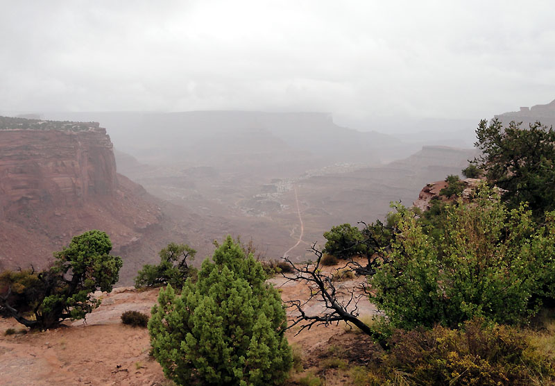
It started to rain harder as we got towards the truck, so we thought maybe we should try our luck in Canyonlands.
As we climbed up to the level of the Island in the Sky, we climbed into cloud cover. Great.
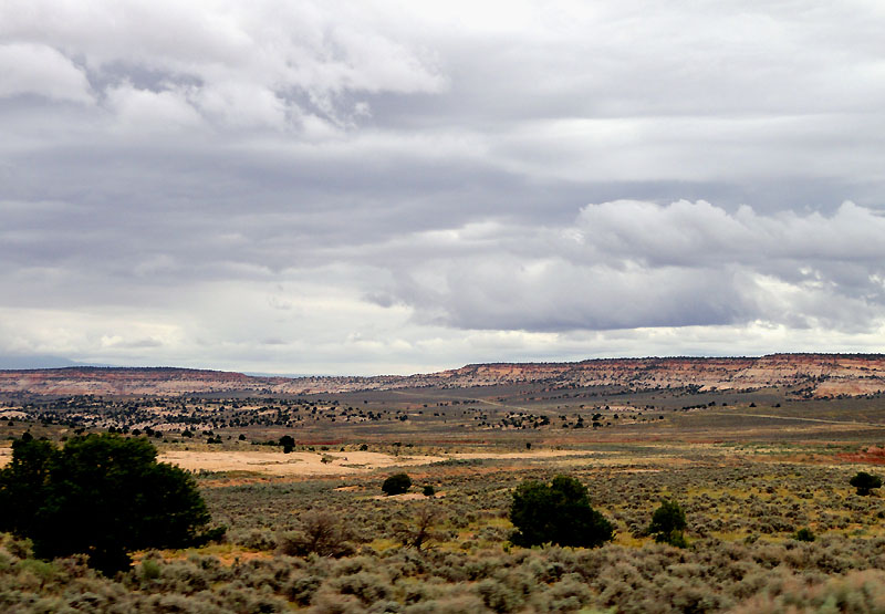
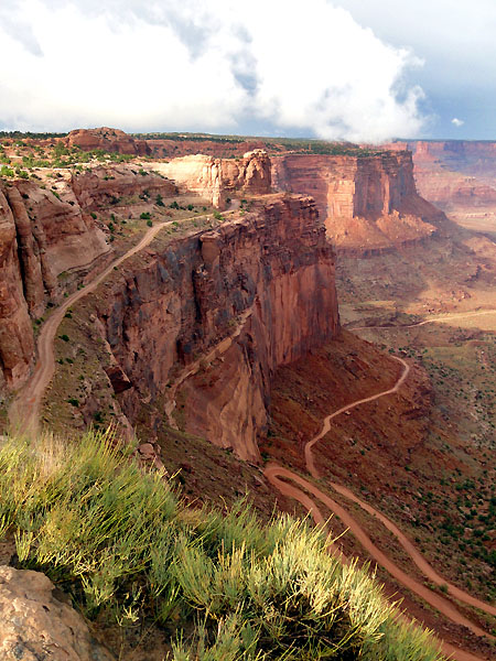
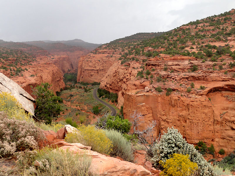
The fog lightened up a bit... this gives you an idea of the view... rain, cloud, fog, and the Shafer Trail.
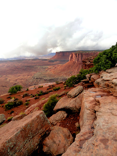
Back into the thick fog... we evidently drove past a few overlooks, not knowing there was anything to look at. I was partially driving by GPS to know what turns were ahead, we could only see about 100 feet at times. A few times I said... maybe we should turn back, there's not going to be anything to see! Luckily Megan said, we've gone this far, lets just go and see.
Luckily, about a minute before we hit the end of the road, the clouds miraculously cleared out at our level. The contrast between fog and clarity made the view that much more sweet. We hung out there for a while, drank in the views and took plenty of photos.
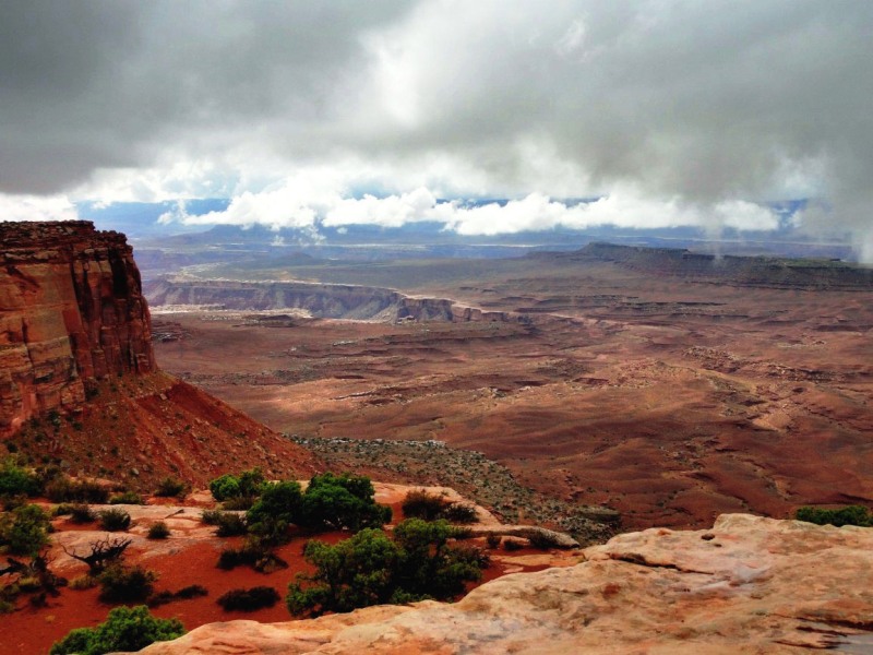
Next time we head out here, by Joe, I'm going to try to get the wife down the switchbacks so we can explore the White Rim... It looks awesome to me, however terrifying to her. We looked back at this picture later in the trip and it didn't look so bad. At least it has a shoulder!
From there, we headed to the small desert town of Hanksville, and stayed in a motel for the night due to the looming possibility of rain. If I was camping near home, I'd have said no big deal... but camping with the wife... on vacation... no need to complicate things.
Tomorrow brings a new landscape to explore.
Video from the day:
We woke early the next morning to a bit of a contrast to the night before. Clouds had rolled in overnight, the wind had picked up, and rain was threatening. Where did our good weather go?
We had a quick breakfast of pop-tarts, and while the wife was getting ready, I explored our little peninsula and grabbed a few more pictures. I've been experimenting a bit with bracketing photos and doing the HDR thing, but I've found it's absolutely critical to use a tripod. So, if any of them appear a bit blurry, that's probably why (not all photos are, but I ended up experimenting with it a good bit today).
It's hard capturing the depth of a landscape as diverse as this.
Anyways, it was time to head off and explore some more. I really wanted to spend the day going deeper into Beef Basin - at least to Bobby's hole. However, I thought it wouldn't be smart to press on with the clouds looking as they were. This was a good call in retrospect, because as we were driving back towards Moab, we looked back at the area north of the Abajos and sure enough it looked like heavy rain was falling on the basin. I confirmed that with the weather radar.
I really like this picture as we were heading out of the basin. It captured the looming cloud cover well.
Megan reluctantly stood out in the sprinkles and got a good shot of me hitting the stream crossing near the entrance to the basin. I think it was well worth it, but then again, I wasn't the one getting wet.
Upon returning to Moab, our hunger caught up with us again. This time we tried Zax, and thus started my love affair with southwest burgers (I love those green chillies!).
So we headed on to Arches (which turned out to be the busiest time of day to go), so we decided to explore some of the dirt roads in the area to escape the hordes of RVs.
I liked the depth of this image... kinda felt 3D to me. Possibly due to the slight double image on the right side foreground.
After putting around a bit, not seeing much, we decided to hack it back with the throngs of tourists. Since it was raining, we weren't in much of a mood to hike up the 3 mile hike to see the delicate arch, so we took the "medium" trail. Not very close, but we got a few snapshots anyways.
The location of the delicate arch was more impressive than anything. Its perched atop a 400 foot sheer cliff... which I hadn't before recognized from the close-in photos I've seen. We stood in wonder, while the skies spit on us, of how the heck it was formed.
I think this shot might do better as a high contrast black and white.
It started to rain harder as we got towards the truck, so we thought maybe we should try our luck in Canyonlands.
As we climbed up to the level of the Island in the Sky, we climbed into cloud cover. Great.
The fog lightened up a bit... this gives you an idea of the view... rain, cloud, fog, and the Shafer Trail.
Back into the thick fog... we evidently drove past a few overlooks, not knowing there was anything to look at. I was partially driving by GPS to know what turns were ahead, we could only see about 100 feet at times. A few times I said... maybe we should turn back, there's not going to be anything to see! Luckily Megan said, we've gone this far, lets just go and see.
Luckily, about a minute before we hit the end of the road, the clouds miraculously cleared out at our level. The contrast between fog and clarity made the view that much more sweet. We hung out there for a while, drank in the views and took plenty of photos.
Next time we head out here, by Joe, I'm going to try to get the wife down the switchbacks so we can explore the White Rim... It looks awesome to me, however terrifying to her. We looked back at this picture later in the trip and it didn't look so bad. At least it has a shoulder!
From there, we headed to the small desert town of Hanksville, and stayed in a motel for the night due to the looming possibility of rain. If I was camping near home, I'd have said no big deal... but camping with the wife... on vacation... no need to complicate things.
Tomorrow brings a new landscape to explore.
Video from the day:
Last edited:
chicken corners
Adventurer
White Rim is awesome !!!!!!
jim65wagon
Well-known member
Thank you for sharing. The photos are awesome, and it looks like you had a great trip!
HARDTRAILZ
Certified
Well Done Sir!
Adventure Jeep
Adventurer
Looks like a lot of fun and I really like the Trailblazer.
haulindave
Observer
Really great trip report . Great pics . :elkgrin: Cute wife ! More pics with her in them !
Great pics . :elkgrin: Cute wife ! More pics with her in them ! JamesDowning
Explorer
Thanks for the encouragement guys.
I've started going through some of the dash cam video, so I uploaded a quick run through of the first 3 days (getting to CO) and posted that into the first post. Not a whole lot of excitement so far, but you get a good idea of how flat the central US is. I'm hoping the remaining video will be a little more exciting...
I've started going through some of the dash cam video, so I uploaded a quick run through of the first 3 days (getting to CO) and posted that into the first post. Not a whole lot of excitement so far, but you get a good idea of how flat the central US is. I'm hoping the remaining video will be a little more exciting...
Last edited:
JamesDowning
Explorer
Added the next video for the post on the Rocky Mountain National Park.
Hoping to get back into posting more pictures once I catch up with the video.
John - 3 weeks will be nice, but I bet you'll wish you had 4... we certainly wished we had 3. Even though we saw a ton, we still felt like we passed up a good bit.
Hoping to get back into posting more pictures once I catch up with the video.
John - 3 weeks will be nice, but I bet you'll wish you had 4... we certainly wished we had 3. Even though we saw a ton, we still felt like we passed up a good bit.
Very nice. Heading that way at the end of the week!!!
JamesDowning
Explorer
Thanks! Hope you have fun! I don't think you can go out there and not enjoy yourself!
I added another video to the 1st Moab day - just 1 more to go now... then it's back to more photos and commentary. Hopefully the soundtracks I've chosen aren't too much for the videos... I hope they add a little something to the scenery and don't detract from it.
I added another video to the 1st Moab day - just 1 more to go now... then it's back to more photos and commentary. Hopefully the soundtracks I've chosen aren't too much for the videos... I hope they add a little something to the scenery and don't detract from it.
JamesDowning
Explorer
So I'm all caught up on the videos now. Hoping to get the waterpocket fold posted in the next few days.
JamesDowning
Explorer
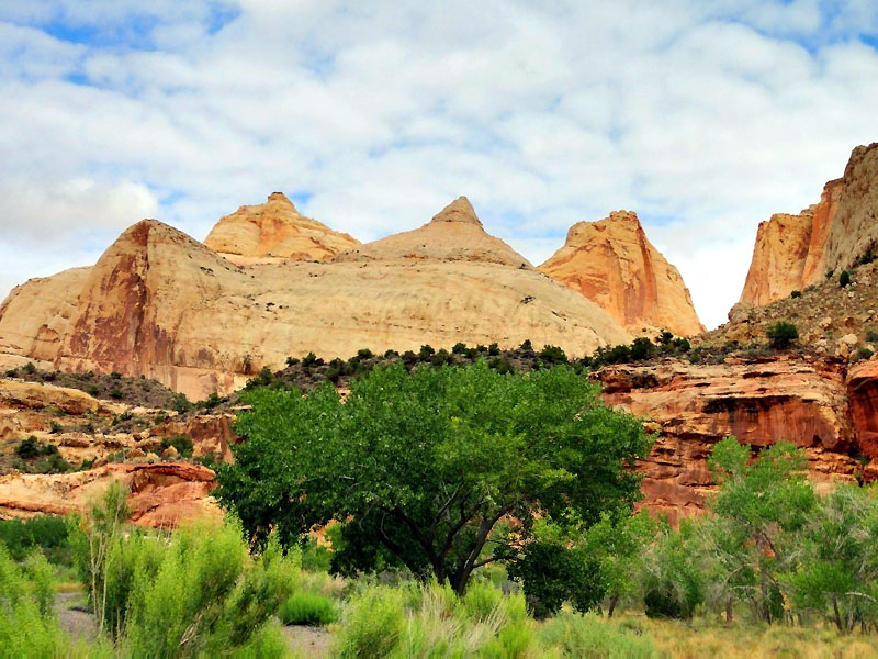
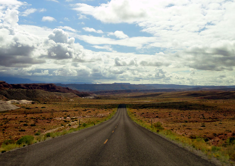
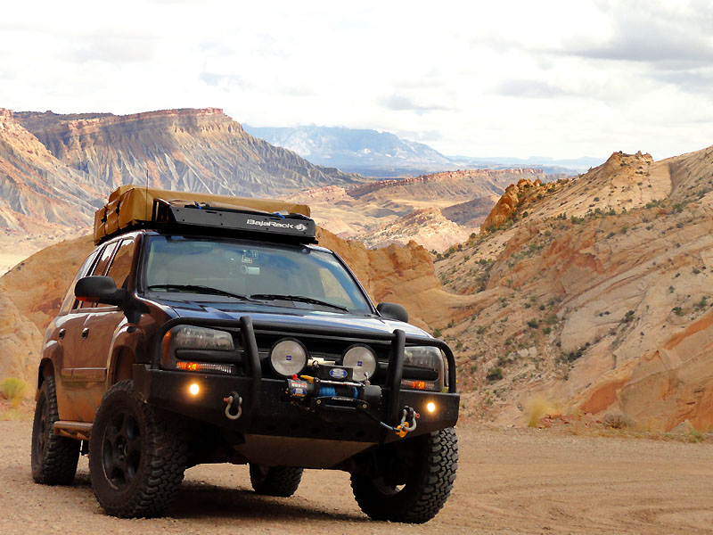
From Hanksville, we headed towards the Capitol Reef National Park. Prior to this trip, I hadn't ever heard of this park... but when I was planning my route between Moab and the GC, I stumbled upon this gem (it's no secret, but it's rather remote, so it doesn't get the same attention). So after an hour of driving through some pretty diverse landscape, we entered the park.
It was at this point that I realized I had left the key from our prior night's motel in my pocket. This was a key key too... none of that plastic stuff. So we hightailed it back to Hanksville, dropped off the key, then high tailed it back... all in all, putting us about an hour and 50 minutes behind. Oh well... just annoying.
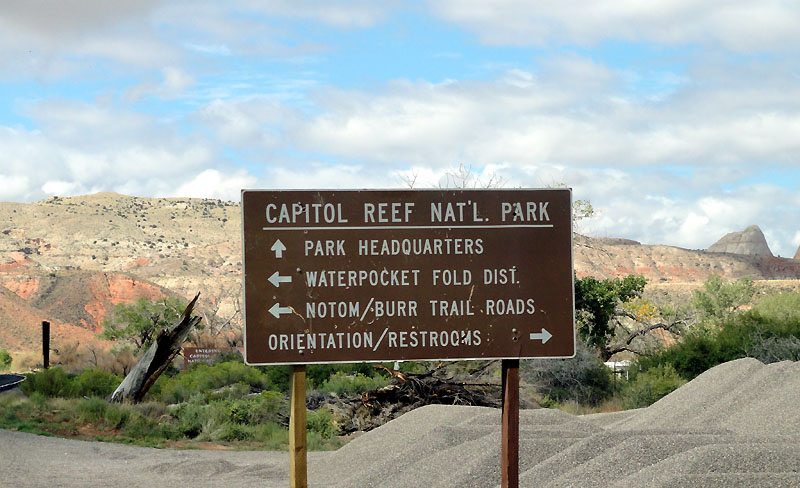
Anyways, now that we were back in the park again, we skipped some of the other parts of the park, and instead turned towards the main attraction of the day... the Burr Trail. So left we go!
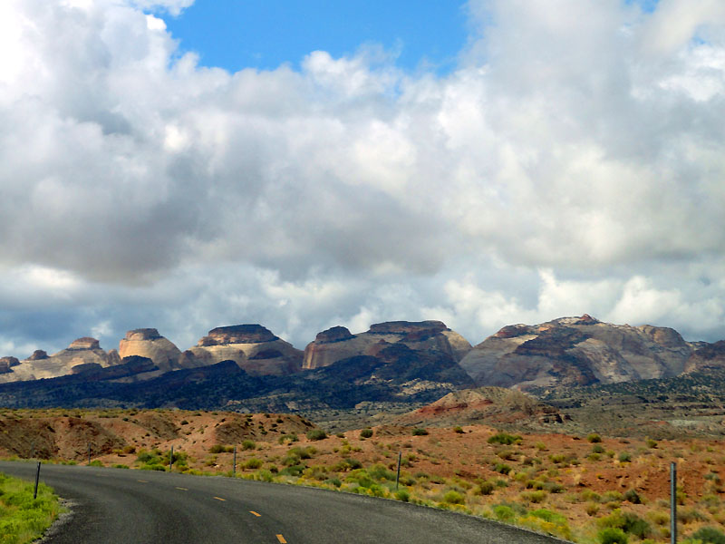
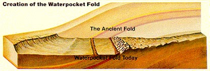
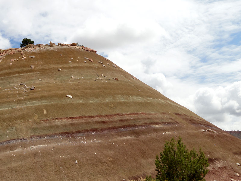
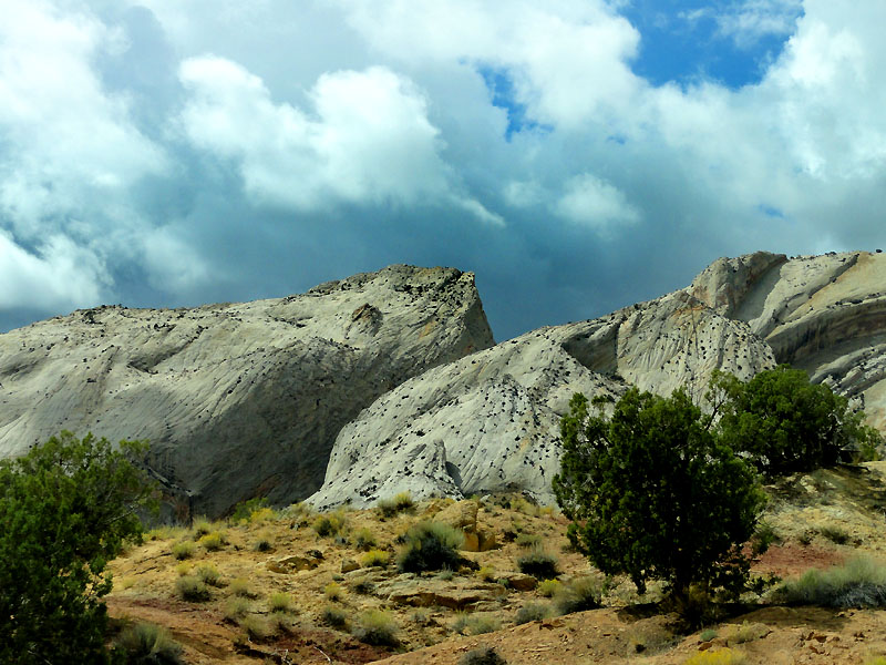
This is where we basically entered the Waterpocket Fold. The fold is a "monoclinal fold" formed from an ancient fault line. The rock layers on one side of the park have essentially been raised more than 7000 feet, and the top layers have been eroded away. So it leaves interesting linear 'stripes' of exposed rock through the area of the fold. The resulting exposed layers in the fold jut out at impressive angles, often around 45 degrees from horizontal.
This picture from the National Park Service helps explain what you'll be seeing in some of the upcoming photos.
From here, we took the Burr Trail through it's switchbacks up to the top of the monocline. You'll see a bit of these switchbacks in the video. It is an impressive road, but not very scary despite the heights. The road is well maintained and wide. I wish I had stopped at the overlook at the top, but it was occupied by another vehicle, and I don't really like disturbing other's solitude.
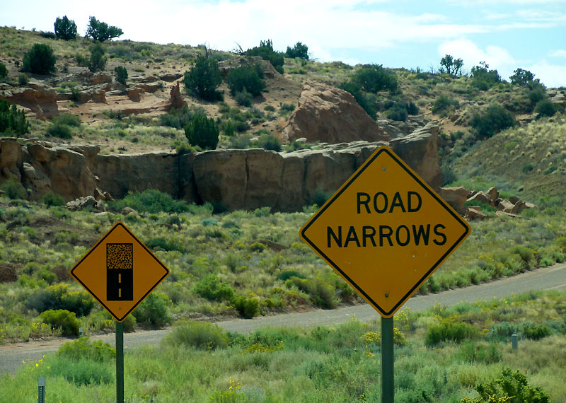
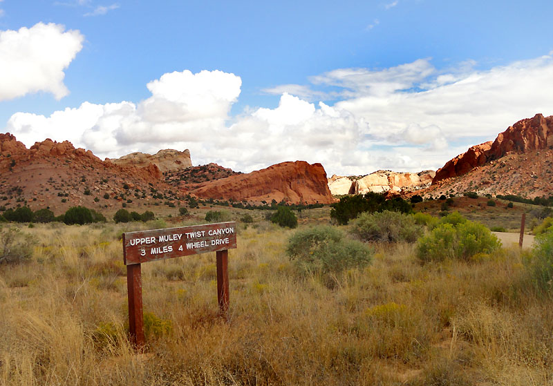
So from there, we took a side trail through the Upper Muley Twist Canyon.
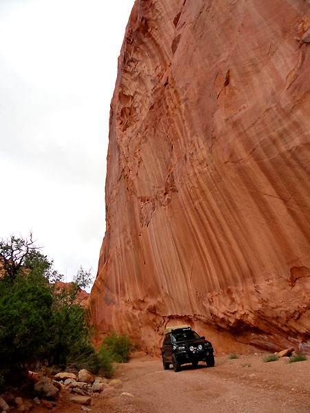
You'll see more of this road in the dash cam video, but basically it was a trail that followed a wash up to a small parking area. From there you could hike to an overlook.
We did hike out there, but by the time we got to the overlook, it was raining pretty hard, my wife was soaked, and my photos did not turn out very well. So there's no reason to include photos of that...
It was at this point that I realized I had left the key from our prior night's motel in my pocket. This was a key key too... none of that plastic stuff. So we hightailed it back to Hanksville, dropped off the key, then high tailed it back... all in all, putting us about an hour and 50 minutes behind. Oh well... just annoying.
Anyways, now that we were back in the park again, we skipped some of the other parts of the park, and instead turned towards the main attraction of the day... the Burr Trail. So left we go!
This is where we basically entered the Waterpocket Fold. The fold is a "monoclinal fold" formed from an ancient fault line. The rock layers on one side of the park have essentially been raised more than 7000 feet, and the top layers have been eroded away. So it leaves interesting linear 'stripes' of exposed rock through the area of the fold. The resulting exposed layers in the fold jut out at impressive angles, often around 45 degrees from horizontal.
This picture from the National Park Service helps explain what you'll be seeing in some of the upcoming photos.
From here, we took the Burr Trail through it's switchbacks up to the top of the monocline. You'll see a bit of these switchbacks in the video. It is an impressive road, but not very scary despite the heights. The road is well maintained and wide. I wish I had stopped at the overlook at the top, but it was occupied by another vehicle, and I don't really like disturbing other's solitude.
So from there, we took a side trail through the Upper Muley Twist Canyon.
You'll see more of this road in the dash cam video, but basically it was a trail that followed a wash up to a small parking area. From there you could hike to an overlook.
We did hike out there, but by the time we got to the overlook, it was raining pretty hard, my wife was soaked, and my photos did not turn out very well. So there's no reason to include photos of that...
JamesDowning
Explorer
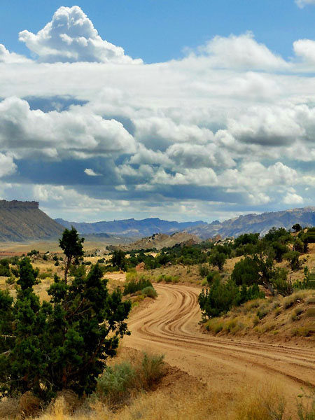
So onward we pressed, and eventually transitioned into the Grand Staircase area. I had overlooked this area in my planning, and much to my surprise, this portion of the trip was very beautiful.
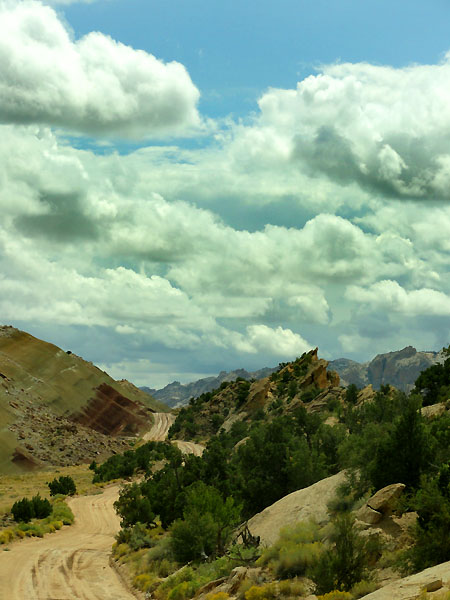
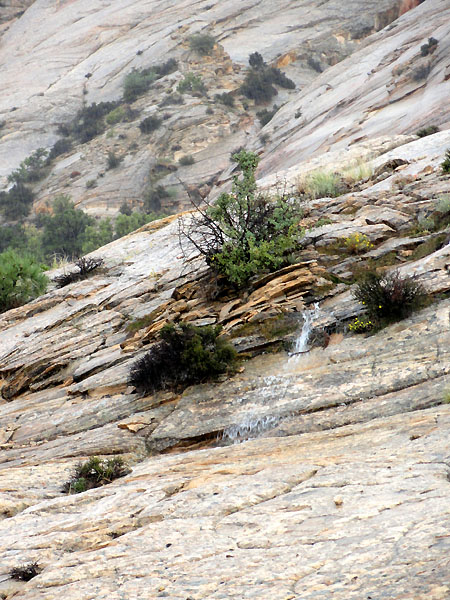
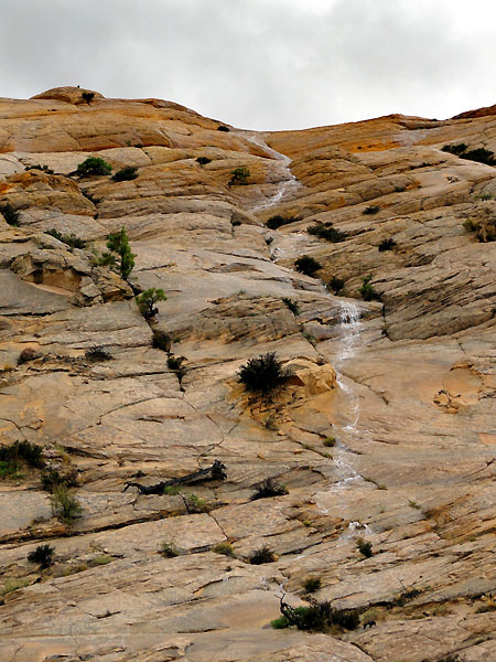
As we climbed out of the canyon, along more of the Burr Trail, we could see the rain beginning to close in.
There's still a beauty to rain in the desert, and I enjoyed all of the little waterfalls that sprang up along the rocks.
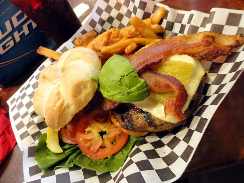
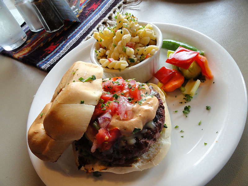
We ended the trail in Boulder, Utah and grabbed a late lunch/early dinner at the Burr Trail Grill. I really enjoyed the spicy twist on the burger. Almost everything was made local, including the beef. Megan didn't really enjoy the sauce that was on the burger - but she doesn't really like mayo-based stuff, nor raw tomatoes - and the burger was slathered in it.
The road from Boulder into Escalante is impressive. Some good drop offs along it's length - you can see some of it in the dash cam footage, towards the end. It felt much steeper while on the road, than it looks in the video.
We had planned to camp in the Dixie NF that night, but sometimes plans don't work out. The rain set into the Escalante area, and we were running ragged. So we furiously scoured the maps for a local hotel (Megan was instant that she wanted a good bed - so we agreed that a standard roadside motel just wouldn't do)... everything was booked within a 100 mile radius. I ended up finding the last room in a Holiday Inn in Kanab... a super-deluxe suite.
So we ended up spending the next two nights there, resting up before pushing on. Sometimes you just need some good rest, and a nice day to relax here and there. We had certainly been pushing it hard lately with most days spending 8 to 10 hours in the truck. So it was actually nice to sleep in and not have to go anywhere the next day. Note to self: for future trips, plan in a rest day here and there...
Here's a peek at the dash cam footage from the day, set to some more lyricless music:
Enjoy.
As we climbed out of the canyon, along more of the Burr Trail, we could see the rain beginning to close in.
There's still a beauty to rain in the desert, and I enjoyed all of the little waterfalls that sprang up along the rocks.
We ended the trail in Boulder, Utah and grabbed a late lunch/early dinner at the Burr Trail Grill. I really enjoyed the spicy twist on the burger. Almost everything was made local, including the beef. Megan didn't really enjoy the sauce that was on the burger - but she doesn't really like mayo-based stuff, nor raw tomatoes - and the burger was slathered in it.
The road from Boulder into Escalante is impressive. Some good drop offs along it's length - you can see some of it in the dash cam footage, towards the end. It felt much steeper while on the road, than it looks in the video.
We had planned to camp in the Dixie NF that night, but sometimes plans don't work out. The rain set into the Escalante area, and we were running ragged. So we furiously scoured the maps for a local hotel (Megan was instant that she wanted a good bed - so we agreed that a standard roadside motel just wouldn't do)... everything was booked within a 100 mile radius. I ended up finding the last room in a Holiday Inn in Kanab... a super-deluxe suite.
So we ended up spending the next two nights there, resting up before pushing on. Sometimes you just need some good rest, and a nice day to relax here and there. We had certainly been pushing it hard lately with most days spending 8 to 10 hours in the truck. So it was actually nice to sleep in and not have to go anywhere the next day. Note to self: for future trips, plan in a rest day here and there...
Here's a peek at the dash cam footage from the day, set to some more lyricless music:
Enjoy.