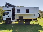
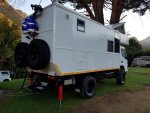
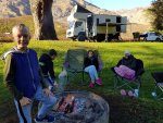
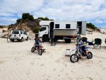
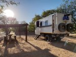
thanks so much for posting these! Love the Fuso evolution
You are using an out of date browser. It may not display this or other websites correctly.
You should upgrade or use an alternative browser.
You should upgrade or use an alternative browser.
FG adventures in Africa (photo thread)
- Thread starter Family Friendly 4x4
- Start date
Family Friendly 4x4
Adventurer
Hi Christian
It is still pretty hard to build a FG in South Africa as no rims, tyres nor suspension options are available down here. All the accessories have to come from either Australia or the States. But we are good at making a plan down here.
We do not even have the facelift FG yet as our diesel is not clean enough. Not neccessarily a bad thing when living and traveling Africa!
Sou
South West is a GREAT place to travel. Probably the best country in Southern Africa to travel around when its all weighed up (safety, quality of roads. quality of infrastructure, Nat Parks, coastline etc to name a few).
This is EXACTLY where we are planing to go once we get a rig together. That and East Africa.
Namibia June/July 2018!
So we finally managed some time off and took "Vlakvark" (Warthog in English), our aptly named FG, up and around Namibia.
We did just over 5,000km (approx 3,125 miles) over 26x days.
A good 2,500km (1,500+ miles) of this distance was done on various grades of gravel and sand roads.
Here are some photos and road descriptions for those who may plan on visiting Namibia, South West Africa (click to enlarge):
View attachment 463616
Above: No location description required, the Tropic of Capricorn runs through Namibia and almost every tourist has a picture of this marker in their album.
View attachment 463607
Above: The C13 along the Orange River from Aussenkehr in the direction Rosh Pinah, Namibia.
View attachment 463608
Above: Gamchab Canyon 4x4 dry riverbed route.
View attachment 463609
Above: The D324 between Ai-Ais Hot Springs and Hobas.
View attachment 463610
Above: More D324 as you get closer to Hobas, Namibia.
View attachment 463611
Above: On the C27 at dusk just before Sinclair Mine, Namibia.
View attachment 463615View attachment 463945
Above: Camping next to our private ablution hut in Sossus Oasis Camp at Sesriem, Namibia. The camping plots all with private ablution huts are arranged around a communial pool area in the middle of the desert!
View attachment 463613
Above: Landscape photo I took from the side of the road between Sesriem and Sossusvlei, Namibia.
View attachment 463612
Above: Another landscape photo showing the beauty of the C27 (D826) running through NamibRand Nature Reserve. Nothing but open country and some Giraffe we came accross close to the road.
.
South West is a GREAT place to travel. Probably the best country in Southern Africa to travel around when its all weighed up (safety, quality of roads. quality of infrastructure, Nat Parks, coastline etc to name a few).
This is EXACTLY where we are planing to go once we get a rig together. That and East Africa.
Family Friendly 4x4
Adventurer
Family Friendly 4x4
Adventurer
Pacific Northwest yetti
Expedition Medic
thank you for sharing! Look forward to following
Family Friendly 4x4
Adventurer
Sadly it looks like we have come to the end of the road with our FG. Not because we don't love it anymore but because it is time for an even bigger adventure to circumnavigate the world over the course of the next 5 yrs!
For a family of 4 on a global expedition we are going to need something a bit bigger.
The build of our new Iveco ML150 4x4 expedition truck has started.
Below is a cab to cab size comparrison between the 6 ton Fuso and the new 15 ton Iveco:
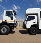

For a family of 4 on a global expedition we are going to need something a bit bigger.
The build of our new Iveco ML150 4x4 expedition truck has started.
Below is a cab to cab size comparrison between the 6 ton Fuso and the new 15 ton Iveco:


biggoolies
Adventurer
Looking forward to seeing you when you bring your new monster to Canada! 
Pacific Northwest yetti
Expedition Medic
Wow, yeah I am also looking forward to following along,
I would love to know what things you are planning on changing/ learned from?
Happy Trails & Safe Travels
I would love to know what things you are planning on changing/ learned from?
Happy Trails & Safe Travels

