Floridians do Utah (a traverse plus some other stuff)

40tude

Adventurer
As a precursor, I would like to say thank you to those who have posted trip reports and information. Sites such as expeditionportal, and expeditionutah, advrider, and Ih8mud, made this trip possible. And a special thanks to xjblue whose route I borrowed much from (the first several days) and for answering many of my questions.

D-Day (Day 1 and Day 2)
June 13, 2012 - June 14, 2012

We enter our coordinates in the driveway: Lutz, FL to Hoover Dam. 39hrs. 54mins...2542 miles to reach the starting point of our journey. This is after months and months of preparation (and lots of discussion with a worried wife) for our first real adventure. Maybe I will add a build thread at some point. Our home and life support for the next few weeks is our 20 year old Land Cruiser with 210,201 miles and the ORIGINAL HEAD GASKET!!!!! (LORD SAVE US!)
IMG_3553.JPG

Hopefully, everything is ready and we haven’t forgotten anything, the day starts out with an oil change early in the morning thanks to my father, while I went in to work. Here goes nothing.
I start the first leg of driving...I75 through the rest of FL (yay). One outstanding thing is this part of the journey was spotting a fellow Floridian in a murdered out Subaru Forester will a snorkel (AWESOME), the vehicle was also apparently protected by snapping turtles.
2012-06-13_14-35-04_958.jpg

The rest of the southeast is much the same...bugs, heat, pine trees, flat land, and more bugs. Whether it is the adrenaline (doubt it) or the thirst to get out west (too cheap to spend money on a hotel) we decide to push on through the night. The one memorable place in the southeast was the town, Grosse Teete (the name provided mild entertainment at 3 am), but memorable for all the wrong reasons. It felt like we were in a different country or maybe planet.

We kept driving westward bound. We ate at a Jack in the Box -pretty yum-in (spicy chicken sandwiches not a good idea on road trip) New Mexico. Well, we kept on driving more until we reached Petrified Forest National Park, and Mrs. 40tude was adamant on stopping even though we had just been there in March (on our trip back from buying the Cruiser is Tucson). We drove through the teepees and headed to the Crystal Forest trail.
IMG_3600.JPG

Light and easy trails, but majestic scenery. And Mrs. 40tude had to do her signature handstands every 50 feet of the trail.
IMG_3617.jpg

Again, we didn’t spend enough time there because we (I) were dead tired and just wanting to get to Utah. We drove and drove, and drove some more till we finally reached the Hoover Dam at 11:30pm. We tried to get a hotel room in the Boulder Dam Hotel, but unfortunalety there were no vacancies. After trying several other hotels and avoiding the seedy ones, we had to drive to Henderson, NV to a Holiday Inn Express for the night, or rather early morning. A rest...FINALLY!
 
Last edited:

40tude

Adventurer
Day 3 June 15, 2012
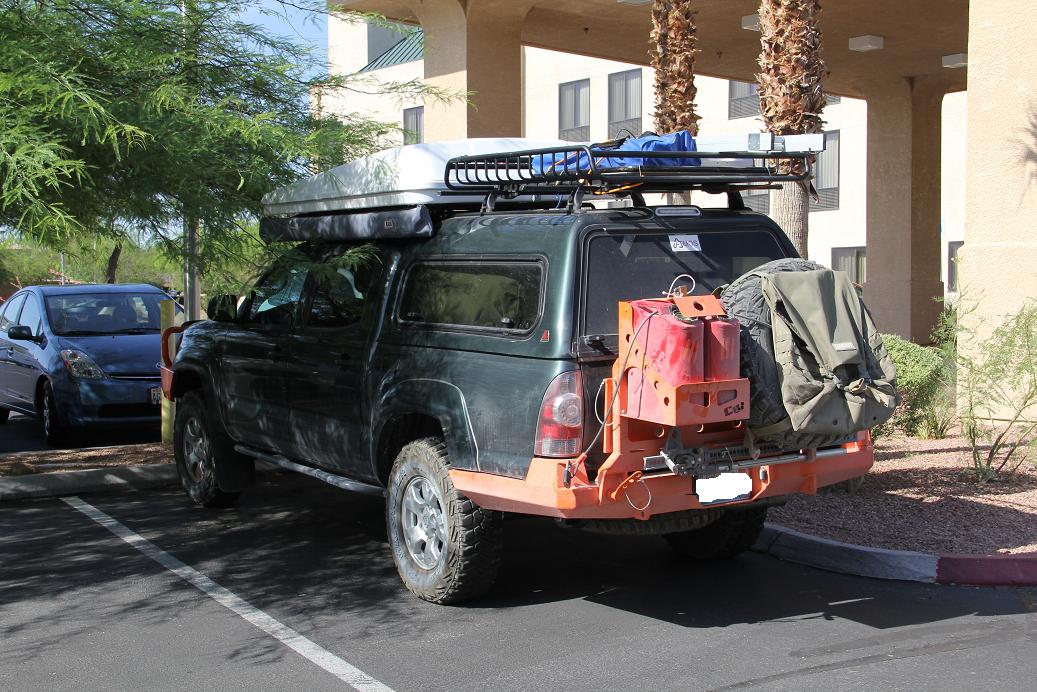
To start the day, we saw this truck in the parking lot (gotta be on Expo member), after that we made our way to the Hoover Dam.
hotel.jpg

Long story short... we got mad at the state of affairs and left disappointed but glad we can check it off the list. If you go there make sure you have used the restroom and have plenty of cold water. They charge for everything...except for the two water fountains out in the middle of the blazing sun. The water was 98.8 degrees.
hoover.jpg


Now, we were really ready to hit the dirt! This required several more hours of driving up Hwy 93 and passing through Vegas, but we made of final fuel stop at a real hidden gem if you are in the area. This Sinclair fuel station in Caliente, Nevada, doesn’t look like much from the outside, but once you get inside it a nearly as well stocked as a full on grocery store. It is a fantastic place to fill up on fuel and supplies.
sinclair.jpg

Soon we were in the dirt heading for the Utah border on Bunker Pass. One thing that quickly became apparent was how quickly and amazingly the landscape changes here. EVERYTHING CAN LOOK COMPLETELY DIFFERENT EVERY 5 MINUTES! INSANITY!

Nevada
nevada%2520rd.jpg

Going into Utah
utah%2520beginning.jpg

We soon hit the much anticipated border of which we had been dreaming for months on end.
border.jpg

We also quickly learned that all of Southern Utah is open range for cattle. Lots of roaming cows.
bull.jpg

The next goal was to find a good spot to settle in for the night. We soon ended up in a dreamscape, though the pictures are good they do not do it justice. The grasses looked like metallic silver and gold shimmering in the wind. I still can’t shake these images from my mind, easily the most beautiful thing I have seen. I am glad the sun decided to put on this performance for us.
gold.jpg

Next we passed through a Joshua tree forest, but because we were chasing daylight and knew that later in the trip we would be driving on the Joshua Tree Scenic Backway, we did not slow down and enjoy it or take the amount of pictures that we should have. I think we have 2 from the unofficial Joshua Tree Scenic road. For the record there are many more Joshua trees on Bunker pass than the Joshua Tree Scenic Backway.
joshua%2520sun.jpg

We finally found a small little spot where we could pull off the trail to set up for the first night out.
camp.jpg

1.jpg
 
Last edited:

28.

Adventurer
Awesome.. Sounds like a great trip. I just got back from Lake Powell myself. Utah is absolutely beautiful. It and Colorado are definitely on my top 5 list.. Keep posting and thnx for sharing..
 

SFROMAN

Adventurer
Nice trip report so far.
Can you post up your route or PM it to me?
I am in Florida as well and was planning to go out west in October until Uncle Sam through me a curve ball. I have a route already planned out but would like to bounce it off of yours.
 

Nomadllc

Born nomadic
Looks like fun!

Yeah, we stopped at the Hoover Dam in March, on our spring trip and I was completely appalled at what had become of the place I had visited just 12 yrs before :-/ My son actually asked me why we had to pour out all our water and throw away all our food to enter the building, thats after passing the armed security check point and paying the entry fee. That was the first talk with a six yr old about domestic terrorism. Other than that it's a cool place with lots of steps to wear out your kids!!

Ok, no more hijack, I'll be quiet and enjoy the show :lurk:
 

40tude

Adventurer
Day 4
Had a great nights sleep and woke up ready for more. We took Bunker Pass to Indian Springs trail which brought us across a great wash. There were some clouds in the sky off to the southeast, these were the only clouds we saw for the entire time we were in Utah. We could see the TV Tower Hill in the distance which was the goal for the morning.
IMG_3811.jpeg

IMG_3815.jpeg

After crossing the wash. We happened upon a cowboy on his trusty steed looking for a lost cow (apparently we are not in FL).

TV Tower Hill is a “Jeep Trail” up to the top of a hill where the television broadcast towers for St. George are located. It was fairly steep but not challenging. The views were amazing though, we could see into Arizona and Nevada from where we were, we could also see the trail we had just travelled hours across.
IMG_3833.jpeg

We then followed Hell Hole Pass until we hit Old Hwy 91 for a quick 9 mile jaunt down the pavement to the aforementioned Mojave Desert/ Joshua Tree scenic Backway.
IMG_3893.jpeg

Not too many Joshua Trees in this backway. It looked like at one time there were more Joshua trees along the route but a fire had taken many of them.

Next up was Hollow Wash Road which provided some fantastic views and some mild wheeling, St. George seemed very close in the distance but that was deceiving.

Hollow Wash Road ends up dumping you out right into the middle of a subdivision in St. George. Right along the street in the middle of the subdivision was a huge boulder covered in ancient petroglyphs.
IMG_3933.jpeg

Since we were back in civilization we decided to get a bite to eat. We stopped at a place called Irmita's which was amazingly good. Mrs. 40tude had a Hawaiian torta. If you are in St. George go here. I would eat at this place nearly every day if I lived nearby.
IMG_3941.jpeg

Next step was crisscrossing St. George to get back on the dirt. We soon found ourselves on the Honeymoon Trail (this was the path that many Mormons used to take to get married in St. George), and a sand pit of sorts. It was Mrs. 40tude's first time in sand and she proclaimed that she was stuck. I thought oh well, I will get out and assess. This is how deep she was stuck.
IMG_3950.jpeg

Mild use of the gas pedal was the emergency extraction device. We continued on until hitting Ft. Peirce. It was extremely hot at this point and the engine temps were showing it. We had to keep our speed up and AC off to keep the engine cool.

There was a sign for dinosaur tracks along the trail, but previous explorers stated that they could not find them, so we kept going.

Very soon after this we had to engage the diff locks for the first time. A tree and a boulder had fallen in the path and getting past them required some throttle and tire spin in the sand.

After feeling that we had just succeeded, we quickly got a bit lost. There were small trails in many direction and it took us nearly an hour to figure out where our route was supposed to be going- turning around, backtracking, and diverging of paths all while trying to keep the engine cool driving in the desert sands. We were a bit stressed at this point I must admit.
IMG_3979.jpeg

We found the continuation of the Honeymoon Trail. Lockers on butt cheeks clenched and go for it. Fairly loose rocks with a path not much wider than the truck and a sheer drop on the passenger side. Mormons are no joke. Period. Made it up no problem (or so I thought) the Mrs. didn't seem to be all that thrilled with being in the middle of nowhere bouncing along the edge of cliff (nothing that couldn't be cured by doing it 20 more times down the road). Anyhow we now refer to Honeymoon Trail as the Trail of Tears.
IMG_3987.jpeg

Continuing on we quickly ended up on Hwy. 59 and added another 2 miles of pavement to the day. We jumped onto the Smithsonian Butte Scenic Backway which was full of fantastic views of Zion NP.
IMG_4004.jpeg

IMG_4011.jpeg

At this point it was getting late and we knew we wanted to get going early to do the Narrows hike in Zion. Somehow we were able to get the last hotel room in Springdale at the Pioneer Lodge. (Yes I know wimpy, but it was the only hotel stay that was non emergency related.) We also decided to throw in a load of laundry because we didn't know when we would be able to next. That might have been more of a stress than the Trail of Tears...people leaving their clothes long after their load is done, coins getting stuck in the machine, and dryers not drying properly. By 11:30, we had finally done one load and hit the sack.
2.jpg
 
Last edited:

loup407

Adventurer
40tude: your report is awesome..I'm looking forward to more. We are way closer to Utah than you, but keep getting distracted by the local stuff. We are spending the month of September wandering around, and will be transiting Utah the last part of the month. If you have a route map, or other details, I'd love to see any details.
Thanks very much for a great trip report..I look forward to the rest of it.
 

1leglance

2007 Expedition Trophy Champion, Overland Certifie
This is a really fun read and some great pics.
I like your story telling style and the pics of the Mrs are a hoot.
Looking forward to the rest of the story.
 

40tude

Adventurer
Thanks for all of the kind words, I will post up some maps later in the thread, but I am not planning on posting up any gps files. There is so much information on all of the sites mentioned in the first post, which is how I planned this trip, I routed routes and contingency routes for over 50 hrs I am sure, its all part of the process. The maps and descriptions given here should make it pretty easy for you though haha.
 
Last edited:

K4CLC

New member
Love the finger pointing in the pictures to show the different locations. For some reason it reminds me of Monty Python.
 

Imnosaint

Gone Microcamping
Always fun to see someone else's perspective of our stomping grounds. Great prose and photos. I PM'd you in the event things go pear-shaped. Great adventures and best of luck. Looking forward to more posts.
 

Forum statistics

Threads
188,298
Messages
2,905,157
Members
229,959
Latest member
bdpkauai
Top