GWNF - George Washington National Forest
First off, the wife and I live in NOVA (Northern Virginia) in the Fairfax, VA area just outside the D.C. Beltway. We went on an exploration trip yesterday to stake out some possible future camping spots. We have been camping at Loft Mountain Campground, but it is always booked and quite frankly, we like our privacy as we go camping to get away from the city folks. The Shenandoah campgrounds are always full of em (no offense)…
I went and bought the Nat Geo map #791 (Staunton/Shenandoah Mountain area of Virginia) which shows this area West of Harrisonburg, VA. After browsing through multiple off-road forums over the past few weeks, we finally were ready to go explore. We packed up a cooler full of lunch goodies and our dog. Since we would be out by ourselves, I brought (2) DC air compressors, recovery bag with a few items, small tool bag, etc… We were set for our expedition. I would have liked to have a winch, but it's just not at the top of the list yet.
It is about 115 miles from our place in Fairfax, VA to Harrisonburg. We filled up our tank there and then headed up 33 into the mountains. Our route from there was as follows:
US-33 W ((A to B)about 20 miles)
Skidmore Ford Rd/Dunkle Hollow Rd (FR 227) ((B to C)about 8 miles)
Forest Road 85A ((C to D)about 0.5 miles)
**Stopped at Flagpole Knob to look around and eat lunch**
Forest Road FR 85A/85 ((D to E)about 1.2 miles)
**Stopped at Meadow Knob to look around and explore**
Union Springs Trail/Rd ((E to F)about 10.5 miles)
**This is the edge of the National Forest and the paved road started here on down**
From here, we drove about another mile down Union Springs Rd and turned left/East onto VA-742. Drove about a half-mile and turned right onto VA-743. Drove 1.3 miles and turned left onto State Road 613/Clover Hill Rd and after, 2 miles, we turned toward Harrisonburg on US-33.

We didn't get into Harrisonburg to begin with until around 12 Noon so it was a late start. I had wanted to explore some areas North of US-33, but we had a great time on our route. All in all, we probably spent about 5 hours in the woods alone as I used 4Lo most of the time. The trail was rough in a lot of areas where speed wasn't desirable. We passed 2 hunters in a pickup and car truck just past Skidmore Lake and didn't see another soul until after we at lunch and was passing the intersection where "Skidmore Fork Rd/Dunkle Hollow Rd (FR 227)" met "FR 85". There was a guy and his wife coming out in a small crossover. He told me that he wouldn't have taken his car up that trail had he known what it was like… lol. I recommended him to head SW on 85A/85 to Briery Branch Rd/924. I believe that it is paved all the way down. We then proceeded on down to Meadow Knob.
Anyway, here's the pics:
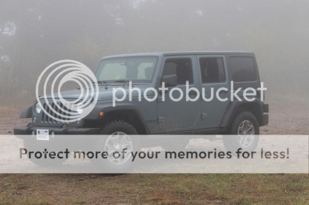
Saw this gem heading down I-81 toward Harrisonburg:

Somewhere along Skidmore Fork Rd/Dunkle Hollow Rd:


Flagpole Knob. So much for the view as we couldn't see anything with all the fog:


Found a deep puddle and decided to take it safe. It was about 30+" deep at the middle:


Meadow Knob:


First off, the wife and I live in NOVA (Northern Virginia) in the Fairfax, VA area just outside the D.C. Beltway. We went on an exploration trip yesterday to stake out some possible future camping spots. We have been camping at Loft Mountain Campground, but it is always booked and quite frankly, we like our privacy as we go camping to get away from the city folks. The Shenandoah campgrounds are always full of em (no offense)…
I went and bought the Nat Geo map #791 (Staunton/Shenandoah Mountain area of Virginia) which shows this area West of Harrisonburg, VA. After browsing through multiple off-road forums over the past few weeks, we finally were ready to go explore. We packed up a cooler full of lunch goodies and our dog. Since we would be out by ourselves, I brought (2) DC air compressors, recovery bag with a few items, small tool bag, etc… We were set for our expedition. I would have liked to have a winch, but it's just not at the top of the list yet.
It is about 115 miles from our place in Fairfax, VA to Harrisonburg. We filled up our tank there and then headed up 33 into the mountains. Our route from there was as follows:
US-33 W ((A to B)about 20 miles)
Skidmore Ford Rd/Dunkle Hollow Rd (FR 227) ((B to C)about 8 miles)
Forest Road 85A ((C to D)about 0.5 miles)
**Stopped at Flagpole Knob to look around and eat lunch**
Forest Road FR 85A/85 ((D to E)about 1.2 miles)
**Stopped at Meadow Knob to look around and explore**
Union Springs Trail/Rd ((E to F)about 10.5 miles)
**This is the edge of the National Forest and the paved road started here on down**
From here, we drove about another mile down Union Springs Rd and turned left/East onto VA-742. Drove about a half-mile and turned right onto VA-743. Drove 1.3 miles and turned left onto State Road 613/Clover Hill Rd and after, 2 miles, we turned toward Harrisonburg on US-33.
We didn't get into Harrisonburg to begin with until around 12 Noon so it was a late start. I had wanted to explore some areas North of US-33, but we had a great time on our route. All in all, we probably spent about 5 hours in the woods alone as I used 4Lo most of the time. The trail was rough in a lot of areas where speed wasn't desirable. We passed 2 hunters in a pickup and car truck just past Skidmore Lake and didn't see another soul until after we at lunch and was passing the intersection where "Skidmore Fork Rd/Dunkle Hollow Rd (FR 227)" met "FR 85". There was a guy and his wife coming out in a small crossover. He told me that he wouldn't have taken his car up that trail had he known what it was like… lol. I recommended him to head SW on 85A/85 to Briery Branch Rd/924. I believe that it is paved all the way down. We then proceeded on down to Meadow Knob.
Anyway, here's the pics:
Saw this gem heading down I-81 toward Harrisonburg:
Somewhere along Skidmore Fork Rd/Dunkle Hollow Rd:
Flagpole Knob. So much for the view as we couldn't see anything with all the fog:
Found a deep puddle and decided to take it safe. It was about 30+" deep at the middle:
Meadow Knob:


