HEMA Maps App. for iPad & iPhone.

FlyNdrive

Adventurer
At OE I met with Rob Boegheim with HEMA and he mentioned that "there's was an App. for that". JK.... I had to do it. He said the HEMA App. Would be out in a month or so. I was searching the App. Store and to my surprise it actually came out a few days after OE. I downloaded it for $9.99 and for that it comes with a US road map like the printed HEMA map & GPS companion.

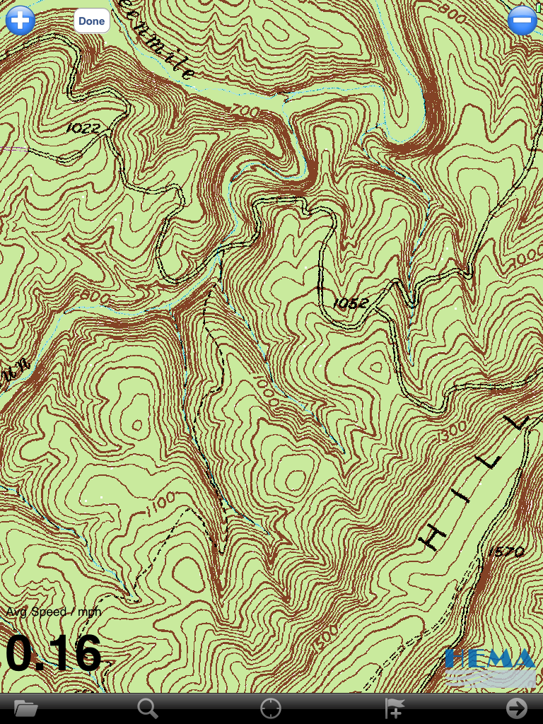
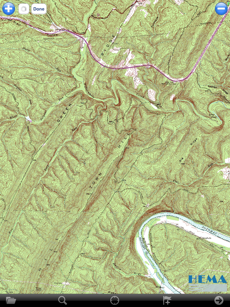
It is labeled as the HEMA US Road Atlas, but after reading about it I was able to download the MD, PA, DE, & VA 1:24000 maps. They downloaded in about 2 Min and I will test them out tomorrow when I head out to Green Ridge State Forest for a little wheel time.

I'm just reading the description now and it mentions you can add not just the topographic maps, but Marine charts as well from the Digital Maps Shop. It also has the ability to work with external GPS antennas.

I will let you know how it goes. I stto some screenshots, but my Photobucket App. Is a little slow today.

-Ben

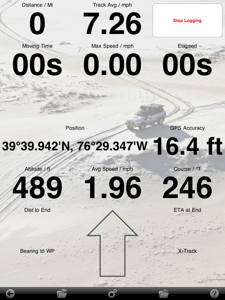
Edit: OK was able to upload screenshots.
659032c5.png


dad49b80.png
 
Last edited:

FlyNdrive

Adventurer
Sorry for not replying sooner.

Yes, the state maps were free. You can download them before you go and they are quick to load. When zoomed out is shows the roadmap and when you draw in it automatically switches to the topo map. They are the scanned maps common with OZ Explorer like on the HEMA Navigator.

I used it this weekend and all the trails traveled were on the map, but the day was cut short with a vehicle malfunction.

I love it and it is definitely worth the $10 spent.
 

Dust999

Observer
How do you get the topo maps for free? When I download its asks for the demo activation, and then its free for 10 days. Thereafter its 9.99 per map it seems??

I also find the app quite 'clunky' and not very friendly to use. On the plus side, if you want to track your position on the atlas maps its ok. Like having the Hema road atlas on your lap, only with your position shown.

GAIA works better for me for topo map detail.
 

Rando

Explorer
I downloaded Hema maps for ipad and am also a bit disappointed. It does not appear that the fine scale maps are included in the purchase price (please correct me if there is a way). The app itself is OK, but in a lot of ways it is really just an image viewer for the US road atlas. The road atlas is also OK, fine for larger scale trip planning purposes, but not enough detail for exploring off of state highways. The city map insets are only marginally useful.

Overall the atlas is not really much better than a standard $5.99 road atlas you would buy from Rand-Mcnally of AAA. Certainly not up to the standards of a gazetteer, let alone a topo map. However if that is what you are after this app works just fine.

On the other hand the Topo Maps application and Gaia are both fantastic on the ipad - much more usable than on an iphone.
 

off-roader

Expedition Leader
On the other hand the Topo Maps application and Gaia are both fantastic on the ipad - much more usable than on an iphone.
Does Gaia require a 3g ipad to download maps when you zoom in? I tried the Lite version and when I switched off my Wifi, it sort of froze map updates... :(
 

Ludedude

Adventurer
Does Gaia require a 3g ipad to download maps when you zoom in? I tried the Lite version and when I switched off my Wifi, it sort of froze map updates... :(

You can download maps to the device then you can zoom to your heart's content without a 3g or wifi connection. Gaia and MotionX both have the ability to do this.
 

off-roader

Expedition Leader
You can download maps to the device then you can zoom to your heart's content without a 3g or wifi connection. Gaia and MotionX both have the ability to do this.

What would be the process to download a hi res map of California or Utah for example?

I'm asking because what I saw was when I zoomed in, it took some time to refresh the screen but it looked beautiful afterward. Do I have to do the same process for the entire state to get the high resolution maps prior to disconnecting from the net?:confused:

TIA!
 

Rando

Explorer
I have the paid version of Gaia, so I can't speak to whether this would work on the lite version, but there is an icon in the top right corner to download maps. You click the icon then select an area of maps you would like to download, select the zoom level you would like and it downloads them for offline use. It is somewhat simpler than the Topomaps download procedure. I have not tried to download more than a few hundred square kilometer area, so I don't know how well it would work for a whole state. It is a little slow to download, even on 12 mb wireless internet.

For $12.99 and $7.99 respectively, Gaia and Topomaps are exceptional value.

Any suggestions for a good quality on road navigation app? I have tried NavFree and was less than impressed.


What would be the process to download a hi res map of California or Utah for example?

I'm asking because what I saw was when I zoomed in, it took some time to refresh the screen but it looked beautiful afterward. Do I have to do the same process for the entire state to get the high resolution maps prior to disconnecting from the net?:confused:

TIA!
 

off-roader

Expedition Leader
I have the paid version of Gaia, so I can't speak to whether this would work on the lite version, but there is an icon in the top right corner to download maps. You click the icon then select an area of maps you would like to download, select the zoom level you would like and it downloads them for offline use. It is somewhat simpler than the Topomaps download procedure. I have not tried to download more than a few hundred square kilometer area, so I don't know how well it would work for a whole state. It is a little slow to download, even on 12 mb wireless internet.

For $12.99 and $7.99 respectively, Gaia and Topomaps are exceptional value.

Any suggestions for a good quality on road navigation app? I have tried NavFree and was less than impressed.

Thanks for the insight on the download process. I'll try it in a bit when my iPad is recharged LOL.
Honestly I prefer my Tom Tom for on road duties versus my difficult to hear, iPad.:ylsmoke:
 

chet

island Explorer
I tried navfree as well and was less than impressed. I am using co pilot right now and it seems alright. You can try it free for 30 days.
 

Forum statistics

Threads
188,334
Messages
2,905,566
Members
229,959
Latest member
bdpkauai
Top