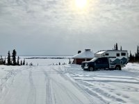
Ice, Ice, Baby 2025

NOPEC

Well-known member
For any fans of the TV show Ice Pilots NWT, we saw the Buffalo Air C46 Curtis Commando coming in to Hay River. It was too distant for a decent photo so I borrowed this from flickr, but the noise of those radials is mighty impressive.

View attachment 873445
So you guys were down by the Airport. The lake is looking considerable less "liquid" than when were there in August! Our friend has the small airline compound right behind the airport terminal parking and we have left our vehicle there a couple of times. Sure fun to walk around all those old "for Parts" Buffalo air rigs. neat open air museum. Those radial engines are amazing!

To bad I wasn't following your timing a bit closer as I could have got you a nice spot in town with a pad and shorepower and some northern hospitality in the form of a couple of monster slabs of lake whitefish from the barby, yup, even at -30!!

Looking forward to following along!! NOPEC
 

Trail Talk

Well-known member
To bad I wasn't following your timing a bit closer as I could have got you a nice spot in town with a pad and shorepower and some northern hospitality in the form of a couple of monster slabs of lake whitefish from the barby

Oh yeah, now you tell us! Any similar arrangement at Ft Simpson?
 

Trail Talk

Well-known member
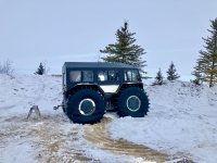
Watched a school group enjoying rides along the beach in this Sherp, cool!

IMG_6193.jpeg

After leaving Hay River we passed the turn-off for Yellowknife and entered new territory for us. Endless miles of burned forest but also new growth. Arrived Fort Simpson at the confluence of Mackenzie and Liard Rivers.
IMG_6205.jpegIMG_6200.jpegIMG_6203.jpeg

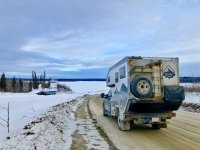
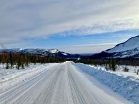
The road was a mixed bag of gravel and paved, bare and ice covered. Tomorrow we enter onto the winter road for Déline, which claims to be the birthplace of hockey.
 

Trail Talk

Well-known member
Oh boy, did I overestimate our rate of travel on the Mackenzie winter road. This nap-of-the-earth track goes up and down creeks around and over muskeg and we are lucky to average 40 kph. Here we are approaching our second Xing of the frozen Mackenzie.

9639886C-7EAB-408A-A1BE-F0E8F9993738.jpeg

The end result after a full day of driving is that we are camped in a roadside pullout on top of a big hill outside of Tulita NWT, two hours short of Déline. No bother, we have an expansive view all around and can even pick up cell service from town.

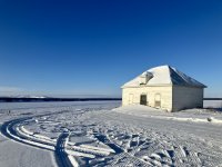
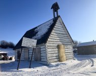
Predicted snow overnight didn’t materialize and we had sunny skies for our visit to Tulita. The old Hudsons Bay post and church still stand sentinel over the river.

5B5AEF4C-AFAE-426D-BF7B-28484CFBB7E7.jpeg

5BF4D85E-EA7F-4ACC-85D8-BAED356D778C.jpeg

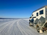
The exit from Tulita is along an ice road then back up onto the tundra.

959A02AB-4543-432B-A1A1-AF0488E9EE89.jpeg
CA3583FB-B0CC-41B9-95C9-DE02AE6F63A1.jpeg

Mid-afternoon today we landed in Norman Wells and the most expensive gasoline around. No matter, the locals were so welcoming. We were invited to use the rec centre showers and visitors centre to boondock, complimentary wifi included. Tomorrow the Arctic Circle.

6D4FB260-A1A8-4B1F-91F8-2AC6C1729547.jpeg1B88C805-C26D-4C98-AACA-B4CC02EDF391.jpeg

Déline will Wait for the return trip South.
 

Attachments

  • 15388767-A921-4140-A366-22B7574D3D4B.jpeg
    15388767-A921-4140-A366-22B7574D3D4B.jpeg
    379.4 KB · Views: 3

NOPEC

Well-known member
Oh boy, did I overestimate our rate of travel on the Mackenzie winter road. This nap-of-the-earth track goes up and down creeks around and over muskeg and we are lucky to average 40 kph. Here we are approaching our second Xing of the frozen Mackenzie.

View attachment 873708

The end result after a full day of driving is that we are camped in a roadside pullout on top of a big hill outside of Tulita NWT, two hours short of Déline. No bother, we have an expansive view all around and can even pick up cell service from town.

Predicted snow overnight didn’t materialize and we had sunny skies for our visit to Tulita. The old Hudsons Bay post and church still stand sentinel over the river.

View attachment 873709

View attachment 873711

The exit from Tulita is along an ice road then back up onto the tundra.

View attachment 873712
View attachment 873713

Mid-afternoon today we landed in Norman Wells and the most expensive gasoline around. No matter, the locals were so welcoming. We were invited to use the rec centre showers and visitors centre to boondock, complimentary wifi included. Tomorrow the Arctic Circle.

View attachment 873714View attachment 873715

Déline will Wait for the return trip South.
Looking Great! We have been watching the temps so looking pretty good. Nice to see some sun and blue sky!

Dean, On a semi-relative note to "Ice,Baby,Ice" and not to highjack your thread :) but we got some great news tonight. Our friends just did the 140 km return sled trip across to the north arm of Great Slave Lake and were able to find our kayaks and all of our gear and have taken it back to Yellowknife. Just for general info, this stuff was abandoned last summer on day 68 of what became an aborted attempt (it's a long story...) to circumnavigate Great Slave Lake. I'll do a separate post on the trip here on EP but we are so stoked I couldn't resist shooting you a message!!!

1000025306.jpg

1000025270.jpg
 
Last edited:

Trail Talk

Well-known member
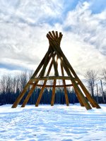
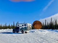
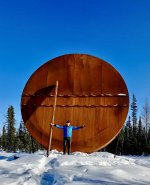
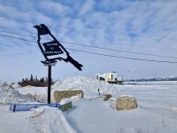
Made it to the Arctic Circle! This 19 ft hand drum was erected in 2021 to mark the only place in NWT where the arctic circle can be reached by road, albeit a seasonal road only accessible in winter.
F3F6A317-2E24-43AB-9CE3-37BDFA2C8BC2.jpeg35F6B2D4-9D37-4254-BFAA-31DCB8EA8365.jpeg
We will now turn south in a race to stay ahead of the various winter road closures predicted to commence in a week. Will take tomorrow as an enforced day off however, gasoline is unavailable up here on the Sabbath.
36ACCAB0-92A9-4927-99E4-917DE38F1DE5.jpeg
 

Trail Talk

Well-known member
A few observations on driving the Mackenzie Heritage Trail, generally applies to most winter roads.
1. LADD Ch.1 comms is very useful to call out location and direction when approaching blind hills and single lane bridges. These roads exist for winter resupply and semis should be expected anywhere at anytime. They are also very friendly, we often chatted about road conditions.
2. The winter road is roughest up to Norman Wells and improves as you go further North due to diminishing traffic. The most enjoyable section for us was the Colville Lake portion, a rollercoaster but very scenic.
3. Many short portions are steep, sharply curved, and off-camber so a well balanced rig is critical. High CG would be rather perilous!
4. Although my photos make it seem like a wide plowed track, you cannot trust the shoulders. They are soft and deep, will pull you off in a heartbeat. There were numerous craters where semis became embedded and we witnessed a road grader retrieving one pickup from the banks, and a few more vehicles just abandoned.
5. Obtaining gas is a logistical challenge. No one North of Ft Simpson sells on a Sunday. Furthermore, each community has different prices and hours. Locations are not accurately marked on Google Maps (surprise) so we just asked the first person we met. Sometimes you might have to telephone the operator and wait a short while, phone numbers are displayed. If you are desperate and outside the posted hours, a $50 callout fee will get service.
6. Your navigator can be an important asset to scan ahead for the telltale snow cloud or headlights of approaching traffic while the driver concentrates on the road immediately in front. Right seat responsibilities also included radio comms and wildlife scanning (our highlight was a lynx with two kits).
7. Boondocking outside of towns is straightforward, just don’t drive down any side road without evidence of previous traffic or you might not get back out. In larger towns, we attempted to contact the tourism or town office for advice/permission. Smaller hamlets won’t have these facilities and to avoid causing any concerns we will choose a spot out of town.
8. Fibre optic internet has arrived and strong local cell coverage (3G at minimum) can be expected in the vicinity of settlements but not inbetween so have you hardcopy and offline maps prepared.

The communities along the Mackenzie Heritage Trail are curious and welcoming of visitors. They are also cautious of covid and flu being brought in, which tempers hospitality a bit. Local leaders express a desire for the economic rewards of tourism so we try to talk up the basic needs of remote RV travel, ie, fuel, water, garbage disposal.
 

NOPEC

Well-known member
A few observations on driving the Mackenzie Heritage Trail, generally applies to most winter roads.
1. LADD Ch.1 comms is very useful to call out location and direction when approaching blind hills and single lane bridges. These roads exist for winter resupply and semis should be expected anywhere at anytime. They are also very friendly, we often chatted about road conditions.
2. The winter road is roughest up to Norman Wells and improves as you go further North due to diminishing traffic. The most enjoyable section for us was the Colville Lake portion, a rollercoaster but very scenic.
3. Many short portions are steep, sharply curved, and off-camber so a well balanced rig is critical. High CG would be rather perilous!
4. Although my photos make it seem like a wide plowed track, you cannot trust the shoulders. They are soft and deep, will pull you off in a heartbeat. There were numerous craters where semis became embedded and we witnessed a road grader retrieving one pickup from the banks, and a few more vehicles just abandoned.
5. Obtaining gas is a logistical challenge. No one North of Ft Simpson sells on a Sunday. Furthermore, each community has different prices and hours. Locations are not accurately marked on Google Maps (surprise) so we just asked the first person we met. Sometimes you might have to telephone the operator and wait a short while, phone numbers are displayed. If you are desperate and outside the posted hours, a $50 callout fee will get service.
6. Your navigator can be an important asset to scan ahead for the telltale snow cloud or headlights of approaching traffic while the driver concentrates on the road immediately in front. Right seat responsibilities also included radio comms and wildlife scanning (our highlight was a lynx with two kits).
7. Boondocking outside of towns is straightforward, just don’t drive down any side road without evidence of previous traffic or you might not get back out. In larger towns, we attempted to contact the tourism or town office for advice/permission. Smaller hamlets won’t have these facilities and to avoid causing any concerns we will choose a spot out of town.
8. Fibre optic internet has arrived and strong local cell coverage (3G at minimum) can be expected in the vicinity of settlements but not inbetween so have you hardcopy and offline maps prepared.

The communities along the Mackenzie Heritage Trail are curious and welcoming of visitors. They are also cautious of covid and flu being brought in, which tempers hospitality a bit. Local leaders express a desire for the economic rewards of tourism so we try to talk up the basic needs of remote RV travel, ie, fuel, water, garbage disposal.
Excellent advice for/from the north! where are you cooling your heels waiting for fuel?
 

Trail Talk

Well-known member
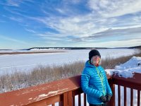
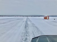
Finally! Arrived Déline after 6 km crossing of the Great Bear Lake.

86EA40CC-CDA0-4524-A1AF-9F06D7EDF2DA.png

We were a bit nervous seeing a large portion of open water but apparently it has always been like that throughout the winter.

IMG_6269.jpeg

This town is bustling! Went first to the town office who were at a loss on what to do with tourists and sent us over to the Parks Canada office. There I met the rudest staffer so far in our journey. With obvious distain, she nodded in some direction and told us to find the Economic Development building, then took her coffee cup off to some meeting.

OK, maybe third time lucky? Not so, we promptly got stuck while turning around. Note to self: snowmobile trails are not roads. Now the pendulum swings the other way; a couple of fellows from the town maintenance dept gave us a pull back on to the actual road. They discussed where we would most enjoy camping the night and one guided us to a wonderful site overlooking the lake.

IMG_6272.jpeg

After we set ourselves up, this gentleman returned with a ginormous front-end loader to “tidy up” our parking spot. I gratefully declined as we were already level.

Tonight I will review Sir John Franklin’s journals of his second Arctic land expedition from 1825 to 1827. Tomorrow we visit the site of Fort Franklin itself.
 
Last edited:

Forum statistics

Threads
189,017
Messages
2,911,984
Members
231,545
Latest member
JPT4648
Top