Get your tickets to THE BIG THING 2026!
You are using an out of date browser. It may not display this or other websites correctly.
You should upgrade or use an alternative browser.
You should upgrade or use an alternative browser.
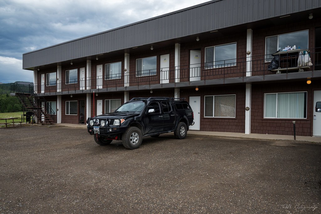
"Lola" - WreckDiver1321's 2005 Frontier CC/SB Nismo Build and Adventure Thread
- Thread starter wreckdiver1321
- Start date
wreckdiver1321
Overlander
:beer: Mazel tov :beer:!
Looks like y'all had a beautiful wedding. Good stuff man.
Thanks man!
It was a really great day. Oh! I totally forgot to mention this: I had to use my winch on my wedding day!
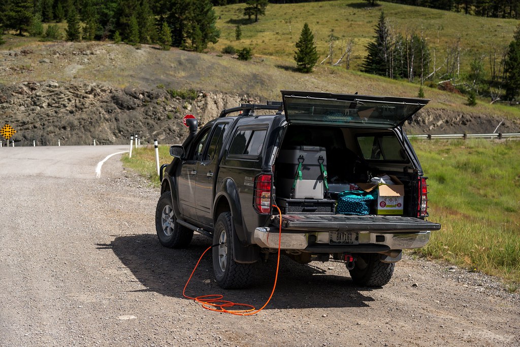
It's a long drive from the highway to the wedding venue, and the road passes several turnoffs that might make it kind of confusing. So, to minimize the confusion, we made a few painted signs to point people in the right direction. On one particular crossroads, we wanted to put up a sign but didn't have anything to anchor it to in between the two roads. On the far side, down a hill, was a large chunk of a dead tree. Thinking that was what we needed, I hooked my winch to the trunk and dragged it across the road before rolling it into place and securing the sign to it.

I'll update the OP with that bit.
bijanjames
Adventurer
Congratulations Tom. Already looking forward to our Morrison Jeep Trail adventure! It would be awesome if we could get a group from the forum to come along.
wreckdiver1321
Overlander
Excellent report, and congrats again on the marriage!
Although, I wish you could have grabbed a few shots of the grizzlies, I'm jealous as I've never seen one in the wild....
Thanks Josh! It was a good day, and we're pretty excited about the things to come. Hopefully you get to meet her next NWOR we attend. Or if you ever get your butt out this way :sombrero:
I know, it was awesome to see but I never got any great shots of them. Don't have the right lens for that duty. I'll tell them to stand closer next time.
Congratulations bud! What an epic honey moon! Glad to have you back giving your great reports.
Thanks! It's good to be back. It was a heck of a trip. Don't know if you knew, but Bijan (silver Frontier, posted right below you) is moving to Bozeman this coming year and he wants to make a run at Morrison. I'm thinking it might be a good plan to attempt Goose in the same run, depending on how everyone feels about it.
Congratulations Tom. Already looking forward to our Morrison Jeep Trail adventure! It would be awesome if we could get a group from the forum to come along.
Thanks Bijan!
I'm really looking forward to it too. I've been thinking about it for a while. I have a friend that recently bought a gen 2 4Runner and is getting it prepped for overland exploring by next summer. He really wants to do Morrison with us. I was also thinking we could consider Goose Lake at the same time. They're in the same neighborhood
Also, MTaco (posted above you) lives in Billings and we've been talking about doing Goose and Morrison for a little bit. I'm sure we could rope him into attending. And gophere, who posts on here, lives near Missoula. He said to me he wanted to do Goose too. So I have a bunch of people that have wanted to do some runs in that area already. Should be fun if we can organize it all. Might have to start a thread and get people involved.
wreckdiver1321
Overlander
A (Sort Of) Overland Honeymoon - Part 2
After eating and filling up on water, we began our descent at about 2:30, planning on a relatively easy hike down to the parking area and back to the truck. This turned out to be a bad assumption. The trail quickly turned quite steep, descending at an extremely fast pace. To exacerbate the situation, the ground we were walking over was loose and occasionally rocky as we hiked through the forest. As we were alone in the woods, a deer darted from his hiding place just a few feet away, which was a cool experience. The forest we were hiking through was a little thin, but there was enough cover to keep the sun at bay. Despite that, the park was beginning to really heat up in the afternoon sun.
We continued walking through the forest when around 3:00 things went from bad to worse. We broke out of the trees and into a clear burned area with zero cover. The sun began beating down on us as the temperature climbed to it's apex at 102 degrees. To add to the problem, we quickly entered an area of lush undergrowth, where thick bushes were growing about four feet tall. This made the hike very humid, which made the already hot weather worse. On top of all that, we were still battling the steep decline. Needless to say, we were going through water fast.
As the trail descends, it never really lets up. You get teased with a brief view of the parking lot before being turned far away from it. You actually end up hiking about a mile away from it, just to turn back and hike the remaining mile back to it. It's very disheartening. We eventually made our way to the bottom of the steepest part, only to be swallowed by thicker and more humid undergrowth. After a while, the trail evened out, but the heat and humidity persisted. It was tough going. We passed a poor park ranger who had to hike the steep portion of the trail uphill to make sure no one was in real danger in the heat. Shortly after, the trail began to climb again. It was about this point I ran out of water. Luckily Beret had a bit left to share, and it was only about a third of a mile before we climbed the last hill, broke out of the undergrowth, and found our way to the parking lot again.
I had burned through half my Camelbak on the 7.6 miles from Logan Pass to Granite Park Chalet, about 1.5 liters. From the Chalet I made it 3.7 miles on 3 liters. It was hot, muggy, and miserable. But we had done it. 11.6 miles, point-to-point, taking in the best scenery Glacier National Park had to offer. Talk about a bucket list item we can check off.
Approaching the truck, we began to feel pretty bad. We climbed in and made the drive to McDonald Lake Lodge, passing an overland equipped Taco and a genuine Camel Trophy Disco on the way. Super cool! We pulled into the parking area at the Lodge, where Beret went into the general store and brought high-protein snacks and Gatorade to recover from the heat and exertion. Waiting for her to check out, I noticed my hands had swollen to the point my ring was immobile and the rubber strap on my watch was a little stretched.
After picking up some sustenance, we pulled into a parking spot by the lake shore and dipped our feet in the water for a short while. We opted to grab dinner at Apgar Village and do a little bit of walking around there before retiring early to our "hotel" and taking a shower. While she found a bathroom, I bought a T-shirt at one of the many trinket shops, as the shirt I was wearing stank to high heaven after the blistering afternoon. We eventually found our way to the restaurant there (the name eludes me) and had a really delicious dinner. It could have tasted terrible, we probably didn't even notice. We were happy to be relaxing and enjoying the cool weather and great views of the late afternoon.
After spending a little time in Apgar, we left the park and filled up at the gas station in West Glacier before driving back towards Coram. On the way, we remembered our awful experience at the border last year and decided to drive down to Columbia Falls to wash the truck before making for the border the next day. We also bought a few jugs of water that we figured we'd need that night.
After arriving back at Under Canvas and taking a shower, we decided to make our way down to the fire. At Glacier Under Canvas, there is a communal fire where travelers from all over can congregate and talk. We were fortunate to meet some great people from Alabama, New York, San Diego, and even a couple from Sweden. Since we had seen much of the park from previous visits before, we were picked for knowledge, which we happily gave. After an hour or so of new friendships, we made our way to the tent, exhausted and still a bit dehydrated.
The next morning we woke early and packed quickly. We checked out and drove into West Glacier, where we ate breakfast at the restaurant there in preparation for our border crossing, knowing we had a long driving day ahead of us and we probably wouldn't get lunch. After eating, I quickly checked my tire pressures and we opted to go over Going-to-the-Sun Road one last time on our way to Waterton. The weather was pleasant, and we were doing much better than the day before. Unfortunately, traffic was a bit heavy going over the pass, but we eventually made it over and into St. Mary. Knowing the upcoming fuel prices, we filled up one last time and made our run at the border.
As we continued north, the weather became stormy. A week of thunderstorms was just beginning, and would be a constant for the remainder of our time in Canada.
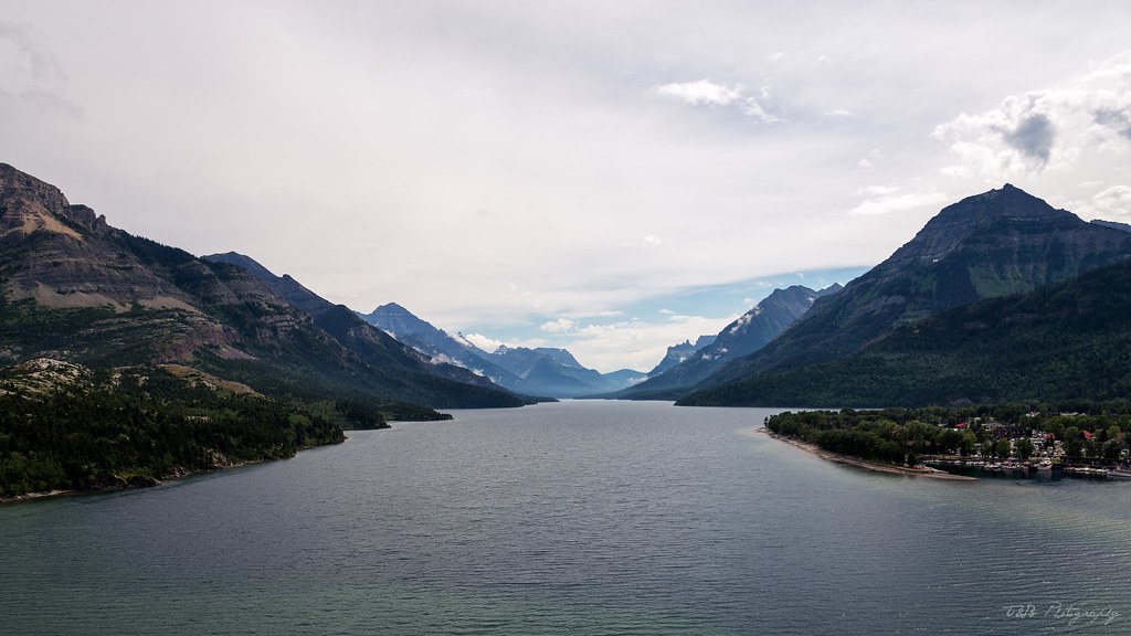
Eventually, we made it to the border with the rain reaching a full-on torrent. We crossed the border into Alberta without issue, and made the scenic drive to Waterton.
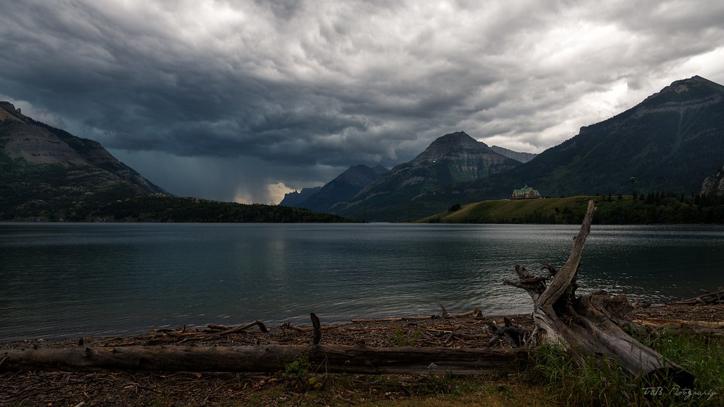
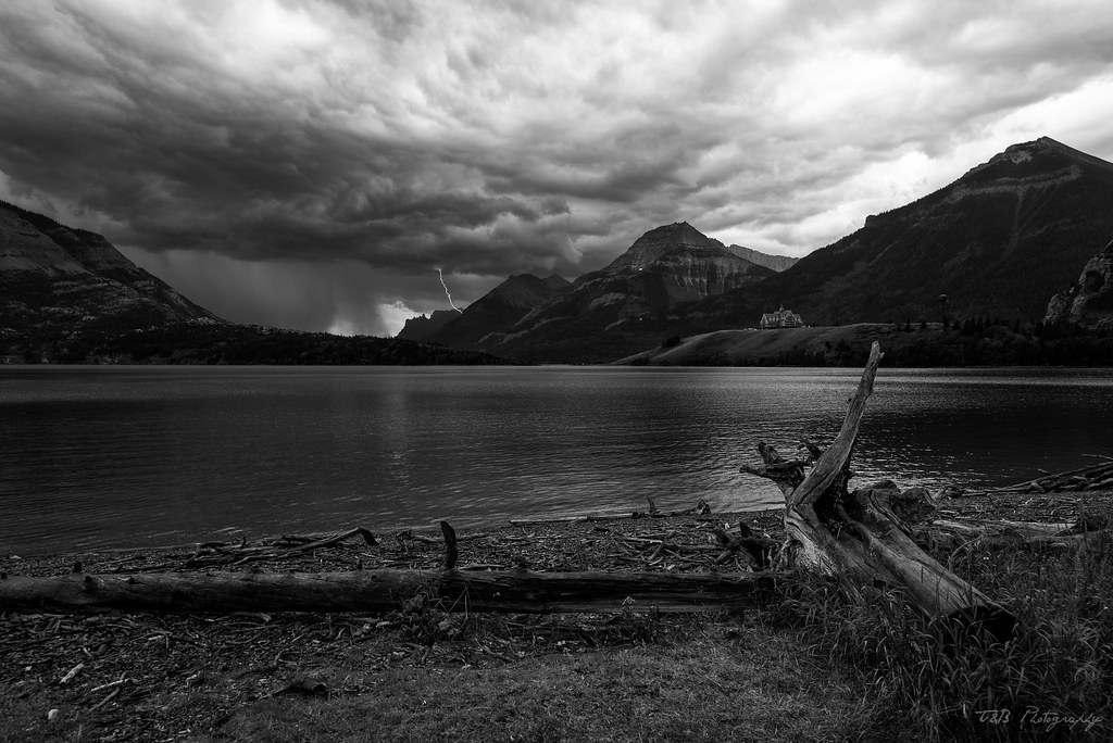
We were greeted with this weather.
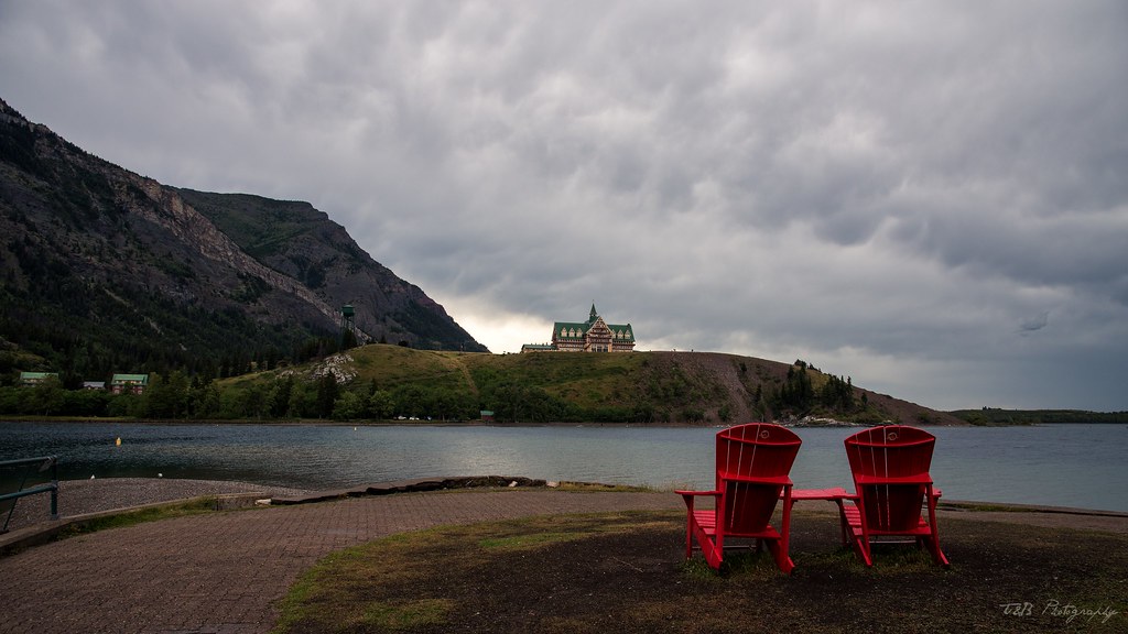
Determined to not let that stop us, we drove into Waterton to check out the town. As we discovered, Waterton is a really nice town full of nice little shops and restaurants, and one really awesome outdoor store. I bought a new French Press for coffee while we camp. I'm pretty excited about that! As we shopped, the storm came down harder and harder, but we pulled on our rain jackets and kept exploring.
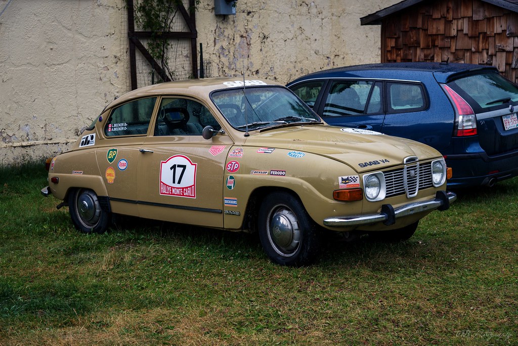
During our walk around Waterton, we even spotted this awesome looking Saab. Not sure of this history on this guy, but it sure looks like it has some good stories.
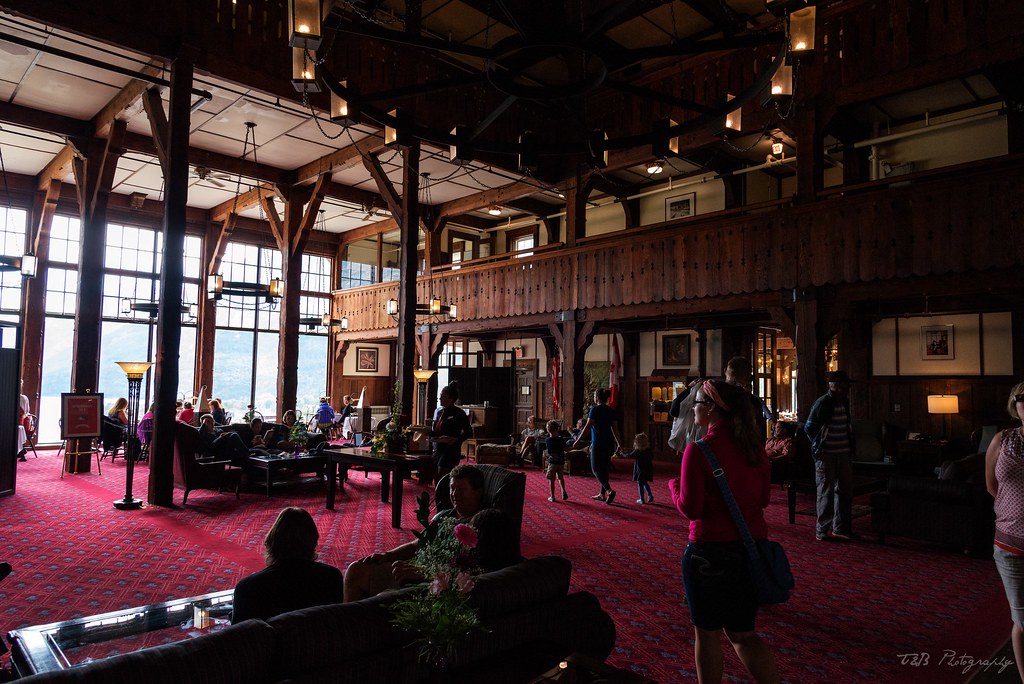
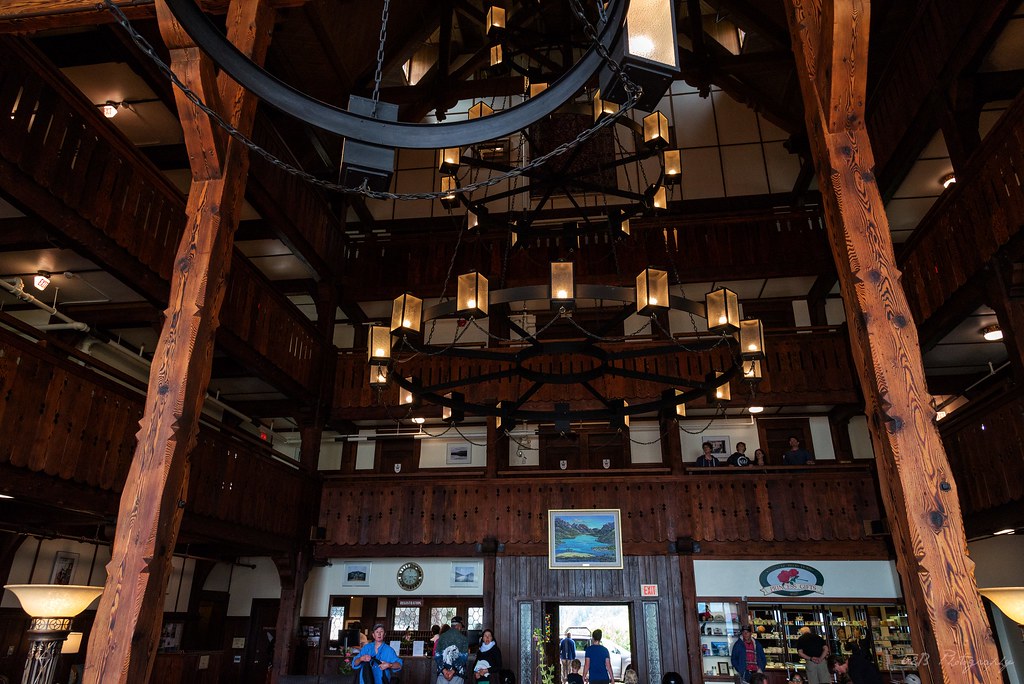
The next sight on the list was the Prince of Wales Hotel.
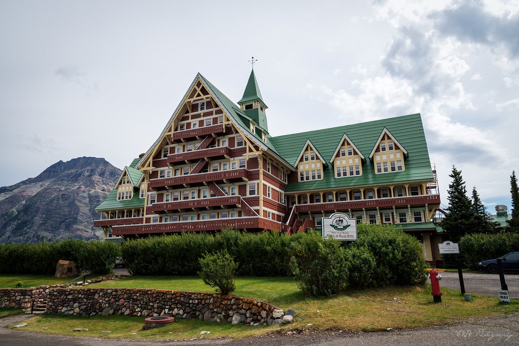
This beautiful and historic hotel was built in the mid 1920's by the American Great Northern Railway (which also runs through Whitefish, MT) to bring American tourists up into Alberta. It's a fantastic piece of history, and a really beautiful building in and of itself.
It does help, though, that it overlooks such amazing scenery.
We saw a sign advertising afternoon tea, but after finding out it was $30 CAD a head, we opted not to. Besides, we had a schedule to keep!
We had made plans to meet up with a couple of friends, who had driven up to Canada after the wedding, and run a trail with them in the Crowsnest Pass near Coleman. After that, we had planned to tackle the Forestry Trunk Road from Coleman to Hinton. Without working cell service in Canada, we planned to meet at a Tim Horton's in Blairmore at a specific time and make plans for the next few days. To make that deadline, we made the decision to move north to Coleman and get checked into our accommodations before going over to meet them.
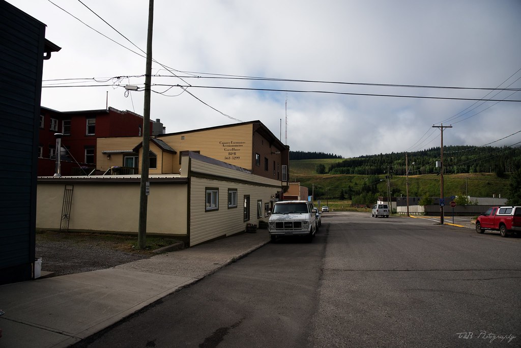
The drive between Waterton and Coleman is a pretty easy one. Not too long, but not overly exciting. The scenery is nice though. Eventually, we turned back west onto the Crowsnest Highway and into the mountains and were greeted by more nice scenery and a part of Canada with some serious history. We passed a series of small towns before being met with an enormous rock field adjacent to the town of Frank that had us a little befuddled. Shortly after, we pulled into Coleman and were a little nervous when we found the neighborhood of our B&B. In the US, this wouldn't look like the most appealing hotel.
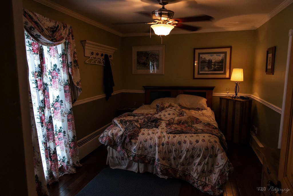
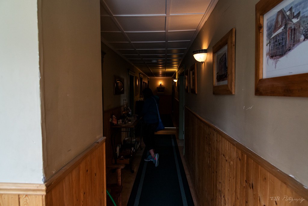
It was obviously an old neighborhood, and things looked a bit run down. When we walked into the office at the B&B, we were a little concerned, but I was determined. The place had stellar reviews and the scenery was at least nice. We rang a bell and the woman running it came out, all pleasantries and smiles. That put us at ease a bit. Then she took us on a tour, past the office and through the B&B, which boasted it's own library, a hot tub, rental bikes, and fresh baked cookies at any time of day. We were shown our room, and we were very impressed at the beauty and charm of this place.
Our room was graced with it's own balcony, which overlooked the scenery and the fire area outside.
But the best part? The old Ford truck they have parked out back, that apparently they give tours of Coleman in.
Suddenly feeling awesome about my choice in places to stay, we relaxed for a bit until we had to drive into Blairmore to meet my friends. Spotting his yellow Xterra, we pulled in and greeted each other. They asked about our trip so far, and we asked about theirs. Then came the part about trip planning. As it turned out, there was a serious problem.
To be continued...
After eating and filling up on water, we began our descent at about 2:30, planning on a relatively easy hike down to the parking area and back to the truck. This turned out to be a bad assumption. The trail quickly turned quite steep, descending at an extremely fast pace. To exacerbate the situation, the ground we were walking over was loose and occasionally rocky as we hiked through the forest. As we were alone in the woods, a deer darted from his hiding place just a few feet away, which was a cool experience. The forest we were hiking through was a little thin, but there was enough cover to keep the sun at bay. Despite that, the park was beginning to really heat up in the afternoon sun.
We continued walking through the forest when around 3:00 things went from bad to worse. We broke out of the trees and into a clear burned area with zero cover. The sun began beating down on us as the temperature climbed to it's apex at 102 degrees. To add to the problem, we quickly entered an area of lush undergrowth, where thick bushes were growing about four feet tall. This made the hike very humid, which made the already hot weather worse. On top of all that, we were still battling the steep decline. Needless to say, we were going through water fast.
As the trail descends, it never really lets up. You get teased with a brief view of the parking lot before being turned far away from it. You actually end up hiking about a mile away from it, just to turn back and hike the remaining mile back to it. It's very disheartening. We eventually made our way to the bottom of the steepest part, only to be swallowed by thicker and more humid undergrowth. After a while, the trail evened out, but the heat and humidity persisted. It was tough going. We passed a poor park ranger who had to hike the steep portion of the trail uphill to make sure no one was in real danger in the heat. Shortly after, the trail began to climb again. It was about this point I ran out of water. Luckily Beret had a bit left to share, and it was only about a third of a mile before we climbed the last hill, broke out of the undergrowth, and found our way to the parking lot again.
I had burned through half my Camelbak on the 7.6 miles from Logan Pass to Granite Park Chalet, about 1.5 liters. From the Chalet I made it 3.7 miles on 3 liters. It was hot, muggy, and miserable. But we had done it. 11.6 miles, point-to-point, taking in the best scenery Glacier National Park had to offer. Talk about a bucket list item we can check off.
Approaching the truck, we began to feel pretty bad. We climbed in and made the drive to McDonald Lake Lodge, passing an overland equipped Taco and a genuine Camel Trophy Disco on the way. Super cool! We pulled into the parking area at the Lodge, where Beret went into the general store and brought high-protein snacks and Gatorade to recover from the heat and exertion. Waiting for her to check out, I noticed my hands had swollen to the point my ring was immobile and the rubber strap on my watch was a little stretched.
After picking up some sustenance, we pulled into a parking spot by the lake shore and dipped our feet in the water for a short while. We opted to grab dinner at Apgar Village and do a little bit of walking around there before retiring early to our "hotel" and taking a shower. While she found a bathroom, I bought a T-shirt at one of the many trinket shops, as the shirt I was wearing stank to high heaven after the blistering afternoon. We eventually found our way to the restaurant there (the name eludes me) and had a really delicious dinner. It could have tasted terrible, we probably didn't even notice. We were happy to be relaxing and enjoying the cool weather and great views of the late afternoon.
After spending a little time in Apgar, we left the park and filled up at the gas station in West Glacier before driving back towards Coram. On the way, we remembered our awful experience at the border last year and decided to drive down to Columbia Falls to wash the truck before making for the border the next day. We also bought a few jugs of water that we figured we'd need that night.
After arriving back at Under Canvas and taking a shower, we decided to make our way down to the fire. At Glacier Under Canvas, there is a communal fire where travelers from all over can congregate and talk. We were fortunate to meet some great people from Alabama, New York, San Diego, and even a couple from Sweden. Since we had seen much of the park from previous visits before, we were picked for knowledge, which we happily gave. After an hour or so of new friendships, we made our way to the tent, exhausted and still a bit dehydrated.
The next morning we woke early and packed quickly. We checked out and drove into West Glacier, where we ate breakfast at the restaurant there in preparation for our border crossing, knowing we had a long driving day ahead of us and we probably wouldn't get lunch. After eating, I quickly checked my tire pressures and we opted to go over Going-to-the-Sun Road one last time on our way to Waterton. The weather was pleasant, and we were doing much better than the day before. Unfortunately, traffic was a bit heavy going over the pass, but we eventually made it over and into St. Mary. Knowing the upcoming fuel prices, we filled up one last time and made our run at the border.
As we continued north, the weather became stormy. A week of thunderstorms was just beginning, and would be a constant for the remainder of our time in Canada.
Eventually, we made it to the border with the rain reaching a full-on torrent. We crossed the border into Alberta without issue, and made the scenic drive to Waterton.
We were greeted with this weather.
Determined to not let that stop us, we drove into Waterton to check out the town. As we discovered, Waterton is a really nice town full of nice little shops and restaurants, and one really awesome outdoor store. I bought a new French Press for coffee while we camp. I'm pretty excited about that! As we shopped, the storm came down harder and harder, but we pulled on our rain jackets and kept exploring.
During our walk around Waterton, we even spotted this awesome looking Saab. Not sure of this history on this guy, but it sure looks like it has some good stories.
The next sight on the list was the Prince of Wales Hotel.
This beautiful and historic hotel was built in the mid 1920's by the American Great Northern Railway (which also runs through Whitefish, MT) to bring American tourists up into Alberta. It's a fantastic piece of history, and a really beautiful building in and of itself.
It does help, though, that it overlooks such amazing scenery.
We saw a sign advertising afternoon tea, but after finding out it was $30 CAD a head, we opted not to. Besides, we had a schedule to keep!
We had made plans to meet up with a couple of friends, who had driven up to Canada after the wedding, and run a trail with them in the Crowsnest Pass near Coleman. After that, we had planned to tackle the Forestry Trunk Road from Coleman to Hinton. Without working cell service in Canada, we planned to meet at a Tim Horton's in Blairmore at a specific time and make plans for the next few days. To make that deadline, we made the decision to move north to Coleman and get checked into our accommodations before going over to meet them.
The drive between Waterton and Coleman is a pretty easy one. Not too long, but not overly exciting. The scenery is nice though. Eventually, we turned back west onto the Crowsnest Highway and into the mountains and were greeted by more nice scenery and a part of Canada with some serious history. We passed a series of small towns before being met with an enormous rock field adjacent to the town of Frank that had us a little befuddled. Shortly after, we pulled into Coleman and were a little nervous when we found the neighborhood of our B&B. In the US, this wouldn't look like the most appealing hotel.
It was obviously an old neighborhood, and things looked a bit run down. When we walked into the office at the B&B, we were a little concerned, but I was determined. The place had stellar reviews and the scenery was at least nice. We rang a bell and the woman running it came out, all pleasantries and smiles. That put us at ease a bit. Then she took us on a tour, past the office and through the B&B, which boasted it's own library, a hot tub, rental bikes, and fresh baked cookies at any time of day. We were shown our room, and we were very impressed at the beauty and charm of this place.
Our room was graced with it's own balcony, which overlooked the scenery and the fire area outside.
But the best part? The old Ford truck they have parked out back, that apparently they give tours of Coleman in.
Suddenly feeling awesome about my choice in places to stay, we relaxed for a bit until we had to drive into Blairmore to meet my friends. Spotting his yellow Xterra, we pulled in and greeted each other. They asked about our trip so far, and we asked about theirs. Then came the part about trip planning. As it turned out, there was a serious problem.
To be continued...
wreckdiver1321
Overlander
Nice cliff hanger! Can't wait to read the next chapter.
As far a the Morrison and Goose Lake goes next year, count me in! Your in charge of setting everything up though. :sombrero:
You got it. I think I'll start a thread over in the NW section of the forum soon. I'll send everyone who I know wants to be involved a PM to get them in on the discussion and we can start planning.
WKexpedition
Built, not bought!
Congrats on getting hitched!! Looks like you guys had one amazing honeymoon. Cant wait to read more, and see more of those amazing pics!!
wreckdiver1321
Overlander
A (Sort Of) Overland Honeymoon - Part 3
We met my friends Ashton and Lucas in Blairmore at the pre-set time, and we said our hellos and described our trips so far. Things seemed to be going well, until we started talking about what was coming next. Our original plan had been to run the trail along North York Creek to the site of the old C47 plane crash the day after we made it to the Crowsnest Pass. The next day, we were going to run up the Forestry Trunk Road to Nordegg, where we'd spend the night, then motor on to Jasper. As it turned out, there had been a scheduling SNAFU that tore that plan to pieces.
Lucas's manager had not gotten him the correct time off, so he had to be hone several days earlier than any of us intended. We talked over our plans and possible outcomes. Eventually, it was decided that they would abandon ship and make a run for Banff on the day we were supposed to do the trail. That way, they could really enjoy the best of the Canadian Rockies instead of being tethered to our plans and missing out on some of the best sights. It was a major bummer and a complete deviation of our original plan, but we rolled with it and turned it around for the better. Beret and I decided we would spend the next day checking out Coleman and the surrounding area, then drive the Forestry Trunk Road by ourselves the following day. It's a road we're familiar with, and I knew Lola could handle it unsupported. We bid them farewell and found a local pub to have dinner at, the Rum Runner.
The restaurant is named for Emilio "Emperor Pic" Picariello, a notorious bootlegger operating out of the Crowsnest Pass during Alberta's Prohibition era (1916 to 1924). An Italian born emigrant, this native of Sicily was well known to be the area's Al Capone, operating illegal liquor operations and running contraband alcohol not only across the province, but also into British Columbia and Montana. His reign was ended in 1922, after a local Alberta Provincial Police constable by the name of Stephen Lawson opened fire on Picariello's son during a raid on Picariello's hotel. After he had been told his son succumbed to these injuries, Emperor Pic joined forces with Florence Lassandro, the wife of one of Picariello's employees. The duo went down to the police barracks in Coleman to confront Constable Lawson. An argument ensued, and guns were drawn. One of Alberta's most notorious gunfights followed, ending in the death of Constable Lawson and the arrest of Emperor Pic and Florence Lassandro. The liquor kingpin was the owner of $200,000 in assets at the time of his arrest. After a brief trial finding both him and his cohort guilty, they both were executed in May 1923. Just a year later, on May 10th, 1924, prohibition in Alberta came to an end.
Carrying on Emperor Pic's tradition of good booze and good times, the bar is a lively place filled with happy, friendly locals and some great craft beers. To add to it, the food is fantastic. Beret and I scarfed down the Tandoori Chicken Pizza, drank a few locally-brewed beers, and retired to the B&B. We were falling in love with the area fast. A little research that night led me to discover just how historic Coleman and the surrounding areas are. As it turns out, they're not run-down or uncared-for. They're just very old, historic, and protected. All this just reinforces my belief that you can't judge a place until you've spent a few days there.
The next morning, we awoke early and headed downstairs for breakfast made Dawn, the owner. It was a delicious way to start the day, with poached eggs and her own corned beef hash recipe. We were also treated to some fellow travelers staying there, and we had a conversation that lasted well past 10 AM. It was a delight to get to know some of these people. Again, this is one of my favorite parts of traveling like this.
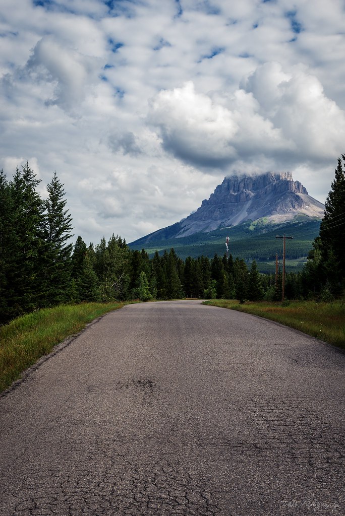
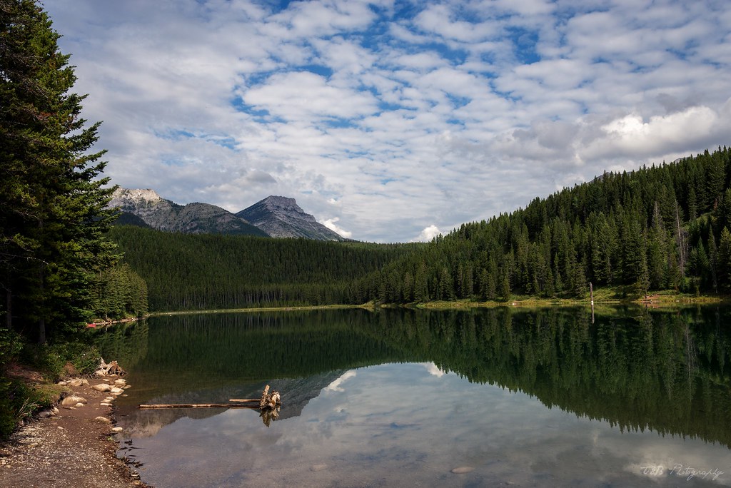
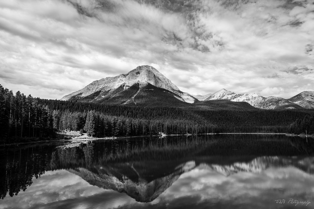
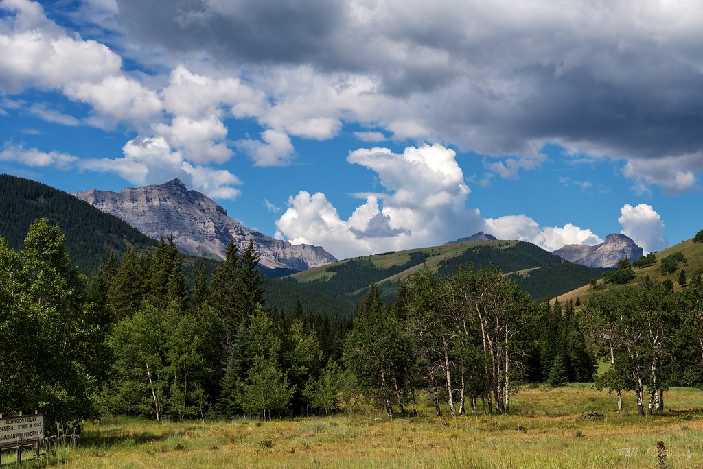
With full bellies, we decided to go check out the campground at Chinook Lake, where our friends had been staying while they were in the area. The weather was nice for the time being, and the scenery was great. Chinook Lake lies below the dominating peak of Crowsnest Mountain, one of the most interesting sights in the area.
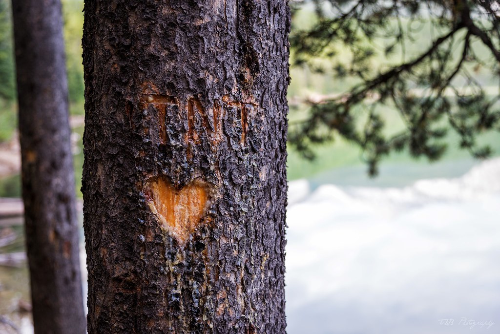
We took a brief walk around the lake, still a little sore from the massive hike on day 2.
Found this carved into one of the trees along the trail.
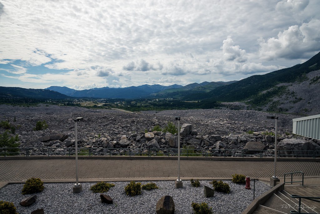
Our curiosity satisfied, we left Chinook Lake and drove a few minutes down the road to Frank, at the site of the enormous rock field.
As we arrived, rain and thunderstorms were blanketing the valley, as they would for the entire day. It's a good thing we didn't attempt the plane crash trail. The recent rains would have turned the dirt to soup. My research had led me to discover that there was an interpretive center dedicated to describing why there was several square miles of huge boulders covering the valley floor. This side trip did not disappoint.
What we found out was a fascinating tale. The town of Frank was a newly-booming mining town, held aloft by the profits of the local mine beneath the looming Turtle Mountain. Despite being founded less than two years before, a permanent population of 600 lived in Frank by April of 1903. During the night of April 29th, 1903, a huge swath of Turtle Mountain let loose. About 90 million tons of limestone rock slid off the mountain, burying part of the town and collapsing the entrance to the mine. Traveling at speeds of up to 70 miles an hour, the slide was heard from as far away as the town of Cochrane, about 120 miles to the north. About 90 people were dead or missing, and the miners on the night shift had become trapped in the mine. Working through the night, they mined their way through a thin portion of the ceiling, eventually mining their way out and back into the sunlight. Every miner that was underground during the slide survived. What remains now is a reminder of the power of nature. The rock field stretches two miles, from the base of Turtle Mountain to partway up the valley on the opposite side.
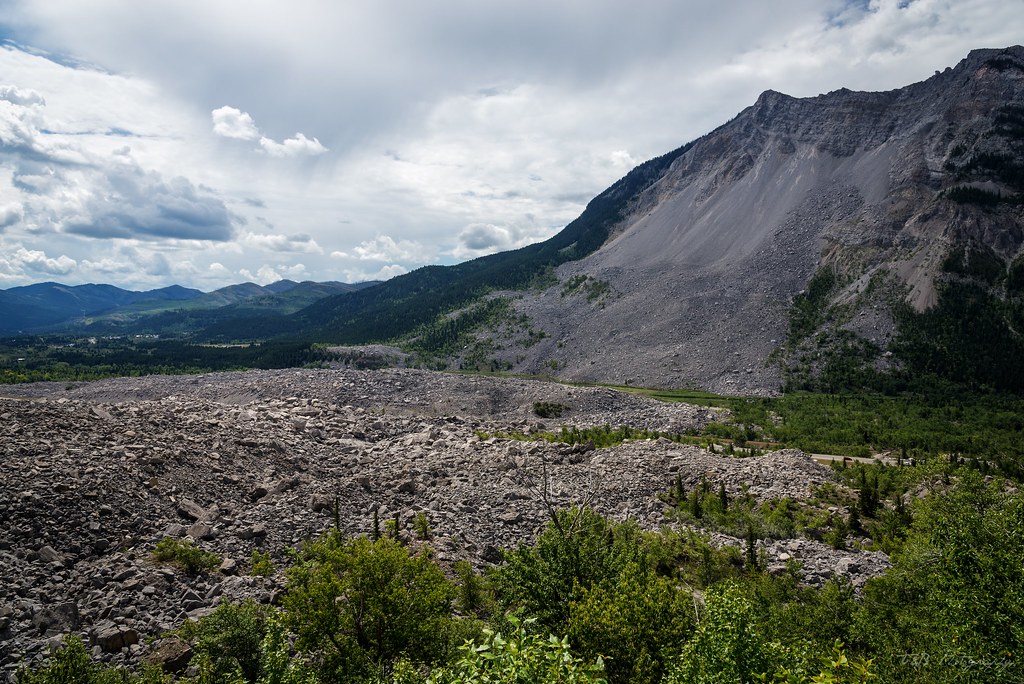
Discovering this history for ourselves was such a cool experience.
Determined to dig into even more of the area's rich mining history, we decided to go for one of the more interesting activities we had seen advertised: a tour of the now abandoned Bellevue Mine a few miles down the road. I wish I had a bunch of great photos to share of this place, but I don't. It's a mine. It's dark.
The tour starts at a small shop, where you sign up and pay, where you're then herded to a staging area and given a traditional miner's hardhat with a headlamp, and a belt-mounted battery pack. Then they go over some history and safety stuff, and you're sent into the mine.

The tour itself was very cool. The guide was awesome, explaining the history of the area as well as the history of coal mining. As you walk into the mine, you see exhibits of old mining technology and tools, and the gal leading the tour gave us a great explanation of a lot of things. It was a really cool tour that I'd recommend to anyone in the area. The entire tour is lit only by the glow from your headlamps and takes about 90 minutes. It's money well spent, at least for us.
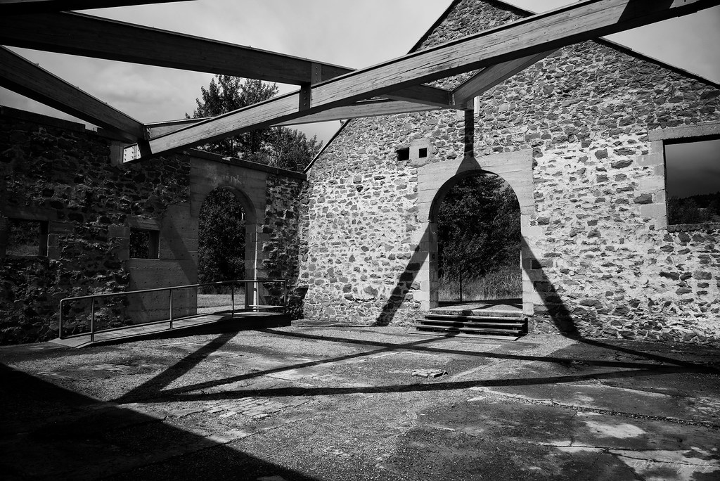
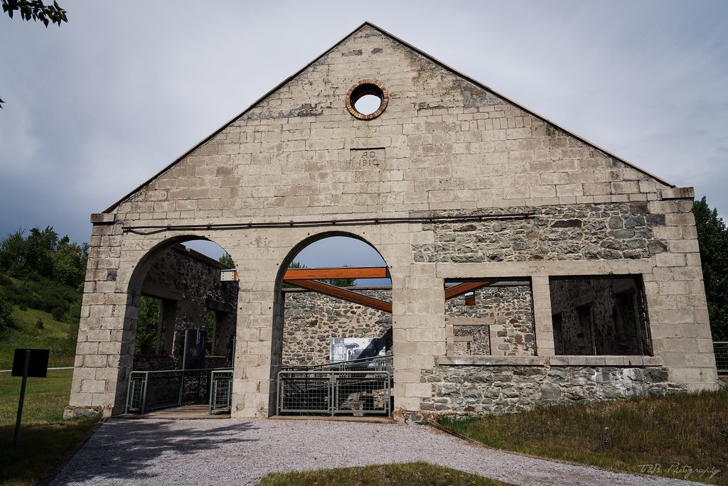
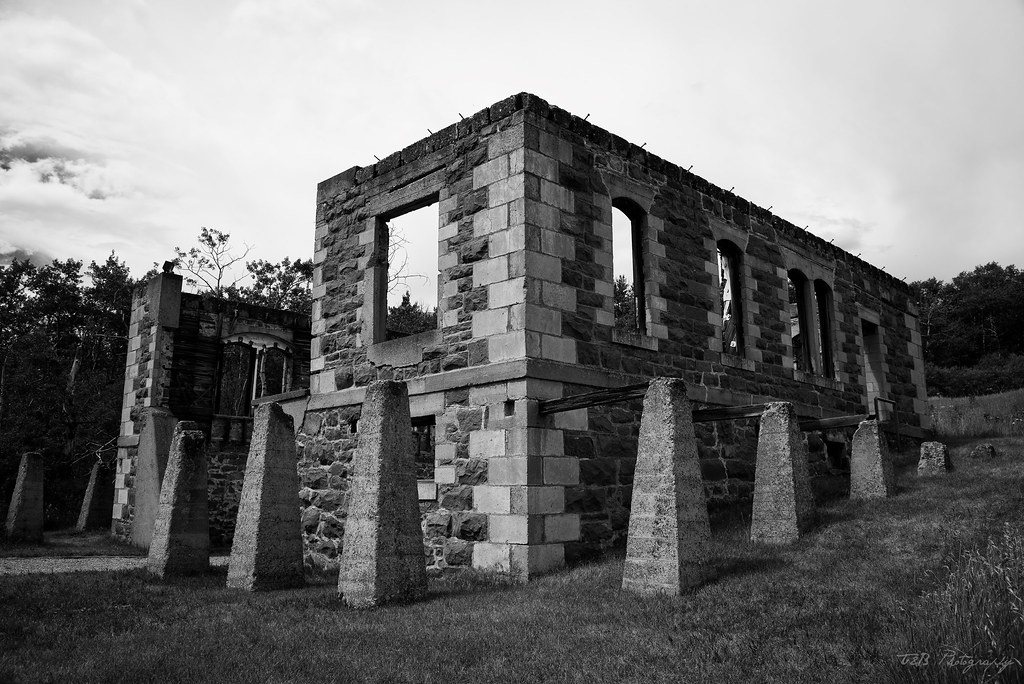
Now imbued with the knowledge of what went on below the surface, we decided to take a look around the site of the abandoned Leitch Collieries, close to Bellevue. This interpretive park is the site of an abandoned mining operation ran by the Leitch Brothers during the height of Alberta's mining rush. It's a very interesting site with a lot of old buildings, and curated by guides who are very knowledgeable about the area's history.
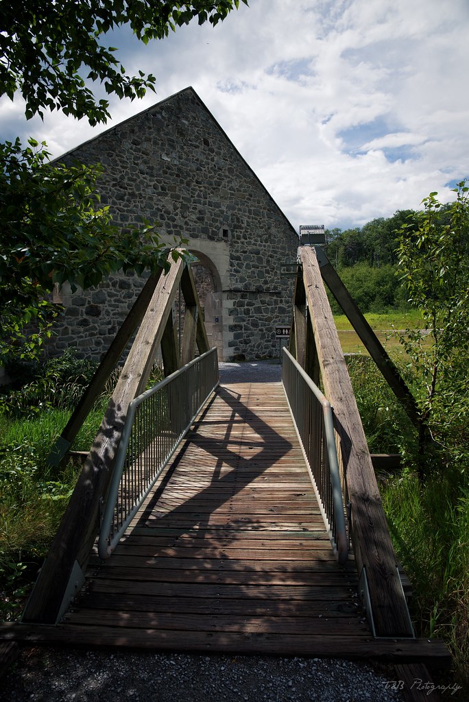
We toured through an old powerstation and train station, as well as through the old manager's mansion, which is now just a foundation.
Now chock full of the history of the Crowsnest Pass, we drove into Blairmore, where we stocked up on food at the local supermarket. We knew we'd be putting a lot of miles on during the next few days, so having some food in the fridge to eat for lunches was a solid plan. We also picked up some Canadian treats that we hadn't tried before. After the excitement and travel of the previous few days, we opted to go back to the B&B to relax for the rest of the day. For dinner, we once again ate at the fantastic Rum Runner, before going back to the B&B to rest and prepare for the real reason we had stayed in Coleman: running the Forestry Trunk Road.
To be continued...
We met my friends Ashton and Lucas in Blairmore at the pre-set time, and we said our hellos and described our trips so far. Things seemed to be going well, until we started talking about what was coming next. Our original plan had been to run the trail along North York Creek to the site of the old C47 plane crash the day after we made it to the Crowsnest Pass. The next day, we were going to run up the Forestry Trunk Road to Nordegg, where we'd spend the night, then motor on to Jasper. As it turned out, there had been a scheduling SNAFU that tore that plan to pieces.
Lucas's manager had not gotten him the correct time off, so he had to be hone several days earlier than any of us intended. We talked over our plans and possible outcomes. Eventually, it was decided that they would abandon ship and make a run for Banff on the day we were supposed to do the trail. That way, they could really enjoy the best of the Canadian Rockies instead of being tethered to our plans and missing out on some of the best sights. It was a major bummer and a complete deviation of our original plan, but we rolled with it and turned it around for the better. Beret and I decided we would spend the next day checking out Coleman and the surrounding area, then drive the Forestry Trunk Road by ourselves the following day. It's a road we're familiar with, and I knew Lola could handle it unsupported. We bid them farewell and found a local pub to have dinner at, the Rum Runner.
The restaurant is named for Emilio "Emperor Pic" Picariello, a notorious bootlegger operating out of the Crowsnest Pass during Alberta's Prohibition era (1916 to 1924). An Italian born emigrant, this native of Sicily was well known to be the area's Al Capone, operating illegal liquor operations and running contraband alcohol not only across the province, but also into British Columbia and Montana. His reign was ended in 1922, after a local Alberta Provincial Police constable by the name of Stephen Lawson opened fire on Picariello's son during a raid on Picariello's hotel. After he had been told his son succumbed to these injuries, Emperor Pic joined forces with Florence Lassandro, the wife of one of Picariello's employees. The duo went down to the police barracks in Coleman to confront Constable Lawson. An argument ensued, and guns were drawn. One of Alberta's most notorious gunfights followed, ending in the death of Constable Lawson and the arrest of Emperor Pic and Florence Lassandro. The liquor kingpin was the owner of $200,000 in assets at the time of his arrest. After a brief trial finding both him and his cohort guilty, they both were executed in May 1923. Just a year later, on May 10th, 1924, prohibition in Alberta came to an end.
Carrying on Emperor Pic's tradition of good booze and good times, the bar is a lively place filled with happy, friendly locals and some great craft beers. To add to it, the food is fantastic. Beret and I scarfed down the Tandoori Chicken Pizza, drank a few locally-brewed beers, and retired to the B&B. We were falling in love with the area fast. A little research that night led me to discover just how historic Coleman and the surrounding areas are. As it turns out, they're not run-down or uncared-for. They're just very old, historic, and protected. All this just reinforces my belief that you can't judge a place until you've spent a few days there.
The next morning, we awoke early and headed downstairs for breakfast made Dawn, the owner. It was a delicious way to start the day, with poached eggs and her own corned beef hash recipe. We were also treated to some fellow travelers staying there, and we had a conversation that lasted well past 10 AM. It was a delight to get to know some of these people. Again, this is one of my favorite parts of traveling like this.
With full bellies, we decided to go check out the campground at Chinook Lake, where our friends had been staying while they were in the area. The weather was nice for the time being, and the scenery was great. Chinook Lake lies below the dominating peak of Crowsnest Mountain, one of the most interesting sights in the area.
We took a brief walk around the lake, still a little sore from the massive hike on day 2.
Found this carved into one of the trees along the trail.
Our curiosity satisfied, we left Chinook Lake and drove a few minutes down the road to Frank, at the site of the enormous rock field.
As we arrived, rain and thunderstorms were blanketing the valley, as they would for the entire day. It's a good thing we didn't attempt the plane crash trail. The recent rains would have turned the dirt to soup. My research had led me to discover that there was an interpretive center dedicated to describing why there was several square miles of huge boulders covering the valley floor. This side trip did not disappoint.
What we found out was a fascinating tale. The town of Frank was a newly-booming mining town, held aloft by the profits of the local mine beneath the looming Turtle Mountain. Despite being founded less than two years before, a permanent population of 600 lived in Frank by April of 1903. During the night of April 29th, 1903, a huge swath of Turtle Mountain let loose. About 90 million tons of limestone rock slid off the mountain, burying part of the town and collapsing the entrance to the mine. Traveling at speeds of up to 70 miles an hour, the slide was heard from as far away as the town of Cochrane, about 120 miles to the north. About 90 people were dead or missing, and the miners on the night shift had become trapped in the mine. Working through the night, they mined their way through a thin portion of the ceiling, eventually mining their way out and back into the sunlight. Every miner that was underground during the slide survived. What remains now is a reminder of the power of nature. The rock field stretches two miles, from the base of Turtle Mountain to partway up the valley on the opposite side.
Discovering this history for ourselves was such a cool experience.
Determined to dig into even more of the area's rich mining history, we decided to go for one of the more interesting activities we had seen advertised: a tour of the now abandoned Bellevue Mine a few miles down the road. I wish I had a bunch of great photos to share of this place, but I don't. It's a mine. It's dark.
The tour starts at a small shop, where you sign up and pay, where you're then herded to a staging area and given a traditional miner's hardhat with a headlamp, and a belt-mounted battery pack. Then they go over some history and safety stuff, and you're sent into the mine.
The tour itself was very cool. The guide was awesome, explaining the history of the area as well as the history of coal mining. As you walk into the mine, you see exhibits of old mining technology and tools, and the gal leading the tour gave us a great explanation of a lot of things. It was a really cool tour that I'd recommend to anyone in the area. The entire tour is lit only by the glow from your headlamps and takes about 90 minutes. It's money well spent, at least for us.
Now imbued with the knowledge of what went on below the surface, we decided to take a look around the site of the abandoned Leitch Collieries, close to Bellevue. This interpretive park is the site of an abandoned mining operation ran by the Leitch Brothers during the height of Alberta's mining rush. It's a very interesting site with a lot of old buildings, and curated by guides who are very knowledgeable about the area's history.
We toured through an old powerstation and train station, as well as through the old manager's mansion, which is now just a foundation.
Now chock full of the history of the Crowsnest Pass, we drove into Blairmore, where we stocked up on food at the local supermarket. We knew we'd be putting a lot of miles on during the next few days, so having some food in the fridge to eat for lunches was a solid plan. We also picked up some Canadian treats that we hadn't tried before. After the excitement and travel of the previous few days, we opted to go back to the B&B to relax for the rest of the day. For dinner, we once again ate at the fantastic Rum Runner, before going back to the B&B to rest and prepare for the real reason we had stayed in Coleman: running the Forestry Trunk Road.
To be continued...
Trikebubble
Adventurer
Canadian treats? I hope you bought some Cheezies? Your travel report has been great, thanks for taking the time to share it.
Sent from the Mountains
Sent from the Mountains
wreckdiver1321
Overlander
Canadian treats? I hope you bought some Cheezies? Your travel report has been great, thanks for taking the time to share it.
Sent from the Mountains
Thanks! I'm glad you enjoyed it.
I'll be honest. It was some chocolate fudge thing. I can't remember for the life of me what they were called.
wreckdiver1321
Overlander
A (Sort Of) Overland Honeymoon - Part 4
Last year when we went to Canada, I had intended on driving the length of the Forestry Trunk Road from Coleman to Hinton, a distance off highway and overland of about 435 miles. My attempt was stymied by weather, when we got 36 hours of heavy rain. Instead of meeting the group to go wheeling in Coleman, we headed for Waiparous. That means instead of going from Coleman to Hinton, we drove from Cochrane to Hinton, taking several miles out of the trip, and making the drive incomplete.
This year, I was determined to see it through to the end. Unfortunately, now I had lost the other vehicle meant to do the route with me, so Beret and I were on our own. The morning of our departure, we awoke early and got the truck packed up. We met Dawn, the owner of the B&B, downstairs to settle up our bill and say our goodbyes. But not before a good breakfast. This time was breakfast sausages and fruits and veggies, enjoyed in completely new company. After scarfing down our final meal, we bid farewell to this awesome place. We will definitely be back.
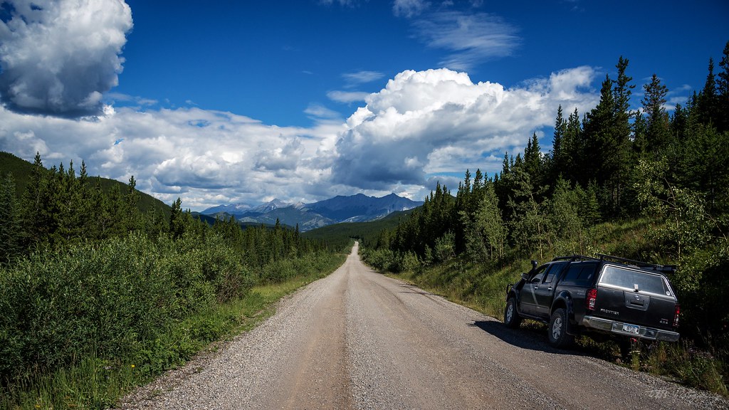
As we turned north, we had some cloudy weather, but once we hit the gravel the road climbed and we got out of the foggy morning. I stopped to air down the tires and hit the music.
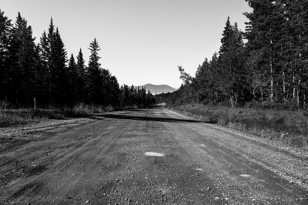
Dawn had informed us that the road was pretty rough and washboarded from Coleman to Livingstone Gap, which was okay by us. At 28 PSI in the tires, we were able to hit 50 miles an hour in total comfort. The drive was an awesome one, that only got better with time.
Before long, we reached Livingstone Gap, a forest fire outpost manned by a decent crew and a Bell Huey helicopter. They waved politely as we made our way past.
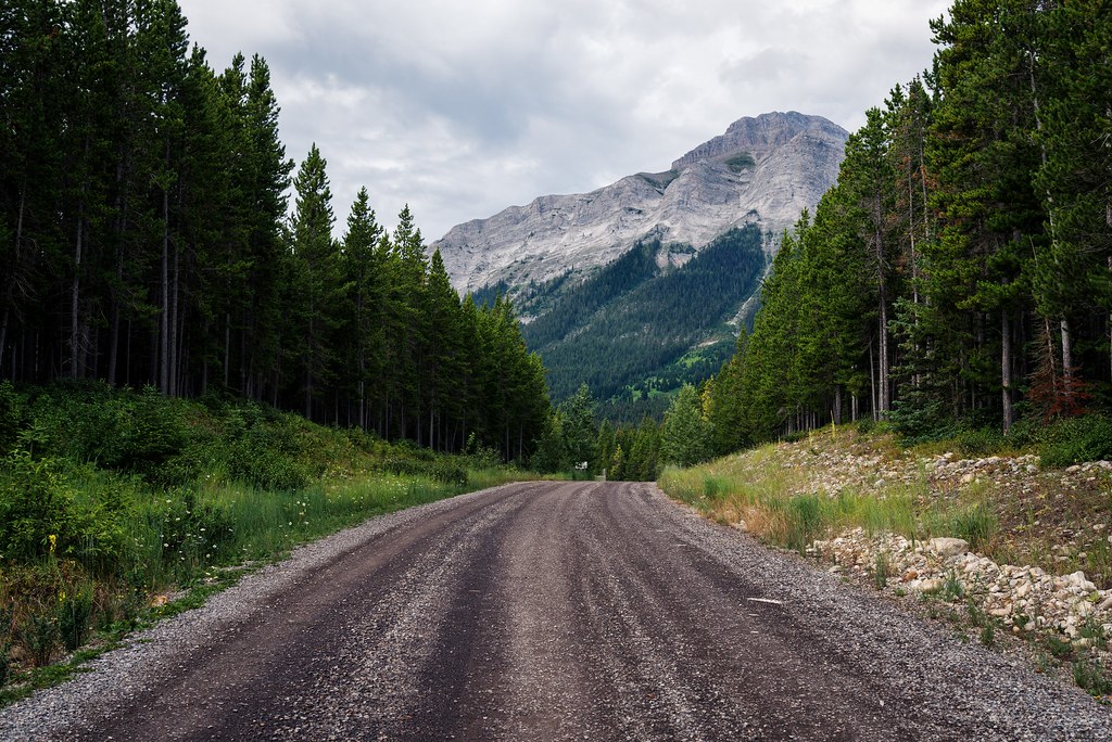
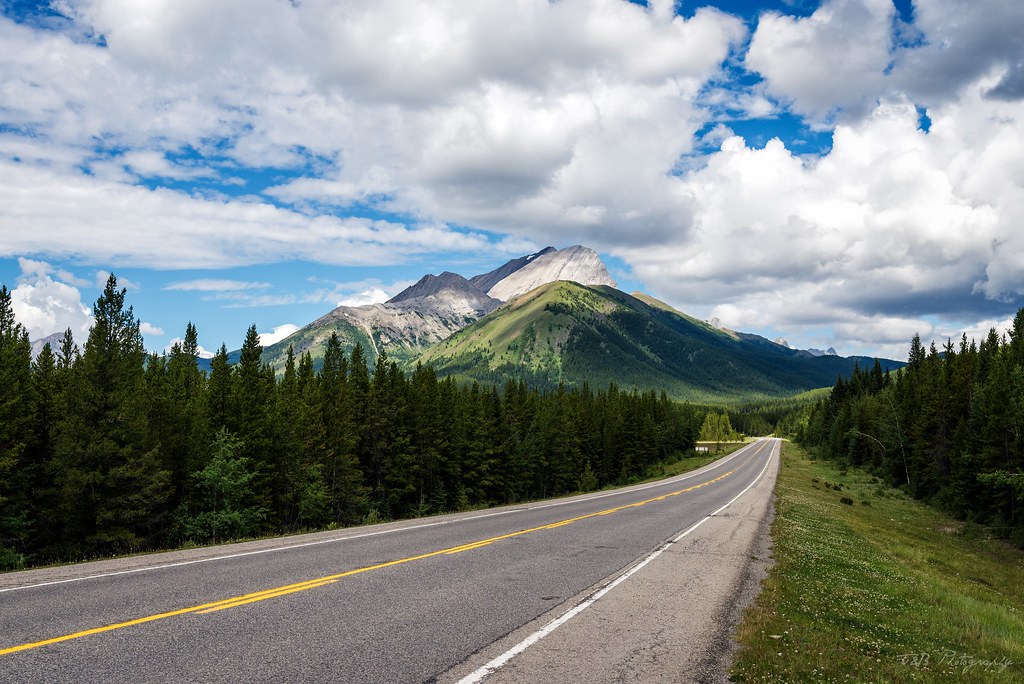
This road is a complete gem. It's not overly rough, but it's length and remoteness keeps most people from traversing the entire route. On the whole drive, which took most of the day, we only saw a handful of other vehicles, most of which were confused by my well-outfitted Nissan. This route passes through some of the best scenery in Alberta, but keeps you away from the traditional tourist traps. It's a truly wild part of the Canadian Rockies, deep in the foothills where the only other travelers you'll meet are locals or fellow overlanders. This won't be the last time I run this route, I'm certain.
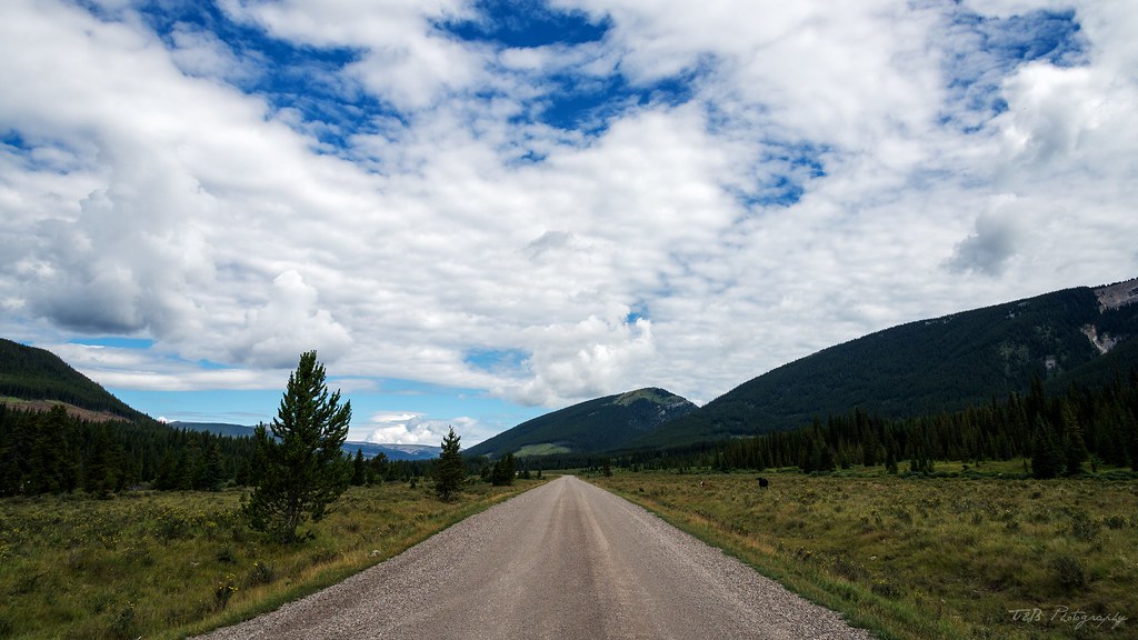
The stretch between Coleman and Cochrane isn't particularly long, and some of the best scenery is near the end, when you approach Kananaskis Country.
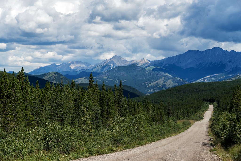
As you push on, you start to see mountains over the crests in the road and through the breaks in the trees. Then, suddenly, you crest a hill and are presented with a vista rarely seen by tourists to the region. What an awesome sight. I love this road!
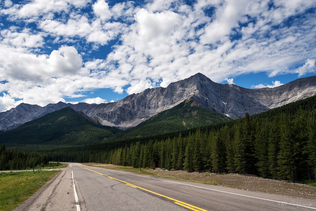
Not too much farther on, the dirt ends at a T-junction with an asphalt highway known as the Kananaskis Highway. Near this junction is a small general store, where we stocked up on a few things and aired the tires up. We turned left and made our way towards Cochrane.
From here, the scenery becomes increasingly epic. The clouds and the light were dancing all over the amazing mountain shapes, leaving us in awe of the landscape. To make matters even better, we were completely alone. Not a soul was on the Kananaskis Highway at the same time as we were, which made it a truly special experience.
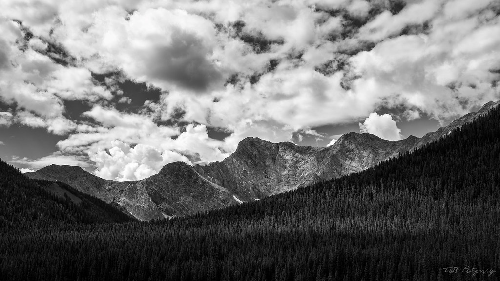
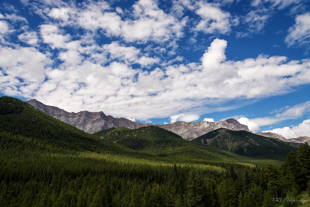
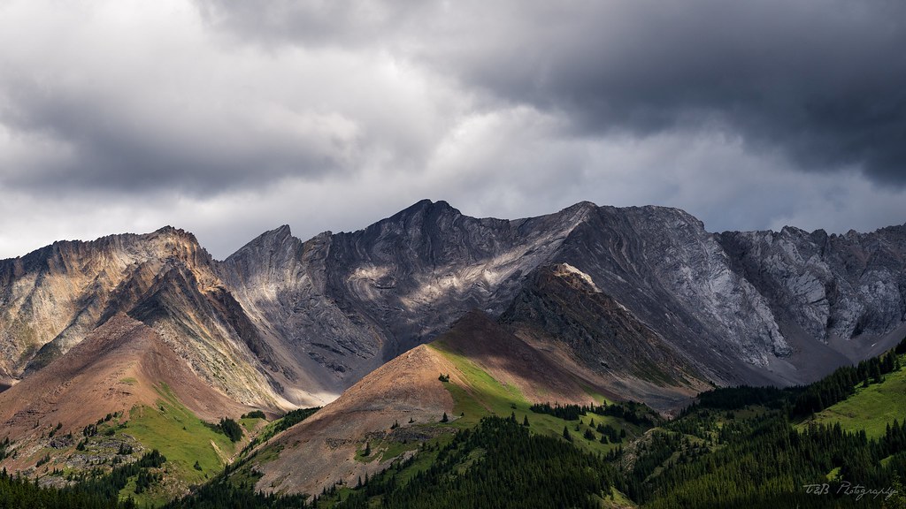
Sadly, this part of the drive is far too brief. We were slowed down for a little bit by a herd of Bighorn Sheep in the road and a little construction, but we made decent time. We stopped for a short time at Kananaskis Lakes, where we quickly ate lunch, but we were eager to get on the road. We filled up when we got to Cochrane and continued on our way. Sadly, I failed as a photographer here and didn't take any photos of the drive between Cochrane and Nordegg. That's a shame, because that's my favorite part of the drive. It's the most wild, and the most remote. We powered through the afternoon and the weather on our way north, passing some truly stunning scenery. Seriously, this drive is one of my favorites in the whole world. I've been on a lot of dirt, but this stretch holds a special place in my heart. Driving through the remote foothills of the Rockies, catching amazing glimpses of scenery and having all of it to yourself is as close as an overlander can get to heaven on earth.
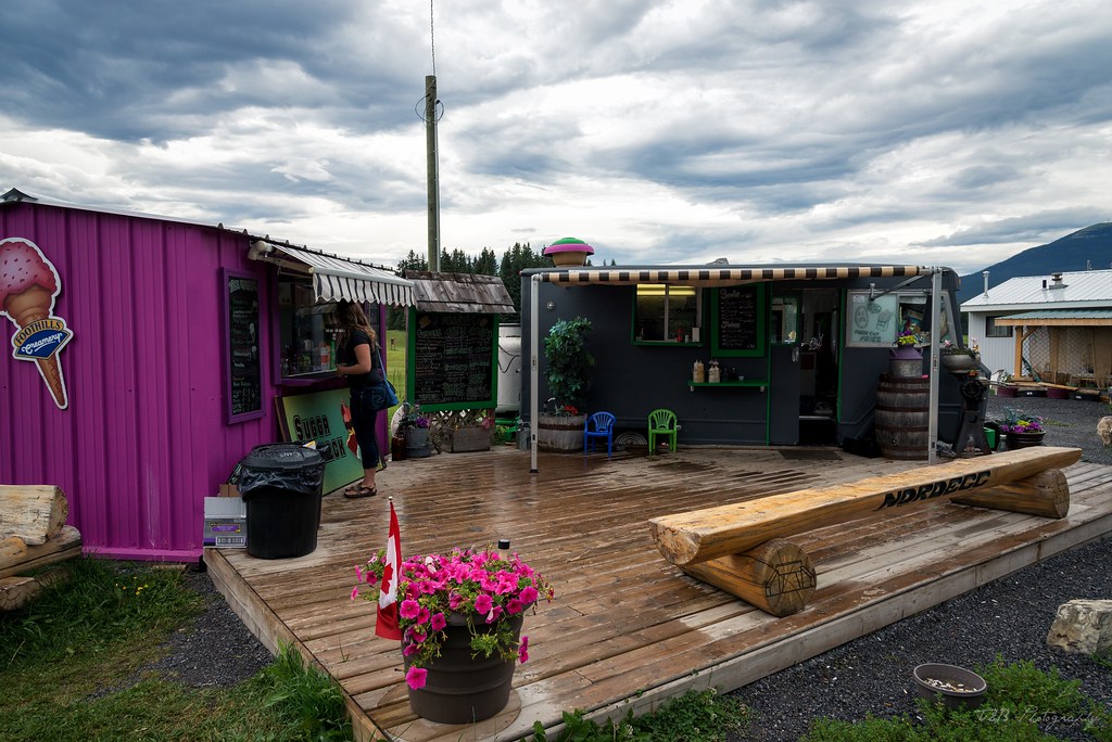
Still drunk off the amazing run, we rolled into Nordegg, our stop for the night. Nordegg has exactly one hotel, which we had booked for the night (although there was no one there, so booking ahead wasn't really necessary. We got checked in and decided to take a short tour of the town. Our first stop was at the awesome little food stand, where we got some really good ice cream.
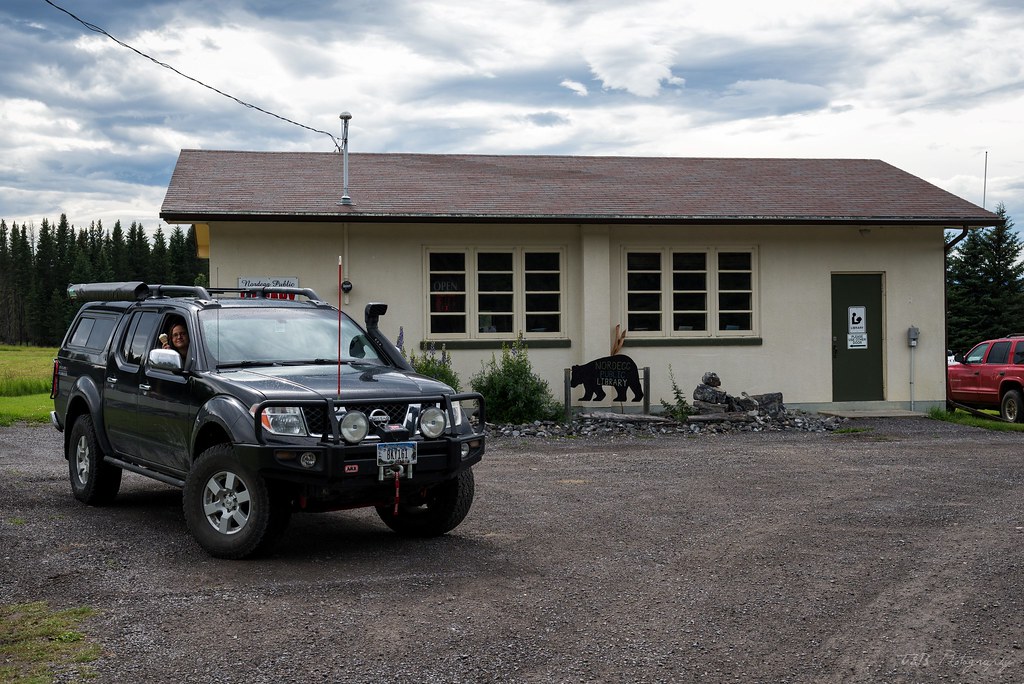
I just had to stop and take a photo to share with you Nordegg's massive public library.
And that's about it. There's a museum, but it was closed, so we didn't get to see that. Suddenly feeling our exhaustion, we drove back to the hotel and decided to eat at their restaurant for dinner.
The owner and his bartender found out we were on our honeymoon, so we got free drinks that night, which was an awesome gesture. Dinner was excellent, and not expensive. So, with our bellies full, we hit the bed and fell fast asleep.
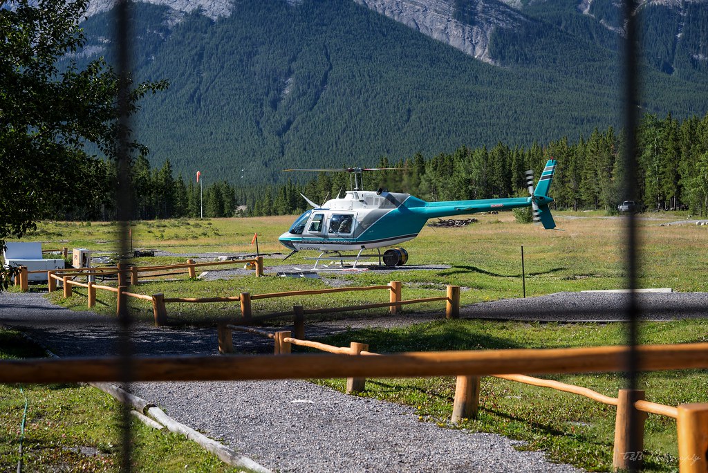
The next morning, we awoke early and gassed up in preparation for a slight detour from the Forestry Trunk Road. We had a special event planned for the day, one that was just a few miles down the road from Nordegg. We left the town and turned west towards Saskatchewan Crossing along the Icefields Parkway. Between there and Nordegg is the beautiful scenery of Abraham Lake, and the mountains that look like layers of earth crust pointing straight into the sky.
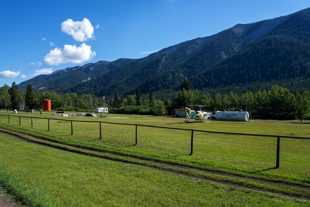
Near Abraham Lake is a small operation manned by a really amazing staff. That operation is Rockies Heli Canada. We pulled into their parking lot at around 9:45 AM.
Our plan was to book a helicopter flight for later in the day and take a tour over the Rockies. When we arrived, the only available flights were in early afternoon. That's not an ideal time for photographs, but it's what we had to work with, so we signed up for a 20 minute ride. As we walked back to the truck, we were discussing what we wanted to do for those few hours. We climbed in and were about to drive out when the staff member we had talked to came running out of the office, trying to get our attention. I put the truck in park, thinking I had forgotten something, and talked to him. He told me that they had a flight going out that wasn't full. It was a family of four, but they had two more seats available. It was a 30 minute flight, but he'd let us upgrade for free so they didn't have empty seats. The one catch was it was leaving almost immediately. We quickly and excitedly agreed and headed back to the office to wait for our flight.
What ensued was better than my wildest imagination. It was a part of the trip I will never forget.
To be continued...
Last year when we went to Canada, I had intended on driving the length of the Forestry Trunk Road from Coleman to Hinton, a distance off highway and overland of about 435 miles. My attempt was stymied by weather, when we got 36 hours of heavy rain. Instead of meeting the group to go wheeling in Coleman, we headed for Waiparous. That means instead of going from Coleman to Hinton, we drove from Cochrane to Hinton, taking several miles out of the trip, and making the drive incomplete.
This year, I was determined to see it through to the end. Unfortunately, now I had lost the other vehicle meant to do the route with me, so Beret and I were on our own. The morning of our departure, we awoke early and got the truck packed up. We met Dawn, the owner of the B&B, downstairs to settle up our bill and say our goodbyes. But not before a good breakfast. This time was breakfast sausages and fruits and veggies, enjoyed in completely new company. After scarfing down our final meal, we bid farewell to this awesome place. We will definitely be back.
As we turned north, we had some cloudy weather, but once we hit the gravel the road climbed and we got out of the foggy morning. I stopped to air down the tires and hit the music.
Dawn had informed us that the road was pretty rough and washboarded from Coleman to Livingstone Gap, which was okay by us. At 28 PSI in the tires, we were able to hit 50 miles an hour in total comfort. The drive was an awesome one, that only got better with time.
Before long, we reached Livingstone Gap, a forest fire outpost manned by a decent crew and a Bell Huey helicopter. They waved politely as we made our way past.
This road is a complete gem. It's not overly rough, but it's length and remoteness keeps most people from traversing the entire route. On the whole drive, which took most of the day, we only saw a handful of other vehicles, most of which were confused by my well-outfitted Nissan. This route passes through some of the best scenery in Alberta, but keeps you away from the traditional tourist traps. It's a truly wild part of the Canadian Rockies, deep in the foothills where the only other travelers you'll meet are locals or fellow overlanders. This won't be the last time I run this route, I'm certain.
The stretch between Coleman and Cochrane isn't particularly long, and some of the best scenery is near the end, when you approach Kananaskis Country.
As you push on, you start to see mountains over the crests in the road and through the breaks in the trees. Then, suddenly, you crest a hill and are presented with a vista rarely seen by tourists to the region. What an awesome sight. I love this road!
Not too much farther on, the dirt ends at a T-junction with an asphalt highway known as the Kananaskis Highway. Near this junction is a small general store, where we stocked up on a few things and aired the tires up. We turned left and made our way towards Cochrane.
From here, the scenery becomes increasingly epic. The clouds and the light were dancing all over the amazing mountain shapes, leaving us in awe of the landscape. To make matters even better, we were completely alone. Not a soul was on the Kananaskis Highway at the same time as we were, which made it a truly special experience.
Sadly, this part of the drive is far too brief. We were slowed down for a little bit by a herd of Bighorn Sheep in the road and a little construction, but we made decent time. We stopped for a short time at Kananaskis Lakes, where we quickly ate lunch, but we were eager to get on the road. We filled up when we got to Cochrane and continued on our way. Sadly, I failed as a photographer here and didn't take any photos of the drive between Cochrane and Nordegg. That's a shame, because that's my favorite part of the drive. It's the most wild, and the most remote. We powered through the afternoon and the weather on our way north, passing some truly stunning scenery. Seriously, this drive is one of my favorites in the whole world. I've been on a lot of dirt, but this stretch holds a special place in my heart. Driving through the remote foothills of the Rockies, catching amazing glimpses of scenery and having all of it to yourself is as close as an overlander can get to heaven on earth.
Still drunk off the amazing run, we rolled into Nordegg, our stop for the night. Nordegg has exactly one hotel, which we had booked for the night (although there was no one there, so booking ahead wasn't really necessary. We got checked in and decided to take a short tour of the town. Our first stop was at the awesome little food stand, where we got some really good ice cream.
I just had to stop and take a photo to share with you Nordegg's massive public library.
And that's about it. There's a museum, but it was closed, so we didn't get to see that. Suddenly feeling our exhaustion, we drove back to the hotel and decided to eat at their restaurant for dinner.
The owner and his bartender found out we were on our honeymoon, so we got free drinks that night, which was an awesome gesture. Dinner was excellent, and not expensive. So, with our bellies full, we hit the bed and fell fast asleep.
The next morning, we awoke early and gassed up in preparation for a slight detour from the Forestry Trunk Road. We had a special event planned for the day, one that was just a few miles down the road from Nordegg. We left the town and turned west towards Saskatchewan Crossing along the Icefields Parkway. Between there and Nordegg is the beautiful scenery of Abraham Lake, and the mountains that look like layers of earth crust pointing straight into the sky.
Near Abraham Lake is a small operation manned by a really amazing staff. That operation is Rockies Heli Canada. We pulled into their parking lot at around 9:45 AM.
Our plan was to book a helicopter flight for later in the day and take a tour over the Rockies. When we arrived, the only available flights were in early afternoon. That's not an ideal time for photographs, but it's what we had to work with, so we signed up for a 20 minute ride. As we walked back to the truck, we were discussing what we wanted to do for those few hours. We climbed in and were about to drive out when the staff member we had talked to came running out of the office, trying to get our attention. I put the truck in park, thinking I had forgotten something, and talked to him. He told me that they had a flight going out that wasn't full. It was a family of four, but they had two more seats available. It was a 30 minute flight, but he'd let us upgrade for free so they didn't have empty seats. The one catch was it was leaving almost immediately. We quickly and excitedly agreed and headed back to the office to wait for our flight.
What ensued was better than my wildest imagination. It was a part of the trip I will never forget.
To be continued...
Last edited:
Similar threads
- Replies
- 9
- Views
- 1K
- Replies
- 6
- Views
- 2K
- Replies
- 7
- Views
- 3K
- Replies
- 27
- Views
- 5K