FortyMileDesert
Adventurer
Land Rover Trek 157 – Lunar Craters plus Other Interesting Places – 07 July 2009
I had wanted to do this trek for some time now. I’ve been asking lots of people to join me too; old buddies who had wheeled with me before, hinted about the trek on a couple of websites, the guys at Rocklin, etcetera to no avail. At first I had planned to get a motel at Tonopah on a Friday evening and then head out to Lunar Craters early on Saturday morning. After the craters I had thought about visiting Tybo and Keystone and then return to Tonopah and then back to Fernley.
When I finally decided, last Monday, to do it alone; I changed the agenda somewhat. I was going to make a giant 500 mile plus loop that would be a bit tricky as to being able to have enough fuel to get from Tonopah to Austin and still being able to see as much country as possible between them; and also being able to do it all in one day. The solution: carry an extra ten gallons of fuel, enough quick food and water for two days, and rudimentary camping gear along with the rest of the off-road equipment usually carried. The “one day” plan:
119º 20’W - 39º 36’N - - Fernley 0200 GAS
117º 12’W - 38º 06’N - - Tonopah 0530 GAS
116º 00’W - 38º 24’N - - Lunar Craters 0630
116º 13’W - 38º 38’N - - Project Faultless 0830
116º 20’W - 38º 31’N - - Hot Creek Canyon 0900
116º 28’W - 38º 37’N - - Little Fish Lake 1100
116º 29’W - 38º 54’N - - Miniature Grand Canyon 1615
116º 47’W - 39º 11’N - - Toquima Cave 1715
117º 42’W - 40º 00’N - - Austin 1830 GAS
119º 20’W - 39º 36’N - - Fernley 2045 HOME
Total Mileage on pavement = 419
Total Mileage on dirt = 146
Total Mileage – ALL = 565
As it turned out, I was able to stick fairly close to the plan.
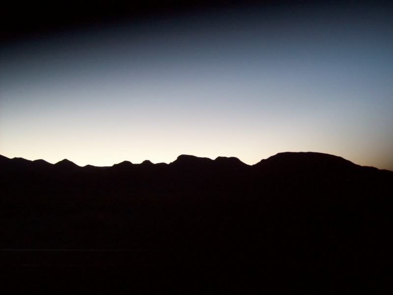
Have you ever tried to go to bed at 8:00pm so that you can get up at 2:00am when your normal routine is 6:30am to 10:30pm? Well, it’s tough! I don’t know how much sleep I actually got, but the alarm going off at 2:00 seemed awfully early. Anyway, I was underway, heading east on US50alt by 2:38. The weather was clear as a bell, the temperature was 61ºF, the moon was nearly full and just a slight hint of wind from the south-west.
I rolled through Fallon at about 3:00 and turned south on US95; passed through Schurz at about 3:40; Hawthorne at 4:07 and then Luning; Mina and eventually arrived at Tonopah at 5:51am. I topped up on fuel and was ready to continue on. The truck took 11.7 gallons for the 213 miles since last fill-up for a mileage of 18.2. Not bad. That was for smooth pavement at 65 to 70 mph at 61º, very low humidity (perhaps 10%), no traffic at all and elevations ranging from 4000 to 6300 feet. By the way, the moonset and sunrise were both gorgeous.
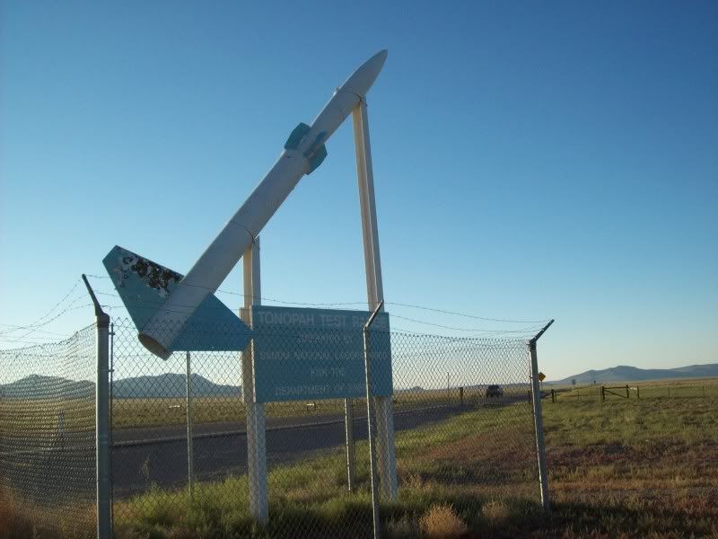
Heading east from Tonopah on US6 would have been much better if I hadn’t have had to drive directly into the sunrise. I even had to stop and clean the bugs off the windshield at the Tonopah Test Range turn-off. The bugs just glowed in the sun glare. For the uninformed: The Tonopah site is where the F-117 was tested among other things – at its south-east end is Groom Lake (Area 51) among other things. Anyway; I arrived at the Lunar Craters turn-off at 7:24am with an accumulated total of 247.5 miles on the GPS odometer.
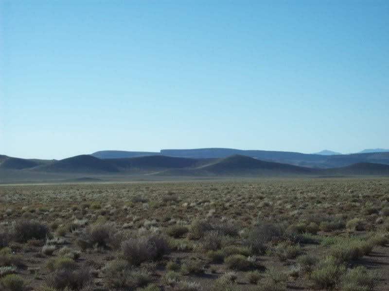
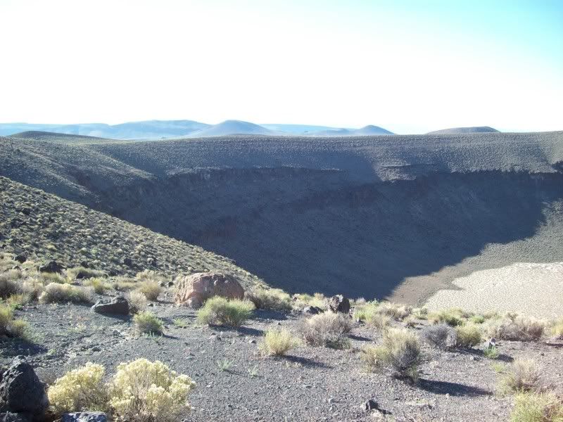
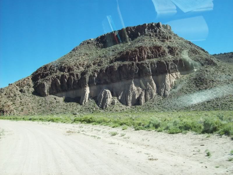
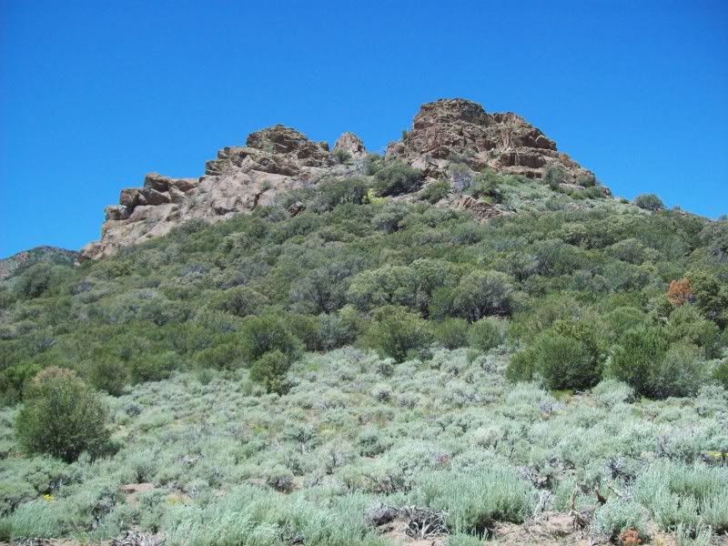
The Lunar Crater volcanic area covers about 50 square miles and includes several dozen cinder cones and the large Lunar Crater itself. The roads are mostly pretty well graded and could be done with a two wheel drive pickup except for a couple of wash crossings over in the Lunar Cuesta/Palisade Mesa area. The ground is covered in cinders and lava bombs (there is a large lava field to the east that I did not drive to).
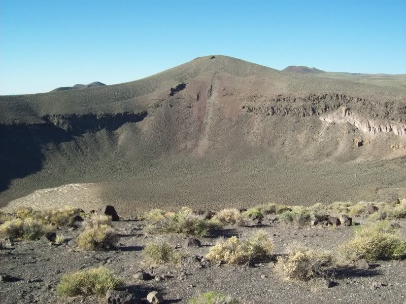
The Lunar Crater itself is about 4000 feet in diameter and 800 feet deep. Some of the named cones are: Easy Chair Crater, North Kidney Butte, South Kidney Butte and lots of un-named cones. Surrounding the craters are buttes and mesas that are the eroded remains of much older lava flows and fault scarps. I didn’t do any climbing or hiking as I wanted to cover a lot of country to the north. I exited the cratered area via a valley to the west bounded by Palisade Mesa (a seven mile long lava mesa with 1000 foot cliffs) and Little Lunar Cuesta (the lava topped small buttes). Incidentally, the area just visited is at the north end of the Pancake Range.
At this point I decided to modify my trek a bit by skipping the visit to Project faultless and instead run straight across the Hot Creek Valley to the mouth of Hot Creek Canyon. Approaching Hot Creek Ranch I find that the roads have changed a bit since these maps were last updated. The road to gain access to the canyon now runs around the south side of the ranch about two miles and then a new road bypasses the main ranch and buildings along a shelf. At the first gate I was able to ask one of the ranch hands if the canyon road was open to the public. He said yes and there are lots of gates; just close them.
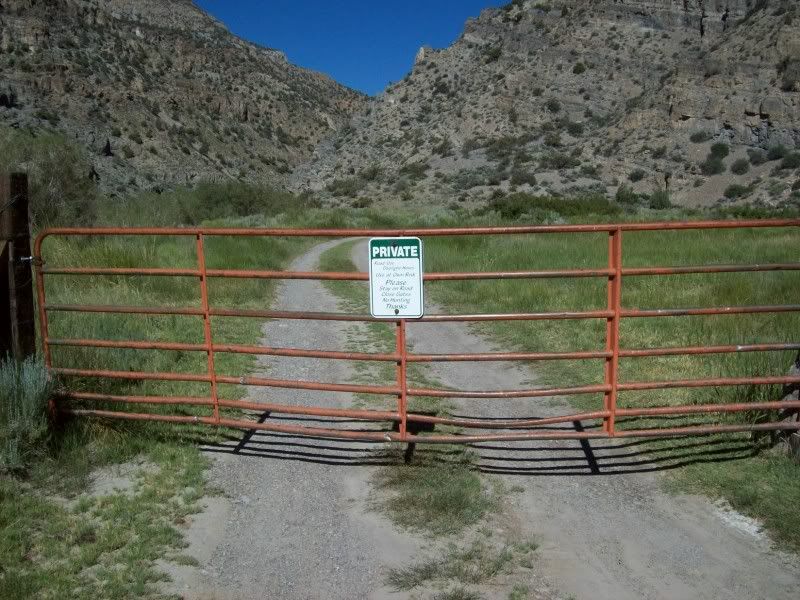
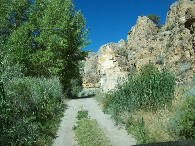
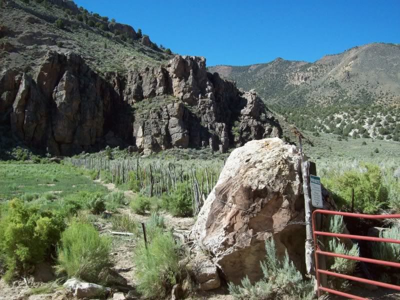
Hot Spring Canyon is about eight miles long, averages about 1000 feet wide at its flat well watered bottom and is bounded by 1000 to 1500 foot cliffs on both sides. The cliffs to the north are on Humboldt-Toiyabe National Forest Lands and the cliffs to the south are on Bureau of Land Management Lands. There are four separate ranches that are privately owned and the natives are friendly. Every quarter to half mile there is a fence from cliff to cliff with a gate and the cattle are moved periodically from pasture to pasture. The canyon bottom is really well watered and rich with grass and cottonwood trees.
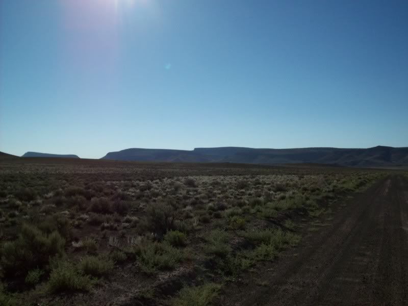
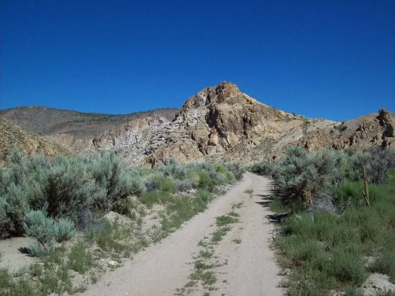
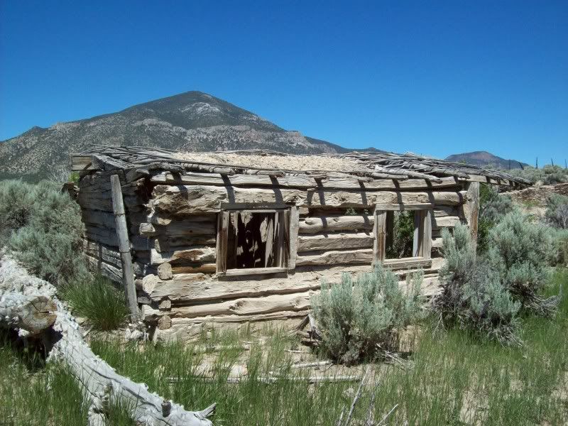
After passing Hot Creek Ranch I went through Upper Hot Creek Ranch and then came to Old Dugan Ranch where I stopped to chat with the owner for a few minutes. From there it was on to the Old Page Place where there is a very old log cabin that has been re-roofed with asphalt shingles and skylights. Then it’s on past Cress Spring, Pat Spring, Upper Warm Spring and finally to the band where the country dries out and looks like Nevada again. The cliffs are a bit strange: at the bottom they are diatomite for about 200 feet, capped by a layer of about 400 feet of limestone and finally topped by hundreds of feet of basalt. The diatomite is indicative of a fresh water lake, the limestone probably a shallow sea and the basalt is volcanic.
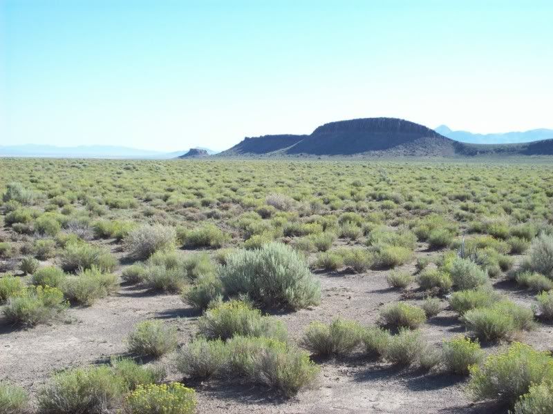
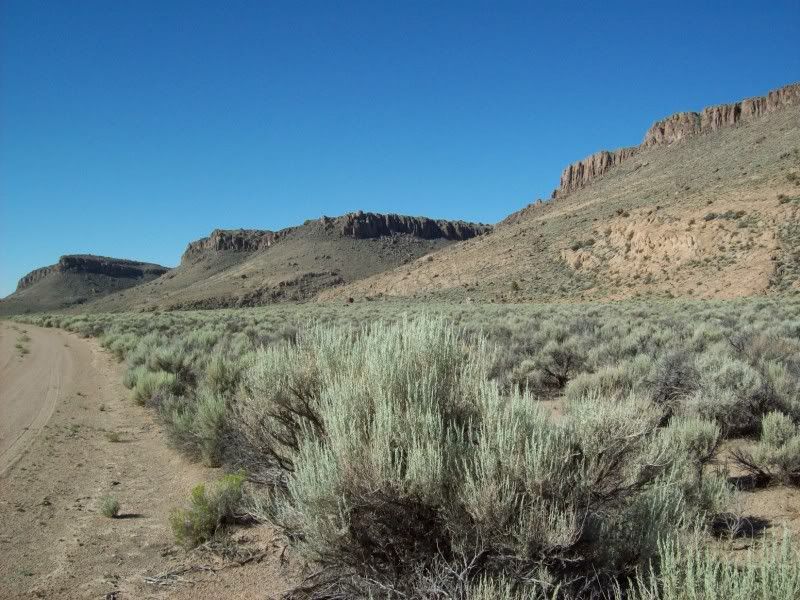
Running north through Box Canyon, basalt cliffs, I cross a headwater divide and begin descending into Fish Lake Valley. I’m now on USFS lands. The valley is broad, maybe 12 to 15 miles, bounded on the east by the Hot Creek Range and the west by the Monitor Range. The valley is about 6300 feet and the ranges on both sides top out at above 10,000 feet. The valley bottom is sage brush and grass covered with scattered juniper trees here and there. The mountains are pinion pine and juniper until the tree line at about 8500 feet where they become bare and alpine.
At Fish Lake there are cattle everywhere and I pass an old log cabin. There is a modern ranch complex at Little Fish lake Ranch that probably runs all of the cattle on mostly leased USFS land.
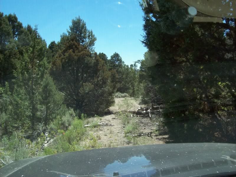
Where Danville Creek drops into the valley I turn off the main road onto a primitive trail that heads up a valley towards a ghost town mining camp called Danville. Very soon the trail gets really overgrown with a few fallen trees and large brush and juvenile trees between the tire tracks. I’m able to move or break off most of the fallen tree branches. Pretty soon the trail just ends at an overgrown spring and a rushing creek.
The town and mines are supposed to be here but all I can find is a sign made by the Lana Gold Mining Company of Vancouver, BC. That says this is Danville. I turn around and return to the USFS road.
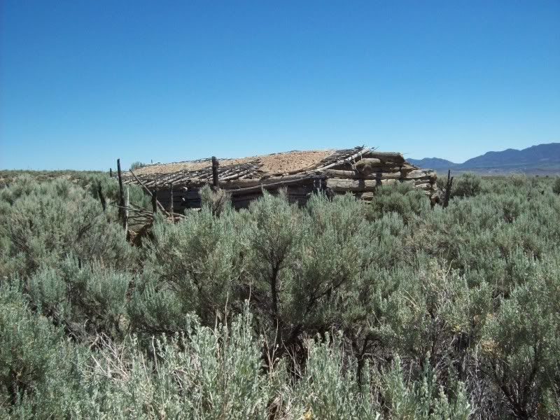
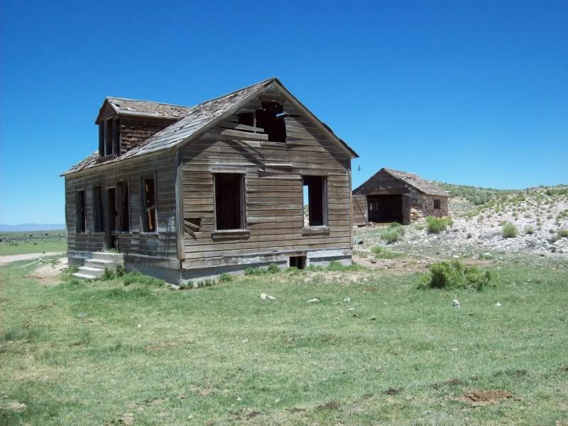
A few more miles north and I am at the Clear Creek Ranch. It has been abandoned for a very long time and consists of at least four buildings and some stone corrals all overgrown with brush.
Several miles further north and I turn west up Dobbin Canyon. The trail is very steep in loose gravel and I make a short photo stop at what the forest service calls Miniature Grand Canyon. Heading further up I see that the Service Engine Soon light has come on. I finally stop at Dobbin Summit and shut her down. I’m at 8637 feet, its 11:55am and I’ve accumulated 366 miles. While eating some lunch, I check over everything that I can think of under the hood plus remove, clean and re-attach the gas cap. I’ve left my OBD2 at home so cannot check and shut off the light. Then I continue down Dobbin Wash on the west side of the mountain and arrive in Monitor Valley.
I cross the valley diagonally, passing a lot of hot springs and the abandoned Potts Ranch buildings. After the Monitor Ranch (more roads that have been moved since last mapped) I start up Sam’s Canyon in the Toquima Range. Near the top I start looking for a trail that will take me to Toquima Paleo-Indian Cave. I find a trail that is really a jumble of rocks. Pretty soon it just ends but I can see the cave about 100 feet above me with a bunch of people gathered around it.
After I clamber over the rocks to the cave I found a group of students and a couple of Professors from The University of Nevada, Reno out on a field trip. One of the girls commented that I looked like a really cool “Jeep Commercial” climbing up through the rocks. I chatted with a Professor Tausch who is a sage brush researcher. I mentioned the caves at Winnemucca Lake. I asked him if he was an expert on all of Nevada’s 40-something species of sage brush. He admitted that he has only actually found about half of them. Oh, they had hiked to the cave up from the campground about a mile down the road. My route was much shorter.
After the climb down to the truck and the ride back to the road I found the campsite and then continued on over Pete’s Summit and then Down Henry Meyer Canyon and then out onto Big Smoky Valley. I can see the pass in the Toiyabe Range where US50 passes through Austin. I reach the highway at 1:49 after 396 miles. At Austin I fill up with 14.0 gallons at 407 miles. 194/14 = 13.85 mpg. After a crappy lunch at a crappy restaurant I head west on 50 towards Fernley.
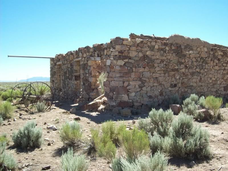
After crossing the Reese River Valley and the Shoshone Mountains, I turn off the highway in the Smith creek valley to look for Peterson’s Mill. I found it; an old stone building and some ruins near a small reservoir and lots of horse pasture.
Back to the highway, moving further west, I turn off again to check out the New Pass Mines. After about five miles up the road, I’m slowing to take a photo and all of a sudden a chime goes off and the ETC and ABS warning lights come on. A bit later the BRAKE warning light comes on. I turn around and stop, but do not shut anything down (just in case I have an alternator or battery problem). I check out the alternator and battery and everything appears OK. At this point I decide to finish the trip home with no further side excursions. I arrive at home at a bit after 6:00pm and a total of 550 miles.
It has been a fun but looong day! I’ll check out the truck tomorrow.
I had wanted to do this trek for some time now. I’ve been asking lots of people to join me too; old buddies who had wheeled with me before, hinted about the trek on a couple of websites, the guys at Rocklin, etcetera to no avail. At first I had planned to get a motel at Tonopah on a Friday evening and then head out to Lunar Craters early on Saturday morning. After the craters I had thought about visiting Tybo and Keystone and then return to Tonopah and then back to Fernley.
When I finally decided, last Monday, to do it alone; I changed the agenda somewhat. I was going to make a giant 500 mile plus loop that would be a bit tricky as to being able to have enough fuel to get from Tonopah to Austin and still being able to see as much country as possible between them; and also being able to do it all in one day. The solution: carry an extra ten gallons of fuel, enough quick food and water for two days, and rudimentary camping gear along with the rest of the off-road equipment usually carried. The “one day” plan:
119º 20’W - 39º 36’N - - Fernley 0200 GAS
117º 12’W - 38º 06’N - - Tonopah 0530 GAS
116º 00’W - 38º 24’N - - Lunar Craters 0630
116º 13’W - 38º 38’N - - Project Faultless 0830
116º 20’W - 38º 31’N - - Hot Creek Canyon 0900
116º 28’W - 38º 37’N - - Little Fish Lake 1100
116º 29’W - 38º 54’N - - Miniature Grand Canyon 1615
116º 47’W - 39º 11’N - - Toquima Cave 1715
117º 42’W - 40º 00’N - - Austin 1830 GAS
119º 20’W - 39º 36’N - - Fernley 2045 HOME
Total Mileage on pavement = 419
Total Mileage on dirt = 146
Total Mileage – ALL = 565
As it turned out, I was able to stick fairly close to the plan.
Have you ever tried to go to bed at 8:00pm so that you can get up at 2:00am when your normal routine is 6:30am to 10:30pm? Well, it’s tough! I don’t know how much sleep I actually got, but the alarm going off at 2:00 seemed awfully early. Anyway, I was underway, heading east on US50alt by 2:38. The weather was clear as a bell, the temperature was 61ºF, the moon was nearly full and just a slight hint of wind from the south-west.
I rolled through Fallon at about 3:00 and turned south on US95; passed through Schurz at about 3:40; Hawthorne at 4:07 and then Luning; Mina and eventually arrived at Tonopah at 5:51am. I topped up on fuel and was ready to continue on. The truck took 11.7 gallons for the 213 miles since last fill-up for a mileage of 18.2. Not bad. That was for smooth pavement at 65 to 70 mph at 61º, very low humidity (perhaps 10%), no traffic at all and elevations ranging from 4000 to 6300 feet. By the way, the moonset and sunrise were both gorgeous.
Heading east from Tonopah on US6 would have been much better if I hadn’t have had to drive directly into the sunrise. I even had to stop and clean the bugs off the windshield at the Tonopah Test Range turn-off. The bugs just glowed in the sun glare. For the uninformed: The Tonopah site is where the F-117 was tested among other things – at its south-east end is Groom Lake (Area 51) among other things. Anyway; I arrived at the Lunar Craters turn-off at 7:24am with an accumulated total of 247.5 miles on the GPS odometer.
The Lunar Crater volcanic area covers about 50 square miles and includes several dozen cinder cones and the large Lunar Crater itself. The roads are mostly pretty well graded and could be done with a two wheel drive pickup except for a couple of wash crossings over in the Lunar Cuesta/Palisade Mesa area. The ground is covered in cinders and lava bombs (there is a large lava field to the east that I did not drive to).
The Lunar Crater itself is about 4000 feet in diameter and 800 feet deep. Some of the named cones are: Easy Chair Crater, North Kidney Butte, South Kidney Butte and lots of un-named cones. Surrounding the craters are buttes and mesas that are the eroded remains of much older lava flows and fault scarps. I didn’t do any climbing or hiking as I wanted to cover a lot of country to the north. I exited the cratered area via a valley to the west bounded by Palisade Mesa (a seven mile long lava mesa with 1000 foot cliffs) and Little Lunar Cuesta (the lava topped small buttes). Incidentally, the area just visited is at the north end of the Pancake Range.
At this point I decided to modify my trek a bit by skipping the visit to Project faultless and instead run straight across the Hot Creek Valley to the mouth of Hot Creek Canyon. Approaching Hot Creek Ranch I find that the roads have changed a bit since these maps were last updated. The road to gain access to the canyon now runs around the south side of the ranch about two miles and then a new road bypasses the main ranch and buildings along a shelf. At the first gate I was able to ask one of the ranch hands if the canyon road was open to the public. He said yes and there are lots of gates; just close them.
Hot Spring Canyon is about eight miles long, averages about 1000 feet wide at its flat well watered bottom and is bounded by 1000 to 1500 foot cliffs on both sides. The cliffs to the north are on Humboldt-Toiyabe National Forest Lands and the cliffs to the south are on Bureau of Land Management Lands. There are four separate ranches that are privately owned and the natives are friendly. Every quarter to half mile there is a fence from cliff to cliff with a gate and the cattle are moved periodically from pasture to pasture. The canyon bottom is really well watered and rich with grass and cottonwood trees.
After passing Hot Creek Ranch I went through Upper Hot Creek Ranch and then came to Old Dugan Ranch where I stopped to chat with the owner for a few minutes. From there it was on to the Old Page Place where there is a very old log cabin that has been re-roofed with asphalt shingles and skylights. Then it’s on past Cress Spring, Pat Spring, Upper Warm Spring and finally to the band where the country dries out and looks like Nevada again. The cliffs are a bit strange: at the bottom they are diatomite for about 200 feet, capped by a layer of about 400 feet of limestone and finally topped by hundreds of feet of basalt. The diatomite is indicative of a fresh water lake, the limestone probably a shallow sea and the basalt is volcanic.
Running north through Box Canyon, basalt cliffs, I cross a headwater divide and begin descending into Fish Lake Valley. I’m now on USFS lands. The valley is broad, maybe 12 to 15 miles, bounded on the east by the Hot Creek Range and the west by the Monitor Range. The valley is about 6300 feet and the ranges on both sides top out at above 10,000 feet. The valley bottom is sage brush and grass covered with scattered juniper trees here and there. The mountains are pinion pine and juniper until the tree line at about 8500 feet where they become bare and alpine.
At Fish Lake there are cattle everywhere and I pass an old log cabin. There is a modern ranch complex at Little Fish lake Ranch that probably runs all of the cattle on mostly leased USFS land.
Where Danville Creek drops into the valley I turn off the main road onto a primitive trail that heads up a valley towards a ghost town mining camp called Danville. Very soon the trail gets really overgrown with a few fallen trees and large brush and juvenile trees between the tire tracks. I’m able to move or break off most of the fallen tree branches. Pretty soon the trail just ends at an overgrown spring and a rushing creek.
The town and mines are supposed to be here but all I can find is a sign made by the Lana Gold Mining Company of Vancouver, BC. That says this is Danville. I turn around and return to the USFS road.
A few more miles north and I am at the Clear Creek Ranch. It has been abandoned for a very long time and consists of at least four buildings and some stone corrals all overgrown with brush.
Several miles further north and I turn west up Dobbin Canyon. The trail is very steep in loose gravel and I make a short photo stop at what the forest service calls Miniature Grand Canyon. Heading further up I see that the Service Engine Soon light has come on. I finally stop at Dobbin Summit and shut her down. I’m at 8637 feet, its 11:55am and I’ve accumulated 366 miles. While eating some lunch, I check over everything that I can think of under the hood plus remove, clean and re-attach the gas cap. I’ve left my OBD2 at home so cannot check and shut off the light. Then I continue down Dobbin Wash on the west side of the mountain and arrive in Monitor Valley.
I cross the valley diagonally, passing a lot of hot springs and the abandoned Potts Ranch buildings. After the Monitor Ranch (more roads that have been moved since last mapped) I start up Sam’s Canyon in the Toquima Range. Near the top I start looking for a trail that will take me to Toquima Paleo-Indian Cave. I find a trail that is really a jumble of rocks. Pretty soon it just ends but I can see the cave about 100 feet above me with a bunch of people gathered around it.
After I clamber over the rocks to the cave I found a group of students and a couple of Professors from The University of Nevada, Reno out on a field trip. One of the girls commented that I looked like a really cool “Jeep Commercial” climbing up through the rocks. I chatted with a Professor Tausch who is a sage brush researcher. I mentioned the caves at Winnemucca Lake. I asked him if he was an expert on all of Nevada’s 40-something species of sage brush. He admitted that he has only actually found about half of them. Oh, they had hiked to the cave up from the campground about a mile down the road. My route was much shorter.
After the climb down to the truck and the ride back to the road I found the campsite and then continued on over Pete’s Summit and then Down Henry Meyer Canyon and then out onto Big Smoky Valley. I can see the pass in the Toiyabe Range where US50 passes through Austin. I reach the highway at 1:49 after 396 miles. At Austin I fill up with 14.0 gallons at 407 miles. 194/14 = 13.85 mpg. After a crappy lunch at a crappy restaurant I head west on 50 towards Fernley.
After crossing the Reese River Valley and the Shoshone Mountains, I turn off the highway in the Smith creek valley to look for Peterson’s Mill. I found it; an old stone building and some ruins near a small reservoir and lots of horse pasture.
Back to the highway, moving further west, I turn off again to check out the New Pass Mines. After about five miles up the road, I’m slowing to take a photo and all of a sudden a chime goes off and the ETC and ABS warning lights come on. A bit later the BRAKE warning light comes on. I turn around and stop, but do not shut anything down (just in case I have an alternator or battery problem). I check out the alternator and battery and everything appears OK. At this point I decide to finish the trip home with no further side excursions. I arrive at home at a bit after 6:00pm and a total of 550 miles.
It has been a fun but looong day! I’ll check out the truck tomorrow.