March 2010 Moab-Swell- Bryce trip report

HenryJ

Expedition Leader
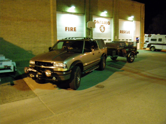
Our trip started right on schedule. Last stop at the fire station to ice up the drink cooler.

IMGP0105.JPG

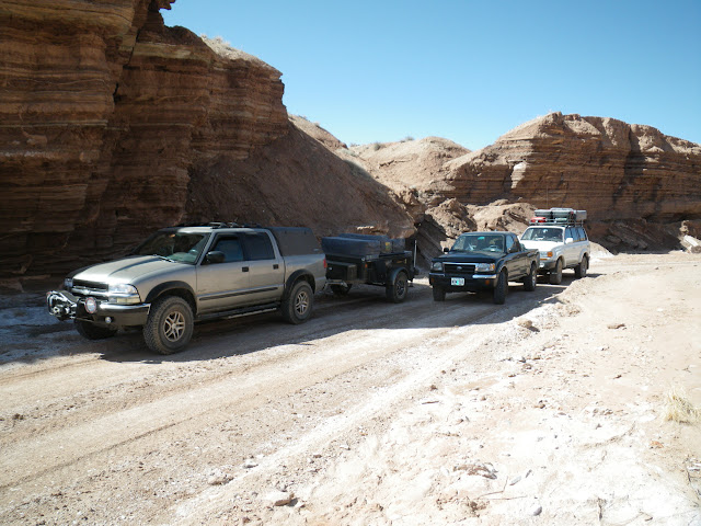
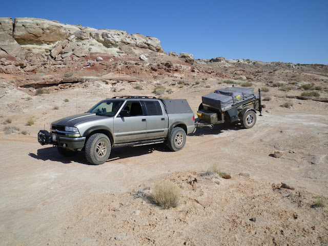
The trip south was uneventful. Rest stop - Lunch break. I had a quick conversation with an older gentleman who had followed us to the sandwich shop. He looked to be a rancher type and was very interested in the trailer.

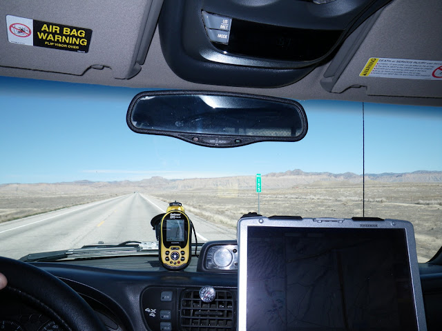
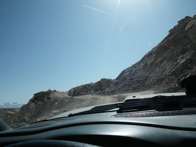
We arrive in Moab late the evening of the first day. It took right at 12 hours to get there.

The next morning we made a run to the City Market and T-Shirt shop for some shirts and stickers.

This trip turned out to be all about the elements. As we would later learn all elements were delivered in pairs.

The first was Water-
IMGP0122.JPG


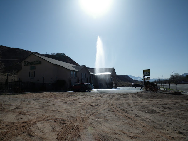
As we were awaiting the arrival of Jack and Eric, the motel we were watching from above, sprouted a geyser. A man had been working on a water line out front and obviously ran into problems. This was followed by the typical OCRIS (Oh, Crap, Run-In-Circles). We were expecting a real disaster when the maid came out with a steel garbage can and attempted to contain the geyser. Fortunately she did not get in the way when it blew the can upward. Quite a comical show with all the running around and crazy ideas on how to help the situation.
We walked down and tried to assist in shutting off the water meter, but to no avail as the tools we had available were not appropriate and the valve very stuck.
Finally we convinced the gentleman to contact public works. Eventually a service vehicle arrived and the water was shut off.

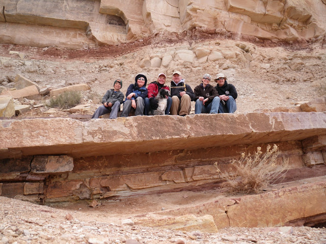
Jack and Eric Joined us and as we were leaving Moab, we saw a large fire ahead. The second element- Fire. It turned out to be workers burning the large build up of tumble weeds. No emergency, although it looked impressive from the road. Firefighter types are always impressed with fire , I guess.

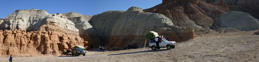
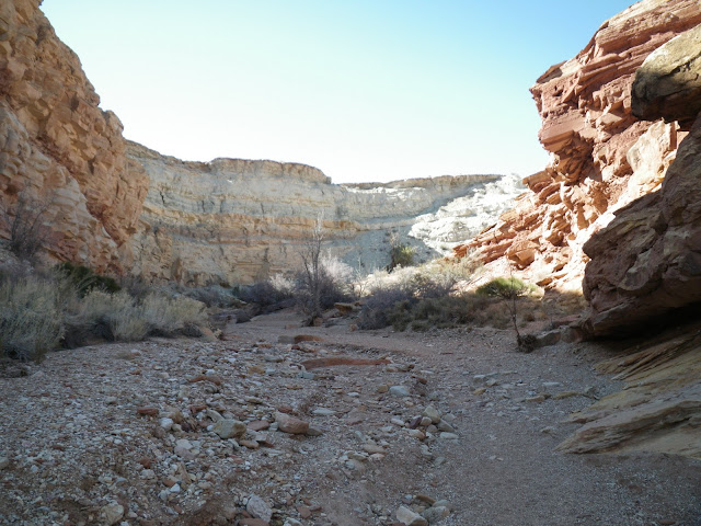
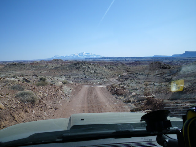
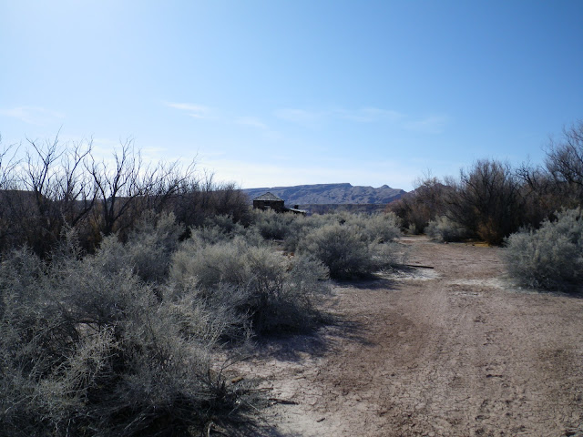
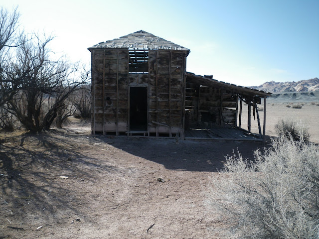
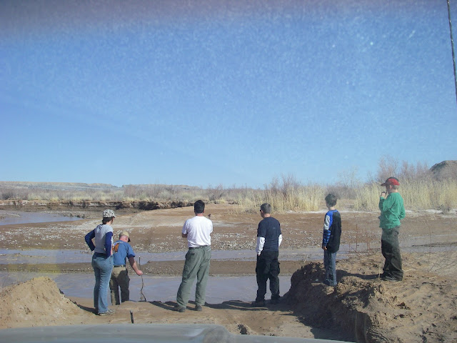
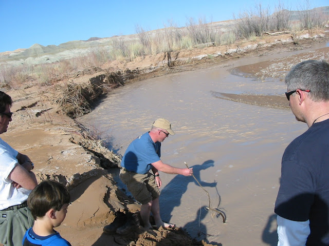
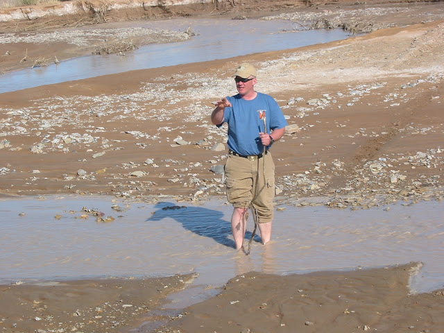
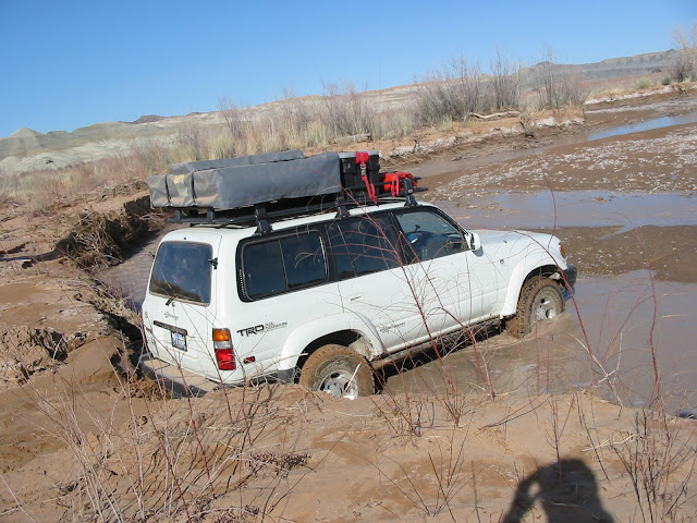
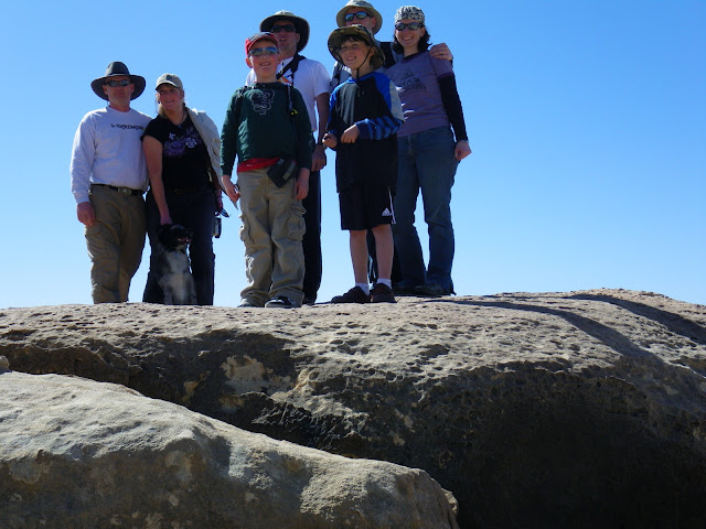
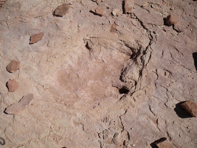
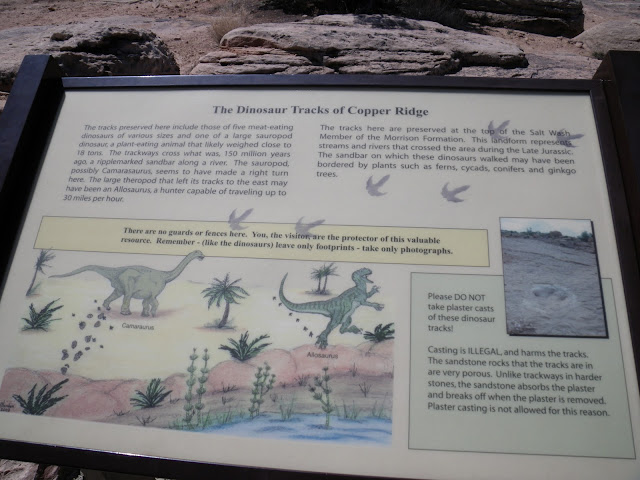
On to the Sauropod track site.

IMGP0125.JPG
 
Last edited:

HenryJ

Expedition Leader
The short jaunt north to the track site was over quickly. It is pretty neat to see the prints and the spacing of the steps.

IMGP0127.JPG


I know that we were told to bring a small brush and some water to clean them up so that they show up better. We had water , but no brush, and really just forgot about that until we were ready to leave.

IMGP0133.JPG


We did a quick side attraction and found a nice Geocache nearby. TFTH!
 

Richie

Adventurer
It looks like you guys had fun. The Toyota's were in good company with your S10. :bike_rider:
 

HenryJ

Expedition Leader
I did get a little friendly ribbing about the superiority of the Toyotas ;)
However I was the one left as an anchorman to recover them should they get stuck :)

Next we are off to Goblin Camp!

I was so careful to share waypoint files and load them on mine too. However, I neglected to include the route file that had waypoints for the track site and campsites. I learned a little something there. That will not happen again.
The new-to-me refurb Panasonic Toughbook did not miss a beat. What a great bargain that was.

IMGP0137.JPG


The road to the campsite was easy to find and the reports of all the little box canyons was right on the money. We could not access what I had set as Goblin Camp. The washes had cut off access to that waypoint. The road ended before it, but there were plenty of other suitable locations. We decided on the second to last and set up camp.


Camp was all set in good time. A little work to clean the fire pit and stack the wood we brought. Then a nice dinner and second lesson on Brazillian BBQ.
This night the next of the elements was shown to us.
Wind.
I don't think anyone got a good nights sleep. The wind really howled. Everything that could flap or fall over, did.
Rising early and a bit weary the morning brought calmer winds and a nice day.

IMGP0176.JPG
 

HenryJ

Expedition Leader
A breakfast of ziplock bag omelets and we are off to Goblin Valley. Greeting us at the entrance are the three sisters.

IMGP0182.JPG


The whole place really is from another planet. I understand that the Rock man scene from Galaxy Quest was filmed here.


Still a little windy, we made the most of it by flying a kite as we wandered among the rock warriors.

IMGP0205.JPG


The whole morning was spent here. We ate lunch and the next stop was to be the waterfolds of Little Wild Horse Canyon.
 

HenryJ

Expedition Leader
The road to Little Wild Horse Canyon passes right by our campsite.

IMGP0219.JPG


It is not a long drive , other than avoiding the constriction equipment working on the road. It is freshly graded and compacted to the canyon now.
A short trail leads to the canyon. Jack stayed behind to rid himself of some awake time. The drive left him weary and need of a nap.

IMGP0222.JPG


Little Wild Horse and Bell canyons are linked by a path. This day we chose to venture up Little Wild Horse. We stopped for a quick group shot on a large ledge. It reminded me of something from a post apocalyptic movie with swelled and broken roadways. Charlton Heston's line from Planet of the Apes came to mind.."Damn you... you destroyed it! Damn you all to hell!"

IMGP0232.JPG


Around each corner the folds got better and better.

IMGP0234.JPG


Traversing the path required some minor climbing and a few places were tight enough to slide sideways.

IMGP0291.JPG


The whole place is just amazing. Rock knurled and twisted in to such wonderful creations.

We did not travel the loop this day as it was getting late in the day so we returned as we came and headed back to camp.
 

HenryJ

Expedition Leader
This day was the second of the Wind elements. Making the most of it we hoisted the heavy kite:

IMGP0303.JPG

Tach's Dragon kite requires lots of wind. as with anything like this when you really need it it dies down.
Dinner this evening was Laurie's pork fried noodles.

IMGP0306.JPG


This night would bring better sleep as the wind died down and with that came a drop in temperature from the clearing skies. A little ice on the edges.

After fighting some greener than expected wood and the supply diminishing, the plan of attack for the next day was to pull up stakes and move on. Another visit to the Bell Canyon this time and off to Hanksville to replenish supplies.
 

1leglance

2007 Expedition Trophy Champion, Overland Certifie
Great pics & report, very cool to see families getting out and enjoying the outdoors together.
Keep it coming!
 

HenryJ

Expedition Leader
Bell Canyon

IMGP0325.JPG


It starts out wide and open. A little bit of snow in the shaded areas of this canyon. The journey started with a cache in need of replenishing. We took little and left more. Thanks Troop2! A nicely hidden cache found by our expert Steve-O.
This canyon was full of "hidey-holes"

IMGP0329.JPG


Even our dog got into the act-

IMGP0339.JPG


Lots of climbing over obstacles through here. With young ones along , their feet getting sore and near lunch time most of us decided to turn back. It looked to be at least a couple hours more to the half way point. Steve-O and Kira decided to make the full loop and pushed on.
We returned to the vehicles ate lunch and lazied about the rigs for a while. They did make it back in good time and said we did the right thing by turning back with the kids and dog. There were some pretty substantial climbs and drops that we missed.
The sandstone is VERY hard on things. I scratched up my camera pretty good. The dogs pads were worn clean. She was done hiking for the rest of our trip. Next time I will bring booties for her.
Everyone fed and rested a little we headed out the "other" way. We were soon greeted by a road sign saying that this road was no longer maintained and may not be passable. Woo Hoo! Our kind of road!

IMGP0352.JPG


The terrain was not too bad. Some climbs, rocky areas and soft stuff. I greatly contrasted with the first half of the road. This was barren almost dark dirt mining type terrain.

IMGP0357.JPG


This road did not show up on my maps. It did roughly follow the direction of one in a USGS map, but cut back an fourth in different directions. Jack said he did find it in another of his mapping programs. I don't recall which.

IMGP0366.JPG
 

HenryJ

Expedition Leader
Up on top again.

IMGP0362.JPG


This landscape was rough , barren and alien. Piles almost like a crusher had been in piling the grindings. A beautiful multi colored layer pyramid right in the middle of it all. Almost out of place, but perfectly natural. It all opened up to a huge flat.

IMGP0372.JPG


In the distance I could see a structure. It was off the road and bordering a fenced area.

IMGP0384.JPG


With the names of the road and canyon being related to horses, I will assume that this must have been some sort of corral and line shack for a horse ranch.
The first structure was collapsed.

IMGP0379.JPG


Rough hewn lumber, mudded joints and chicken wire stucco interior. Roof ridge made from gallon steel (rusted) cans. From here you could see the "new" house.

IMGP0380.JPG


This one was really upscale with a loft, or second story, although we really found on way to access it. Under the spacious porch was a nice fire place. Lots of work went into this one and I bet it was quite a nice shack in its day.

IMGP0382.JPG


Back to the rigs and on the road. Mapping shows our point of decision ahead.
 

HenryJ

Expedition Leader
I could clearly see at least three washes lie ahead. One pretty wide blue line. I knew that we were in for something as I had seen the picture of the red truck negotiating a cut into the banks of a wash. Thus far the signs had been light. We had been watching the drainage along the way for signs of erosion and the chance that we might meet doom at the banks of a river cut.

Our first decision.

IMGP0387.JPG


This was a twin channel. On the other side a set of tracks coming toward us stopped deep and I assume were pulled back. They were deep and the tracks in front of us I had to assume could be the same. The width of the tires that had tracked through had me assume 35"-36" tires as they were a full 12" tread width. Jack and I run 33" tires. Kira's rig 31".
Poking around a little it did feel like it had a bottom. The problem would be if the ruts were too deep. The right bank was silt and very soft mud. The best option looked to be hugging the left bank.
We talked it over and decided Jack would go first. I have the winch and could pull him back if need be. kira would go second as Jack could hook a strap and pull her through. The two of them together could anchor me if I needed to winch through.

A little bounce to the left and Jack pulled through with out a problem.

IMGP0389.JPG


Kira's tires were not as aggressive as the BFG TAKO Jack and I run. About half way through she slipped to the side and into the ruts. I think she was past the worst of it and stayed in to to pull through with out a problem.

IMGP0392.JPG


A battery failure in Laurie's camera happened just as I entered. Just as well as it was nothing special. It felt good and no issues pulling through for me. On I go and around the next turn...

IMGP2352.JPG


We looked this over just as carefully. A blade had cut down the top foot. Still it was down probably another two foot to a briskly flowing Muddy Creek. It was maybe 60' across, with a muddy bar in the middle.
A little poking from the shore was not going to tell us enough about this crossing.

IMG_2050.JPG


Off with the shoes and into the FREEZING water I go! Dumb? Crazy? Well... no one else volunteered. The mud at the mid point was maybe 10" deep. It had a good solid bottom. Jack and Kira should do fine there as they would get a little run at it once they dropped into the creek. I had to wait for the trailer to drop before I "get after it". That would put me into it before I could gain momentum.

IMG_2052.JPG


The other side was not nearly as deep. Overall the deepest part was maybe calf deep on me. My left pant leg did get a little wet.

We chose the same order for the same reasons. Jack was the guinea pig.

IMGP2363.JPG
IMG_2056.JPG


He made it look easy. The wet sand of the bank really held the weight well. Nice and easy in then across.

IMGP0400.JPG


A call on the radio and Jack ran ahead a little way to see if there was anything more in our path. Coming back up this slope would not be as easy as it was going down. He went quite a distance and said, although soft there did not appear to be another crossing or further obstacles in our near future.
 
Last edited:

Forum statistics

Threads
189,799
Messages
2,920,978
Members
232,931
Latest member
Northandfree
Top