My Journey

PNWY.....I was in Alabama Hills and the internment camp earlier this year when I drove to Portland to get the camper. I will return to Alabama Hills. It's certainly beautiful. Thank you.....

Sierra Valley.....I'll be headed into northern Nevada soon (at least that's what I'm thinking). If you know of any free / undeveloped hot springs (anything really) please let me know. Thank you.....

I'm always looking for new / unusual / rarely visited places so if anyone has any tips, please let me know. I'm headed south (generally) towards Baja, Mexico. Thank you.....

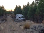
We left the Lava Beds National Monument through the what appeared to me seldom used southern route. Not too far down the road we pulled onto a national forest service road and found ourselves a spot for the night.....no neighbors, no generators.....me and my dogs.....
20181021_072638-1600x1200.jpg

It was a great spot for a long evening walk and again in the morning. So peaceful out there.....

20181021_072612-1600x288.jpg

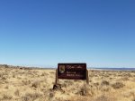
The plan from here was to stay on national forest service roads driving east and then spend the night at Clear Lake National Wildlife Refuge.....
20181021_112720-1600x1200.jpg

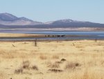
That plan was thwarted by barbed wire fences and locked gates. The lake was far off, but it sure was nice country.....

20181021_113853-1600x292.jpg

20181021_113934-1600x1200.jpg

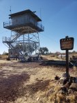
We pushed east, came across a sign for one more look out tower, so we took a hike to check out the views. On the summit of Blue Mountain.....
20181021_133414-1600x2133.jpg

After nearly 70 miles of gravel & dirt roads we finally came to a stop along the shores of Goose Lake.....

20181021_173547-1600x398.jpg

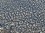
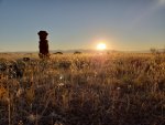
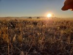
We walked from what once was the shores of the lake to the new shores of Goose Lake. The lake's surface had retreated nearly a mile. I think Tanner was hoping to swim.....
20181022_074340-1600x1200.jpg

20181022_074321-1600x1200.jpg

The dry lake bottom reminded me of the Tibetan Plateau.....
20181021_174245-1600x2133.jpg
 
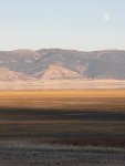
We spent the night here and watched the nearly full moon rise.....

20181021_181906-1600x279.jpg

20181021_180305-1600x271.jpg

The dry lake bed looked like an abstract piece of art.....

20181022_080937-1600x1200.jpg

We left a few hours after sunrise.....

20181022_074818-1600x319.jpg

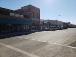
We then drove north, more gravel & dirt roads, and eventually re-entered Oregon and visited the small town of Lakeview, Oregon.....

20181022_111721-1600x1200.jpg

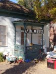
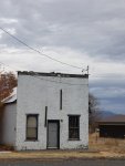
What a great little ranching community.....a dwelling I saw downtown.....

20181022_110001-1200x1600.jpg

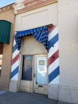
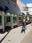
The main street barbershop closed down.....

20181022_111558-1200x1600.jpg

But this little town had 2 weed stores right across from each other on Main Street. Times sure have changed.....the woman holding the sign said business was great.....

20181022_113240-1200x1600.jpg

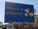
We loaded up with tax free groceries and cheaper diesel fuel, then, driving south again, we headed back into California.....

20181022_125905-1600x1200.jpg

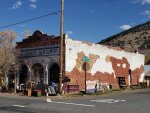
I love this old building I saw on the way, right on the state line (see road sign).....

20181022_125849-1600x1200.jpg
 
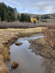
Now we've been wandering around quite a bit lately without any planned destinations but at this point in the trip, we'd made some plans.....and those plans revolved around the rarely explored Warner Mountains and the South Warner Wilderness Area. From all my research on Google, this area sounded desolate and quite amazing. So we drove south to the Alturas, California national forest service headquarters to get the local information before heading into the forest. As I was walking into the building I noticed a bulletin near the entrance door regarding the removal of wild horses in the Devil's Garden Plateau, just a few miles up the road. Oddly enough just 2 nights before this, I had come across a YouTube video about these wild horses, but had no idea where Devil's Garden Plateau was located, and had no plans to stop there. Next stop.....Devil's Garden Plateau.....
20181022_172154-1600x1200.jpg

20181022_172201-1600x1200.jpg

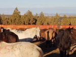
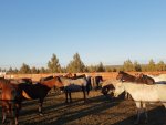
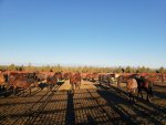
The Devil's Garden herd is the largest wild horse herd managed by the National Forest Service and currently has a population of approximately 3,900 wild horses.....and these horses live and thrive in an area that has been deemed livable for approximately 400 horses. Obviously the over grazing and the damage that they're doing to the environment has to be managed, so the forest service is in the process of removing 1,000 wild horses.....

What I saw was a first class operation managed by people that seem to care for the well being of the wild horses. The BLM has agreed to take 700 horses and to manage their adoption process. Horses will be available January, 2019. Apparently they're getting quite a bit of flack over this.....that's unfortunate.....

20181022_171941-1600x1200.jpg

20181022_172832-1600x350.jpg

Well, that was an unplanned visit.....but then we were right back on track.....into the Warner Mountains.....and Modoc National Forest.....

20181023_095957-1200x1600.jpg

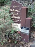
We drove about 20 miles east of Alturas, California with a goal of hiking into the South Warner Wilderness Area.....

20181023_110619-1200x1600.jpg

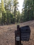
We camped at the Pine Creek trailhead, and the following morning hiked into the mountains.....

20181023_121403-1200x1600.jpg

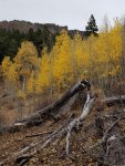
I'd read that the fall colors here were unmatched in quality but maybe we were just a little late in our timing.....

20181023_123624-1200x319.jpg

20181023_123734-1200x1600.jpg

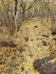
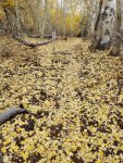
Golden leaves covered the trail and even the fallen leaves continued to show the beauty of Mother Nature.....

20181023_123827-1200x1600.jpg
 
20181023_123914-1200x1600.jpg

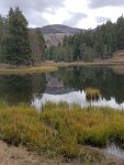
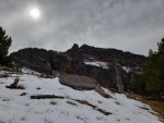
We hiked deep into the forest, passed by so many small mountain lakes as we ascended the mountain trail. After nearly 3 hours of hiking and exploring we reached the Summit Trail.....a trail that crosses the entire length of the Warner Mountains.....

20181023_140107-1600x199.jpg

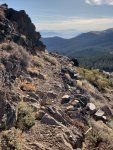
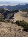
Here we had grand views looking east into Nevada, as well as looking west, back into California. We hiked the Summit Trail north until we came to a saddle in the mountains.....and here we had to choose between summitting Warner Peak (9,710').....

20181023_143208-1600x1200.jpg

Or descending from the saddle to check out Patterson Lake.....another summit was tempting, but with 2 dogs and possible Class 4 climbing, we chose the lake.....

20181023_141338-1200x1600.jpg

20181023_141145-1600x303.jpg

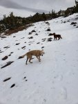
We descended the north slope.....covered in fresh snow.....the dogs must have thought we found Heaven.....I did.....

20181023_150326-1200x1600.jpg

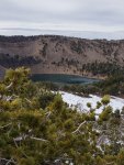
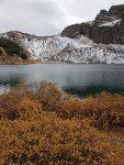
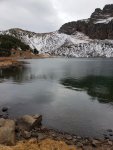
Patterson Lake was absolutely magical and magnificent.....

20181023_144541-1200x1600.jpg

20181023_144117-1600x223.jpg

Patterson Lake is actually quite unique as twice a year the water flips.... soon these green waters will turn turquoise.....and then in the spring, will again turn to the greenish tones.....

20181023_144447-1200x1600.jpg

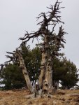
This old weathered tree, like the fallen leaves, still held unmatched beauty.....

20181023_144401-1200x1600.jpg
 
It was late in the afternoon and we needed to begin our ascent back up to the saddle, then backtrack the Summit Trail, and then descend into the mountain valley.....

20181023_155134-1600x294.jpg

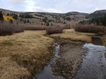
We followed the meandering banks of Pine Creek as we descended the mountain.....

20181023_162507-1600x1200.jpg

20181023_162532-1200x1600.jpg

It never fails to amaze me how different the exact same trail can look between ascending and descending.....it's just a truth.....

20181023_124833-1600x194.jpg

I seemed to notice more fall colors descending.....

20181023_155408-1600x1200.jpg

20181023_161315-1600x461.jpg

We explored the small mountain lakes again.....some were frozen over.....some were not.....

20181023_172032-1200x1600.jpg

20181023_172047-1600x1200.jpg

20181023_172111-1200x1600.jpg

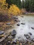
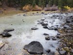
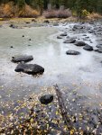
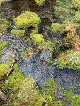
At the lower elevations the trail was surrounded by towering pines. Every stone in Pine Creek was totally covered with a green moss. Just before the end of our hike I looked down to the creek bed, maybe 50' down to the creek bed, and a huge bald eagle flew by.....magical.....

20181023_173216-1200x1600.jpg

We hiked nearly 14.5 miles that day with nearly 4,000 feet of elevation gain. It was a lot to ask of Yukon, but we all had a good day visiting Heaven.....
 

NevadaLover

Forking Icehole
If you need directions to good hot springs when you get into nevada, shoot me a P.M. and I will give you a list and directions, there are some nice ones.
If you get a chance go to the sheldon antelope refuge and follow the sign to yellow peak, it's the only fire lookout in northern nevada and 1 of 2 in the state
 
Last edited:

ROKTAXI

Adventurer
View attachment 480512

We hiked deep into the forest, passed by so many small mountain lakes as we ascended the mountain trail. After nearly 3 hours of hiking and exploring we reached the Summit Trail.....a trail that crosses the entire length of the Warner Mountains.....

View attachment 480513

Here we had grand views looking east into Nevada, as well as looking west, back into California. We hiked the Summit Trail north until we came to a saddle in the mountains.....and here we had to choose between summitting Warner Peak (9,710').....

View attachment 480524

Or descending from the saddle to check out Patterson Lake.....another summit was tempting, but with 2 dogs and possible Class 4 climbing, we chose the lake.....

View attachment 480525

View attachment 480514

We descended the north slope.....covered in fresh snow.....the dogs must have thought we found Heaven.....I did.....

View attachment 480515

Patterson Lake was absolutely magical and magnificent.....

View attachment 480520

View attachment 480521

Patterson Lake is actually quite unique as twice a year the water flips.... soon these green waters will turn turquoise.....and then in the spring, will again turn to the greenish tones.....

View attachment 480522

This old weathered tree, like the fallen leaves, still held unmatched beauty.....

View attachment 480523
Is that a fishing line I see near the top on the left side?
 

Pacific Northwest yetti

Expedition Medic
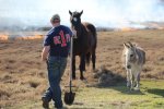
I have an adopted mustang from the Malhuer herd in Eastern Oregon- one of the best horses I have ever owned or worked with. The adopt a mustang program has a lot of bad press, but like most things its just lack of knowledge or experience with it. It is a great program, and needed. In the lands where peoples lively hoods depends on their grazing land for livestock and it being over grazed by wild protected horses, it can become real sticky in a quick way. Not to mention they make great horses of you have the patience to gain their trust. Roland, ( named from the Dark Tour series literature). Smart, loyal, and will do anything and can go all day in rough stuff. Always ready for the next trip, and so curious. Whilst burning pasture this year, they had 15 acres of green " safe " zone, choose to follow me around watching it instead. They were never in danger* In the picture with the flat bed, he is not even tied there, just left the lead rope on the flat bed as i tacked up. Not something that you could, or should do with most horses. He prefers the company of his "people herd" FB_IMG_1520812686671.jpgIMG_20180307_152908.jpg
 

Mccaf

Adventurist
As a follow up to Jerry’s post on the Devil’s Garden wild horses issue, I came across this article about an hour before I read the post on here.
http://www.latimes.com/local/lanow/la-me-modoc-county-lion-20181029-htmlstory.html

Enable private browsing if the LA Times blocks you (and wants a subscription).
Jerry, Looks like your post was spot on accurate, and you had “no plans to stop there” lol.


Now we've been wandering around quite a bit lately without any planned destinations but at this point in the trip, we'd made some plans.....and those plans revolved around the rarely explored Warner Mountains and the South Warner Wilderness Area. From all my research on Google, this area sounded desolate and quite amazing. So we drove south to the Alturas, California national forest service headquarters to get the local information before heading into the forest. As I was walking into the building I noticed a bulletin near the entrance door regarding the removal of wild horses in the Devil's Garden Plateau, just a few miles up the road. Oddly enough just 2 nights before this, I had come across a YouTube video about these wild horses, but had no idea where Devil's Garden Plateau was located, and had no plans to stop there. Next stop.....Devil's Garden Plateau.....
View attachment 480501

View attachment 480502

The Devil's Garden herd is the largest wild horse herd managed by the National Forest Service and currently has a population of approximately 3,900 wild horses.....and these horses live and thrive in an area that has been deemed livable for approximately 400 horses. Obviously the over grazing and the damage that they're doing to the environment has to be managed, so the forest service is in the process of removing 1,000 wild horses.....
What I saw was a first class operation managed by people that seem to care for the well being of the wild horses. The BLM has agreed to take 700 horses and to manage their adoption process. Horses will be available January, 2019. Apparently they're getting quite a bit of flack over this.....that's unfortunate.....
View attachment 480503

View attachment 480504

Well, that was an unplanned visit.....but then we were right back on track.....into the Warner Mountains.....and Modoc National Forest.....
View attachment 480505

We drove about 20 miles east of Alturas, California with a goal of hiking into the South Warner Wilderness Area.....
View attachment 480506
 
NevadaLover.....thanks for posting up and following along. Unfortunately I missed all the hot springs.....some of which were so close to me I could hardly believe it. But I did finally get a shower at a church mission.....I was so overdue.....
PNWY.....I swear there doesn't seem to be a right answer to some issues. I, being an avid hiker and a vegetarian, could easily do away with all the free range cattle that tramples the plants and pollutes the water (just like the wild horses). So called Wilderness Areas are covered in cattle ********. But I'm open minded enough to see both sides of the coin. People like you are certainly a part of the solution.....looks like a great horse and the dog I'm loving too.....

ROKTAXI.....I'm not sure which picture you're referring to but I assure you I'll never have another fishing pole in my hands. I grew up with a fanatical fisherman father and I always say that I've already fished a lifetime's worth.....

Sierra Valley.....thanks for the tips. I think I'm just now realizing how difficult it can be trying to help someone that has such a broad spectrum as to where we're going.....

Anyhow, after the climb, we headed back to Alturas, California, and from there we drove north, then east, climbing the Warner Mountains, crossing the Summit Trail at Cedar Pass (6,305'), and then dropping down into the small hamlet known as Cedarville (population 500), still in California.....

20181024_154038-1600x1200.jpg

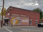
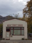
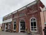
I think the best way to describe Cedarville is "charming".....

20181024_154145-1600x1200.jpg

20181024_155517-1600x1200.jpg

20181024_154952-1200x1600.jpg

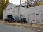
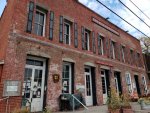
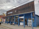
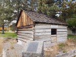
Cedarville, originally known as Deep Creek, was established in 1865 by James Townsend, and he was killed a year later in a fight with the Indians. Here's a shot of the trading post he built, the first dwelling in Cedarville.....

20181024_162034-1600x1200.jpg

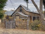
We hung out here for an afternoon, talked with a few locals, and grabbed a meal. With my "could I live here thought in mind", I checked out some real estate for sale. This in town cabin listed for $74,900.....

20181024_161051-1600x1200.jpg

I spoke with a woman that transplanted to Cedarville from Seattle and she said she loved the small town atmosphere but what a change of life. I loved this town.....

20181024_153931-1600x1200.jpg

20181024_155129-1200x1600.jpg

20181024_162723-1600x1200.jpg

.....I doubt I could ever live in a town so small.....but it sure is nice that others can so people like me can enjoy a day in their wonderful little town.....

20181024_160013-1200x1600.jpg
 
Mccaf.....thanks for linking that article. As I said in the PM (for the benefit of others reading this), the foal that died was born the night before we arrived. The national forest staff and the contractors were so proud of their new foal.....I can't even imagine how sad they (and the herd of horses) are after that sad event. The pictures I posted of the horses were taken by a contractor.....his goal was to get me a picture of the foal.....the horses were too protective of the foal, so no pictures.....

.....I also made a stop at the ranger station in Cedarville to get more local information on my next little adventure. My plan was to hike to the summit of Eagle Peak (9,898').....the highest peak in the Warner Mountains. The one point that the ranger in Cedarville emphasized was that I was hiking into an area with a high concentration of mountain lions. She said "keep your dogs close", and that's just what I did. We drove south, towards the trailhead, through Surprise Valley.....

20181024_174105-1600x558.jpg

Seventy miles long and ten miles wide, Surprise Valley was amazing. We drove into the mountains.....mule deer were abundant.....and always curious.....

20181024_171310-1600x1200.jpg

The ranger advised me not to take the truck / camper up the forest service road. I went three quarters of the way up.....it got steep.....

20181024_175439-1600x1200.jpg

We stayed here a few nights.....quiet with grand views.....

20181025_085825-1600x389.jpg

This hike would only be Tanner and I.....this would be a long day and a tough climb.....Yukon's joints were still healing.....

20181025_075339-1600x1200.jpg

So there we were, back into the South Warner Wilderness Area, but this time on the east side of the Warner Mountains.....

20181025_075614-1200x1600.jpg

With Tanner on leash all day, we once again went deep into the forest, then broke through the trees.....scenery constantly changing.....

20181025_100425-1200x1600.jpg

Emerson Lake down below.....

20181025_094208-1200x242.jpg

There's no trail to the summit so much of our climb was bushwacking and finding a route.....

20181025_124521-1600x335.jpg

Tanner ate the snow, and he cooled himself in it as well.....

20181025_124550-1600x1200.jpg
 
Masonjar.....it's so beautiful that it's hard to believe. The rangers say it's rarely visited (and they hope that never changes). I saw one other person my entire time hiking there.....

Once off trail, we worked our way through the pine forest, then it was a steep climb for quite a distance climbing through loose scree.....

20181025_131753-1600x2133.jpg

It's quite interesting to cross all the game trails along the mountainside.....

20181025_124454-1600x331.jpg

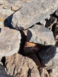
I'd read that this summit had a register so I searched around until I found it hidden in the rocks.....

20181025_130328-1200x1600.jpg

I'm not usually one to sign these things but on this day I did.....

20181025_130356-1600x1200.jpg

It's kind of cool to read the comments that people have left behind. I simply write my name and Tanner with the date.....

20181025_130517-1600x1200.jpg

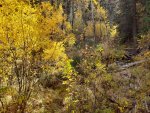
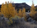
On the exit, we took a different trail out, much steeper as this trail followed the creek, still covered in yellow leafed aspens, down the mountain.....

20181025_150119-1600x1200.jpg

The roadside camp.....

20181026_072410-1600x1200.jpg

This day we hiked nearly 16.5 miles and we exceeded over 5,000' of elevation gain. I was sore.....

20181026_071759-1600x280.jpg

On the third day we returned to Surprise Valley.....

20181026_094140-1600x383.jpg

We drove south.....

20181026_093946-1600x383.jpg
 
Last edited:

Forum statistics

Threads
188,214
Messages
2,903,872
Members
229,665
Latest member
SANelson
Top