jscherb
Expedition Leader
Over the past dozen years or so I've done literally thousands of miles off-road, mostly in Colorado, Utah, Arizona and California. We make at least one and usually two trips out west each year to explore off-road because there's not much interesting off-road exploration possible in upstate NY. Most of the trail miles have been done in the LJ, but the Retro Wrangler pickup has been to Easter Jeep Safari and the JKU (and the LJ) have been camping in Death valley. The LJ has also done a little off-road in Alaska and about 500 miles off-pavement up there.
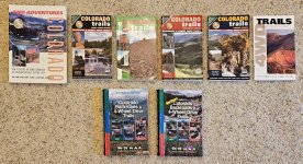
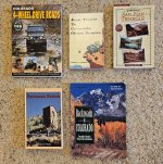
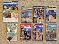
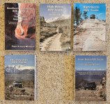
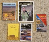
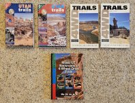
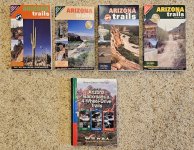
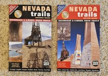
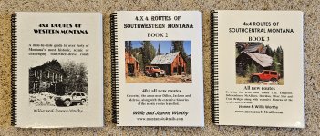
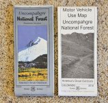
Since I'm a compulsive planner all of these trips are planned ahead of time in a lot of detail. I use a number of sources for planning these trips, and rely a lot on various trail guidebooks. Also Forest Service maps can be very helpful, and the MVUMs (Motor Vehicle Use Maps) can keep you out of trouble as they list places where one can drive and where one can't. These are available for a nominal fee at Forest Service Offices in the area you plan to explore. I got these two in the Montrose, Colorado office some years ago and I probably should get a new MVUM as they get updated with changes to areas available to motor vehicles. Many of the books I'll list here are available on Amazon and other new book sellers, but I've bought almost all of my collection on eBay and Thriftbooks.com, mostly for $10 or less.
I usually bring the books for an area we're about to explore with me on the trip, but I only use them if I decide to go off-plan and take a trail that wasn't part of the original agenda. For the trails we plan, I scan the book pages for the trails and print them because it's much easier to have printed pages than to try to keep the book open to the right page on the trail, and it saves wear and tear on the book. I also put the GPS coordinates from the book into my GPS so I can use that to follow the trail.
Having the printouts and the GPS coordinates is a good idea even at an organized event like Easter Jeep Safari. One year we were on the Secret Spire trail following the trail leader and he got lost. He stopped the group to try to figure out the way. A BLM person at the back of the pack came up to see what was wrong and she didn't know the trail either. Luckily I had the coordinates and the printout with me so I led the trail for a few miles until we got back to somewhere the leader knew.
I don't just use these books to plan longer expeditions - if I'm driving through a state I'll see if there's a trail near my route and if I have time I'll explore it. In 2022 on my way to Las Vegas for the SEMA Show I explored the trail to the bottom of the Grand Canyon on the Havasupai Indian Reservation. I planned my drive through the state to allow about 5 hours to detour onto the trail and it was a great experience.
Another resource I use, usually just before we depart from NY State, is the Bushducks web site (http://www.bushducks.com/tripreps/passopen.htm). Especially if the trip is late spring or early fall, at Bushducks you can find out the status of most Colorado high pass trails - has the snow metled enough for a trail to be passable? Has an early snowfall made a trail impassible in the fall? Check Bushducks.
We're moving to a new state sometime in the first half of next year and I've been organizing everything for the move; the other day I organized all of the expedition planning resources and since they were all organized I took some photos and thought maybe sharing the list might help others, so here goes. I'll try to do this by state...
Since I'm a compulsive planner all of these trips are planned ahead of time in a lot of detail. I use a number of sources for planning these trips, and rely a lot on various trail guidebooks. Also Forest Service maps can be very helpful, and the MVUMs (Motor Vehicle Use Maps) can keep you out of trouble as they list places where one can drive and where one can't. These are available for a nominal fee at Forest Service Offices in the area you plan to explore. I got these two in the Montrose, Colorado office some years ago and I probably should get a new MVUM as they get updated with changes to areas available to motor vehicles. Many of the books I'll list here are available on Amazon and other new book sellers, but I've bought almost all of my collection on eBay and Thriftbooks.com, mostly for $10 or less.

I usually bring the books for an area we're about to explore with me on the trip, but I only use them if I decide to go off-plan and take a trail that wasn't part of the original agenda. For the trails we plan, I scan the book pages for the trails and print them because it's much easier to have printed pages than to try to keep the book open to the right page on the trail, and it saves wear and tear on the book. I also put the GPS coordinates from the book into my GPS so I can use that to follow the trail.
Having the printouts and the GPS coordinates is a good idea even at an organized event like Easter Jeep Safari. One year we were on the Secret Spire trail following the trail leader and he got lost. He stopped the group to try to figure out the way. A BLM person at the back of the pack came up to see what was wrong and she didn't know the trail either. Luckily I had the coordinates and the printout with me so I led the trail for a few miles until we got back to somewhere the leader knew.
I don't just use these books to plan longer expeditions - if I'm driving through a state I'll see if there's a trail near my route and if I have time I'll explore it. In 2022 on my way to Las Vegas for the SEMA Show I explored the trail to the bottom of the Grand Canyon on the Havasupai Indian Reservation. I planned my drive through the state to allow about 5 hours to detour onto the trail and it was a great experience.
Another resource I use, usually just before we depart from NY State, is the Bushducks web site (http://www.bushducks.com/tripreps/passopen.htm). Especially if the trip is late spring or early fall, at Bushducks you can find out the status of most Colorado high pass trails - has the snow metled enough for a trail to be passable? Has an early snowfall made a trail impassible in the fall? Check Bushducks.
We're moving to a new state sometime in the first half of next year and I've been organizing everything for the move; the other day I organized all of the expedition planning resources and since they were all organized I took some photos and thought maybe sharing the list might help others, so here goes. I'll try to do this by state...

