Plan B: the UP...The Report...

Haggis

Appalachian Ridgerunner
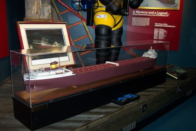
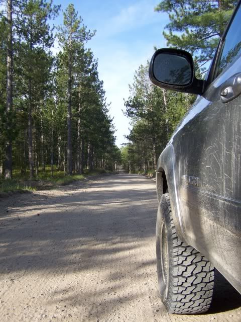
It was all set. Plans were made. Meet ups with some local friends where arranged. Passports were in hand. We were heading towards Newfoundland, an island I fell in love with and one I wanted to share with my family as they did not get a chance to experience it yet. Then my wife's workplace took back some of her requested vacation days, thus leaving us to little time to merit the long drive north. Not ones to sit around feeling sorry for ourselves, action was called for. We decide to make a trip that's been bubbling in our future travels cauldron for some time. We laid plans to head up to Michigan's UP and see some of those places our ExPo brethen have been taunting us with. With the help of some of those fine folks we made ready to see new terriory for us and have a great time in the backwoods of Michigan's northern territory.

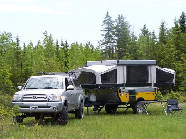
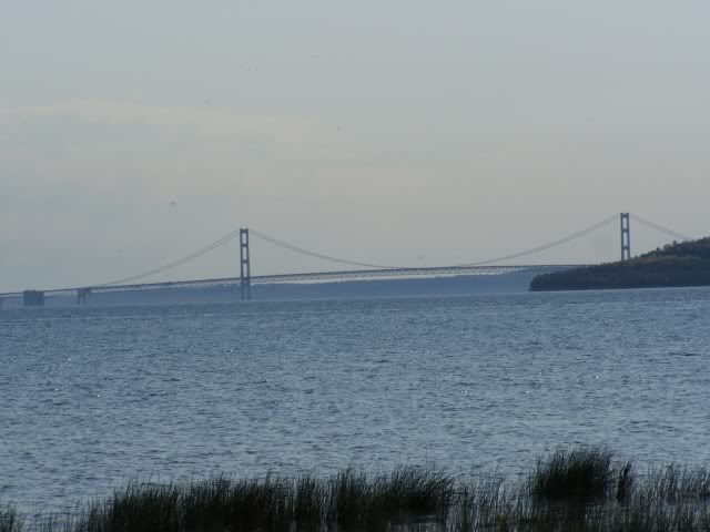
We set out early last Friday morning heading our Tundra towards I-80. In tow was our Fleetwood Evolution pop-up trailer. Loaded with gear and supplies we were rearing to go! With good weather and some fine navigating by my wife Michelle we pulled up towards the Mackinaw bridge in under 10 hours. Taking a cue from 86cj, we decide to spend the night at the southern side of the bridge at the Wilderness State Forest campground. We were in no particular hurry and it was getting close to supper time anyways. After getting the trailer set-up and making some potato soup and biscuits for supper we settled down for the night.

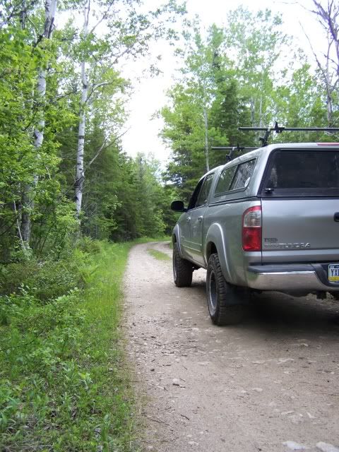
The next morning we were rolling across the bridge early intent on making our way to our first stop, Drummond Island.

100_1440a.jpg


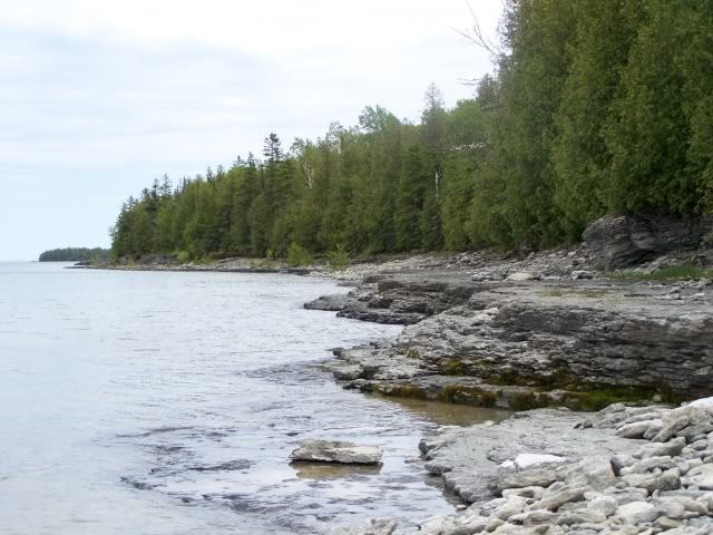
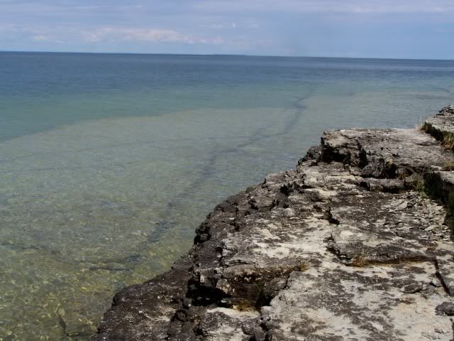
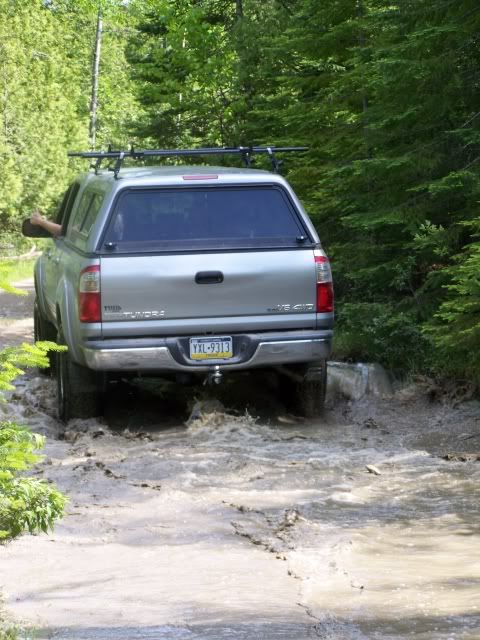
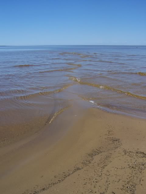
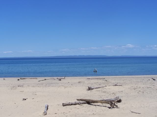
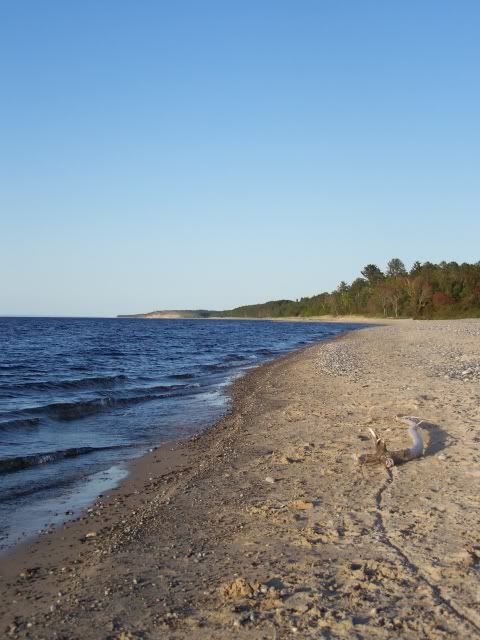
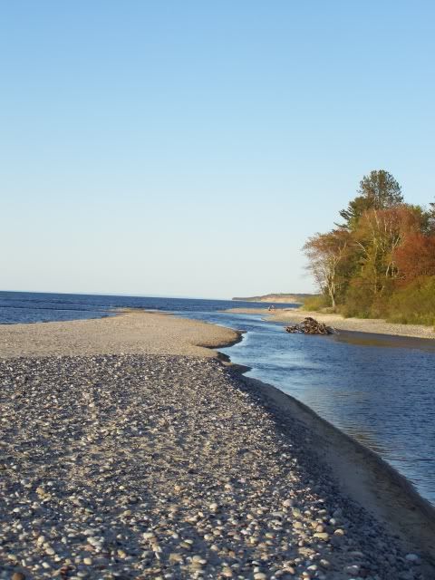
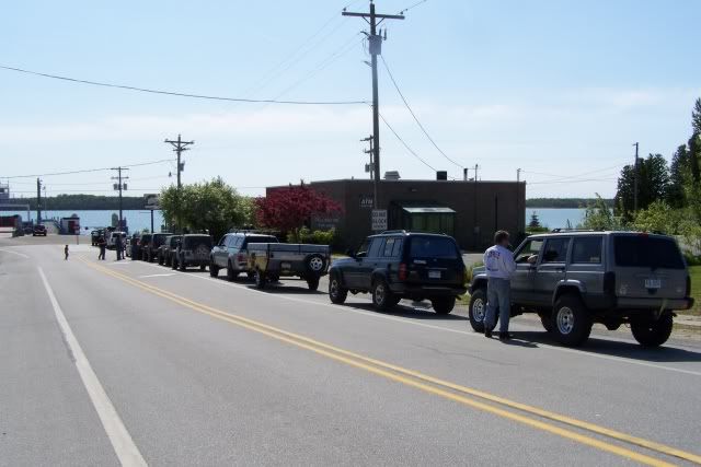
We found ourselves rolling down highway 134 taking in the lakeshore sights as we rolled east. We stopped at a little bakery in Cedarville and bought some kick butt pastries and peanutbutter cookies. The folks who ran the shop were really great as we spent some time shooting the breeze with them. Later we pulled off the side of 134 to check out a stretch of dunes and beach. While we we're messing around on the shoreline a group of lifted Jeeps and one Land Cruiser drove by, honking their horns and waving. We later caught up with that group at the gas station in Detour and found out they were from the Great Lakes 4WD Club. My Jeep liscense plate on the front off my Tundra got some laughs as it's not something you see every day. I spent some time BSing with a couple of those folks and we found out they were heading to Drummond also. The driver of the LC, Dave, seemed to check out the Expo from time to time and asked if we had been here before. After we replied it was our first time here, he was kind enough to give us one of his island trail maps. That came in handy for the next couple of days, so if your checking in Dave, thanks man that was sure decent of you! Here's a shot of us stuck in the middle of the Great Lakes crew.

100_1449a.jpg


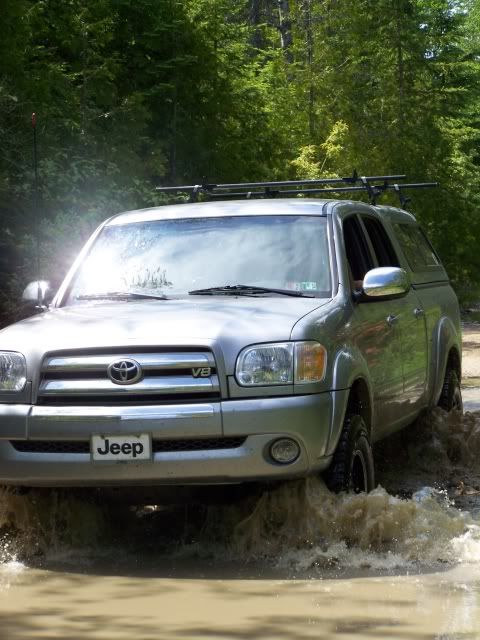
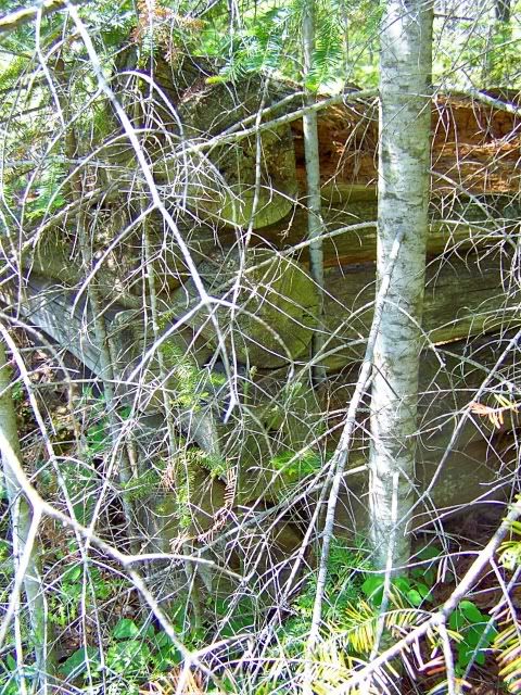
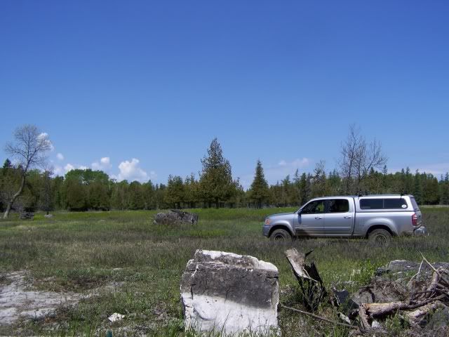
We loaded up on the ferry where my Toyota was surround by Jeeps. A couple minutes later we were on Drummond Island soil and heading towards the backwoods.
 
Last edited:

Haggis

Appalachian Ridgerunner
Drummond Island

Here we were on an island with no idea where we were going. Perfect! Just the way we like it. Thanks to Dave and his map we had a good idea of what was private land and what was state forest (and as we had dispersed camping permits in hand) it helped us narrow down an area to search for a campsite in. We decide it would probably be best to find a place to set up camp first before we went explorin'. While the E1 is great for forest roads it's not made for trails. Checking out the map we decide to head north and see what we could find. Heading up Maxton Road we came to the Maxton Plains. It reminded me of New Brunswick with its cedars, hemlocks and white birch trees bordering stone filled meadows. Next it was on to Colton Bay road...

100_1453a.jpg


..where we found a great campsite. Now I've spent a good amount of time in the bush in northern territories so I know what to expect this time of the year, skeeters and flies. And so I try to find a campsite that's more open and has some good wind to help keep the flies down to abit. This site was good.

100_1451a.jpg


About 200 hundred yards off the road with a well built firering, it was sheltered from passing cars by a crescent of cedars and white birches. There,s enough room here for a half a dozen rigs and trailers here, more if it's mostly ground tents. Bear in mind though that the ground is rocky so driving stakes is difficult to say the least. A steady wind blew from the NW and the skeeters were few in number. Camp was set. Fafhrd the Tundra was freed from his burden and ready to go explorin'....
 
Last edited:

Haggis

Appalachian Ridgerunner
With the Tundra freed up we spent the next couple of days putzing around the island. We poked into every corner we could find and down any road that looked interesting. One of the promises I made to Michelle was that we would keep trail riding to a moderate level as we were on our own with no winch and limited cell phone service. Sure I had two straps, a chain and a highlift, but I'd rather spend our vacation having fun then yanking on a highlift handle and listening to my wife scold me.

One of our first runs was up to the Fossil Ledges. Since it sat on the north shore of Drummond, we headed east from our campsite on Colton Bay RD and then turned north on Poe Bay RD. Where Colton was a sandy gravel road with a few whoopdedos and just a couple shallow waterholes, Poe was much more marked with waterholes and deep pockets.

100_1473a.jpg


With each turn the waterholes got abit deeper and deeper until Michelle was getting abit anxious, the kids on the other hand were having a good time. We had to pull off the road once to let some bikers and atvers pass. They were wet and mud splattered but had huge smiles on the faces and passsed us by with freindly waves. At one point we rounded a turn and faced a beaver marsh on the left and a deep waterhole on the road. Towards the marsh there was a berm of black muck and towards the right was a rock ledge. We eased through, the water up close to the rockers. But the bottom was solid and the Tundra push water with no drama to break back on dry dirt once again. Finally we found the sign to the Fossil ledges, pulled the truck off the road and hiked the couple hundered yards to the shoreline.

Here sandstone and limestone ledges ease out into the lake...

100_1457a.jpg


Underfoot fossil remains of aquatic plantlife are everywhere underfoot. We started hiking up the shoreline and with each step found cooler and cooler fossils...

100_1461a.jpg
100_1466a.jpg


The water was clear and cold, with a green blue cast to it. You could see a long way into the depths of the lake.

100_1464a.jpg


We spent a good bit of time wandering down the coast, checking out the fossils before heading back to the truck. The rest of the day was spent trooping in the the north part of the island and then back to camp. I grilled up some chicken, rubbed in olive oil and spiced with a rosemary rub, over the coals of our fire while Michelle took slivers of parmesean cheese and made parmesean noodles to accompany the chicken. Bellys happy, we spent the evening tossing Cam's football around, reading and exploring the woods around camp. Other than the riders, we only saw two vehicles all day. Other than an occasionial plane droning on by, it was just woodland noises that we heard. Speaking of noises, as evening set, I was putting a stalk on some deer when I heard something big flying just out of my sight in the woods. It let out a weird whooping cry, and I could tell it was a big bird but had no idea what it was. I didn't find out till the next day that it was a sandhill crane. We spotted one the next day at the Plains and it let the same call out that I had heard the night before. First one I've ever saw.
 
Last edited:

upcruiser

Perpetual Transient
Ah, good stuff! Keep it coming. I'm assuming the guy with the cruiser you met was Timbercruiser.
 

Haggis

Appalachian Ridgerunner
We spent two more days on Drummond, mucking about, talking to some of the locals and walking the shoreline. We hit some of the "lighter" trails of the OHV network, trying to aviod those ones where we were told that a fullsize might be in for abit of a squeeze or ones where we might find ourselves in a mud tank trap. We headed up Glen Cove Road the second day, making our way towards Marblehead. The plan was to park the truck and hike the rest of the way in, but half way through the hike the skies turned black and the leaves inverted. A storm system was on it's way in and we didn't want to be caught in it while hiking. So we marched back towards the Tundra, getting there just in time for the skies to open up with a deluge of rain. Hail the size of marbles began pelting the truck and the winds ripped. By the time we got back to camp, it had passed through and the sun was shining again. This is when I realized that deploying the awning on the trailer wasn't such a good idea. A huge swarm of skeeters was holing up under the awning, seeking shelter from the rains, and it sounded like a dozen circular saws cutting hardwood. With a sooty torch and some deet spray we cleared the awning enough so you could get in the trailer and not be stripped of flesh and blood. That night we cooked up some venison burgers and some homemade Mac and Cheese, and spent the night playing games with the kids. Apple to Apples, Uno and Spit if I remember right.

Here's another puddle shot...

100_1474a.jpg


And one of the many deer on the island...

100_1476a.jpg


Critters abound here on Drummond. We saw an untold number of deer, good sized examples to boot. I'd like to see some of the bucks in antler some time. They've got to be bruisers. Also we spotted cranes, grouse, bald eagles (about a dozen or so),snowshow hares and a couple of ospreys. While we saw no bears here, on the old skid road leading away from our camp, a bear had recently walked that road turning over logs and rocks looking for ants. Oh, that reminds me. Red ants are everywhere, and they're mean angry little suckers. Put your tent in the wrong place and you could have an interesting night. Taking the trailer was one of our best decisions. Not only did it give us a refuge from the flying insects, it kept us off the ground away from the ants.
 

Haggis

Appalachian Ridgerunner
Our last day on Drummond found us exploring the south eastern end of the island. We drove down several different county roads eventually ending up on West Canoe Lake Rd down at Canoe Bay. There's a fair campsite here next to the bay and the inlet stream. A couple of hundred yards down from the bridge there's an access road with a few more private, though smaller sites. After eating lunch at a beach on Bay Rd we found ourselves on East Canoe Bay Rd. What started out as a typicial dirt road for the area slowly turned into a shallow rock shelf, waterhole truck trail. On one beaver pond we found the remains of an old lease log cabin rotting back into the enviroment...

100_1484a.jpg


While the roads are really well marked we did make a wrong turn and ended up in a logging job landing. Being raised in a lumber and logging family it was cool to see the type of harvesting they were doing and the smell of the harvested cedars was awesome. Michelle said it was the nicest smelling log job she's ever been on.

Back on Canoe Bay Rd the track was getting narrower until we broke into an open plain. Michelle dubbed it the Seregenti for the solitary boulders and trees scattered around it.

100_1485a.jpg


As we were passing through this area, keeping between the orange road markers, we turned a blind corner and found ourselves in a goopy marsh. As it was to late to stop and the truck was in 2WD I gave the Tundra some juice and gunned through deep thick mud. Hoping the LSD in the Toy was a tight one I ripped on through and cleared the marshy section. But up ahead was a two hundred long pit of water with a steep climb out. We got out and checked the pit and there was around three feet of water with a gumbo bottom. The marshy area we blasted through was up to my knees when I went back to check it out. Deciding discretion was the order of the day, with Michelle spotting, I made a 27 point turn and Turned the truck back the way we had come. Then the Tundra was locked into 4 Low. Michelle grabbed the camera and said she was going to video my burying the truck in the marsh so she could blackmail me at a later date. With the kids holding on tight we powered through the marsh and back to more solid ground. If your ever around Michelle's got a great video of the Tundra flinging mud. Just like the old days in the Ram. Those Dean tires churned mud good I tell you, and Fafhrd proved himself that day as a dependable member of our Clan. After that we headed back to camp, cooked some campfire pizzas and made ready to leave in the morning.

The next morning found us on the Ferry and then North bound towards Whitefish Point...
 
Last edited:

Haggis

Appalachian Ridgerunner
Doing the Touristy Thing

The day found us rolling back down highway 134. We really enjoyed our time on Drummond and we laying plans for our next move. All of the Clan agreed that today would be a tourist day. It was decide we'd make our way towards Whitefish Point and check out the Shipwreck Museum then we'd move on over to the Tahquamenon Falls. Michelle can't resist a waterfall. The trip up to Whitefish Point was a black top day though we did stop at a few spots along the road from time to time. Here's a shot along one beach where the waves were converging...

100_1489a.jpg


We stopped in the village of Paradise and gassed up the truck before heading up the the Point. Once there we checked out the Museum. While not a large one, the Shipwreck Museum was pretty cool. Well worth the time to check it out. Here's a couple of random shots of the Museum grounds...

100_1495a.jpg
102_3525a.jpg


100_1493a.jpg


This is the beach at the Museum. As you can see on the horizon there is a land mass over there. Supposedly its some fabled land called "Kanada" or some such place. It is said to be a land of milk and honey where the people are freindly and say "eh" and "hoser" alot, plus they drink a lot of beer. I think it's a wives tale myself, much like Bigfoot.
 
Last edited:

Haggis

Appalachian Ridgerunner
A short time later we were down at the Tahquamenon Falls area, walking the boardwalks down towards the falls. There were tons of people here, it felt kind of strange after seeing so few peolpe on the island. Anyway heres a couple shots of the falls.

Lower falls

100_1499a.jpg


Upper falls

100_1508a.jpg
 

Haggis

Appalachian Ridgerunner
Onwards to Two Hearted River

I know what your thinking..."Man, doesn't this guy ever give it a rest!". But once started you've got to finish so bear with me till we get to the end of this thing.

After the Falls we headed up Rd 500 and we were back on dirt with the woods around us. The road were well graded, covered in a sugary sand of intermittent depth (just a couple inches really) and passed through jackpine barrens and an occassionial marsh. We spotted lots of deer heading north, and had a few grouse run across the road in a game of "chicken". Or "grouse" if you happen to be ..........a grouse.

100_1549a.jpg


Taking Rd 414 of from 500 we worked our way west. Then it was onto 412, then 423 until we found ourselves up at the Two Hearted River Area. It was getting late, around 7:30, when we reached the area so we decide to use the State Forest campground instead of taking the time to find a dispersed sight. The campground is divided into two sections. Area #1 is more open hardwoods next to the river, while Area #2 is nestled back in a hemlock grove. We choose a site in Area #1 next to the river. There was less bugs with the wind off the lake than back in the hemlocks. In both sections there were only three other campers. Two in the hemlocks and one on the other side of the hardwoods from us. Once we got the trailer set up we headed over the swinging bridge to the beach. It was awesome! A mix of sand and smooth rock beach stretch both to the east and the west. The sun was warm, the waves of the lake and the flow of the river mingled in our ears perfectly. Michelle took one look and said, "We're spending all day here tomorrow just doing nothing."

I went back, started a fire and when the coals were ready I fixed a supper of venison steaks and parsley red potatos. After supper we headed down to the beach and watched the sunset.

Here's a couple of pics..,

The Beach towards the east and then the Two Hearted River....

100_1515a.jpg
100_1520a.jpg
 
Last edited:

Pskhaat

2005 Expedition Trophy Champion
So I've got to know, how is that Evolution (e1|e2)? Worth it? How is it to tow?
 

Forum statistics

Threads
189,800
Messages
2,920,999
Members
232,931
Latest member
Northandfree
Top