turbodb
Well-known member
Double Dose of Indian Hot Springs
The day started out just like any other. Well, any other where the previous included a 12-hour drive from home to the starting point of our next adventure.
So let's back up for a moment... We'd arrived at Bruneau Canyon Overlook just after 10:00pm the day before - our drive from home behind us, capped off by dinner with Ben @m3bassman, Kirsten, Mikey @pizzaviolence, and Amber at their local taco joint - Enrique's - a place they'd recommended a year before when we spent Two-and-a-Half Days in Idaho.
Having grown up in California and with a few great taco trucks at home, I'd have to say it was OK, but not great sorry: y'all); the company on the other hand was fabulous! And, as we'd parted ways, Mikey had recommended that we spend the night at Bruneau Canyon Overlook - a couple hours closer than we'd planned to camp, and a beautiful spot come morning light. So, as the sun set behind us, that's exactly where we ended up.
And with that, we're all caught up. It's TODAY again!
Our time zones all screwy, it was early - 4:15am or so - when my alarm went off, urging me out of bed to capture the orange on the horizon, an hour or so before the sun would make its appearance for the day.
And then - as has become a habit - I was back to bed The previous day had left me exhausted, and the already warm morning air was such a nice change from the freezing cold that I'm used to waking up to. Soon, I was fast asleep, and nearly 4 hours passed before @mrs.turbodb and I were awoken to the scream of a jet engine and a sonic boom overhead!
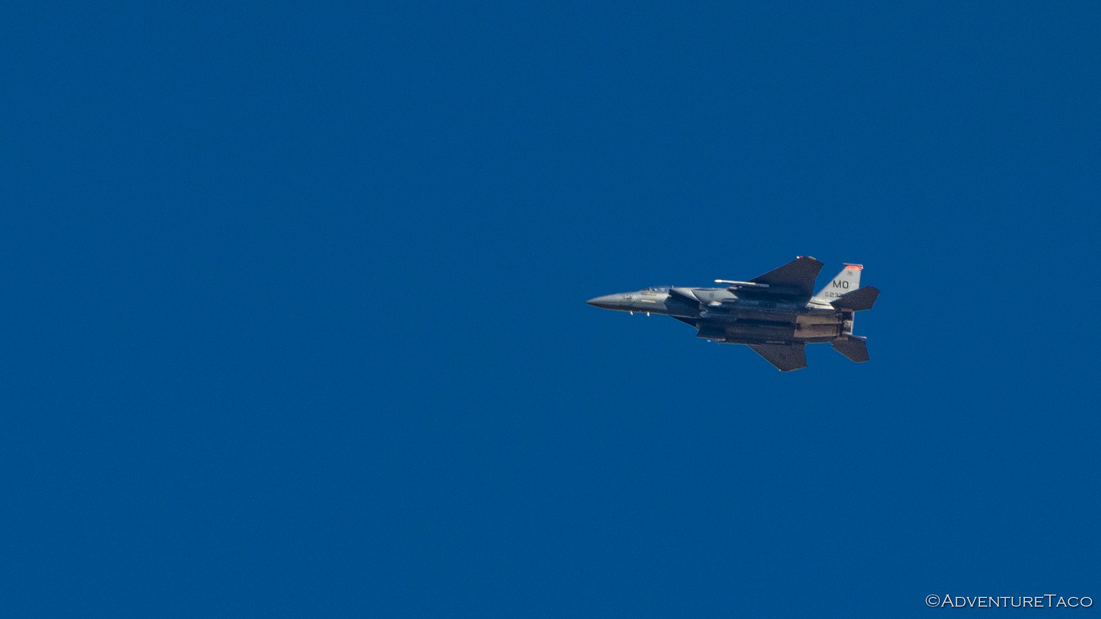
There are few things as exhilarating to me as watching low-flying jets - perhaps an indication that I'm still young at heart - and we watched as 8 jets sped north over our camp site - each and every one doing barrel rolls and having a splendiferous time. Man, how I'd love to get a ride in one of those puppies! And then, as we lay in bed, I looked over and said, "I've got an idea."
Hey! Get. Your. Head. Out. Of. The. Gutter.
See, we'd planned to spend the day heading to Indian Hot Springs via the east entrance - a dirt track that we'd been meaning to take since we'd first come to Idaho 18 months ago to pick up the CBI Outback Bumper. Having run our of time, we'd headed straight down to The Maze, Canyonlands, and we'd never made it back. Then, at dinner the night before, Ben reminded me that he and Kirsten had tried to reach the springs via the west entrance - stymied by a rock slide on the final descent down into the valley.
So I proposed to @mrs.turbodb that we try the west route first. And then, if we couldn't make it down, we'd drive around to the east. But if we could - and if we could ford the Bruneau River (since the bridge over the river had reportedly been out for a few years) - then we could do both sides on our way east towards City of Rocks, our next destination.
My proposal was accepted, and we climbed out of the tent to a hot 75°F morning. And it wasn't even 9:00am yet.
As breakfast was made - homegrown blueberries and Cheerios - I took a few minutes to try (and if we're honest, fail miserably) capturing Bruneau Canyon; what turned out to be a perfect spot to camp for the night.
And then, we headed out - backtracking a few miles to ID-51 where we'd head south, our well-planned trip now "off-the-rails" before we really even started. The best kind of trip - if you ask me. ?
Routeless at this point, we pulled off the highway at a road that looked like it went the direction we needed to go, and set of east - the temperature now already above 80°F, both of us wishing that the AC was in full working order (and a story for another time). But, we couldn't complain about the surroundings - as usual, out here and away from the hustle and bustle of everything else, it was beautiful.
Along the way, we ran into a couple on a side-by-side - out scouting for Elk, the woman having drawn a tag for later in the year. Curious where we were off to, they were surprised to hear of the hot spring and decided it might be just a bit more fun to follow us than continue their scouting mission - a bit of a bummer in our opinion, but who were we to tell them where they could go?
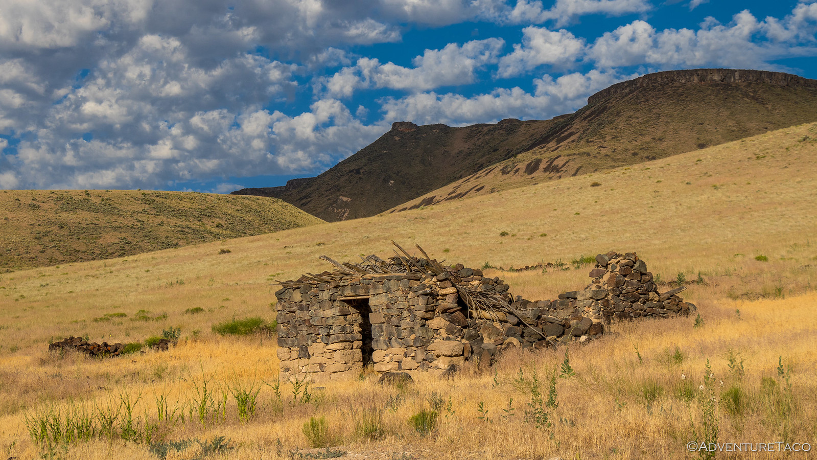
At any rate, ahead of us on the trail, they paused at each fork to see which way we'd go - that is, until the last one where they proceeded left as we went right. Strange, but just fine with us - as we pulled up next to an old rock house at the top of the cherry-stem descent - to an old ghost town located at Indian Hot Springs.
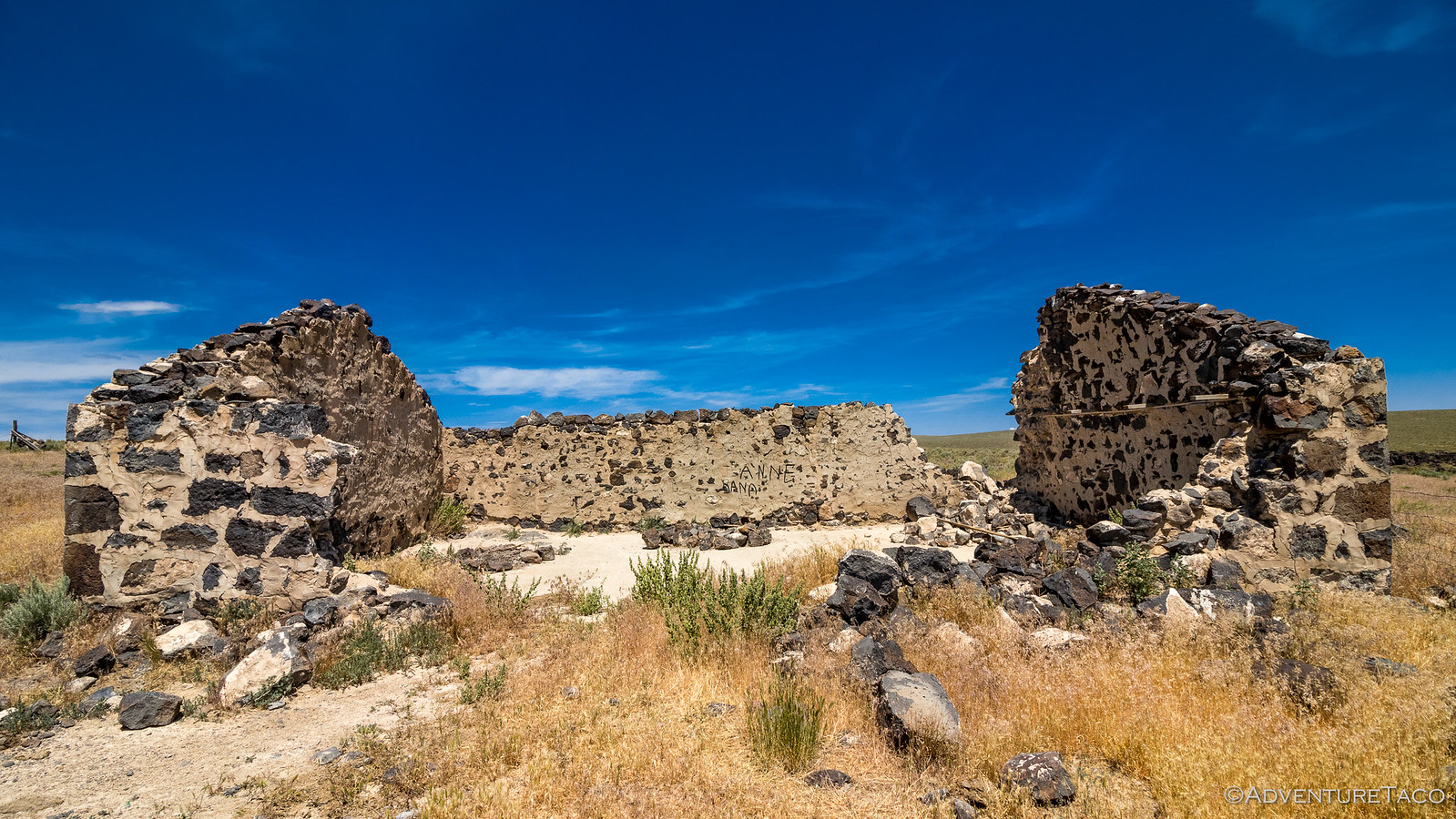

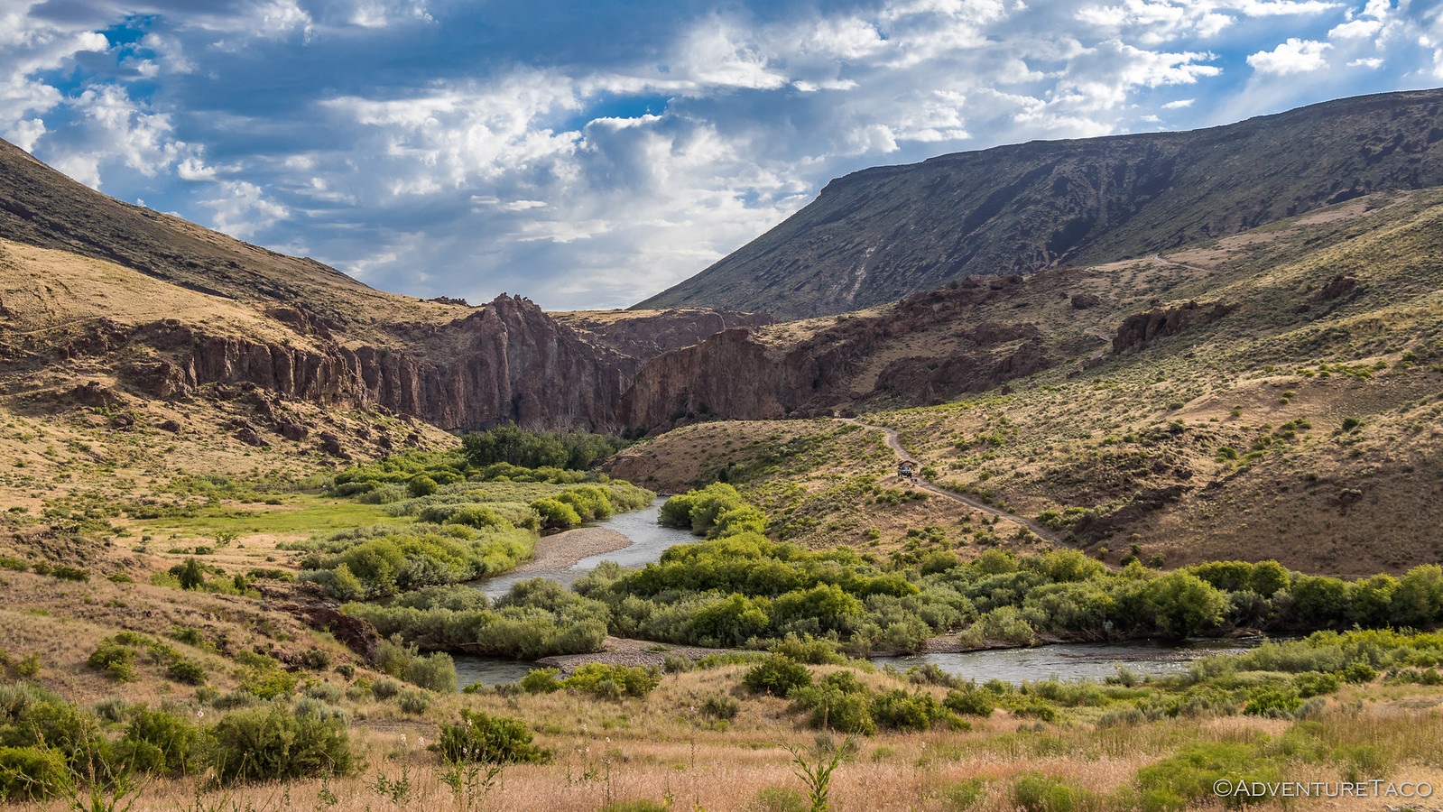
It was here that I decided it would be prudent to walk the trail for a bit before proceeding. This was where Ben had been turned around, and I figured that it was better to find out if the rock slide was still there before we headed down rather than make it half way down, only to have to back up a narrow ledge road. And it was quite the road - only a few inches wider than the Tacoma's track in a few places, eventually making its way down into the valley...
Don't miss the rest of the story, and all the remaining photos that don't fit here (due to max post size). Hopefully that can change in the future, but until then...
.
The day started out just like any other. Well, any other where the previous included a 12-hour drive from home to the starting point of our next adventure.
So let's back up for a moment... We'd arrived at Bruneau Canyon Overlook just after 10:00pm the day before - our drive from home behind us, capped off by dinner with Ben @m3bassman, Kirsten, Mikey @pizzaviolence, and Amber at their local taco joint - Enrique's - a place they'd recommended a year before when we spent Two-and-a-Half Days in Idaho.
Having grown up in California and with a few great taco trucks at home, I'd have to say it was OK, but not great
And with that, we're all caught up. It's TODAY again!
Our time zones all screwy, it was early - 4:15am or so - when my alarm went off, urging me out of bed to capture the orange on the horizon, an hour or so before the sun would make its appearance for the day.
And then - as has become a habit - I was back to bed The previous day had left me exhausted, and the already warm morning air was such a nice change from the freezing cold that I'm used to waking up to. Soon, I was fast asleep, and nearly 4 hours passed before @mrs.turbodb and I were awoken to the scream of a jet engine and a sonic boom overhead!
There are few things as exhilarating to me as watching low-flying jets - perhaps an indication that I'm still young at heart - and we watched as 8 jets sped north over our camp site - each and every one doing barrel rolls and having a splendiferous time. Man, how I'd love to get a ride in one of those puppies! And then, as we lay in bed, I looked over and said, "I've got an idea."
Hey! Get. Your. Head. Out. Of. The. Gutter.
See, we'd planned to spend the day heading to Indian Hot Springs via the east entrance - a dirt track that we'd been meaning to take since we'd first come to Idaho 18 months ago to pick up the CBI Outback Bumper. Having run our of time, we'd headed straight down to The Maze, Canyonlands, and we'd never made it back. Then, at dinner the night before, Ben reminded me that he and Kirsten had tried to reach the springs via the west entrance - stymied by a rock slide on the final descent down into the valley.
So I proposed to @mrs.turbodb that we try the west route first. And then, if we couldn't make it down, we'd drive around to the east. But if we could - and if we could ford the Bruneau River (since the bridge over the river had reportedly been out for a few years) - then we could do both sides on our way east towards City of Rocks, our next destination.
My proposal was accepted, and we climbed out of the tent to a hot 75°F morning. And it wasn't even 9:00am yet.
As breakfast was made - homegrown blueberries and Cheerios - I took a few minutes to try (and if we're honest, fail miserably) capturing Bruneau Canyon; what turned out to be a perfect spot to camp for the night.
And then, we headed out - backtracking a few miles to ID-51 where we'd head south, our well-planned trip now "off-the-rails" before we really even started. The best kind of trip - if you ask me. ?
Routeless at this point, we pulled off the highway at a road that looked like it went the direction we needed to go, and set of east - the temperature now already above 80°F, both of us wishing that the AC was in full working order (and a story for another time). But, we couldn't complain about the surroundings - as usual, out here and away from the hustle and bustle of everything else, it was beautiful.
Along the way, we ran into a couple on a side-by-side - out scouting for Elk, the woman having drawn a tag for later in the year. Curious where we were off to, they were surprised to hear of the hot spring and decided it might be just a bit more fun to follow us than continue their scouting mission - a bit of a bummer in our opinion, but who were we to tell them where they could go?
At any rate, ahead of us on the trail, they paused at each fork to see which way we'd go - that is, until the last one where they proceeded left as we went right. Strange, but just fine with us - as we pulled up next to an old rock house at the top of the cherry-stem descent - to an old ghost town located at Indian Hot Springs.


It was here that I decided it would be prudent to walk the trail for a bit before proceeding. This was where Ben had been turned around, and I figured that it was better to find out if the rock slide was still there before we headed down rather than make it half way down, only to have to back up a narrow ledge road. And it was quite the road - only a few inches wider than the Tacoma's track in a few places, eventually making its way down into the valley...
Don't miss the rest of the story, and all the remaining photos that don't fit here (due to max post size). Hopefully that can change in the future, but until then...
Keep reading the rest here
Double Dose of Indian Hot Springs
Double Dose of Indian Hot Springs
.


