FortyMileDesert
Adventurer
Land Rover Trek 149 – 25 April 2009 – The Return and Conquest of Bald Mountain
Friday night I gave Chris a call. It’s just going to be the two of us, the two ’04 Discovery’s and his dog Max. It was snowing here in Fernley and I had wondered how we were going to get to the top of a mountain that had beaten Ben and me last month because of too much snow.
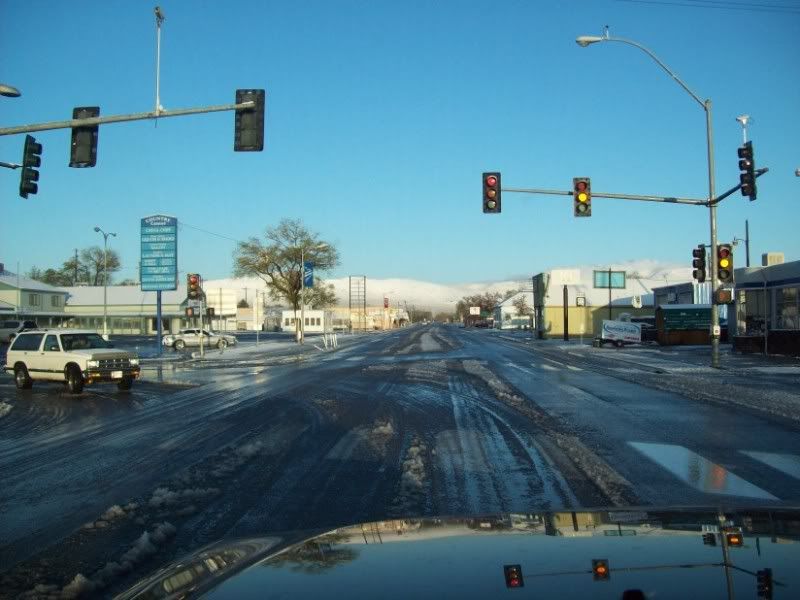
Saturday morning I am up at 5:45 and underway at 6:30. It has snowed most of the night and there is two to four inches of really wet snow as I head through town. I make the turn south onto ALT95 and pass a NHP car parked on the opposite side of the road. He pulls out, does a u-turn, turns on the lights and pulls me over. I’m cited for doing 35 in a 25 zone. The 35mph sign is ahead of me less than 100 feet away. I guess that is what I get for having my mind on the upcoming trails while still on the blacktop.
It is a long slow drive all the way to Yerington. The roads are pretty sloppy in spots so the guy in front of me keeps it at about 45 all the way. I arrive in Yerington at about 7:40 and top up on fuel. I’m in the casino at about 7:50 and Chris shows up about a minute after me.
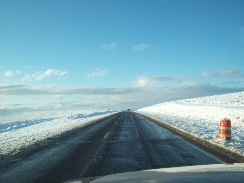
We spend most of an hour in the Casino West coffee shop having a hearty breakfast and some educational chatter. What do we talk about? Land Rovers and trails; what else is there? It is 8:45 and we get Chris’ rig topped up and are heading south through the alfalfa fields (on a road) and towards the gravel East Walker Road. The road is very sandy gravel, very wet and has patches of snow at the worst places (those blind curves going over small rises) so we keep the speed down to about 40.
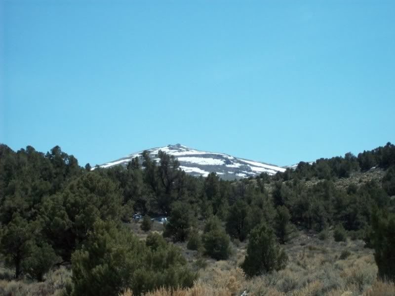
After almost an hour we pass the Flying M Ranch (where Fossett left on his last flight). On the last Bald Mountain Trek Ben and I had done the mountain climb in the morning and the Walker River trails in the afternoon. Today with last nights snows, Bald Mountain and the rest of the Pine Grove Hills are very white; so we will explore the low country first and do the mountain after some of that snow melts and evaporates.
About a mile past the ranch a trail turns off that should take us across the Rattlesnake Creek Flat and around a hill to the Walker River. Just barely starting and we come across a sign “Road Closed Ahead, Keep Out” This was a different trail than the one Ben and I had run last month so who knew. We travel another mile down the road and turn onto the trail that we did last month.
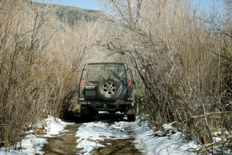
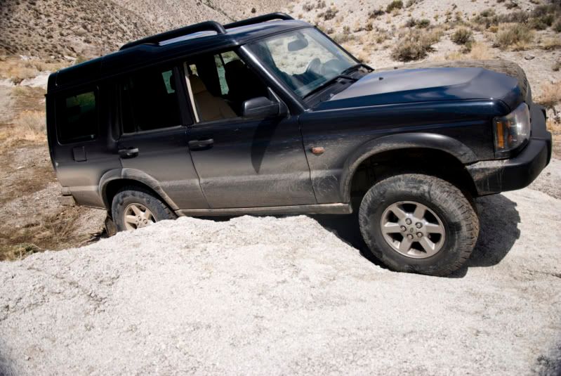
Shortly after turning onto the trail we stop to air down to about 22 pounds due to the snow and mud on the trail. It has warmed up enough that the snow is starting to disappear. The run across Rattlesnake Flat is uneventful and we eventually reach the drop down into the big un-named wash that comes off of the Wassuk Range to the east.
We are in unexplored territory as Ben and I had not completed the run to the river last time. The wash runs through decomposing granite and is mostly sand with granite outcroppings. Going down to the river we are primarily exploring but noting some nice little technical rock challenges to tackle on the way back. After about another half hour we reach the river. We explore along the river for almost a mile eventually reaching the point where the “closed road” comes out. Evidently the sign is something put up by the ranch to keep out the fishermen.
The whole mile long area is full of trees and campsites. We even contemplate fording across the river at one point. It looks as if it might only be about 2 ½ feet deep but it is hard to tell about the depth in the middle. The water is really cold and I’m not looking forward to wading out with a tow strap or the possibility of a hydro-locked engine. I decline and we start back up the wash.
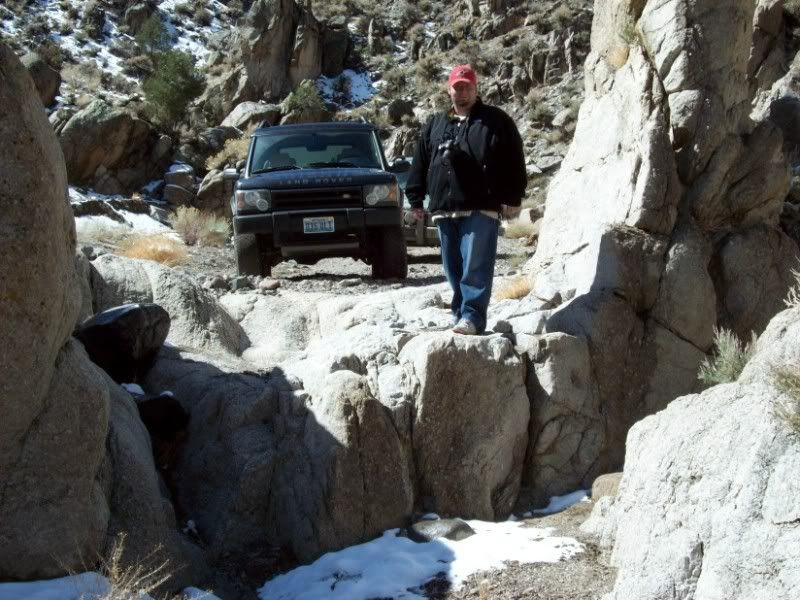
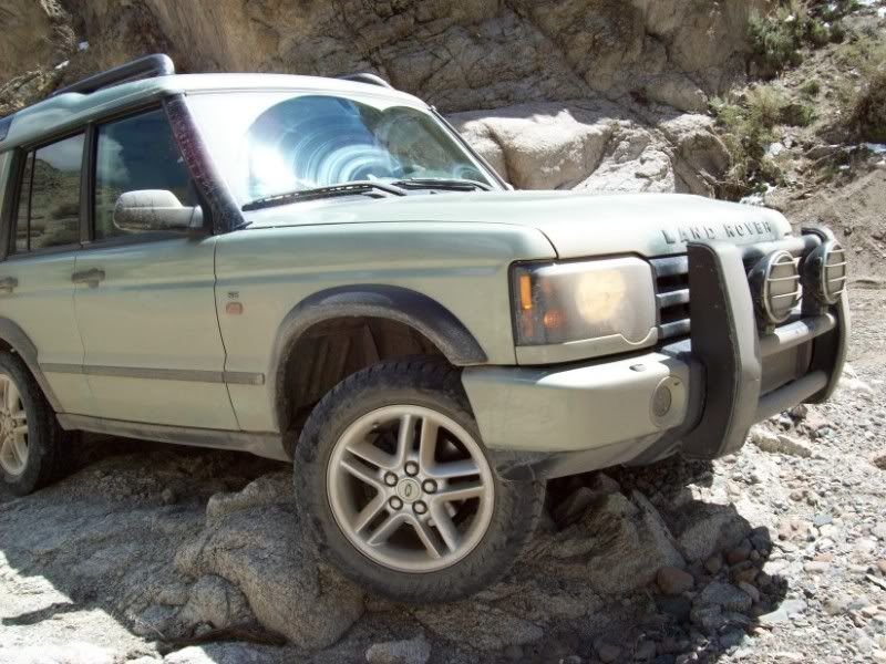
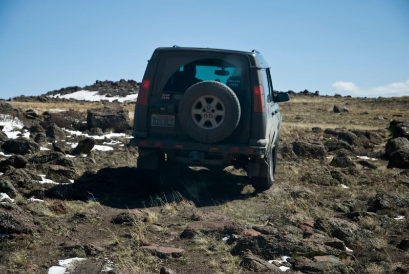
Going up the wash we do some minor rock crawling in three places. At one spot I crawl my truck over a big granite bed-rock out cropping. I manage to scrape the right side slider pretty good and leave some black tire tracks on the face of the rock. At this one spot we pose Chris’ truck but do not take it all the way over since his sills are four inches closer to the ground than mine and he’s scraping his grill guard. We both think he’s going to have to get rid of that grill guard or modify the heck out of it. I have a feeling that he’s looking forward to a steel bumper and a winch.
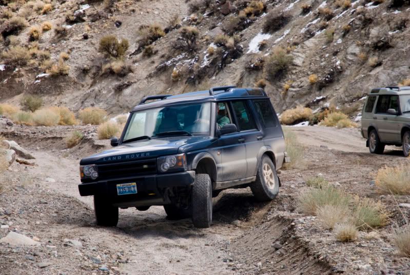
Note: I spent all day taking pictures of Chris’ truck while he took pictures of mine. So you will have to wait for Chris to add his a bit later. You might note that at several places we did a different line for Chris truck than we did for mine. Sometimes it was due to the differences in ground clearance and sometimes just to be different.
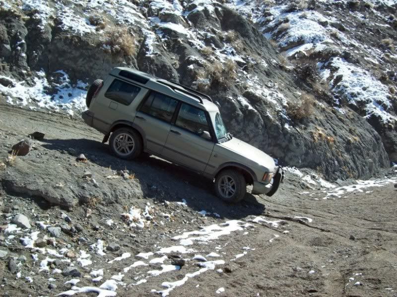
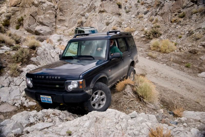
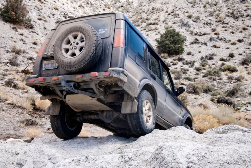
Once we reach the point where we originally entered the wash, I decide we should take the fork that Ben and I did not explore last month. The fork entering from the south has an interesting looking dry waterfall at the very beginning that looks like fun. That first waterfall was neat. We both did it by unique lines. Actually I think that Chris’ line may have been the tougher; he wound up with his rear diff hung up on a rock projection but it didn’t do anything more than cosmetic damage.
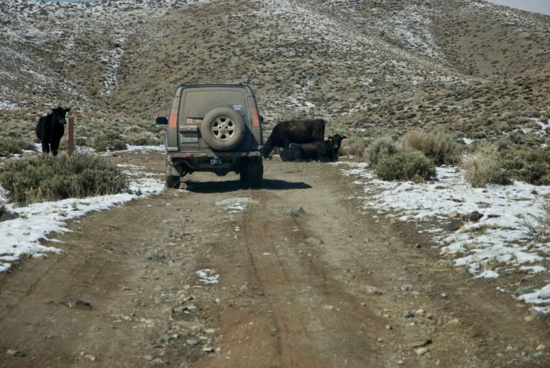
There were a couple more challenges going up the wash until we eventually climbed out of the wash onto a sagebrush covered bench and headed east towards the main road. We actually passed a Tacoma coming the other way at one point. This was the first vehicle since leaving Yerington.
Next was the long fast run down south towards Fletcher; west crossing Bodie and Rough Creeks; From Nine Mile Ranch along Sweetwater Road, passing a couple dozen truckloads of people fishing the East Walker; and eventually reaching the site of the Conway Stage Station. Next was a ten mile stretch of pavement until we reached our turnoff onto the Nye Canyon Trail.
A mile up Nye Canyon and we stopped for a snack break at Big Crystal Mine. We took a couple of flashlights and explored the tunnel. It turned out to go straight into the welded basalt tuff only about sixty feet or so. For the life of us, we could not find any evidence of any kind of big crystals. The tunnel was less than four feet tall so made for tough hunched over walking. In my opinion; this is not a recommended tourist attraction.
From the mine we continued up the canyon, passing the Sand Canyon Trail and the Dead Ox Canyon Trails. Nearing the head of Nye Canyon, we had to pull deep into the brush for three trucks coming down packing quads. One was a Chevy one-ton dually, one was a Chevy Silverado and the last was a Toyota Tundra. For the life of me I couldn’t figure these guys out: it seemed as if they just could not get their trucks to fit through a space that had about three feet of clearance.
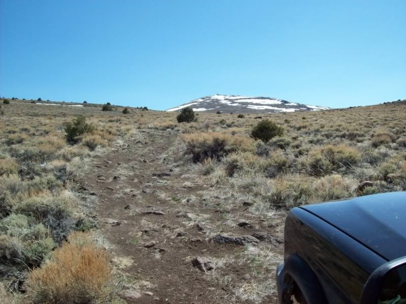
At last we came out of the canyon and began the trek south towards Bald Mountain. For the next four miles it is boulder field. Last time here with Ben the boulders were at least softened by the 12 to 18 inches of snow packed between them. This time it was mind numbing, shoulder and elbow wrenching bouncing over and dropping between the boulders. We just could not go slowly enough; the wheels would independently climb up a boulder, kick it back and then slam into a hole. Wham, slap, scrape, bang! We stopped at the point where Ben and I could go no further in the snow and took a break. Man! Our shoulders are going to feel it tomorrow!
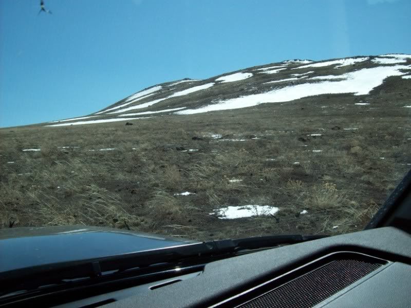
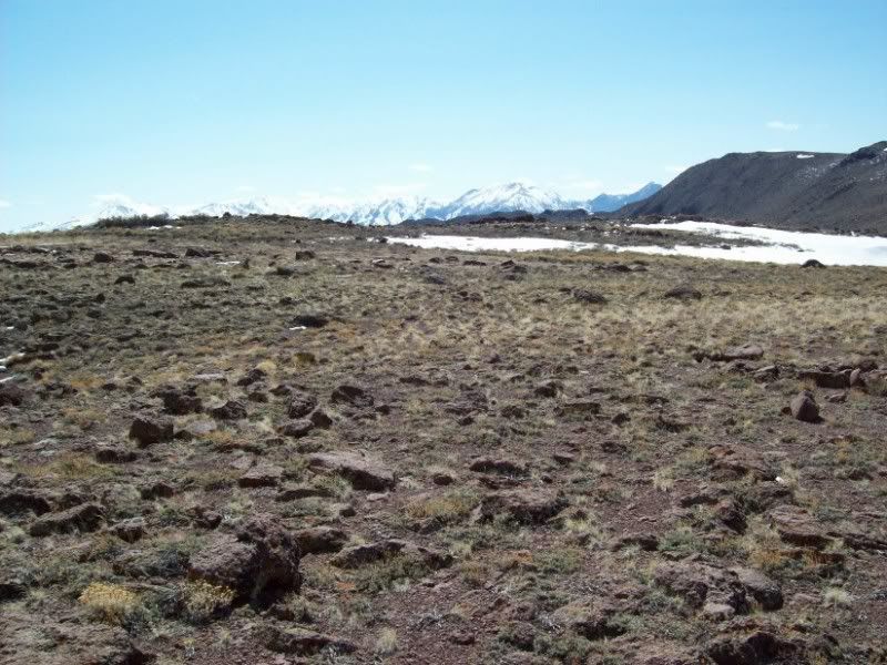
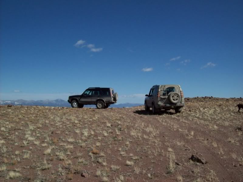
This trip the snow is totally gone where I got stuck last time. There are only the remains of the cornices in the shaded and wind protected places on the mountain. Another mile past the last treks ending we reach the high point of the mountains shoulder at 9095 feet. The actual top of the mountain is about 2000 feet to the west and about 450 feet higher.
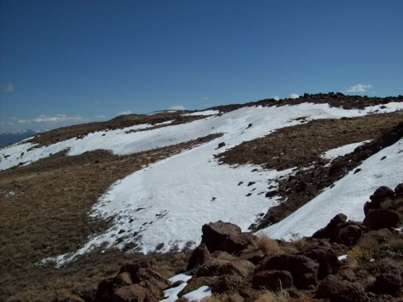
The trail appears to go on another half mile or so towards a saddle and an adjacent point. We decide that since we are here we may as well go to the absolute end of the trail. The trail passes through some three foot tall jagged basalt boulders. No problem, though; and we eventually reach the end of the trail overlooking the caldera of the volcano about a mile to the east and 2000 feet below us. To the west is a deep canyon that drops down to the Walker River. We are at 9025 feet at 38º31.5’N x 119º06.6’W. The views are fabulous, but the wind is blowing about 25 knots and it is 36 degrees F. My plan is still to hike to the top.
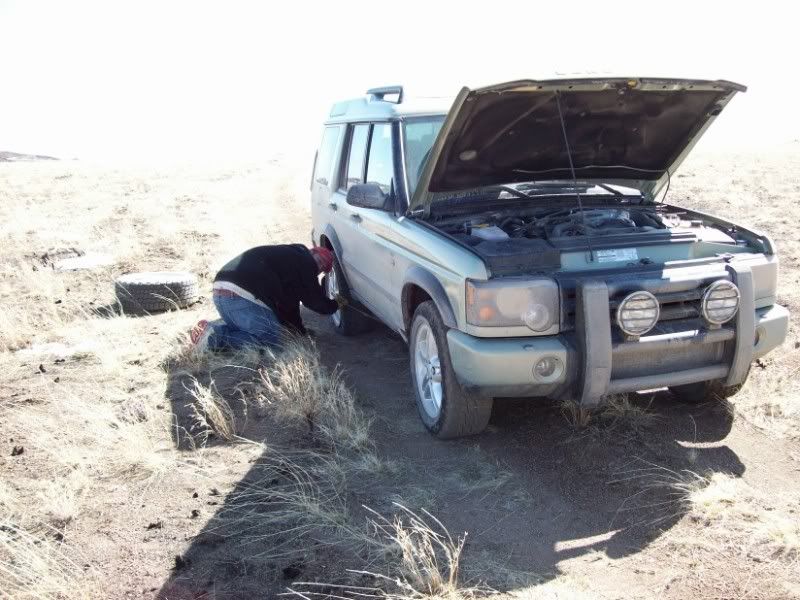
Driving back to the high point where we can hike up, Chris discovers that his right rear tire is flat. It turns out that he has a 2 inch long slash through the sidewall. We spend the next twenty minutes getting the wheel changed. By now it is almost four, we are really cold and sore and don’t even feel like hiking to the top. Besides, now we don’t even have time to travel north to visit the Rockland ghost town. So it’s the four miles back across the boulder field and the run down Nye Canyon to the highway.
By about 4:30 we are back to pavement and airing all of the tires back up. From here it is north to Wellington where I will head east to Yerington and Chris west to Gardnerville. I’m finally back in Fernley at 7:00pm; 12 hours and 247 miles since I left this morning. Another one of the better treks
Friday night I gave Chris a call. It’s just going to be the two of us, the two ’04 Discovery’s and his dog Max. It was snowing here in Fernley and I had wondered how we were going to get to the top of a mountain that had beaten Ben and me last month because of too much snow.
Saturday morning I am up at 5:45 and underway at 6:30. It has snowed most of the night and there is two to four inches of really wet snow as I head through town. I make the turn south onto ALT95 and pass a NHP car parked on the opposite side of the road. He pulls out, does a u-turn, turns on the lights and pulls me over. I’m cited for doing 35 in a 25 zone. The 35mph sign is ahead of me less than 100 feet away. I guess that is what I get for having my mind on the upcoming trails while still on the blacktop.
It is a long slow drive all the way to Yerington. The roads are pretty sloppy in spots so the guy in front of me keeps it at about 45 all the way. I arrive in Yerington at about 7:40 and top up on fuel. I’m in the casino at about 7:50 and Chris shows up about a minute after me.
We spend most of an hour in the Casino West coffee shop having a hearty breakfast and some educational chatter. What do we talk about? Land Rovers and trails; what else is there? It is 8:45 and we get Chris’ rig topped up and are heading south through the alfalfa fields (on a road) and towards the gravel East Walker Road. The road is very sandy gravel, very wet and has patches of snow at the worst places (those blind curves going over small rises) so we keep the speed down to about 40.
After almost an hour we pass the Flying M Ranch (where Fossett left on his last flight). On the last Bald Mountain Trek Ben and I had done the mountain climb in the morning and the Walker River trails in the afternoon. Today with last nights snows, Bald Mountain and the rest of the Pine Grove Hills are very white; so we will explore the low country first and do the mountain after some of that snow melts and evaporates.
About a mile past the ranch a trail turns off that should take us across the Rattlesnake Creek Flat and around a hill to the Walker River. Just barely starting and we come across a sign “Road Closed Ahead, Keep Out” This was a different trail than the one Ben and I had run last month so who knew. We travel another mile down the road and turn onto the trail that we did last month.
Shortly after turning onto the trail we stop to air down to about 22 pounds due to the snow and mud on the trail. It has warmed up enough that the snow is starting to disappear. The run across Rattlesnake Flat is uneventful and we eventually reach the drop down into the big un-named wash that comes off of the Wassuk Range to the east.
We are in unexplored territory as Ben and I had not completed the run to the river last time. The wash runs through decomposing granite and is mostly sand with granite outcroppings. Going down to the river we are primarily exploring but noting some nice little technical rock challenges to tackle on the way back. After about another half hour we reach the river. We explore along the river for almost a mile eventually reaching the point where the “closed road” comes out. Evidently the sign is something put up by the ranch to keep out the fishermen.
The whole mile long area is full of trees and campsites. We even contemplate fording across the river at one point. It looks as if it might only be about 2 ½ feet deep but it is hard to tell about the depth in the middle. The water is really cold and I’m not looking forward to wading out with a tow strap or the possibility of a hydro-locked engine. I decline and we start back up the wash.
Going up the wash we do some minor rock crawling in three places. At one spot I crawl my truck over a big granite bed-rock out cropping. I manage to scrape the right side slider pretty good and leave some black tire tracks on the face of the rock. At this one spot we pose Chris’ truck but do not take it all the way over since his sills are four inches closer to the ground than mine and he’s scraping his grill guard. We both think he’s going to have to get rid of that grill guard or modify the heck out of it. I have a feeling that he’s looking forward to a steel bumper and a winch.
Note: I spent all day taking pictures of Chris’ truck while he took pictures of mine. So you will have to wait for Chris to add his a bit later. You might note that at several places we did a different line for Chris truck than we did for mine. Sometimes it was due to the differences in ground clearance and sometimes just to be different.
Once we reach the point where we originally entered the wash, I decide we should take the fork that Ben and I did not explore last month. The fork entering from the south has an interesting looking dry waterfall at the very beginning that looks like fun. That first waterfall was neat. We both did it by unique lines. Actually I think that Chris’ line may have been the tougher; he wound up with his rear diff hung up on a rock projection but it didn’t do anything more than cosmetic damage.
There were a couple more challenges going up the wash until we eventually climbed out of the wash onto a sagebrush covered bench and headed east towards the main road. We actually passed a Tacoma coming the other way at one point. This was the first vehicle since leaving Yerington.
Next was the long fast run down south towards Fletcher; west crossing Bodie and Rough Creeks; From Nine Mile Ranch along Sweetwater Road, passing a couple dozen truckloads of people fishing the East Walker; and eventually reaching the site of the Conway Stage Station. Next was a ten mile stretch of pavement until we reached our turnoff onto the Nye Canyon Trail.
A mile up Nye Canyon and we stopped for a snack break at Big Crystal Mine. We took a couple of flashlights and explored the tunnel. It turned out to go straight into the welded basalt tuff only about sixty feet or so. For the life of us, we could not find any evidence of any kind of big crystals. The tunnel was less than four feet tall so made for tough hunched over walking. In my opinion; this is not a recommended tourist attraction.
From the mine we continued up the canyon, passing the Sand Canyon Trail and the Dead Ox Canyon Trails. Nearing the head of Nye Canyon, we had to pull deep into the brush for three trucks coming down packing quads. One was a Chevy one-ton dually, one was a Chevy Silverado and the last was a Toyota Tundra. For the life of me I couldn’t figure these guys out: it seemed as if they just could not get their trucks to fit through a space that had about three feet of clearance.
At last we came out of the canyon and began the trek south towards Bald Mountain. For the next four miles it is boulder field. Last time here with Ben the boulders were at least softened by the 12 to 18 inches of snow packed between them. This time it was mind numbing, shoulder and elbow wrenching bouncing over and dropping between the boulders. We just could not go slowly enough; the wheels would independently climb up a boulder, kick it back and then slam into a hole. Wham, slap, scrape, bang! We stopped at the point where Ben and I could go no further in the snow and took a break. Man! Our shoulders are going to feel it tomorrow!
This trip the snow is totally gone where I got stuck last time. There are only the remains of the cornices in the shaded and wind protected places on the mountain. Another mile past the last treks ending we reach the high point of the mountains shoulder at 9095 feet. The actual top of the mountain is about 2000 feet to the west and about 450 feet higher.
The trail appears to go on another half mile or so towards a saddle and an adjacent point. We decide that since we are here we may as well go to the absolute end of the trail. The trail passes through some three foot tall jagged basalt boulders. No problem, though; and we eventually reach the end of the trail overlooking the caldera of the volcano about a mile to the east and 2000 feet below us. To the west is a deep canyon that drops down to the Walker River. We are at 9025 feet at 38º31.5’N x 119º06.6’W. The views are fabulous, but the wind is blowing about 25 knots and it is 36 degrees F. My plan is still to hike to the top.
Driving back to the high point where we can hike up, Chris discovers that his right rear tire is flat. It turns out that he has a 2 inch long slash through the sidewall. We spend the next twenty minutes getting the wheel changed. By now it is almost four, we are really cold and sore and don’t even feel like hiking to the top. Besides, now we don’t even have time to travel north to visit the Rockland ghost town. So it’s the four miles back across the boulder field and the run down Nye Canyon to the highway.
By about 4:30 we are back to pavement and airing all of the tires back up. From here it is north to Wellington where I will head east to Yerington and Chris west to Gardnerville. I’m finally back in Fernley at 7:00pm; 12 hours and 247 miles since I left this morning. Another one of the better treks