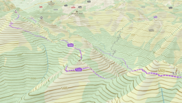
I have been using GaiaPro for many years. Started when it was created, owned and shared by two very enthusiastic (sp?) young people. Good friends that explored together and wanted a good mapping app. They grew it with an open community approach, asking for input. Complied suggestiosn and let the users select the changes they preferred. It kept growing and improving. Their app help was spectacular. They guided me thru my initial learning spell. I was just one of many GPS navigation app searchers that found GAIAGPS to my liking. The business was sold to Outside+ . Things changed. But the app is still available and supported.
Features I use a lot are creating Areas. Name the area and create a Area file for info in that area. Put all Waypoints, Routes, Tracks and Maps for that Area file in sub files, One sub fike for each type of info, ie Waypoints, Routes, Tracks and Maps sub-files. I start each sub folder name with an acronymn for the Area file (ie: North Death Valley area, NDV starts each sub file name. Yu can download all maps for an area, I choose to download one map type at a time. Helps organize date geographically. Note that the visability of any area file can be turned on/off, along with its sub files. Individually or as an area file, on/off visability. It seems that the app renders the map with all mapping info every time you move around the map. By turning off the areas you are not interested in at the time, rendering happens faster, the map runs smoother.
Creating an area can be done by creating a route around the perimeter of the area and then converting that route to an area.
I found that all my maps can be put in Maps sub files.
I have 43.24 GB of data on mny iPAD, still have 431 GB space still available on the iPad. I have additional data ARCHIVED on the GaiaPro webb site that I uploaded from my iPad. Mostly out of state areas or areas I do not visit often.
I like to use GaiaGPS Pro. I can make it work for me. I Don't necessarily like the user interface, support or the latest changes made for no apparent reason. I live with it. It works for me to plan adventures 4wheeling. One such adventure was an ORIDAVADAH 800 mile loop on dirt roads ORegon, IDAho, neVADa & utAH. I researched the route, downloaded the maps, created routes and waypoints. 90% of my route research was right on. Went from english descriptions of route, place names, geographic locations mentioned in a trip planning bulletin board to create my routes. Adventure was created lead by Brett from Twin Falls followed by about 8 of us. A seven night moving camp adventure. Use of Gaia GS made it possible for me to create the route I thought we might take, download all the Maps (GB'S of map data).
I'm getting old, brain fade. So I'll stop typing now.

