You are using an out of date browser. It may not display this or other websites correctly.
You should upgrade or use an alternative browser.
You should upgrade or use an alternative browser.
Something Completely Different : BC 2020
- Thread starter rfoubi
- Start date
Trikebubble
Adventurer
Thanks for the story (so far). I'm in Penticton, and have been wanting to go and drive up that road that starts by following the Grandby River for years.
Last edited:
rfoubi
Observer
Part 2:
My work rotation went fairly quickly, since I spent most of it in the field, with my few office days mostly spent trying to not spend too much time on google earth planning routes. Anyway, we left from Kamloops and headed to Logan Lake, where we spent a couple cold nights visiting friends and staying at the municipal campground. It was still +8C (46F) and raining/windy. (Though as I write this in the wildfire smoke with an air quality index of 480 PM2.5, I’m sure we can all agree there are worse things than rain). On the plus side, we did get to see a few nice bucks wandering through the campground.

As the weather finally cleared, we were keen to hit the semi-arid parts of BC, which always feels like home to me, growing up in Kamloops amongst the sagebrush and ponderosa pine. So we left Logan Lake and drove past Highland Valley Copper. Of course, since my wife and I are both geologists we had to stop and take a look. And lets face it, who doesnt love a giant hole in the ground!


From here, we descended almost 1000m to the town of Ashcroft on the Thompson river. Its got the reverse treeline familiar to many who live/travel in the desert southwest, where forests give way to scrub, sagebrush and grass as you drop to the hot valley bottoms. We stopped at Desert Hills Farm and stocked up on some veggies and fruit, pet a few llamas and such, and then headed southwest


Our goal for the day was get up into the Oregon Jack provincial park, apparently host to some cool limestone canyon, with a rec site called three sisters at the base of a cool scenic drive to a fire lookout (Cornwall Hills).
That feeling of turning off a paved road onto a new gravel road to explore is always so good, but especially this year with covid fatigue, stress, travel restrictions, etc, it felt like such an incredible relief to be back to the basics.
We headed up in elevation, back into the saskatoon bushes, then pines, and eventually mixed coniferous forest. The sun was hot, and after a rainy spring/summer, it felt amazing.

As we climbed in elevation, the road was pretty good, and the 4 banger suby chugged along just fine in 2nd gear. We were only around 1km from the rec site now. (gotta shout out here to the Gaia app, I know you guys all have it already but its a game changer... still love the backroads books for campfire reading etc but for the dash navigation its hard to beat).
The road started to get a bit muddy from all the recent rain and there were a few small mudholes. And then, there was this:
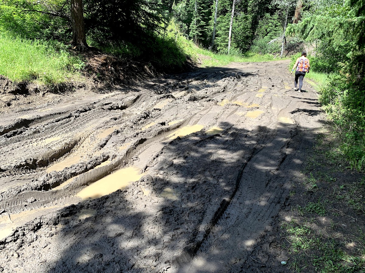
We jumped out to scout it, and literally just on the other side of the mudhole was the rec site. It was empty, it was beautiful. We had to give it a go. And honestly, I just love to find the limit of whatever I’m driving, and the challenge of an obstacle is just too much to ignore. Plus, i figured worst case scenario we could unhook the anchor, i mean trailer, and get the suby out, then worry about the trailer from there. With maxtrax, shovels, straps, jacks and everything else we needed on hand, we decided to give it a go. My wife Kim jumped out to film, and I jumped behind the wheel.

Yes, sweet success! Definitely had a few beers after that day!
Stay tuned for next installment, featuring surprise guests of a toyota 4x4 crew and some beautiful alpine driving
Thanks for following along!
My work rotation went fairly quickly, since I spent most of it in the field, with my few office days mostly spent trying to not spend too much time on google earth planning routes. Anyway, we left from Kamloops and headed to Logan Lake, where we spent a couple cold nights visiting friends and staying at the municipal campground. It was still +8C (46F) and raining/windy. (Though as I write this in the wildfire smoke with an air quality index of 480 PM2.5, I’m sure we can all agree there are worse things than rain). On the plus side, we did get to see a few nice bucks wandering through the campground.
As the weather finally cleared, we were keen to hit the semi-arid parts of BC, which always feels like home to me, growing up in Kamloops amongst the sagebrush and ponderosa pine. So we left Logan Lake and drove past Highland Valley Copper. Of course, since my wife and I are both geologists we had to stop and take a look. And lets face it, who doesnt love a giant hole in the ground!
From here, we descended almost 1000m to the town of Ashcroft on the Thompson river. Its got the reverse treeline familiar to many who live/travel in the desert southwest, where forests give way to scrub, sagebrush and grass as you drop to the hot valley bottoms. We stopped at Desert Hills Farm and stocked up on some veggies and fruit, pet a few llamas and such, and then headed southwest
Our goal for the day was get up into the Oregon Jack provincial park, apparently host to some cool limestone canyon, with a rec site called three sisters at the base of a cool scenic drive to a fire lookout (Cornwall Hills).
That feeling of turning off a paved road onto a new gravel road to explore is always so good, but especially this year with covid fatigue, stress, travel restrictions, etc, it felt like such an incredible relief to be back to the basics.
We headed up in elevation, back into the saskatoon bushes, then pines, and eventually mixed coniferous forest. The sun was hot, and after a rainy spring/summer, it felt amazing.
As we climbed in elevation, the road was pretty good, and the 4 banger suby chugged along just fine in 2nd gear. We were only around 1km from the rec site now. (gotta shout out here to the Gaia app, I know you guys all have it already but its a game changer... still love the backroads books for campfire reading etc but for the dash navigation its hard to beat).
The road started to get a bit muddy from all the recent rain and there were a few small mudholes. And then, there was this:
We jumped out to scout it, and literally just on the other side of the mudhole was the rec site. It was empty, it was beautiful. We had to give it a go. And honestly, I just love to find the limit of whatever I’m driving, and the challenge of an obstacle is just too much to ignore. Plus, i figured worst case scenario we could unhook the anchor, i mean trailer, and get the suby out, then worry about the trailer from there. With maxtrax, shovels, straps, jacks and everything else we needed on hand, we decided to give it a go. My wife Kim jumped out to film, and I jumped behind the wheel.
Yes, sweet success! Definitely had a few beers after that day!
Stay tuned for next installment, featuring surprise guests of a toyota 4x4 crew and some beautiful alpine driving
Thanks for following along!
rfoubi
Observer
Man, this takes me back to 10 years ago when EVERY trip report was like this. Not just a post with a link to some blog or youtube video.
Yeah call me old school but i love a good old fashioned trip report with text and photos. It takes time to write and ******** around but the journal aspect of it brings me a lot of joy in reminiscing. And also, for me its the best way to read other peoples reports too. I can take it a few pages/pics at a time, scroll fast if its boring, slow down if its good. Flip back and forth when i need a break from work tasks, etc. I love a good vlog too, when i wanna chill in the evening and get into something, but to be honest most of the time when i see a vlog/blog link i dont get around to clicking/watching it.
rfoubi
Observer
Thanks for the story (so far). I'm in Penticton, and have been wanting to go and drive up that road that starts by following the Grandby River for years.
Yeah its pretty sweet. Have you done the christian valley? (parallel route up north from westbridge). I think camping wise its got some nicer spots along the way. (Aside from the bluejoint/granby fork detour on the granby route). Both good thru routes.
rfoubi
Observer
The day dawned sunny, so after a good breakfast and some time for the kids to run around in the grass, we left the trailer, loaded into the suby, and headed up. We switchbacked through steeper but drier roads, with nothing like the mudhole we had dragged the trailer through down below. As we started to crest the treeline, the views got pretty decent:

Didnt really take any more pics on the way up, but the road was pretty much driveable with anything awd and or high clearance. No real difficulties. As we crested over treeline, we started to see the fire lookout, and spotted a bunch of rigs up there already. Kinda weird for a random weekday, but pretty funny in the since we sure made an appearance climbing the shortcut steep last bit to the top.
It was a group of sweet built toyotas mostly from the coast, and they were doing a day trip to the lookout. As they were chilling getting drone shots and enjoying the view, the sight of a grandpa-brown mostly stock subaru with car seats in the back and bikes on the roof zooming up to the top elicited some chuckles for sure. When we got out one guy said something along the lines of “so much for justifying my bigger tires before this trip ” or something like that. Haha. Anyway,
Which of these is not like the others?

Heres the lookout- Cornwall Hills, BC
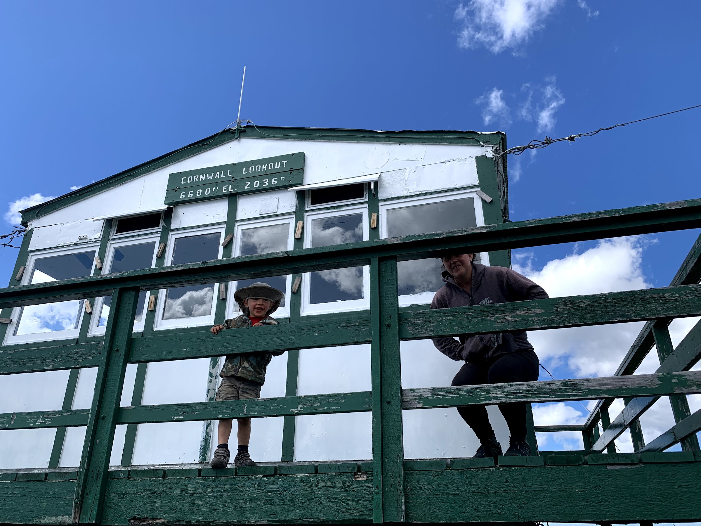
Doesnt sound like much to you colorado folks, but there are only a handful of roads in BC that go over 2000m (6600 ft). I always think how hot/barren the western states they would be if they were at BC’s elevation, and alternatively, how much of a solid glacier blob BC would be if it had the same elevation as the plateaus in the western US. Anyway, geography facts aside, the views were spectacular...west to the coast mountains, north and east to the rolling forested hills and dry valleys 5000’ below.
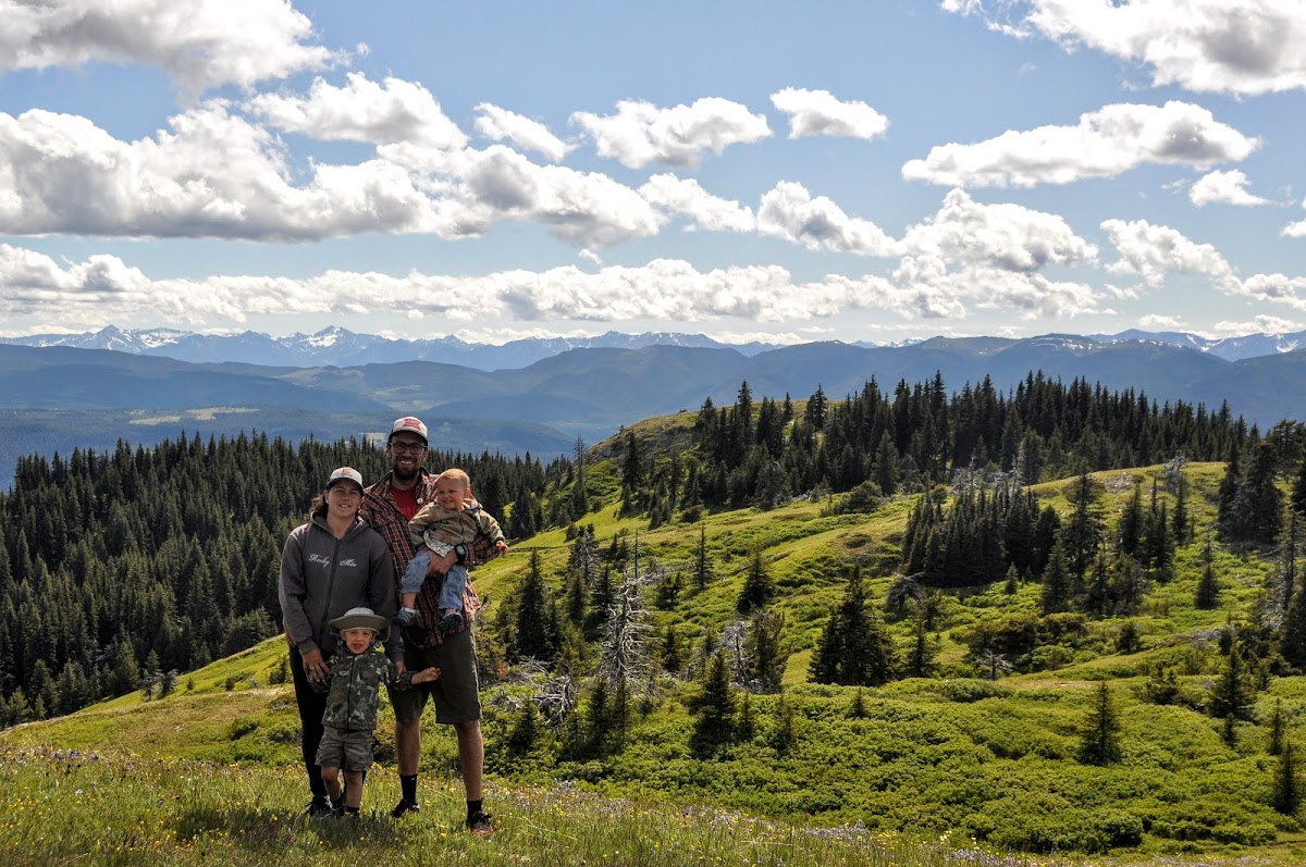
After a while chatting with the toyota crew, we started our descent. We took turns taking a kid on the macride (on the mtb) and driving the other kid down in the suby. Both were fun

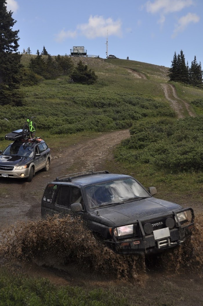
toyota leaves grandpa mobile in the dust

Kim and Orson shredding


how we roll

such a nice spot


sorry i cant stop taking photos

my daughter and i get a turn to rip on the bike

more nice toyotas. If any of you guys are on here it was awesome meeting you all!

Next, we go climbing, find some pictographs, and then head down into the valley. Stay tuned!
Didnt really take any more pics on the way up, but the road was pretty much driveable with anything awd and or high clearance. No real difficulties. As we crested over treeline, we started to see the fire lookout, and spotted a bunch of rigs up there already. Kinda weird for a random weekday, but pretty funny in the since we sure made an appearance climbing the shortcut steep last bit to the top.
It was a group of sweet built toyotas mostly from the coast, and they were doing a day trip to the lookout. As they were chilling getting drone shots and enjoying the view, the sight of a grandpa-brown mostly stock subaru with car seats in the back and bikes on the roof zooming up to the top elicited some chuckles for sure. When we got out one guy said something along the lines of “so much for justifying my bigger tires before this trip ” or something like that. Haha. Anyway,
Which of these is not like the others?
Heres the lookout- Cornwall Hills, BC
Doesnt sound like much to you colorado folks, but there are only a handful of roads in BC that go over 2000m (6600 ft). I always think how hot/barren the western states they would be if they were at BC’s elevation, and alternatively, how much of a solid glacier blob BC would be if it had the same elevation as the plateaus in the western US. Anyway, geography facts aside, the views were spectacular...west to the coast mountains, north and east to the rolling forested hills and dry valleys 5000’ below.
After a while chatting with the toyota crew, we started our descent. We took turns taking a kid on the macride (on the mtb) and driving the other kid down in the suby. Both were fun
toyota leaves grandpa mobile in the dust
Kim and Orson shredding
how we roll
such a nice spot
sorry i cant stop taking photos
my daughter and i get a turn to rip on the bike
more nice toyotas. If any of you guys are on here it was awesome meeting you all!
Next, we go climbing, find some pictographs, and then head down into the valley. Stay tuned!
Trikebubble
Adventurer
Yeah its pretty sweet. Have you done the christian valley? (parallel route up north from westbridge). I think camping wise its got some nicer spots along the way. (Aside from the bluejoint/granby fork detour on the granby route). Both good thru routes.
I have meandered up the Christian Valley a ways. Spent a night at a nice lake behind Big White somewhere, then hooked back up with the 201 and came back to Penticton that way.
Trikebubble
Adventurer
If you enjoy the summits, you should check out Apex Mountain here in Penticton some time. The summit is about 7300ft and you can drive to it without any real problem. It's a great place for a picnic (or overnight stay). Their is no fire tower, but a ton of antenna's, and you can look down on the ski hill one mountain over and have a great view of all the mountains in the Similkameen area.


rfoubi
Observer
Looks great. Most ski areas seem to have gated access so I never even gave it a thought actually. I'll have to check that out on the way by one day. ThanksIf you enjoy the summits, you should check out Apex Mountain here in Penticton some time. The summit is about 7300ft and you can drive to it without any real problem. It's a great place for a picnic (or overnight stay). Their is no fire tower, but a ton of antenna's, and you can look down on the ski hill one mountain over and have a great view of all the mountains in the Similkameen area.
View attachment 612445
rfoubi
Observer
Next stop was the Oregon Jack provincial park, which was only 5 mins down the logging road. We hooked the trailer up and went back through that same mudhole. Made it in one try this time thanks to a slightly better route choice. We stopped in at Oregon Jack and it sure was amazing. No facilities at all, but a very cool bouldering/climbing area on beautiful limestone crags.


Did some short climbs with the kids, and then scrambled around the cliffs looking for the pictographs.
Found them!
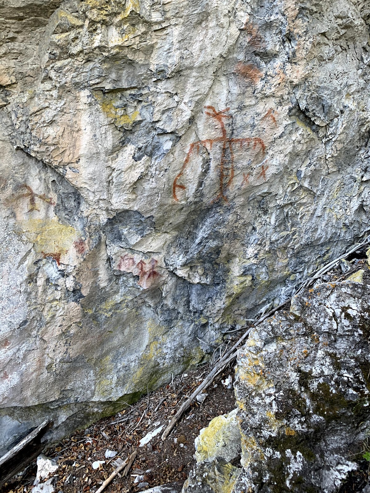

It was a powerful place, sun and shade dappled amongst the monster trees and overhanging limestone. The pictographs were the icing on the cake, and we spent a few moments appreciating them, and then hit the road.
We descended out of the forest and into the grasslands. We decided to take a side road looking for saskatoons. We found some great bushes (trees really) loaded with saskatoons, and spent half an hour picking ‘toons and basking in the sun.


After our fill of picking, we headed down to the valley bottom. On the way, the temperature finally crested 30 degrees C, which for this cold summer, was amazing! It normally would be 35-40 degrees at valley bottom here, which is one of the hottest places in Canada.

Oh and while I’m at it, another app shoutout: here we are using maps.me which is a free, offline turn by turn navigation app. The maps are basic and it doesnt have the topo/sat capability of gaia, but it has all of the open source trails/roads and you can download whole countries. We use it all over the world for offline turn by turn navigation. Anyway plugging that ******** kinda makes me feel like one of those #vanlifers that i made fun of in the intro to this post. I swear its not an affiliate link! I just want to share the knowledge, since i love that app.

As we headed south down the thompson, we enjoyed the desert canyon scenery... a few mountain sheep along the side, some cool colours in the rock, and even a waterfall:

We hit spences, bridge, and then swung east up the Nicola river valley. This quiet paved highway wound alongside the river and past some more great scenery.
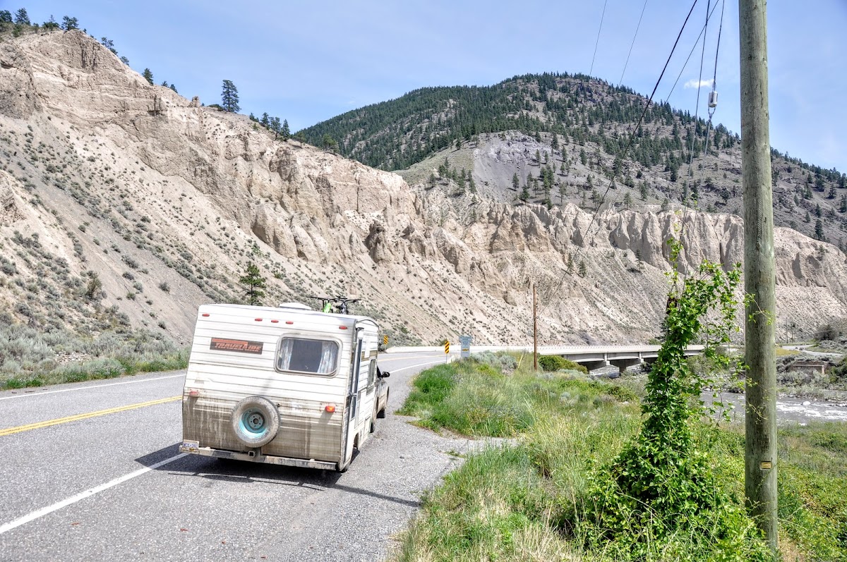
From here, it was all pavement pounding to Merritt, BC, where we grabbed some food, gas, and ice. Next, we head back onto the gravel and find a campsite
Did some short climbs with the kids, and then scrambled around the cliffs looking for the pictographs.
Found them!
It was a powerful place, sun and shade dappled amongst the monster trees and overhanging limestone. The pictographs were the icing on the cake, and we spent a few moments appreciating them, and then hit the road.
We descended out of the forest and into the grasslands. We decided to take a side road looking for saskatoons. We found some great bushes (trees really) loaded with saskatoons, and spent half an hour picking ‘toons and basking in the sun.
After our fill of picking, we headed down to the valley bottom. On the way, the temperature finally crested 30 degrees C, which for this cold summer, was amazing! It normally would be 35-40 degrees at valley bottom here, which is one of the hottest places in Canada.
Oh and while I’m at it, another app shoutout: here we are using maps.me which is a free, offline turn by turn navigation app. The maps are basic and it doesnt have the topo/sat capability of gaia, but it has all of the open source trails/roads and you can download whole countries. We use it all over the world for offline turn by turn navigation. Anyway plugging that ******** kinda makes me feel like one of those #vanlifers that i made fun of in the intro to this post. I swear its not an affiliate link! I just want to share the knowledge, since i love that app.
As we headed south down the thompson, we enjoyed the desert canyon scenery... a few mountain sheep along the side, some cool colours in the rock, and even a waterfall:
We hit spences, bridge, and then swung east up the Nicola river valley. This quiet paved highway wound alongside the river and past some more great scenery.
From here, it was all pavement pounding to Merritt, BC, where we grabbed some food, gas, and ice. Next, we head back onto the gravel and find a campsite
rfoubi
Observer
The next campsite we hit was the rec site at Lundbom lake. This was a popular place, and we were lucky to get a spot at all, let along one with lakefront. We’ll take it! The nice thing about camping in a van/small trailer/”expo rig” is that all the guys with big trailers cant fit into the good spots.

This is the perfect place for the movable solar panel. There was sun for 4 days more or less, but always through the trees, and never for more than an hour in one place. We did lots of moving the panel to keep the sun energy flowing. The main power draw is the fridge, which i think uses around 1.5-2 amps per hour.

theres another shot of the trailer interior. It’s changed since then, with the big clunky furnace there replaced with a thermostat controlled push button start propex that weighs 17 lbs less and takes 1/5th the space. The propex served us well in the VW van so hopefully itll work well this winter in the trailer.


The sunsets in this place were incredible. The lake is on a plateau, so unlike most rec sites in BC, the mountains dont block the sunset, and watching it set over the lake felt like sitting on the pacific watching the sun set into the ocean.
The next morning, we set off to go drive some fun roads and get out on the bikes. I knew from a previous trip (actually, the photo i posted of the VW stuck in the mud) that you could drive almost to the top of the mountain in the distance here.
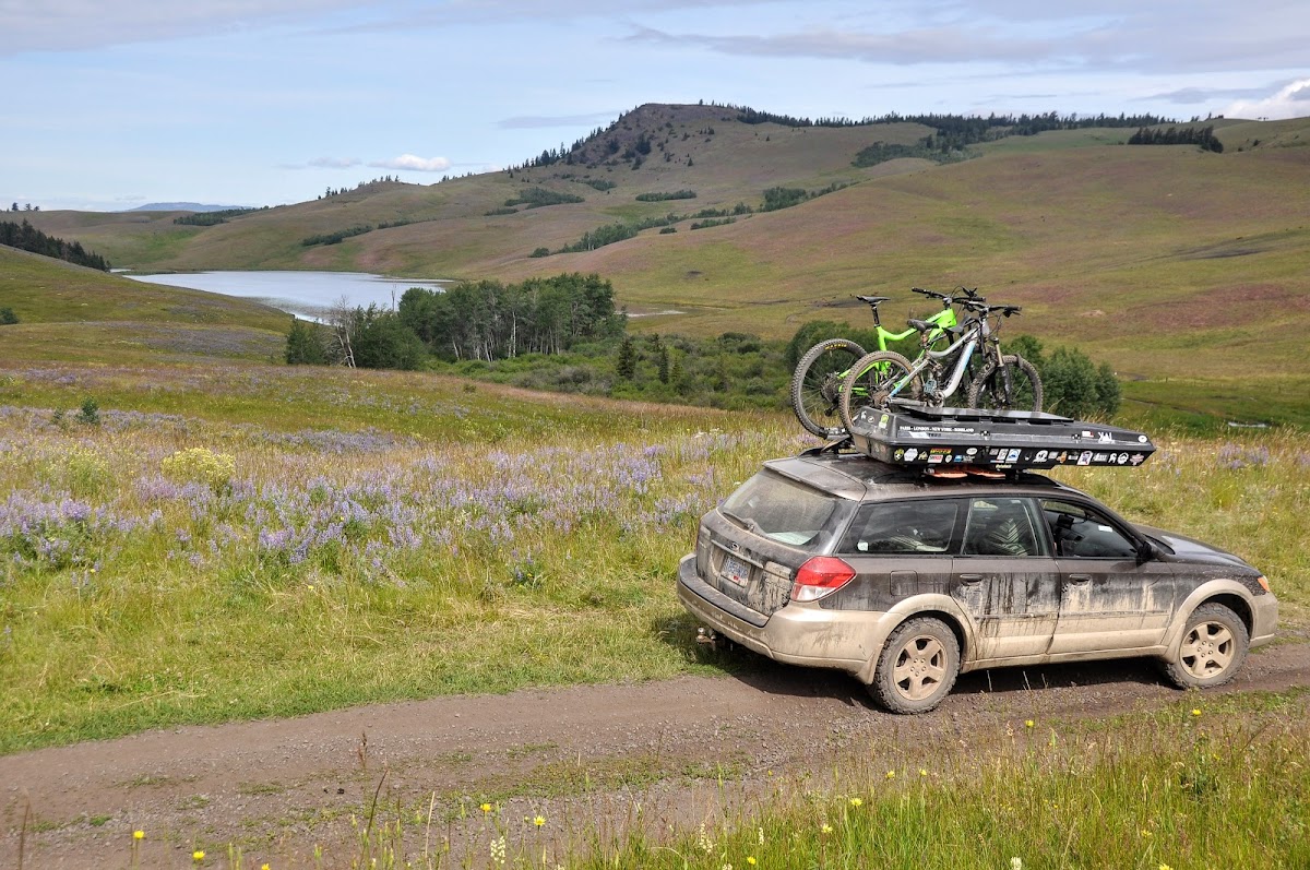
however, long story short, there was some impassable (at least to this rig) mud pits, so we had to backtrack to the highway and come in from the west.

its cattle country out here for sure. Eventually, we found our way up to the height of land, and the start of the bike trails we were looking for

This is the perfect place for the movable solar panel. There was sun for 4 days more or less, but always through the trees, and never for more than an hour in one place. We did lots of moving the panel to keep the sun energy flowing. The main power draw is the fridge, which i think uses around 1.5-2 amps per hour.
theres another shot of the trailer interior. It’s changed since then, with the big clunky furnace there replaced with a thermostat controlled push button start propex that weighs 17 lbs less and takes 1/5th the space. The propex served us well in the VW van so hopefully itll work well this winter in the trailer.
The sunsets in this place were incredible. The lake is on a plateau, so unlike most rec sites in BC, the mountains dont block the sunset, and watching it set over the lake felt like sitting on the pacific watching the sun set into the ocean.
The next morning, we set off to go drive some fun roads and get out on the bikes. I knew from a previous trip (actually, the photo i posted of the VW stuck in the mud) that you could drive almost to the top of the mountain in the distance here.
however, long story short, there was some impassable (at least to this rig) mud pits, so we had to backtrack to the highway and come in from the west.
its cattle country out here for sure. Eventually, we found our way up to the height of land, and the start of the bike trails we were looking for
Trikebubble
Adventurer
Looks great. Most ski areas seem to have gated access so I never even gave it a thought actually. I'll have to check that out on the way by one day. Thanks
Apex Mountain is behind the ski resort area (Apex Alpine ski resort is actually on a different mountain). Access is via an open forestry road, it's a great view from the top.
Similar threads
- Replies
- 16
- Views
- 2K
- Replies
- 3
- Views
- 752
