You are using an out of date browser. It may not display this or other websites correctly.
You should upgrade or use an alternative browser.
You should upgrade or use an alternative browser.
The Grand Expedition Colorado to Alaska to Baja...
- Thread starter aero
- Start date
aero
Adventurer
Many Forms of Water
Last week I crossed into Montana for the first time on the trip and found a beautiful location to camp. After I broke camp that morning, I drove east along the Beartooth Scenic Byway. I only made it halfway down that route before turning onto the Chief Joseph Scenic Byway that would point me in a southeast direction towards Cody, WY. I figured it would be a larger city where I could finally get my tire properly patched from the inside to replace the plugs I put in it a few weeks back. Along the route I stopped at the top of Dead Indian Mountain for lunch as well as being able to upload last week's update since there happened to be cell service up there. Only after I descended, and got a way down the pavement did I realize that I could've seen the Morrison Trail from the top of the mountain where I was hanging out.
In Cody, I got the tire patched, swung by the FS office who confirmed that the Morrison Trail would not be opening on time due to snow. After running around I continued east to the Bighorn National Forest. Once there I ended up driving until dark looking for a campsite, found one and fell asleep quickly. The next day I did a bit of hiking to two waterfalls, Bucking Mule and Porcupine. The water at Porcupine was very refreshing, I was tempted to get in which I did not, but I did try my hand at panning for gold on my second hike out to the waterfall that day. I brought the drone along to get some video of it. I wanted to get a video of Bucking Mule Falls, but the 5 mile round trip hike didn't seem as tempting the second time around.
Bucking Mule Falls
Porcupine Falls
After all of my hiking that day (coupled with working out during the hikes) I was pretty beat but still wanted to see the Medicine Wheel. On my way to the wheel I spotted a flock of sheep.
And the sheep dog. I think he could use a haircut as well.
This particular Medicine Wheel is claimed to be one of the most sacred Medicine Wheels in the area out of nearly 100 that have been discovered. Indians still make pilgrimages to the site and hang offerings on the fences. It was a very great opportunity to go there, I hung around until sunset since I knew it would make great pictures. After visiting the Medicine Wheel, I confirmed (since I always forgot in the past) that I have ancestors who were part of the Ponca Tribe from Nebraska.
Last week I crossed into Montana for the first time on the trip and found a beautiful location to camp. After I broke camp that morning, I drove east along the Beartooth Scenic Byway. I only made it halfway down that route before turning onto the Chief Joseph Scenic Byway that would point me in a southeast direction towards Cody, WY. I figured it would be a larger city where I could finally get my tire properly patched from the inside to replace the plugs I put in it a few weeks back. Along the route I stopped at the top of Dead Indian Mountain for lunch as well as being able to upload last week's update since there happened to be cell service up there. Only after I descended, and got a way down the pavement did I realize that I could've seen the Morrison Trail from the top of the mountain where I was hanging out.
In Cody, I got the tire patched, swung by the FS office who confirmed that the Morrison Trail would not be opening on time due to snow. After running around I continued east to the Bighorn National Forest. Once there I ended up driving until dark looking for a campsite, found one and fell asleep quickly. The next day I did a bit of hiking to two waterfalls, Bucking Mule and Porcupine. The water at Porcupine was very refreshing, I was tempted to get in which I did not, but I did try my hand at panning for gold on my second hike out to the waterfall that day. I brought the drone along to get some video of it. I wanted to get a video of Bucking Mule Falls, but the 5 mile round trip hike didn't seem as tempting the second time around.
Bucking Mule Falls

Porcupine Falls

After all of my hiking that day (coupled with working out during the hikes) I was pretty beat but still wanted to see the Medicine Wheel. On my way to the wheel I spotted a flock of sheep.

And the sheep dog. I think he could use a haircut as well.

This particular Medicine Wheel is claimed to be one of the most sacred Medicine Wheels in the area out of nearly 100 that have been discovered. Indians still make pilgrimages to the site and hang offerings on the fences. It was a very great opportunity to go there, I hung around until sunset since I knew it would make great pictures. After visiting the Medicine Wheel, I confirmed (since I always forgot in the past) that I have ancestors who were part of the Ponca Tribe from Nebraska.
Last edited:
aero
Adventurer
Last pictures of the above post, wouldnt work in that post.
---------------
It is flat, there were some pieces of memory foam under it in the picture. I'll try to find a picture without the mattress on there.
Not sure why it'll let me upload one picture, but not my update with a few.
Here it is under the mattress.


---------------
sweet trip! any pictures of your in cab sleeping area?

It is flat, there were some pieces of memory foam under it in the picture. I'll try to find a picture without the mattress on there.
Not sure why it'll let me upload one picture, but not my update with a few.
Here it is under the mattress.

Last edited:
aero
Adventurer
Many Forms of Water Continued
(Still trying to figure out why the forum wont let me post the first half of the update)
I headed towards Billings since I was somewhat in the area and wanted to build a PVC shower water tube for the roof. I stopped along the way to check out the Big Ice Cave near Big Pryor Mountain. Its 32 degree temperature was a welcomed change to the 90 degree temperatures outside. As I continued into Billings, the temperatures reached triple digits, and I knew I had to scurry west to find higher elevations and lower temperatures. I found myself in the Helena-Lewis and Clark NF where I would do some ‘chores' all of the following day. I built and mounted the PVC water tube on the roof (6-7 extra gallons of water), did a bunch of laundry, organized the truck a little bit, and it was a full day. At 1am that morning I heard a strange sound coming from outside of the truck. I was next to the stream so I could not hear exactly what it was. I heard the noises again and realized that there were animals under the hood. That was the last thing I wanted to deal with when it was pitch black outside. There were two kangaroo rats that were under the cowl that I had to remove to get them out of there. One fled, the other one I ended up playing cat and mouse games with for the next hour and a half. I left the campground since I did not want them coming back in a few hours and ended up spending the rest of the night along the road.
Current mess on the roof
Leaving the water connected, I have a valve at the rear of the tube to shut it off when needed
Glacier NP was the next on my list, and its location and popularity was a bit of a headache to find a spot to camp. On the east side, it is bordered by the Blackfeet Indian Reservation which means no NF sites to camp in. On the west side all of the camping areas are a good hour or so drive to the hiking spots. All of the campsites inside the park were booked as well. But I found a beautiful spot 50 feet from the river, 40 miles south of Canada that I called home for a few days. I spent the first day playing in the river on the paddleboard. Being my third time on the board; which is deemed ‘advanced' for my height and weight, I did pretty well coping with the challenges that the moving river provided. I hiked upriver with the paddleboard and stayed within a 200 foot section of the river. Thanks to the wind, I was able to paddle (sometimes didn't even need to paddle) against the current up the river. The combination of the gusty winds, small wavy areas and the current, I got a very good workout and now I'm ready to take on Class IV rapids on this thing! Ok, maybe not.
Camp spot
I went hiking the following day in Glacier National Park. It is starting to be a common occurrence; I plan on doing a short hike and end up doing a crazy long hike. I planned on doing maybe 5 miles and ended up logging over 15 miles over 5 hours with a half a mile of elevation gain. Not bad for someone who is pretty ‘new' to hiking; since I used to spend all my time on the mountain bike. During the hike I was able to get to an overlook of the Grinnell Glacier, which there's not much left and I'm sure it'll be gone soon. There were two different locations where the bighorn sheep decided to graze along the hiking trail and you had to wait until they were finished so you could pass. The first was a ram, the second was an ewe and a yearling. Glacier NP has free shuttles which make the hiking experience much easier. If I did it again, I would stay in the park (if the campgrounds were not all full) and use the shuttles to get around. I slept well that night back at my location along the river.
Grinnell Glacier
Ram
Highline Trail
(Still trying to figure out why the forum wont let me post the first half of the update)
I headed towards Billings since I was somewhat in the area and wanted to build a PVC shower water tube for the roof. I stopped along the way to check out the Big Ice Cave near Big Pryor Mountain. Its 32 degree temperature was a welcomed change to the 90 degree temperatures outside. As I continued into Billings, the temperatures reached triple digits, and I knew I had to scurry west to find higher elevations and lower temperatures. I found myself in the Helena-Lewis and Clark NF where I would do some ‘chores' all of the following day. I built and mounted the PVC water tube on the roof (6-7 extra gallons of water), did a bunch of laundry, organized the truck a little bit, and it was a full day. At 1am that morning I heard a strange sound coming from outside of the truck. I was next to the stream so I could not hear exactly what it was. I heard the noises again and realized that there were animals under the hood. That was the last thing I wanted to deal with when it was pitch black outside. There were two kangaroo rats that were under the cowl that I had to remove to get them out of there. One fled, the other one I ended up playing cat and mouse games with for the next hour and a half. I left the campground since I did not want them coming back in a few hours and ended up spending the rest of the night along the road.
Current mess on the roof

Leaving the water connected, I have a valve at the rear of the tube to shut it off when needed

Glacier NP was the next on my list, and its location and popularity was a bit of a headache to find a spot to camp. On the east side, it is bordered by the Blackfeet Indian Reservation which means no NF sites to camp in. On the west side all of the camping areas are a good hour or so drive to the hiking spots. All of the campsites inside the park were booked as well. But I found a beautiful spot 50 feet from the river, 40 miles south of Canada that I called home for a few days. I spent the first day playing in the river on the paddleboard. Being my third time on the board; which is deemed ‘advanced' for my height and weight, I did pretty well coping with the challenges that the moving river provided. I hiked upriver with the paddleboard and stayed within a 200 foot section of the river. Thanks to the wind, I was able to paddle (sometimes didn't even need to paddle) against the current up the river. The combination of the gusty winds, small wavy areas and the current, I got a very good workout and now I'm ready to take on Class IV rapids on this thing! Ok, maybe not.
Camp spot

I went hiking the following day in Glacier National Park. It is starting to be a common occurrence; I plan on doing a short hike and end up doing a crazy long hike. I planned on doing maybe 5 miles and ended up logging over 15 miles over 5 hours with a half a mile of elevation gain. Not bad for someone who is pretty ‘new' to hiking; since I used to spend all my time on the mountain bike. During the hike I was able to get to an overlook of the Grinnell Glacier, which there's not much left and I'm sure it'll be gone soon. There were two different locations where the bighorn sheep decided to graze along the hiking trail and you had to wait until they were finished so you could pass. The first was a ram, the second was an ewe and a yearling. Glacier NP has free shuttles which make the hiking experience much easier. If I did it again, I would stay in the park (if the campgrounds were not all full) and use the shuttles to get around. I slept well that night back at my location along the river.
Grinnell Glacier

Ram

Highline Trail

Brandon great pics! & great trip so far. Thanks for sharing. I grew up in Riverton (25 miles from Lander). That is a great area! The Sinks and Atlantic City bring back alot of memories. I am planning a short trip up there to see the eclipse next month. The Tetons and Cody are also great areas. I could spend a month up there and still not see everything I wanted to. I also spent time in Montana growing up and been to Glacier a few times. Awesome as well.
Haven't heard of that ice cave you mentioned so I will have to check that out sometime. Have fun on the rest of your trip and I look forward to seeing more updates.
Haven't heard of that ice cave you mentioned so I will have to check that out sometime. Have fun on the rest of your trip and I look forward to seeing more updates.
Last edited:
aero
Adventurer
Brandon great pics! & great trip so far. Thanks for sharing. I grew up in Riverton (25 miles from Lander). That is a great area! The Sinks and Atlantic City bring back alot of memories. I am planning a short trip up there to see the eclipse next month. The Tetons and Cody are also great areas. I could spend a month up there and still not see everything I wanted to. I also spent time in Montana growing up and been to Glacier a few times. Awesome as well.
Haven't heard of that ice cave you mentioned so I will have to check that out sometime. Have fun on the rest of your trip and I look forward to seeing more updates.
Thanks! Yeah, as far as I know its just called the Big Ice Cave. Theres another one just west of it that you have to hike a mile or so to get to. There is also another one listed on my map a bit further down the trail, on the east face of the main mountain, but not sure if its still around or accessible since I didnt see anything about it online.
But heres a little map of the trip so far.
CharlieCafe
New member
Sneaking over here from TW to check out the good stuff :elkgrin:
aero
Adventurer
Brandon, It was really great meeting and talking with you today. My wife thought that it was funny that I wouldn't stop listing off places to see and drive once you reach the great land. I hope I didn't throw you to far off your schedule while talking your ears off.
Was great to meet you and chat with you. No schedule, I appreciated the talk and all of the good advice for the trip! I survived the Magruder, made it to Missoula to swap out the fridge and am currently trying my best to knock out a trip update with some pictures!
aero
Adventurer
Idaho! I forgot the potatoes.
I think I'm getting old… trying to remember where I left off, and where I went from there.
Ok, we were last at Glacier NP. It was a nice camp spot I found, but the drive into Glacier took quite a while. I headed to the soutwest, I cant remember if I was heading somewhere in particular or just that direction.
I pulled off the road for a nice lunch spot along the river and decided it was a pretty nice spot, so I set up camp there for the night. Part of the reason I liked that spot was the crystal clear river that had a little bit of flow and some wavy areas for the paddleboard. I got it out and hit the water for a few hours. I accomplished my goal of staying on the board through the rapid section! Its strange how quickly you adjust to the 50 degree water that felt like ice when I first dipped my toes in. I also got some laundry done, a nice perk of being next to the river.
It seems like I am just jumping around the country from one body of water to the next, which is fine by me having all this refreshing water around.
I ended up in Coeur d'Alene, and camped on the cliffs of Pend Oreille. It was a bit windy and wavy here for the paddleboard so it was just a nice relaxing time.

The city park in Coeur d'Alene is a really neat area, lots of shops and walking areas, the marina with float planes, and the waters edge has steps into the swimming area. I drug the board out and it was then that I realised using it on choppy/wavy water is quite a task! My knees were quickly worn out but I did somewhat get the hang of it.
Next up, I camped southeast from Coeur d'Alene near a hike to Crystal Lake. As usual, horrible views! While in the area, I met a few locals that gave me great info for the rest of my time in Idaho as well as tons about Alaska!
I continued my scenic route down towards the Magruder Corridor. Dent Bridge was appearing majestic.
As well as the Clearwater River, which was just as refreshing!
And yeah, all the time in Idaho, I forgot to stop for some potatoes. There has to be some special plate, right?
I think I'm getting old… trying to remember where I left off, and where I went from there.
Ok, we were last at Glacier NP. It was a nice camp spot I found, but the drive into Glacier took quite a while. I headed to the soutwest, I cant remember if I was heading somewhere in particular or just that direction.
I pulled off the road for a nice lunch spot along the river and decided it was a pretty nice spot, so I set up camp there for the night. Part of the reason I liked that spot was the crystal clear river that had a little bit of flow and some wavy areas for the paddleboard. I got it out and hit the water for a few hours. I accomplished my goal of staying on the board through the rapid section! Its strange how quickly you adjust to the 50 degree water that felt like ice when I first dipped my toes in. I also got some laundry done, a nice perk of being next to the river.

It seems like I am just jumping around the country from one body of water to the next, which is fine by me having all this refreshing water around.
I ended up in Coeur d'Alene, and camped on the cliffs of Pend Oreille. It was a bit windy and wavy here for the paddleboard so it was just a nice relaxing time.

The city park in Coeur d'Alene is a really neat area, lots of shops and walking areas, the marina with float planes, and the waters edge has steps into the swimming area. I drug the board out and it was then that I realised using it on choppy/wavy water is quite a task! My knees were quickly worn out but I did somewhat get the hang of it.
Next up, I camped southeast from Coeur d'Alene near a hike to Crystal Lake. As usual, horrible views! While in the area, I met a few locals that gave me great info for the rest of my time in Idaho as well as tons about Alaska!


I continued my scenic route down towards the Magruder Corridor. Dent Bridge was appearing majestic.

As well as the Clearwater River, which was just as refreshing!

And yeah, all the time in Idaho, I forgot to stop for some potatoes. There has to be some special plate, right?
aero
Adventurer
The Magruder!
After all the waiting, it was time to hit one of the trails I wanted to do. Maybe it was the fact that it crosses one of the most desolate areas in the lower 48; maybe it was the thrill of the historic slaughter that gave the trail its name, probably a little bit of everything.
The area was originally home to the Nez Perce Indians, then some guys named Lewis and Clark hiked through the area. The road got its name when Lloyd Magruder, a successful merchant was on a return trip with $25k. He hired men to guard his money and while on the return trip, the hired help murdered Magruder and the rest of his party; rolling their bodies off the cliff. They killed all of the animals and burned the rest of the gear and went on the run. They ran to California where they were caught and returned to the Idaho Territory. Three were hanged and ones life was spared due to testifying against the others. This was the first trial in the Idaho Territory.
I continued on the Magruder by myself… I didn't want to test my luck hiring any guides to see me safely across.
 Magruder Corridor by Brandon M, on Flickr
The area has been victim to multiple forest fires over the years and most of the 100+ miles of the trail you are surrounded by burnt trees.
I drove up to top of Burnt Knob Point where I shared the views with three fire fighters from the Teton area. They were keeping an eye on one of the multiple fires that were currently burning in the area, likely started by lightning in the last week.
The fire that they were watching.
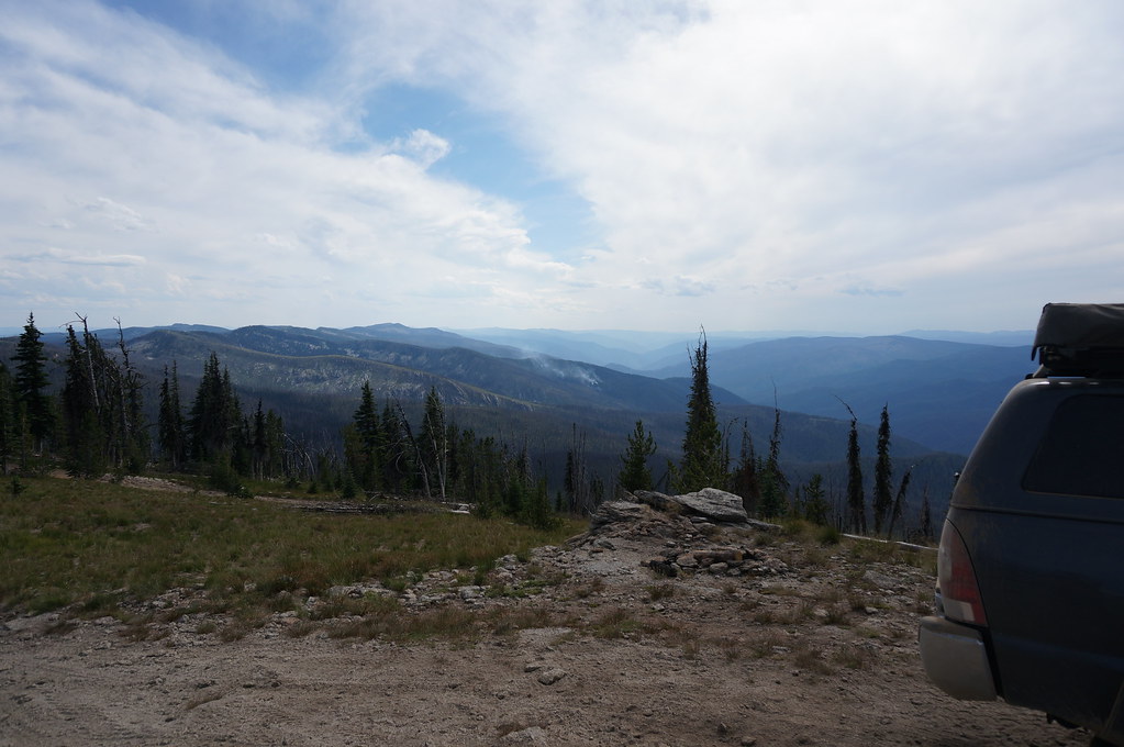
I finished the trail without incident, only had to cut one large tree out of the road. Not bad for the 100+ miles in a burn area with a ton of trees just waiting to fall over.
I cruised up to Missoula to pick up a Dometic dual zone fridge/freezer to replace my Indel B which was a fridge or freezer. The Dometic was a little larger so I had to do a little bit of work to get it to fit, but its in there! It'll be great to be able to freeze meat and veggies and of course… ice cream.
I had no issues with the Indel B over the year and a half or more that I have owned it. They make a dual zone unit, but it happened to be sold out for over a month, so that would not work!
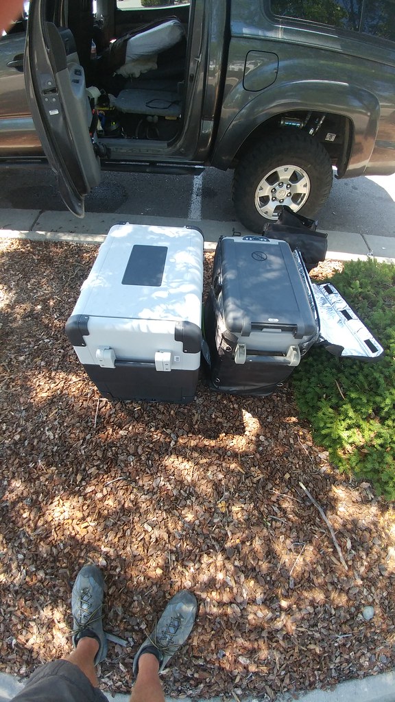
I originally had the Indel B TB51 http://www.truckfridge.com/tb51/
And replaced it with a Dometic CFX-DZUS http://amzn.to/2uvHaHG
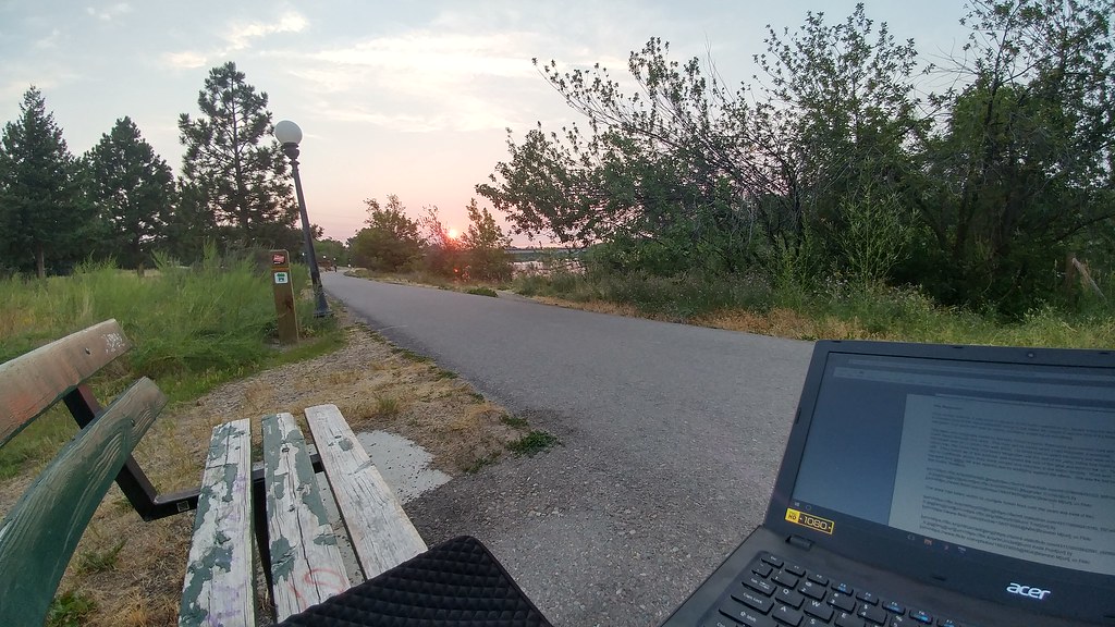
And I found a decent little spot along the path along the river in Missoula to get this update posted!
Next on the list, exploring a little bit of the ID/MT/WY border before heading over to another well known trail, the Morrison Road!
After all the waiting, it was time to hit one of the trails I wanted to do. Maybe it was the fact that it crosses one of the most desolate areas in the lower 48; maybe it was the thrill of the historic slaughter that gave the trail its name, probably a little bit of everything.
The area was originally home to the Nez Perce Indians, then some guys named Lewis and Clark hiked through the area. The road got its name when Lloyd Magruder, a successful merchant was on a return trip with $25k. He hired men to guard his money and while on the return trip, the hired help murdered Magruder and the rest of his party; rolling their bodies off the cliff. They killed all of the animals and burned the rest of the gear and went on the run. They ran to California where they were caught and returned to the Idaho Territory. Three were hanged and ones life was spared due to testifying against the others. This was the first trial in the Idaho Territory.
I continued on the Magruder by myself… I didn't want to test my luck hiring any guides to see me safely across.
 Magruder Corridor by Brandon M, on Flickr
The area has been victim to multiple forest fires over the years and most of the 100+ miles of the trail you are surrounded by burnt trees.

I drove up to top of Burnt Knob Point where I shared the views with three fire fighters from the Teton area. They were keeping an eye on one of the multiple fires that were currently burning in the area, likely started by lightning in the last week.

The fire that they were watching.

I finished the trail without incident, only had to cut one large tree out of the road. Not bad for the 100+ miles in a burn area with a ton of trees just waiting to fall over.
I cruised up to Missoula to pick up a Dometic dual zone fridge/freezer to replace my Indel B which was a fridge or freezer. The Dometic was a little larger so I had to do a little bit of work to get it to fit, but its in there! It'll be great to be able to freeze meat and veggies and of course… ice cream.
I had no issues with the Indel B over the year and a half or more that I have owned it. They make a dual zone unit, but it happened to be sold out for over a month, so that would not work!

I originally had the Indel B TB51 http://www.truckfridge.com/tb51/
And replaced it with a Dometic CFX-DZUS http://amzn.to/2uvHaHG
And I found a decent little spot along the path along the river in Missoula to get this update posted!

Next on the list, exploring a little bit of the ID/MT/WY border before heading over to another well known trail, the Morrison Road!
aero
Adventurer
I've been getting around lately. I dont have a weekly update done yet, but I do have one that might be a little more interesting. Bombed across the state to do the Morrison Jeep Trail. I'll work on some videos I got of it, as well as a trail writeup for Trailsoffroad.com.
The Morrison
The Morrison Jeep Trail is one of those bucket list trails that once you hear about it (and dont have a huge fear of ledges), you want to do it at some point. I had the trip planned out that I would run the trail when I passed through since it is supposed to open on July 15th of each year. I later learned that due to the snow, it usually opens later in the year. The forest service confirmed that in the weeks leading up and said it should be open a week or two later. After we confirmed that it was open, we had a few of us that would be able to get into the area to get it done.
Above the switchbacks looking east
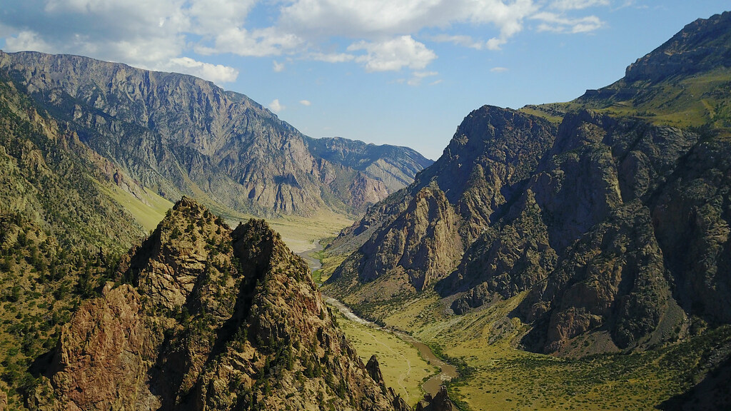
I drove about 6 hours to arrive later on Friday night. I knew there were reports of a large rock on the trail that fell during the winter and may have blocked too much of the trail for a ‘wide' Tacoma. The boulder ended up being more of a pain in the butt for the planning and organization than a physical obstacle. I got there on Friday, spotted the rock just above the first switchback and there was no traffic on the trail. I drove up to it to make sure I could get past. I was able to make it happen and then had the fun opportunity of backing down that switchback which is a ledgy/rocky corner. It was quite interesting. I made it back down, ran out to pass on the trail info. The other two tacomas were going to be there tomorrow to round out our first, second and third gen tacoma posse.
The famous switchbacks of the Morrison Trail is on the right…
Vehicles on the trail for scale (mostly smaller UTV's and atvs. White JK is the bottom most, older CJ5? And old black Toyota pickup at the top)
Saturday rolls around and due to miscommunication around the boulder issue and the lack of cell service, the group didn't assemble until too late in the day. The switchback section of the trail takes hours to complete and the traffic that was already on it, and the looming storm did not seem like a great idea. We decided it was smart to push the trail back until Sunday and work on good food for the evening. On the way out, it was raining, I was adjusting my CB squelch and hit an unsuspecting rock along the edge of the trail with one heck of an impact. I instantly heard hissing and knew what that was. I reluctantly called out that I had a flat (since I didnt want the Cooper tire owners to bash the Duratracs). Thankfully… he likely hit the same rock, and also had a sidewall tear. We had the pleasure of changing two driver rear flats in the rain. A group of atv/utv's came up behind us and they said they earned two or three flats as well during the day.
It's not an adventure until something goes wrong
We got dinner… a DELICIOUS dinner and decided what to do from there. Nowhere was open to get replacement tires with it being Sunday. Being that we drove a combined 30 hours round trip to get to the trail...we went against better judgement to do the trail; with neither of us having a spare tire, and running different sizes. We would only have the second and third gen Tacomas on Sunday and had help in the area if we happened to need it.
We got an early start, the 4.5 miles leading up to the switchbacks is slow… and rocky. We started the ascent of the switchbacks at 11:20. Even though we have ‘wide' vehicles and the maximum wheelbase you want for the trail, we were making good time. Most of the turns would require a three or four point turn, but we only needed a little spotting on a few corners. It was HOT with no breeze or shade.
The ‘new as of this winter' rock feature
The Morrison
The Morrison Jeep Trail is one of those bucket list trails that once you hear about it (and dont have a huge fear of ledges), you want to do it at some point. I had the trip planned out that I would run the trail when I passed through since it is supposed to open on July 15th of each year. I later learned that due to the snow, it usually opens later in the year. The forest service confirmed that in the weeks leading up and said it should be open a week or two later. After we confirmed that it was open, we had a few of us that would be able to get into the area to get it done.
Above the switchbacks looking east

I drove about 6 hours to arrive later on Friday night. I knew there were reports of a large rock on the trail that fell during the winter and may have blocked too much of the trail for a ‘wide' Tacoma. The boulder ended up being more of a pain in the butt for the planning and organization than a physical obstacle. I got there on Friday, spotted the rock just above the first switchback and there was no traffic on the trail. I drove up to it to make sure I could get past. I was able to make it happen and then had the fun opportunity of backing down that switchback which is a ledgy/rocky corner. It was quite interesting. I made it back down, ran out to pass on the trail info. The other two tacomas were going to be there tomorrow to round out our first, second and third gen tacoma posse.
The famous switchbacks of the Morrison Trail is on the right…

Vehicles on the trail for scale (mostly smaller UTV's and atvs. White JK is the bottom most, older CJ5? And old black Toyota pickup at the top)

Saturday rolls around and due to miscommunication around the boulder issue and the lack of cell service, the group didn't assemble until too late in the day. The switchback section of the trail takes hours to complete and the traffic that was already on it, and the looming storm did not seem like a great idea. We decided it was smart to push the trail back until Sunday and work on good food for the evening. On the way out, it was raining, I was adjusting my CB squelch and hit an unsuspecting rock along the edge of the trail with one heck of an impact. I instantly heard hissing and knew what that was. I reluctantly called out that I had a flat (since I didnt want the Cooper tire owners to bash the Duratracs). Thankfully… he likely hit the same rock, and also had a sidewall tear. We had the pleasure of changing two driver rear flats in the rain. A group of atv/utv's came up behind us and they said they earned two or three flats as well during the day.
It's not an adventure until something goes wrong

We got dinner… a DELICIOUS dinner and decided what to do from there. Nowhere was open to get replacement tires with it being Sunday. Being that we drove a combined 30 hours round trip to get to the trail...we went against better judgement to do the trail; with neither of us having a spare tire, and running different sizes. We would only have the second and third gen Tacomas on Sunday and had help in the area if we happened to need it.
We got an early start, the 4.5 miles leading up to the switchbacks is slow… and rocky. We started the ascent of the switchbacks at 11:20. Even though we have ‘wide' vehicles and the maximum wheelbase you want for the trail, we were making good time. Most of the turns would require a three or four point turn, but we only needed a little spotting on a few corners. It was HOT with no breeze or shade.
The ‘new as of this winter' rock feature

aero
Adventurer
The Morrison Continued
All was going well until I went into the corner that I later learned had a feature that was called ‘slider rock'. It is a tight switchback with a vertical rock face on the upper side of the trail. In the apex, there is a large rock that is not moving. I started around the corner, and after making a three or four point turn I got on the uphill side of the boulder. I was inching past, watching the rock pass by the driver side sheet metal of the rear door within a half an inch. Unfortunately I was not watching the front (still being turned slightly passenger) which was on soft dirt. I gained too much height and the truck slid downhill leaving the slider kickout resting against the rock. What I did next was the wrong answer, keeping it turned passenger, I was attempting to drive where the tires were pointed. Instead it put more weight on the slider and as soon as it fell off the slider, it made a nice chorus of sheet metal being adjusted. Not much option at that point other than not being able to back up. It hit the rear door, but at this point, it still appeared to be a functional door. If I backed up, the door may not seal correctly, so forward it was. There are ZERO anchor points, not much of a chance in maneuvering a vehicle to act as one, so we stacked some rocks and I pushed forward. At that point my biggest fear was removing the tire from the rim, since… my spare was not useful. In hindsight, while the rock was still on the slider, I should've turned completely into it and hoped to swing the rear out, and may have been able to gain the distance I needed.
Switchbacks
CARNAGE!
Gotta pay to play! The bed is touching the cab, so I'll probably bend that out, trim the fender and fasten it on (probably with gorilla tape that matches so well). The door seals fine so no worries. It'll just be an accent panel.
After that, we continued up without incident. With the nonstop sun, 80-90 degree heat and cloudless day, we and the vehicles were burning up. We thought we were out of the tough stuff when we got to the top of the switchbacks, but the trail is pretty unrelentless until you reach the parking lot which is a mere 15 more miles. There were not many places to stop for a bite to eat, we made it to a prairie just over 10k feet. I shut off my truck, put out my foxwing awning… exhausted. While I was on the drivers side, the first breeze of the day came from the east...which I hadnt seen once in the past two days (always from the west). It picked up the awning, snapped two of the pivot points, and folded it over the truck. Fantastic! I went to start the truck to turn it around to put it away since we couldn't fight the wind and the truck wouldnt start. We let the truck sit and it started up without an issue after 30 or so minutes. We continued on our journey to the end. At the trailhead, we accomplished a 4 tire rotation on the third gen since his alignment was off. Our setup may not have been OSHA approved, but, lacking a floor jack, we made it work.
A few muddy sections at the top
In the end, it was a great trail that we were glad to be able to accomplish. With these legendary trails being closed due to misuse, or damaged beyond repair, you never know if you'll get another chance to run them. We were able to run the switchback section in just over two hours including my 30 minutes or so hung up on the rock. If you plan on running the trail, I saw no dedicated or existing campsites/fire rings along the whole 22 miles. No pull offs, no parking areas, but there is camping information on the sign at the Beartooth Highway Trailhead so apparently you can. We were on the trail for between seven and eight hours from pavement to pavement not including the hour and a half that we stopped for.
The Beartooth Highway scenery does not dissapoint! There is lingering smoke from fires further west, but still one heck of a view.
If you ever wondered how they plowed the passes when there are snow drifts that are two stories high… here's one of those animals.
All was going well until I went into the corner that I later learned had a feature that was called ‘slider rock'. It is a tight switchback with a vertical rock face on the upper side of the trail. In the apex, there is a large rock that is not moving. I started around the corner, and after making a three or four point turn I got on the uphill side of the boulder. I was inching past, watching the rock pass by the driver side sheet metal of the rear door within a half an inch. Unfortunately I was not watching the front (still being turned slightly passenger) which was on soft dirt. I gained too much height and the truck slid downhill leaving the slider kickout resting against the rock. What I did next was the wrong answer, keeping it turned passenger, I was attempting to drive where the tires were pointed. Instead it put more weight on the slider and as soon as it fell off the slider, it made a nice chorus of sheet metal being adjusted. Not much option at that point other than not being able to back up. It hit the rear door, but at this point, it still appeared to be a functional door. If I backed up, the door may not seal correctly, so forward it was. There are ZERO anchor points, not much of a chance in maneuvering a vehicle to act as one, so we stacked some rocks and I pushed forward. At that point my biggest fear was removing the tire from the rim, since… my spare was not useful. In hindsight, while the rock was still on the slider, I should've turned completely into it and hoped to swing the rear out, and may have been able to gain the distance I needed.
Switchbacks


CARNAGE!


Gotta pay to play! The bed is touching the cab, so I'll probably bend that out, trim the fender and fasten it on (probably with gorilla tape that matches so well). The door seals fine so no worries. It'll just be an accent panel.
After that, we continued up without incident. With the nonstop sun, 80-90 degree heat and cloudless day, we and the vehicles were burning up. We thought we were out of the tough stuff when we got to the top of the switchbacks, but the trail is pretty unrelentless until you reach the parking lot which is a mere 15 more miles. There were not many places to stop for a bite to eat, we made it to a prairie just over 10k feet. I shut off my truck, put out my foxwing awning… exhausted. While I was on the drivers side, the first breeze of the day came from the east...which I hadnt seen once in the past two days (always from the west). It picked up the awning, snapped two of the pivot points, and folded it over the truck. Fantastic! I went to start the truck to turn it around to put it away since we couldn't fight the wind and the truck wouldnt start. We let the truck sit and it started up without an issue after 30 or so minutes. We continued on our journey to the end. At the trailhead, we accomplished a 4 tire rotation on the third gen since his alignment was off. Our setup may not have been OSHA approved, but, lacking a floor jack, we made it work.
A few muddy sections at the top


In the end, it was a great trail that we were glad to be able to accomplish. With these legendary trails being closed due to misuse, or damaged beyond repair, you never know if you'll get another chance to run them. We were able to run the switchback section in just over two hours including my 30 minutes or so hung up on the rock. If you plan on running the trail, I saw no dedicated or existing campsites/fire rings along the whole 22 miles. No pull offs, no parking areas, but there is camping information on the sign at the Beartooth Highway Trailhead so apparently you can. We were on the trail for between seven and eight hours from pavement to pavement not including the hour and a half that we stopped for.

The Beartooth Highway scenery does not dissapoint! There is lingering smoke from fires further west, but still one heck of a view.

If you ever wondered how they plowed the passes when there are snow drifts that are two stories high… here's one of those animals.

aero
Adventurer
OUCH! Glad you made it out with no further damage. So, what did you rate the trail on trailsoffroad?
I haven't started the writeup yet, just got all the material I needed to get it done. Its been a minute since I've had to think about the ratings since I haven't done a trail for a while, but off the top of my head, I would think 4-5. There really isn't anything that is difficult by itself, no huge steps or rocks, you dont need a huge vehicle, lockers would be nice on some of the switchbacks where you flex out, but we watched a stock 97ish 4runner do it... on what I recall to be what looked like highway tires, so its very possible with spotting. The shelf roads are quite a mental obstacle. I am fairly used to them since they are all over the place in Colorado and there were quite a few sections where I was puckering. So, you need to know your rig, have the experience (or experienced spotter to help), but if I rate it too low based on just the physical obstacles, people will get out there that shouldn't be. I'll post it up when I get it finished, but it'll probably be a few weeks since I wont be travelling for the next week, and the write ups get completed, then checked over before being published to the public.
Similar threads
- Replies
- 5
- Views
- 1K
- Replies
- 1
- Views
- 765
- Replies
- 0
- Views
- 328
- Replies
- 3
- Views
- 1K
