NHenson
Observer
TAT IV Day 4: Thursday, July 21, 2011
View on Google Maps
We stayed at the Executive Inn. It sounds a lot more prestigious than it actually was. No one minded though as we cooked food on our camp stove just outside the room .
.
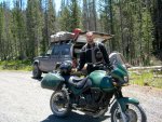
Aaron and his Triumph Tiger.
In the evening of Day 3, our friend Aaron Meyer joined our trip. Aaron rides a Triumph Tiger, and was excited to see how it would go on the trail. He stayed with us that night, and just having a friend come meet us made the night into a little party.
We got up reasonably early and packed up the hotel room. Somehow we managed to make a far greater mess with the addition of just one person--who had already eaten supper when he arrived--than usual. I don't know, we're just messy, I guess. Leaving Lakeview, we had to squeeze past a closed gate, and Aaron's motorcycle made it just fine. I got out and walked, leaving NH to the extremely tight squeeze for the Jeep, leaning far over and driving through marshy deep grass (it always seems that the most interesting photo opportunities are missed b/c you are too busy dealing with the situation at hand. . . this scenario being no exception - NH). He made it, though, and we went on through ranches until we came to a gate that we could not squeeze past. We were kerflummaxed for a while until we found a way to drive through the adjoining pasture and make it out to the road just a few feet ahead.
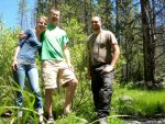
Leaving the ranch land surrounding Lakeview and the area, we drove lots of bumpy, dusty pasture roads. Aaron got the first taste of probably the single most challenge-filled day of the entire TAT on those bumpy, uncomfortable trails. We drove some nice, smooth forest roads, and stopped for lunch by a beautiful creek. We hiked down, dipped our feet in the water, and ate our fill. We didn't want to leave, but knew we would be glad to have more trail behind us, so onward.
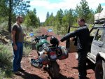
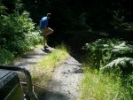
Switching places with Aaron to ride the bike for a while. My goofy grin came from putting a sweat soaked riding jacket on - NH.
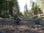
We made it out to railroad grade, covered with a red volcano-y rock, very loose and just fine to drive the jeep on. It was tortuously difficult going on the motorcycle. Aaron's Triumph is a comparatively heavy bike for some of the looser sections of the trail, and he was immediately introduced to one of the very loosest sections of all. The bike was difficult to handle, requiring constant effort to keep it upright and moving in the right direction. We stopped to rest, and Aaron was drenched in sweat, tired of the road. NH was eager to ride the motorcycle, and took over for him. He was soon drenched in sweat himself, but made it to the end of that section.
Only to find even more challenging road ahead, if it can be called road. We began to drive a dirt road that soon became just a dry creek bed. NH was still handling the motorcycle while Aaron and I drove in the Jeep. Aaron was doing probably far better than I ever would maneuvering over the larger and larger rocks strewn in our path, but soon he became concerned with the scrapes and bumps the jeep was taking underneath. The going became slower and slower, but opening the windows to look at the placement of the tires proved a near fatal error--this was as mosquito-laden ground as the swamp of Arkansas where NH and I took on more mosquitoes than air when opening the doors. We swatted angrily and drove slowly, nearly as angry at the rockier and rockier ground as at the mosquitoes. The trail seemed to follow the creek bed, and then rose slightly to the right, leaving a small ravine dropping off to our left. Between rocks, the dirt was soft and dusty, and we began to mire a little, sinking and tipping left toward the ravine. Though the drop was not far at all, I had no desire to be winching the Jeep off its side, so we stopped and waited for NH to come back and find us so he could winch us to a better location.
A better location was not really to be found. The creek bed-trail got more and more difficult to navigate, and it began to be clear that we were expected to follow this section for several more miles. After NH laid the bike on its side, denting a side pannier and bending the brake handle, Aaron was not willing to go further. He was convinced that, had he been riding the bike, he would have laid it down at least as early as NH did, but didn't feel that he could risk more damage to his motorcycle. I was sick enough trying to coax the Jeep over impassible ground to agree with him, and after a short hike ahead to see whether anything would change, NH was soon persuaded to agree as well. The creek bed may have at one time been DSCN0462graded into a road of sorts, but too much time had dropped too many large rocks (and a multitude of mid-sized ones), too many trees, and had washed out too much good ground to make driving over it a practicable thing. Had we begun the section at the beginning of the day, we may have made it through in a day. Or perhaps not--we may well have come to an impasse and had to pick our way back out of it. We decided it was not worth it.
We found a place where the bank was not too steep or too strewn with fallen trees, and drove up to the right of the dry creek bed, now located in a deep ravine. Up above the valley, we drove across a pasture and came within sight of a two-track, a beautiful sight to behold after the 5th circle of hell we had just driven through. Within sight, but not on. A single barbed wire blocked our path. We found that the wire was anchored at points far enough from one another to allow us to lift the wire so that Aaron could ride under it. And, reaching as high as they both could over their heads, Aaron and NH were able to hold the wire up just high enough for me to drive the Jeep under, as well. We were happy to have made it underneath--I think we would have cut the wire and tried to repair it if necessary, we were so eager to get away from that awful creek bed.
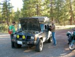
We just made it to a real road, and stopped at the intersection to navigate the turn. Then the Jeep died. And wouldn’t start. I pulled out a granola bar, despairing of ever getting to a nice camping spot. NH and Aaron pragmatically looked under the hood. After some more tries at starting, and a little analysis, NH decided that the O2 sensor wire had come loose and was rubbing against the drive line, which caused it to short out and blow the fuse for the Jeep’s computer. Fortunately, NH carries extra fuses with him. Unfortunately, he blew a couple before he got it right. Fortunately, he had just enough fuses. NH also carries plenty of zip ties, and he used one to put the O2 sensor wire where he wanted it. The Jeep started up, and we were off, happy for a comparatively simple fix.
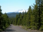
More bumpy, miserable pasture paths until nearly dark, and then we made it to some more of that fine forest gravel road. Better still, we found a lovely lake, Thompson Reservoir, to camp at. We set up camp and made some tasty supper before turning in to bed. – Written by EH
View on Google Maps
We stayed at the Executive Inn. It sounds a lot more prestigious than it actually was. No one minded though as we cooked food on our camp stove just outside the room

Aaron and his Triumph Tiger.
In the evening of Day 3, our friend Aaron Meyer joined our trip. Aaron rides a Triumph Tiger, and was excited to see how it would go on the trail. He stayed with us that night, and just having a friend come meet us made the night into a little party.
We got up reasonably early and packed up the hotel room. Somehow we managed to make a far greater mess with the addition of just one person--who had already eaten supper when he arrived--than usual. I don't know, we're just messy, I guess. Leaving Lakeview, we had to squeeze past a closed gate, and Aaron's motorcycle made it just fine. I got out and walked, leaving NH to the extremely tight squeeze for the Jeep, leaning far over and driving through marshy deep grass (it always seems that the most interesting photo opportunities are missed b/c you are too busy dealing with the situation at hand. . . this scenario being no exception - NH). He made it, though, and we went on through ranches until we came to a gate that we could not squeeze past. We were kerflummaxed for a while until we found a way to drive through the adjoining pasture and make it out to the road just a few feet ahead.
Leaving the ranch land surrounding Lakeview and the area, we drove lots of bumpy, dusty pasture roads. Aaron got the first taste of probably the single most challenge-filled day of the entire TAT on those bumpy, uncomfortable trails. We drove some nice, smooth forest roads, and stopped for lunch by a beautiful creek. We hiked down, dipped our feet in the water, and ate our fill. We didn't want to leave, but knew we would be glad to have more trail behind us, so onward.

Switching places with Aaron to ride the bike for a while. My goofy grin came from putting a sweat soaked riding jacket on - NH.
We made it out to railroad grade, covered with a red volcano-y rock, very loose and just fine to drive the jeep on. It was tortuously difficult going on the motorcycle. Aaron's Triumph is a comparatively heavy bike for some of the looser sections of the trail, and he was immediately introduced to one of the very loosest sections of all. The bike was difficult to handle, requiring constant effort to keep it upright and moving in the right direction. We stopped to rest, and Aaron was drenched in sweat, tired of the road. NH was eager to ride the motorcycle, and took over for him. He was soon drenched in sweat himself, but made it to the end of that section.
Only to find even more challenging road ahead, if it can be called road. We began to drive a dirt road that soon became just a dry creek bed. NH was still handling the motorcycle while Aaron and I drove in the Jeep. Aaron was doing probably far better than I ever would maneuvering over the larger and larger rocks strewn in our path, but soon he became concerned with the scrapes and bumps the jeep was taking underneath. The going became slower and slower, but opening the windows to look at the placement of the tires proved a near fatal error--this was as mosquito-laden ground as the swamp of Arkansas where NH and I took on more mosquitoes than air when opening the doors. We swatted angrily and drove slowly, nearly as angry at the rockier and rockier ground as at the mosquitoes. The trail seemed to follow the creek bed, and then rose slightly to the right, leaving a small ravine dropping off to our left. Between rocks, the dirt was soft and dusty, and we began to mire a little, sinking and tipping left toward the ravine. Though the drop was not far at all, I had no desire to be winching the Jeep off its side, so we stopped and waited for NH to come back and find us so he could winch us to a better location.
A better location was not really to be found. The creek bed-trail got more and more difficult to navigate, and it began to be clear that we were expected to follow this section for several more miles. After NH laid the bike on its side, denting a side pannier and bending the brake handle, Aaron was not willing to go further. He was convinced that, had he been riding the bike, he would have laid it down at least as early as NH did, but didn't feel that he could risk more damage to his motorcycle. I was sick enough trying to coax the Jeep over impassible ground to agree with him, and after a short hike ahead to see whether anything would change, NH was soon persuaded to agree as well. The creek bed may have at one time been DSCN0462graded into a road of sorts, but too much time had dropped too many large rocks (and a multitude of mid-sized ones), too many trees, and had washed out too much good ground to make driving over it a practicable thing. Had we begun the section at the beginning of the day, we may have made it through in a day. Or perhaps not--we may well have come to an impasse and had to pick our way back out of it. We decided it was not worth it.
We found a place where the bank was not too steep or too strewn with fallen trees, and drove up to the right of the dry creek bed, now located in a deep ravine. Up above the valley, we drove across a pasture and came within sight of a two-track, a beautiful sight to behold after the 5th circle of hell we had just driven through. Within sight, but not on. A single barbed wire blocked our path. We found that the wire was anchored at points far enough from one another to allow us to lift the wire so that Aaron could ride under it. And, reaching as high as they both could over their heads, Aaron and NH were able to hold the wire up just high enough for me to drive the Jeep under, as well. We were happy to have made it underneath--I think we would have cut the wire and tried to repair it if necessary, we were so eager to get away from that awful creek bed.
We just made it to a real road, and stopped at the intersection to navigate the turn. Then the Jeep died. And wouldn’t start. I pulled out a granola bar, despairing of ever getting to a nice camping spot. NH and Aaron pragmatically looked under the hood. After some more tries at starting, and a little analysis, NH decided that the O2 sensor wire had come loose and was rubbing against the drive line, which caused it to short out and blow the fuse for the Jeep’s computer. Fortunately, NH carries extra fuses with him. Unfortunately, he blew a couple before he got it right. Fortunately, he had just enough fuses. NH also carries plenty of zip ties, and he used one to put the O2 sensor wire where he wanted it. The Jeep started up, and we were off, happy for a comparatively simple fix.
More bumpy, miserable pasture paths until nearly dark, and then we made it to some more of that fine forest gravel road. Better still, we found a lovely lake, Thompson Reservoir, to camp at. We set up camp and made some tasty supper before turning in to bed. – Written by EH
Last edited:

