Travel vs. Truck - Nathan's Grand ExPoordition

ExPoordition Update - White Rim II

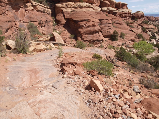
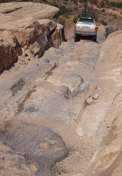
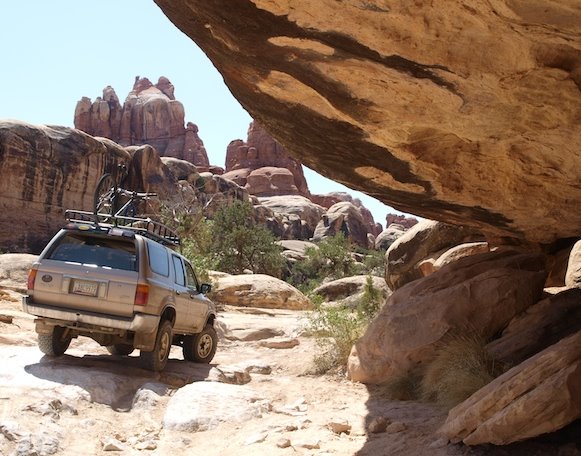
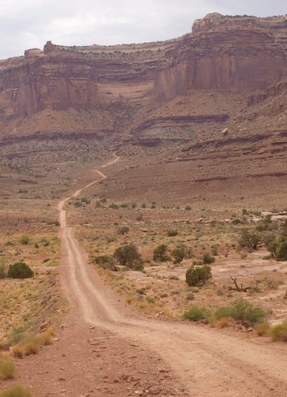
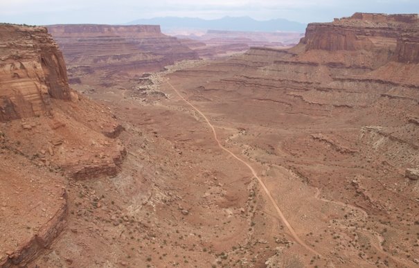
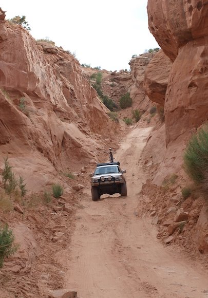
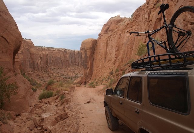
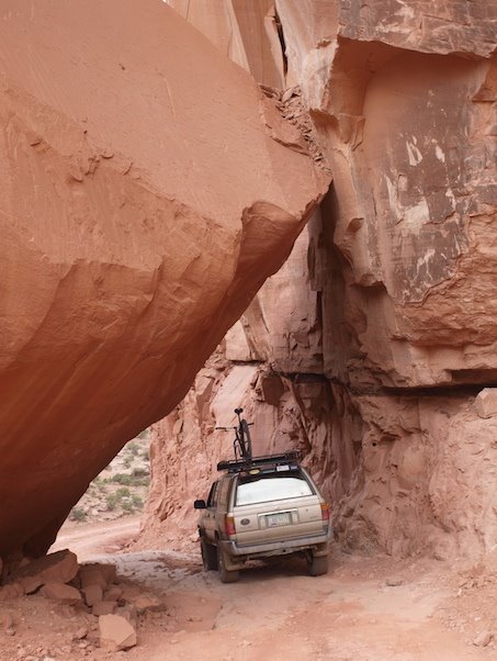
It seems around every bend or every mile there is something that requires additional exploration. The guide books, as well as my self, highly recommend taking at a minimum 2 days to drive and explore this trail.

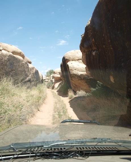
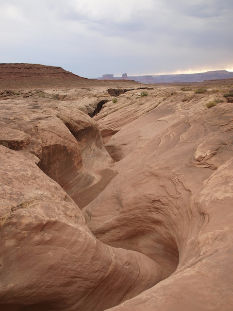
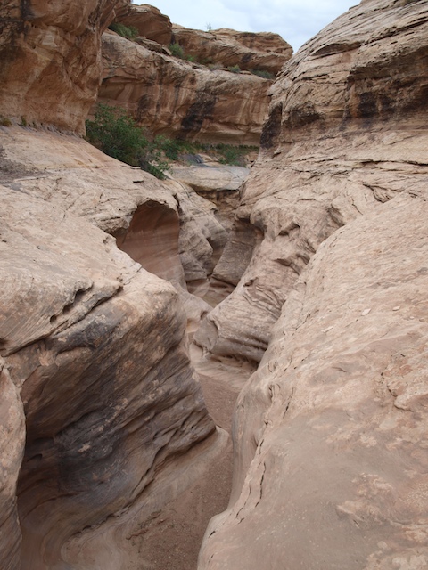
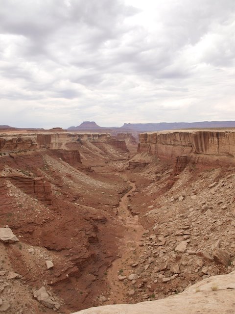
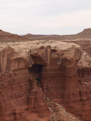
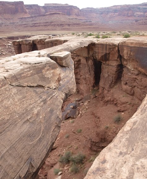
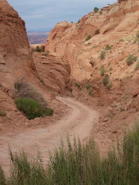
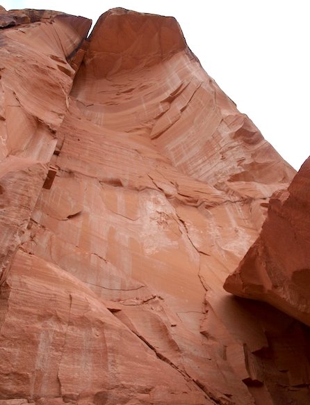
This slot canyon was so fun, because it literally began next to the road, and you step into it at the very top.

ExPoordition%20-%20White%20Rim%20Trail%20%287%29.jpg


ExPoordition%20-%20White%20Rim%20Trail%20%289%29.jpg


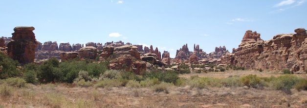
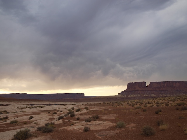
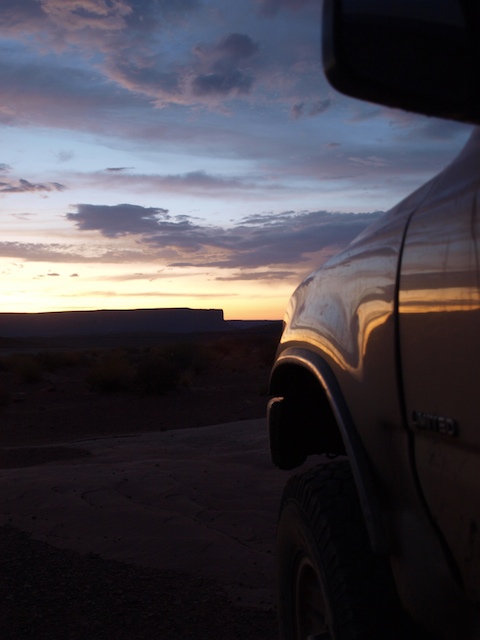
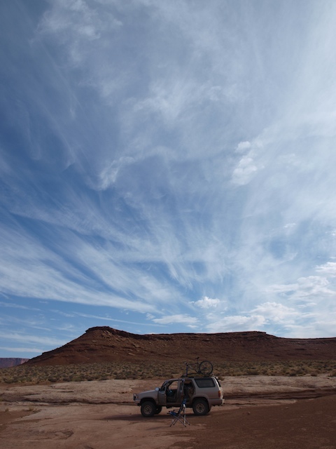
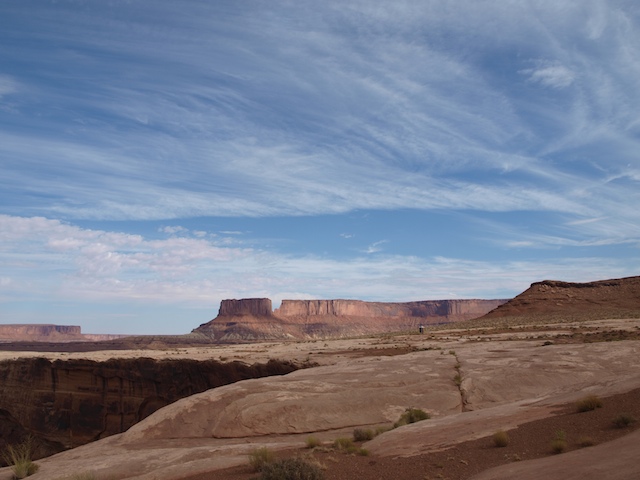
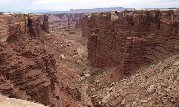
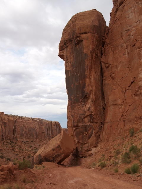
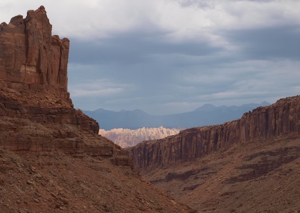
I feel I was fortunate to have a high overcast almost the entire time I was on the trail. This kept the temps very nice, and made for some cool evening skys. On the flip side though, the afternoon light was very subdued and diffused preventing much of the dramatic colors and shapes to be easy captured.

ExPoordition%20-%20White%20Rim%20Trail%20%2811%29.jpg


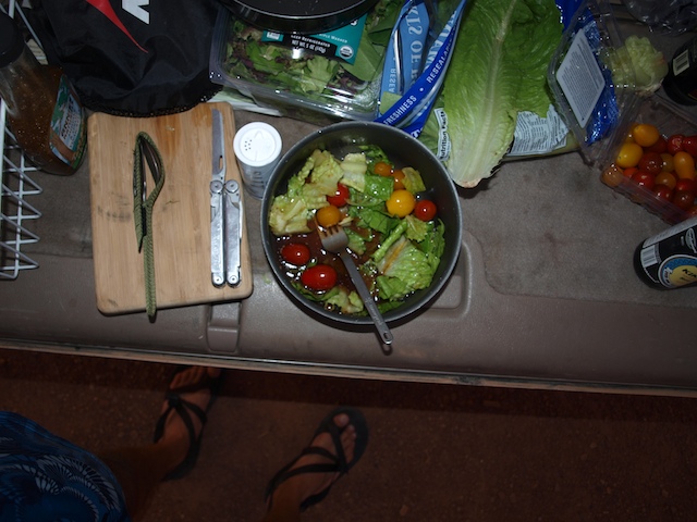
Thanks again to Liz at Natural Grocer for this meal. Yes Scott it only salad, but I'm OK with that. There will be steak when I get home.
ExPoordition%20-%20White%20Rim%20Trail%20%2813%29.jpg


ExPoordition%20-%20White%20Rim%20Trail%20%2814%29.jpg


Did I mention I like salad? And Sierra Nevada "Christmas Beer". This is one of the advantages of an ExPoordition, you clean out all the lost beers in the fridge to save money down the road.
ExPoordition%20-%20White%20Rim%20Trail%20%2816%29.jpg


ExPoordition%20-%20White%20Rim%20Trail%20%2817%29.jpg


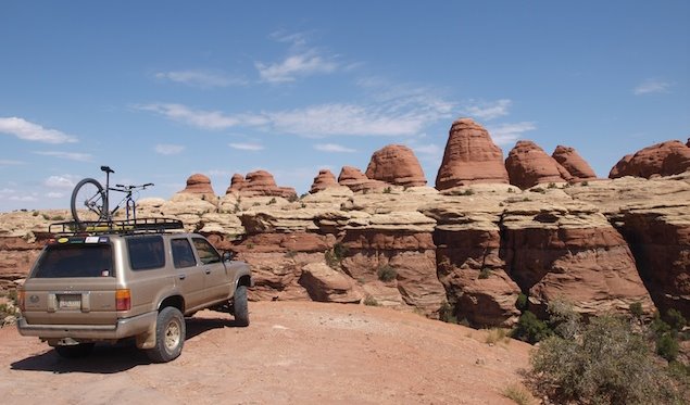
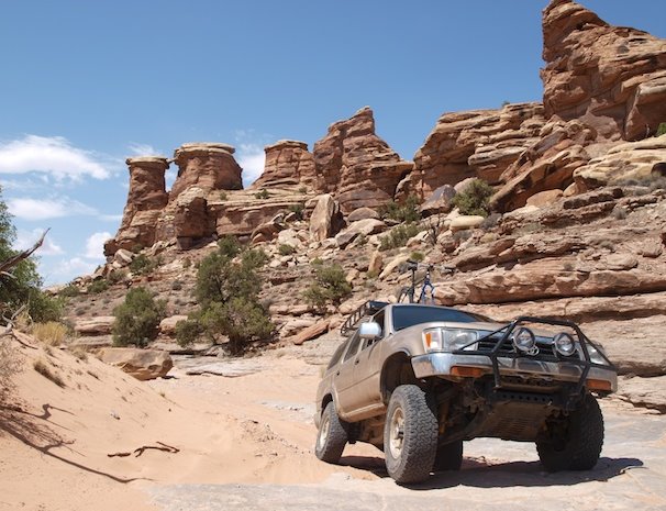
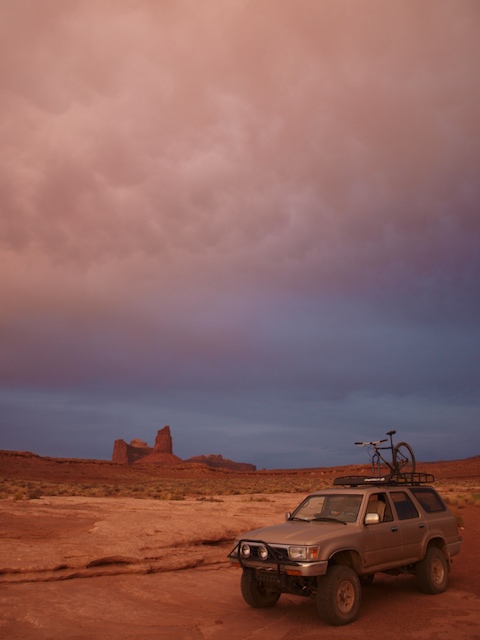
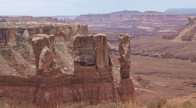
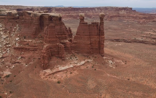
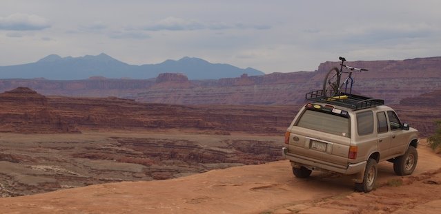
The next days views of my campsite on the Rim. This was called the "Candle Stick" site.
ExPoordition%20-%20White%20Rim%20Trail%20%2818%29.jpg


ExPoordition%20-%20White%20Rim%20Trail%20%2819%29.jpg


ExPoordition%20-%20White%20Rim%20Trail%20%2821%29.jpg
 
Last edited:
ExPoordition Update - White Rim III

These photos are from my second day on the White Rim, which mostly consisted of the Eastern half of the trail.

ExPoordition%20-%20White%20Rim%20Trail%20%2823%29.jpg


ExPoordition%20-%20White%20Rim%20Trail%20%2824%29.jpg


ExPoordition%20-%20White%20Rim%20Trail%20%2825%29.jpg


See the heart in the rock? I guess I was missing a close friend here...
ExPoordition%20-%20White%20Rim%20Trail%20%2826%29.jpg


ExPoordition%20-%20White%20Rim%20Trail%20%2827%29.jpg


ExPoordition%20-%20White%20Rim%20Trail%20%2828%29.jpg

Musselman Arch
ExPoordition%20-%20White%20Rim%20Trail%20%2830%29.jpg


ExPoordition%20-%20White%20Rim%20Trail%20%2832%29.jpg


View looking up to Shafer Pass. It looks like a road that dead ends in the mountain.
ExPoordition%20-%20White%20Rim%20Trail%20%2834%29.jpg


View down from Shafer Pass.
ExPoordition%20-%20White%20Rim%20Trail%20%2836%29.jpg
 
ExPoordition Update - Canyonlands Exit and Pucker Pass

Here is how the Canyonland Rangers get around, patrol and rescue folks out on the rim. I talked at length with a few of them, and they were super great guys. They were stoked about my trip, and in exchange gave some great local Moab tips and extended many helpful offers for future ventures Canyonlands.

ExPoordition%20-%20White%20Rim%20Trail%20%2837%29.jpg


ExPoordition%20-%20White%20Rim%20Trail%20%2838%29.jpg


ExPoordition%20-%20Canyonlands.jpg


Pucker Pass. This is a great little connector to go to or from the Island In the Sky to Moab. Its a great way to bypass the inefficient pavement way.
ExPoordition%20-%20White%20Rim%20Trail%20%2839%29.jpg


ExPoordition%20-%20White%20Rim%20Trail%20%2841%29.jpg


ExPoordition%20-%20White%20Rim%20Trail%20%2842%29.jpg


The way this rock just fell off the cliff and the way it sits is really cool. It must have been quite a sight to sit this thing drop off and fall back against the wall.
ExPoordition%20-%20White%20Rim%20Trail%20%2843%29.jpg


ExPoordition%20-%20White%20Rim%20Trail%20%2844%29.jpg


ExPoordition%20-%20White%20Rim%20Trail%20%2845%29.jpg


ExPoordition%20-%20White%20Rim%20Trail%20%2846%29.jpg
 

ttora4runner

Expedition Leader
Hey, salad is always good.


So how manys miles are you up too on the trip and how's the 4runner holding up?

Great photo's.
 
ExPoordition Update - Elephant Hill and the Road Home

From Moab, I drove in the dark, via highways to get close to the "Needles
District" of Canyon Lands Nat'l Park to camp for the night. It had been suggested to me that I follow some challenging routing from the Elephant Hill trail to Bobby's Hole, Beef Basin, and various roads through the Southern Manti La Sal Mountains finally to end at HWY 95.

I decided however, given time, and emotional energy to only try my skills at the Elephant Hill loop. I would then take highways to my next destination, which would be a some indian ruins on Comb Ridge. Roads on the East and West sides of Comb Ridge connect highway 95 with 163.

Newspaper Rock
ExPoordition%20-%20White%20Rim%20Trail%20%2847%29.jpg


The "Gate Way" to Elephant Hill
ExPoordition%20-%20Elephant%20Hill.jpg


ExPoordition%20-%20Elephant%20Hill%20%282%29.jpg


ExPoordition%20-%20Elephant%20Hill%20%284%29.jpg


Two turns required a "Pull in and back up/down" manuever. Keeps thing interesting.
ExPoordition%20-%20Elephant%20Hill%20%285%29.jpg


ExPoordition%20-%20Elephant%20Hill%20%287%29.jpg


ExPoordition%20-%20Elephant%20Hill%20%2812%29.jpg


ExPoordition%20-%20Elephant%20Hill%20%2813%29.jpg


ExPoordition%20-%20Elephant%20Hill%20%2816%29.jpg


ExPoordition%20-%20Elephant%20Hill%20%2817%29.jpg
 

Trail Monkey

Adventurer, Overland Certified OC0014
Nathan, I just noticed this whole thread. Needless to say i had to read through it all before work, now im late.. THX it's great stuff. Enjoy!
 

Forum statistics

Threads
189,909
Messages
2,922,071
Members
233,083
Latest member
Off Road Vagabond
Top