Traversing the US (and back)

jessejman

Adventurer
Day 3

219.jpg
After dropping down out of the mountains for gas in Oark, we climbed back up first thing in the morning and ran ridges for the rest of the morning.

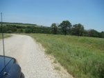
The roads varied greatly. Sometimes they would be in good condition and fast.

223.jpg

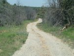
But here it was slow going. Even aired down we had to keep under 10 mph in order not to break the truck or ourselves.

226.jpg

Not done justice here but the rare views were beautiful.

227.jpg

There was no one up here with us. It was like we had the forest to ourselves.

233.jpg

We wound around some rock outcroppings, passed by Hurricane Creek and looked for the unmarked trail that apparently descends next to or through it ?? but we couldn't find it so we rerouted down a steep gravel road...

236.jpg

and came to Warloop Road. This is supposed to the hardest section East of Colorado on the Trans-america Trail. At least that's what some motorcyclists report. It is also marks the end of the Ozark mountains and the beginning of what we imagined was going to be a flat boring transit through Oklahoma.

237.jpg

We are happy to report that after our route through the Ozarks, Warloop Road was very tame, maybe even a bit disappointing but that may be going to far due to the high-stress situations of yesterday.

241.jpg

There is one section with a small step-down but it's no big deal on four wheels.

243.jpg

Warloop Rd threw one more curveball with a large mudhole that the locals had really bogged out. There was no way around due to a fence and hillside so we dropped in nice and slow and had no trouble easing our way through it. The kids loved it.

246.jpg

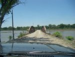
We quickly made our way into Oklahoma, but first we had one last water crossing to manage.
 

jessejman

Adventurer
Day 3 Continued


So my wife pushed the wrong button on the camera and I couldn't have that crossing not recorded so you get to see my cross it twice. She walked across scouting the first time, too scared to ride along. Also the video is best without sound as I think she forgot that the camera was not her one year-old child.

259.jpg

Stopped here for lunch and some playtime.

261.jpg

We all enjoyed the nice swim. I think we stopped for more than hour. No one came by - big surprise.

264.jpg

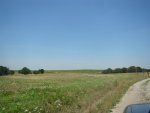
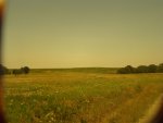
And then we got back to it. Eastern Oklahoma was much more hilly than we had expected, also greener than expected.

269.jpg

280.jpg

It is dotted with many small farms...

281.jpg

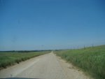
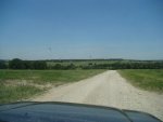
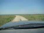
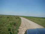
and wide graded roads.

285.jpg

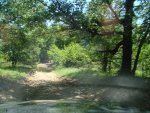
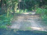
Well, we occasionally found smaller, more enjoyable roads like this one.

290.jpg

299.jpg

We were really impressed with beauty of this area and the general lack of civilization. We rarely, if ever, met other cars.

313.jpg

For the duration of the trip we always looked for fellow adventurers out here way off the normal paths but so far we had seen no one. Sometime close to when this photo was taken we ran into one, almost literally. Coming down a small hill I saw that a road merged with the straight one we were on. I looked briefly and then accelerated gaining momentum for the hill ahead. About the time I was really getting into the throttle -which means I was going maybe 35- my wife and son both started yelling. I look to my left and stomped on the brakes as I make eye-contact with a rider on loaded down Honda 650 who is also braking all out. We both slid to a stop, he much faster than I, and we chatted for a moment about our trip. Turns out we were both headed to Salina, Ok. He, of course, was riding the TAT. We hoped to meet up later but it didn't happen.
 

mrwizard

Adventurer
mrwizard, we passed just north of you and fell absolutely in love with Idaho. Oh man, crossing the Sawtooths and fording the Middle Boise due to a closed bridge were unforgettable!

Did you take the Magruder road north of the Frank Church Wilderness area? Idaho is an amazing place...be sure to keep the pictures of the Sawtooths to an absolute minimum...we don't want the word getting out. :)
 

98roamer

Explorer
Jessejman,
What a great adventure for the family! please keep posting pictures. How long did it take for the kids to get use to riding all day, and your wife? What would you change if you were to do it all over again?

Thanks
Lance
 

BirchHill

goat farmer
Amazing trip. We have wanted to do a trip like this with our 5 kids since we first heard about the TAT. Any chance of getting the GPX files of your route?
 

skibum315

Explorer
Very much looking forward to following along on this report, looks like the kind of 'trip-of-a-lifetime' that I can actually envision myself attempting with my wife & (soon to be) kiddo. From my first quick pass through - and you can belive I'll come back and read in more detail, probably more than once - it sure looks like you guys had a phenomenal time!

If I might offer the small suggestion of adding a link to the planning thread from your first post, for ease of access to those of us who happen to stumble upon the trip thread ... I'm sure I could track it down (and will happily do so, if you'd rather keep the two decidedly separate) ... but it's just a thought.
 

jessejman

Adventurer
If I might offer the small suggestion of adding a link to the planning thread from your first post, for ease of access to those of us who happen to stumble upon the trip thread ... I'm sure I could track it down (and will happily do so, if you'd rather keep the two decidedly separate) ... but it's just a thought.

No worries. Fixed on the first page and with a few other helpful links. -Jesse
 

jessejman

Adventurer
Jessejman,
What a great adventure for the family! please keep posting pictures. How long did it take for the kids to get use to riding all day, and your wife? What would you change if you were to do it all over again?

Our kids (ages 6,4,1) adapted very well to being in the car. That was a serious consideration for us especially as we jumped right in to seven hour days. We stopped often and tried not to push too hard. If we could tell they needed to get some energy out, we stopped at a nice shady place (easier in the east). We had a DVD player but used it only three times. We did lots of kid-music and books on Ipod-CS Lewis, James Herriot, Tolkien. They each had crayons, paper and books. Color pencils are better as they don't melt and/or get ground into the carpet (all of which I tore out in Oregon). My wife is great. She was in from day one and I kept her very very busy with navigation, especially through Arkansas.

We did a lot of things right. But we also did some things wrong. I'll do it some along the way and I'll definitely hit that question towards the end.
 

jessejman

Adventurer
End of Day 3

315.jpg

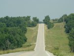
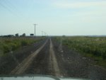
We cruised most of the afternoon on these nice wide roads.

316.jpg

You could keep your speed up but it's always of question of how far you can see ahead and who/what might be coming around the bend. We had one 'close call' coming down and around a turn with another truck approaching in the middle of the road. The feeling of all the weight of our cruiser shifting as I hit the brakes is unsettling. Though, even heavy (top heavy) it has good manners.

322.jpg

319.jpg

It took us some to find a good place to camp in Salina as it's on a big reservoir and most of the camping is expensive and the real estate doesn't lend itself to boondock camping. We first tried Snowdonia State Park but the sites were $20 and the neighbors loud and close. We ended up in a small field next to a boatramp south of town and right on the lake. There were other people camped there so we pulled in and asked them about it. They acted like they owned the place (in a good way) and said we were free to camp as long as we wanted as long as we kept the area clean and the noise down. I'm not sure they did either of those but we were glad for a nice-r place to camp.

Oh, sure enough, later that evening some kids came in and did donuts in the grass and the locals camped there called the police. They really did take care of the place.

323.jpg

Setting up for bed. The chair at the front corner of the truck was the time-out chair that night. As I remember Bailey, son, 6, spent a lot of time parked there that night. Larkin, daughter, 1, was teething and cried so much that the locals camped at a distance of 75 meters or so took up singing nursery ryhmes at about 10:30. I'm pretty sure they were just having fun with us but we were jealous that they were that far away (and probably drinking ice cold drinks of which we usually only had room for one or two in the cooler - bummer).

324.jpg

327.jpg

331.jpg

Hungry and tired. You'd think they would go to bed early but oh no, not until the sun set.

334.jpg

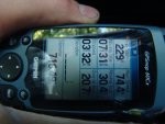
Days stats. Finally climbing into the bed at 10:30 with one still crying off and on I took out the laptop and GPS so that I could load a new route onto it as my segment had ended in Salina, OK. I pulled out the cord, hooked it up and tried to transfer a route. It didn't connect. It charged the GPS but would not transfer any data. A quick note, in packing the day we left I remembered seeing two nearly identical cords on my desk: one for the external hard drive and GPS and one for some other unknown piece of technology. They have identical fittings at each end so I assumed they both served the same function. Oh no. Ludite me was very wrong.

So there I was cursing my lack of preparedness at midnight in Salinas, OK where I had, essentially, just run out of maps.
 

skibum315

Explorer
No worries. Fixed on the first page and with a few other helpful links. -Jesse
Fantastic! Thanks for adding to my rapidly growing list of helpful links ... ;)

I really do appreciate the time it takes to document something like this, so thanks for that as well.
 

jessejman

Adventurer
Day 4: near Salinia, OK to near Newkirk, OK

So after lots of practicing swear words, I went to sleep with plans for finding an electronics store nearby. I inquired with the locals and it looked like the nearest store would be a radioshack about an hour away. We would have to drive payment but with luck they would have a new cord.

349.jpg

Next morning, abandoning our route and running slab for about an hour, we made a larger city and where we shopped for groceries, a piece for the water system and finally a cord for the GPS. Instead of a cord I bought a $2 adapter for a phone cord we already had. We tried the phone cord/adapter cord and it worked! I really wished I'd kept my cool the previous night rather than getting fatalistically anger. My wife went to sleep early and told me it would be fine, to calm down. I've got to learn to listen.

360.jpg

GPS fixed and route loaded, we headed out again.

368.jpg

385.jpg

Lunch and infamous site of the broken Laptop screen. Shade was hard to come by and we timed our stops with the rare opportunities for it. From the beginning we had a strict no-big-children-up-front rule. There were just too many buttons to push, wires to rip out of various technological devices and our new(ish) laptop. Today, after loading the route, I had not put the computer back in the door in its case where it normally lives, well out of the way. Today it was tucked in between the center console and the drivers seat. Somehow while parents were fixing lunch sandwiches both of the older kids ended up running, yes, running, in the front seats. I'm not sure how it's possible but it is.

As soon as I realized what was going on I ran to the front nicely/calmly (right) asking them to obey the rules. I immediately checked the laptop and sure enough - broken screen. Now, almost three months later, half of the screen before me is black!

I tried to keep my cool and, indeed, I made it to the back of the car, complete silence all around me, where, providentially, in the middle of the road there was an empty grain sack. I kicked the dam sack as hard as I could for about a mile up the road. In retrospect I'm so glad that sack was there. It was the perfect outlet - much better than kicking my kids down the road.

386.jpg

389.jpg

Most may already know this, I didn't; most roads in Oklahoma are laid out in 1 mile square grids. The funny things is that sometimes these grids would devolve into these tiny two tracks that were wonderful to drive. Sometimes they would end in a locked gate but usually they would go through and slowly grow once again into nice graded gravel ways.

402.jpg

406.jpg

410.jpg

412.jpg

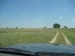
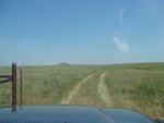
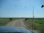
Oklahoma, not as flat as we expected.
 
Last edited:
Glad to hear I'm not the only one that throws tangents at the drop of a hat. A lot of times I feel bad, rightfully so, for my wife and daughter who take the brunt of it. Chalk it up to being human.

Can't wait to hear more of your story!
 

jessejman

Adventurer
Day 4: Salina, OK to Newkirk, OK continued

DSC05942.jpg

Sometime in late morning we entered a wetland area and then crossed into the Osage Wilderness Management Area. I was looking forward to this area because instead of traveling long straight mile-grid sections this section wound north, west and then south again. There was a good reason roads weren't straight through here.

DSC05949.jpg

DSC05950.jpg

The views in the Osage WMA were very beautiful with long lines of sight and then we would drup down into a creekbed, cross it three or four times and climb back up onto the ridges with great views. After about six crossings we came to our first locked gate - private property. Okay, reroute, back through the crossings and take a road about a mile north of here. Thirty minutes later - locked gate.

The GPS showed roads only a mile from where we were. Frustrated I made the decision to follow a natural gas pipeline 'road.' Bad decision number one. Steph told me not to but the main road was so close on the gps. The pipeline 'road' began down a large hill that turned to deep deep mud near the bottom. We lost momentum (going down hill) and stuck. In four-low I was just able to pull the truck through flinging the thick stuff all over the truck.

Here comes bad decision number two: oh, we're closer now, let's keep pushing through. Gas pipeline ends at a big parkinglot and pump station. No more road. But there is a gate and it is OPEN! Rare for out here.

Bad decision three: the gate's open so people must use it (guess what my wife was thinking). We continued on a swath of land between the trees. It was not a road. It was not even a trail. We were on our own now completely off the maps. And we continued - silly, true, but I did not want to run the risk of getting stuck in that mud and there was no way around it. Reasoning that if we bogged down in the that stuff going down hill there was no way we were going to pull through going uphill. So we pushed on, around a fence line and then along it going the wrong way. Then down a steep, rocky hill to another creek crossing that was uncrossable. I walked all around it trying to find a way out.

Finally it was time for a good but very regrettable decision. We had to go back. It would take well over an hour and we would have to brave the muddy slope. We turned around - up the rocky hill, over a creek crossing, around a fenceline, up a hill off trails. And then at the top we found a trail that we had missed coming from the other direction. It was on the GPS and though faint, I could just make out a two track beaten down long ago in the grass. Knowing that just about anything would be better than the mud we followed it. After a mile we ran into fresh tracks. After two miles, it became a nice path. Soon I recognized the large open hill we had come in on. Through some open gates and onto the hill and we were finally back (well, almost) to where we had entered the Osage WMA.

We were hot, tired, muddy, frustrated/angry but relieved. We had wasted four hours trying to get through this one little WMA. We threaded our way the rest of the way out and headed to Pawhuska for gas, dinner and a little spray clean for the Cruiser. Stephanie stalked the Pioneer Woman, who apparently lives on a feudal farm somewhere around there, while we ate at Buffalo Joes, a burger joint. It was so good to drink cold water and sit in air-conditioning while I worked out a new route to rejoin the original.

DSC05952.jpg

DSC05958.jpg

DSC05961.jpg

DSC05969.jpg

DSC05971.jpg

DSC05973.jpg

DSC05979.jpg

This last photo shows us heading out of the WMA. Notice what's on the windshield.
 

jessejman

Adventurer
Day 4: Salina, OK to Newkirk, OK continued

DSC06003.jpg

It took about an hour driving pavement but we finally joined our route. It was nice to get back out of 'traffic' and drive on the familiar.

DSC06004.jpg

DSC06005.jpg

When we were all at our limit and starting to think we'd spend the night in someone's field we crossed a little creek and found a bunch of people catching turtles. There were tons on the road throughout Arkansas and Oklahoma. The families were very nice and pointed us to a nice campsite along Kaw Lake. We didn't camp exactly where he told us to go but they were very kind all the same. Oh, we also spent some time looking for Kronan State Park. It was on the GPS and gazetteer but did not exist. Don't waste your time.

DSC06012.jpg

DSC06013.jpg

DSC06021.jpg

DSC06026.jpg

DSC06044.jpg

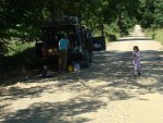
We took our first showers of the trip here. The water was pleasantly warm as it gets heated throughout the day by the exhaust. Nice for showers not fun to drink. But it was great to be clean and in the shade.

DSC06048.jpg

Day's stats. Our longest day so far and most miles traveled but many of those were pavement miles trying to get back on route.
 

Forum statistics

Threads
188,454
Messages
2,905,173
Members
230,428
Latest member
jacob_lashell
Top