vevans
Retired 4-Wheeler
Trip Report for the ROF Journey thru the WA/OR Cascade Mtn. Backcountry Part 1
All of the pre-trip planning, length of trip, route, daily travel goals, what to bring, start times, etc. are located at:
https://www.expeditionportal.com/fo...hru-the-wa-or-cascade-mtn-backcountry.216058/.
One thing that we did not expect but was true everywhere we went in Washington and Oregon was the number of people camping. They were everywhere. We think they are escaping the boredom of the COVID-19 situation. We could tell when we were approaching a paved road. The number of campers on the sides of the roads started to increase.
Because we arrived at our camp area in the mid afternoon we were always able to find suitable empty camp sites. Had we planned longer drive days we would have had difficulty finding camp sites many of our sites.
Our group of participants in this trip included 5 people and 4 vehicles. Ace driving his Toyota Forerunner, George and Marie driving their Jeep JK towing a trailer, Richard driving his Nissan Xterra, and me, Vince, driving my Jeep TJ.
On the drive from Colorado to Wenatchee, WA, Ace became ill and had to drop out of the trip and return home.
The remaining 4 of us met on Tuesday, July 14, at the Red Lion Motel in Wenatchee. Our rooms were very close together so we had our first pre-trip meeting in the hall of the Red Lion Motel. We decided that because of the COVID-19 situation we would not have the normal pre-trip meal together that night. We planned to leave the next morning at 9:00am.
DAY 1 - BDR Day. Wed, 7/15/2020
Richard, the early morning riser of the group, was out walking the parking lot at 7:00am and the rest of us followed about 8:00am. Once packed, topped gas tanks, and ice in the coolers we headed up out of Wenatchee on the WABDR route from Wenatchee to Ellensburg. This was the only BDR route that we followed the entire trip. There was one section where the road had slid. We spotted George through this area. It was the worst area we encountered the entire trip.
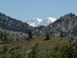
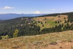
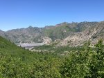
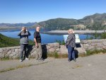
View of the Columbia River Valley, Wenatchee, and Cascade Mtns.

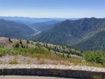
BDR Route going down into the Ellensburg Valley. Mt Rainier in the background.

We topped off gas at Ellensburg and started up Manastash Creek and climbed up the ridge to find a place to camp our first night. The wind kept us from camping in the view areas. We camped down in the trees instead.
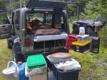
Day 1 camp spot out of he wind.

DAY 2 - Chinook Pass and Crystal Mtn. day. Thurs. 7/16
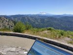
That first night was windy but not too cold. We departed about 8:30am to start the day’s adventures. George dropped his trailer at the Bald Mountain “Y” and we started up the rocky road to the top of the ridge where the old fire lookout tower used to be located. We enjoyed the views to the West dominated by Mt Rainier and then views to the East of Mt Stuart and the Ellensburg Valley.
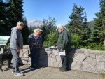
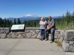
George, Marie, Richard, and Vince with Mt. Rainier in the background.

With the trailer reconnected we continued down the Rock Creek road to Hwy 410. We stopped at Whistlin’ Jacks to top off gas and have ice cream cones. We continued up Hwy 410 up and over Chinook Pass.
Chinook Pass

We continued down over Cayuse Pass to the Crystal Mountain Ski Area. There we rode the gondola lift up to the Summit House. We had a nice lunch and enjoyed the views of Mt Rainier, Mt Adams, Mt Hood, and all of the ski lifts. It was a beautiful day with very little wind at the Summit House.
Crystal Mountain Ski Area Gondola

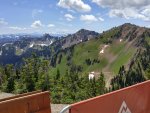
Mt. Rainier from the Crystal Mountain Summit House

After leaving Crystal Mountain Ski Area we continued down Hwy 410 to the Ranger Creek Airfield. We camped in a free old campground located in the trees along the side of the landing strip. It was a nice night with just a few mosquitoes and no wind.
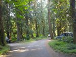
Day 2 camp

DAY 3 - Mt Rainier Day. Friday 7/17
We were scheduled to drive high up on two sides of the mountain; the East side on Sunrise Ridge and the South side at Paradise. The day started with us driving back up Hwy 410 into Mt Rainier National Park and taking the turn off to Sunrise Ridge. The mountain was shrouded with clouds early but they started to part as we approached the lodge on Sunrise Ridge. We were disappointed to find that the Park Service had closed both the lodges at Sunrise and Paradise because of COVID-19. We were not able to see all the information and pictures of Mt Rainier. The clouds parted enough while we were at Sunrise to see the mountain. We were disappointed that we could not see any groups climbing the mountain that day. Clouds covered the mountain the entire time we were on the Paradise side of the mountain.
Sunrise Lodge.

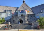
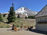
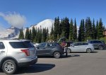
Paradise Ranger Station and Lodge. Mt Rainier in the background is covered by clouds.

We stopped at Longmire on our way out the Park for lunch and the obligatory walk thru the gift shop.
After leaving Mt Rainier National Park we decided to stay on a paved road and go off-route to Packwood, WA. We topped off the gas tanks, Richard restocked his toilet paper and I bought ice. There was a nice herd of Elk grazing in a field about 100 yards off the highway right in town. We continued on to Randle and eventually arrived at Tower Campground for the night. This being a Friday night, we had reservations for the four vehicles so we had an extra site which was sold to a very happy couple that evening.
Because we can attach only 10 pictures to one post we have had to break this trip report into many parts. Please continue onto Trip Report for the ROF Journey thru the WA/OR Cascade Mtn. Backcountry Part 2.
All of the pre-trip planning, length of trip, route, daily travel goals, what to bring, start times, etc. are located at:
https://www.expeditionportal.com/fo...hru-the-wa-or-cascade-mtn-backcountry.216058/.
One thing that we did not expect but was true everywhere we went in Washington and Oregon was the number of people camping. They were everywhere. We think they are escaping the boredom of the COVID-19 situation. We could tell when we were approaching a paved road. The number of campers on the sides of the roads started to increase.
Because we arrived at our camp area in the mid afternoon we were always able to find suitable empty camp sites. Had we planned longer drive days we would have had difficulty finding camp sites many of our sites.
Our group of participants in this trip included 5 people and 4 vehicles. Ace driving his Toyota Forerunner, George and Marie driving their Jeep JK towing a trailer, Richard driving his Nissan Xterra, and me, Vince, driving my Jeep TJ.
On the drive from Colorado to Wenatchee, WA, Ace became ill and had to drop out of the trip and return home.
The remaining 4 of us met on Tuesday, July 14, at the Red Lion Motel in Wenatchee. Our rooms were very close together so we had our first pre-trip meeting in the hall of the Red Lion Motel. We decided that because of the COVID-19 situation we would not have the normal pre-trip meal together that night. We planned to leave the next morning at 9:00am.
DAY 1 - BDR Day. Wed, 7/15/2020
Richard, the early morning riser of the group, was out walking the parking lot at 7:00am and the rest of us followed about 8:00am. Once packed, topped gas tanks, and ice in the coolers we headed up out of Wenatchee on the WABDR route from Wenatchee to Ellensburg. This was the only BDR route that we followed the entire trip. There was one section where the road had slid. We spotted George through this area. It was the worst area we encountered the entire trip.
View of the Columbia River Valley, Wenatchee, and Cascade Mtns.

BDR Route going down into the Ellensburg Valley. Mt Rainier in the background.

We topped off gas at Ellensburg and started up Manastash Creek and climbed up the ridge to find a place to camp our first night. The wind kept us from camping in the view areas. We camped down in the trees instead.
Day 1 camp spot out of he wind.

DAY 2 - Chinook Pass and Crystal Mtn. day. Thurs. 7/16
That first night was windy but not too cold. We departed about 8:30am to start the day’s adventures. George dropped his trailer at the Bald Mountain “Y” and we started up the rocky road to the top of the ridge where the old fire lookout tower used to be located. We enjoyed the views to the West dominated by Mt Rainier and then views to the East of Mt Stuart and the Ellensburg Valley.
George, Marie, Richard, and Vince with Mt. Rainier in the background.

With the trailer reconnected we continued down the Rock Creek road to Hwy 410. We stopped at Whistlin’ Jacks to top off gas and have ice cream cones. We continued up Hwy 410 up and over Chinook Pass.
Chinook Pass

We continued down over Cayuse Pass to the Crystal Mountain Ski Area. There we rode the gondola lift up to the Summit House. We had a nice lunch and enjoyed the views of Mt Rainier, Mt Adams, Mt Hood, and all of the ski lifts. It was a beautiful day with very little wind at the Summit House.
Crystal Mountain Ski Area Gondola

Mt. Rainier from the Crystal Mountain Summit House

After leaving Crystal Mountain Ski Area we continued down Hwy 410 to the Ranger Creek Airfield. We camped in a free old campground located in the trees along the side of the landing strip. It was a nice night with just a few mosquitoes and no wind.
Day 2 camp

DAY 3 - Mt Rainier Day. Friday 7/17
We were scheduled to drive high up on two sides of the mountain; the East side on Sunrise Ridge and the South side at Paradise. The day started with us driving back up Hwy 410 into Mt Rainier National Park and taking the turn off to Sunrise Ridge. The mountain was shrouded with clouds early but they started to part as we approached the lodge on Sunrise Ridge. We were disappointed to find that the Park Service had closed both the lodges at Sunrise and Paradise because of COVID-19. We were not able to see all the information and pictures of Mt Rainier. The clouds parted enough while we were at Sunrise to see the mountain. We were disappointed that we could not see any groups climbing the mountain that day. Clouds covered the mountain the entire time we were on the Paradise side of the mountain.
Sunrise Lodge.

Paradise Ranger Station and Lodge. Mt Rainier in the background is covered by clouds.

We stopped at Longmire on our way out the Park for lunch and the obligatory walk thru the gift shop.
After leaving Mt Rainier National Park we decided to stay on a paved road and go off-route to Packwood, WA. We topped off the gas tanks, Richard restocked his toilet paper and I bought ice. There was a nice herd of Elk grazing in a field about 100 yards off the highway right in town. We continued on to Randle and eventually arrived at Tower Campground for the night. This being a Friday night, we had reservations for the four vehicles so we had an extra site which was sold to a very happy couple that evening.
Because we can attach only 10 pictures to one post we have had to break this trip report into many parts. Please continue onto Trip Report for the ROF Journey thru the WA/OR Cascade Mtn. Backcountry Part 2.
Last edited:


