Ugh. From what I see on your first image, I'd expect that at least the large circles should be respected as waypoints. (The small circles are just anchor points that gmaps uses when doing pathfinding, and those are subject to change based on realtime inputs.)
As an example, here's a short route that I'm usually able to manage without any issue:
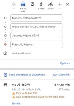
I setup four points (start, and 3 destinations):
View attachment 833677
That gets me this URL:
https://maps.app.goo.gl/B7PUhS83WvjSvAnu7
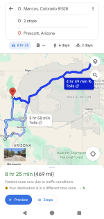
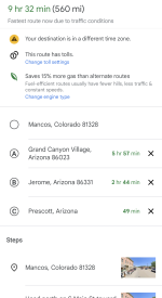
When I share this to my phone, I get a route with all four points plotted out:
View attachment 833688
View attachment 833689
(The difference in travel time on the last image because estimates vary depending on which suggested route I select and whether or not I allow tolls, etc.)
Once I start navigating that route, it will basically do realtime guidance to point 'A' until I reach it. Yes, it will try to route me on the fastest or most efficient route, but point 'A' is definitely the target destination. When I arrive there, I can either "Cancel Navigation" or "Continue", at which point it will guide me to point 'B', and so on.
This works well for me, except for the 10-waypoint limit. If this does NOT work for you, then maybe there's some variation in behavior down to app version? (or platform? iOS vs. Android?)


