What online tools do you use for long (road) trip planning?

SDDiver5

Expedition Leader
I use Onx for everything travel related. Last time I did a long trip, I had it from the meet up point in San Diego going to the desert and north through J Tree and then home. Multiple way points to check out spots if they would be good for future camping. I find it much easier than any other system. Easy to build routes, add waypoints with notes and share with friends.
 

Herbie

Rendezvous Conspirator
This is my struggle. Just plotted a route today on Google Maps to ride Alberta oldest road with a couple neat historic pit stops:

View attachment 833618

Saved and then send to my phone / email and open it on my phone and this is what I get:

View attachment 833619

So curious what you are all using to plot the route and send to your device with way points saved.

Apps, devices or something? It's frustrating and there must be a better way...

Ugh. From what I see on your first image, I'd expect that at least the large circles should be respected as waypoints. (The small circles are just anchor points that gmaps uses when doing pathfinding, and those are subject to change based on realtime inputs.)

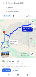
As an example, here's a short route that I'm usually able to manage without any issue:

I setup four points (start, and 3 destinations):
sample-route.jpg


That gets me this URL: https://maps.app.goo.gl/B7PUhS83WvjSvAnu7

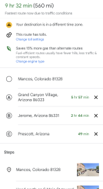
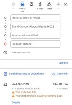
When I share this to my phone, I get a route with all four points plotted out:

route1.png
route2.png
(The difference in travel time on the last image because estimates vary depending on which suggested route I select and whether or not I allow tolls, etc.)

Once I start navigating that route, it will basically do realtime guidance to point 'A' until I reach it. Yes, it will try to route me on the fastest or most efficient route, but point 'A' is definitely the target destination. When I arrive there, I can either "Cancel Navigation" or "Continue", at which point it will guide me to point 'B', and so on.

This works well for me, except for the 10-waypoint limit. If this does NOT work for you, then maybe there's some variation in behavior down to app version? (or platform? iOS vs. Android?)
 

Todd780

OverCamper
Ugh. From what I see on your first image, I'd expect that at least the large circles should be respected as waypoints. (The small circles are just anchor points that gmaps uses when doing pathfinding, and those are subject to change based on realtime inputs.)

As an example, here's a short route that I'm usually able to manage without any issue:

I setup four points (start, and 3 destinations):
View attachment 833677


That gets me this URL: https://maps.app.goo.gl/B7PUhS83WvjSvAnu7

When I share this to my phone, I get a route with all four points plotted out:

View attachment 833688
View attachment 833689
(The difference in travel time on the last image because estimates vary depending on which suggested route I select and whether or not I allow tolls, etc.)

Once I start navigating that route, it will basically do realtime guidance to point 'A' until I reach it. Yes, it will try to route me on the fastest or most efficient route, but point 'A' is definitely the target destination. When I arrive there, I can either "Cancel Navigation" or "Continue", at which point it will guide me to point 'B', and so on.

This works well for me, except for the 10-waypoint limit. If this does NOT work for you, then maybe there's some variation in behavior down to app version? (or platform? iOS vs. Android?)
Oh maybe? Never thought of app version. I'm using iOS. (Whatever the latest version is) on a iPhone 14. Are you using iOS or Android?

Either way, unless I'm missing something, I think I need to find another resource for pre planning routes.
 

Herbie

Rendezvous Conspirator
Oh maybe? Never thought of app version. I'm using iOS. (Whatever the latest version is) on a iPhone 14. Are you using iOS or Android?

Either way, unless I'm missing something, I think I need to find another resource for pre planning routes.

I'm on Android, version 11.127.0102 of the App (from May 2) when I did the screenshots above. (Looks like there's a new update today, but it's a moving target).

I'm also on a Pixel phone (Google flagship), which sometimes gets me special features, but usually that's limited to stuff like the Camera app or things tied to the Google One ecosystem. (VPN, etc.)
 

donniefitz2

New member
I wanted to follow up on this post. When this was created, I mentioned that I was working on an app for planning overlanding trips. A few weeks ago, I completed it and put it in the App Store. Some of you here really helped me with some suggestions and I appreciate that. It's available for iPhones currently but I plan to make it available on Android eventually. Below you can find a link for a 1 year free trial (which you can cancel anytime). I would love to hear what you all think of it. I have plans for many more features.

https://apps.apple.com/redeem?ctx=offercodes&id=6480252140&code=EARLYACCESS2025
 

ckrough

New member
Thanks I’ll check out Wildplan. I’ve been using a combination of RVTripWizard, Gaia, and Apple Maps. Similar to Google maps, Apple Maps is always trying to optimize my route in realtime, which is a pain when you are intentionally exploring.

rvtrip good for planning road routes, especially when towing, but it’s turn by turn navigation isn’t the best.

Just switched from onx to Trails Off-road for forest roads and trails, we’ll see how that goes.
 

dstefan

Well-known member
I wanted to follow up on this post. When this was created, I mentioned that I was working on an app for planning overlanding trips. A few weeks ago, I completed it and put it in the App Store. Some of you here really helped me with some suggestions and I appreciate that. It's available for iPhones currently but I plan to make it available on Android eventually. Below you can find a link for a 1 year free trial (which you can cancel anytime). I would love to hear what you all think of it. I have plans for many more features.

https://apps.apple.com/redeem?ctx=offercodes&id=6480252140&code=EARLYACCESS2025
Hey @donniefitz2 — just came across this and thought it was a great idea. Tried the link and it didn’t work — say’s can’t redeem the code? Does your offer still stand? I downloaded the app, just wondering if I can get in on the longer than one week trial.
 
Last edited:

montechie

Active member
I use Onx for everything travel related. Last time I did a long trip, I had it from the meet up point in San Diego going to the desert and north through J Tree and then home. Multiple way points to check out spots if they would be good for future camping. I find it much easier than any other system. Easy to build routes, add waypoints with notes and share with friends.
Same here, I've been using OnX (Offroad) for route planning and sharing. For myself I create a route and markers (campsites, POIs, etc) with information that I'll want off line. Markers all have my notes, photos, other details and are color coded for marker type or based on how sure I am on details (like if I've been to the campsite before and it's details are confirmed). I'll put everything into a folder to share with others.

My one issue with OnX vs Gaia is that they split functionality over multiple apps so wanting to plan around non-motorized adventures (BC skiing, hiking, MTB, etc) plus moto-adventuring to those requires multiple apps to share and double on device storage. Gaia is good for that, but the Overland layer is way weaker than OnX offroad on details.
 
I take a major trip every summer, mostly to get away from the AZ heat, but also to visit friends in other states and see places I've never been. I use a combination of Google Earth and (currently) OnX on my desktop. The sat view in OnX and GAIA sucks, so I use GE to get a closer view - especially when going on backcountry routes. GAIA has a bug that I consider significant for road-trip planning and since they won't fix it, I've switched to OnX, which does not have the bug. I create the route in OnX so that I can follow it from an tablet mounted in the cab that synchronizes with the desktop. I also create a spreadsheet to track the daily stops/mileage and costs, allowing me to set a limit on travel distances. I also note any scenic/interest stops along the track on the spreadsheet, then print it out to place on a clipboard in the cab.

For local (in-state) camping trips, I've been doing it for so long now that I have libraries of tracks covering the state, so that if I go to a particular region, I just go to that region folder on my desktop, find the tracks I want and I can then import them into OnX and the Garmin. I will also convert tracks to Garmin format so that when I go offroading, I can use my Garmin Montana. I've also created a packing list that covers items for all sorts of camping adventures. For meal planning, I create a matrix with the Day (MTWTHFSS) down the left margin, leaving a couple of spaces between each day, then across the top (B,L,D) for the meals. I then fill in the matrix with meals and from that I create a shopping/packing list.

I checked out the APP and it looks pretty cool. I'd be willing to test it for Android, but I'm not sure it's something I would use long-term. My problem is that while my phone is convenient, I hate typing on tiny mobile keyboards - so much so that I also bring a laptop for any on-road modifications or notes.
 

Forum statistics

Threads
189,321
Messages
2,915,547
Members
232,132
Latest member
quigleyth
Top