Photobug
Well-known member
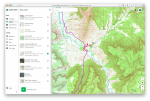
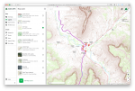
I have downloaded a bunch of maps to cover the entire group of Western States. I have downloaded really a stupid amount of maps. When I browse through them they all seem to offer a slightly different view, with each offering something. Still, I would like to get rid of the excess maps.
I feel the following add a layer of good info.
MVUM
US State and County Borders
Public Land (US)
USFS Recreation Sites.
What other maps should I concentrate on? Which maps are the best for?
Satellite Imagery
Roads/Highways
Backroads
I feel the following add a layer of good info.
MVUM
US State and County Borders
Public Land (US)
USFS Recreation Sites.
What other maps should I concentrate on? Which maps are the best for?
Satellite Imagery
Roads/Highways
Backroads


