10 Days in southern Oregon and far northern California

OTG_1

Well-known member
My buddy Andreas and I had been planning our 10 day trip for the last several months. After hemming and hawing over visiting the North Rim of the Grand Canyon, I decided we'd change it up and head to the Klamath Mountains that straddled NW California and SW Oregon. The Klamaths have similar geology to the northern Sierra Nevada, and many geologists believe they're remnants of the same geological province, along with the Blue Mountains further to the northeast. Interestingly enough, all of these ranges are known for their gold deposits, although certainly none of the mining districts rival the most product mines found in the Sierra Nevada gold fields to the south.

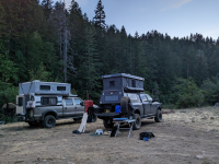
I'd get a head start on Andreas, leaving my home from the North Bay (San Francisco Bay Area) and heading up to northern Mendocino County for a quick overnighter at Usal Beach. Usal can get a bit rowdy on weekenders over summer, so I was thankful I was visiting during the week. There were perhaps 10 or so vehicles camped in the vicinity, and the vibe was rather laidback (and quiet!). The weather was perfect as well. Somewhere in the 70s with a very slight breeze. I enjoyed a couple of cervezas, made a small fire, and reheated the carnitas that we'd made at home just a few days ago. An otter swam by in the creek, slyly hunting for its next meal. We ended up turning in around 9pm, as the pink horizon was beginning to turn black.

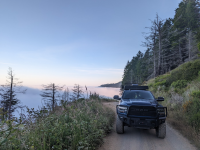
The next morning, the beach was enveloped in a thick fog. A family of ducks wandered the creek, the mother noisily quacking with her ducklings in tow behind her. I needed to be up in Arcata to meet Andreas by 9pm, so I hit the road early knowing it was over an hour to get back to highway 1. I dropped the tent and loaded Shasta the adventure shepsky into her familiar perch in the backseat. We pulled out of Usal and climbed up the steep switchbacks above the marine layer. It was pretty cool to look drive just above the fog line.

You can follow along on the Youtubez if you'd like as well!
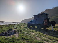

AP1GczOT59xFgBrCqg0VDTssXV5mrMHx.png
Another clear evening at Usal Beach.

AP1GczM_eHHyB5P2tnPtH2ljOSlSl2Gp.png
Driving above the fog along Usal Road.
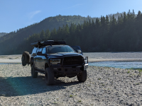
AP1GczPOfhbe1aQQaLJiW3kwxYx7HUdf.png
Dyerville Bar and the Eel River.


Well ahead of schedule and nary a cloud in sight, I made the quick drive down to Dyerville Bar, where two forks of the Eel River Converge. A few hours later we made it to the Arcata Plaza, but not without making a few stops along the way first. Hippies have long left the Bay Area, but Arcata is definitely still one of their strongholds. This funky college town prides itself for being weird and eccentric. And the bright, colorful buildings that surround the plaza only accentuate the funkiness. Shasta was getting a bit antsy waiting in the park. Her Husky half tends to come out in these situations, she's the type of dog that is most content on a long walk or run. And when sitting idly for a minute or two, she begins to vocalize her discontent with the situation. Luckily, Andreas arrived after a short 15 minute wait, that probably seemed like two hours to Shasta. We hit highway 101 headed north for the Smith River National Recreation Area. We'd be taking on some of my favorite portions of the Steelhead Adventure Trail.
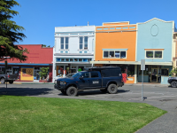
AP1GczMoWFGUMSjsxTdZCkSo35_bTdMZ.png
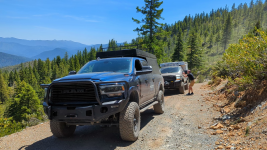
Big Blue at the Arcata Plaza

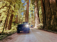
There's so much to see an experience in northern Humboldt and Del Norte Counties. The drive along highway 101 is enough to make most folks smile, but we had bigger plans. We'd kick things off by jumping on the start of the Steelhead Adventure Trail at Howland Hill Road. Howland Hill is a 10 mile dirt road through the old growth forest of Jedediah Smith Redwoods. Jedediah Smith Redwoods features some of the largest known redwoods on earth, and the newly completed Grove of Titans trail takes visitors to some of the park's largest trees. We didn't get a chance to visit the grove on this trip, as the summer crowds were at in force, and it was friggin' hot for being so close to the coast.
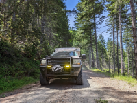
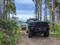
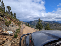
After driving Howland Hill we followed the paved ribbon of highway along the Smith River to Gasquet Toll Road. This dirt road once connected the communities of southern Oregon (Cave Junction, Grants Pass, etc) to Crescent City, but now anyone can take the dirt road high into the Smith River NRA. As we gained elevation, we could see snow capped peaks all around us in the Siskiyous (a subrange of the Klamaths) and Klamath mountains. Gasquet Toll Road intersects with Wimer Road, and old wagon trail that the national forest leaves in its natural state-- which means lots of loose rocks. Wimer Road is by no means technical, but the neverending rocks will certainly keep you on your ties and wishing for smoother roads ahead. After bouncing along on Wimer Road for a couple of hours, we finally made it to our turn off to camp. The trail to camp winds its way several miles down a steep incline and through various tunnels of shrubs and trees. Even mid-sized vehicles like a 4Runner are guaranteed to pick up their fairshare of pinstriping-- imagine two full size trucks with campers on them!

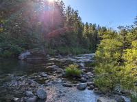
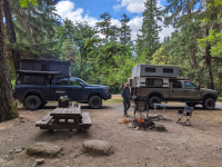
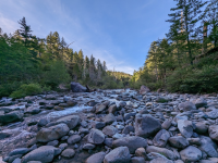
It was a balmy 95F as we pulled into camp along the north fork of the Smith. I changed into my swim trunks as fast as I could, grabbed a cerveza (Scrimshaw to be exact), and made a beeline for the crystal clear waters of the Smith. Unlike the rivers and creeks in the Sierra, the Smith's waters are rather pleasant in the summer months as the majority of its water is not from snowmelt. I'd guess the water temp was somewhere around 70F. I splashed around in the water for an hour or so as one cerveza turned into three. Every being the loyal dog, Shasta followed me as I explored the river, and proudly perched myself atop a giant boulder. Day 1 our of our trip had gone well, and the cool river water was the perfect remedy for the blazing sun above us. We wondered what the coming days had in store for us as we'd head north into Oregon and the western corridor of the Rogue River-Siskiyou National Forest.
AP1GczNsyaN-Fw9hImoTRwbJX8dhxzxp.png
Howland Hill never disappoints.

AP1GczOwpXBdD0dZz-8pu0V991IFH6ip.png
Smith River NRA

AP1GczN5MMu5q3_S0Ho-sZvZ6JdgwOLC.png
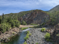
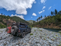
One of the many swimming holes along the north fork of the Smith.
AP1GczO1FVDHuCy38rvVbXTp3B4cen-x.png
Further upstream from camp.

AP1GczM1L27pMhktHYKcYGhLyn_F5Hx3.png
One of my favorite campsites in the PNW!
 
Last edited:

86scotty

Cynic
Cool stuff. We stumbled upon Usal Beach on one of our first trips out there when the kids were young and still with us. I'll never forget the elk that paid us a visit around dusk and then stepping out of the van in the middle of the night to find several fishing boats lit up out in the bay. I have pics somewhere.

It's a magical spot.
 

OTG_1

Well-known member
Rolling into camp in the early evening didn't leave much time to enjoy our campsite along the north fork of the Smith. I really wanted to stay another day, especially given the warm temps and refreshingly cool waters of the Smith. But the show must go one. Andreas and I packed up our rigs and began our journey back down the mountain to civilization. We crossed the North Fork bridge and campground. I used the opportunity to launch the drone and capture Andreas working his way up the various switchbacks. A couple hours later we were zooming north on the 101 passing some of the baddest hombres in the country (Pelican Bay maximum security prison). We limped across the border with our tanks just above empty, ready to tap into that discount diesel that every state seems to have except California 😅

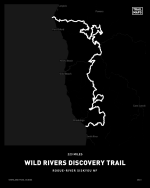
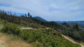
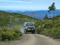
Ready to hit the trail, we backtracked a mile or so to the official start of the next leg of our adventure. Over the next 3-4 days, we'd be exploring the 223 mile long Wild Rivers Discovery Trail that winds its way through the western half of the Rogue-River Siskiyou NF. The track is named for the numerous Wild & Scenic rivers that it passes, like the Chetco, Rogue, Illinois, and a number of smaller rivers like the Elk, Pistol, S. Coquille, and Sixes Rivers. Having already been on the road for nearly 3 hours, we decided it was time for an early lunch next to a nice shaded spot next to a creek. Surprise, surprise (not really), we were swarmed by mosquitoes and ate our meals in an expeditious manner. Soon enough we were back in our rigs and climbing up into the mountains. The dense forests of the lowlands soon gave way to incredible views of the Kalmiopsis Wilderness to the east. The Klamath Mountains, and in particular the Siskiyou subrange, contain the largest serpentine area in North America. The minerals found in serpentinite soils and rocks tends to turn a greenish or reddish color, and in this corner of the country, it turns a martian red, painting entire mountain slopes in rusty red and orange hues. The martian landscape creates quite the juxtaposition against the dark green conifers that cloak the mountain slopes and canyons. And if you pay extra close attention, you may just find the Kalmiopsis plant, an endemic flowering shrub with pink flowers that's only found in Siskiyous. We made a quick stop at an old fire tower that'd seen better days, and then began our descent down to the Chetco River. But before we searched for camp along the river, I had plans to visit one of the northernmost stands of coast Redwoods in a designated bonatical area. Unfortunately, the area had burned from the Chetco Bar fire back in 2017, severely damaging the few remaining redwoods in the area. I always find it amazing the Chetco Bar fire burned so close to the coast given the colder, maritime climate. On the flip side, and I'm trying my best to remain optimistic, the fire along with the Biscuit Fire (2002) opened up the landscape, creating incredible views along the southern portion of the track.
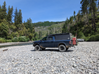
Underwhelmed by the charred remains of the grove, we continued our descent down to the Chetco in search of camp. It was a weekend, so the crowds were out in force. The first river bar we explored was light on crowds, probably because the area lacked any decent swimming holes. So we trekked south to the Redwood Bar. A massive river bar that's nearly a mile long that features numerous deep swimming holes-- and lots of people. I never understood folks who head into the woods and like to fly their favorite political flag 30' in the sky. I mean, don't many of us head to the woods/mountain/desert to escape the trappings of our busy lives? Well, to each his/her own I suppose! After surveying the entire bar, we found a nice spot about 50 yards from our nearest neighbors not far from one of the deeper pools of water. As beautiful as Oregon is, the folks that visit are absolutely horrible when it comes to picking up trash. 5 minutes later, I'd removed all the junk that was left in the firepit by the previous occupants-- You know what the means? It's cerveza time. I grabbed a nice cold one, and headed down to the riverbank. The temps were in the high 60s, but the cool waters (probably around 70F) were still quite enjoyable. Shasta, ever the velcro dog, couldn't stand to see me leaving her behind, so she decided to jump in and show off her rather impressive doggy paddling skills. As nice as the swimming hole was, I wished we'd camped upstream at the less crowded bar. Our nearest neighbors thought it'd be fun to play Dubstep until 1:30am!?

Since we weren't at the Redwood Bar to drink jeger and party through the night, we were up bright and early. And our neighbors in the dubstep camp, I don't think we saw them that entire morning. We gave a nice honk as we passed their camp on our way out. And so we continued on our journey making our way towards the confluence of the Rogue and Illinois Rivers. Just like yesterday, we were blessed with more views of the surrounding mountains. One of the nice things about the Wild Rivers Discovery Trail, is that it's mostly soft roading at it's finest, so it's pretty easy to cover 100+ miles of dirt in a single day, while making plenty of stops along the way. We passed a couple more fire towers, one of which was occupied, but the friendly couple who was staying for the weekend let us snap a few photos. Before making our way to Agnes, we hit a beautiful stretch of trail that was filled with rhododendrons. I dubbed the 10 mile stretch the rhododendron highway. In some places, the flowering bushes extended for hundreds of yards into the forest.
Finally we made it to Agnes and stopped by the market to pick up a soda and quick snack, then it was off to Oak Flat, where the Illinois River dumps into the mighty Rogue. The dispersed camping area was rather unimpressive, so we followed an old trail on the river bar as far as we could and stopped for lunch. Sadly, not long after our departure the Oak Flat fire would erupt and 30k acres in the Illinois River watershed. Our journey brought us further north, we crossed the Rogue and begain our ascent back into the mountains. The forest here was much more dense-- a dark and brooding rain forest, exactly what the Pacific Northwest is famous for. Long gone were the open hill sides. Old man's beard hung from the Doug firs, pine and spruce that towered above us. We ended up making it to the south fork Coquille river, and after doing a bit scouting, we decided to stay at one of the developed campgrounds. We'd come across some shady characters in one prospective dispersed camping area, and decided the comforts of a developed campground would work for now. And what do you know, it began to rain. Luckily, it was a light rain and the dense forest canopy helped to provide additional cover.
The next morning we awoke to light rain that turned into moderate rainfall. We hurriedly packed up our belongins and hit the trail. Rather than follow the Wild Rivers Discovery Trail to its terminus in Port Orford, we'd be cutting east cross the mountains to start our next leg of the journey along the Siskiyou Crest Adventure Trail. Our rigs maneuvered through the tight mountain roads and trails, with the occasional glimpse of the surrounding scenery, which was spectular! As we climbed higher, the temps dropped into the 30s and soon enough our vehicles were being pelted with wet snow. Cutting eastward across the mountains, the monotany of endless trees began to take a toll on both of us. Finally we made it to the Rogue River Canyon. The rain had stopped and we could see blue sky above us, and a half dozen or so rafts in the canyon waiting to shoot a series of rapids. Upon making it to the bridge across the Rogue, we discovered our planned route was impassable. The road had been closed from a recent fire, so we'd need to detour towards the Grants Pass area in order to meet up with our planned route.

Next up, we take on the Siskiyou Crest Adventure Trail!


Again, you can watch our adventure on the Youtubez


wild rivers.png

AP1GczNr81WtnNLlZ4oT0dP0QeDf7uC (1).png
Crossing the north fork of the Smith leaving the Smith River NRA


AP1GczNFhrQFU6gtBwxwjv_0pnK6Vgso.png
Officially on the Wild Rivers Discovery Trail!


AP1GczPzx_ca7sf2UcwccbMdDcmWSQs5.png
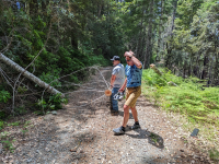
We thought we'd be doing a lot of chainsaw work, but it really wasn't that bad!


AP1GczNVmF5GsGrImXzzQvX9jj-ay8Ip.png
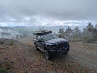
Views for days!

AP1GczOBjgIGmRFDn9WPjU-K--4SS1v.png
The redwood botanical area burned severely in the 2017 Chetco Bar fire.


AP1GczOGxhz-0w4nwn8wjyDrO9OHVn0U.png
We should have stayed at this less crowded river bar instead of the Redwood Bar down the road.


AP1GczOpInqtF-c-rmaCIHN9rBm4jM8y.png
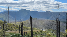
Mas views!!

AP1GczM5I5Zpto97IT_pi7t2of9tSzCC.png
The Siskiyous are a work of art!
 
Last edited:

OTG_1

Well-known member
Some more photos from our time along the Wild Rivers Discovery Trail.

AP1GczNrhtThG1UIKhNnhDh2hfeGH4G0.png
Can you spot the red rock serpentine in the background?

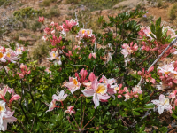
AP1GczP98TWKVQo5v_-1fdWk8_eA4MOI.png
The endemic Kalmiopsis plant, only found in the Siskiyou mountains.

AP1GczNoiqmiv4BXwlZ3BV6-nYsSNsJh.png
More views!

AP1GczMO0pTyI--8DKFM33y2A8WvlLNB.png
The rhododenrons stretched into the forest as far as the eye could see.

AP1GczMdlMD2rwiLyiWEqkXBfkm5ikGc.png
Illinois River near Agnes.

AP1GczPFkw5dVzCL5qhS7bC_ZXUKjJK9.png
Crossing the Rogue and into the rainforest.

AP1GczPznDvZhwVMTTd58__AUpP4vR4S.png
The forest north of the Rogue was dank, dense and dark, and views weren't quite as frequent. But when we did come across one, WOW!

AP1GczNlAMVrV2eWsv-XmDgRafbtma0u.png
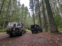
Camp along the south Coquille, before the rains arrived!

AP1GczP4LgaKnAQSGHdleUn9-rfluv4p.png
Typical PNW scenery!

AP1GczNh4CL0dPvU_97xEDoinf21Gj_A.png
Man, I do love big trees. But being a native northern California son, nothing matches the grandeur of the coast redwood!
 

sancap

Active member
My buddy Andreas and I had been planning our 10 day trip for the last several months. After hemming and hawing over visiting the North Rim of the Grand Canyon, I decided we'd change it up and head to the Klamath Mountains that straddled NW California and SW Oregon. The Klamaths have similar geology to the northern Sierra Nevada, and many geologists believe they're remnants of the same geological province, along with the Blue Mountains further to the northeast. Interestingly enough, all of these ranges are known for their gold deposits, although certainly none of the mining districts rival the most product mines found in the Sierra Nevada gold fields to the south.

I'd get a head start on Andreas, leaving my home from the North Bay (San Francisco Bay Area) and heading up to northern Mendocino County for a quick overnighter at Usal Beach. Usal can get a bit rowdy on weekenders over summer, so I was thankful I was visiting during the week. There were perhaps 10 or so vehicles camped in the vicinity, and the vibe was rather laidback (and quiet!). The weather was perfect as well. Somewhere in the 70s with a very slight breeze. I enjoyed a couple of cervezas, made a small fire, and reheated the carnitas that we'd made at home just a few days ago. An otter swam by in the creek, slyly hunting for its next meal. We ended up turning in around 9pm, as the pink horizon was beginning to turn black.

The next morning, the beach was enveloped in a thick fog. A family of ducks wandered the creek, the mother noisily quacking with her ducklings in tow behind her. I needed to be up in Arcata to meet Andreas by 9pm, so I hit the road early knowing it was over an hour to get back to highway 1. I dropped the tent and loaded Shasta the adventure shepsky into her familiar perch in the backseat. We pulled out of Usal and climbed up the steep switchbacks above the marine layer. It was pretty cool to look drive just above the fog line.

You can follow along on the Youtubez if you'd like as well!


View attachment 842649
Another clear evening at Usal Beach.

View attachment 842648
Driving above the fog along Usal Road.

View attachment 842647
Dyerville Bar and the Eel River.


Well ahead of schedule and nary a cloud in sight, I made the quick drive down to Dyerville Bar, where two forks of the Eel River Converge. A few hours later we made it to the Arcata Plaza, but not without making a few stops along the way first. Hippies have long left the Bay Area, but Arcata is definitely still one of their strongholds. This funky college town prides itself for being weird and eccentric. And the bright, colorful buildings that surround the plaza only accentuate the funkiness. Shasta was getting a bit antsy waiting in the park. Her Husky half tends to come out in these situations, she's the type of dog that is most content on a long walk or run. And when sitting idly for a minute or two, she begins to vocalize her discontent with the situation. Luckily, Andreas arrived after a short 15 minute wait, that probably seemed like two hours to Shasta. We hit highway 101 headed north for the Smith River National Recreation Area. We'd be taking on some of my favorite portions of the Steelhead Adventure Trail.

View attachment 842650
Big Blue at the Arcata Plaza

There's so much to see an experience in northern Humboldt and Del Norte Counties. The drive along highway 101 is enough to make most folks smile, but we had bigger plans. We'd kick things off by jumping on the start of the Steelhead Adventure Trail at Howland Hill Road. Howland Hill is a 10 mile dirt road through the old growth forest of Jedediah Smith Redwoods. Jedediah Smith Redwoods features some of the largest known redwoods on earth, and the newly completed Grove of Titans trail takes visitors to some of the park's largest trees. We didn't get a chance to visit the grove on this trip, as the summer crowds were at in force, and it was friggin' hot for being so close to the coast.
After driving Howland Hill we followed the paved ribbon of highway along the Smith River to Gasquet Toll Road. This dirt road once connected the communities of southern Oregon (Cave Junction, Grants Pass, etc) to Crescent City, but now anyone can take the dirt road high into the Smith River NRA. As we gained elevation, we could see snow capped peaks all around us in the Siskiyous (a subrange of the Klamaths) and Klamath mountains. Gasquet Toll Road intersects with Wimer Road, and old wagon trail that the national forest leaves in its natural state-- which means lots of loose rocks. Wimer Road is by no means technical, but the neverending rocks will certainly keep you on your ties and wishing for smoother roads ahead. After bouncing along on Wimer Road for a couple of hours, we finally made it to our turn off to camp. The trail to camp winds its way several miles down a steep incline and through various tunnels of shrubs and trees. Even mid-sized vehicles like a 4Runner are guaranteed to pick up their fairshare of pinstriping-- imagine two full size trucks with campers on them!

It was a balmy 95F as we pulled into camp along the north fork of the Smith. I changed into my swim trunks as fast as I could, grabbed a cerveza (Scrimshaw to be exact), and made a beeline for the crystal clear waters of the Smith. Unlike the rivers and creeks in the Sierra, the Smith's waters are rather pleasant in the summer months as the majority of its water is not from snowmelt. I'd guess the water temp was somewhere around 70F. I splashed around in the water for an hour or so as one cerveza turned into three. Every being the loyal dog, Shasta followed me as I explored the river, and proudly perched myself atop a giant boulder. Day 1 our of our trip had gone well, and the cool river water was the perfect remedy for the blazing sun above us. We wondered what the coming days had in store for us as we'd head north into Oregon and the western corridor of the Rogue River-Siskiyou National Forest.

View attachment 842646
Howland Hill never disappoints.

View attachment 842645
Smith River NRA

View attachment 842654
One of the many swimming holes along the north fork of the Smith.

View attachment 842644
Further upstream from camp.

View attachment 842643
One of my favorite campsites in the PNW!
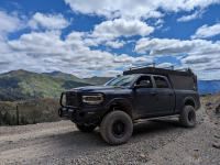
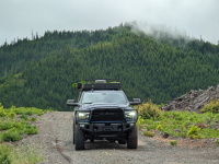
Beautiful Images! What rear bumper is that on the RAM?
 

gator70

Active member
Thanks for your story. Fun to follow. Is there anywhere you went that the size of your rig was at the limit? As context my rig is more the size of a earth cruiser and I would love to travel theses routes.
 

Cabrito

I come in Peace
Thanks for your story. Fun to follow. Is there anywhere you went that the size of your rig was at the limit? As context my rig is more the size of a earth cruiser and I would love to travel theses routes.

@gator70 at first I was thinking "wow, full size rigs on Usal in the Lost Coast" but then I remembered seeing this sucker and while it might be tight in spots, at least on Usal Road it's doable.


Great write up! These days it pays to carry a chainsaw if you're traveling in wooded areas in Nor-Cal or Oregon.
 

OTG_1

Well-known member
@gator70 at first I was thinking "wow, full size rigs on Usal in the Lost Coast" but then I remembered seeing this sucker and while it might be tight in spots, at least on Usal Road it's doable.


Great write up! These days it pays to carry a chainsaw if you're traveling in wooded areas in Nor-Cal or Oregon.

Full Size rigs are a cakewalk to Usal. I've also driven a Sprinter 4x4 down to Usal and managed to get it on three wheels hitting one of the ruts and hairpin turns a few years back. Now, that beast above definitely ain't gonna make it to the north fork to the smith. We were smacking low hanging limbs and branches the entire 3+ miles down there, and Wimer road isn't much better!
 

OTG_1

Well-known member
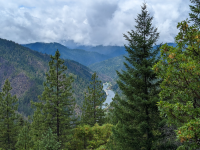
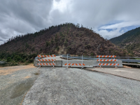
The connector that links the Wild Rivers Discovery Trail in the west to the Siskiyou Crest Adventure Trail in the east, is a mixture of dirt and pavement that travels through the temperate rain forest of SW Oregon. As you drop into the Rogue River canyon, the views are impressive. Our plan was to make it down to the Bridge and then link up with the north terminus of the Siskiyou Crest Adventure Trail-- except the road was closed so we'd need to detour through Merlin (outside of Grants Pass) and take Galice Road west.

AP1GczOzRJ-uTEtH1joBMVM3vZV6RGT.png
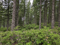
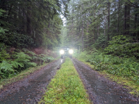
Much of the forest on the northern end of the Wild Rivers and the connector looks like this-- ferns and Doug Firs dominate the flora.

AP1GczP16fMjNDNsrQcllqYVEPbyEnqZ.png
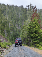
A rare view along the connector!
AP1GczMEpAydodfFEs4FnKTZOlKiaO_9.png
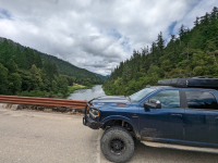
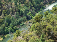
The Rogue River Canyon.

AP1GczNpB94ENd8ekKJBOlYQC64HJ6zw.png
Getting ready to hit the rapids on the Rogue.


AP1GczMxfjKqueXsml7hyYZPB0Z_YTTf.png
Detours and reroutes are one of the constants of overlanding. This trip would be no different!

AP1GczM8NHBLj5QrW2FZ_ZXv381ePACC.png
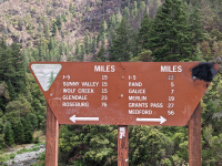
What should have been a 7 mile drive to Galice, was now 10 miles to Merline plus the additional mileage up Galice Road to reach Galice.


Pacific Northwest yetti

Expedition Medic
“I always find it amazing the Chetco Bar fire burned so close to the coast given the colder, maritime climate.”

In the large forest fires, they actually create their own weather. Pulling in cooler dry air, as the heat rises. It of course heats up as it gets closer, At the same time, there is still super-heated air at the flame front. This pretty much dries everything out. It’s not uncommon to hear trees explode, as the moisture inside tries to boil out of them.
 

Forum statistics

Threads
188,206
Messages
2,903,767
Members
229,665
Latest member
SANelson
Top