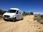
3 Years Around North America, Plus a Few More

Umnak

Adventurer
Fire trucks and old school campers

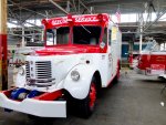
I visited cousins in Birmingham, Alabama this past week after a 53 year absence. It was a good visit, and I won't bore you with the details. However, one of my cousins showed me around and that included a collection of privately held fire and emergency response vehicles housed in an old manufacturing building in central Birmingham. Of note to Expedition Portal folk is this 1953 REO Civil Defense Vehicle. REO is the founder's initials, Ransom E. Olds, as in Oldsmobile. Built in Lansing, Michigan.
DSCF9827.jpg


DSCF9828.jpg


We spent a couple of hours in the Barbers Autosports Museum just north of Birmingham, which houses the largest collection of motorcycles in the world. There are 1000s of bikes and a large collection of Lotus race cars.
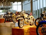
DSCF9878.jpg

I have an album on my flickr account of the fire trucks and the bikes, no account is required just follow this link https://www.flickr.com/gp/umnak/Eo89Ba

And just a day before that visit we stumbled upon an interesting set of campers in South Carolina including this Shasta pulled by a 1956 NomadDSCF9786.jpg
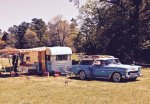
And a 1948 Ford Truck with matching camper
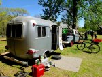
DSCF9798.jpg
 

Umnak

Adventurer
Moving on from North Carolina

It's been more than six months since we decided to spend some time in Western North Carolina. It has been a great experience and has allowed us to learn more about this part of the country. Our final days have been spent backpacking and saying good bye to new friends.
DSCF9994.jpg

DSCF9982.jpg

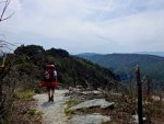
A friend and I backpacked the ridge line of Linville Gorge over two days of very hot weather. The trail followed steep ridges and moved across formerly burned ground.
IMG_3991.jpg

DSCF0094.jpg

DSCF0084.jpg

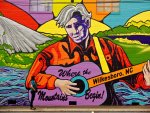
We went to the Bluegrass Music Festival, Merlefest in Wilksboro, NC a finish to the Blue Ridge visit. It had been decades since I’d attended a music festival, and this one was a great reintroduction. There were great musicians performing on multiple stages, a lot of vendors and some damn good food.

DSCF0060.jpg

On our second to last night Eve performed at the Newgrasss Brewhouse to friends and strangers as a final farewell to Shelby.

IMG_4014.jpg


We will be traveling from WNC to stops in Maryland, West Virginia, Michigan, Montana, Idaho and finally the Olympic Peninsula over the course of the next couple of months. From there we head to the UK for a month then back and make our way to New Mexico for 4-6 months. I’ll post some of that trip along the way.
 
Last edited:

Umnak

Adventurer
Heading north and West

Heading north and west

We’ve been back on the road for a few weeks, having driven the Blue Ridge Parkway north, eaten blue crab in Maryland, walked the steep ridges of West Virginia and visited friends along the way to Chicago. We head west now to spend some time in Montana.


A few pictures:
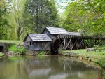
DSCF0149.jpg Mabry Mill, VA

DSCF0157.jpg Easy Dinner

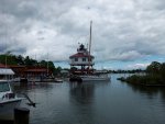
DSCF0167.jpg Solomons, MD

DSCF0218.jpg Blue Crab

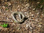
DSCF0320.jpg First snake in 20 years!

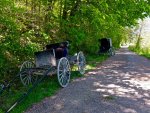
DSCF0329.jpg Amish

DSCF0368.jpg Ohio Camp

IMG_0711.jpg West Virginia

IMG_0718.jpg Steep
 

Umnak

Adventurer
Moon Pass Road, Idaho

DSCF0483.jpg

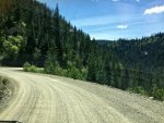
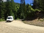
We found an interesting Forest Service Development Road outside of Wallace, Idaho. The 32 mile Road to Moon Pass begins on King Street in Wallace and follows Placer Creek, and it eponymous road up stream for a few miles until it crests and changes to Moon Pass Road. We spent the night in Wallace, whose entire downtown was placed on the National Historical Registration in order to fend off having Rt 90 cover it in asphalt. It seems to have worked, though the interstate now passes over the town on a viaduct giving it a troll-like atmosphere when looking from the highway.

Edge.jpg

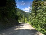
We were coming out of Montana into Idaho on our way to visit friends in St. Maries when Jarel suggested we get off the highway and take Moon Pass. Once cresting the mountain from the Wallace side, the dirt road follows the ridges and the head waters of the St. Joe River down to Avery.

Down hill.jpg

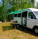
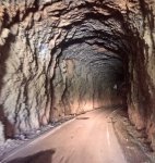
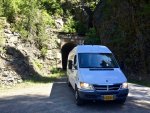
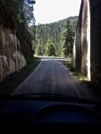
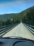
The route includes a portion of an old railway line and infrastructure such as paved trestle bridges and four tunnels. Two of the single track tunnels have curves that don’t let you see if anyone is coming in from the other direction. We passed a pickup mid-way through one of those tunnels and fortunately were able to squeeze by with the wheels of the van in the side ditch — love that 9.5” clearance of the Sprinter.

Tunnel 3.jpg Tunnel 2.jpg

Tunnel 1.jpg
There are a few roads leading off Moon Pass, which look like they would be fun in the 4Runner.

Bear.jpg

Seems that spring bear season was still on when we drove the pass.

Bridge.jpg

It took us about 90 minutes to drive the 32 miles, and that’s with a few stops for pictures.

St.Joe.jpg
 

Attachments

  • Tunnel Exit.jpg
    Tunnel Exit.jpg
    585.5 KB · Views: 40

Kgh

Let’s go already!
Fantastic trip, and great posts with good details. The Cabin looks like a good mix of comfort and capability. The attitude that you shre is also uplifting, I appreciated the post about going into situations not as "Mr. X, who does Y" with an occupation being the definition of who you are.

Can you share a bit about costs? I am sure many of us reading this are wondering. I also noticed that for the most part, you have probably slashed your budget by perparing your own food. Good move.

Thanks again for posting, will be following.
KGH
 

Umnak

Adventurer
Fantastic trip, and great posts with good details. The Cabin looks like a good mix of comfort and capability. The attitude that you shre is also uplifting, I appreciated the post about going into situations not as "Mr. X, who does Y" with an occupation being the definition of who you are.

Can you share a bit about costs? I am sure many of us reading this are wondering. I also noticed that for the most part, you have probably slashed your budget by preparing your own food. Good move.

Thanks again for posting, will be following.KGH

Costs have been fairly low, at least from our perspective as Alaskans, where everything costs more than it should. So, we are frugal but not cheap -- and there is a difference -- and frankly don't have to look at the price of things before making a purchase. Our expenses for this trip that are different from our previous sedentary life can be parsed into food, fuel/vehicle expenses, lodging and entertainment

We do prepare our own food, in part because we don't enjoy eating bad food in bad restaurants and also because I'm a pretty good cook. So, food costs are whatever it would be if you do that at home. That being said, we don't scrimp. Steak on Fridays, Boars Head luncheon meat, lots of vegetables and good chocolate. Not being able to buy in bulk, and often shopping at small independent grocers does cost more than hitting COSTCO and targeting sales at Safeway. We ate out a lot more in Shelby than Juneau, because we could walk to the Brewhouse and hear great Bluegrass.

I've been keeping tabs on our fuel and vehicle expenses. We get 23-25 mpg; diesel varies considerably across North America, with Canada being the most expensive, even with the 30% exchange rate, and the Carolinas the least expensive. I've replaced the alternator, changed out the sway bar, bought a new macerator pump and bought way too many headlamps. That's after 24K miles in under a year, so no complaints.

We figured we would stay in a hotel once every 10-14 days when we started the trip. By late September we had spent one night in a hotel. Instead of a hotel, we found that paying a little more for an electric and water site at a campground was more than enough of an upgrade, especially if it was hot -- the ac works on shore power. Still, we've probably plugged in less than a dozen times in the past year. Love that solar. Our apartment in Shelby was $675 a month and was so close to everything, so the van was used to drive Eve to work and pick her up ( under 5 miles a day).

Our entertainment is derived from playing outside. We've gotten used to having to get permits to camp and pay a nominal service charge for backcountry campsite when backpacking. Our long kayaking trips, winter forest service cabins and backpacking in Southeast Alaska where our vacations. Those were "trips of a lifetime" for people form Outside, but for us consisted of a ferry ticket and some food.

In terms of dollars, our checking accounts have stayed even over the past year. My SS deposit and Eve's concomitant monthly contribution to the joint checking account -- which pays all the bills -- covers it all with no loss. And that includes our insurance, mortgage payment and other incidentals like shoes for her and jackets for me. We all have our issues ;-)

Want a number? PM me.

Joseph
 

Umnak

Adventurer
Theodore Roosevelt National Park to Glacier National Park

We stopped for a couple of days at two outstanding national parks along our route west from Chicago.

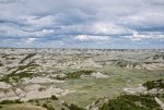
The first was the Theodore Roosevelt Park along the Little Missouri River in western North Dakota’s Bad Lands. A long hiking trail connects the northern portion of the park with the more settled section off of Route 94. The town of Medora was just coming to life the week before Memorial Day and there were few people in the park itself.
Bad Lands.jpg
There are buffalo, wild horses, elk and mule deer scattered around the park.
Wild Horses.jpg
Little Missouri.jpg
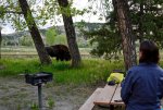
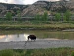
We drove the park road and hiked a few of the trails before settling in to our camp site along the river. A buffalo passed through our camp toward dusk heading to the Little Missouri. It seemed unconcerned with our, and everyone else, presence.
Buffalo in Camp.jpg
Buffalo on the Little Missouri.jpg
Morning on the Little Missouri.jpg
We drove into and across Montana from the Bad Lands, stopping in Fort Peck at the world’s, or country’s largest earthen damn on the Missouri. Traveling north we linked with Rt 2 across the northern edge of the state.
Fort Peck Damn.jpg

We could see the Rockies from Cut Bank, Montana by late afternoon, and were climbing the east side of Glacier Park by the end of the day.
The Rockies.jpg
We camped at Summit which has a memorial to the engineer who opened the pass for the railroad.
Summit Camp.jpg
Summit Memorial.jpg
 

MarionCohrs

New member
View attachment 329683

Our first experience with a KOA was very positive. We were one of two vehicles at the 300 plus site in Rodanthe on Hatteras Island, with a site that backed up to the dunes. The wifi worked, the bathrooms were clean and there was no one else around. No one.

View attachment 329676

View attachment 329675

We spent another day on Hatteras Island around the communities of Buxton and Cape Hatteras. Most everything was closed and there were far fewer shops and houses here than on Brodie Island. The almost full moon and storm surge had closed some of the access points to the beach and covered a few of the roads, but we did enjoy a walk in the Buxton Forest and along the lee of the Sound.

View attachment 329674


View attachment 329681

Our final day on the Outer Banks started with the ferry ride from Hatteras to Ocracoke Island and from there another 2.5 hour ferry trip to Cedar Island. Ocracoke is far less crowded that the northern islands, but it is clear that it survives on the summer season. Most of the town was closed. We saw some of the ponies that have roamed the island since they were left there by the Spanish, and ate at the Oyster House while waiting for the ferry. The crossing was calm and gave one a sense of the size of Pamlico Sound, which is second only to Puget Sound in size in the U.S.

View attachment 329677

View attachment 329678

Once across, we spent that night close to the Sound in the almost empty Forest Service campground at Cedar Point. The next morning we walked along a trail and boardwalk system which is part of the National Forest. Great views and a lot of birds.
View attachment 329679

View attachment 329682

View attachment 329680

I doubt we would endure the Outer Banks in season, but would definitely return again for a winter visit.

Thanks for this bloggy type of post.. I enjoy reading this.
 

Umnak

Adventurer
Side Trip to England and France

Side Trip to Europe


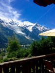
We spent July and the first week of August hiking and visiting in England and France. A week in Chamonix - Mont Blanc, a few days in London and Stafford before heading north and walking the best part of Hadrian's Wall, ending with a week in Dartmoor Park in the Southwest.

Mont-Blanc from the Deck.jpg

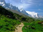
Chamonix is an alpine hikers paradise. Our friends who live there — and who are mountain guides and climbers — said it was expected that people would take the trams to alpine, shaving off as much as a 4,000 vertical ascent at the start. In Juneau we would have been called cheaters.
Alpine.jpg

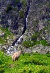
Bouquetin, also known as Ibex, graze along the trails and near the alpine lakes. The view is constantly changing from glacier to peak to meadow to cliffs. And even in the height of summer there are secluded ponds and valleys to spend time in for lunch.

Ibex.jpg

Eve's cousin and family live in London which gave us built in guides and the chance for me to meet more of her family.
We also visited cousins and an uncle in Stafford, where we discovered that the Ancient High House was once owned by folk with the same last name as her father, Fieldhouse.

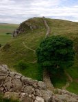
Hadrian, when commanding Roman troops in Britain, had the epeynemous 80 mile wall constructed beginning in 132, before he became Emperor. It has survived in places and is a great way to get to know the land and, to a certain extent, the people along the northern reaches of England. We started the walk in Corbridge and ended west of Brampton.
Sycamor and wall.jpg

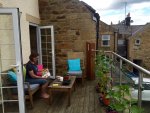
And for the first time in our hiking history we stayed in B&Bs along the way. Part of that was convenience — didn't have to bring tents, bags etc — and part is because it really isn't the kind of place we typically expect to spend 5 nights walking around. There are also pubs, that serve great ale and cider. And they make a mean Stilton Meat and Ale pie.

IMG_4620.jpg

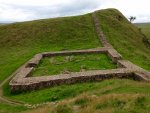
The wall once stood 16 feet high and as much as 6 feet wide. There were mile castles and towers and even turrets along the way. The wall was used to build houses, farms, churches and even a road over the past 1900 years. Still, there is enough to get a sense of the scale, and the excavated forts along the way make you realize this was a major occupation force.

Milecastle.jpg

Paradoxically, one of the forts was manned by a large number of Syrian Archers. That means the Syrians were in Britain before the Anglo Saxons, Vikings and Normans merged to become the English. There were also units from Spain and Romania. Funny, that no one mentioned that in the Brexit vote.

We rented a car in Carlisle and headed to south to Dartmoor. It took little time to feel comfortable with the left hand shifting and right hand driving, but I never got used to the idea of side view mirrors as “whiskers” for determining how close we were to the brick/hedge on the left side of the road. If road is what one calls an old one track that has become a paved curving nightmare through a small hamlet of thatched roof stone houses.

Grimspound Neolethic.jpg

Dartmoor rocks. The Neolithic and Medieval Tin Miners cut down all the trees tera forming the area into a tundra-like land. The moor is a great place to hike.

Cox Tor Wild Horses.jpg

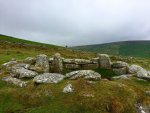
And there are plenty of neolithic relics to consider along the trails.

Beehive hut Dartmoor.jpg

I noticed that Land Rovers were most often used as farm vehicles in the north and around Dartmoor. The Defenders, 90s and 110s were fun to spot. A friend tells me that the Land Rover Defenders are in the country and the Land Rangers are in the city.

Rover 110 Defender.jpg

I'm also going to post a series of Rover photographs in the Land Rover Section of the forum. http://www.expeditionportal.com/forum/threads/161666-British-based-Land-Rovers

We are back with the Sprinter getting ready to head toward New Mexico, where we plan on spending the fall and winter.
 
Last edited:

Umnak

Adventurer
On the way to Farmington, New Mexico

Google maps a 1,350 mile route along interstates from Port Townsend, Washington to Farmington, New Mexico. We took Blue Highways and did it in just under 2,000 miles.

We stopped at the Sprinter Store south of Portland before heading east across the Cascades. I had a Sprinter Store sway bar installed last winter, which has made a big difference in our stability along Forest Service and BLM roads. We had hoped to buy a set of floor mats, but learned they are not held in stock and take quite a while to order.

The change in the land is pronounced once over the Cascades and through Bend. High Desert and heat become the norm. My public campground app showed a couple of BLM and Reclamation campgrounds close to the highway. We stopped for the night at the Chickahominy Reservoir on Route 20 before Burns. It was a hot day with temperatures in the low 90s. The cost of the camp, which has water and nice pit toilets was $4.00 with my Geezer Pass. We sat in the shade of the van until the sun moved close to the horizon, then moved to a view of the water and sunset. There is surprisingly little traffic along Route 20 at night, so we were able to sit in the cool evening and stargaze without the interference of headlights. Chickahominy Resivoir.jpg
Sunrise Chicamoniny.jpg

Our next camp was just outside of Austin, Nevada. We had driven a long day through very isolated sections of Oregon — a sign said no services for 120 miles, even though a few small communities dotted the route — and northern Nevada to Winnemucca where we chose to avoid the interstate and take another road south over the pass. The Bob Scotts Summit camp was at 7,200’ and nestled into a beautiful small forest service tract. Bob Scotts Summit.jpg
Bob Scotts Camp.jpg

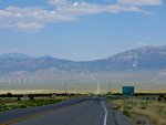
They call Route 50 both the Lincoln Highway and the Loneliest Highway in America. The former gets its name from the fact that the Lincoln Administration pushed ahead Nevada’s statehood in order to get a couple of Republican senators in Congress to support abolition. We’ve driven roads with less traffic, but the fact that it is a major highway and that it stumbles over Basin and Range to the Utah border, does give some credence to the brag about it being a lonely highway.
The Hickison Petroglyph site and campground is just down the highway a few miles from Bob Scotts Summit. A trail passes by a number of historic and very old petroglyphs.

Basin and Range.jpg
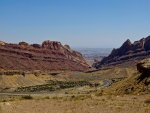
From Hickson, we drove east through the Great Basin and into Delta, Utah. Haze, either from distant fires or naturally occurring, obscured the long view. Still, we were impressed with the scale and topography, having never seen this country before. The passes are often dramatic and the valleys flat, dry and full of sage. Delta is a farming community sucking water from the local river. Its wide main street seems too large for the town, and there were many places shuttered.

The next leg to Moab was estimated at 4 hours, but we managed to stretch that to 7 with frequent gawking stops and to purchase the famous melons in Green River.
Rt 70.jpg

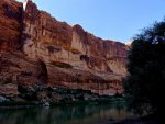
We got the last spot in the Goose Island Campground along the Colorado River. It was well into the 90s when we arrive at 4:00 pm. Fortunately, the sun went behind the cliff at 5 and gave us welcomed shade. This was one of the most dramatic camp sites we’ve found. The cliffs, the river and the desert are a remarkable combination.

Colorado River and Cliff at Goose Island Camp.jpg

There are not a lot of options for coffee in Moab on a Sunday morning. I’m sure the people in the Marriott and Hilton were sipping Starbucks, while we waited for the only shop to open. It’s Utah, so that’s understandable.

The road to Farmington in the Four Corners was more settled than the previous few days. We found a very nice place to rent in mid town, and then took off for four days to explore the region.

Angel Peak Camp.jpg

Desert Road.jpg

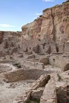
This is going to be a great place to learn about the high desert and Pre-Puebleon Culture. We used a free BLM camp at Angle Peak — and were the only ones there — for a night then went south to Chaco Canyon Culture Park. The Sprinter did well on the rough roads.

Chaco Great House.jpg
The great houses and Kivas are astonishing.
 
Hi, really enjoyed your thread! Looks like you are having an awesome time, and the van is holding up well, continued safe travels!

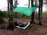
p.s. I'm impressed that you guys will just sleep under a tarp out in the open, if the weather and bugs permit. Have you ever considered using a hammock?
 

Umnak

Adventurer
Hi, really enjoyed your thread! Looks like you are having an awesome time, and the van is holding up well, continued safe travels!

p.s. I'm impressed that you guys will just sleep under a tarp out in the open, if the weather and bugs permit. Have you ever considered using a hammock?

I slept in a hammock for almost two years when I lived in Kabala, Sierra Leone back in the late 1970s. My problem with hammocks in Alaska was the need for both the hammock and the tarp to be coordinated enough to cover from the rain -- and it does rain a lot in Southeast Alaska -- and to figure out a way for the lines not to serve as a path for the water. A tarp and bivy provides a lot more options. We bought a tent for the desert because of the bugs, more specifically the huge spiders for whom Eve has no patience or love.
 

Arjan

Fossil Overlander
Oh man... this is so much a memory lane trip - please, please keep this running !!

Back in '77 & '78 I made several long trips with my late Canadian girlfriend.

This brings back many very good memories.

Thank you very much
 

Forum statistics

Threads
188,411
Messages
2,907,000
Members
230,176
Latest member
Arcadia1415
Top