NOPEC
Well-known member
NB: I hit the EP Photo cap with this Post. So I will send this first (the "paddling" Part and then send the "Overlanding" as Part 2) If that makes any sense at all......
We are just back from a couple of months of exploring the NWT by both kayak and with our truck and camper. I thought folks might be interested in seeing some images of our month long paddling trip on the south shore of Great Slave Lake and as well, getting a bit of an update on the newly finished super gravel "highway" which runs north from NWT Hwy 3, starting between Ft. Providence and Bechecho and ending in the hamlet of Wha ti' which is located on Lac la Martre (road constructed to the tune of 452 million $CDN....).
WARNING: theses posts are quite wordy and photo "heavy".....
Paddling - Part 1.
Great Slave Lake (GSL) is the 9th largest lake in the world and is basically a small freshwater ocean with winds to prove it. Four of us using hard shell single kayaks (all with ABS thermoform hulls, three Deltas and one Eddyline for the kayak teckies....) started at the community of Ft. Resolution which is near Wood Buffalo National Park on the south shore of GSL. The plan was to go east along the shore and into the new National Park known as "Thaidene nene" and then re-supply at the small village of Lutsel ke' which is within the Park boundaries. From there we planned to continue further east in the Park and into the depths of the Historic East Arm of GSL (any early visitors to the north and GSL such as trappers, geologists, fur traders, explorers, adventurers, etc. and worth their salt, would have travelled this area in the early days of the last few centuries, not to mention the first nations people who have lived here for thousands of years). We then planned a return by a slightly different route.
Sadly, early in the going, the water was unusually high which made finding campsites and take outs extremely difficult (the night spent sleeping (trying to) on a floating mass of driftwood was extra special...). The Athabasca/Peace/Slave River Delta was a mass of basically forest growing out of the water. Add in almost continual headwinds (despite what our daily Inreach weather forecast promised (lied to.. ) us regarding wind direction....). We were also continually bucking a slight west flowing current along the south shore of GSL as its water moves westward to the source of the Mackenzie River. So our estimated 20 to 25 km/days quickly turned in a dismissal average of 10 to15 km/days, so right from the start we were waaaay behind schedule. As well, I think we were all a bit generous with our estimations of personal stamina when thrown into the deep end (that's about a 3 beer discussion sometime..) However, as we moved east into the start of the pre-Cambrian Shield (or "Canadian Shield" as we Canucksters like to call it....) the scenery, water clarity, weather and spirits improved. If we had pushed on and followed our original plan, the time would never would have been made up and the trip would have been effectively double what we had planned. So we took stock of our 30 days of provisions and decided to truncate the trip to 30 days and not do a resupply. As it worked out, we got back to our starting point still with some GORP and one supper in hand so it worked out perfectly.
Despite all of the whining above, it was a superb trip and the combination of big water and the dotted hills and islands of the "shield" granite remains one of my absolutely favorite landscapes. For reference, it is very similar to some of the areas located around the Great Lakes.
Here are a few photos to give you a sense of the trip and the scenery......
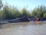
"log" campsite....(anything more than a light "doze", you were going swimming. We all survived though and were still dry when we left at 0400)
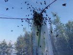
Horseflies regularly jointed us Inside "Big Bertha" our cooking/eating shelter. (interesting entomological observation was that once Horseflies get inside some sort of enclosure, they seem to spend all of their time trying to escape, where as all of the other little biting basstodds spend their time hunting the human prey that they are sharing the enclosure with..) For fun, Horseflies also love getting in between the fly sheet and the tent proper and then buzz and bounce the night away, having a great old time, until someone (me) eventually can't stand it any longer and staggers out and takes the fly sheet off and chases them away.....)
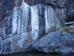
The leaching of the various mineral compounds found in the pre-Cambrian shield rock made for some interesting viewing.
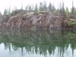
Rare calm water
Of course, the nightly sunsets are almost worth the price of admission alone. Sadly, we were usually too knackered and thus sleeping, to see many of them!
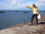
nothing sadder than posing (poser?) wannabe explorers... (especially after "summitting" a whopping 250 foot high round dome)
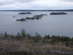
There were just hundreds of kilometers of this type of vista, similar in many ways to the Great Lakes, just no people!
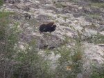
Lone Muskox Bull keeping an eye on us. We probably saw a dozen small and larger herds, many with spring calves, as well as single and small groups of two or three bulls hanging out together. The traditional range of the Muskox is changing in that they are moving south and were generally found on the North shore of GSL and further north into the Thelon game sanctuary. We had a lone bull wander through our campsite one night after we had turned in, it was really cool but it did tend to get one's attention........
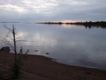
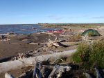
As we continued East, the camping opportunities continued to steadily improve.
To Be Continued......
We are just back from a couple of months of exploring the NWT by both kayak and with our truck and camper. I thought folks might be interested in seeing some images of our month long paddling trip on the south shore of Great Slave Lake and as well, getting a bit of an update on the newly finished super gravel "highway" which runs north from NWT Hwy 3, starting between Ft. Providence and Bechecho and ending in the hamlet of Wha ti' which is located on Lac la Martre (road constructed to the tune of 452 million $CDN....).
WARNING: theses posts are quite wordy and photo "heavy".....
Paddling - Part 1.
Great Slave Lake (GSL) is the 9th largest lake in the world and is basically a small freshwater ocean with winds to prove it. Four of us using hard shell single kayaks (all with ABS thermoform hulls, three Deltas and one Eddyline for the kayak teckies....) started at the community of Ft. Resolution which is near Wood Buffalo National Park on the south shore of GSL. The plan was to go east along the shore and into the new National Park known as "Thaidene nene" and then re-supply at the small village of Lutsel ke' which is within the Park boundaries. From there we planned to continue further east in the Park and into the depths of the Historic East Arm of GSL (any early visitors to the north and GSL such as trappers, geologists, fur traders, explorers, adventurers, etc. and worth their salt, would have travelled this area in the early days of the last few centuries, not to mention the first nations people who have lived here for thousands of years). We then planned a return by a slightly different route.
Sadly, early in the going, the water was unusually high which made finding campsites and take outs extremely difficult (the night spent sleeping (trying to) on a floating mass of driftwood was extra special...). The Athabasca/Peace/Slave River Delta was a mass of basically forest growing out of the water. Add in almost continual headwinds (despite what our daily Inreach weather forecast promised (lied to..
Despite all of the whining above, it was a superb trip and the combination of big water and the dotted hills and islands of the "shield" granite remains one of my absolutely favorite landscapes. For reference, it is very similar to some of the areas located around the Great Lakes.
Here are a few photos to give you a sense of the trip and the scenery......
"log" campsite....(anything more than a light "doze", you were going swimming. We all survived though and were still dry when we left at 0400)

Horseflies regularly jointed us Inside "Big Bertha" our cooking/eating shelter. (interesting entomological observation was that once Horseflies get inside some sort of enclosure, they seem to spend all of their time trying to escape, where as all of the other little biting basstodds spend their time hunting the human prey that they are sharing the enclosure with..) For fun, Horseflies also love getting in between the fly sheet and the tent proper and then buzz and bounce the night away, having a great old time, until someone (me) eventually can't stand it any longer and staggers out and takes the fly sheet off and chases them away.....)

The leaching of the various mineral compounds found in the pre-Cambrian shield rock made for some interesting viewing.

Rare calm water

Of course, the nightly sunsets are almost worth the price of admission alone. Sadly, we were usually too knackered and thus sleeping, to see many of them!

nothing sadder than posing (poser?) wannabe explorers... (especially after "summitting" a whopping 250 foot high round dome)

There were just hundreds of kilometers of this type of vista, similar in many ways to the Great Lakes, just no people!

Lone Muskox Bull keeping an eye on us. We probably saw a dozen small and larger herds, many with spring calves, as well as single and small groups of two or three bulls hanging out together. The traditional range of the Muskox is changing in that they are moving south and were generally found on the North shore of GSL and further north into the Thelon game sanctuary. We had a lone bull wander through our campsite one night after we had turned in, it was really cool but it did tend to get one's attention........

As we continued East, the camping opportunities continued to steadily improve.

To Be Continued......
Last edited:
