Phoo
Observer
Stardate: 2017.8.9
Local Coordinates: 46.870114, -113.985723
Ship's Log:
- Data Shifting and Blasting North -
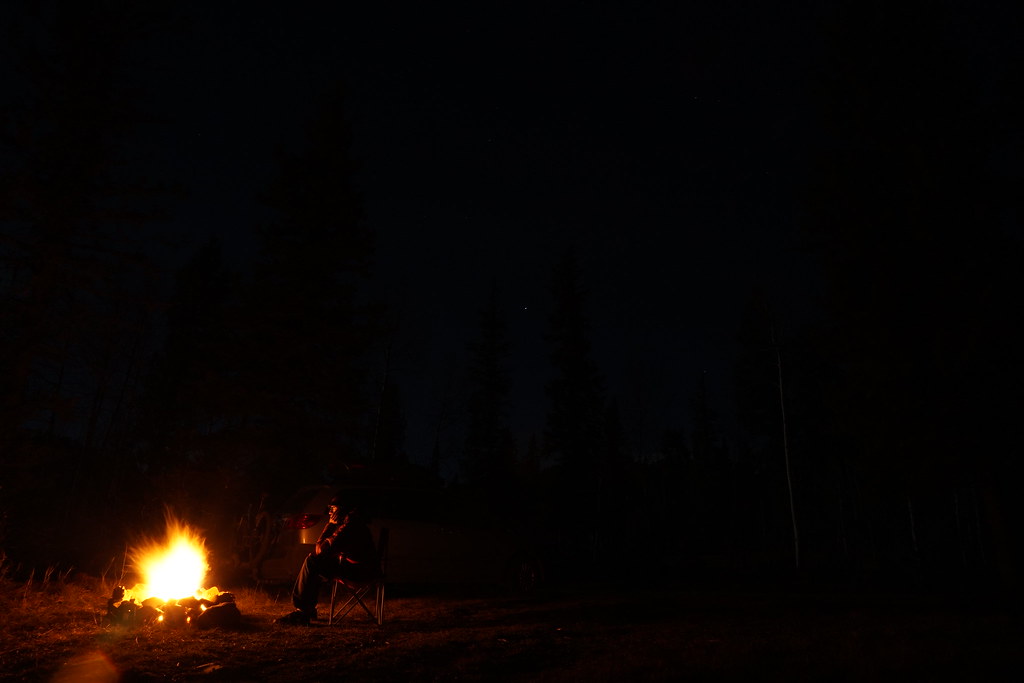
In the pointy headed world of math/science/engineering, we often use the term “normalizing” to refer to the process of shifting a datum or data either to unity or some commonly recognized numerical range. Colloquially, it's more like “gettin' used ta sumpn' differnt”. Extended travel through beautiful places has a notable normalizing effect on one's perception of reality. As my time adrift marches onward, I am less inclined to snap photos of outrageous sunsets, inky-black night skies illuminated only by the blaze of distant stars spilled across yawning infinitum, one more impossibly jagged mountain range, one more bottomless canyon. That is my New Normal. Y2 = Y1 * Z where Z = 1 / [AWESOME]. Then, I remember that I've long since passed apogee, and there are just precious months left before touching down in reality. The old normal. Days illuminated by LCD computer screens and nights blotted by sodium vapor street lamps. Angry drivers in caffeine withdrawal rage-stupor. Deadlines and responsibility. The daily grind. It's coming for me, and I think about it now and again. Creeping into the corners of my consciousness. Mold in the peripheries of a dark, musty basement.
Precious months. That's still a fair chunk of time to get some stuff done.
So for now,
Landing gear up, flaps up, nose to the sky and full afterburner.
Real Life can eat my shockwave.
For now.
Right. So, where was I?
Ah, yes. Being overtly melodramatic. Yeah, yeah, yeah.
Since I finally escaped the gravitational pull of Oregon, life has been a blur of constant motion, with more adventures and experiences than I can reasonably keep track of. I'll share some of the more memorable outings, or at least when I remembered to pull out my camera.
Mt. Rainier Splitboarding -
Between ever increasing temperatures and a nagging foot injury, I've been telling myself for some time that “this will be the last one”, only to dig out my winter gear for yet another mountain mission a couple of weeks later. Sadly, this truly was the last one (until December, of course). The approach was long and the snow mediocre, but I was blessed with great touring partners, astonishing views and inspiration for bigger adventures to come.
Our day started in the White River campground parking lot, slinging heavy packs, surrounded by all manner of folks escaping the heat of the city for the Independence Day weekend.
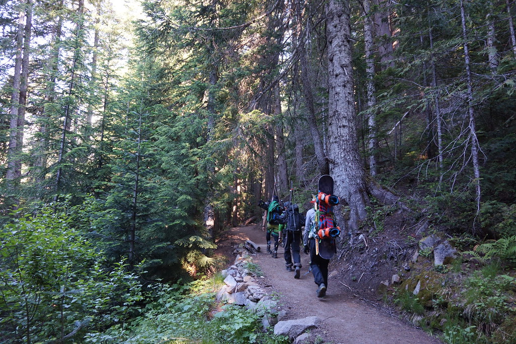
The approach was a fairly easy four mile, dry hike up a well worn path.
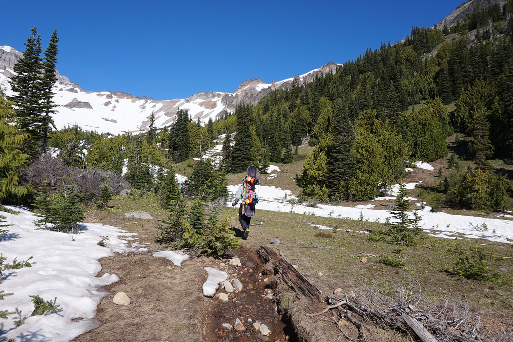
Pushing past treeline, we found snow and glimpses of the behemoth.
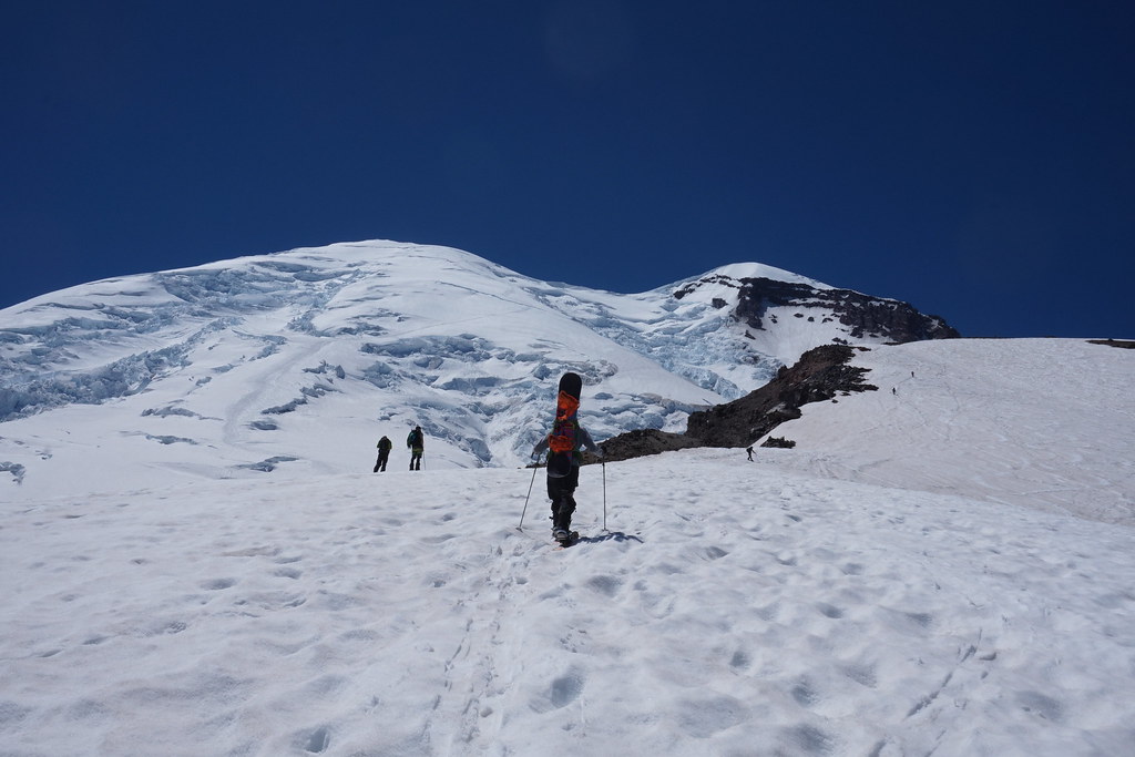
This trip ended a few hundred feet below 10k on Steamboat Prow of the Inter Glacier (right side of the photo), while the mighty Emmons Glacier (left side of the photo) extends toward the 14,411 foot summit. Zoom in and try to spot the tiny climber-specs as they slog their way up. I can confidently say that I don't currently have the mountaineering chops to get there quite yet, but look forward to getting up there on a return trip in the near future.
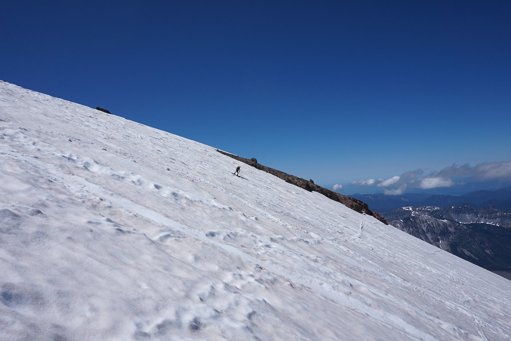
The ride down varied from half frozen chop to sticky applesauce, with every other texture in between, but as always, was well worth the effort.
Enchantments Through Hike -
The next stop on my slow march out of the Pacific Northwest was the quaint and slightly goofy little town of Leavenworth, Washington. For whatever reason, the entire town is built in an old-timey Bavarian theme. Even the local McDonalds. As you might guess, that's not exactly my jam, nor what I came for. My primary objective was an approximately 18 mile hike through a swath of wilderness, home to a string of mountain lakes called The Enchantments. Due to its popularity, overnight camping in the area requires a permit, for which there is a lottery. As with any lottery, you can't win if you don't play. BUT, if you are dumb enough, you can feel free to hike the whole thing in one shot and not worry about the camping permit. And so, determination plus stupidity = ?
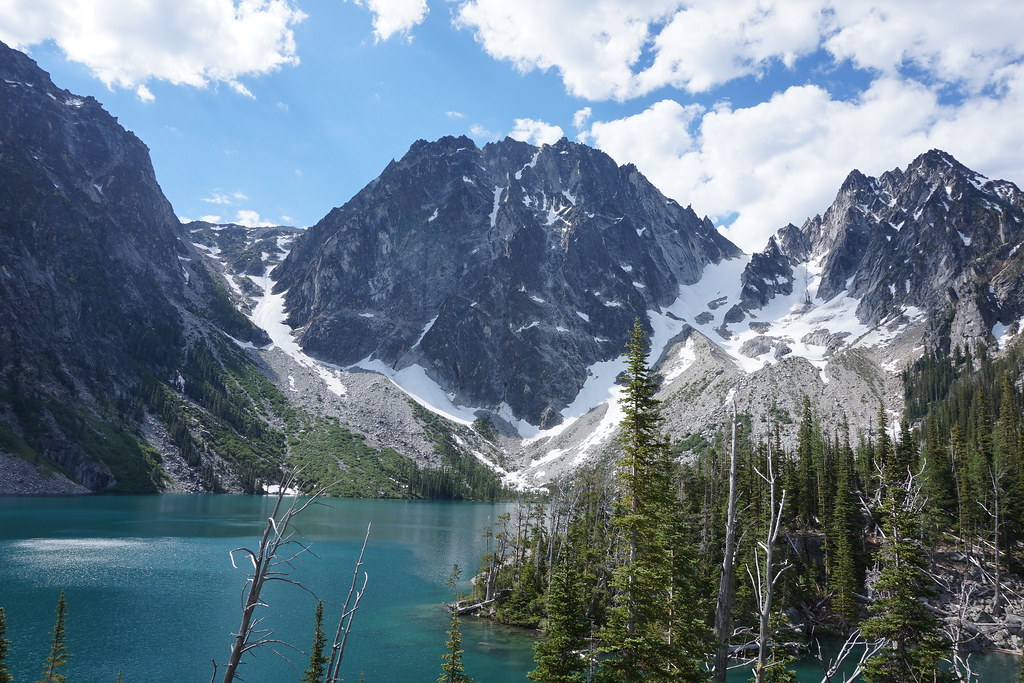
Feeling fresh and happy with my progress a few miles in, I stopped to admire Colchuck Lake. The first of several magnificent blue pools, Colchuck sits at the foot of Asgard Pass. The pass is the rocky, partially snow covered gap in the mountains. If it looks tall, it is, and the trail goes right up the center.
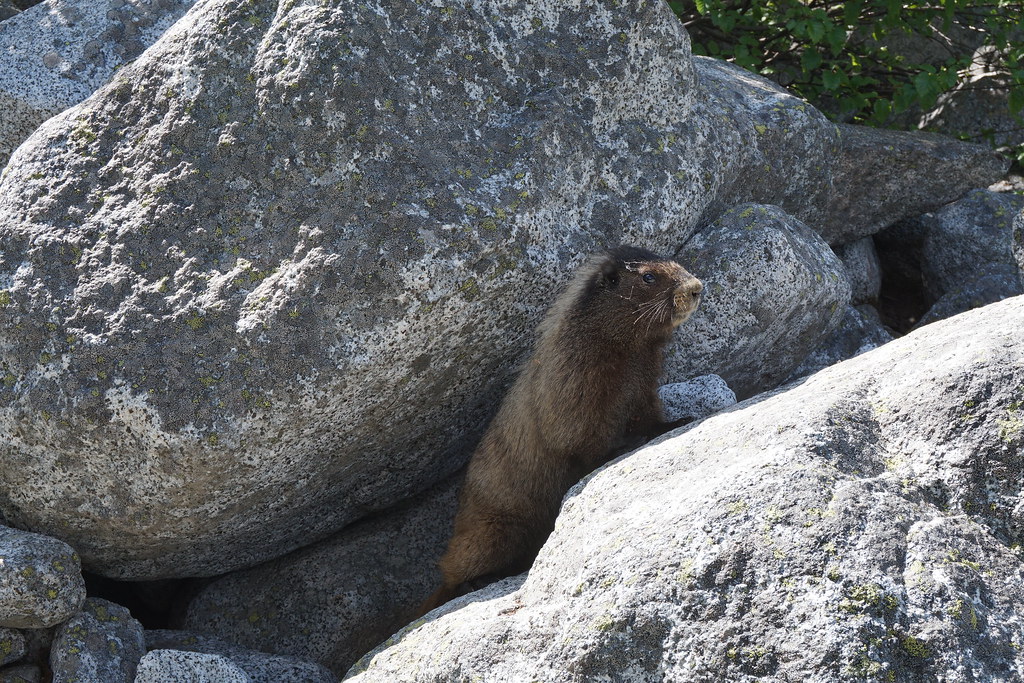
One of the friendly locals greeted me on the way up. He clearly had no fear, and was probably expecting an edible donation.
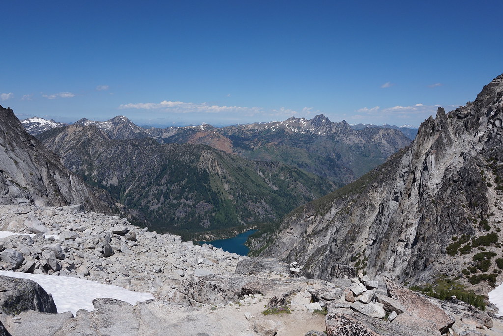
After much sweat and effort, I enjoyed this view from the top. From there, things got interesting

A fair number of hours later, after trudging through deep snow, dodging some overly curious mountain goats and tracking a magically vanishing trail. I'm smiling here because I've more or less descended past the snow line.
I was a bit too busy racing the sun to take a lot of pictures, but it is a truly stunning bit of wilderness. Just under 12 hours after my start, I staggered back to the van. Solid Class II fun, for sure.
Squamish/Whistler Mountain Biking -
Are you really from Pennsylvania?
Did you actually drive all of the way here?
How long did that take?
And where are you headed?
What will you be doing there?
Where were you last?
What were you doing there?
Are you employed?
How are you funding this trip?
How much money do you have access to?
I love border crossings.
After a brief stay in Bellingham, Washington, having enjoyed some of their local trails and a pleasantly divey blues bar, I crossed back into British Columbia yet again. On this occasion, I was meeting up with a few members of the PDX splitboard tribe for some world class mountain biking.
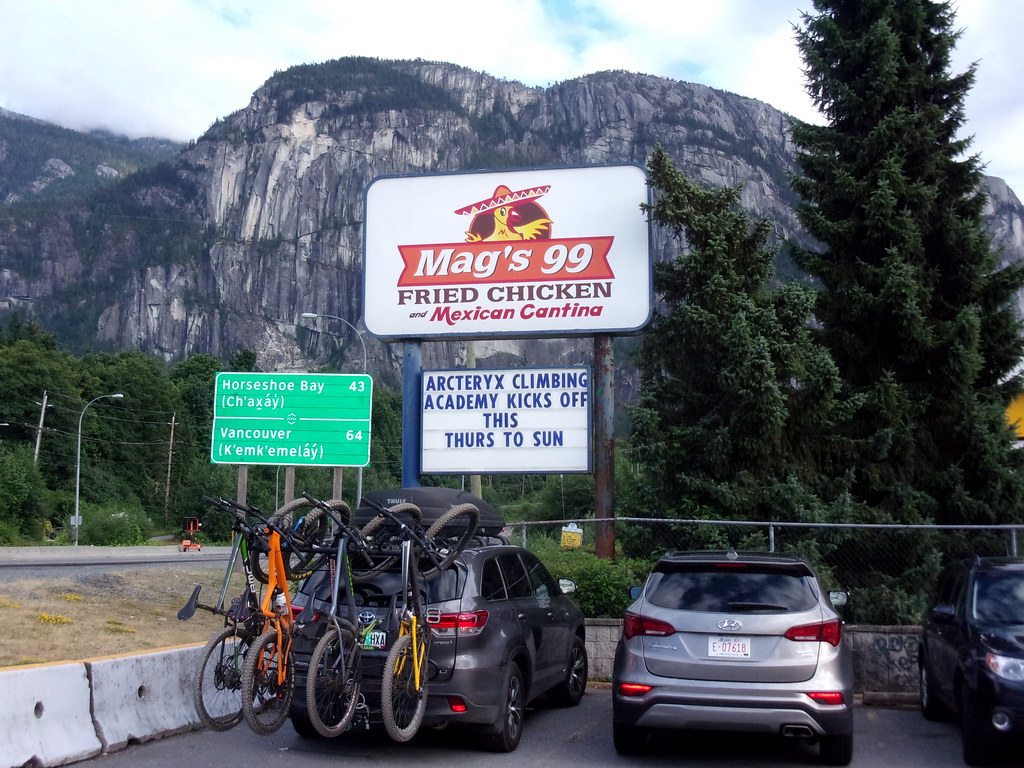
This photo sums up a lot of my thoughts and memories of Squamish. Fast food, bikes and climbing. That's Jesse's land yacht all loaded up with bikes, but if I were to zoom out, you'd see that most of the vehicles in the parking lot were similarly packed. Squamish is a very active town. Rock climbing is the other summertime activity that draws people here. That giant rock wall in the background is known as “the chief”, and is the popular destination for that particular tribe.
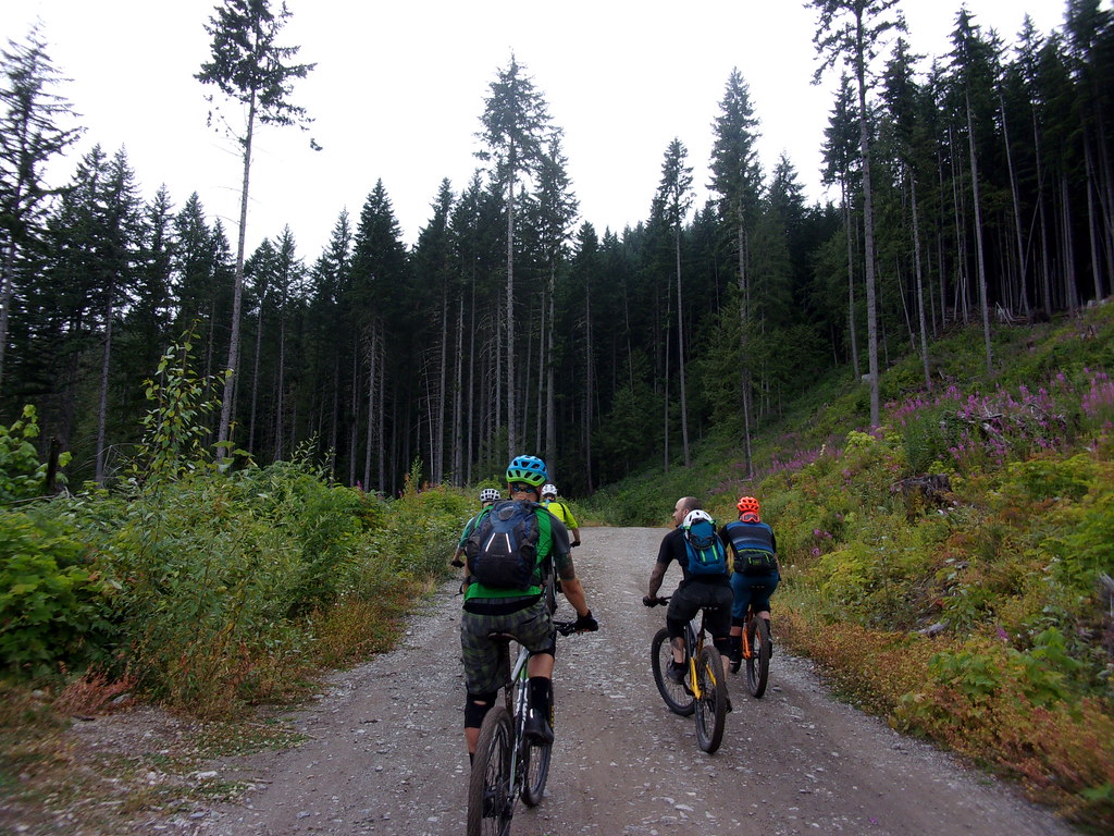
On our first day of riding, we met up with Jesse's Canadian buddy, Dan, for some smooth, jumpy, flow trails in a zone called Highland
But the main event was our attempt of the Top of the World Trail at Whistler Bike Park. Feeling good after a couple of laps through the lower park trails, we rode the gondola to the top for the beginning of a long, difficult day in the saddle.

Standing in line for the lifts.
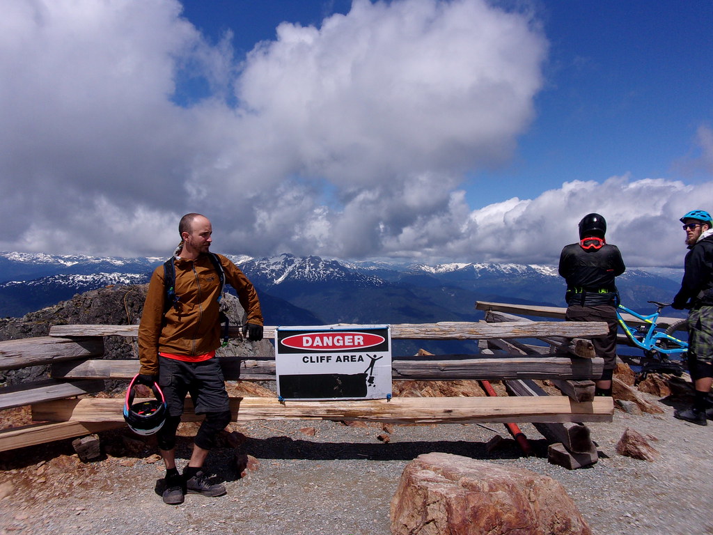
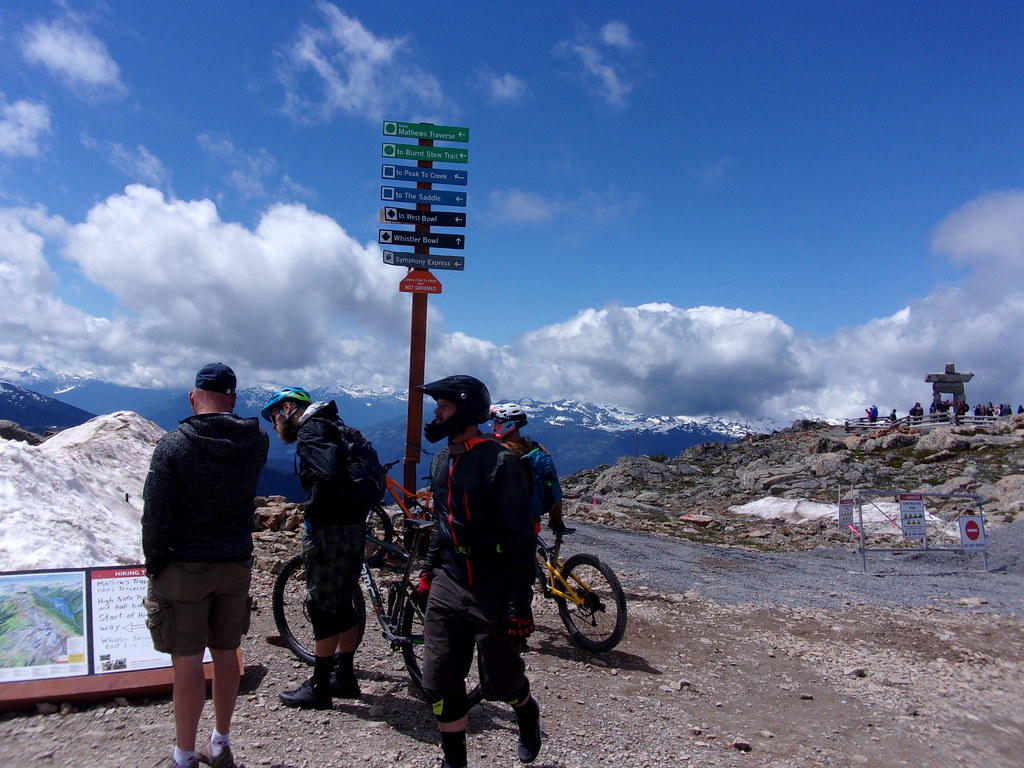
We were greeted by snow and cool temperatures at the top. Notice how content and happy we all look. This is before the mountain ground us into dust.
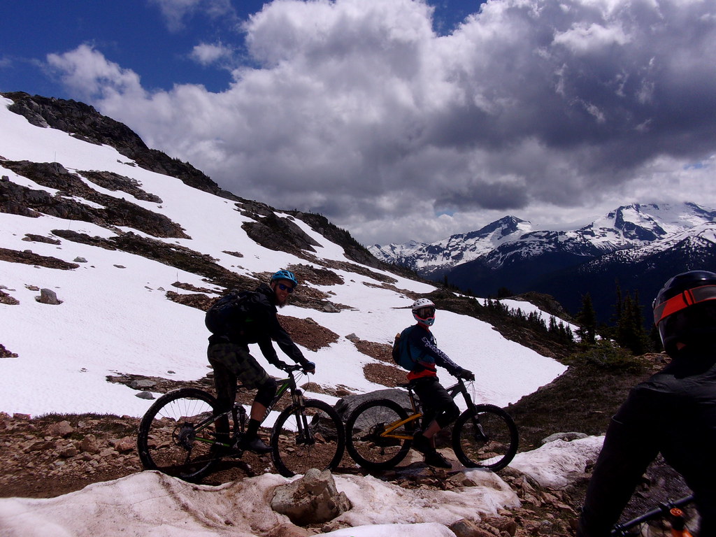
Top of the World Trail starts with a few rock drops, roll-ins and other technical features, but quickly mellows out. And, of course, the views were stunning. This is about where “fun”, as it is typically defined, ended, and the adventure began. About halfway down the trail, there is a turnoff onto another trail system that goes outside of the resort proper, then loops back to join one of the park's outermost service roads. Studly adventurers as we are (or thought at the time), the plan was to leave the silly tourists behind, taking the trails, Khyber Pass, Middle of Nowhere and Kush through the dense Pacific Coast rain forest to enjoy some extra awesome. The problem with that, is Whistler. Whistler, and B.C. in general, is where you go to truly test your mettle as a rider. It is a site of pilgrimage for the two-wheeled tribe. Thus, chances are that down-mountain trails ducking out of the safe confines of the resort were pioneered by and are ridden by folk several clicks gnarlier than you (and most certainly me), even in the most ambitious of dreams.
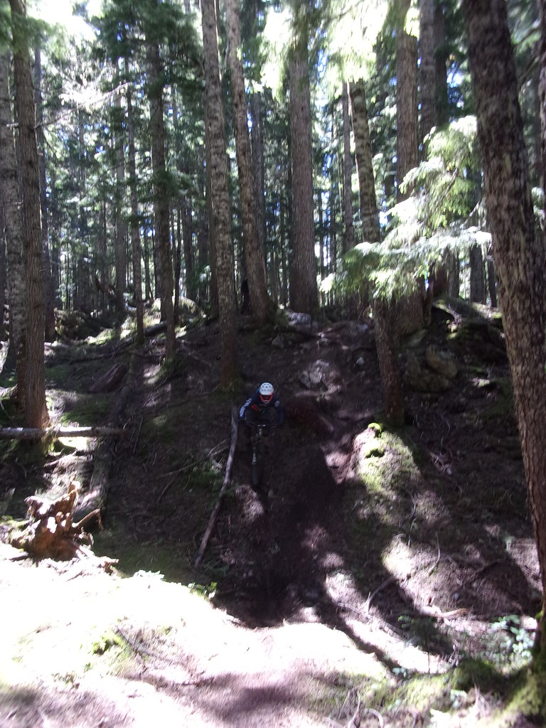
Needless, to say, I was quite busy for a while, and the camera rarely came out of the bag. I did manage to snag this one grainy photo of Jay sending it down a slick, rooty, near vertical section of trail.
There was a bit of walking, some bruised egos and a broken pinky, but we all survived and earned another interesting life story. Hey, remember that time Whistler mopped the floor with us? Yeah. Sweet, dude.
After my buddies returned to their regularly scheduled lives, I managed one more day of riding in the area, on a rugged cross country trail called “Comfortably Numb”.
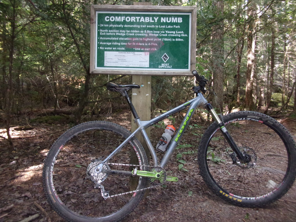
While far less fear inducing, Comfortably Numb was a rough grind, featuring one very long climb over notably chunky terrain. The trailhead sign is no joke.
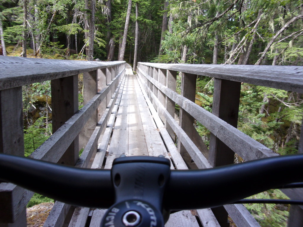
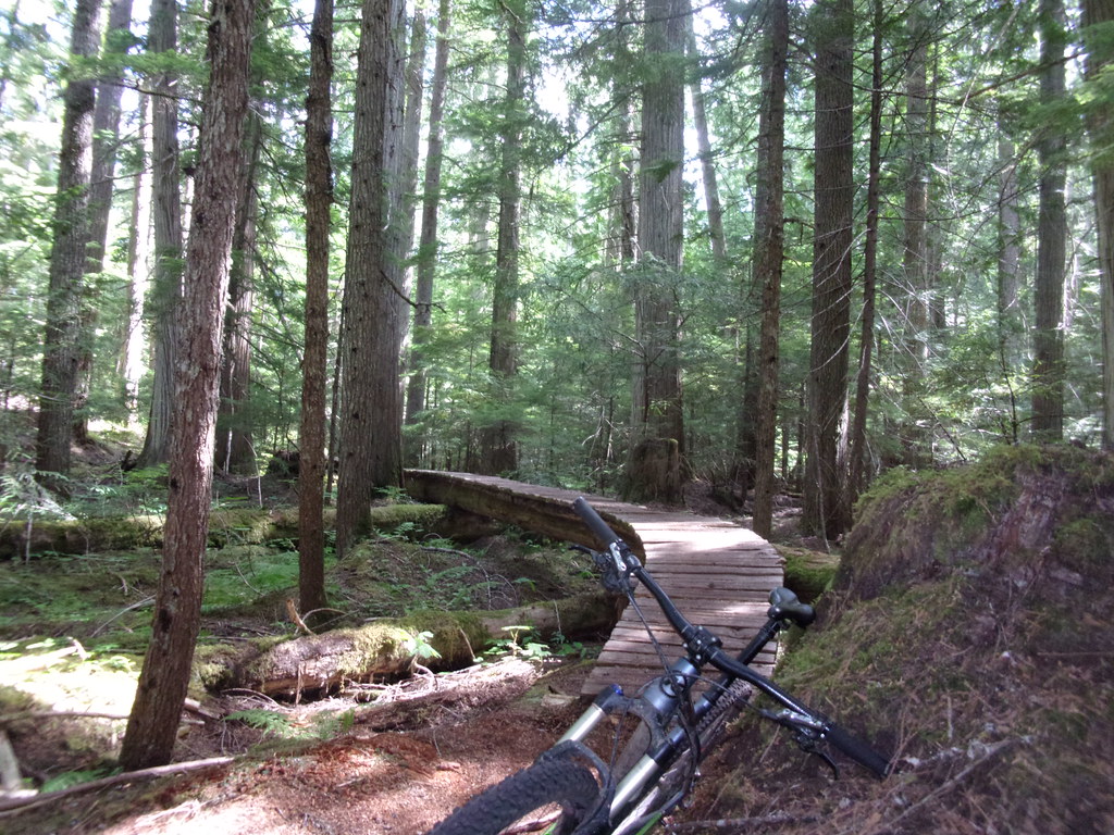
A couple of the more tame wooden trail features.
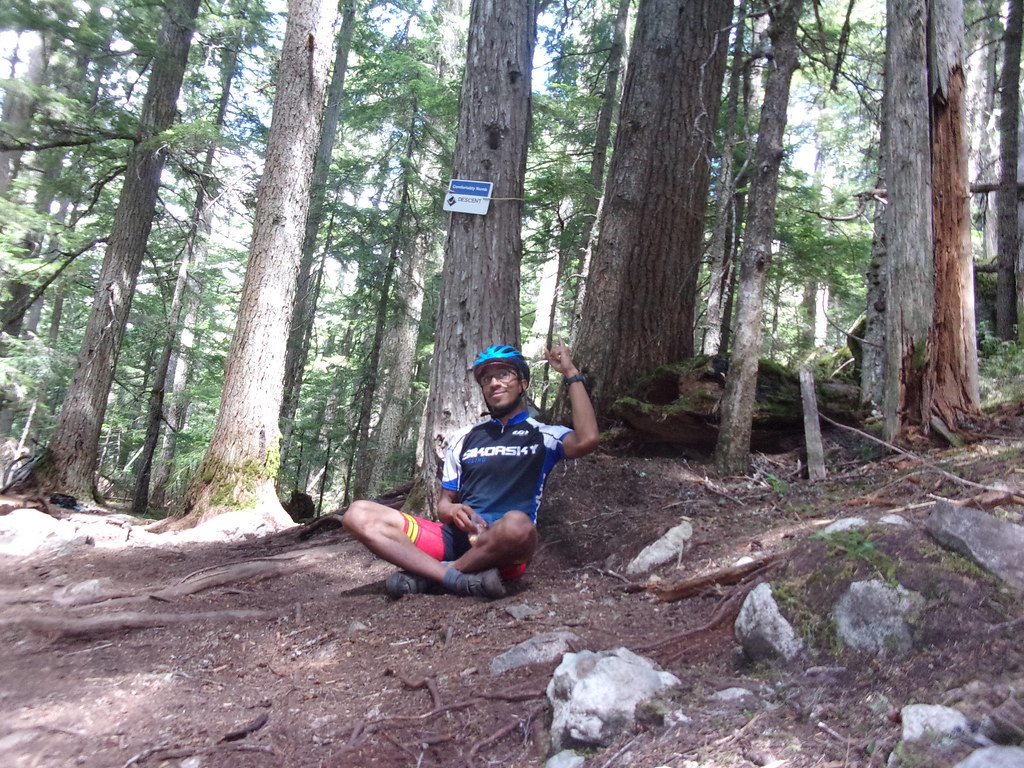
After about three hours of nearly continuous uphill, I reached the start of the big descent and broke out my victory cookies.
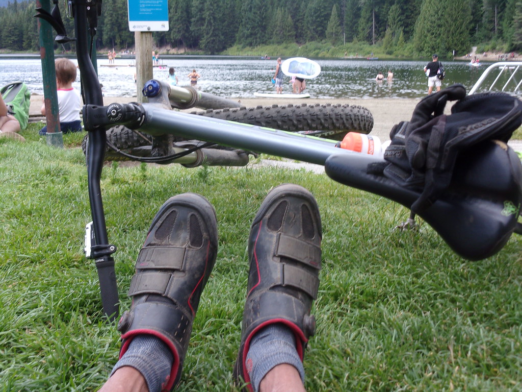
After about four total hours in the saddle, I reached Lost Lake, effectively marking the end of the ride.
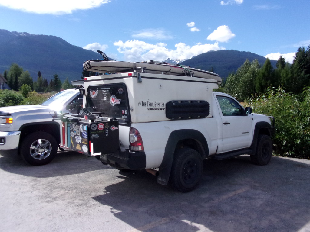
Shoutout to fellow travelers The Trail Gypsies . Spotted their rig in the Whistler Village parking lot
Seven Summits Mountain Bike -
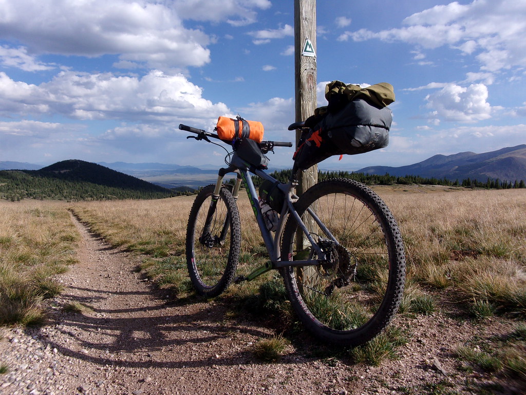
My last and probably favorite ride in B.C. was the Seven Summits loop in Rossland. Typically ridden as a one-way outing, facilitated by a shuttle dropoff, Seven Summits starts with a stout climb, followed undulating, predominately, downhill singletrack across an exposed, alpine ridgeline. The trail proper is 18 miles in length, with a couple extra on a second trail system to get back to the road. Being the cheapskate dirtbag that I am, I opted to save the $25 it would have cost to take the shuttle and simply rode to/from the trail heads.
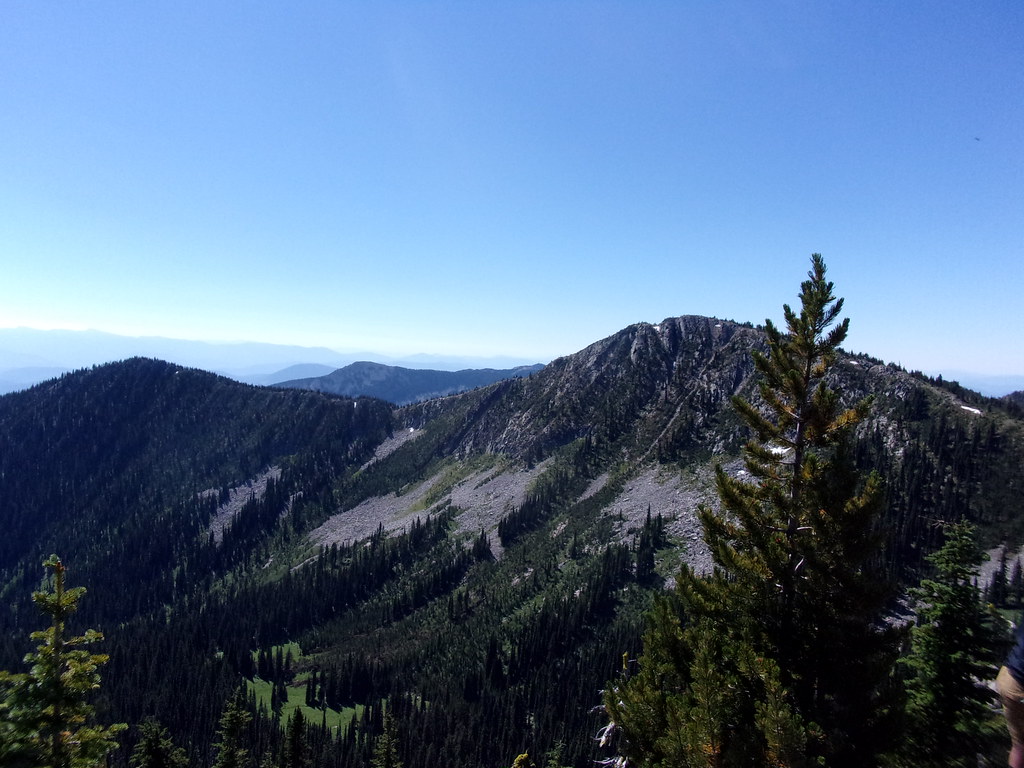
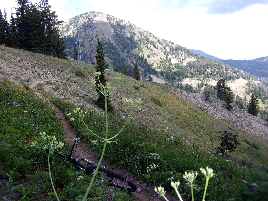
The trail traces the ridge in the background of this photo.
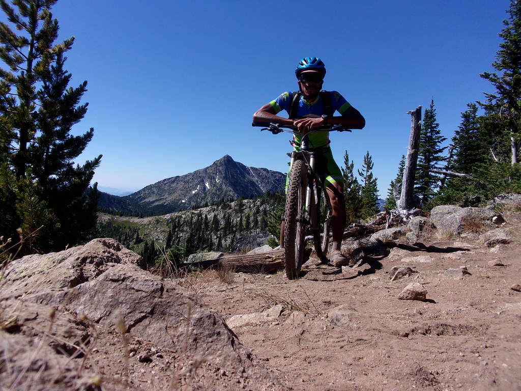
Standing at the top of the long, opening singletrack climb, having a logged a few thousand feet and a fair number of miles.
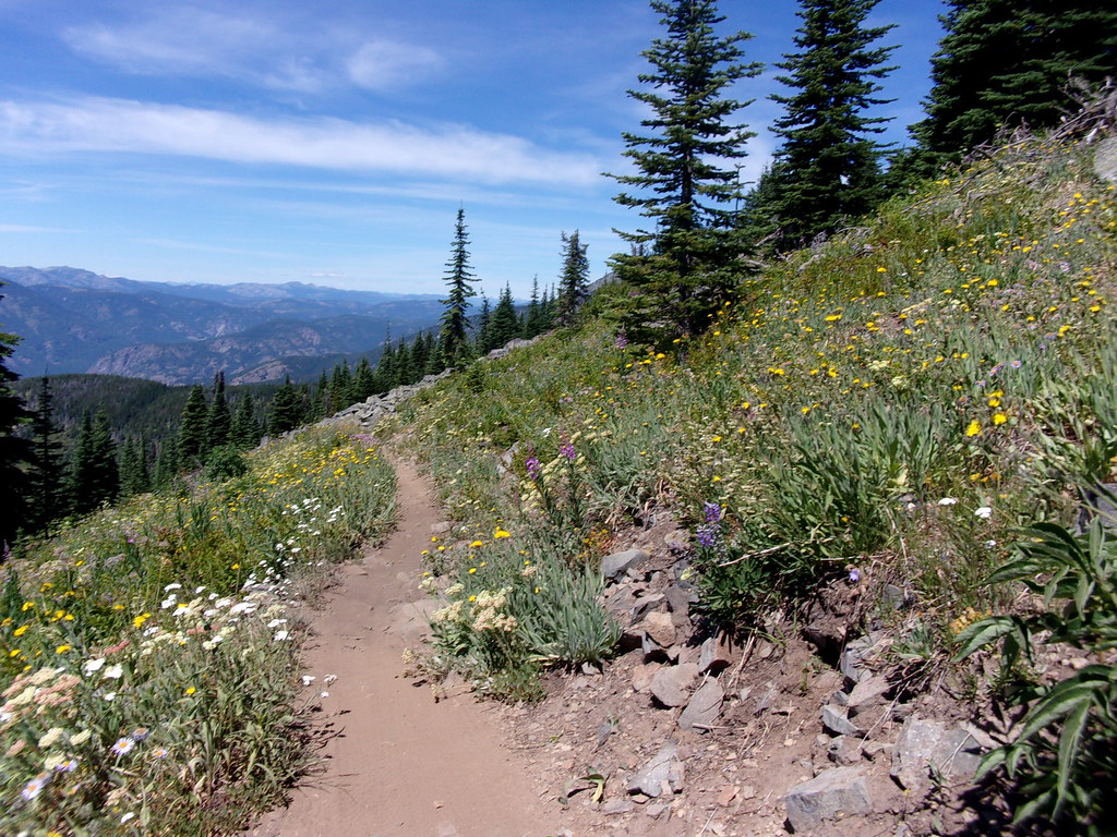
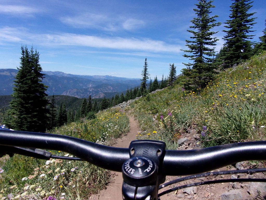
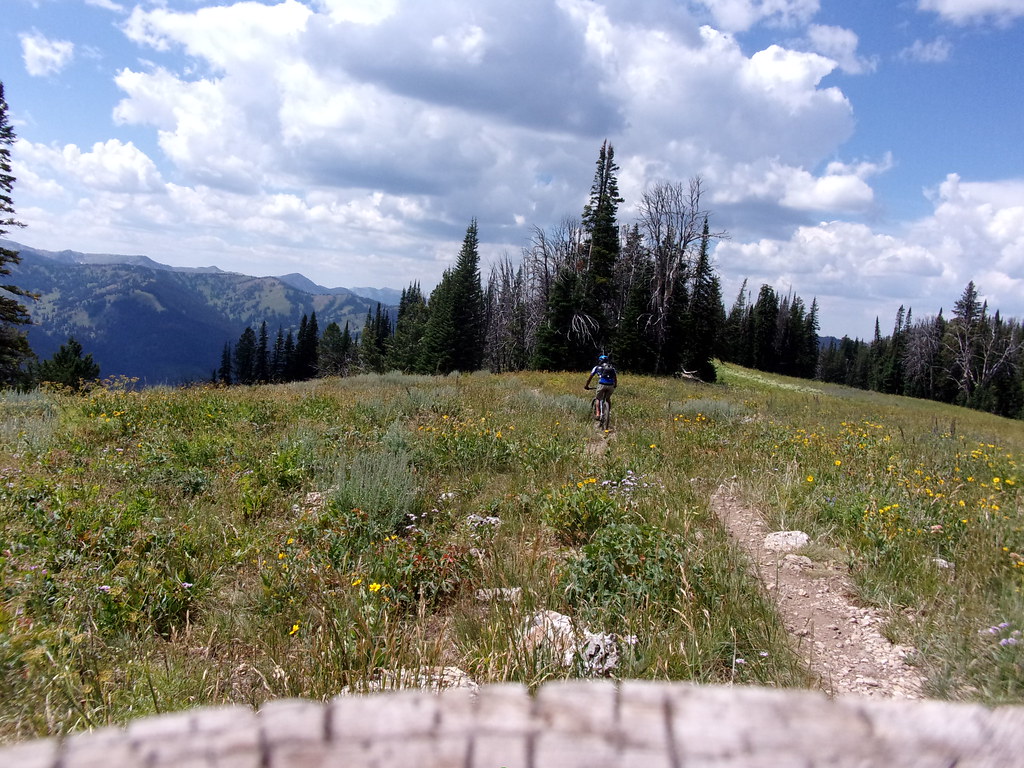
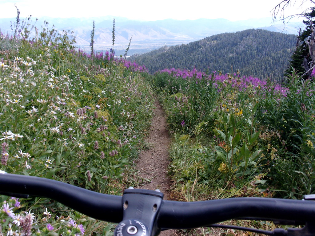
Remember that dream you had? Blue skies, perfect temperatures, endless, rolling, wildflower lined trail across a dramatic mountain skyline? Yeah, that one. This was the physical manifestation of that dream.
Out of water, out of food, completely wrung out, enjoying the 90ish degree heat of the valley, with 40 miles and quite a few hours in the bag, I reached my starting point in Rossland and contemplated my departure from Canada.
Are you really from Pennsylvania?
- Yes.
Where did you visit in Canada?
- Rossland.
What were you doing there?
- Mountain biking.
Where were you before that?
- Whistler.
What were you doing there?
- Mountain biking?
Where you before that?
- Bellingham.
What were you doing there?
- Mountain biking.
What is your occupation?
- Well, I was an engineer, bu-...
Was?
- Currently a space pirate.
Any fruits or vegetables?
- Some strange berries I lifted from Endor.
Any weapons?
- Just the turret mounted photon canon.
Okay. Have a great day.
WELCOME TO IDAHO!
Gear up. Flaps up. Now, just eeeease back on the stick and watch the ground slip away...
'Phoo is Listening:
While tripping my way out of the PNW, I took a little detour to Spokane, WA to see the Marcus King Band play. Certainly not on my way to anywhere I was trying to get to, but well worth the miles. The dude looks a bit like Sam Kinison, sounds like a young Warren Haynes, and plays with a band reminiscent of Tower of Power (where were YOU in the '70s?). No clips from the actual show, but I'll leave you with their Jam in the Van session, which I feel is equally appropriate, for obvious reasons.
Plant Your Corn Early - LINK!
Local Coordinates: 46.870114, -113.985723
Ship's Log:
- Data Shifting and Blasting North -
In the pointy headed world of math/science/engineering, we often use the term “normalizing” to refer to the process of shifting a datum or data either to unity or some commonly recognized numerical range. Colloquially, it's more like “gettin' used ta sumpn' differnt”. Extended travel through beautiful places has a notable normalizing effect on one's perception of reality. As my time adrift marches onward, I am less inclined to snap photos of outrageous sunsets, inky-black night skies illuminated only by the blaze of distant stars spilled across yawning infinitum, one more impossibly jagged mountain range, one more bottomless canyon. That is my New Normal. Y2 = Y1 * Z where Z = 1 / [AWESOME]. Then, I remember that I've long since passed apogee, and there are just precious months left before touching down in reality. The old normal. Days illuminated by LCD computer screens and nights blotted by sodium vapor street lamps. Angry drivers in caffeine withdrawal rage-stupor. Deadlines and responsibility. The daily grind. It's coming for me, and I think about it now and again. Creeping into the corners of my consciousness. Mold in the peripheries of a dark, musty basement.
Precious months. That's still a fair chunk of time to get some stuff done.
So for now,
Landing gear up, flaps up, nose to the sky and full afterburner.
Real Life can eat my shockwave.
For now.
Right. So, where was I?
Ah, yes. Being overtly melodramatic. Yeah, yeah, yeah.
Since I finally escaped the gravitational pull of Oregon, life has been a blur of constant motion, with more adventures and experiences than I can reasonably keep track of. I'll share some of the more memorable outings, or at least when I remembered to pull out my camera.
Mt. Rainier Splitboarding -
Between ever increasing temperatures and a nagging foot injury, I've been telling myself for some time that “this will be the last one”, only to dig out my winter gear for yet another mountain mission a couple of weeks later. Sadly, this truly was the last one (until December, of course). The approach was long and the snow mediocre, but I was blessed with great touring partners, astonishing views and inspiration for bigger adventures to come.
Our day started in the White River campground parking lot, slinging heavy packs, surrounded by all manner of folks escaping the heat of the city for the Independence Day weekend.

The approach was a fairly easy four mile, dry hike up a well worn path.

Pushing past treeline, we found snow and glimpses of the behemoth.

This trip ended a few hundred feet below 10k on Steamboat Prow of the Inter Glacier (right side of the photo), while the mighty Emmons Glacier (left side of the photo) extends toward the 14,411 foot summit. Zoom in and try to spot the tiny climber-specs as they slog their way up. I can confidently say that I don't currently have the mountaineering chops to get there quite yet, but look forward to getting up there on a return trip in the near future.

The ride down varied from half frozen chop to sticky applesauce, with every other texture in between, but as always, was well worth the effort.
Enchantments Through Hike -
The next stop on my slow march out of the Pacific Northwest was the quaint and slightly goofy little town of Leavenworth, Washington. For whatever reason, the entire town is built in an old-timey Bavarian theme. Even the local McDonalds. As you might guess, that's not exactly my jam, nor what I came for. My primary objective was an approximately 18 mile hike through a swath of wilderness, home to a string of mountain lakes called The Enchantments. Due to its popularity, overnight camping in the area requires a permit, for which there is a lottery. As with any lottery, you can't win if you don't play. BUT, if you are dumb enough, you can feel free to hike the whole thing in one shot and not worry about the camping permit. And so, determination plus stupidity = ?

Feeling fresh and happy with my progress a few miles in, I stopped to admire Colchuck Lake. The first of several magnificent blue pools, Colchuck sits at the foot of Asgard Pass. The pass is the rocky, partially snow covered gap in the mountains. If it looks tall, it is, and the trail goes right up the center.

One of the friendly locals greeted me on the way up. He clearly had no fear, and was probably expecting an edible donation.

After much sweat and effort, I enjoyed this view from the top. From there, things got interesting

A fair number of hours later, after trudging through deep snow, dodging some overly curious mountain goats and tracking a magically vanishing trail. I'm smiling here because I've more or less descended past the snow line.
I was a bit too busy racing the sun to take a lot of pictures, but it is a truly stunning bit of wilderness. Just under 12 hours after my start, I staggered back to the van. Solid Class II fun, for sure.
Squamish/Whistler Mountain Biking -
Are you really from Pennsylvania?
Did you actually drive all of the way here?
How long did that take?
And where are you headed?
What will you be doing there?
Where were you last?
What were you doing there?
Are you employed?
How are you funding this trip?
How much money do you have access to?
I love border crossings.
After a brief stay in Bellingham, Washington, having enjoyed some of their local trails and a pleasantly divey blues bar, I crossed back into British Columbia yet again. On this occasion, I was meeting up with a few members of the PDX splitboard tribe for some world class mountain biking.

This photo sums up a lot of my thoughts and memories of Squamish. Fast food, bikes and climbing. That's Jesse's land yacht all loaded up with bikes, but if I were to zoom out, you'd see that most of the vehicles in the parking lot were similarly packed. Squamish is a very active town. Rock climbing is the other summertime activity that draws people here. That giant rock wall in the background is known as “the chief”, and is the popular destination for that particular tribe.

On our first day of riding, we met up with Jesse's Canadian buddy, Dan, for some smooth, jumpy, flow trails in a zone called Highland
But the main event was our attempt of the Top of the World Trail at Whistler Bike Park. Feeling good after a couple of laps through the lower park trails, we rode the gondola to the top for the beginning of a long, difficult day in the saddle.

Standing in line for the lifts.


We were greeted by snow and cool temperatures at the top. Notice how content and happy we all look. This is before the mountain ground us into dust.

Top of the World Trail starts with a few rock drops, roll-ins and other technical features, but quickly mellows out. And, of course, the views were stunning. This is about where “fun”, as it is typically defined, ended, and the adventure began. About halfway down the trail, there is a turnoff onto another trail system that goes outside of the resort proper, then loops back to join one of the park's outermost service roads. Studly adventurers as we are (or thought at the time), the plan was to leave the silly tourists behind, taking the trails, Khyber Pass, Middle of Nowhere and Kush through the dense Pacific Coast rain forest to enjoy some extra awesome. The problem with that, is Whistler. Whistler, and B.C. in general, is where you go to truly test your mettle as a rider. It is a site of pilgrimage for the two-wheeled tribe. Thus, chances are that down-mountain trails ducking out of the safe confines of the resort were pioneered by and are ridden by folk several clicks gnarlier than you (and most certainly me), even in the most ambitious of dreams.

Needless, to say, I was quite busy for a while, and the camera rarely came out of the bag. I did manage to snag this one grainy photo of Jay sending it down a slick, rooty, near vertical section of trail.
There was a bit of walking, some bruised egos and a broken pinky, but we all survived and earned another interesting life story. Hey, remember that time Whistler mopped the floor with us? Yeah. Sweet, dude.
After my buddies returned to their regularly scheduled lives, I managed one more day of riding in the area, on a rugged cross country trail called “Comfortably Numb”.

While far less fear inducing, Comfortably Numb was a rough grind, featuring one very long climb over notably chunky terrain. The trailhead sign is no joke.


A couple of the more tame wooden trail features.

After about three hours of nearly continuous uphill, I reached the start of the big descent and broke out my victory cookies.

After about four total hours in the saddle, I reached Lost Lake, effectively marking the end of the ride.

Shoutout to fellow travelers The Trail Gypsies . Spotted their rig in the Whistler Village parking lot
Seven Summits Mountain Bike -
My last and probably favorite ride in B.C. was the Seven Summits loop in Rossland. Typically ridden as a one-way outing, facilitated by a shuttle dropoff, Seven Summits starts with a stout climb, followed undulating, predominately, downhill singletrack across an exposed, alpine ridgeline. The trail proper is 18 miles in length, with a couple extra on a second trail system to get back to the road. Being the cheapskate dirtbag that I am, I opted to save the $25 it would have cost to take the shuttle and simply rode to/from the trail heads.

The trail traces the ridge in the background of this photo.

Standing at the top of the long, opening singletrack climb, having a logged a few thousand feet and a fair number of miles.


Remember that dream you had? Blue skies, perfect temperatures, endless, rolling, wildflower lined trail across a dramatic mountain skyline? Yeah, that one. This was the physical manifestation of that dream.
Out of water, out of food, completely wrung out, enjoying the 90ish degree heat of the valley, with 40 miles and quite a few hours in the bag, I reached my starting point in Rossland and contemplated my departure from Canada.
Are you really from Pennsylvania?
- Yes.
Where did you visit in Canada?
- Rossland.
What were you doing there?
- Mountain biking.
Where were you before that?
- Whistler.
What were you doing there?
- Mountain biking?
Where you before that?
- Bellingham.
What were you doing there?
- Mountain biking.
What is your occupation?
- Well, I was an engineer, bu-...
Was?
- Currently a space pirate.
Any fruits or vegetables?
- Some strange berries I lifted from Endor.
Any weapons?
- Just the turret mounted photon canon.
Okay. Have a great day.
WELCOME TO IDAHO!
Gear up. Flaps up. Now, just eeeease back on the stick and watch the ground slip away...
'Phoo is Listening:
While tripping my way out of the PNW, I took a little detour to Spokane, WA to see the Marcus King Band play. Certainly not on my way to anywhere I was trying to get to, but well worth the miles. The dude looks a bit like Sam Kinison, sounds like a young Warren Haynes, and plays with a band reminiscent of Tower of Power (where were YOU in the '70s?). No clips from the actual show, but I'll leave you with their Jam in the Van session, which I feel is equally appropriate, for obvious reasons.
Plant Your Corn Early - LINK!
Last edited:

