Adventure Through Maine's Allagash Wilderness

2180miles

Endurance Adventuring
Hey all,

Back again after a bit of silence following our 2017 Trans-Canada Overland Trip and QB-5 Overland Adventure. I finally got to work editing photos and beginning to write about our club's trip last summer through the remote wilderness of Northern Maine, so here I am to document it. Might take a little since I haven't written much yet, but I will follow through because this area of the country deserves to be seen.

Glossary:

Trip Introduction
Day 1 - En Route to Katahdin
Day 2 - Caucomgomoc Dam
Day 3 - Allagash Mountain
Day 4 - Wadleigh Trail
Day 5 - 20 Mile to Home

Hope it's enjoyable to read and look at! More detail of the Jeep and other trips on my website, www.2180miles.com

Ryan
 
Last edited:

2180miles

Endurance Adventuring
Trip Introduction

First off, I’m a year overdue in writing this; that said, better late than never, so here we go.

The North Maine Woods is an incredibly unique place consisting of more than 3.2 million acres of privately-owned land abundant with trees, rivers, and almost entirely undeveloped land, located 100 miles north of Bangor and some 6 hours north of Boston. Wikipedia describes it as“a thinly populated region is overseen by a combination of private individual and private industrial owners and state government agencies, divided into 155 unincorporated townships within the NMW area.” and almost enthusiastically notes, “There are no towns or paved roads.” As reference for anyone who followed along with my 2014 Appalachian Trail thru-hike, the southern end of the Woods borders the edges of Baxter State Park.

Last August our Jeep/overland club got together for a five-day trip through Maine’s Allagash Wilderness and the aforementioned North Woods as our annual summer trip. A lot of the group are recurring faces from our 2017 QB-5 Overland trip, including myself (Ryan) and Dani, Brendan, his dog Jackson, Bob, Jessica, their boys and dog Niko, and Shaun and Jenny. All together we had two JKU Wranglers and two WK2 Grand Cherokees, two roof top tents and two teardrop trailers. It’s a group that’s used to traveling together and this trip was no exception to our adventures in years past.


2018 Adventure Crew Photo
by 2180miles

Brendan and I worked over the course of a few weeks drawing up a route, referencing data and maps from this group’s 2016 trip through some of the same regions. For those that have never heard of, visited, or planned a trip through this remote section of Maine, it’s unlike anywhere else in the US. With no established towns the areas are instead divided into a grid and labeled by location on a horizontal and vertical axis. For example, one of our campsites might be located in an area called T3R10, or further northeast at T12R15. Once we established where possible campsites were, we’d plot out exact GPS points and then begin stringing trails and roads together to create a route.

Having enough data compiled for a 5-day, 4-night adventure through one of the most remote places in America, we then turned to mapping gas stations, hospitals, and general “SHTF” waypoints in the event of an emergency. As far as the North Maine Woods goes, you’re basically on your own shy of a MedFlight chopper. Fuel, food, and first aid must all be carried on-board the vehicle, and redundant supplies for parts and troubleshooting are all on a bring-what-you-need basis. The route spanned a respectable 800 miles (including the drive to/from home) and gave us 3.5 days inside the Allagash Wilderness to explore, hike, swim, and relax.

With the maps digitized and the details detailed, it was just an inpatient waiting game to our date of departure.


North Maine Woods Adventure
by 2180miles
 

AbleGuy

Officious Intermeddler
Nice, thx for sharing. I’ve always wanted to see firsthand that corner of the US.

I’m looking forward to hear more of your adventure.

Please include info as to what the bugs were like.
 

NHBeast

New member
Thanks for the timely post. Going up there in the near future. Will be going solo.
Took a fall trip to CO and UT last year. Want to stay local this time.
 

2180miles

Endurance Adventuring
Thanks for the timely post. Going up there in the near future. Will be going solo.
Took a fall trip to CO and UT last year. Want to stay local this time.

Hey, glad it's going to be a useful writeup! It's an absolutely fantastic area of the country and one that is in our New England backyards. We haven't been out to CO/UT yet with the Jeep, and it's on the list, but my fiancé wants a Pacific Northwest trip before anything else.

Happy to answer any questions about NMW as you're planning it out!
 

2180miles

Endurance Adventuring
Nice, thx for sharing. I’ve always wanted to see firsthand that corner of the US. I’m looking forward to hear more of your adventure. Please include info as to what the bugs were like.

Happy to, it's an amazing and under appreciated area. Bugs were almost non-existent. In my personal experience with Maine and bugs, I'd say that May to mid-July really is the worst time for black flies and the like. We were not bothered in the slightest during our time there in mid-August.
 

2180miles

Endurance Adventuring
Day 1 - En Route to Katahdin

Having packed the last of our gear into the Jeep the night before our departure, we had no reason to rush around the house the morning we left for Maine. With the temperatures climbing into the mid-80s and a good amount of humidity blanketed over Boston, we did a final inventory check and pulled out of the driveway around 09h30. The dash-mounted iPad had GPS coordinates put in for Millinocket, Maine, located some 290 miles north; from there we’d switch over to Gaia, our backcountry navigation app, and make our way off-pavement to our first night’s campsite just south of the North Maine Woods Telos Checkpoint.

The highway miles were easy, and the Jeep rolled along smoothly. We had just mounted our new Wildpeak AT3W tires a few weeks prior thanks to a partnership with Falken Tire from Rancho Cucamonga, CA, and I was interested to see how our gas mileage would compare to the factory tires. On top of the Jeep was our brand new hard-shell roof top tent, and freshly installed on the front end of the Jeep was Chief Products' Lower Front Guard, a skid plate that replaced the plastic bumper from the factory to add protection from rocks and trees as we adventure through the woods. The Grand Cherokee had all three of these products installed in the last month and here we were, headed into the woods, excited to see how they all performed.


I-95 Northbound in Maine
by 2180miles
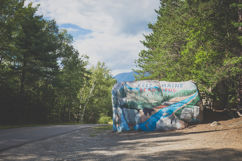

Outside Millinocket, ME
by 2180miles


From Boston to Millinoket we averaged 21 miles per gallon, a number I was pleased with given the equipment load we were carrying. The town and roads were very familiar to me and brought a smile to my face and great deal of memories to my mind. As we slowed to the local speed limits I used every opportunity to point out to Dani places I remembered from the last days of my Appalachian Trail adventure four years prior. We drove through the sleepy town in search of a last snack from civilization before continuing down the final maintained road we’d see for days, our sights set way out of town far beyond where the pavement ended.

Our final stop was at an old service station/convenience store a few miles outside of town where a gas pump, antiquated by modern standards, rolled its analog dials counting out gallons of fuel at a glacial pace. Writing down the digits behind the pump’s glass, I carried the information inside and paid the attendant while Dani perused the store. Heading out again we traveled down Baxter State Park Road for another fifteen or so minutes before splitting from the dissipating pavement and breathing a sigh of relief as we rolled onto roads comprised entirely of dirt for the first time in the trip.

We passed the Abol Bridge Campground & Store, a place where I rested for an hour or two after exiting the Hundred Mile Wilderness during my 2014 Appalachian Trail thru-hike before heading on to Katahdin’s finish line, and continued on Golden Road for a long while. I stopped to fly the drone and capture some footage of Katahdin and the Nesowadnehunk Deadwater, a river flowing out from the Ripogenus Lake just west of where we stood.


Passing Familiar Mountains
by 2180miles


I Once Spent 114 Days Following These Signs
by 2180miles


Perimeter Road - Baxter State Park
by 2180miles


Turning onto Telos Road a few miles from Harrington Pond Camp where we’d spend the night, I was able to reach Bob on his handheld radio. Our 2m Ham radio setup in the Jeep has an incredible range but hearing back from lesser powered handheld units can be a little more difficult in thickly wooded areas. He reported back that the campsite we’d chosen was a perfect spot for the night and directed us to its exact location. An open clearing nestled up along Harrington Pond, the area would easily fit our group’s four vehicles and two trailers once everyone had arrived. Dani and I found a good spot for the WK2 and I got to work setting up the roof top tent while she set up our base camp gear.

The Sweeneys arrived shortly thereafter, and the group cooked meals while I got some drone footage over the lake as the sun set. We sat around a campfire until 21h00 when Brendan’s voice came through on the radio proclaiming he was just a few minutes away but would need help finding the nearly invisible turnoff from the main route to access the campsite. I met him on Telos Road with my radio and a flashlight and helped him squeeze his Jeep and trailer down the narrow road, the final vehicle and driver to join our North Maine Woods adventure.

With nine people sitting around a campfire and two dogs playing in the clearing around us, we discussed the days ahead. As the last logs burned down and only the glow of embers (and Bob’s multi-color rope lighting) remained, people retreated to their roof top tents and trailers for the night, excited for the trip that lay ahead of us past the Telos Checkpoint and deep into the North Maine Woods.


Night 1 - Setting Up Camp
by 2180miles


Bob's RTT Party
by 2180miles
 

NHBeast

New member
Hey, glad it's going to be a useful writeup! It's an absolutely fantastic area of the country and one that is in our New England backyards. We haven't been out to CO/UT yet with the Jeep, and it's on the list, but my fiancé wants a Pacific Northwest trip before anything else.

Happy to answer any questions about NMW as you're planning it out!
I haven't been to the PNW in ages, went for the climbing back in the day. Wish I'd spent more time in CO/UT...next time.

Regarding NMW, how many miles did you cover between points A and J on your map. My rough Google estimation is around 150 miles. Am I close? My tank is 26 gallons and will probably get 14 mpg depending on how much cruising versus crawling.
Enjoyed looking through your photos and those of others who have documented their trips. Been marking lakes, bridges, trails, etc as places to visit. With no straight lines and unknown road/trail closures my plans will be flexible. Going to head out early September, clear weather permitting.
 

2180miles

Endurance Adventuring
Day 2 – Beyond Telos Checkpoint

I woke up early the next morning to a thick fog encompassing our campsite. Grabbing my drone in hopes of capturing some of the eerie surroundings (picture tall pine tree silhouettes standing in stark contrast against the sun-lit haze) I headed out down a walking path to Harrington Lake. The night before I’d been able to see Katahdin, but this morning I could barely see a hundred feet in front of me. Piloting the drone around for a little I headed back to camp to find a few more people milling around the camp picnic bench. Dani and I made a quick breakfast, cooking egg sandwiches she had pre-made and frozen for us, while Brendan pulled out his Skottle stove and others went about their morning routines.

As the fog burned off in the morning sun we packed up our vehicles and trailers, held a short driver’s meeting to review the plan for the day ahead, and turned north on the main dirt road to head up towards the Telos Checkpoint. Manned year round by employees of the North Maine Woods, the Telos Checkpoint requires each vehicle to fill out paperwork detailing their anticipated route and durations inside the boundaries of the immense private landscape. Entry fees are nominal, and I may or may not have purchased an ice cream sandwich to celebrate the beginning of our backwoods adventure.


Morning at Camp
by 2180miles


Cooking Breakfast
by 2180miles


Referencing Maps
by 2180miles


Leaving Harrington Pond
by 2180miles

Carrying on northward on Telos Road we eventually turned west on Umbazookus Road. We navigated at a comfortable pace through the woods, passing interconnected lakes both expansive and laughably small, enjoying the scenery, weather, and radio chatter amongst our group. The itinerary designed for the day included 46 miles of vehicular travel, about half that of our 2017 QB-5 adventure through Canada, intentionally shorter to allow for a more relaxed pace/atmosphere and to allow leisurely time to be spent at any of the points of interest we encountered throughout the day.

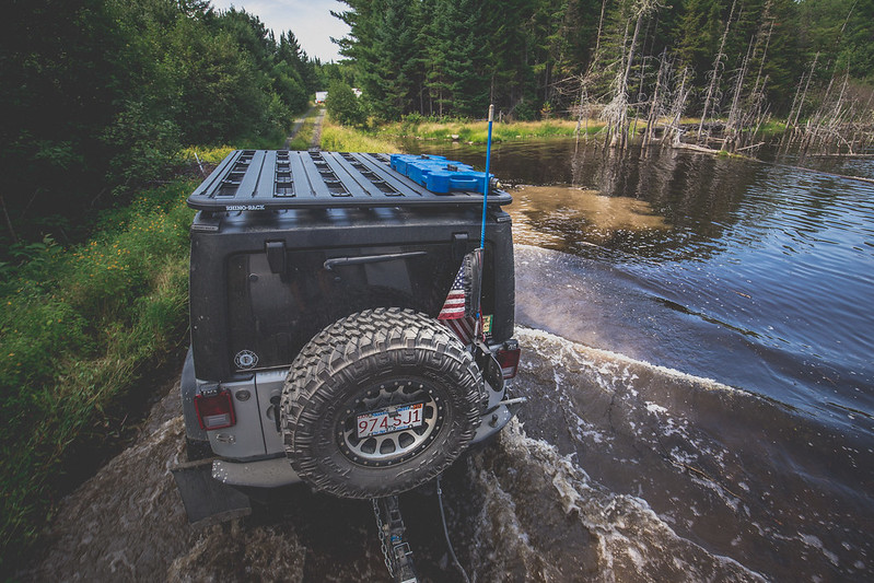
The further we got from Telos, the more the feeling of being alone sunk in. We passed by two individuals standing aside a small sedan on the side of the road and stopped to ensure they were okay, pulling out our paper maps and pointing them in the right direction to exit the North Maine woods. We continued on, taking occasional bathroom breaks and pausing shortly while I got the drone in the air to capture the expansive landscape we were winding our way through. We were held up to investigate crossing a small bridge that had collapsed on one side. Despite how silly the photo makes it look, ensuring that there wasn’t risk as we each navigated multiple thousands of pounds of vehicle overtop the remaining wood planks was worth the time taken to check it out first.


Setting Up for Drone Footage
by 2180miles

Broken Bridges
by 2180miles


Water Crossing in the Trailhawk
by 2180miles


Brendan Crosses the River
by 2180miles

Another hour or so leading us down the various roads and through some flooded areas of our planned route, I turned right down a narrow and less traveled trail where tall brush scraped against the underside of the Jeeps skid plates. Located a few miles down was our lunch stop, the Caucomgomoc Dam, nestled up alongside Caucomgomoc lake and actively limiting waterflow downstream. We found a shaded picnic bench at an established campsite along a narrow and rushing river called The Horserace, and enjoyed snacks and lunch while the two German Shepherds wrestled each other and ran around us. The group dissipated as Brendan, Bob, and I walked across the dam and explored the shores of the lake on the other side. The warmth of summer sun and expansive blue skies overhead made for an all-around gorgeous day, and made me glad we’d chosen to explore Maine this time around.

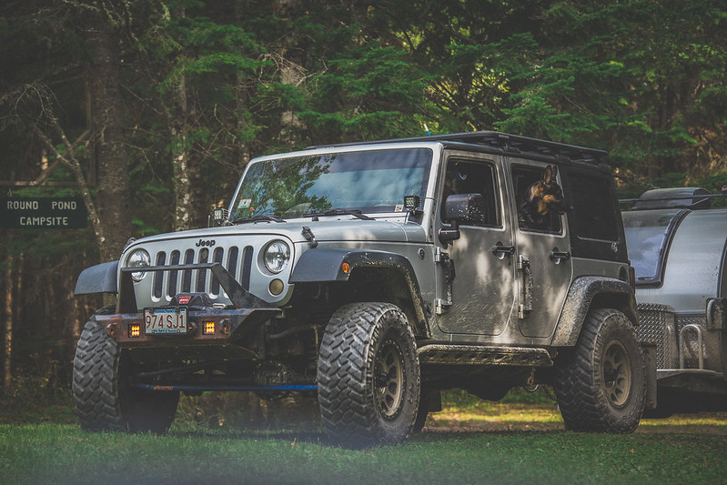
Heading out again after an hour or two of relaxation, we set our sights towards the Round Pond campsite located a few miles down the road. We were grateful to arrive there in the mid-afternoon, securing ourselves the entire site for our multiple vehicles and trailers. The arrival time proved even more important a half hour later when another group of well outfitted overland trucks rolled by slowly, scoping out the site for themselves. We waved and exchanged hellos before they took off in search of somewhere else to camp.


Crossing Caucomgomoc Dam
by 2180miles


Arriving at Round Pond
by 2180miles


Dani Reading at Round Pond
by 2180miles


With some clouds moving in but the air still warm, our group broke off from each other as every family got their camp set-ups together and enjoyed the surroundings. Dani and I sat down by the rocky shore of Round Pond, Bob’s youngest son found a small orange salamander to play with, and Brendan sat back watching the dogs roughhouse each other. Our dinners were cooked under pop-up tents shielding from a light rain later on, and we spent the evening around a fire Shaun built, talking about trips of the past and plans for future ones. With no cell service and just the company of those around us, the guys lingered around the campfire till nearly midnight before dousing it, returning to our respective tents and trailers just in time for the rain to pick up and drench the North Maine Woods overnight.


Round Pond Campsite
by 2180miles


Gathered Around
by 2180miles
 

Bulwinkle

New member
That was a great trip. Thanks for putting that story together. Planning to go into western NMW with some friends Oct 19th between weeks 2 and 3 of moose hunt. Looking forward to getting back in that part of the state. In late 70's and early 80's went into Chimney Pond via skis in early March for many years.
 

2180miles

Endurance Adventuring
Great story, thx. Great colorful pics too...especially of Dani sitting in her camp chair, reading, right in the shallow waters of a big lake. That’s a photo that kinda captures the free spirit of why we all love to go camping.

Thank you. That photo is one of my favorites as well for that exact reason. THAT is why we do this. Simplicity, relaxation, adventure, free spirit.

That was a great trip. Thanks for putting that story together. Planning to go into western NMW with some friends Oct 19th between weeks 2 and 3 of moose hunt. Looking forward to getting back in that part of the state. In late 70's and early 80's went into Chimney Pond via skis in early March for many years.

Appreciate it! Few more posts to go... things have been difficult as of late with some life circumstances (post to follow) but I got some more writing done today, so keep scrolling!
 

2180miles

Endurance Adventuring
Day 3: Allagash Mountain Views

This post will be photo heavy. Sorry (or you’re welcome, depending on your take) in advance.

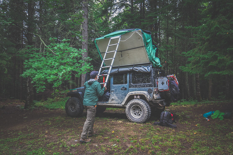
I awoke around 2 AM to torrential rain pouring down, each drop making that soothing sound on the hardshell tent’s molded roof. By the time we got up the next morning the campsite was absolutely soaked and the air had a chill that was unexpected for mid-August in New England. Throwing on a jacket and my trusty trail runner footwear I climbed down the ladder from the Jeep’s roof and faced the day. Others in the camp were also waking up, noises and voices growing in that familiar way that campsites come to life every morning.


The plan for the day wasn’t overly drawn out… a handful of options had been presented in the pre-trip itinerary, and over breakfast we chose to hike the nearby Allagash Mountain. Tents and stoves were packed up and put away as Bob’s kids ran around with the dogs, and by 09h30 we were rolling out towards our next adventure. The trailhead itself was located just a few miles down a narrow dirt road that strategically began directly across the road from our Round Pond campsite. Dani and I lead the way in the Trailhawk as the four other vehicles fell in line behind us, tall wet grass sliding underneath the vehicle’s skid plates as we drove through the woods, our surroundings eerily dark and vividly green as a result of the overcast skies above. Parking just shy of a wide metal gate in a makeshift lot where the fire road ended, we gathered up backpacks and water bottles before beginning the hike. Shaun wasn’t feeling well, and hunkered down in their teardrop trailer with a handheld radio to sleep while the rest of the group began down the trail.


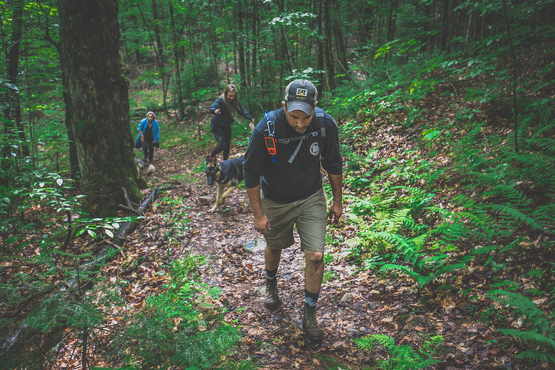
Allagash Mountain stands 1,770-feet tall and features a thousand feet of elevation gain during its ascent. Round trip the route was in the ballpark of 5 miles, and the summit would feature an old fire tower facilitating views of the entire region. Claude and Ben led the way with Bob and Jessica in tow, while Jenny, Dani, Brendan and I brought up the back. The trail started off relatively level down the remainder of the gated fire road before running straight into the backyard of the otherwise undiscoverable Ranger Station at Allagash Lake, nestled into the woods with gorgeous views of the lake’s waters. From there we turned back into the forest and began the upwards climb, gradual at first before becoming a steep final pitch that left us scrambling up wet rocks and grabbing at tree trunks to maintain balance before emerging to a cleared summit.


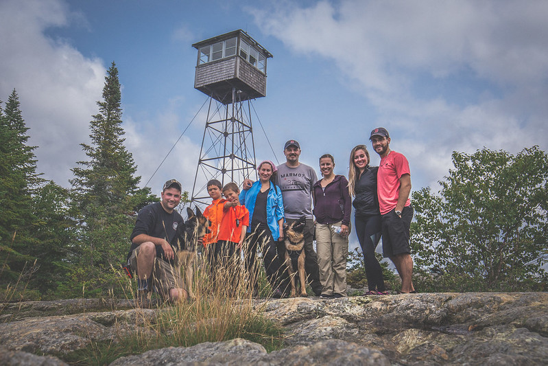
The Allagash Mountain fire tower stood proudly atop the mountain, reminding me of dozens of peaks with the same adornments that were strewn throughout the Appalachian Trail. A strong breeze was moving clouds above us and the morning sun had burned off most of the fog while we were climbing. As the group wandered around, took photos, and enjoyed the view, Brendan and I climbed the narrow ladder up the fire tower itself to see what was inside. Squeezing through a narrow door hinged to the floor of the structure we found old topographical maps, a tiny stove, and what appeared to be an old telegraph/morse code key (I may be wildly wrong, but it truly appeared to be such a device!). I snapped some photos as Brendan consulted the topo map and pointed out at Canada to our west and Katahdin to our south, then we carefully descended the ladder back down to the rocky surface of the summit.

Wedging my camera into a crevice of granite I was able to snap a group photo before we headed back down the mountain. The initial descent was even more difficult than climbing up, with wet rocks and fallen leaves making for less than ideal conditions and sketchy steps forward. The group took just over an hour to get down, having paused briefly for a few slips and falls, and found Shaun drinking a cider in his camp chair next to their Jeep.


Our drive from the makeshift parking lot to our anticipated campsite at Wadleigh Beach was only supposed to be 11 miles. Rolling out through the fire trail we turned back onto the wider and more maintained roads, increasing our speed and taking in the scenery and warm afternoon air. Dani and I were leading the way when out of nowhere a young moose darted across the road a few hundred feet in front of us. Before I could reach for the Ham radio to call it in to the rest of the group behind us, the huge animal had disappeared into the woods on the other side of the road. I came to a full stop, anticipating another one or two to follow across the road, but unfortunately none appeared.

...continued below :)
 
Last edited:

2180miles

Endurance Adventuring
A half hour or so later we arrived at the campsite that Brendan and I had chosen months prior, only to find it happily occupied by a few vehicles with a handful of people down by the lake. We pulled the vehicles off the side of the road, constantly aware of the possibility for a fully loaded logging truck to come flying down the road at any given moment, and laid out our paper maps across the hood of Jenny’s Jeep in search of a new place to spend the night.


Lucky for us after inadvertently splitting up, dead ends and u-turns down decades old overgrown trails, and some sketchy radio communications, we all arrived at a quiet campsite nestled right alongside Saint Francis Lake. Dinner was family style taco night, a crowd favorite and pretty much trip tradition at this point, and was followed by smores over the campfire. The night rolled on as a handful of people went to bed, a few of us staying up late drinking bourbon under a vast and brilliant starry sky while Freebird and other instantly recognizable rock songs played on into the night.


Last edited:

2180miles

Endurance Adventuring
And for what happened...

It's with great frustration and disappointment that I type this from a new laptop. Last weekend while on a work trip in San Francisco with Dani, we took a lunch-time stroll through Golden Gate Park to visit the Japanese Gardens. We walked around for about 45 minutes before returning to the rental car, parked alongside the park's main thoroughfare, only to find the rear two windows shattered, and two of my work bags stolen from the SUV's trunk area. I had folded the 3rd row seats over my backpack and suitcase, but it was returned to an upright position and covered in glass where my stuff used to be.

In total, over $15,000 of equipment, computers, cameras, lenses, my passport, and a multitude of hard drives were stolen from me, including the primary and redundant backups of my photo library and computer data drives.

We even had the unfortunate opportunity to watch my LTE enabled iPad trace its way across San Francisco as the police took a report. Yes, insurance is in place for all of this, but the loss of the photo files and memories (including but not limited to the last year's trips to Grand Canyon National Park, Mt. Rainier National Park, Hong Kong, Shanghai, etc.) are what breaks my heart the most. Equipment will be replaced, but I'll never be able to get those images back.

So anyway, thankfully I uploaded the North Maine Woods photos to The Cloud prior to writing this trip report, but still a disappointing situation all around.


SFO Rental Rear Window
by Fellsway Media


SFO Rental Rear Bench
by Fellsway Media


SFO Rental Passenger Windows
by Fellsway Media
 

Forum statistics

Threads
188,377
Messages
2,903,915
Members
230,227
Latest member
banshee01
Top