couple of Colorado Day trips (and a few overnighters too): Pass pictures inside

Bushmaster6

Adventurer
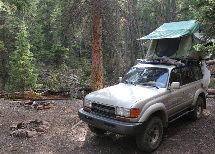
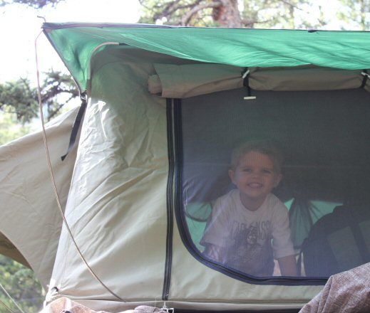
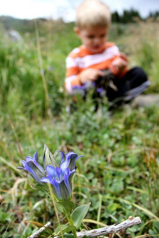
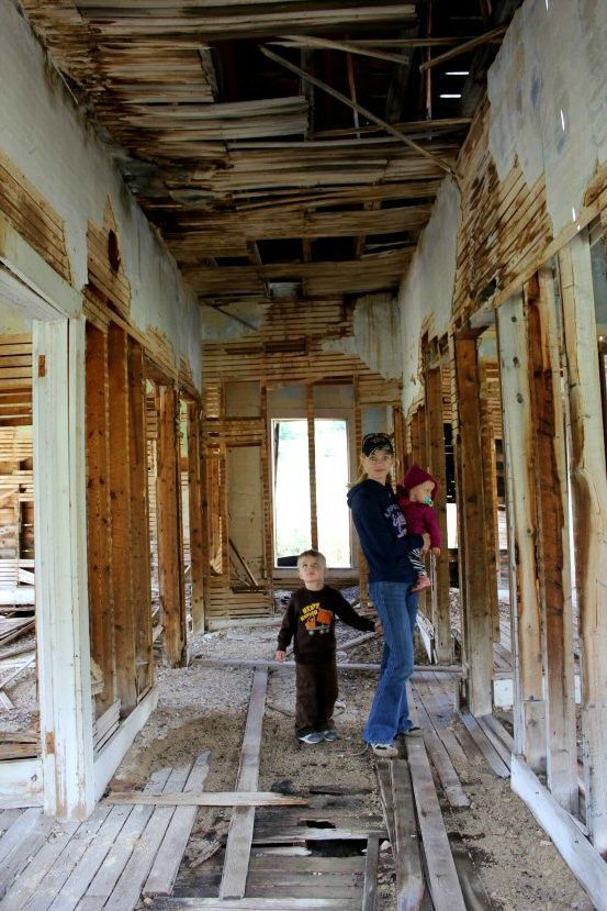
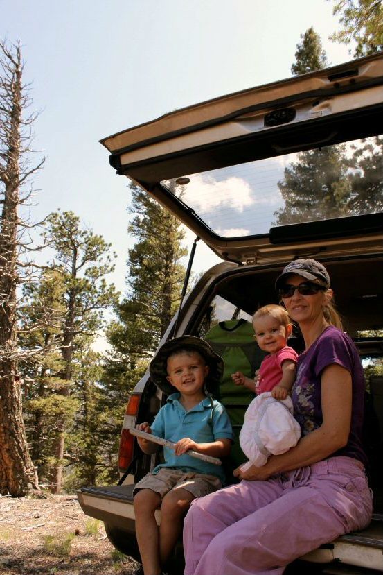
I do a pretty poor job of chronicling our day trips, as I tend to be focused on the driving, and we also take our two (young) kids with us so, alot of my attention is on keeping them asleep/happy and us on a timeline. We just did a 4-day/3-night trail/camping trip in Central CO as well, and I did a bit better of pictures there..

I won't blather on about the trail details.. most of that is easily found in trail guides and I don't have much more to add. None of these are particularly hard, and some of them I would like to get back to (sans kids) but I'm working my way through a long "to go" places in Colorado (I lived here once before for three years and failed to take advantage of the time here, now I'm trying hard to get out and see as much as I can).

ON with the show.

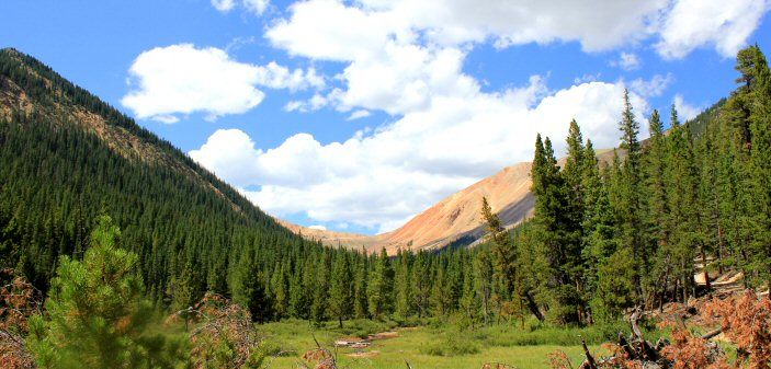
Poorly documented trip over Boreas Pass to Breckenridge for a rest stop/ice cream, and then back over Georgia Pass coming home.

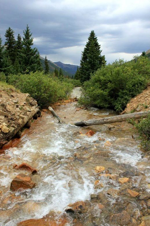
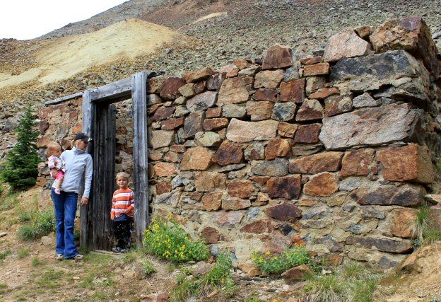
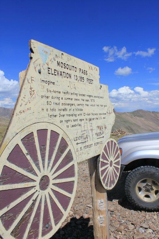
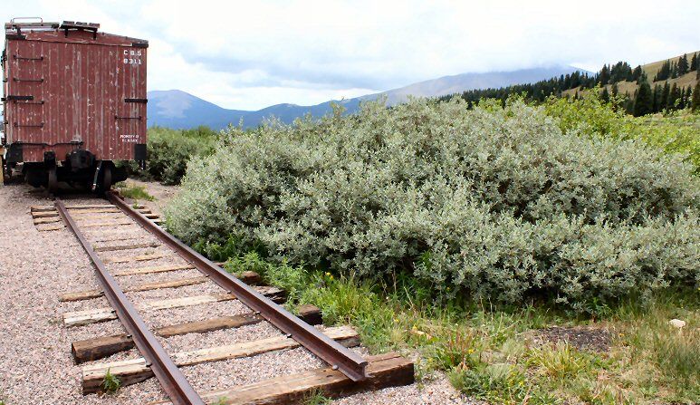
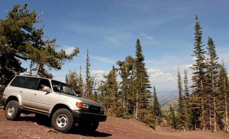
Boreas Pass, goes between the historic hamlet of Como and over to Breckenridge along a former rail line. At the pass there are rental cabins (part of the 10th Mountain Division ski hut sytem) and an old static-display rail car). Easily driven by any type of car.. basically a smooth dirt road.

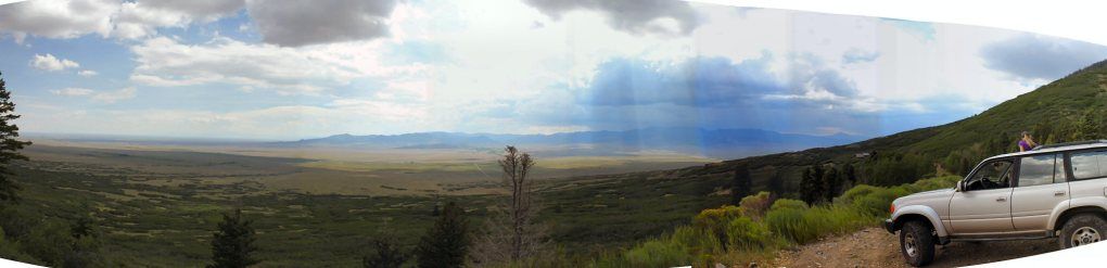
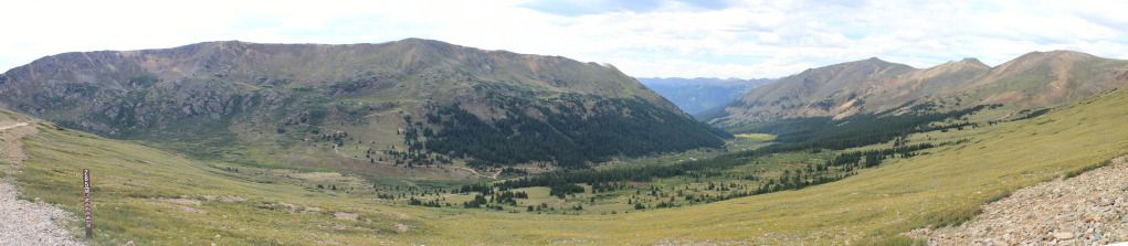
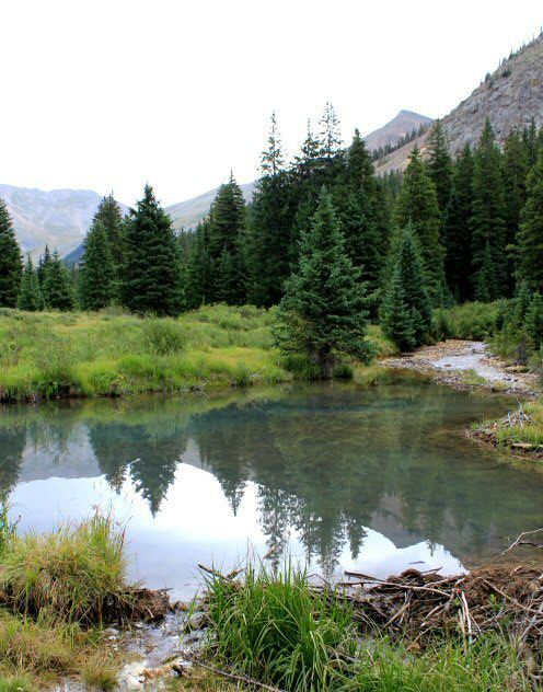
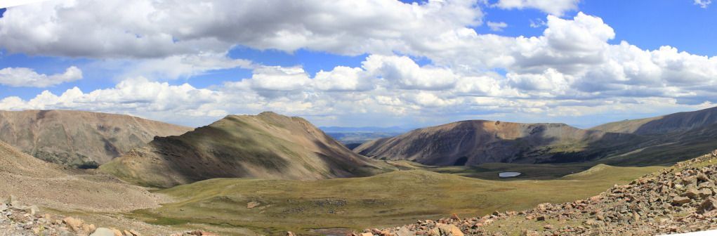
view to the West from just west of the pass
201206boreaspass2.jpg

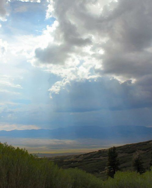
view to the east on a cloudy cool day from the pass
201206boreasendoftheline.jpg

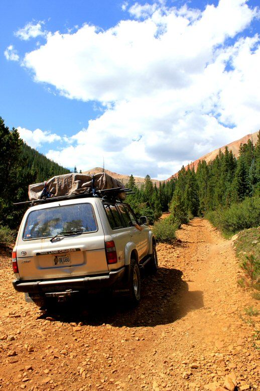
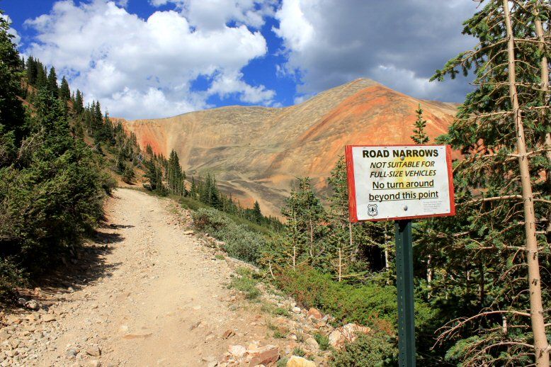
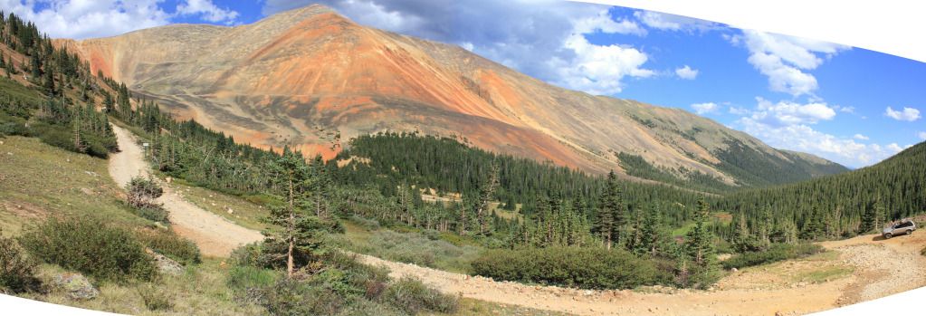
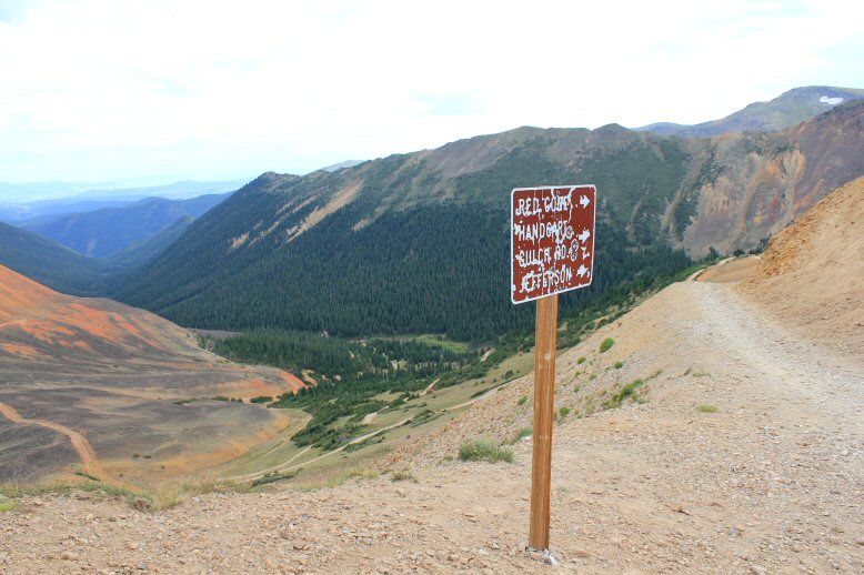
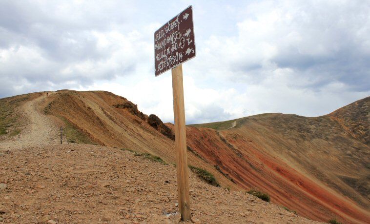
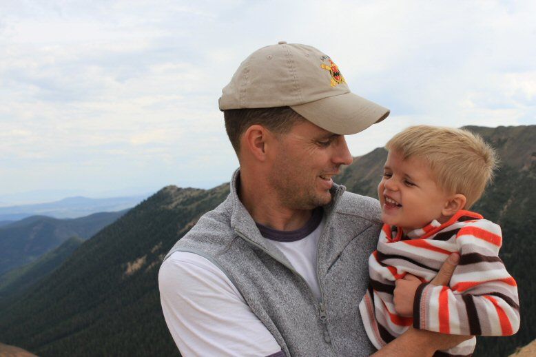
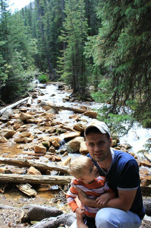
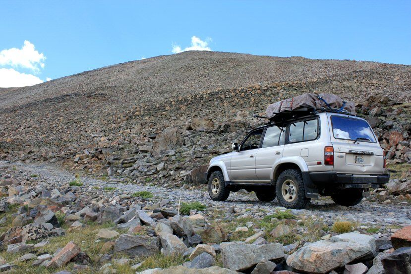
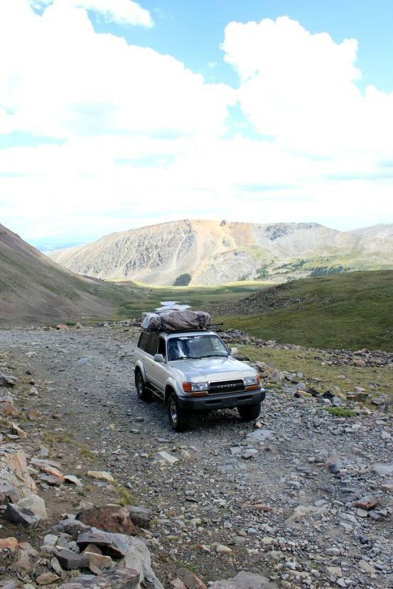
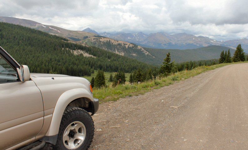
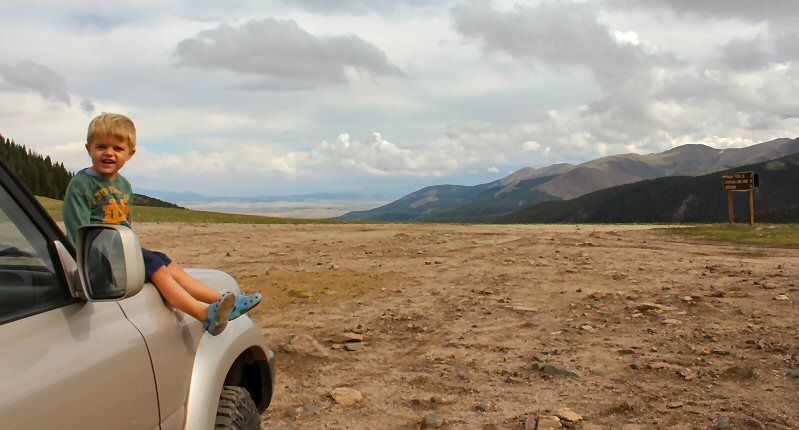
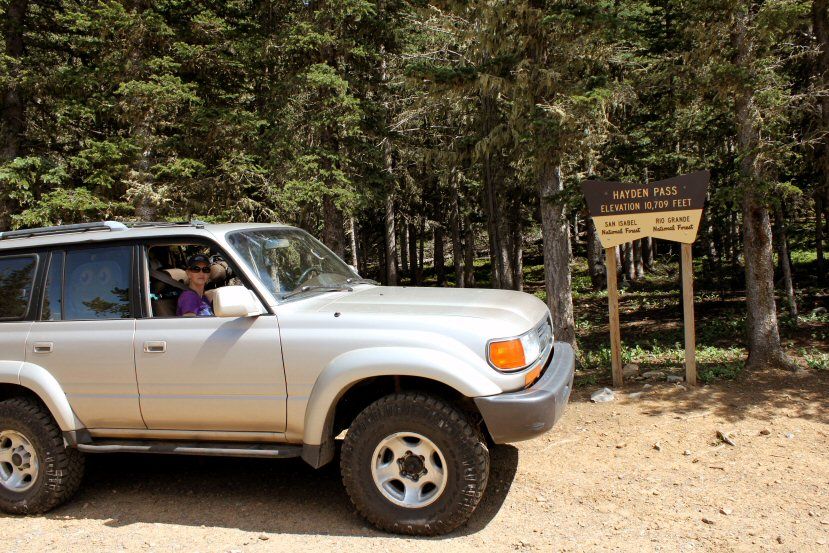
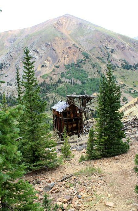
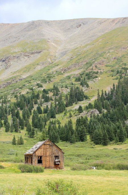
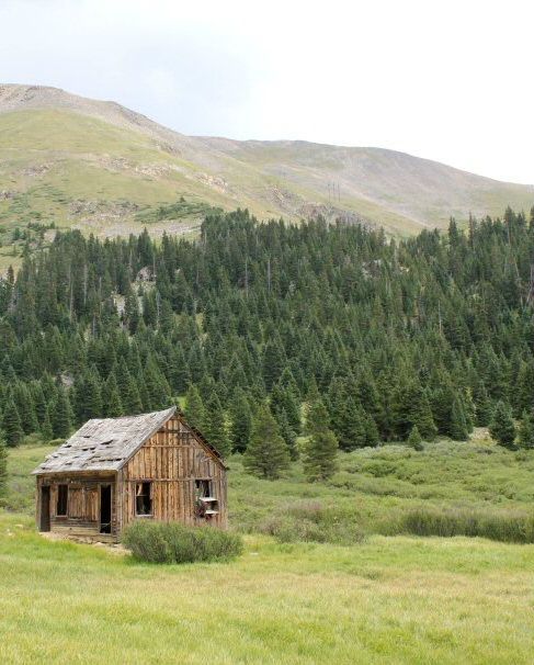
Georgia Pass (named for a Georgia based mining company that used it for access to their mine). A bit technical on the west side (definitely a 4WD trail) and also poorly marked. Coming out of Breckenridge, you occassionally have to guess which of the numerous splits in the trail will carry your along your desired path.. not as hard as I am making it sound, but some bits of fun driving. Shot of the boy/cruiser at the Pass looking East. The east side is much smoother/easier.
201206GeorgiaPass1.jpg
 
Last edited:

Bushmaster6

Adventurer
Hayden Pass

Hayden Pass crosses the Sangre de Cristo range

201207HaydenPassCruiser.jpg


Stopped on the east side for a quick tailgate lunch

Untitled-1.jpg


201207HaydenPassKazAlana.jpg


201207HaydenPassCruiser2.jpg


looking west... there are NOT great views from Hayden Pass, you have to come down through the treeline a fair bit until the line of sight clears, but.. "not great views" is a relative term in CO ;)
201207HaydenPassPanosmall.jpg

201207HaydenPassvista.jpg


Untitled.jpg
 
Last edited:

Bushmaster6

Adventurer
Webster Pass

long story but we did NOT cross Webster pass from the east.. the gulch on the west side has a very narrow/tight road leading to the pass, and the majority of traffic was coming DOWN hill at the time of day we reached it, so I halted at the last possible turn around and went downhill to our first camp.. we did end up hitting the same pass from the west side.. I would do both, and Red Cone, if I did not have the kids with me and was more flexible in my timeline/driving style..


starting up the path on the east side:
201208websterpasscruiser.jpg

Red Cone is to the upper right (there's a trail turn off along the base of the Panhandler's Gulch Road that shows the (one way) route, sponsored by a local Jeep club for maintenance
201208websterpassfromeast.jpg

we got this far and ended up turning around as I didn't want to risk the jam of traffic coming down the hill with the kids on board
201208websterpassbelowredcone.jpg

panoramic view above our turnaround point
201208websterpassredconepano.jpg

back down the hill we find a nice primitive campsite next to a series of waterfalls which made for great "noise" to sleep by
201208websterpasscampsite.jpg

son enjoyed his first night in the tent (our daughter did not, therefore nor did Mommy/Daddy, but she settled in on night 2 and after)
201208NateinRTT.jpg
 

Bushmaster6

Adventurer
Webster Pass day 2

next day we took the highway around via Fairplay and up through Breckenridge and Dillon, through Montezuma, and then to Webster Pass' western entry:

Montezuma one of the many small mountain towns that has a sense of both whimsy and, uh, dumpiness.. but a cool little place perfect for access to local ski resorts (Keystone and A-Basin)
201208montezumasign-1.jpg

local humor:
201208montezumahumor-1.jpg


Untitled-2.jpg


looking down East from Webster Pass looking at the same trail we turned around on the day prior. The west side, other than a few tight switchbacks, was a non-technical drive coming up, passed two guys humping it up on Mountain Bikes.. an impressive feat
201208websterpasslookingeast.jpg

looking up at Red Cone (this is a STEEP decline.. saw some MX guys dump their bikes coming down):
201208redcone.jpg

Pano looking west from Webster Pass back toward where we would camp that night
201208websterpasswestpano.jpg

me and the boy:
201208natedaddywebsterpass.jpg
 
Last edited:

Bushmaster6

Adventurer
Peru creek, horsehoe basin, and Pennsylvania Mine ruins

next day was headed up into Horseshoe basin (pass from West to east is closed)

trail comes out of Montezuma again and follows Peru Creek... if you're not sure if you have the right entry point, there's a sign at the parking lot that reads "This is Peru Creek" ;)

Peru creek provides miles of scenic small waterfalls headed up into the basin (also the feeder fo the Pennsylvania mine pollution into the Dillon Resevoir)

201208perucreekfalls-1.jpg


201208perucreekreflection1-1.jpg


Untitled-3.jpg


creek crossing to Pennsylvania mine
201208horseshoebasinstreamcrossing-1.jpg


old car body just below the mine:
201208pennminecarbody-1.jpg
 

Bushmaster6

Adventurer
Pennsylvania Mine

I probably took about 300 pictures here, but passing on just a few shots from the mine ruins... pretty cool site.

A couple of observations on mines/ruins in general..
1. I think it's great how things are able to just lie "in state". It really looks as though people just walked away from some of these places.. there's a bunch of residue all over, and apparently no outside drive to clean them up (for liability, etc). It is "as is", and I like that.
2. Our predecessors in this country were some hard people.
3. The financial incentives that drove people to work/dig/explore in some of these areas must have been great (at least for the owners, I suspect the guys with the shovels were just trying to survive, which is its own incentive).

lower mine
201208pennminehardware1.jpg

from the days of American manufacturing (out of NY of all places, don't think there's much heavy machinery out of my home state anymore)
201208pennmineengine2-1.jpg

some heavy duty connecting rods.. can only assume this was a steam engine
Untitled-4.jpg

upper mine ruins
201208pennmineupper-1.jpg

201208pennmineupper2-1.jpg

201208pennmineupperkarekids.jpg
 
Last edited:

Bushmaster6

Adventurer
Horseshoe Basin

we continued further up the trail to it's terminus, stopped for lunch (cancelled by a sudden electric storm) and took a few pics:

201208horseshoebasinhomestead1-1.jpg

201208horseshoebasinhomestead2-1.jpg

201208horseshoebasinnate2-1.jpg


more random road side ruins on the way back into town
201208montezumaruins.jpg
 

HenryJ

Expedition Leader
Great pics! Thanks for taking us along on a virtual trip!

This shot is a classic:

Untitled-1.jpg


That same shot could be seen from the back of a station wagon decades ago. Classy.
 

Bushmaster6

Adventurer
Mosquito Pass

drove the highway back down through Breckenridge, Hoosier Pass,through Alma and took the easterly entrance to Mosquito Pass, the highest passable road in the US (13,185 ft)...

lower mine processing ruins (house on the compound)
201208mosqpassruins2.jpg

201208mosqpassruins3-1.jpg

wife liked the floor plan:
201208mosqpassruinskazkids-1.jpg

and the views from the Master suite:
201208mosqpassruinsview-1.jpg


a stop at the N London mine for picnic, and then back on the trail.. this is a BUMPY but passable road by most any 4x4 (or high clearance vehicle)
201208mosqpasscruiser2.jpg

201208mosqpasscruiser1-1.jpg

panoramic view to the SE from the peak/pass, hard in the picture but we could see all the way to Pike's Peak with the naked eye:
201208mosquitopasssouthernpano.jpg

obligatory sign pic:
201208mosqpasssign13185ft-1.jpg


and headed to Leadville, via the rather precipitous looking drop on the Western Slope (actually an easier drive than the east)... still BUMPY

got into Leadville and basically breezed through so we could haul-******** home.. been on the road for 4 days and had two kids and wife to get home for feeding/cleaning that night.. would like to revisit Leadville for a few hours, neat town.

We stopped in Buena Vista for dinner at a old-fashioned take out/fast food stand called K's Dairy Delite.. pretty good chow and, among other peculiarities, they assign you a celebrity name to call (in lieu of a number) to pick up your order.. I was Kirk Douglas (whom I've actually met). They are also adjacent to the city park, so good place for young kids (like mine) to hit the monkey bars while I got dinner, and burn off some steam
 
Last edited:

Bushmaster6

Adventurer
Great pics! Thanks for taking us along on a virtual trip!

This shot is a classic:

That same shot could be seen from the back of a station wagon decades ago. Classy.

I grew up as the 4th of 5 sons that spent many an hour on long road trips in the "way back" of a 1970 Plymouth Fury wagon.. I know that tailgating sentiment well. My wife and I have discussed that one of our favority features of our '80 is the split tailgate/window. Provides a seat and shelter, a work bench, diaper changing area, etc etc.. There are other/newer trucks I'd love to own, but I'd miss that feature.
 

28.

Adventurer
Dude great pics and enjoy it while you can.. I lived in Greely Colorado for a few years and was never really able to do these trails cause of my wifes fear of heights.
 

Forum statistics

Threads
189,149
Messages
2,913,870
Members
231,861
Latest member
Herb colvert

Members online

Top