You are using an out of date browser. It may not display this or other websites correctly.
You should upgrade or use an alternative browser.
You should upgrade or use an alternative browser.
Finally! The DE-III trip report (multi-part)
- Thread starter Martinjmpr
- Start date
Vegas_Nick
Adventurer
Subscribed! Thanks for the great trip report. This will be helpful for my 2014 trip as I am wanting to go Vegas to Reno.
Ace Brown
Retired Ol’ Fart
Subscribed! Thanks for the great trip report. This will be helpful for my 2014 trip as I am wanting to go Vegas to Reno.
That sounds like an interesting trip. BTW we ran into another FJ Cruiser devotee from Vegas; Nevadaesh (Gary). He was just finishing up a trip as we were starting ours. I'd be surprised if you did not know him. Not sure he is on Expo but do know he is the FJCF.
Ace
Sent from my iPhone using Tapatalk
Vegas_Nick
Adventurer
Hey Ace! Yeah, I know Gary. He lives "over the hump" from Las Vegas. He and I have talked a time or two about some trip planning. Absolutely small world. We just got back from our 5 day trip around Cali and Nevada. I don't wanna thread jack here but we had 13 rigs at the high point of the trip! Was good to escape for a week.
Martinjmpr
Wiffleball Batter
My apologies - looks like I hit my bandwidth limit! My account will reset on Tuesday and I'll try to post the rest.
Martinjmpr
Wiffleball Batter
Day 5, Saturday May 25th, 2013:
Day 5, Saturday, May 25th 2013:
OK, sorry again for the long delay – I am about 2 trip reports behind, so this may come out a bit rushed.
After another great breakfast (I think it was Chorizo Burritos this morning?) we hit the road out of Bellhehelen. There was a ranch that showed up on the map just up the road from us (east into the Kawich mountains) so Ace led the way heading that direction. The road was surprisingly narrow and overgrown with thick brush on both sides, so was all got a nice bit of “desert pinstriping!”

Arriving a few miles later at the ranch, instead of the abandoned ranch we thought we’d find, we instead discovered a very active ranch with a very big “no trespassing” sign at the gate. So we reluctantly turned around and headed back.
After visiting the barely-there remains of the town of Bellehelen (basically there’s about one partial structure standing) we looked at the map and decided to head South towards the towns of Golden Arrow and Silverbow, also in the Kawich range.
Along the way, we saw several herds of wild horses, some of the herds were very big: 20 to 30 horses, at least. I’ve seen wild horses before but never in groupings this large.

Golden Arrow was the first town we came to. Unlike most of the other towns we visited which are tucked into the sides of mountains, this one is more or less out in the middle of an open plain. The ruins are pretty extensive and include what looks to me like a fairly recent concrete wall (I’m not used to seeing poured concrete walls in 19th century ghost towns.)

There were also more than a few large vertical shafts that have been fenced off for safety.

After Golden Arrow we headed Southeast towards Silver Bow. Silver Bow is back in the hills of the Southern Kawich range, and like Golden Arrow, has fairly extensive ruins including this apparently well tended grave site:

According to the trail guide we purchased, several of these mines were active as late as the 1950’s or 60’s, which would explain the “modern” ruins like this car that probably dates from the 1940’s or 50’s:

The car had some curious markings we were trying to figure out. This same sticker appeared in 3 places: On the inside of the driver’s door frame, on the rear bumper, and above the rear window. We have no idea what it is, anyone know?

Given that this is literally on the border of the Nevada Test Site, where nuclear bombs were detonated in the 1950’s and early 60’s, I wonder if it is some kind of “pass” or base registration sticker?
Speaking of bases, the Tonopah Test Range Airport was pretty clearly visible in the distance, along with it’s long array of bunkers, possibly for storing munitions, aircraft or maybe alien bodies?

We continued generally Northwest until we hit the paved road that led up to US highway 6. This paved road is the same one that is used to access the Tonopah Tests Range Airport and at its juncture with US 6, there is this sign, seen and photographed by many, many tourists:

After hitting 6, we drove into Tonopah for gas and groceries. Michael went off to try and find a new tire to replace his blown one, and several of us went to the Tonopah mining museum. Off in the distance we could hear a distinctive “clang! Clang!” of hammers hitting spikes – because this was Memorial Day weekend, it was also Tonopah’s “Mining Days” and they were having a hand-drill competition! We toured the museum and then met up at the grocery store, where Michael related that the local robber-baron tire dealer wanted more than $500 to replace a single tire. Needless to say, he declined. From here we decided to head back up to the Northeast to find a campsite in the mountains there. We drove a long way across another flat basin and into the Monitor Range. After much searching, Scott found a nice camping area in an open wash and we set up for the night, just in time for sunset.

TO BE CONTINUED….
Day 5, Saturday, May 25th 2013:
OK, sorry again for the long delay – I am about 2 trip reports behind, so this may come out a bit rushed.
After another great breakfast (I think it was Chorizo Burritos this morning?) we hit the road out of Bellhehelen. There was a ranch that showed up on the map just up the road from us (east into the Kawich mountains) so Ace led the way heading that direction. The road was surprisingly narrow and overgrown with thick brush on both sides, so was all got a nice bit of “desert pinstriping!”

Arriving a few miles later at the ranch, instead of the abandoned ranch we thought we’d find, we instead discovered a very active ranch with a very big “no trespassing” sign at the gate. So we reluctantly turned around and headed back.
After visiting the barely-there remains of the town of Bellehelen (basically there’s about one partial structure standing) we looked at the map and decided to head South towards the towns of Golden Arrow and Silverbow, also in the Kawich range.
Along the way, we saw several herds of wild horses, some of the herds were very big: 20 to 30 horses, at least. I’ve seen wild horses before but never in groupings this large.

Golden Arrow was the first town we came to. Unlike most of the other towns we visited which are tucked into the sides of mountains, this one is more or less out in the middle of an open plain. The ruins are pretty extensive and include what looks to me like a fairly recent concrete wall (I’m not used to seeing poured concrete walls in 19th century ghost towns.)

There were also more than a few large vertical shafts that have been fenced off for safety.

After Golden Arrow we headed Southeast towards Silver Bow. Silver Bow is back in the hills of the Southern Kawich range, and like Golden Arrow, has fairly extensive ruins including this apparently well tended grave site:

According to the trail guide we purchased, several of these mines were active as late as the 1950’s or 60’s, which would explain the “modern” ruins like this car that probably dates from the 1940’s or 50’s:

The car had some curious markings we were trying to figure out. This same sticker appeared in 3 places: On the inside of the driver’s door frame, on the rear bumper, and above the rear window. We have no idea what it is, anyone know?

Given that this is literally on the border of the Nevada Test Site, where nuclear bombs were detonated in the 1950’s and early 60’s, I wonder if it is some kind of “pass” or base registration sticker?
Speaking of bases, the Tonopah Test Range Airport was pretty clearly visible in the distance, along with it’s long array of bunkers, possibly for storing munitions, aircraft or maybe alien bodies?

We continued generally Northwest until we hit the paved road that led up to US highway 6. This paved road is the same one that is used to access the Tonopah Tests Range Airport and at its juncture with US 6, there is this sign, seen and photographed by many, many tourists:

After hitting 6, we drove into Tonopah for gas and groceries. Michael went off to try and find a new tire to replace his blown one, and several of us went to the Tonopah mining museum. Off in the distance we could hear a distinctive “clang! Clang!” of hammers hitting spikes – because this was Memorial Day weekend, it was also Tonopah’s “Mining Days” and they were having a hand-drill competition! We toured the museum and then met up at the grocery store, where Michael related that the local robber-baron tire dealer wanted more than $500 to replace a single tire. Needless to say, he declined. From here we decided to head back up to the Northeast to find a campsite in the mountains there. We drove a long way across another flat basin and into the Monitor Range. After much searching, Scott found a nice camping area in an open wash and we set up for the night, just in time for sunset.

TO BE CONTINUED….
Martinjmpr
Wiffleball Batter
Day 6, Sunday May 26th (part 1)
Day 6, Sunday, May 26th, 2012
After rising and consulting the map, we decided to pass through Tonopah again headed South along US 95. A few miles before Goldfield we turned West onto dirt heading towards the remains of an old spa.

Other than the old pool, there wasn’t much left so we continued on towards the town of Sliver Peak.
Silver Peak is one of the older mining communities in Nevada, but has been somewhat “enlivened” by the massive mining of lithium. The town is bordered on the east by huge precipitation ponds that are used for lithium extraction.

The town itself is semi-active. There are a number of fairly modern looking houses and mobile homes there along with some buildings that appear to have been open for business as recently as a few years ago.


There is even a new (relatively speaking!) post office right next to the old one. However, other than a union hall and the post office (which of course was closed on this Sunday morning) there didn’t appear to be any ‘public buildings’ that were open in Silverpeak.
After spending some time in Silver Peak we headed Southeast towards Railroad Pass. We stopped at the pass for lunch and to let Scott’s overheated transmission cool down.

Heading down from Railroad pass, our destination was Gold Point, a ghost town I’d visited once before in 1998. But about 5 miles from Gold Point, we got a call on the CB that Michael was having a “tire problem” again. It appears that his gamble in not getting another tire had been a bad one, as he had another flat (actually, another complete blowout sidewall failure!)
We all stopped and got the truck jacked up, despite the heat of the mid-afternoon, and contemplated what to do. Tonopah was the nearest town but we’d already had a taste of their highway-robbery “hospitality” and in any case it was now Sunday of a 3 day weekend. We consulted the map and determined that Bishop, CA, was about 65 miles away. Somewhat surprisingly, Laura had good cell phone and 3g service so she was able to google the name of a tire shop in Bishop and then was able to call and confirm that they would stay open for Michael.
Sib graciously let Michael borrow his spare tire, and we decided that since it was smaller than the tire on the other side of Michael’s truck, the spare should go on the front. So, after jacking up the back of Michael’s truck and removing the shredded tire, we had to jack up the front to move the front tire to the back. The spare then went on the front and Michael was on his way.
But not for long. Minutes later he realized that the smaller spare from Sib’s older truck wouldn’t clear Michael’s larger front calipers, so the whole process was reversed with the spare put on the rear and the remaining good tire on the front. All in all the process took probably an hour and a half under the unrelenting desert sun.
TO BE CONTINUED…
Day 6, Sunday, May 26th, 2012
After rising and consulting the map, we decided to pass through Tonopah again headed South along US 95. A few miles before Goldfield we turned West onto dirt heading towards the remains of an old spa.

Other than the old pool, there wasn’t much left so we continued on towards the town of Sliver Peak.
Silver Peak is one of the older mining communities in Nevada, but has been somewhat “enlivened” by the massive mining of lithium. The town is bordered on the east by huge precipitation ponds that are used for lithium extraction.

The town itself is semi-active. There are a number of fairly modern looking houses and mobile homes there along with some buildings that appear to have been open for business as recently as a few years ago.


There is even a new (relatively speaking!) post office right next to the old one. However, other than a union hall and the post office (which of course was closed on this Sunday morning) there didn’t appear to be any ‘public buildings’ that were open in Silverpeak.
After spending some time in Silver Peak we headed Southeast towards Railroad Pass. We stopped at the pass for lunch and to let Scott’s overheated transmission cool down.

Heading down from Railroad pass, our destination was Gold Point, a ghost town I’d visited once before in 1998. But about 5 miles from Gold Point, we got a call on the CB that Michael was having a “tire problem” again. It appears that his gamble in not getting another tire had been a bad one, as he had another flat (actually, another complete blowout sidewall failure!)
We all stopped and got the truck jacked up, despite the heat of the mid-afternoon, and contemplated what to do. Tonopah was the nearest town but we’d already had a taste of their highway-robbery “hospitality” and in any case it was now Sunday of a 3 day weekend. We consulted the map and determined that Bishop, CA, was about 65 miles away. Somewhat surprisingly, Laura had good cell phone and 3g service so she was able to google the name of a tire shop in Bishop and then was able to call and confirm that they would stay open for Michael.
Sib graciously let Michael borrow his spare tire, and we decided that since it was smaller than the tire on the other side of Michael’s truck, the spare should go on the front. So, after jacking up the back of Michael’s truck and removing the shredded tire, we had to jack up the front to move the front tire to the back. The spare then went on the front and Michael was on his way.
But not for long. Minutes later he realized that the smaller spare from Sib’s older truck wouldn’t clear Michael’s larger front calipers, so the whole process was reversed with the spare put on the rear and the remaining good tire on the front. All in all the process took probably an hour and a half under the unrelenting desert sun.
TO BE CONTINUED…
Martinjmpr
Wiffleball Batter
Day 6, Sunday, May 26th, 2013 (Part 2)
Day 6, Sunday, May 26th, 2013 (continued)
After Michael drove off (carefully!) towards Bishop, the rest of us headed into Gold Point. Now, as I said above, I'd been to Gold Point before, in 1998, when I was taking a vacation to California to visit my sister who was then living near Stockton. I was just back from a tour in the Balkans with the Army Reserves and my next semester of college didn't start until fall, so I had some time to kill. I'd read about Gold Point in an old “Sunset” book about ghost towns and was fascinated. When I went through in 1998, there were a couple of people living there but it was otherwise deserted. I was expecting pretty much the same this time around.
Well, that's not what we got. As we got closer to Gold Point, I could see what appeared to be the roofs of dozens of RVs parked on one side of town, and flags and banners flapping in the wind. We drove up into the town, which appeared to be occupied by several hundred people at least, and there was even some difficulty finding an area big enough to park all of our vehicles. There was a bar and grille at one corner of the town (which had been closed and shuttered when I was here in '98) that appeared to be open for business with a bunch of people sitting on the porch and music playing through a loud speaker.
We got out and started wandering around, taking pictures.


Now, many old ghost towns have old trucks and vehicles in them, especially if they've been active within the past 50 years. But somebody in Gold Point – we never found out who – has a serious “thing” for fire equipment, because there were old fire trucks everywhere


And not just engines, but all sorts of fire equipment and this funky old gas pump (with a fire engine behind it, of course!)

Talking to the people in the bar, the story they told us was this: There were a lot of folks who owned property or houses in or near Gold Point but didn't live there full time. This being the big holiday weekend that opens Summer (memorial day), they come out and have a big gathering/celebration. Apparently the RV folks over on the other side of town were actually a different group of owners.
There was also some kind of “paranormal tours” of Nevada ghost towns that also passes through Gold Point looking for ghosts or other paranormal-type things.
Hearing that they were putting on a big feast, we decided to make our reservations for dinner there and wandered around taking photos. Some parts of Gold Point are set up for “touristy” type things, like part of the old main street.
I like this juxtaposition of the minivan and the hangman's gallows:

One of the other things I like doing in small towns is taking pictures of the old or oddball vehicles you find there. Like this old Jeep and truck:

That may look like a CJ-5 but I believe it's actually a military M38A1, given that it has the snorkel cutout on the side of the hood. Then there was this:

That's a classic Wagoneer from the 60's along with an old Power Wagon. And there's this old Beetle:

That somebody cut down to make into a truck.
So while we were standing there looking at the various people and old equipment, a little “parade” of sorts started, right past us:


Yes, they're clowns. And apparently this is also something of a Gold Point “tradition.” Since we were the only “audience” for the parade, they were quite friendly with us.
While wandering around, Scott and Laura wandered over to the other corner of town where there appeared to be an old “mercantile” shop. When they started looking around, they were greeted by the resident, an older woman who ran a small souvenier shop.
When I went over, Scott and Laura were talking to the woman named Colleen (thanks for the correction, Keith!) and I immediately said to her “We've met before!”
She said “When?”
And I replied “Right here in Gold Point, 15 years ago in 1998, I passed through in early May, you showed me around your shop and I think I bought a couple of rocks from you!”
Collette is a retired school teacher and no longer lives in Gold Point full time, but she does live there during the summer months. She gave us the grand tour again and even showed us her home, which is in an old bar/restaurant.
By this time, it was getting close to supper time so we bade our goodbyes and headed over the bar and grille for some excellent steaks, fries and veggies. Everyone seemed to be having a good time. After dinner, with sunset approaching, we realized we'd better find a place to camp for the night. Since the town was pretty well “occupied” we figured we'd need to head outside of town for a campsite. After much searching, we finally found a place in a shallow wash and set up camp. As soon as it was set up, I went back to town to wait for Michael, since we had no way of letting him know our exact camp location. He departed for Bishop at about 2:30 pm and we figured by 7:30 or 8 he should be back. Well, I sat on the edge of town but he didn't show up. While I was there I watched a magnificent Nevada desert sunset…


… and was accompanied by this long-eared fella:

I was a bit worried about Michael, but then I knew he was an experienced traveler and could take care of himself, so I headed back to camp and rolled out my sleeping bag.
Next morning, I got up and packed, and then headed into town, only to see Michael's truck sitting in front of Colleen's shop, and Michael and Colleen sitting on her porch having a cup of tea!
We drove back to camp, and that's where I left the group – I had a LONG day's drive ahead of me, with the final destination being Grand Junction, CO. So I shook hands, made my goodbyes, and hit the road around 8:00.
Unfortunately, there's no real ‘direct' route from Gold Point to Grand Junction. Any travel East from there has to go around the Nellis AFB/Nevada Test Site so there is a considerable detour. I consulted my computer and the quickest route it gave me was to head South through Beatty, skirt the northern suburbs of Las Vegas and then jump onto I-15.
The I-15 route wasn't that much fun, although coming off the San Rafael Swell is always worth a picture or two:

Due to my relatively late start, I didn't get in until nearl 10. Fortunately, I had decided to go ahead and pop for a hotel room as I was in no condition to search for a campsite.
Next day I passed through Basalt to get my new bumper installed, and finally arrived home late in the afternoon on the 28th.
"Lessons Learned" and other observations to follow! :sombrero:
Day 6, Sunday, May 26th, 2013 (continued)
After Michael drove off (carefully!) towards Bishop, the rest of us headed into Gold Point. Now, as I said above, I'd been to Gold Point before, in 1998, when I was taking a vacation to California to visit my sister who was then living near Stockton. I was just back from a tour in the Balkans with the Army Reserves and my next semester of college didn't start until fall, so I had some time to kill. I'd read about Gold Point in an old “Sunset” book about ghost towns and was fascinated. When I went through in 1998, there were a couple of people living there but it was otherwise deserted. I was expecting pretty much the same this time around.
Well, that's not what we got. As we got closer to Gold Point, I could see what appeared to be the roofs of dozens of RVs parked on one side of town, and flags and banners flapping in the wind. We drove up into the town, which appeared to be occupied by several hundred people at least, and there was even some difficulty finding an area big enough to park all of our vehicles. There was a bar and grille at one corner of the town (which had been closed and shuttered when I was here in '98) that appeared to be open for business with a bunch of people sitting on the porch and music playing through a loud speaker.
We got out and started wandering around, taking pictures.


Now, many old ghost towns have old trucks and vehicles in them, especially if they've been active within the past 50 years. But somebody in Gold Point – we never found out who – has a serious “thing” for fire equipment, because there were old fire trucks everywhere


And not just engines, but all sorts of fire equipment and this funky old gas pump (with a fire engine behind it, of course!)

Talking to the people in the bar, the story they told us was this: There were a lot of folks who owned property or houses in or near Gold Point but didn't live there full time. This being the big holiday weekend that opens Summer (memorial day), they come out and have a big gathering/celebration. Apparently the RV folks over on the other side of town were actually a different group of owners.
There was also some kind of “paranormal tours” of Nevada ghost towns that also passes through Gold Point looking for ghosts or other paranormal-type things.
Hearing that they were putting on a big feast, we decided to make our reservations for dinner there and wandered around taking photos. Some parts of Gold Point are set up for “touristy” type things, like part of the old main street.
I like this juxtaposition of the minivan and the hangman's gallows:

One of the other things I like doing in small towns is taking pictures of the old or oddball vehicles you find there. Like this old Jeep and truck:

That may look like a CJ-5 but I believe it's actually a military M38A1, given that it has the snorkel cutout on the side of the hood. Then there was this:

That's a classic Wagoneer from the 60's along with an old Power Wagon. And there's this old Beetle:

That somebody cut down to make into a truck.
So while we were standing there looking at the various people and old equipment, a little “parade” of sorts started, right past us:


Yes, they're clowns. And apparently this is also something of a Gold Point “tradition.” Since we were the only “audience” for the parade, they were quite friendly with us.
While wandering around, Scott and Laura wandered over to the other corner of town where there appeared to be an old “mercantile” shop. When they started looking around, they were greeted by the resident, an older woman who ran a small souvenier shop.
When I went over, Scott and Laura were talking to the woman named Colleen (thanks for the correction, Keith!) and I immediately said to her “We've met before!”
She said “When?”
And I replied “Right here in Gold Point, 15 years ago in 1998, I passed through in early May, you showed me around your shop and I think I bought a couple of rocks from you!”
Collette is a retired school teacher and no longer lives in Gold Point full time, but she does live there during the summer months. She gave us the grand tour again and even showed us her home, which is in an old bar/restaurant.
By this time, it was getting close to supper time so we bade our goodbyes and headed over the bar and grille for some excellent steaks, fries and veggies. Everyone seemed to be having a good time. After dinner, with sunset approaching, we realized we'd better find a place to camp for the night. Since the town was pretty well “occupied” we figured we'd need to head outside of town for a campsite. After much searching, we finally found a place in a shallow wash and set up camp. As soon as it was set up, I went back to town to wait for Michael, since we had no way of letting him know our exact camp location. He departed for Bishop at about 2:30 pm and we figured by 7:30 or 8 he should be back. Well, I sat on the edge of town but he didn't show up. While I was there I watched a magnificent Nevada desert sunset…


… and was accompanied by this long-eared fella:

I was a bit worried about Michael, but then I knew he was an experienced traveler and could take care of himself, so I headed back to camp and rolled out my sleeping bag.
Next morning, I got up and packed, and then headed into town, only to see Michael's truck sitting in front of Colleen's shop, and Michael and Colleen sitting on her porch having a cup of tea!
We drove back to camp, and that's where I left the group – I had a LONG day's drive ahead of me, with the final destination being Grand Junction, CO. So I shook hands, made my goodbyes, and hit the road around 8:00.
Unfortunately, there's no real ‘direct' route from Gold Point to Grand Junction. Any travel East from there has to go around the Nellis AFB/Nevada Test Site so there is a considerable detour. I consulted my computer and the quickest route it gave me was to head South through Beatty, skirt the northern suburbs of Las Vegas and then jump onto I-15.
The I-15 route wasn't that much fun, although coming off the San Rafael Swell is always worth a picture or two:

Due to my relatively late start, I didn't get in until nearl 10. Fortunately, I had decided to go ahead and pop for a hotel room as I was in no condition to search for a campsite.
Next day I passed through Basalt to get my new bumper installed, and finally arrived home late in the afternoon on the 28th.
"Lessons Learned" and other observations to follow! :sombrero:
Last edited:
I enjoyed reading your post and was imagining that I was there. This adventure excites me alot and I will convince my friends to have this kind of adventure as well. I'm so excited to try all the things that you had tried specially driving around the ghost towns. This is one of a kind adventure. Enjoy guys!!!:victory:
Martinjmpr
Wiffleball Batter
Hey, I just noticed something. Regarding the mysterious sticker on the car in Silver Bow:
Look at the outline of the sticker: A rectangle with the upper right corner nibbled off. I knew I'd seen that before somewhere....

State of Kansas. Must have been some kind of registration or inspection sticker?
The car had some curious markings we were trying to figure out. This same sticker appeared in 3 places: On the inside of the driver's door frame, on the rear bumper, and above the rear window. We have no idea what it is, anyone know?

Look at the outline of the sticker: A rectangle with the upper right corner nibbled off. I knew I'd seen that before somewhere....

State of Kansas. Must have been some kind of registration or inspection sticker?
4x4x4doors
Explorer
I always enjoy reading trip reports and seeing pictures. Its especially interesting to read someone's report of a trip you were on and to hear/see the things that someone else decided to include (or not). I also get to catch details I missed because I wasn't paying attention or remembering like I used to! Thanks.
As Martin says, on Monday, the group started heading our separate ways.
Goldfield, Tonopah, Manhattan, Belmont and Pine Creek Campground
We bid adieu to the others but Gary, Ace and I stayed together with plans to see some more and hoped to make it to Great Basin National Park.
We left and headed back to Tonopah for re-provisioning. Along the way, we passed through Goldfield NV but didn't stop. Goldfield is more recent town which grew from the discovery of gold in 1902. Mining until 1940, over $86 million was extracted. Much of the town was destroyed by a fire in 1923, although several buildings survived and remain today, notably the Goldfield Hotel, the Consolidated Mines Building (the communications center of the town until 1963), and the schoolhouse. Gold exploration still continues in and around the town today. The hotel is not currently open and some accounts describe it as haunted. There is an ongoing effort to restore many of the old buildings and build the tourist trade. You can find out more at Ghost Town Operations.com website.
Teddy Roosevelt visited Goldfield and there is a story that Wyatt Earpp came to Goldfield after the Gunfight at the OK Corral but there is little to support that. It is confirmed that his brother, Virgil, worked, lived and died in Goldfield although he is buried in Portland, Oregon.
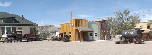
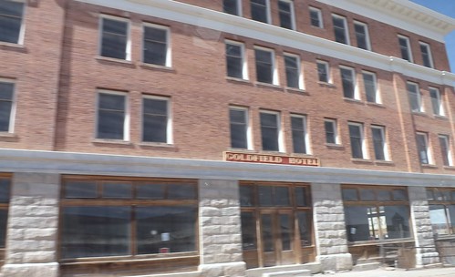
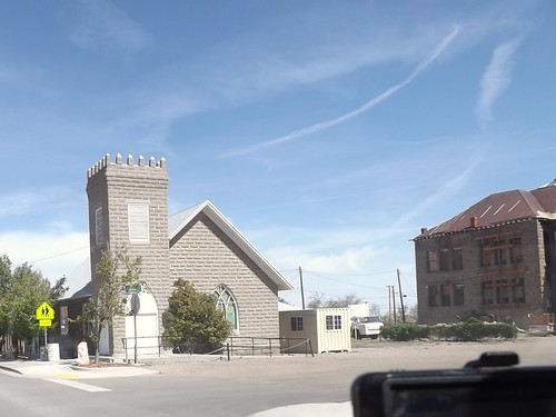
The school is the building in the right of the picture above.
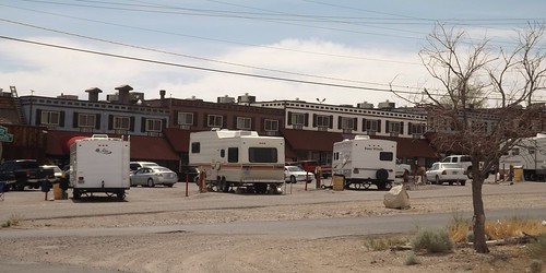
RV parking behind the casino in Tonopah.
Continuing along to Manhattan, we find another town's mainstreet which has obvously seen better days.
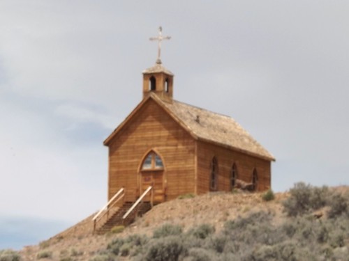
This church, which sets on a hill above Manhattan's main street was orignially constructed in Belmont.

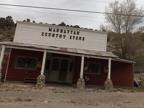
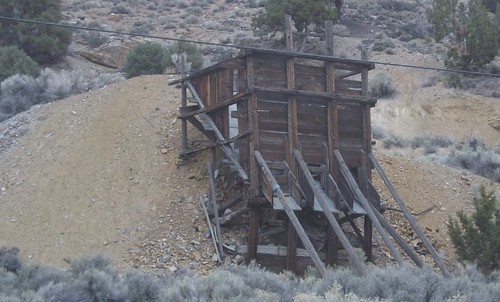
We stopped for lunch outside of town and then went on to Belmont, NV.

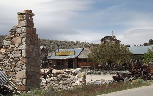
Although closed this day, there are still accommodations to be had at the old Combination Miining Co. building, including the Old Boots Saloon.
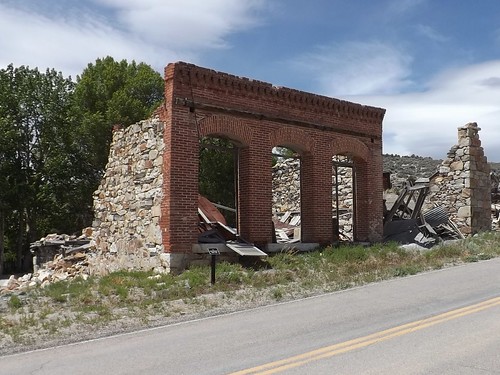
Remains of the bank.
Belmont is the site of a spring used by the Shoshone. In 1865, the discovery of silver ore led to a boom that eventually led to the buildup of a commercial center including schools, a post office, a newspaper and eventually becoming the county seat of Nye County from 1867 to 1905.
Belmont was known as a rowdy town with saloons, a red light district and various ethnic neighborhoods. Roughly $4 million was extracted from the shallow ore.
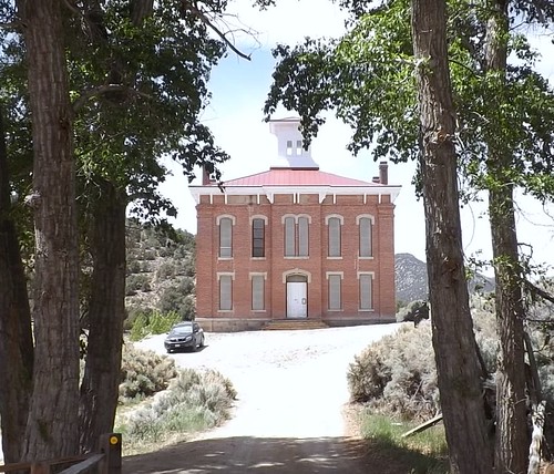
Courthouse from the days of County seat.
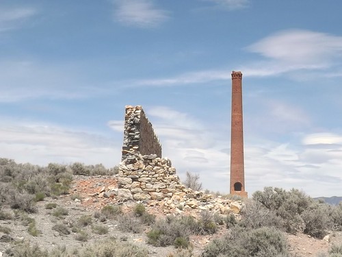
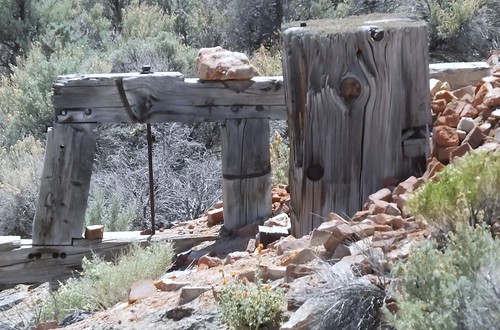
Remnants of the Combination Mining Mill in East Belmont.
We traveled further north and found a spot for the night in the Pine Creek Campground in the Toiyabe National Forest.
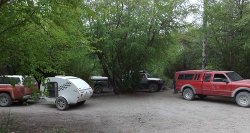

The weather forecasts were calling for cold, possible rain/sleet and this spot seemed fairly sheltered.
More photos from this leg of the trip.
As Martin says, on Monday, the group started heading our separate ways.
Goldfield, Tonopah, Manhattan, Belmont and Pine Creek Campground
We bid adieu to the others but Gary, Ace and I stayed together with plans to see some more and hoped to make it to Great Basin National Park.
We left and headed back to Tonopah for re-provisioning. Along the way, we passed through Goldfield NV but didn't stop. Goldfield is more recent town which grew from the discovery of gold in 1902. Mining until 1940, over $86 million was extracted. Much of the town was destroyed by a fire in 1923, although several buildings survived and remain today, notably the Goldfield Hotel, the Consolidated Mines Building (the communications center of the town until 1963), and the schoolhouse. Gold exploration still continues in and around the town today. The hotel is not currently open and some accounts describe it as haunted. There is an ongoing effort to restore many of the old buildings and build the tourist trade. You can find out more at Ghost Town Operations.com website.
Teddy Roosevelt visited Goldfield and there is a story that Wyatt Earpp came to Goldfield after the Gunfight at the OK Corral but there is little to support that. It is confirmed that his brother, Virgil, worked, lived and died in Goldfield although he is buried in Portland, Oregon.


The school is the building in the right of the picture above.

RV parking behind the casino in Tonopah.
Continuing along to Manhattan, we find another town's mainstreet which has obvously seen better days.

This church, which sets on a hill above Manhattan's main street was orignially constructed in Belmont.


We stopped for lunch outside of town and then went on to Belmont, NV.


Although closed this day, there are still accommodations to be had at the old Combination Miining Co. building, including the Old Boots Saloon.

Remains of the bank.
Belmont is the site of a spring used by the Shoshone. In 1865, the discovery of silver ore led to a boom that eventually led to the buildup of a commercial center including schools, a post office, a newspaper and eventually becoming the county seat of Nye County from 1867 to 1905.
Belmont was known as a rowdy town with saloons, a red light district and various ethnic neighborhoods. Roughly $4 million was extracted from the shallow ore.

Courthouse from the days of County seat.

Remnants of the Combination Mining Mill in East Belmont.

We traveled further north and found a spot for the night in the Pine Creek Campground in the Toiyabe National Forest.


The weather forecasts were calling for cold, possible rain/sleet and this spot seemed fairly sheltered.
More photos from this leg of the trip.
4x4x4doors
Explorer
West to East - Nevada to Maryland and Home
The air had turned cooler overnight and the wind had picked up as well. We hadn't gotten the showers but there had been wind-driven sprinkles. Although we planned to go to Great Basin today, it didn't look like a great day for being out and about. It was time to head home. Gary and Ace weren't outside yet but they were both up as I'd heard them stirring around. I packed up and told them I was heading for home.
Ace gave me directions to hit Rt. 50 which should make for a scenic drive home. I was planning to take a bit more time headed east than I had taken going west.
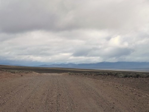
The last 5 miles to US 50 were windy and raining pretty hard. Maybe it would be better once I crossed the ridge.
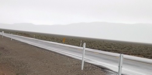
I drove on through the rain through Eureka and Ely with no signs of clearing.
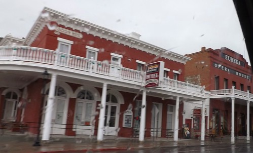
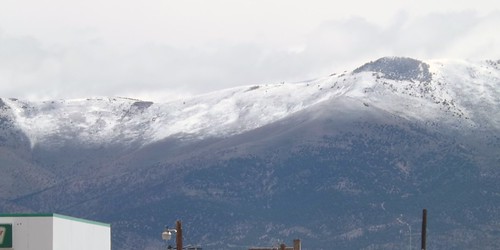
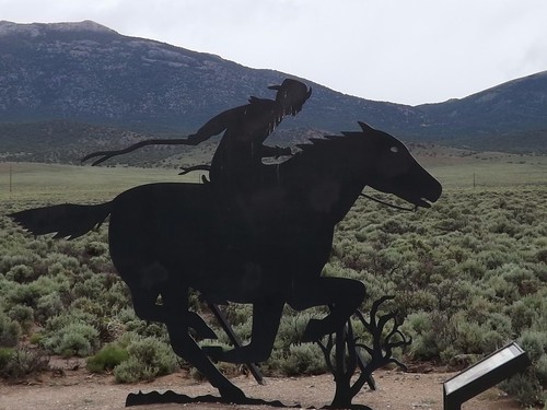
50 is called the Lincoln Highway and was built to connect the country's east and west coasts. Parts of the Pony Express routes follow roughly the same lines.
By the time I had reached I80 and the Utah state line, the weather had let up a bit so I decided to hit the Nevada Welcome Station on the way out of state. The woman working at the tourist info desk was a bounty of information. She asked where I was going and I told her I was headed for home after a week of ghost towns. I asked about non-camping accommodations as Betty and I had toyed with making a similar trip without the camping. She told me that in the small mining towns, upwards of 60% of the hotel rooms were occupied by workers at the mines or construction. Further south, where we had been it was closer to 40%. The point being that a trip such as ours without camping that you should make reservations before arriving. She also had two audio CDs provided by BLM for a car tour of the mining areas and the Pony Express routes.
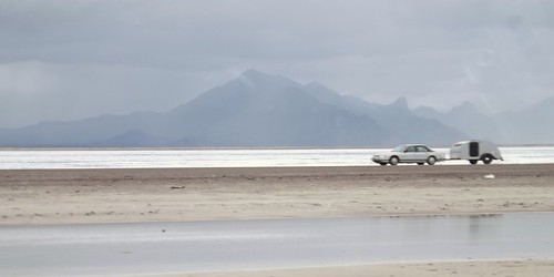
I hit the road and quickly was back into the rain. As I crossed over the Bonneville Salt Flats, I noticed another teardrop headed west.
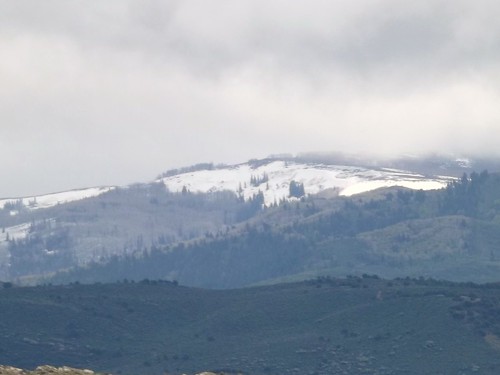
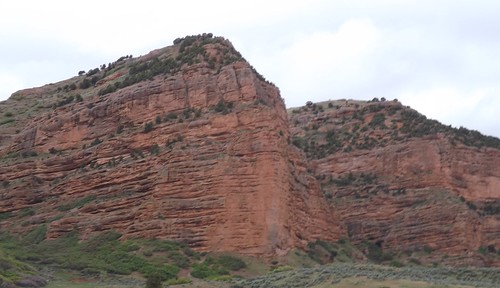
The scenery continued to be great, even though the rains continued.
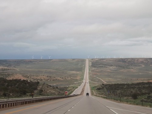
Crossing into Wyoming, the rains continued. Spending most of my life on the East Coast, I'm still taken aback when I see a road this long and straight.
In Wyoming, I decided it was time to stop fighting the rain and check into a motel. A hot shower and a comfy bed worked wonders.
The weather continued (sort of like on the trip west) to be unsettled. From the limited weather information, I had thoughts of possibly driving out of it eventually. Radio weather reports and severe warnings usually give the county affected. As a traveler, I'll usually know what city I'm near but not always what county so word of Tornado Watches for XYZ County just meant somewhere nearby but could have been in front of me or behind me, who knows?
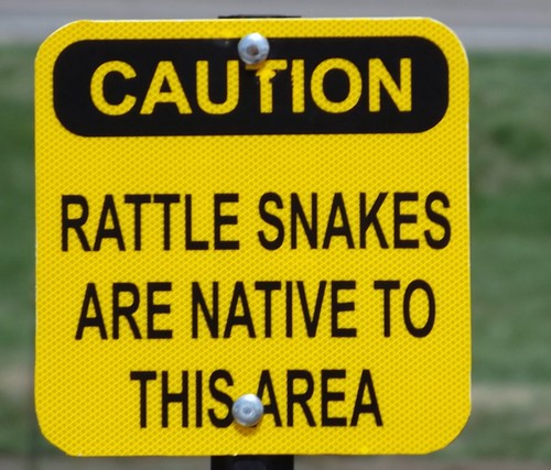
On the whole trip, I've mentioned that the only reptiles I saw were lizards. When I stopped at a Nebraska rest area, I'll admit the thought that crossed my mind was "We're going to argue natives versus tourists here?"
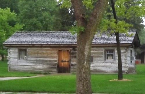
Nebraska does do well with the promoting local tourism though. Almost every exit had an 8x10 feet sign in color advising of tourist attractions at that or an upcoming exit. Not just "Historic Marker 500 feet". That's how I found this original Pony Express station when I had to stop for fuel.
I kept seeing the heavy clouds and lightning and hearing reports of severe weather. Going through my mind was the notion that perhaps I would be in more danger if I stopped for the night than if I just kept going and was aware of what was going on around me. This kept me going until well after midnight and into Iowa where I pulled into a rest stop for some sleep in the Little Guy.
I did discover that Iowa rest stops along I80 all have free wifi!
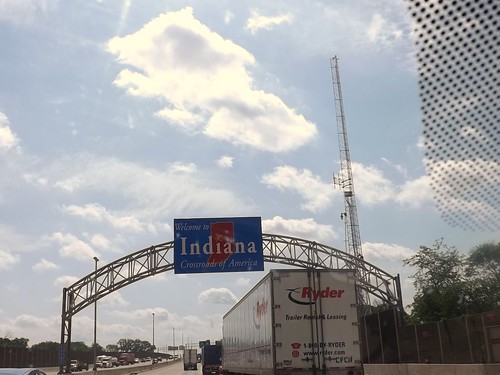
By the next morning, the sun was shining and it was an uneventful trip through Illinois, Indiana, Ohio, Pennsylvania and into Maryland and home!

It was a great trip with some quality folks. I got to see things I'd never seen and learned more about the area. I also learned a few things about this type of travel (overlanding or travel camping) where you're in a different place each night. I identified a few things that need adjustment to the truck, the trailer and the way I pack.
Where to next?
More photos from this leg of the trip.
Ace and Gary made it to Great Basin and I hope they'll share some of their story and pictures, too.
The air had turned cooler overnight and the wind had picked up as well. We hadn't gotten the showers but there had been wind-driven sprinkles. Although we planned to go to Great Basin today, it didn't look like a great day for being out and about. It was time to head home. Gary and Ace weren't outside yet but they were both up as I'd heard them stirring around. I packed up and told them I was heading for home.
Ace gave me directions to hit Rt. 50 which should make for a scenic drive home. I was planning to take a bit more time headed east than I had taken going west.

The last 5 miles to US 50 were windy and raining pretty hard. Maybe it would be better once I crossed the ridge.

I drove on through the rain through Eureka and Ely with no signs of clearing.


50 is called the Lincoln Highway and was built to connect the country's east and west coasts. Parts of the Pony Express routes follow roughly the same lines.

By the time I had reached I80 and the Utah state line, the weather had let up a bit so I decided to hit the Nevada Welcome Station on the way out of state. The woman working at the tourist info desk was a bounty of information. She asked where I was going and I told her I was headed for home after a week of ghost towns. I asked about non-camping accommodations as Betty and I had toyed with making a similar trip without the camping. She told me that in the small mining towns, upwards of 60% of the hotel rooms were occupied by workers at the mines or construction. Further south, where we had been it was closer to 40%. The point being that a trip such as ours without camping that you should make reservations before arriving. She also had two audio CDs provided by BLM for a car tour of the mining areas and the Pony Express routes.
I hit the road and quickly was back into the rain. As I crossed over the Bonneville Salt Flats, I noticed another teardrop headed west.

The scenery continued to be great, even though the rains continued.


Crossing into Wyoming, the rains continued. Spending most of my life on the East Coast, I'm still taken aback when I see a road this long and straight.

In Wyoming, I decided it was time to stop fighting the rain and check into a motel. A hot shower and a comfy bed worked wonders.

The weather continued (sort of like on the trip west) to be unsettled. From the limited weather information, I had thoughts of possibly driving out of it eventually. Radio weather reports and severe warnings usually give the county affected. As a traveler, I'll usually know what city I'm near but not always what county so word of Tornado Watches for XYZ County just meant somewhere nearby but could have been in front of me or behind me, who knows?
On the whole trip, I've mentioned that the only reptiles I saw were lizards. When I stopped at a Nebraska rest area, I'll admit the thought that crossed my mind was "We're going to argue natives versus tourists here?"

Nebraska does do well with the promoting local tourism though. Almost every exit had an 8x10 feet sign in color advising of tourist attractions at that or an upcoming exit. Not just "Historic Marker 500 feet". That's how I found this original Pony Express station when I had to stop for fuel.

I kept seeing the heavy clouds and lightning and hearing reports of severe weather. Going through my mind was the notion that perhaps I would be in more danger if I stopped for the night than if I just kept going and was aware of what was going on around me. This kept me going until well after midnight and into Iowa where I pulled into a rest stop for some sleep in the Little Guy.
I did discover that Iowa rest stops along I80 all have free wifi!
By the next morning, the sun was shining and it was an uneventful trip through Illinois, Indiana, Ohio, Pennsylvania and into Maryland and home!


It was a great trip with some quality folks. I got to see things I'd never seen and learned more about the area. I also learned a few things about this type of travel (overlanding or travel camping) where you're in a different place each night. I identified a few things that need adjustment to the truck, the trailer and the way I pack.
Where to next?
More photos from this leg of the trip.
Ace and Gary made it to Great Basin and I hope they'll share some of their story and pictures, too.
Scott B.
SE Expedition Society
Better late...
I'd like to thank everyone for joining me on the expedition. I had a great time, and I hope everyone else did as well.
I still have not gone through my pictures, but I will soon.
Our return trip, while enjoyable, did not go where we were planning on when we left the group. We took 6 to Ely, NV - found a car wash! Picked up 50 through Utah, stopped at Cabela's in Grand Junction, then headed south to Montrose, CO. We spent a morning at Black Canyon of the Gunnison National Park (thanks for the suggestion, Ace!). Headed south through Ouray, Durango and down to Albuquerque where we had a great BBQ dinner at Ruby's. On to Arkansas to spend another night with Laura's friends, then home.
I still have some minor things to work on/tweak on the truck. Considering I just swapped in a V8, the issues were negligible. For those wondering, I got anywhere from 11 to 17 MPG.
All in all, a memorable trip. I am still in awe over how many ghost towns we did not see. We could probably spend 6 months wandering though the desert and still not see everything. Guess we'll have to go back for more! We had some great campsites, good food and good comradery. Can't wait 'til DE IV!
Similar threads
- Replies
- 29
- Views
- 5K
- Replies
- 4
- Views
- 871
