You are using an out of date browser. It may not display this or other websites correctly.
You should upgrade or use an alternative browser.
You should upgrade or use an alternative browser.
Land Rover ideas for Jeeps
- Thread starter jscherb
- Start date
shays4me
Willing Wanderer
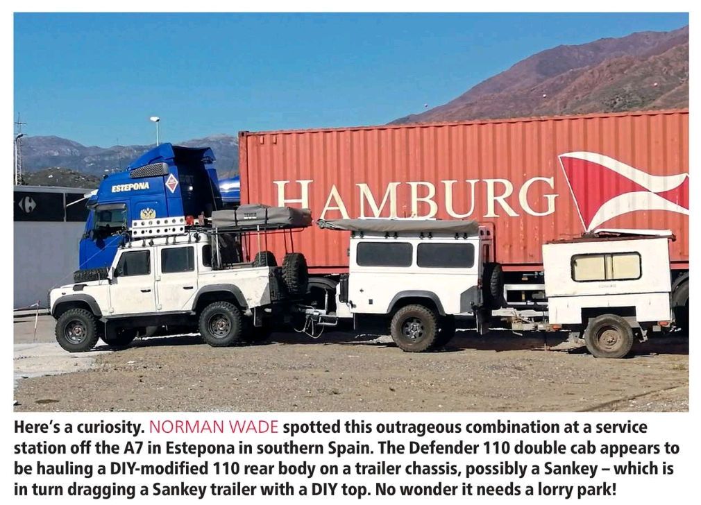
I’m not sure if it’s still legal but I used to see trucks out of Idaho pulling an rv and a boat.Is this a good idea? Is it even legal here in the U.S.?
Florida Native
Active member
My understanding is you can pull a 2nd trailer behind a 5th wheel trailer, but not behind a bumper pull trailer. Many western states allow this, I don't know about other parts of the country.
What is pictured above would not be legal anywhere in the US as far as I know.
It varies by state. Some do allow two bumper pulls, some only allow if first trailer is fifth wheel and some don’t allow double tows at all.
It would be legal in some states, but definitely not all of them.
-Mike
jscherb
Expedition Leader
I came across this Defender for sale in South Carolina: https://classiccars.com/listings/vi...fender-for-sale-in-aiken-south-carolina-29801. Description from the web site:
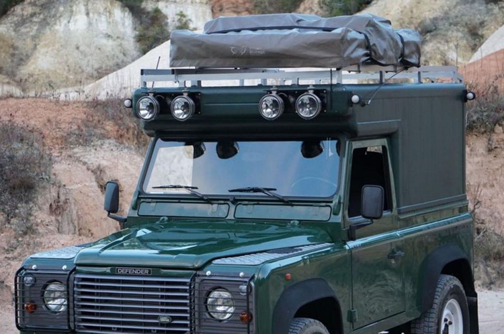
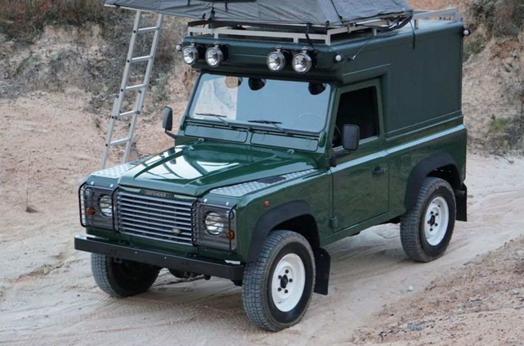
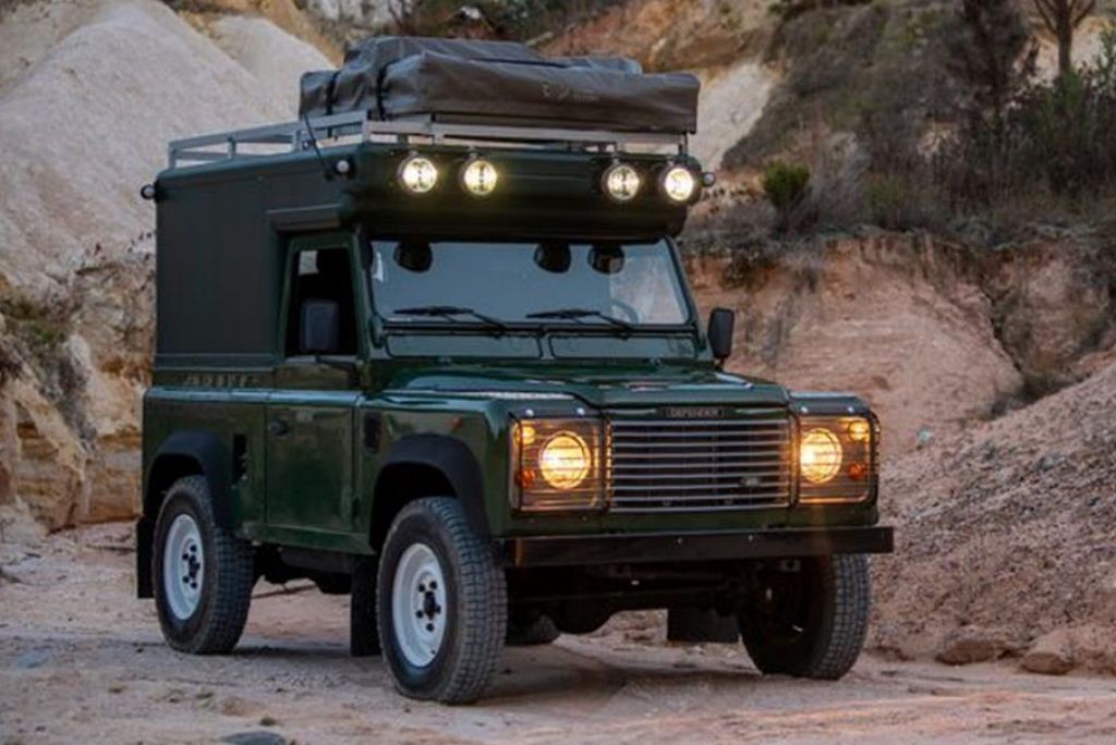
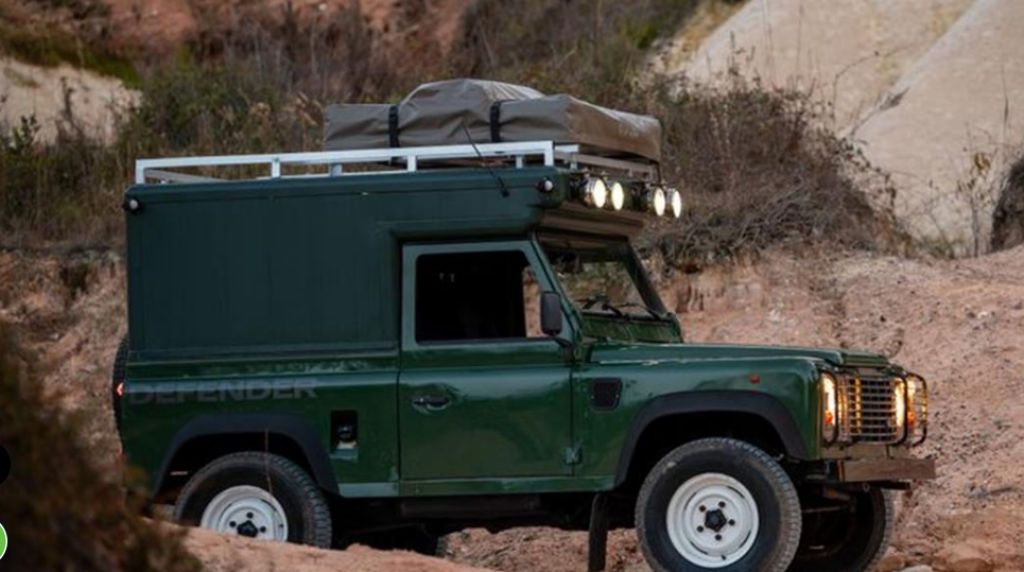
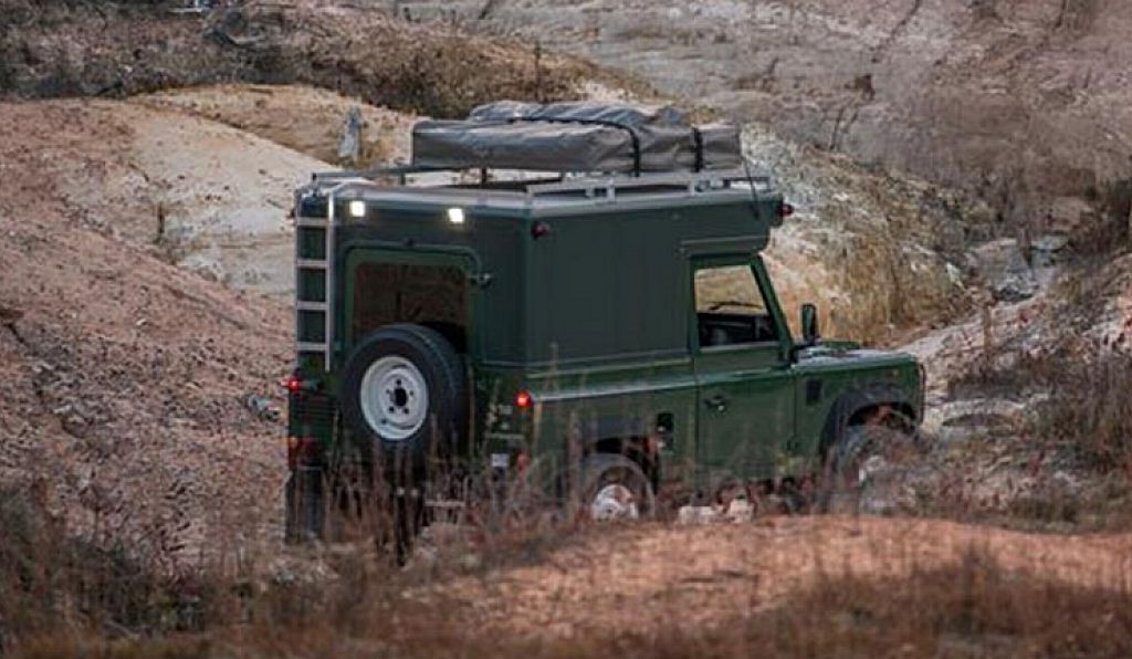
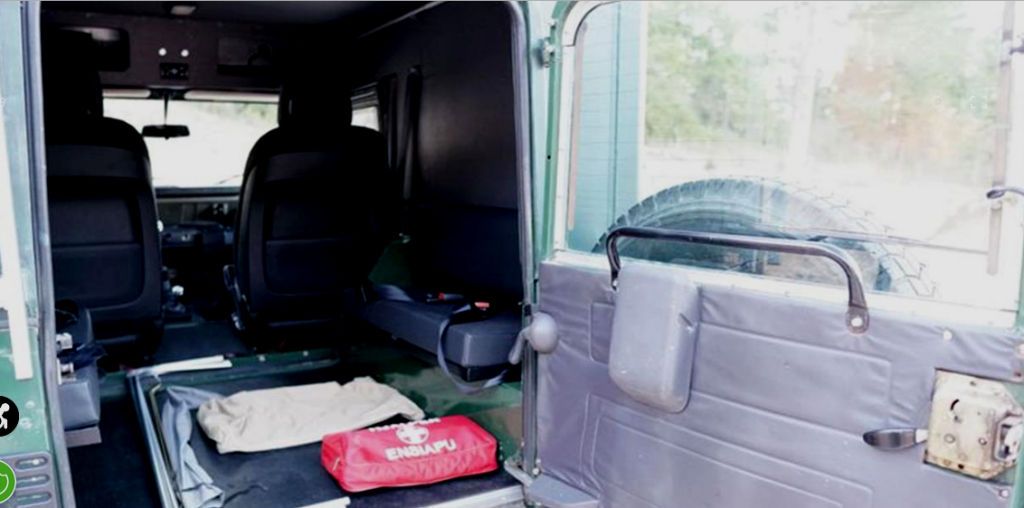
The camper box doesn't seem to be fully implemented, so maybe this is an unfinished project.
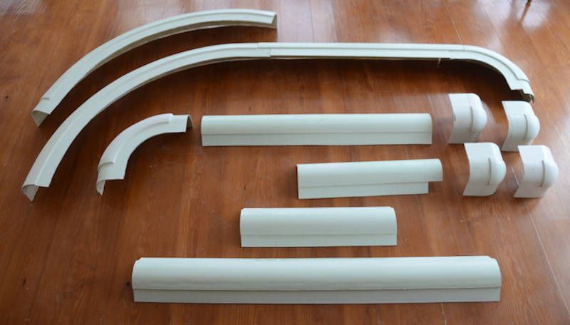
The reason it caught my eye is that I've got the materials to make one. A few years ago I made molds for a range of fiberglass framing parts for building camper tops, trailer tops, etc. These are some of the parts out of those molds:
One of the toppers I made using those parts was for my Jeep-tub trailer. It uses those framing parts for the corners and 1/4" plywood for the walls.
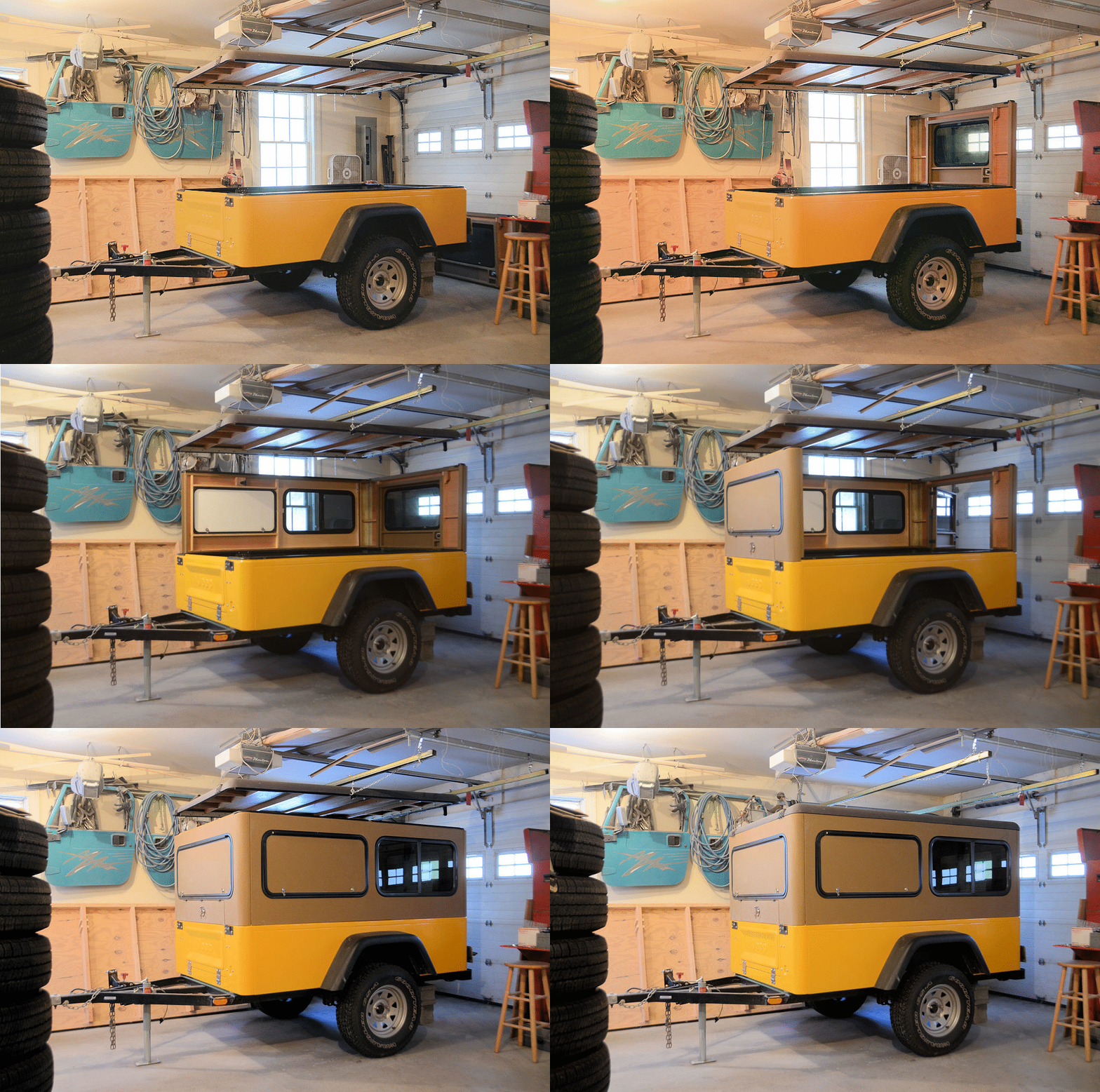
Back when I was doing this project I drew these concepts...
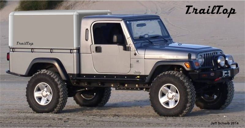
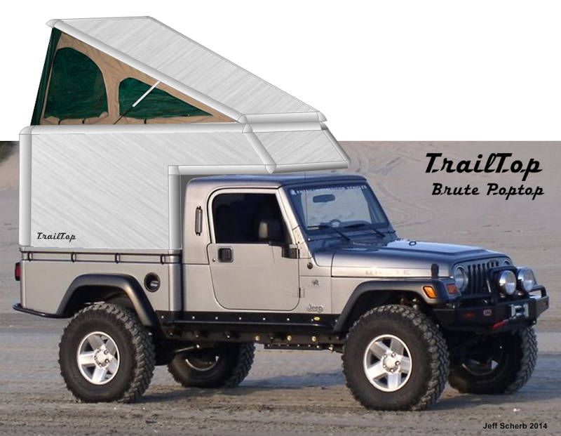
If I didn't know any better I'd think that Land Rover camper top was made using my parts.
This 1996 Land Rover Defender 90 is shown with a Coniston Olive Green exterior featuring a custom built insulated aluminum camper box. The camper box is removable and easy to convert for use as a standard wagon or convertible.


The camper box doesn't seem to be fully implemented, so maybe this is an unfinished project.

The reason it caught my eye is that I've got the materials to make one. A few years ago I made molds for a range of fiberglass framing parts for building camper tops, trailer tops, etc. These are some of the parts out of those molds:

One of the toppers I made using those parts was for my Jeep-tub trailer. It uses those framing parts for the corners and 1/4" plywood for the walls.

Back when I was doing this project I drew these concepts...


If I didn't know any better I'd think that Land Rover camper top was made using my parts.
jscherb
Expedition Leader
I had forgotten about the EarthRoamer. It does look very similar.It looks a lot like the old JK Earth Roamer.
The EarthRoamer also had a pop-top...
I did a pop-top on the camper top for the Jeep-tub trailer, so that could be done with the fiberglass parts I posted as well...
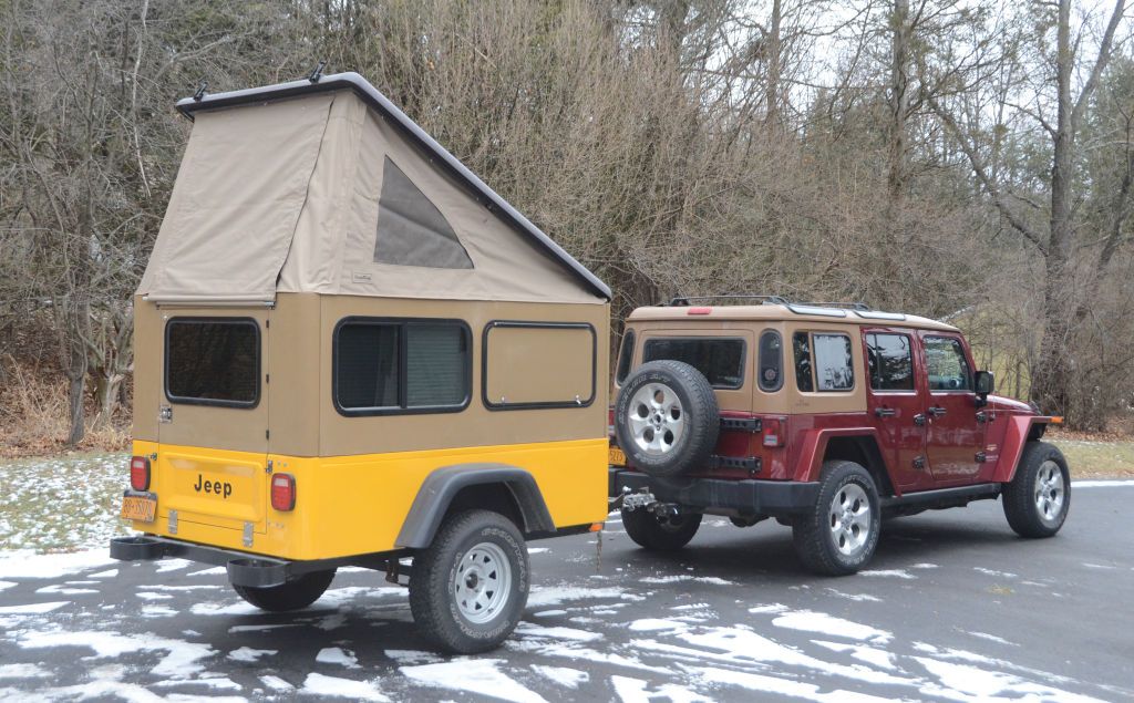
If I wanted to turn my Jeep into a dedicated camper I probably would have built one by now
Fly fisherman
Member
jscherb
Expedition Leader
Greg has done an outstanding job developing that top, the fit is great and the materials are the best. In my opinion, it's a very good value for the price considering the quality.I like this product. Price is a little steep for me.
jscherb
Expedition Leader
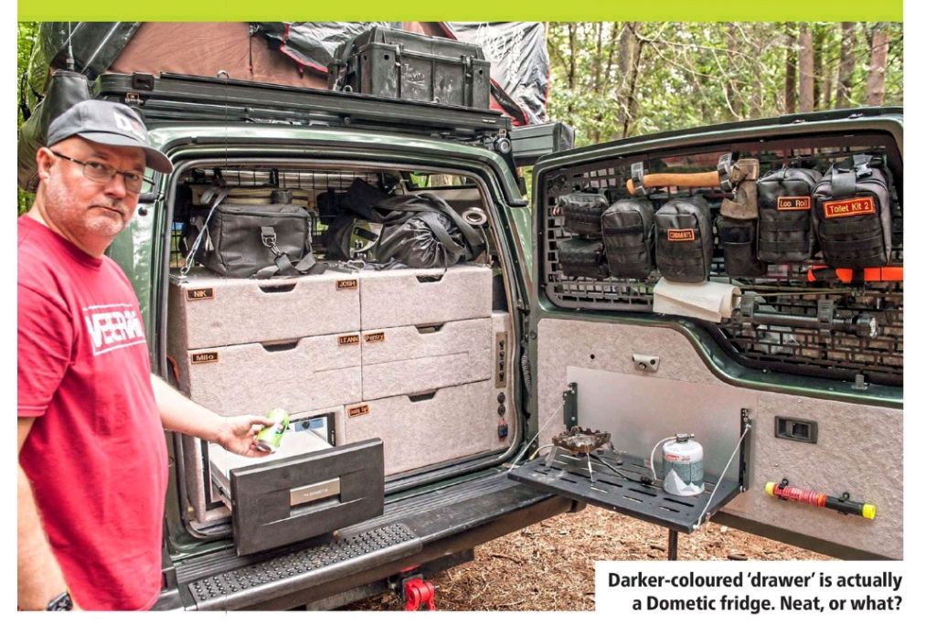
From the January issue of Land Rover Owner, a fully built storage system for the inside of a Discovery:
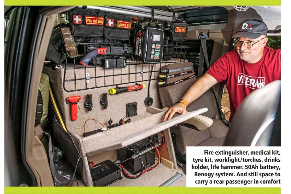
This next view is from the front. One side of the split rear seat is removed and there's storage and the accessory electrical system in its place.
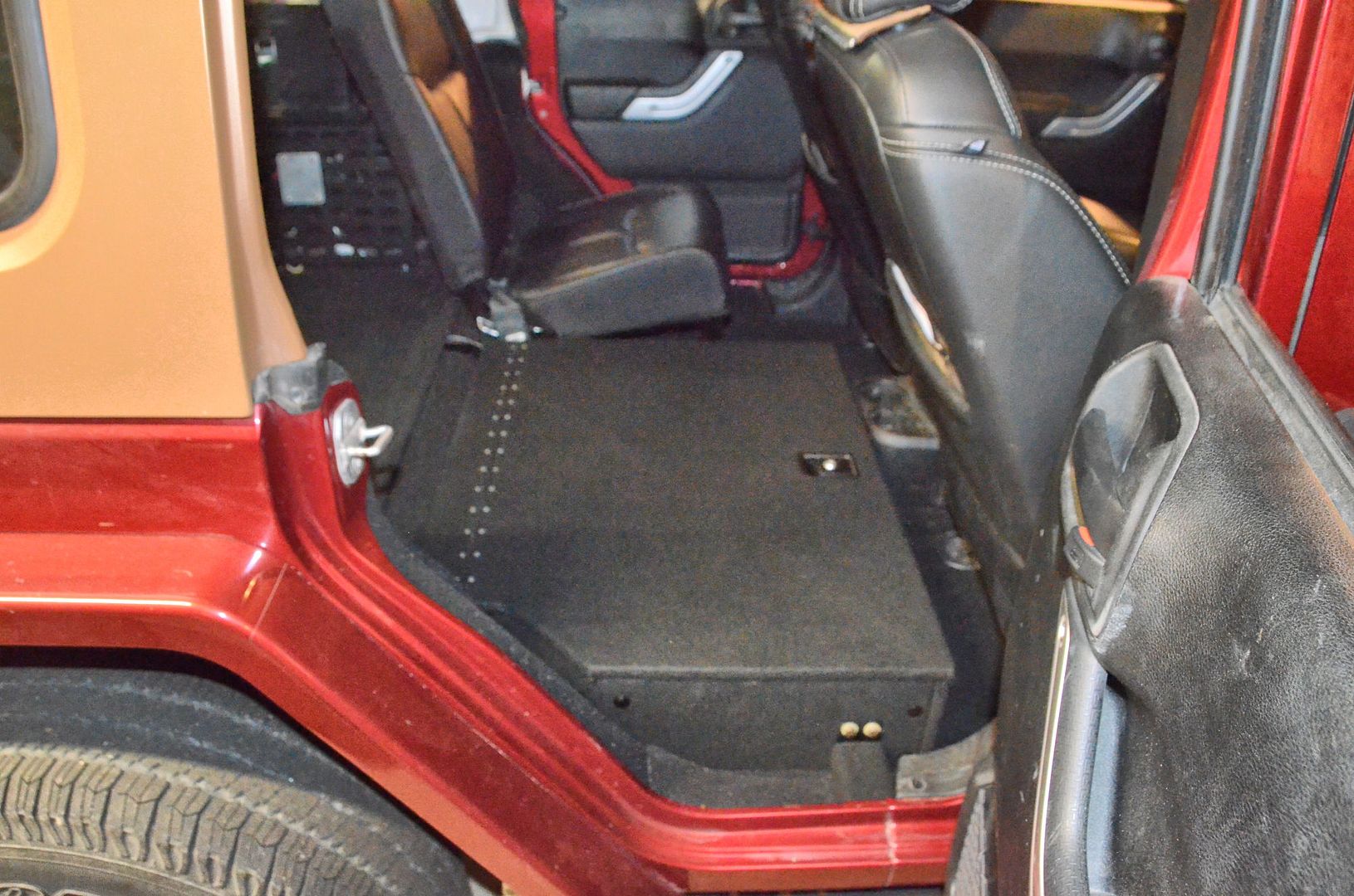
It's not uncommon to remove half of a Wrangler's split rear seat. I've got a floor extension with storage under it in my '13 JKU, but I don't think I'd go as far as that Disco owner did in building it out:
Back to the first photo - did you notice the drawer fridge? They're fairly common in big rigs but almost unheard of in expedition vehicles. It's a Dometic 31-quart: https://www.dometic.com/en-us/outdo...dometic-coolmatic-cd-30-137040#specifications
I used a Dometic drawer fridge in a slide-out kitchen design I did for Tentrax trailers. Everything folded up and slid into a box that mounted on the tongue of the Tentrax (or most any other trailer tongue). The drawer fridge was accessible even when the full kitchen was stowed, it was very handy.
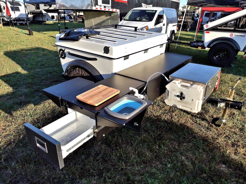
I had the Dometic drawer fridge here for a while while when I was doing the design.
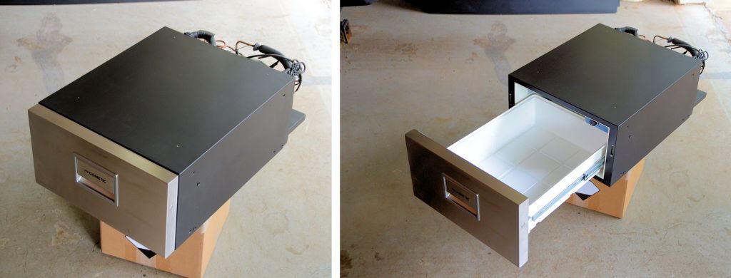
I posed it on my MORryde Trail Kitchen just to see how it might work out in that application.
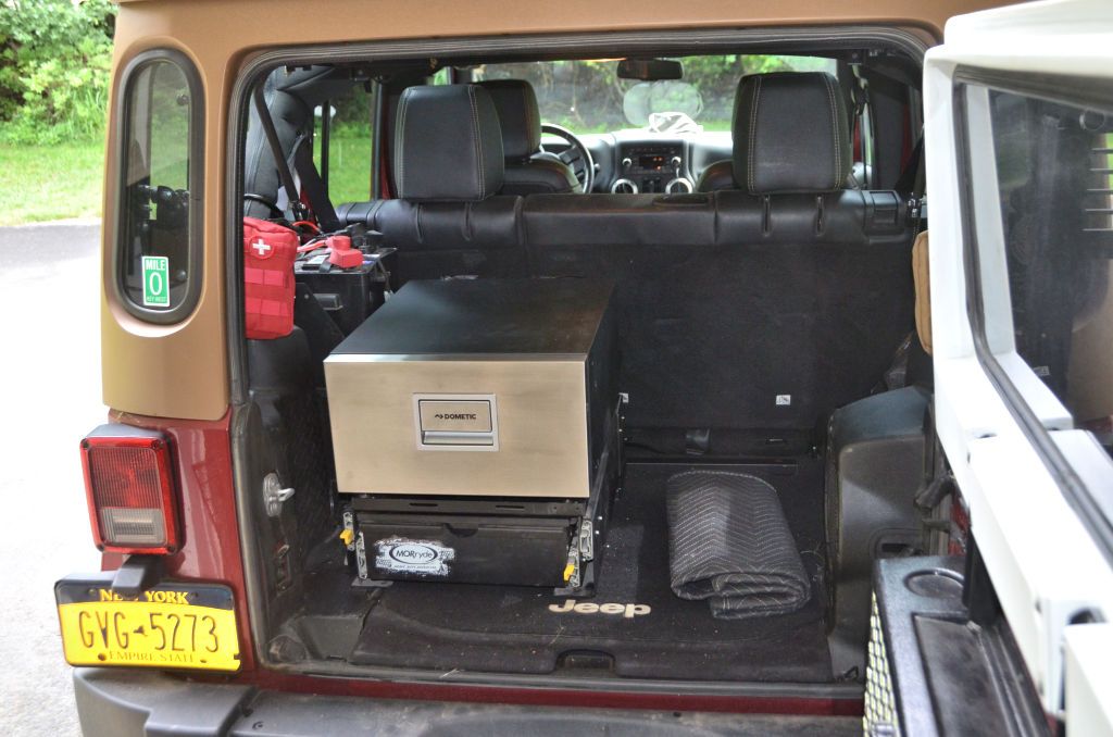
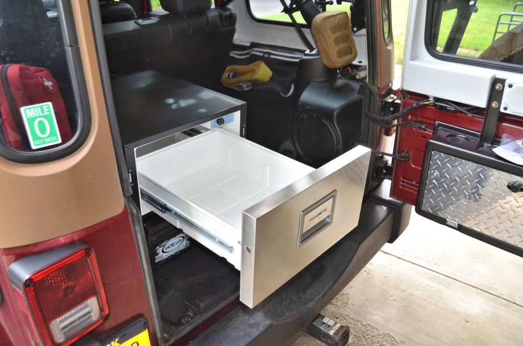
I think drawer fridges are worth considering for an expedition build.

This next view is from the front. One side of the split rear seat is removed and there's storage and the accessory electrical system in its place.

It's not uncommon to remove half of a Wrangler's split rear seat. I've got a floor extension with storage under it in my '13 JKU, but I don't think I'd go as far as that Disco owner did in building it out:

Back to the first photo - did you notice the drawer fridge? They're fairly common in big rigs but almost unheard of in expedition vehicles. It's a Dometic 31-quart: https://www.dometic.com/en-us/outdo...dometic-coolmatic-cd-30-137040#specifications
I used a Dometic drawer fridge in a slide-out kitchen design I did for Tentrax trailers. Everything folded up and slid into a box that mounted on the tongue of the Tentrax (or most any other trailer tongue). The drawer fridge was accessible even when the full kitchen was stowed, it was very handy.

I had the Dometic drawer fridge here for a while while when I was doing the design.

I posed it on my MORryde Trail Kitchen just to see how it might work out in that application.


I think drawer fridges are worth considering for an expedition build.
jscherb
Expedition Leader
I think need something like this (from the December issue of Land Rover Owner):
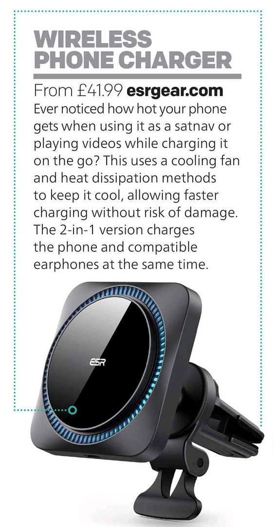
I do already have a wireless charging mount in each of my Jeeps:
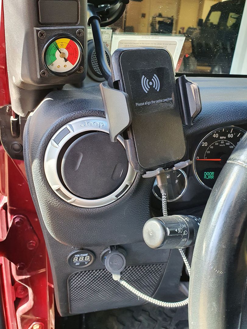
But... I often use my Samsung Android phone for navigation, and on long trips it heats up and charging shuts off so the Google Maps app ends up draining the phone battery. Remember a few years back when Samsung phones were catching on fire on airplanes? I think after that they made the wireless charging so conservative that it shuts down when the phone gets even slightly warm.
Maybe if I can find a charging cradle with a fan in it like the one in the magazine I won't have that problem.
While I'm on the subject of "satnav" as they call it in the Land Rover magazines, I'm dissatisfied with all of the navigation options I've got and usually end up using two devices and three apps for navigation.
- Google Maps. Seems to have the best knowledge of traffic delays and the best detours around them. But the ability to see what's at the next exit, or if there's a Culvers restaurant (for example) at an upcoming exit really sucks while driving - so much scrolling and swiping is required that it's unsafe to use while driving.
- I also have a Garmin GPS in each Jeep, and while they're not so good at traffic problems, they excel at "whats at the next few exits". The user interface is optimized to minimize driving distraction, so it's much better at some things than Google Maps. I have them mounted to the footman loop at the top of the windshield:
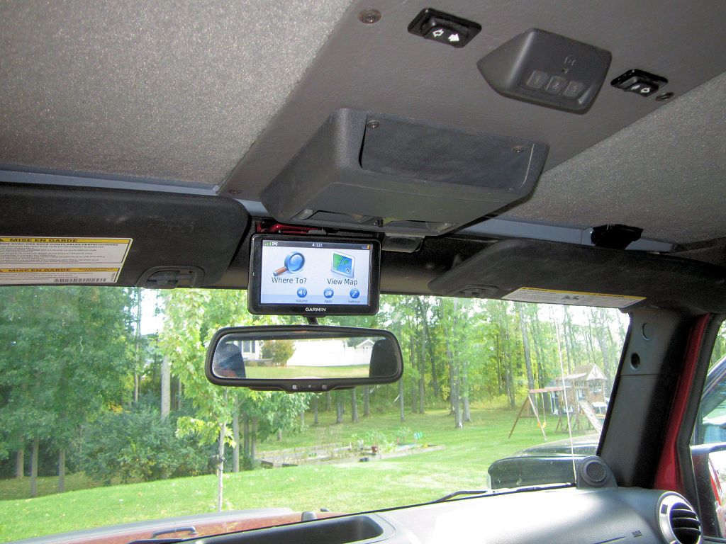
BTW all of the Garmins are older models which you can pick up on eBay for very little, which is why I have three of them.
The Garmins are also very good on the trail, many forest service roads and trails are already in the database, and I always load the GPS coordinates of any trails I plan to do before I leave home so they're great for navigating off road.
The Garmin "what's at upcoming exits" feature is great, but it's limited - only shows for the next 40 miles or maybe 8 exits. Many times I want to plan the rest of the day - for example, if I figure I'll go 200 more miles on the highway before stopping at a hotel, neither Google Maps or the Garmins are very good at finding a hotel in 200 miles. So for that I use the iExit app. I can scroll easily (and without much distraction) many miles forward to find hotels, or truck stops (I prefer them to random gas stations on the highway). These screen shots are from the iExit web site:

Another thing iExit is good at is showing gas prices at upcoming exits.
Sorry for so much whining (in the Land Rover magazines they might call it "whinging"?) about satnav, but I really haven't found one single solution that does it all.
I can live with using two devices and three apps, but I really want to solve the charging problem. I need to get charging cradles with fans like the one above.

I do already have a wireless charging mount in each of my Jeeps:

But... I often use my Samsung Android phone for navigation, and on long trips it heats up and charging shuts off so the Google Maps app ends up draining the phone battery. Remember a few years back when Samsung phones were catching on fire on airplanes? I think after that they made the wireless charging so conservative that it shuts down when the phone gets even slightly warm.
Maybe if I can find a charging cradle with a fan in it like the one in the magazine I won't have that problem.
While I'm on the subject of "satnav" as they call it in the Land Rover magazines, I'm dissatisfied with all of the navigation options I've got and usually end up using two devices and three apps for navigation.
- Google Maps. Seems to have the best knowledge of traffic delays and the best detours around them. But the ability to see what's at the next exit, or if there's a Culvers restaurant (for example) at an upcoming exit really sucks while driving - so much scrolling and swiping is required that it's unsafe to use while driving.
- I also have a Garmin GPS in each Jeep, and while they're not so good at traffic problems, they excel at "whats at the next few exits". The user interface is optimized to minimize driving distraction, so it's much better at some things than Google Maps. I have them mounted to the footman loop at the top of the windshield:

BTW all of the Garmins are older models which you can pick up on eBay for very little, which is why I have three of them.
The Garmins are also very good on the trail, many forest service roads and trails are already in the database, and I always load the GPS coordinates of any trails I plan to do before I leave home so they're great for navigating off road.
The Garmin "what's at upcoming exits" feature is great, but it's limited - only shows for the next 40 miles or maybe 8 exits. Many times I want to plan the rest of the day - for example, if I figure I'll go 200 more miles on the highway before stopping at a hotel, neither Google Maps or the Garmins are very good at finding a hotel in 200 miles. So for that I use the iExit app. I can scroll easily (and without much distraction) many miles forward to find hotels, or truck stops (I prefer them to random gas stations on the highway). These screen shots are from the iExit web site:

Another thing iExit is good at is showing gas prices at upcoming exits.
Sorry for so much whining (in the Land Rover magazines they might call it "whinging"?) about satnav, but I really haven't found one single solution that does it all.
I can live with using two devices and three apps, but I really want to solve the charging problem. I need to get charging cradles with fans like the one above.
jscherb
Expedition Leader
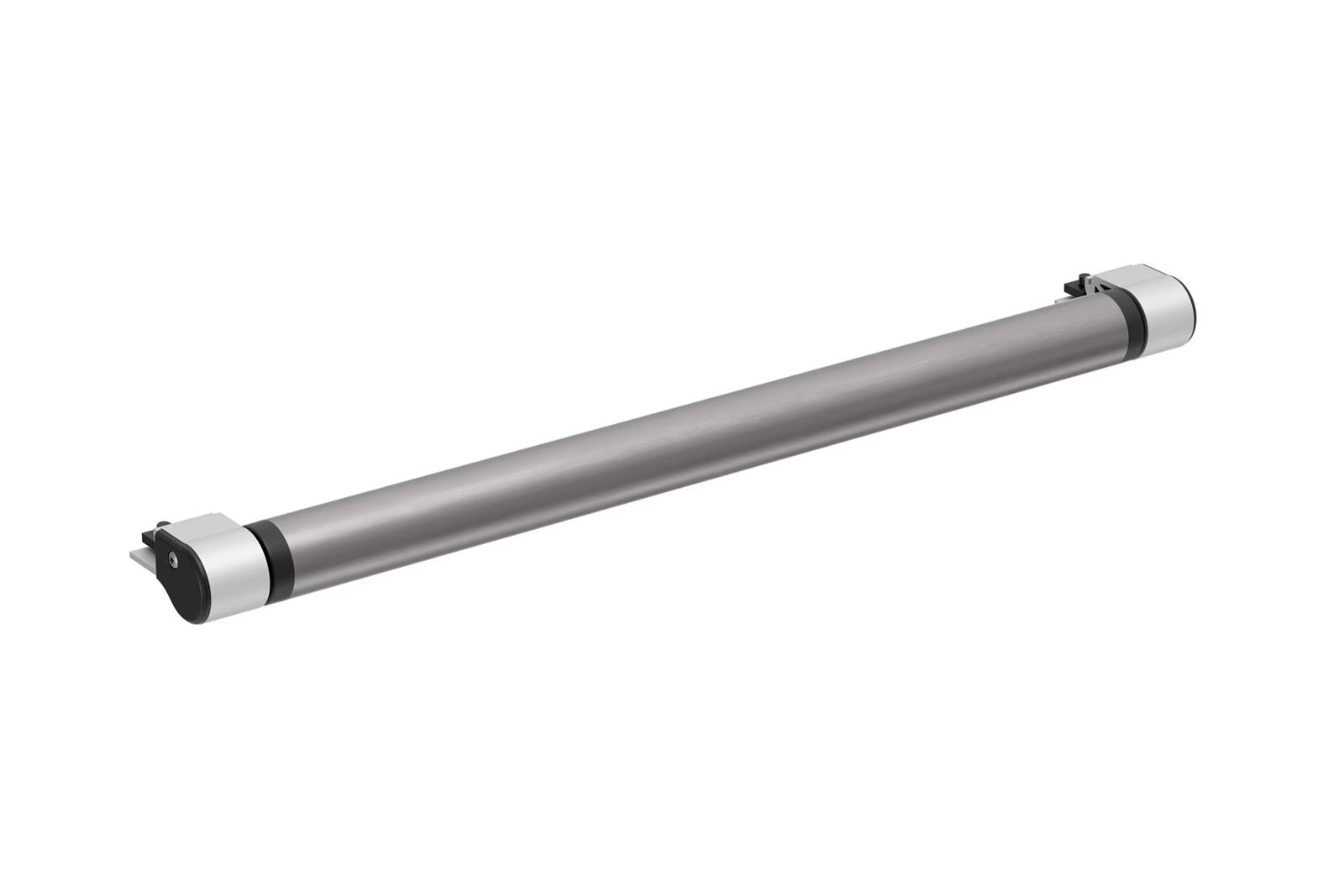
I haven't seen anything like this before (from the February issue of Land Rover Owner):

Seems like rollers on a rack would be great for loading things like kayaks. Might be good for me too, I install my RTT singlehandedly and having rollers like that might make one-person installation of a roof top tent even easier...

Seems like rollers on a rack would be great for loading things like kayaks. Might be good for me too, I install my RTT singlehandedly and having rollers like that might make one-person installation of a roof top tent even easier...
Rollers have been used for loading canoes and kayaks for many years. Some are attached directly to roof racks. Some are strapped to vehicles. Some use suction cups.... Seems like rollers on a rack would be great for loading things like kayaks. Might be good for me too, I install my RTT singlehandedly and having rollers like that might make one-person installation of a roof top tent even easier...
Some examples:

ShowBoat 66
All those extra hands you're bringing will only needed for applause. With the Showboat 66 the load-assist roller slides out over the rear of the vehicle for easy access and vehicle protection while loading and unloading your boat. It also adjusts from side to side for loading multiple kayaks.
Thule 335102 Thule Roller XT Bars | Summit Racing
Free Shipping - Thule Roller XT Bars with qualifying orders of $109. Shop Roof Rack Components at Summit Racing.

Kayak Lift Assist | Suction Mounted Roof Roller
A suction cup tool for helping you lift your watercraft up on your roof rack.
 www.storeyourboard.com
Last edited:
Jurfie
Adventurer
I think drawer fridges are worth considering for an expedition build.
I think the drawer fridges are great in a permanent rig setup, however one thing I like about my portable fridge/freezer(s) is the ability to pack it up the night before and leave it plugged into the wall safely inside, then throw it in the Jeep plugged into the rear 12V when I leave. I plug it into a Bluetti AC50S power station when I’m not driving, which is plenty for my needs and adheres to my KISS principle (#notsponsored).
A permanently affixed fridge (like a drawer) would take time to load in the morning before setting out. Not the end of the world, but I’m not much of a morning person and hate feeling rushed to leave to make camp before dark, or more likely for me these days: trying catch an early scheduled ferry.
jscherb
Expedition Leader
Came across this photo in one of the magazines, hadn't seen a canopy/awning/whatever like it before:
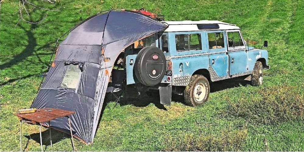
Not sure if I'd use one like that, but the slant on it reminded me of something I saw at Walmart recently:
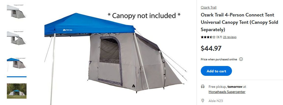
Seems like that tent would integrate well with almost any awning mounted to the side or rear of a vehicle and make for a nice base camp you could leave set up and drive away from. The tent: https://www.walmart.com/ip/Ozark-Tr...-Canopy-Tent-Canopy-Sold-Separately/460806076
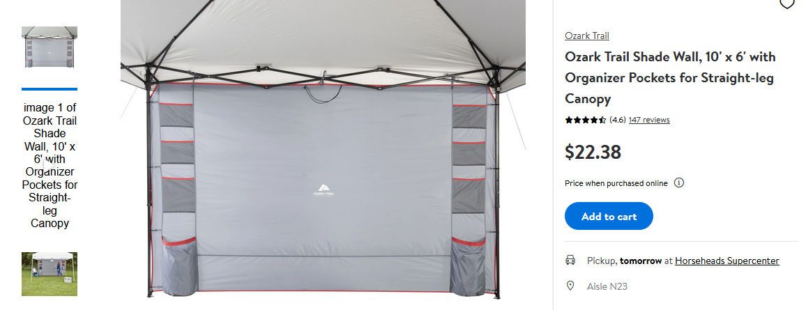
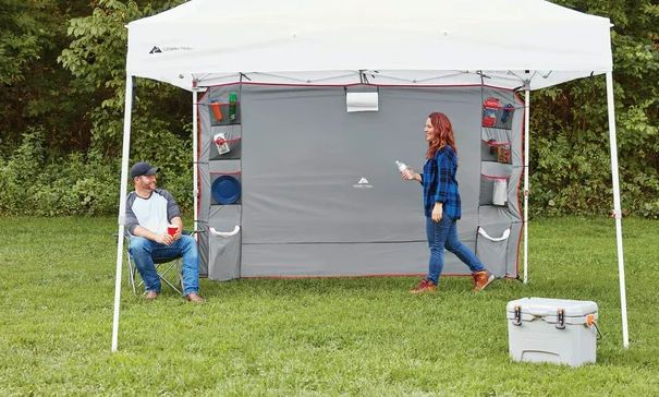
And speaking of awnings (and an awning connected to the tent above), for more weather protection, some of these might be good as side walls (https://www.walmart.com/ip/Ozark-Tr...zer-Pockets-for-Straight-leg-Canopy/495552727):

Not sure if I'd use one like that, but the slant on it reminded me of something I saw at Walmart recently:

Seems like that tent would integrate well with almost any awning mounted to the side or rear of a vehicle and make for a nice base camp you could leave set up and drive away from. The tent: https://www.walmart.com/ip/Ozark-Tr...-Canopy-Tent-Canopy-Sold-Separately/460806076
And speaking of awnings (and an awning connected to the tent above), for more weather protection, some of these might be good as side walls (https://www.walmart.com/ip/Ozark-Tr...zer-Pockets-for-Straight-leg-Canopy/495552727):


Similar threads
- Replies
- 0
- Views
- 1K
- Replies
- 2
- Views
- 2K
- Replies
- 2
- Views
- 2K

