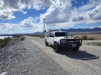
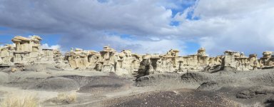
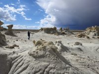
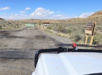
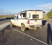
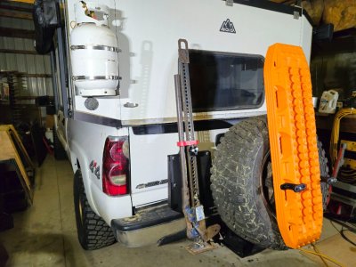
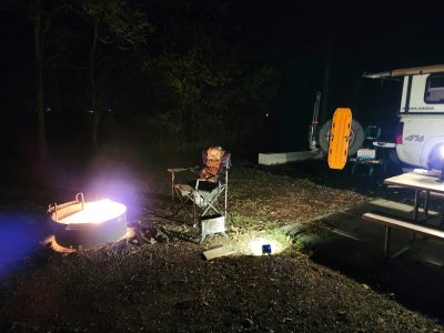
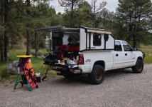
Lee's '04 Chevy Silverado 2500HD and Radica MoonLander camping shell

Lee

Active member
So, my nephew decided to get married out in California where I am originally from.
My brother and his half of the clan still live out west but my parents moved to Ohio 20 years ago, Dad is passed now so it fell on me to get Mom out for the wedding.
For the price of air fair I got my adult daughter to travel with Nana and I loaded up the truck, took two weeks’ vacation and started driving.

At the last minute I finished hooking up the diesel heater.
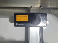
But when I tried to fire it up I got an error code for a duct blockage.
Apparently the unit detects the motor speed is too low but it doesn’t know why.
And to add to the confusion, there is a fan on one end of the motor for the hot air circulation and a fan on the other end to circulate the combustion air.
So I have no idea which end has too much restriction.
Out of time I ignored the heater for the duration.
20251004_220322.jpg

My wife flew out to Tucson to visit her sisters so I had a little more flexibility with the first part of the trip.
I departed from work on a Thursday and drove a few hours to get to the other side of Indianapolis before hitting a hotel.
I-70 threw Indiana is horrible, it feels like there has been construction for the last 30 years.

Friday night I camped in Sayre Oklahoma, a thousand miles out from home.
The city park in Sayre allows camping with electrical hookups for $12 a night.
It sort of looks like the camping for the local fairgrounds.
It’s not glamorous but it is very convenient, park next to a utility hook up, plug in (I brought an electrical space heater since I didn’t have diesel heat) then walk over and drop your money in a box.
I didn’t get a picture.

Day two I drove through Amarillo, Roswell and Alamogordo and camped in the James Canyon campground in the Lincoln National Forest.
The campground has two decent spots that were already taken and a few walk in sites, I just parked in the parking lot for the walk-in sites for the night.
20251011_174123.jpg

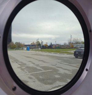
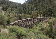
Picture of the abandoned train trestle near Cloudcroft.
20251011_164333.jpg

Day three, Sunday, I was up before the sun and driving down off the mountain headed west.
Between the mountain road, the dark and the fog I was doing a lot of 10 ~ 15 mph.
It’s probably a pretty drive in the summer.

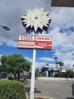
I didn’t stay long in Tucson but I did stop at Lucky Wishbone.
It’s a local fast food right out of the 50’s and 60’s, they still have the original neon sign out front.
20251012_113944.jpg

My wife grew up just down the street from this place.

Day 4, Monday, the adventure really gets started.
To be continued…
 
Last edited:

Lee

Active member
Continued from above.

We left Tucson early Monday morning and drove ~400 miles to the start of the Mojave Road.
Growing up in the south bay area of Los Angeles Dad took us camping a lot in the Mojave Desert.
It was a reasonable distance from home for a weekend getaway.
When I left California 30 years ago the federal government had closed down a huge swath of desert right across the middle of the Mojave.
At that time it looked like a death blow for off roading unless you wanted to do circles around camp.
Maybe that was short sighted, now 30 years later there are several overland tracks that are able to stitch together interesting routes that travers the closed areas on the few roads that cross the Mojave preserve.

After catching a late lunch in Parker Az we arrived at the start of the Mojave road along the banks of the Colorado River.
The Colorado looks more like a canal in this area but don’t try to burst my bubble – this is a bucket list trip for me.

20251013_133952.jpg

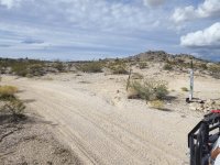
The very eastern end of the road seemed a little more off roady than I expected.
It probably had to do with which of the many tracks thought the desert your map told you was the “real” Mojave Road.
I was using the Overland Trail Guides GPX file loaded on a Garmin Overlander.

Side note: are we using the word overland a little too much?
When I was a kid we just called it “camping”.
We lived in Australia for five years when I was middle school / high school age and the family “camping” was out of a series 2 Land Rover skirting the edge of the Simpson Desert, but it was still just “camping”.

Anyway, the first few miles I carefully picked my way along making slower than anticipated progress.
I had estimated we could do ~20 mph but the reality was more like 10 mph.

Nevada / California border and no immigration check point, as the son of a Japanese immigrant mother it feels like I’m sticking it to the man crossing the border in the middle of the desert without playing 20 questions with the immigration agent (small victories I know).

20251013_143958.jpg

However, soon after crossing in to California the trail crossed some sand stone features that were smooth enough but a jump up about 6 feet tall had me dragging the frame.
Unfortunately, when I added the 52 gallon fuel tank it added a lightly made cross member to support the tank that was pushed back about 18”.
I stopped to assess the situation and decided to continue but to be more careful.
I didn’t want to mess with moving the tank support, I figured if I could leave it alone there was less chance of tweaking one of the ends and breaking a weld or something.
I figured if I had too, I could support the tank with a ratchet strap but it would be better to just leave it.

Fort Piute [edit] I spent more time checking the rig while my wife checked out the interpretive signs.

20251013_160616.jpg

The last part of the road in to Fort Piute was rough with a lot of lose rocks.
I slowed down significantly to make sure I was not causing more damage to the truck.
On the way out we decided to take one of the escape routes out to I-40 and reaccess our plan.
However, after a few miles I heard something scuffing along under the truck, stopped to check just in case and found a significant diesel leak from the engine.

Poking around under the hood I found one of the diesel return lines had popped off at the high pressure pump – located at the front of the block deep in the valley between the cylinder banks.
This hose was under the air intake and under several cooling hoses / pipes.
The thing that pissed me off is I had a replacement hose with hose clamps on my work bench in Ohio – it wasn’t doing me any good there.
As I was getting ready for the trip I made a list of maintenance items I thought a 20 year old truck should have done.
I got about a quarter of the items done but ran out of time.

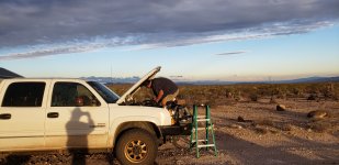
I dug the tools out and got to work.
It took me about two hours to get things disassembled, put the hose back on then reassembled and add coolant – yes I had just enough coolant to refill the system.

-7207337356143169006.jpg

FYI, the hi-lift jack mounted on top of the bull bar was comfy to sit on (another small victory).

It was close to dark when I was ready to restart the engine, and as soon as I did the same fuel return line popped off and started pissing fuel on the engine again.
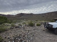
At this point I moved the truck off the track and we “camped” there for the night.
From our camp we didn’t see any lights of other camps or buildings, and no one passed by us on the track.
If the overlanders dream is remote camping I found it.

After stewing on my predicament most of the night I had a list of things to check.
I followed the fuel return line from the engine to the tank and found one of the rubber hoses pinched between the tank and the cab.
When the crossmember was pushed back the tank is sloped so the tank was pushed up pinching the hose.
I used the OEM screw jack and some boards to lift and relieve the load on the cross member, moved the crossmember back to where is belonged and fished the return line from between the tank and the cab floor.
While tearing in to the hose in the engine compartment I was able to blow into the hose and confirm it was free.
There was a lot of restriction but with the length of the return line that was expected.
This time I added a gallon of straight water to the cooling system.

Around noon we got underway.

Lesson learned – There is a list in my head of things that I think are suspect – things related to the accessories I have added that I think are not quite up to snuff, and a list of things I think should be checked or replaced just because of the age (21 years) and miles (160k) on the truck, it’s time to address that list.

Continued below (Spoiler- we survived).
 
Last edited:
Lee

Active member
I should add an addendum to the stranded in the desert saga.
Where we were we had 5G service on the phones.
My wife did her Japanese language lessons on Duolingo, talked to her sisters and answered some question from her work.
For whatever reason she didn’t worry (that I could tell) and carried on making the best of the situation.
(You would think after 40 years of marriage she would know better than to trust me)
She is definitely a keeper to put up with my craziness.

20251019_163753.jpg

Thanks babe, I love ya.
 

Lee

Active member
Continued from above.

After out “remote Camping” escapade we decided to take it easy on the truck.
We kept to dirt roads and other places that a tilt back tow truck could make it to just in case.
We had popped out of the desert on to Lanfair Road not far from the Mojave Desert Heritage & Cultural Association compound in Goffs.
With the government shutdown I knew the ranger station at Hole in the Wall would be closed so the MDH&CA was on my list of stops.
It’s basically a bunch of desert rats who have banded together and they save what they can that is of historical or cultural interest.
Their main building is the old schoolhouse in Goffs, but they have the old railroad depot as well.
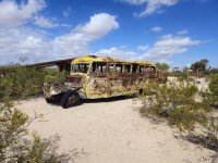
And they have rescued anything the rangers consider “trash” and are wanting to remove from the desert, like the old school bus that has sat out in the desert for years and the gnomes and frogs from the gnome and frog shrines.
It would seem the rangers have no sense of humor.

20251014_113127.jpg

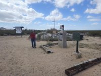
And an old World War 1 memorial that has a cross, can’t have that in a national preserve.

20251014_113856.jpg

This cross led to a supreme court case, in the end the original cross ended up in the MDH&CA compound and the original site ownership was transferred to the VFW where a recreation of the original memorial was built.
The VFW maintains the property with public access and signs pointing out it is private land.
There is even a Wikipedia entry for the cross.

The MDH&CA is on the south side of the Mojave Preserve near I-40.
We decided to drive through the interior of the National Preserve taking Lanfair Road North then Cedar Canyon West, this becomes part of the Mojave Road.

20251014_125122.jpg

Then we hit Black Canyon Road South out to the Hole in the Wall hiking trail.
The trailhead is at the official National Preserve visitors center, it loops around the mountain and short cuts through a cleft in the mountain.
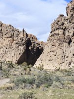
Back side of the mountain where the trail cuts through.

20251014_145249.jpg

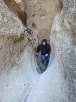
This trail is also called the Ring Trail for iron rings set in to the rocks to enable hikers to traverse the cleft in the mountain.

20251014_150242.jpg

By the time we had returned to the truck it was getting late in the afternoon.
We decided to head into Barstow for the night and get a hotel.
I think my wife was a little adventured out for one day…

To be continued.
 

Lee

Active member
Continued from above.

On Wednesday we headed North East on I-15 towards Vegas.
I-15 defines the Northern boundary of the Mojave Preserve.
From the town (or wide spot in the road) of Baker we headed south into the Mojave Preserve toward Kelso on Kelbaker road.
Not a very original name for a road but it does give a sense of where it goes.
A short side trip on Aiken mine road brought us to the lava tube.
The road parallels the edge of the lava flow for a bit giving a sense of cataclysm that once visited this valley.
There is grass growing on the lava flow now but the sheer volume of it is impressive.

20251015_115240.jpg

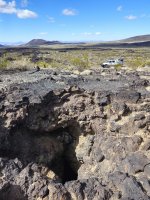
Aiken Mine road skirts the edge of the lava flow for all but the last ¼ of a mile to the lava tube, this is easily reachable with my mom’s Honda CR-V and there is a parking area where the road climbs up on to the lava flow.
Initially I drove past the entrance to the lava tube, only looking at the GPS and seeing the marker behind my position let me know I had missed it.
I guess a hole in the ground requires a little attention to find.
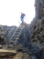
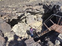
There is ladder to gain entry into the lava tube, once in the area the pipe railing is a giveaway to the location.

20251015_115535.jpg

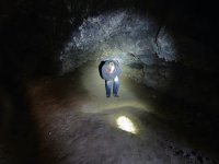
Lava tubes are formed when the outer skin of a lava flow hardens and the interior of molten rock continues to flow leaving a hollow chamber.
This example has a smaller passage leading to a large chamber with only the one entry passage.

The ceiling is a little low.

20251015_120237.jpg

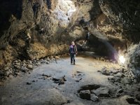
Then it opens up to a larger chamber with a few irregular “skylights”.

20251015_115958.jpg

After being inside and seeing where the holes in the ground lead to I was a little more careful when walking around up top.

Going out the way we went in.

20251015_120358.jpg

After checking out the lava tube we drove on into Kelso.
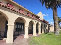
The old Kelso train station is usually opened as a visitors’ center but this year it’s closed for construction working on the air conditioning.
The train depot was originally a dining room and waiting room downstairs with dormitory rooms upstairs for the railroad workers.
The National Parks Service has done a good job restoring and maintaining the property to give a feel of the former glory of railroad infrastructure.

20251015_131600.jpg

Apparently the depot had quite the garden out front but after a period of abandonment in the 1980’s and 90’s only the palm trees survived.

After Kelso we headed back north to I-15 via Cima, another declining railroad town.
Cima Road passes through a Joshua Tree forest, there are multiple pull offs to stop and take pictures from.
Of course, no vehicles passed us while we stopped to take pictures, and no vehicles passed us going the other way while driving back to I-15.

20251015_135721.jpg

This ended our Mojave Desert adventure.
Driving the Mojave road is still on my bucket list but we did get to see a few of the sights.

Once back on I-15 we headed into the LA area and on to Oxnard.
My Dad picked up a number of time share places after he retired.
One was on the Outer Banks in North Carolina that my wife muscled in on.
Every year in August the extended family still goes for a vacation at the beach.
My brother and his family got to go to the beach in Oxnard, so my nephew lives in that general area now (not on the beach thou).
Most of the extended family was able to rent accommodation from the Oxnard time share company in the area for the wedding, my Mom was thrilled to be next door to her great grand kids.
We spent a relaxing long weekend visiting with family and playing with my brothers’ grand kids in a beautiful setting on the beach and attending the nephew’s wedding.

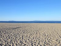
From half a block down from our time share unit, the Channel Islands off the Oxnard coast.

20251016_081544.jpg

While making a Walmart run I stopped into a NAPA and picked up some fuel hose, connectors and hose clamps sized for the fuel feed as well as the fuel return lines.
Can’t be too over prepared.

To be continued.
 

Lee

Active member
Continued from above.

On Sunday, day 11, our daughter loaded up Nana and headed off for the airport to return to Ohio.
We packed up the time share and hit the road to continue our adventure.
My original plan was to head for the Trona Pinnacles, Saline Valley (it’s the valley west of Death Valley and part of the National Park) then tour Nevada along US Route 6.
However a tropical storm passed up from Mexico through Arizona and Utah the week before and now a mass of cold air dropped down from Canada into Nevada.
Elko Nevada was predicting nighttime temperatures in the mid 20’s.
A little colder than I wanted to brave without a functional diesel heater.

While camping on the way out our sleeping bags did a great job keeping us warm with temps in the mid 40’s.
In the morning I would run an electric heater off my power station and the camper would heat right up, but the power station was only good for two hours running the electric heater.
So, plan B was to stay south and hit the four corners area.

On Sunday we headed East towards I-40 stopping at the same ARCO gas station in Victorville that we stopped at on the way into town.
Before moving to Ohio 20 years ago my parents lived just outside of Victorville and this ARCO was my Dads favorite gas station for having low prices, and it still had significantly lower prices for fuel.
A quick calculation showed we got 10 mpg while driving around for four days in the LA area.
Note to self: don’t try to daily a fully loaded, full size overland rig in the big city.
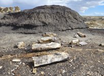
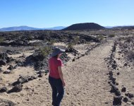
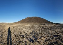
We took a little detour on old Route 66 through Amboy California and stopped at the Amboy Crater, it’s an extinct volcanic cinder cone designated a National Natural Landmark now.
I remember as a kid my Dads Jeep club driving in from the South on a jeep road and having several flat tires, it’s probably been 50 years since I’ve been there.
Now the only way in is a short paved road to a parking lot a mile and a half from the cinder cone.

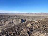
20251019_154459.jpg

It was a beautiful day for a hike, the temperature was around 80 degrees F but when the road turned into the lava field it bumped up to 90F.
It was a bit late in the day when we started hiking.
The sun was behind the cinder cone making taking pictures difficult, the volcano just looked black with no detail.
When I finally got around to the side in the sun it felt like there was too much sun.

20251019_171012.jpg

The trail climbs a hole blown in the side of the cinder cone and circles the rim of the crater.
The view from the rim is fantastic, the lava field is super lumpy not what I would have guessed.
In my next life I’m thinking I want to be a geologist.

20251019_163646.jpg

While we were hiking, we chatted with a lady who mentioned they where there for the comet.
I didn’t really understand what she was talking about until we got back to the parking lot.
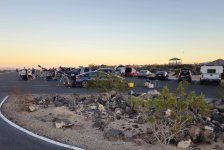
There was an astronomy club setting up their telescopes getting ready for the sun to set, apparently there were two comets visible at the time.

20251019_175616.jpg

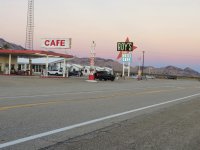
Just down the road from the Amboy Crater is the town of Amboy, a gas / motel stop on old Route 66.
The old “ROYs” sign has been restored and is illuminated again, this made for a more dramatic picture just after sun set as we passed by.
I posted this picture in the Route 66 thread, but it was too good not to re-use.

20251019_180535.jpg

Sunday night we stopped in Needles California, I had hoped to make Flagstaff but it just wasn’t going to happen.

To be continued.
 

Lee

Active member
Continuing from above, Monday, day 12.

We slept in a little after the hiking the day before, then we where off to Valley of the gods in Southern Utah, about 400+ miles from Needles Ca.
With a stop at Walmart in Flagstaff for a few supplies it was getting onto evening when we found a camping spot.

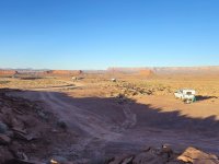
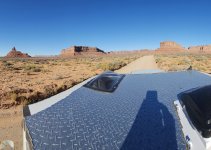
20251020_181049.jpg

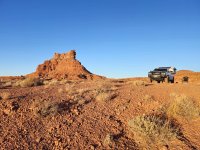
The formation in the background is Setting Hen Butte.
It looks fantastic but I found the reports about heavy usage to be true along the south entrance road.
There is a Subaru behind the bush on the left, that’s why the super low angle picture.

Facing the other way:

20251021_081549.jpg

From the camper we really can’t see out the windshield, so I pointed the truck towards the line of campers.
I did enjoy watching the Subaru leave in the morning, he scraped the chin spoiler multiple times despite driving super slowly.
Later in the day driving along the loop road through the valley the number of vehicles dropped off significantly.
Apparently the camper trailers, vans and SUVs are not too keen on how rough the road is, but again my Mom's Honda CR-V could have made it.

I had heard about Valley of the Gods years ago from my Dad, after retiring Mom and Dad would travel in a camper trailer for six to nine months of the year.
It’s been on my list for years.

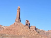
20251021_094017.jpg

All of my pictures are just snapshots, I’m not any kind of a photographer, yet it’s still hard to pick just a few pictures to illustrate the area.

20251021_095216.jpg


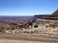
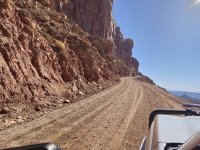
Near the West entrance to Valley of the Gods is Moki Dugway.
The road is officially part of Utah State Route 261, yet it is a narrow dirt road with multiple switchbacks and no guard rails.
The climb up the mesa face was originally made to haul zinc ore down to Mexican Hat.
Must have been an interesting job driving loaded trucks down the hill back in the day.

20251021_132921.jpg

Here I’m pulled off to the side waiting for the water truck to pass.

20251021_103915.jpg

At the top of the hill we took the road out to Muley Point.
Monument Valley is off in the far distance, the river below is the San Juan.

20251021_111523.jpg

Because of the cold nights we opted to find a dispersed camping spot mid-day and set up to eat lunch and take showers.

After we headed back down off the mesa we drove over to Goosenecks State Park.
Here the state of Utah takes your $10 so you can find a spot on BLM land to camp.
I found it amusing more than annoying, the state does provide clean pit toilets and a nice area to air up tires before leaving.

20251021_142142.jpg

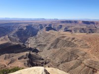
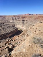
The San Juan River has carved out meanders in this area that are 1000 feet deep.
The park and the camping area encompass one gooseneck that is about a mile long and very flat.
Most of the campers are collected around the entrance with just a few venturing out to the half mile mark.
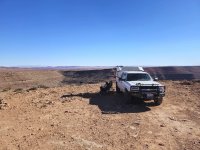
I wanted to try and get a picture of my truck at the end of the gooseneck, so we drove out to the end.
The trail was really rough for the last half mile, we were the only vehicle that ventured out beyond the half mile mark during our stay.

20251021_145941.jpg

However, without a drone it’s impossible to get a picture that shows just how unique this campsite is.
I hadn’t intended to camp out at the end but we did.

Watching the low angle sun just before sun set light up the surrounding desert.

20251021_182109.jpg

To be continued.
 

Lee

Active member
Commentary:

I've posed the question before, can you really be an overlander without a drone?
Camped out at the end of the gooseneck I could not get a picture that showed just how far out we were.
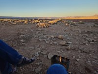
Driving out, camped and just sitting by our fire can I was all too aware that we were out on the edge of a cliff on three sides.
And yes I did jamb a rock front and back of all four tires - and still didn't sleep well.

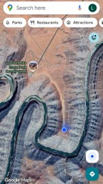
This is the best I could do to show how unusual this camp spot was.
Screenshot_.jpg

This is a screen grab of my phone showing our location, I used this tell our daughter where we were camping, she keeps tabs on us like we used to try and do when she was a teen (if I only knew how that was going to come back to haunt me...)

If you ever get out to southern Utah I highly recommend it.
 

Forum statistics

Threads
190,620
Messages
2,929,700
Members
234,294
Latest member
Joseph McCormack
Top