Maine to James Bay March 2007

mike h

Adventurer
Looks like I'm driving to James Bay in March for about 10 days to do some research on the hydro-electric project and Cree culture. This link shows most of the communities I'll visit. (hit the map link)

http://www.creetourism.ca/james-bay-cree.asp

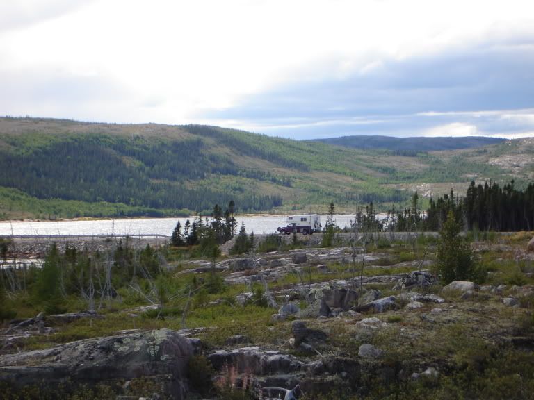
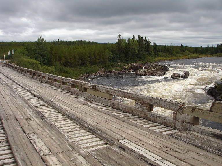
Anyone been there? I'll enter at Montreal. Not much of a hardcore expedition, these are maintained roadways. We'll be sleeping indoors. Two years ago I drove a three week, 4000 mile loop: Maine - Cape Breton - Newfoundland - Labrador (Trans-Lab Hwy) - Quebec - New Brunswick - Maine, but that was dirt roads in June. This will be all on hardpack snow/ice.

I'll be with one other guy (same person accompanied me on the Trans-Lab trip) who knows the region a little bit from previous (summer) trips. We will of course be prepared for multiple days in the truck should a major mechanical or stuck occur, but again, these are fairly well traveled roads.

I drive a well-built 97 Nissan Pathfinder. My primary decision today revolves around tire choice, currently on Goodyear MTRs (31 x 10.5) but these aren't so great for covering ground on hardpack snow. I could look into getting them siped, or maybe I should buy a set of BFG ATs, or the Goodyear AT version of the MTR. I'd rather not buy dedicated snow tires just for this trip.

Thoughts?

thx,

m.
 

BajaTaco

Swashbuckler
Michael, this sounds like a GREAT trip! Good luck with it.

On the tires, I think the BFG AT's would be great for this trip. If you wanted something a bit more aggressive, I can tell you that I am using the Cooper STT's and they work really well in snowy/muddy/icy/slushy conditions. The BFG's will last much longer though.
 

upcruiser

Perpetual Transient
Great link for the info. I've wanted to go up this way for some time. I'd really like to go in the summer though and get some paddling in on the bay and inland waterways. KMR who posts on this forum has made this trek before from the east, maybe he'll post up some additional info for you.
 

mike h

Adventurer
Thanks for the input - mounted a set of 31x10.5 BFG ATs on Cragar Soft-8 steelies, so I have a complete second set of wheels/tires in addition to the MTRs. As heavier tires go, the MTRs are very streetable, but I forgot how quiet the ride can be with ATs. I can actually hear my exhaust again. We went over the Nissan closely this weekend and did fluids, dealer did an injector cleaning service and alignment; everything looks ready to go.

m.
 

KMR

Adventurer
Ooooh that is going to be fun!
The BFG ATs will do great in the hard packed snow roads they have up there, the tread pattern seems to be the perfect compromise to clear the lugs and yet be quiet and manageable on the road.
 

BajaTaco

Swashbuckler
I agree on the BFG's... Scott's Tacoma rides so nice and quiet with the new AT's on there. They'll work GREAT for where we are headed.
 

Lost Canadian

Expedition Leader
Mike, I was actually up there a few years ago. It can be a somewhat boring drive as it's fairly flat, but it's OK. I'm not sure if you are going any further then the northern part of the James Bay road but if you do end up jumping on the Trans-Taiga Road go seriously prepared, there are no towns around aside from the hydro settlements. Spares and fuel are a must. Also be prepared for an emergency. You don't want to be stranded up there in summer let alone winter. Cell phones don't work that far north either so a sat. phone is a good idea. Emergency phones are spaced out over a pretty good distance. Watch for rocks because there are some pretty big ones scattered along the road that will kill tires. Any chance you have to fill up do it. Fueling stations span some pretty good distances. Other then that enjoy the drive.
 

mike h

Adventurer
I'm not doing the Trans-Tiaga, just Radisson and Chisasibi, then working south and traversing west to the communities on James Bay as time permits. I'd like to return north with one or more other vehicles to explore the Trans-Tiaga one of these seasons, preferably in the fall. Those tangential roads are considerably less travelled than James Bay Road or Trans-Lab, which have light traffic daily.

When I drove the Trans-Lab, I was a bit shocked at the level of ignorance we encountered among fellow travellers who were very unprepared. Certainly we met several who were very independent and self-sufficient, but the Quebec City couple who's tire I changed for them was a disaster waiting to happen.

I'm expecting it to be a monotonous drive, but I enjoy that level of remote landscape, it has its own rewards, just experiencing the vastness of place. A lot of white place, I expect, in March.

I'll carry two mounted spares, full fluids, filters and a few belts/hoses, 5 gallons of fuel on the roof, recovery gear - my usual backcountry kit. This particular route is remote but not in the sense that a mechanical will leave us 'unfound' for days. My bigger concern is whiteout conditions and impassable drifts. But again, this would mean waiting for less than 24 hours for the plow crew. Not exactly a severe hardship, but reason for concern. No sat phone, not expecting the cell to work, nor many options for the CB.

We're comfortable in winter conditions, so we'll have appropriate clothes/bags/food if we have to spend time camped out in the vehicle. But when I say winter conditions, I mean around zero - this region can become much colder. I'm more concerned about potential vehicle problems with the cold than human.

But that is exactly what makes it alluring as well.

m.
 

Lost Canadian

Expedition Leader
The wife and I are doing "the loop" with a jaunt down the trans-lab this June. How were the ferries? Did you see any ocean life? My wife is hoping to see some whales.
 

paulj

Expedition Leader
Lost Canadian said:
The wife and I are doing "the loop" with a jaunt down the trans-lab this June. How were the ferries?.

I haven't look at trans-lab web sites in a while, but my impression is that the ferry situation varies from year to year, particular the run to Goosebay. They have been extended the road north along the coast of Labrador, so the south end of the ferry run can change with the road progress.

The government of Newfoundland and Labrador has reasonably good web information on this route. I've also found various travelers journals.

paulj
 

Rhode Trip

Adventurer
My wife and I did a loop through Newfoundland and Labrador this past August. We went up through Maine to Bay of Fundy NP in New Brunswick, then to Cape Bretton NP in Nova Scotia, then took the ferry from North Sydney, NS to Channel Port aux Basques, Newfoundland. Went up the west coast of Nfld to Gros Morne, NP where we stayed about 10 days. Then north to St Barbe, Nfld. Ferry from there to Blanc Sablon, Quebec- that is not connected by road to the rest of Quebec- and drove north from there along the south coast of Labrador- they have only had a road connecting these fishing towns for about 2 years now. Spent about a week along here, up to Cartwright, where the road ends. From there we took a ferry overnight-14 hours- to Happy Valley/Goose Bay, Labrador. YOU NEED RESERVATIONS FOR THIS FERRY. The others, not so much, but this is just a stop on a long ferry from St. John's, Nfld, so there often isn't room, and it only arrives 2 times a week.
From Happy Valley/Goose Bay, a weird slice of suburbia in the middle of the wilderness, we drove west to Churchill Falls- where we stayed in town, with free electric hookup, since there's nothing there but the hydro plant. West again until Labrador City, again with anything you might need- Labrador's only Walmart!- over the border to nearby Fremont, Quebec, and then south from there to Baie Comeau, Qc.
Almost all of this distance from Blanc Sablon is on Gravel Highway- better than I expected it to be. The section south from Fremont (QC389, I think) is the roughest.
Then south to Quebec City, and home from there through Vermont. A really great trip, we were gone a month, and could easily have stayed much longer. We like hiking and flyfishing, so that's what we looked for. I could tell you a lot more, so feel free to let me know if you have any questions. At some point I hope to have more of my photos online. Here's a few:
DSC01745.jpg
Southern Labrador landscape
DSC01763.jpg

Inuksuk on the road to Battle Harbor
DSC01812.jpg

Sunset on the Goose Bay Ferry
DSC01968.jpg

River crossing in Quebec
This is my first post on this forum, I hope it works out!
 

Lost Canadian

Expedition Leader
Fantastic. The wife and I have 6 weeks booked off for our trip. Ironically enough we are following almost an identical route as you did, only difference is we are coming from Ontario and will be dipping down into New Brunswick from Quebec. Thanks for the insight and pics. Now I'm really excited.:hehe: We are going to the Outdoor Adventure show in Toronto tomorrow and hope to gain some valuable info from the people of Tourism Newfoundland and Labrador. I'll be sure to keep your name close at hand however should I have more questions.

Cheers
 
Last edited:

Rhode Trip

Adventurer
Well, I forgot the most important part. Tell your wife we saw a whale while on the Ferry from St.Barbe to Blanc Sablon!
I've been planning to do the Trans-Taiga this year, so maybe we can trade some notes. We overnighted right at Muskrat Falls, which was an awesome spot. Here's another photo:
144-1.jpg
 

Lost Canadian

Expedition Leader
Actually maybe you could help me. Aside from the NP's was it hard to find remote spots to set up camp in New Brunswick, Nova Scotia or even Newfoundland? I would love not to have to spend too much time (or money) camping in parks if we can avoid it. I am kinda afraid we'll be forced to in certain spots however. Gros Morne NP, and along the Cabot Trail will be the major exceptions of course.
 

Forum statistics

Threads
188,531
Messages
2,906,333
Members
230,547
Latest member
FiscAnd
Top